The Role of Satellites in Protecting Critical Infrastructure
In our fast-paced, technology-driven world, the significance of satellites in safeguarding critical infrastructure cannot be overstated. From communication networks to energy systems and transportation, satellites play a pivotal role in ensuring that these essential services remain operational, especially during crises. Imagine a scenario where a natural disaster strikes; the first responders rely heavily on satellite technology to coordinate their efforts, assess damage, and deliver aid effectively. This article delves into the multifaceted contributions of satellites, emphasizing their importance in disaster management and security.
At the heart of modern connectivity, satellite communication systems enable reliable data transmission across vast distances. These systems are crucial during emergencies, providing seamless connectivity that ensures critical infrastructure can continue to function even when terrestrial networks fail. For instance, during a hurricane, when local communication lines might be down, satellites ensure that emergency services can still communicate with each other and with those in need. This capability is not just about maintaining operations; it's about saving lives.
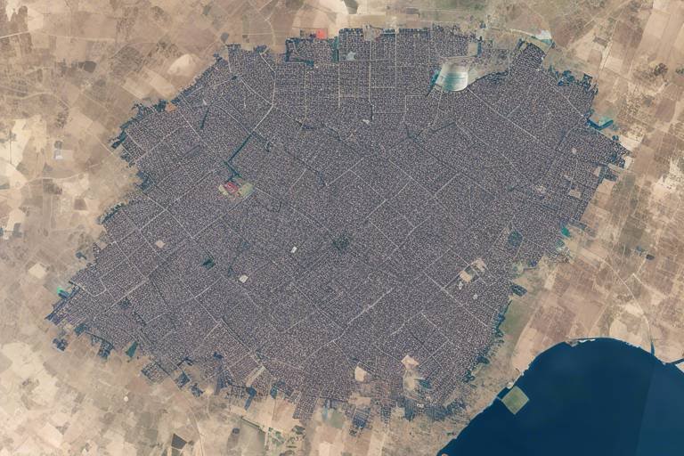
Another significant aspect of satellite technology is the role of earth observation satellites. These satellites gather vital data that helps monitor environmental changes, urban development, and the condition of infrastructure itself. By analyzing this data, authorities can make informed decisions that enhance the resilience of critical infrastructure. For example, if a city is experiencing rapid urbanization, satellite data can help planners understand the implications on transportation and utilities, allowing for proactive measures to be implemented.
Satellites are indispensable in disaster monitoring. They provide real-time imagery and data that are crucial for assessing damage and coordinating response efforts. When a natural disaster occurs, the ability to quickly gather and analyze data can significantly improve emergency management strategies. For instance, after an earthquake, satellite imagery can reveal the extent of damage to roads and bridges, enabling quicker response times and more effective resource allocation.
One of the standout features of satellite technology is its ability to track severe weather events like floods and storms. By providing early warnings, satellites help protect infrastructure and, most importantly, save lives. This predictive capability is essential for disaster preparedness, allowing communities to evacuate or take necessary precautions before disaster strikes. The integration of satellite data with local emergency services creates a robust framework for disaster management.
Moreover, satellites equipped with thermal sensors can detect wildfires at their inception. This early detection allows for prompt action, protecting not only critical infrastructure but also minimizing damage to surrounding areas. Imagine a small spark in a remote area; without satellite monitoring, it could quickly escalate into a catastrophic wildfire. With satellite alerts, firefighting resources can be deployed rapidly, potentially saving both lives and property.
Beyond disaster management, satellites play a crucial role in infrastructure security. They provide surveillance and intelligence capabilities, helping to monitor sensitive areas and detect unauthorized access. This is particularly important for critical facilities such as power plants and water treatment facilities. By assessing potential threats from above, satellites enhance the overall security posture of these vital installations, ensuring they remain safe from harm.
Another vital contribution of satellites is through Global Navigation Satellite Systems (GNSS). This technology is essential for accurate positioning and timing across various sectors, including transportation and energy. GNSS ensures the efficient operation of critical infrastructure, enhancing safety protocols. For example, in transportation, GNSS allows for precise navigation, which is crucial for logistics and supply chain management.
Satellites facilitate real-time tracking of vehicles and shipments, optimizing logistics and improving the efficiency of transportation networks. This capability is vital for maintaining supply chain integrity, especially in today's global economy where timely deliveries can make or break a business. Imagine a delivery truck navigating through a city; with satellite tracking, businesses can monitor its location and ensure it reaches its destination on time, avoiding delays that could ripple through the supply chain.
In the energy sector, satellites support management by monitoring power grids and renewable energy sources. They provide critical data that helps in balancing supply and demand, ensuring a stable energy infrastructure. For instance, during peak usage times, satellite data can inform grid operators about which areas are consuming more energy, allowing for adjustments to be made in real time.
Looking ahead, emerging satellite technologies promise to further enhance the protection of critical infrastructure. Innovations such as small satellites and enhanced data analytics will provide more comprehensive monitoring and response capabilities. These advancements will allow for even more precise tracking and analysis, which is vital as the world continues to face new challenges related to climate change, urbanization, and security threats.
- How do satellites contribute to disaster management? Satellites provide real-time data and imagery that help assess damage and coordinate emergency responses during disasters.
- What role do satellites play in infrastructure security? They offer surveillance capabilities to monitor sensitive areas and detect unauthorized access to critical facilities.
- How does GNSS technology enhance transportation? GNSS allows for accurate positioning and real-time tracking of vehicles, optimizing logistics and improving supply chain efficiency.
Satellite Communication Systems
Satellite communication systems are the unsung heroes in the realm of critical infrastructure. Imagine a world where communication lines are severed during a natural disaster or a sudden technical failure. Panic would ensue, and chaos would reign. But thanks to satellite technology, we can maintain reliable data transmission even in the most challenging circumstances. These systems ensure that emergency responders can coordinate efforts seamlessly, allowing for quick action when every second counts.
At the heart of satellite communication is the ability to provide uninterrupted connectivity. Whether it's a hurricane battering the coast or an earthquake shaking the ground, satellite communication remains operational, enabling critical services such as police, fire, and medical assistance to communicate effectively. This capability is not just a luxury; it's a necessity that can mean the difference between life and death.
Furthermore, satellite communication systems are not limited to just emergency situations. They also play a crucial role in everyday operations. For instance, businesses rely on satellite links for data transfer, ensuring that their operations run smoothly. In remote areas, where traditional communication infrastructure may be lacking, satellite systems bridge the gap, providing essential connectivity. Here are some key benefits of satellite communication systems:
- Global Coverage: Satellites can provide communication services to even the most remote locations on Earth.
- Rapid Deployment: Satellite systems can be set up quickly, making them ideal for disaster response.
- Resilience: They are less susceptible to terrestrial disruptions, ensuring consistent service.
In addition to emergency response, satellite communication systems are integral in various sectors, including transportation, energy, and healthcare. For instance, in the transportation sector, satellites enable real-time tracking of vehicles, which enhances logistics and ensures timely deliveries. In the energy sector, satellite communication aids in monitoring power grids and managing energy resources effectively. This interconnectedness of systems showcases how vital satellite communication is in maintaining the integrity and functionality of critical infrastructure.
As we look to the future, advancements in satellite technology promise to enhance these communication systems further. Innovations such as high-throughput satellites (HTS) and low Earth orbit (LEO) satellite constellations are set to revolutionize data transmission speeds and reduce latency. This means that not only will communication be more reliable, but it will also be faster and more efficient, paving the way for new applications and services that can further protect our critical infrastructure.
Earth Observation Satellites
Earth observation satellites are pivotal in our quest to monitor and understand the planet's ever-changing dynamics. These sophisticated machines orbit the Earth, capturing a plethora of data that informs us about environmental changes, urban development, and the condition of our critical infrastructure. Imagine having a bird's-eye view of the Earth, where you can see everything from deforestation to urban sprawl, all in real-time. This capability is not just fascinating; it's essential for making informed decisions that enhance the resilience of critical infrastructure.
One of the most significant benefits of earth observation satellites is their ability to provide timely and accurate information. For instance, they can monitor the health of our transportation networks, identifying areas that need maintenance or repair. This proactive approach helps prevent catastrophic failures that could disrupt services and endanger lives. Moreover, satellites can track environmental changes, such as rising sea levels or changing weather patterns, which are crucial for urban planning and disaster preparedness.
To illustrate the impact of earth observation satellites, consider the following key applications:
- Urban Planning: By analyzing satellite imagery, city planners can make data-driven decisions that optimize land use and infrastructure development.
- Environmental Monitoring: Satellites help track pollution levels, deforestation, and biodiversity loss, providing valuable insights for conservation efforts.
- Agricultural Management: Farmers can utilize satellite data to assess crop health, optimize irrigation, and increase yield, ensuring food security.
Furthermore, the data collected by these satellites is invaluable in disaster management. When natural disasters strike, such as hurricanes or earthquakes, the real-time imagery provided by earth observation satellites allows emergency responders to assess damage quickly and coordinate relief efforts more effectively. This capability not only saves time but also saves lives, as resources can be allocated where they are needed most.
In addition to disaster response, earth observation satellites play a crucial role in long-term sustainability initiatives. They help track the effectiveness of policies aimed at reducing carbon emissions and protecting natural resources. By providing hard data, these satellites enable governments and organizations to hold themselves accountable for their environmental impact.
As technology continues to evolve, we can expect even greater advancements in earth observation capabilities. The integration of artificial intelligence and machine learning with satellite data will allow for more sophisticated analysis and predictive modeling, transforming the way we approach infrastructure protection and environmental stewardship. The future is bright, and earth observation satellites will undoubtedly be at the forefront of these innovations.
Disaster Monitoring and Response
When it comes to disaster monitoring and response, satellites are like the vigilant eyes in the sky, constantly watching over our planet. Imagine having a superhero that can see everything happening on Earth in real time—that's precisely what satellites do! They provide invaluable data that helps us assess the impact of natural disasters, such as earthquakes, hurricanes, and floods. By capturing high-resolution images and collecting data from various sensors, satellites enable emergency responders to understand the situation on the ground quickly and effectively.
One of the most remarkable aspects of satellite technology is its ability to provide real-time imagery. This means that during a disaster, decision-makers can access up-to-the-minute information, which is crucial for coordinating response efforts. For instance, after a hurricane strikes, satellites can help identify the areas most affected, allowing rescue teams to focus their efforts where they are needed most. This capability significantly enhances the efficiency of disaster response, ensuring that help reaches those in need as quickly as possible.
Furthermore, satellites play a vital role in damage assessment. Once the immediate threat has passed, authorities can analyze satellite data to evaluate the extent of the destruction. This information is essential for planning recovery efforts and allocating resources effectively. For example, a satellite might reveal that a particular neighborhood has been severely affected, prompting local governments to prioritize aid in that area.
In addition to monitoring disasters as they happen, satellites are also instrumental in predictive analysis. By analyzing historical data and current conditions, they can help forecast potential disasters, giving communities a chance to prepare. This predictive capability is akin to having a weather forecast that not only tells you when it might rain but also warns you about the possibility of a flood. With satellite technology, we can anticipate disasters and take proactive measures to protect lives and property.
To illustrate the impact of satellites in disaster monitoring, consider the following table that summarizes their key contributions:
| Satellite Contribution | Description |
|---|---|
| Real-time Imagery | Provides up-to-the-minute visuals of disaster-affected areas for rapid assessment. |
| Damage Assessment | Helps evaluate the extent of destruction for effective recovery planning. |
| Predictive Analysis | Forecasts potential disasters based on historical and current data. |
| Coordination of Response Efforts | Enhances communication between agencies and responders for efficient action. |
In conclusion, satellites are indispensable tools in disaster monitoring and response. They not only provide critical data during emergencies but also empower us to prepare for potential disasters. With their ability to offer real-time imagery, assess damage, and predict future events, satellites ensure that we can take swift and effective action when it matters most. As technology continues to evolve, we can expect even greater advancements in how satellites support disaster management, ultimately leading to safer communities and more resilient infrastructure.
- How do satellites provide real-time data during disasters? Satellites use advanced imaging technology to capture current conditions on Earth, which is transmitted to ground stations for analysis.
- What types of disasters can satellites help monitor? Satellites can monitor a wide range of disasters, including hurricanes, floods, wildfires, and earthquakes.
- Can satellites predict natural disasters? While satellites can't predict disasters with absolute certainty, they can analyze trends and conditions to forecast potential events.
- How does satellite imagery aid in recovery efforts? Satellite imagery provides crucial information on the extent of damage, helping authorities prioritize recovery efforts and allocate resources effectively.
Flood and Storm Tracking
Flood and storm tracking is one of the most critical roles that satellites play in safeguarding our infrastructure and communities. Imagine waking up to the news of a massive storm heading your way. It's not just a weather update; it's a call to action. Satellites equipped with advanced sensors and imaging technology provide invaluable data that can predict the path and intensity of severe weather events. This information is crucial for local authorities and emergency services as they prepare to respond to potential disasters.
When a storm brews, satellites orbiting our planet continuously monitor atmospheric conditions, capturing real-time imagery that reveals changes in weather patterns. This data is processed and analyzed to forecast flooding and storm surges, allowing for timely warnings to be issued. For instance, the National Oceanic and Atmospheric Administration (NOAA) utilizes satellite data to track hurricanes and other severe weather systems, enabling them to issue alerts that can save lives.
Moreover, the predictive capabilities of satellites extend beyond just forecasting. They can also assess the impact of these weather events on critical infrastructure. Consider a city that's prone to flooding. By analyzing satellite imagery before and after a storm, emergency managers can identify which areas are most at risk, allowing them to deploy resources effectively. This proactive approach not only enhances safety but also minimizes economic losses by ensuring that response teams are where they are needed most.
In addition to storm tracking, satellites also play a vital role in monitoring flood levels. They can detect rising water levels in real-time, providing crucial data that helps emergency responders make informed decisions. For example, during significant flooding events, satellites can deliver updates on the extent of inundation, helping to coordinate evacuations and resource allocation. This is particularly important in urban areas where infrastructure can be severely impacted.
Furthermore, the integration of satellite data with ground-based systems creates a comprehensive approach to disaster management. By combining satellite imagery with local weather stations and river gauges, authorities can gain a clearer picture of the situation, ensuring that they are prepared for any eventuality. This synergy between satellite technology and local data sources is what makes modern disaster response so effective.
In summary, the role of satellites in flood and storm tracking is indispensable. They not only provide early warnings that can save lives but also enhance our ability to respond to and recover from natural disasters. As technology continues to evolve, we can expect even more sophisticated satellite systems that will further improve our capabilities in disaster preparedness and response.
- How do satellites predict storms? Satellites use advanced sensors to monitor atmospheric conditions and capture real-time imagery, which helps meteorologists forecast storm paths and intensity.
- What is the role of satellites in flood management? Satellites provide data on rising water levels and the extent of flooding, which aids in emergency response and resource allocation.
- Can satellites help during other natural disasters? Yes, satellites are used in various disaster scenarios, including wildfires, earthquakes, and landslides, providing critical data for emergency management.
Wildfire Detection
Wildfires can be devastating, not just for the environment, but also for the critical infrastructure that supports our daily lives. With the increasing frequency and intensity of wildfires, early detection has become essential. Satellites equipped with advanced thermal sensors are at the forefront of this battle against wildfires. These satellites can detect temperature anomalies on the Earth's surface, allowing them to identify potential fire outbreaks before they escalate into uncontrollable infernos.
Imagine a watchful guardian in the sky, continuously monitoring vast expanses of land. This is precisely what satellites do. They scan for heat signatures that indicate a fire's presence, even in remote areas where human eyes may never reach. This capability is crucial because the sooner a wildfire is detected, the quicker response teams can mobilize to contain it. In many cases, this rapid response can mean the difference between a small controlled burn and a catastrophic wildfire that engulfs entire communities.
Moreover, the data collected from satellites is not just about spotting fires; it also provides invaluable information for assessing the potential spread of wildfires. By analyzing wind patterns, humidity levels, and vegetation types, satellites can help predict how a fire might behave. This predictive capability is essential for emergency management agencies as they strategize their response efforts. For instance, they can determine which areas need immediate evacuation or where to deploy firefighting resources most effectively.
In addition to real-time monitoring, satellites play a critical role in post-wildfire assessment. After a fire has been contained, satellite imagery can be used to evaluate the damage to infrastructure and the environment. This data is vital for planning recovery efforts and ensuring that critical services can be restored as quickly as possible. The integration of satellite technology into wildfire management not only enhances safety but also contributes to the resilience of communities that are vulnerable to such natural disasters.
In summary, satellite technology is revolutionizing wildfire detection and management. With their ability to provide early warnings, assess fire behavior, and evaluate damage, satellites are indispensable tools in the fight against wildfires. As we continue to face the challenges posed by climate change and its impact on fire frequency, reliance on these high-tech guardians will only grow stronger.
- How do satellites detect wildfires? Satellites use thermal sensors to identify heat anomalies on the Earth's surface, allowing them to detect wildfires even in remote areas.
- What is the importance of early wildfire detection? Early detection allows for quicker response times, which can prevent small fires from becoming large, uncontrollable wildfires.
- Can satellites predict the spread of wildfires? Yes, satellites analyze various environmental factors such as wind patterns and humidity to predict how a wildfire may behave.
- What role do satellites play after a wildfire? Satellites provide imagery and data that help assess damage and plan recovery efforts in affected areas.
Infrastructure Security
In today's world, where threats to critical infrastructure are becoming increasingly sophisticated, satellites play a pivotal role in ensuring safety and security. Imagine a watchful guardian in the sky, constantly monitoring sensitive areas and providing invaluable data that can prevent disasters before they happen. With advanced surveillance capabilities, satellites help in detecting unauthorized access and assessing potential threats to vital facilities. This proactive approach is essential for maintaining the integrity of infrastructure that supports our daily lives.
One of the most significant advantages of satellite technology is its ability to offer real-time information. For instance, satellites equipped with high-resolution imaging can identify changes in infrastructure conditions, such as the construction of unauthorized structures or changes in land use around critical sites. This data allows authorities to take swift action, ensuring that potential risks are mitigated before they escalate into serious threats.
Moreover, the integration of satellite data with ground-based security systems enhances overall situational awareness. By combining information from various sources, including sensors and surveillance cameras, authorities can create a comprehensive security framework. This interconnectedness not only improves response times but also facilitates better decision-making during emergencies. For example, in the event of a security breach, satellite imagery can provide real-time insights into the situation, allowing law enforcement to deploy resources more effectively.
To illustrate the importance of satellite technology in infrastructure security, consider the following scenarios:
- Border Security: Satellites monitor vast stretches of land, providing crucial data that helps in detecting illegal crossings or unauthorized activities.
- Critical Facility Protection: Facilities such as power plants and water treatment centers can be monitored for any unusual activity, ensuring that potential threats are addressed promptly.
- Cybersecurity: Satellites can also help in monitoring the digital landscape, identifying potential cyber threats that could impact infrastructure.
As we look to the future, the evolution of satellite technology promises to enhance infrastructure security even further. Innovations such as artificial intelligence and machine learning will enable satellites to analyze vast amounts of data quickly and accurately, identifying patterns and anomalies that may indicate security risks. This capability will empower authorities to stay one step ahead of potential threats, ensuring that critical infrastructure remains protected.
In conclusion, the role of satellites in infrastructure security cannot be overstated. Their ability to provide real-time monitoring, enhance situational awareness, and facilitate rapid response makes them an indispensable tool in the fight against threats to our critical infrastructure. As technology continues to advance, we can expect satellites to play an even more significant role in ensuring the safety and resilience of the systems that underpin our society.
- How do satellites enhance infrastructure security? Satellites provide real-time monitoring and surveillance capabilities, allowing authorities to detect unauthorized access and assess potential threats quickly.
- What types of threats can satellites help monitor? Satellites can help monitor various threats, including physical security breaches, environmental changes, and cyber threats that could impact critical infrastructure.
- What future technologies will improve satellite capabilities? Emerging technologies such as artificial intelligence and machine learning will significantly enhance the data analysis capabilities of satellites, allowing for more effective monitoring and response.
Global Navigation Satellite Systems (GNSS)
are the backbone of modern navigation and timing services, playing a critical role in various sectors, including transportation, telecommunications, and energy management. At their core, GNSS provides accurate positioning information that is essential for the efficient operation of critical infrastructure. Imagine trying to coordinate a massive logistics operation without knowing exactly where your vehicles are—it's a recipe for chaos! This is where GNSS steps in, ensuring that everything runs smoothly.
With the help of a constellation of satellites orbiting the Earth, GNSS allows users to determine their precise location anywhere on the globe. This capability is not just a luxury; it’s a necessity for maintaining the integrity of supply chains and ensuring safety in transportation systems. For example, the aviation industry heavily relies on GNSS for navigation and air traffic control, which enhances the safety of millions of passengers flying every day.
Moreover, GNSS technology is instrumental in energy management. It enables utilities to monitor and manage power grids effectively, ensuring that energy supply meets demand. By providing real-time data on energy consumption and generation, GNSS helps operators detect outages and respond swiftly, minimizing disruption. This is particularly important as the world shifts towards renewable energy sources, where monitoring and balancing supply becomes increasingly complex.
To illustrate the impact of GNSS on various sectors, consider the following table that outlines some key applications:
| Sector | Application | Benefits |
|---|---|---|
| Transportation | Vehicle tracking and navigation | Improved efficiency and safety |
| Telecommunications | Network synchronization | Enhanced communication reliability |
| Energy | Grid management | Stable energy supply and demand balance |
| Agriculture | Precision farming | Optimized resource use |
As we look to the future, the role of GNSS will only continue to grow. With advancements in technology, such as the integration of GNSS with other systems like the Internet of Things (IoT), we can expect even greater efficiencies and capabilities. This integration will allow for more precise monitoring and management of critical infrastructure, making it more resilient to challenges like natural disasters or cyber threats.
In conclusion, GNSS is not just a tool; it's a vital component of our modern infrastructure ecosystem. Its ability to provide accurate positioning and timing is essential for enhancing safety, efficiency, and reliability across various sectors. As we continue to innovate and improve these systems, the potential for GNSS to protect critical infrastructure will only expand, ensuring a safer and more connected world.
- What is GNSS? - GNSS stands for Global Navigation Satellite Systems, which includes various satellite systems that provide positioning, navigation, and timing information.
- How does GNSS benefit transportation? - GNSS enhances transportation by providing accurate location data for vehicle tracking, improving logistics, and ensuring safer navigation.
- Can GNSS be used in disaster management? - Yes, GNSS plays a crucial role in disaster management by providing real-time data for emergency response and recovery efforts.
- What are the future trends in GNSS technology? - Future trends include the integration of GNSS with IoT, improved accuracy, and enhanced data analytics for better infrastructure management.
Transportation and Logistics
In today's fast-paced world, the significance of satellite technology in transportation and logistics cannot be overstated. Imagine a bustling city where trucks, trains, and ships are constantly on the move, delivering goods to every corner. How do they know the best routes to take? How do they avoid traffic jams or delays? The answer lies in the power of satellites. These technological marvels provide real-time data that is crucial for optimizing logistics operations.
One of the key benefits of satellite technology is its ability to enable real-time tracking of vehicles and shipments. This capability allows companies to monitor their assets closely, ensuring that products reach their destinations on time. For example, logistics companies can utilize satellite data to:
- Track the location of delivery trucks in real-time.
- Monitor the status of cargo shipments across oceans.
- Optimize delivery routes based on current traffic conditions.
Consider a scenario where a shipment of fresh produce is en route to a grocery store. If a truck is delayed due to unforeseen circumstances, satellite tracking can alert the logistics team, allowing them to reroute the vehicle or notify the store in advance. This not only enhances efficiency but also helps maintain customer satisfaction. In the world of logistics, time is money, and satellite technology ensures that every second counts.
Furthermore, satellites are pivotal in managing the complexities of global supply chains. As businesses expand their reach across borders, the need for precise coordination becomes paramount. Satellites facilitate this coordination by providing data that helps companies understand supply chain dynamics, from sourcing materials to delivering finished products. With access to satellite imagery and data analytics, businesses can:
- Identify potential disruptions in the supply chain.
- Evaluate the impact of weather conditions on transportation routes.
- Enhance inventory management through accurate demand forecasting.
Moreover, the integration of satellite technology with other systems, such as Internet of Things (IoT) devices, creates a holistic approach to logistics management. For instance, sensors on trucks can relay information about fuel consumption, temperature control for sensitive shipments, and even driver behavior. This data, when combined with satellite information, provides a comprehensive view of logistics operations, allowing businesses to make informed decisions quickly.
As we look to the future, the role of satellites in transportation and logistics is set to expand even further. With emerging technologies like autonomous vehicles and advanced data analytics, the synergy between satellite systems and transport networks will redefine efficiency standards. Imagine a network of self-driving trucks guided by satellite data, navigating the most efficient routes while communicating with each other to avoid congestion. This is not just a dream; it's the future of logistics.
In conclusion, the integration of satellite technology into transportation and logistics not only enhances operational efficiency but also ensures the safety and reliability of supply chains worldwide. As we continue to innovate and adapt, the importance of these systems in safeguarding our global economy will only grow.
Q1: How do satellites improve delivery times?
A1: Satellites provide real-time tracking and route optimization, allowing logistics companies to make informed decisions that minimize delays.
Q2: Can satellite technology help in disaster situations?
A2: Absolutely! Satellites can track severe weather events and provide critical data that helps logistics companies reroute shipments and ensure safety.
Q3: What is the future of satellite technology in logistics?
A3: The future includes advancements like autonomous vehicles and enhanced data analytics, which will further streamline operations and improve efficiency.
Energy Management
When we talk about , we’re diving into a world where satellites play a pivotal role in ensuring our energy systems run smoothly and efficiently. Imagine a bustling city where energy flows like a river, powering homes, businesses, and public services. Now, picture satellites hovering above, acting as vigilant guardians, constantly monitoring this flow. They gather essential data that helps us balance supply and demand, ensuring that our energy infrastructure remains stable and reliable.
Satellites equipped with advanced sensors track various energy sources, from traditional power plants to innovative renewable energy installations like solar farms and wind turbines. This real-time data is crucial; it allows energy providers to make informed decisions about where to allocate resources. For instance, on a sunny day, solar energy production may peak, prompting grid operators to adjust their strategies accordingly. Without this satellite data, we’d be flying blind, risking blackouts or energy shortages during peak usage times.
Moreover, satellites help in detecting and diagnosing issues within the energy grid. They can identify outages or irregularities in power flow, acting as an early warning system. This capability is akin to having a doctor monitoring your health; they can spot potential problems before they escalate into serious conditions. When an issue is detected, energy companies can respond swiftly, minimizing downtime and ensuring that consumers remain connected to the power they need.
Another fascinating aspect of satellite technology in energy management is its role in supporting renewable energy integration. As more countries shift towards green energy, the need for effective management of these resources becomes paramount. Satellites provide insights into weather patterns, which are essential for predicting energy output from renewable sources. For example, knowing when a storm is approaching allows wind farms to prepare for potential decreases in energy production, thus maintaining grid stability.
In summary, the influence of satellite technology on energy management is both profound and multifaceted. By offering real-time data, enhancing decision-making processes, and supporting renewable energy integration, satellites are not just passive observers; they are active participants in shaping a sustainable energy future. The synergy between satellites and energy systems illustrates a remarkable evolution in how we manage our vital resources.
- How do satellites monitor energy consumption?
Satellites use advanced sensors to gather data on energy production and consumption patterns, helping grid operators make informed decisions. - Can satellites predict energy shortages?
Yes, by analyzing weather patterns and energy output from renewable sources, satellites can provide early warnings about potential energy shortages. - What role do satellites play in renewable energy management?
Satellites provide crucial data that helps in forecasting energy output from renewable sources, ensuring their effective integration into the energy grid. - How does satellite technology improve grid reliability?
By detecting outages and irregularities in power flow, satellites enable quick responses to maintain grid stability.
Future Trends in Satellite Technology
As we gaze into the horizon of technological advancements, it's clear that the future of satellite technology is not just bright; it's positively dazzling! With the rapid evolution of small satellites, often referred to as CubeSats, we are witnessing a revolution that promises to enhance our ability to monitor and protect critical infrastructure like never before. These miniaturized satellites are not only cost-effective but also agile, allowing for more frequent launches and a multitude of applications, from environmental monitoring to disaster response.
Moreover, the integration of artificial intelligence (AI) and machine learning into satellite operations is set to transform how we analyze data. Imagine a world where satellites can autonomously process vast amounts of information, identifying patterns and anomalies in real-time without human intervention. This capability will significantly improve our response times during emergencies, enabling quicker decision-making that could save lives and resources.
Another exciting trend is the development of high-throughput satellites (HTS). These advanced satellites can provide significantly greater bandwidth compared to traditional systems, which means faster internet speeds and more reliable communication networks. This is especially critical for remote areas where traditional infrastructure is lacking. As these HTS become more prevalent, we can expect a surge in connectivity that will bolster the resilience of critical infrastructure across the globe.
Furthermore, the rise of mega-constellations—groups of satellites working together to provide global coverage—will enhance capabilities in both communication and Earth observation. Companies like SpaceX, with its Starlink project, are leading the charge in deploying thousands of satellites into low Earth orbit. This ambitious endeavor not only aims to provide internet access to underserved regions but also offers a unique opportunity to gather data that can be used for monitoring environmental changes and assessing the health of critical infrastructure.
As we look ahead, we must also consider the ethical implications of these advancements. With the increased capabilities of satellites, there arises a responsibility to use this technology wisely. For instance, the ability to monitor sensitive areas raises questions about privacy and security. The balance between leveraging satellite technology for the greater good and protecting individual rights will be a crucial discussion in the years to come.
In summary, the future trends in satellite technology are poised to revolutionize how we protect and manage critical infrastructure. With innovations in small satellites, AI integration, high-throughput capabilities, and mega-constellations, we are entering an era where real-time data and connectivity will enhance our resilience against disasters and threats. The potential is enormous, and as we embrace these changes, we must also navigate the ethical landscape that comes with them.
- What are small satellites and why are they important?
Small satellites, or CubeSats, are compact, cost-effective satellites that can be launched in groups. Their importance lies in their ability to provide frequent data updates and flexible monitoring solutions for critical infrastructure. - How does AI enhance satellite technology?
AI allows satellites to autonomously analyze data, identify patterns, and make real-time decisions, improving response times during emergencies and enhancing the overall efficiency of satellite operations. - What are high-throughput satellites?
High-throughput satellites are advanced satellites that offer significantly higher bandwidth, enabling faster internet speeds and more reliable communication, particularly in remote areas. - What are mega-constellations?
Mega-constellations are large groups of satellites working together to provide global coverage for communication and Earth observation, significantly enhancing capabilities in these areas.
Frequently Asked Questions
- How do satellites contribute to disaster management?
Satellites play a crucial role in disaster management by providing real-time data and imagery. They help authorities assess damage, coordinate response efforts, and issue early warnings for severe weather events like floods and storms. This capability significantly enhances emergency management strategies, ensuring a quicker and more effective response to disasters.
- What is the importance of satellite communication systems?
Satellite communication systems are vital for ensuring reliable data transmission, especially during emergencies. They maintain seamless connectivity for critical infrastructure, allowing for effective communication among emergency responders and operational continuity during natural disasters or technical failures. Without these systems, the response to crises would be severely hampered.
- How do Earth observation satellites help in infrastructure resilience?
Earth observation satellites provide essential data that helps monitor environmental changes, urban development, and the condition of infrastructure. This information allows authorities to make informed decisions about protecting and enhancing the resilience of critical infrastructure, ensuring it can withstand various challenges, including natural disasters.
- What role do satellites play in energy management?
Satellites support energy management by monitoring power grids and renewable energy sources. They provide crucial data that helps balance supply and demand, ensuring a stable energy infrastructure. This is particularly important as we move towards more sustainable energy solutions and require precise management of resources.
- How do satellites enhance infrastructure security?
Satellites enhance infrastructure security by providing surveillance and intelligence capabilities. They monitor sensitive areas, detect unauthorized access, and assess potential threats to critical facilities. This proactive approach helps protect vital infrastructure from various risks, including terrorism and natural disasters.
- What are Global Navigation Satellite Systems (GNSS) and their significance?
Global Navigation Satellite Systems (GNSS) are essential for accurate positioning and timing across various sectors, including transportation and energy. They ensure the efficient operation of critical infrastructure, improve safety protocols, and facilitate real-time tracking, which is vital for maintaining supply chain integrity and optimizing logistics.
- What future trends can we expect in satellite technology?
Emerging satellite technologies are set to enhance the protection of critical infrastructure even further. Innovations such as small satellites and advanced data analytics will provide more comprehensive monitoring and response capabilities. These advancements promise to improve our ability to manage and safeguard vital systems and services in an increasingly complex world.


