How Satellites Aid in Humanitarian Crisis Assessment
In an increasingly unpredictable world, the role of satellites in humanitarian crisis assessment has become more critical than ever. Imagine being able to see the aftermath of a natural disaster from space, gaining insights that are impossible to achieve from the ground. Satellites provide a bird's-eye view, offering real-time data that can be the difference between life and death. This article delves into how satellites are transforming the way we respond to humanitarian crises, highlighting their applications, benefits, and the technology that powers them. As we explore this fascinating topic, we'll also look ahead to future trends in satellite utilization for disaster response, ensuring that we remain prepared for whatever challenges lie ahead.
Satellites are like the watchful eyes in the sky, constantly monitoring our planet for signs of trouble. They provide invaluable real-time data essential for tracking disasters such as hurricanes, earthquakes, and floods. When a disaster strikes, the ability to assess the situation quickly can save countless lives. Satellite imagery allows humanitarian organizations to visualize the extent of damage in affected areas, enabling timely interventions. For instance, during a flood, satellites can capture images that reveal the areas most impacted, guiding rescue teams to where they are needed most. This capability not only enhances response times but also helps in identifying safe routes for evacuation and delivering aid.
Understanding the techniques used in satellite data collection and analysis is vital for effective humanitarian assessments. The process begins with remote sensing technology, which captures data about the Earth's surface without physical contact. This technology employs various methods to gather information, including optical and radar imaging. Each technique has its own strengths, making it crucial to choose the right one based on the specific needs of a crisis situation.
Remote sensing technology plays a pivotal role in obtaining crucial information during humanitarian crises. By employing sensors mounted on satellites, we can gather data on everything from land use to environmental changes. This information is then analyzed to produce actionable insights. The beauty of remote sensing lies in its ability to cover vast areas quickly, making it an essential tool for humanitarian organizations striving to respond effectively in times of need.
Optical and radar imaging are the two primary techniques used in satellite data collection. Optical imaging captures light reflected from the Earth's surface, providing detailed images that are particularly useful for assessing damage in urban areas. On the other hand, radar imaging uses radio waves to penetrate clouds and can capture data regardless of weather conditions, making it invaluable during storms or heavy rain. Each method has its unique applications, and understanding these differences is key to effective crisis assessment.
Integrating Geographic Information Systems (GIS) with satellite data enhances our understanding of crisis situations through spatial analysis. GIS allows us to visualize and analyze the data in ways that reveal patterns and relationships. For example, by mapping the locations of affected populations against infrastructure, humanitarian organizations can better allocate resources and plan interventions. This synergy between satellite data and GIS is a game-changer in humanitarian efforts.
Examining real-world examples of satellite applications during humanitarian crises provides invaluable insight into their effectiveness. One notable case occurred during the 2010 Haiti earthquake. Satellite imagery was used to assess the damage and identify areas in need of immediate aid. Similarly, during the 2015 Nepal earthquake, satellites helped map the destruction, guiding rescue teams to the hardest-hit regions. These case studies illustrate not just the capabilities of satellite technology but also its profound impact on saving lives and facilitating recovery.
The advantages of using satellite technology in humanitarian efforts are numerous. Primarily, satellites improve response times, enhance data accuracy, and facilitate better resource allocation. For instance, when a natural disaster occurs, the speed at which satellite data can be processed and disseminated can significantly influence the effectiveness of the response. Furthermore, the accuracy of satellite imagery allows organizations to make informed decisions, ensuring that aid reaches those who need it most.
Effective coordination among humanitarian agencies is essential during crises. Satellite data fosters collaboration and information sharing among different organizations, enabling them to work together more efficiently. By having access to the same real-time data, agencies can synchronize their efforts, reducing duplication and ensuring that resources are used effectively.
Using satellite technology can be remarkably cost-effective compared to traditional methods. While the initial investment in satellite systems may seem high, the long-term savings in terms of time, resources, and lives saved can be monumental. Moreover, as technology continues to advance and become more accessible, the financial barriers to using satellites for humanitarian assessments are gradually diminishing.
Despite their numerous advantages, satellite technology faces challenges and limitations. Issues such as data accessibility, resolution constraints, and the need for technical expertise can hinder effective crisis assessments. For example, while satellites can capture vast amounts of data, interpreting that data requires skilled professionals who can analyze and contextualize the information.
Data privacy is another significant concern in the usage of satellite imagery. The ethical implications of collecting data on affected populations must be carefully considered. Regulations are needed to protect the privacy of individuals during assessments, ensuring that humanitarian efforts do not inadvertently infringe on people's rights.
Finally, an over-reliance on technology can lead to gaps in understanding crises. While satellite data is invaluable, it should not replace human insights and ground verification. Combining satellite imagery with on-the-ground assessments ensures a comprehensive understanding of the situation, leading to more effective responses.
Q: How do satellites help in disaster response?
A: Satellites provide real-time data and imagery that help assess damage, track disasters, and plan effective response strategies.
Q: What types of satellite imagery are used in humanitarian efforts?
A: Both optical and radar imaging are commonly used, each serving unique purposes in crisis assessment.
Q: Are there any privacy concerns with satellite data?
A: Yes, data privacy is a significant concern, and regulations are needed to protect affected populations during assessments.
The Role of Satellites in Disaster Monitoring
When a disaster strikes, every second counts. In the chaotic aftermath of a natural calamity, timely information can be the difference between life and death. This is where satellites come into play, acting as our eyes in the sky. They provide real-time data that is essential for monitoring various types of disasters, from hurricanes and earthquakes to floods and wildfires. By capturing high-resolution images of affected areas, satellites enable humanitarian agencies to assess damage quickly and accurately, allowing for immediate intervention and resource allocation.
Imagine a hurricane barreling toward a coastal city. As the storm approaches, satellites orbiting the Earth can capture detailed images of the developing storm system, providing meteorologists with vital information about its path and intensity. This data can be relayed to local authorities, who can then issue timely evacuation orders, potentially saving countless lives. Similarly, after a disaster has occurred, satellites can help assess the extent of damage. For instance, they can identify flooded regions, destroyed infrastructure, and even the status of displaced populations.
One of the most significant advantages of satellite monitoring is its ability to cover vast areas that may be difficult to access on the ground, especially in the immediate aftermath of a disaster. This capability allows for a comprehensive overview of the situation, which is crucial for effective response planning. Furthermore, satellite data can be integrated with other technologies, such as Geographic Information Systems (GIS), to create detailed maps that illustrate the impact of the disaster, helping responders prioritize their efforts.
However, the role of satellites in disaster monitoring goes beyond just imagery. The data collected can also be analyzed to predict future disasters. For example, satellites equipped with advanced sensors can monitor changes in land use, vegetation, and weather patterns, providing insights into potential risks. This proactive approach can help communities prepare better for future events, reducing vulnerability and enhancing resilience.
In summary, the role of satellites in disaster monitoring is multifaceted and indispensable. They not only provide critical real-time data during emergencies but also contribute to long-term disaster preparedness and risk management. As technology continues to advance, the capabilities of satellites are expected to improve, making them even more effective in supporting humanitarian efforts.
- How do satellites collect data during a disaster? Satellites use various sensors to capture images and gather information about the Earth's surface, including optical and radar imaging techniques.
- Can satellite data be accessed in real-time? Yes, many satellite systems are capable of providing near real-time data, which is crucial for timely disaster response.
- What are the limitations of using satellites for disaster monitoring? Limitations may include data accessibility, resolution constraints, and the need for technical expertise to interpret the data accurately.
Data Collection and Analysis Techniques
Understanding the intricacies of in satellite imagery is crucial for effective humanitarian assessments. Satellites are not just floating cameras; they are sophisticated instruments that gather a plethora of data, which can be transformed into actionable insights during crises. The process begins with remote sensing, where satellites capture images and data across various wavelengths. This information is then processed and analyzed to provide a clear picture of the situation on the ground.
One of the primary methods of data collection involves multispectral imaging. This technique allows satellites to capture images in different spectral bands, which can reveal details invisible to the naked eye. For instance, in the aftermath of a natural disaster, multispectral images can help identify areas affected by flooding or fires by highlighting changes in vegetation health. Furthermore, hyperspectral imaging takes this a step further, capturing data across hundreds of spectral bands, enabling even more precise analysis of materials and conditions.
Another essential technique is synthetic aperture radar (SAR). Unlike optical imaging, SAR can penetrate clouds and operate during nighttime, making it invaluable in situations where visibility is compromised. This capability allows for continuous monitoring of disaster zones, enabling responders to track changes in infrastructure and assess damage over time.
To make sense of the vast amounts of data collected, various data analysis techniques come into play. One prominent method is image classification, where algorithms categorize pixels in satellite images into different classes, such as water, urban areas, or vegetation. This classification can help humanitarian agencies quickly identify regions that require immediate assistance.
Additionally, integrating Geographic Information Systems (GIS) enhances the analysis process. GIS combines satellite data with other geographical information, allowing for spatial analysis that can uncover patterns and relationships in the data. For example, GIS can be used to overlay satellite imagery with population density maps, helping organizations prioritize areas with the highest need for aid.
Moreover, the rise of machine learning and artificial intelligence is revolutionizing data analysis in satellite imagery. These technologies can automate the identification of changes in landscapes and detect anomalies that human analysts might miss. By training algorithms on historical data, machine learning models can predict potential disaster impacts, enabling proactive measures rather than reactive responses.
In conclusion, the combination of various data collection and analysis techniques empowers humanitarian organizations to respond swiftly and effectively during crises. The integration of advanced technologies not only enhances the accuracy of assessments but also facilitates better decision-making in the face of disasters.
- What types of data can satellites collect? Satellites can collect various types of data, including optical images, thermal data, and radar signals, which can be used for different analyses such as land use, vegetation health, and disaster impact assessment.
- How do satellites help in disaster response? Satellites provide real-time imagery and data, allowing responders to assess damage, track the progression of disasters, and coordinate relief efforts efficiently.
- What is the role of GIS in satellite data analysis? GIS integrates satellite data with other geographical information, enabling spatial analysis that helps identify patterns and prioritize areas in need of assistance.
- Can satellite data be accessed by anyone? While some satellite data is publicly available, certain datasets may require permissions or subscriptions due to privacy and security concerns.
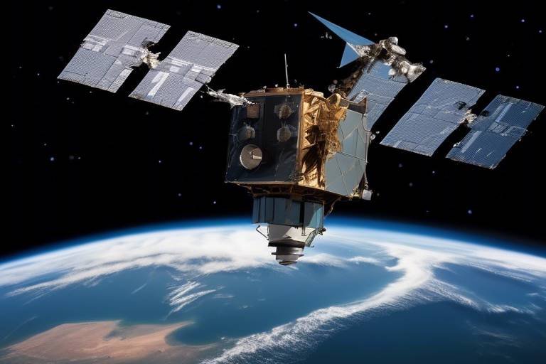
Remote Sensing Technology
When we think about understanding our planet, stands out as one of the most powerful tools in our arsenal. This technology allows us to collect data about the Earth's surface without having to be physically present. Imagine being able to see a vast area from miles away, gathering crucial information that can help in times of crisis. It’s like having a bird's-eye view of the world, enabling us to monitor changes and assess conditions efficiently.
At its core, remote sensing involves the use of satellites equipped with various sensors that capture data in different wavelengths of light. These sensors can be broadly categorized into two types: passive sensors, which detect natural radiation emitted or reflected by objects, and active sensors, which emit their own energy to scan objects and areas. This dual capability allows for a comprehensive understanding of various environmental conditions.
In the context of humanitarian crises, remote sensing technology has become indispensable. It provides vital information during disasters such as earthquakes, floods, or hurricanes. For instance, after a natural disaster, satellites can offer immediate imagery that helps assess the extent of damage, identify affected areas, and even track displaced populations. This information is not just useful; it's critical for orchestrating timely and effective responses.
Furthermore, remote sensing technology is continuously evolving. With advancements in spatial resolution and temporal resolution, we can now capture images with incredible detail and frequency. This means that humanitarian organizations can obtain up-to-date information, which is essential for decision-making. For example, high-resolution images can reveal changes in land use or infrastructure that might otherwise go unnoticed.
To illustrate the impact of remote sensing technology, consider the following applications:
- Damage Assessment: Quickly evaluating the extent of destruction following a disaster.
- Resource Management: Identifying areas in need of aid and prioritizing resource allocation.
- Environmental Monitoring: Tracking changes in ecosystems that may affect humanitarian efforts.
As we look to the future, it’s clear that remote sensing technology will continue to play a pivotal role in humanitarian crisis management. The ability to gather and analyze data from afar not only enhances our understanding of crises but also empowers organizations to act swiftly and effectively. With the right tools and collaboration, we can leverage this technology to make a significant difference in the lives of those affected by disasters.
Optical and Radar Imaging
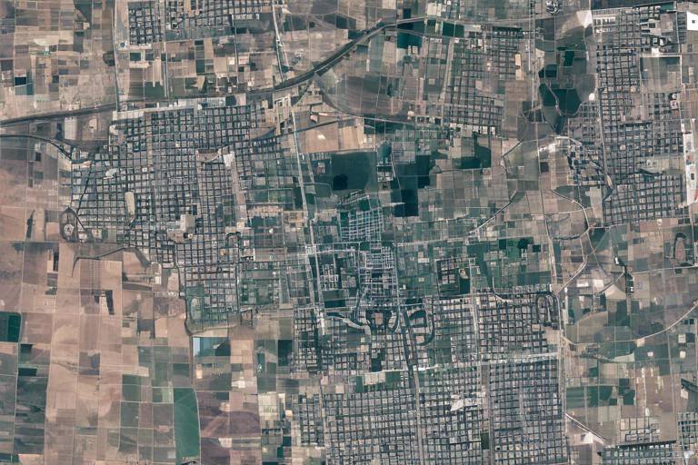
When it comes to satellite data collection, stand out as two of the most powerful techniques available. Each method has its unique strengths and applications, making them invaluable tools in humanitarian crisis assessment. Optical imaging utilizes visible light to capture images of the Earth’s surface, much like a traditional camera. This technique is particularly effective in providing detailed, high-resolution images that can reveal critical information about affected areas, such as the extent of damage to infrastructure, the state of agricultural lands, and even the displacement of populations.
On the other hand, radar imaging operates on a different principle. Instead of relying on sunlight, radar systems emit radio waves that bounce off the Earth's surface and return to the satellite. This technology allows for imaging in all weather conditions, day or night, making it a reliable option when optical imaging may fall short due to cloud cover or darkness. Radar imaging can penetrate through vegetation and even some structures, providing insights into the ground conditions that optical images might miss. For instance, it can help assess flood levels or landslide impacts more effectively than optical images alone.
To illustrate the differences and applications of these technologies, consider the following table:
| Feature | Optical Imaging | Radar Imaging |
|---|---|---|
| Operating Principle | Uses visible light | Uses radio waves |
| Weather Dependence | Requires clear skies | Can operate in any weather |
| Time of Day | Daytime only | 24/7 capability |
| Resolution | High resolution | Moderate to high resolution |
| Applications | Detailed damage assessment, land use analysis | Flood mapping, land deformation monitoring |
In summary, both optical and radar imaging are crucial for providing a comprehensive understanding of crisis situations. While optical imaging offers stunning detail under ideal conditions, radar imaging ensures that assessments can continue regardless of weather or time constraints. Combining these technologies often leads to the most accurate and actionable insights, allowing humanitarian agencies to respond effectively to crises.
GIS Integration
Geographic Information Systems (GIS) have become an indispensable tool in the realm of humanitarian crisis management. By integrating satellite data with GIS, organizations can visualize, analyze, and interpret complex data sets that provide a clearer picture of crisis situations. Imagine trying to solve a puzzle without knowing what the final image looks like; that’s what crisis management can feel like without GIS. It stitches together various data layers, allowing responders to see not just the immediate effects of a disaster, but also the broader context, such as population density, infrastructure, and environmental factors.
At its core, GIS enhances the ability to make informed decisions during humanitarian emergencies. For example, during a natural disaster like an earthquake or flood, GIS can help identify which areas are most affected and prioritize them for aid distribution. This technology allows for the mapping of critical data points, such as:
- Locations of shelters and medical facilities
- Routes for emergency responders
- Areas with high population vulnerability
Furthermore, GIS integration facilitates real-time data updates, which are crucial during fast-evolving crises. As new satellite imagery becomes available, GIS can overlay this information onto existing maps, providing a dynamic view of the situation. This capability not only aids in immediate response efforts but also assists in long-term recovery planning. For instance, after a major disaster, GIS can help assess damage over time, track recovery progress, and inform future resilience strategies.
Moreover, the use of GIS in conjunction with satellite data can significantly improve collaboration among various humanitarian agencies. By sharing a common platform where data is visualized and analyzed, organizations can work together more effectively. This collaborative approach ensures that resources are allocated efficiently, reducing duplication of efforts and maximizing the impact of aid delivered to affected populations.
In summary, the integration of GIS with satellite technology is a game-changer in humanitarian crisis management. It transforms raw data into actionable insights, enabling responders to navigate the complexities of crises with greater accuracy and speed. As we look to the future, the potential for GIS to enhance crisis response will only continue to grow, paving the way for more resilient communities worldwide.
Case Studies of Satellite Use in Crises
When it comes to humanitarian crises, the use of satellites has proven to be a game-changer. Let's take a look at some compelling case studies that illustrate the profound impact of satellite technology during emergencies. One notable example is the 2010 earthquake in Haiti. Within moments of the earthquake striking, satellite imagery was utilized to assess the extent of the damage. Organizations like the United Nations and the Red Cross relied on high-resolution images to identify affected areas, allowing for targeted aid delivery. This rapid assessment saved countless lives by ensuring that resources were allocated where they were most needed.
Another significant case is the response to the 2015 Nepal earthquake. In the aftermath, satellites provided crucial data to map out the destruction in remote regions that were otherwise inaccessible. The European Space Agency deployed its Sentinel-1 satellites to capture radar images, which were instrumental in identifying landslides and blocked roads. This information was vital for rescue teams and humanitarian organizations to navigate the challenging terrain and deliver aid effectively.
Moreover, during the ongoing conflict in Syria, satellite imagery has played a pivotal role in monitoring the humanitarian situation. Organizations like Human Rights Watch have used satellite data to document the destruction of civilian infrastructure and assess the impact on displaced populations. By analyzing before-and-after images, they have been able to provide compelling evidence for international advocacy efforts. This kind of data not only highlights the severity of the crisis but also helps in strategizing humanitarian responses.
In addition to these examples, the role of satellites in monitoring natural disasters extends to areas like flooding. For instance, during the 2017 monsoon season in South Asia, satellite technology was employed to track rising water levels and predict flood zones. The NASA MODIS (Moderate Resolution Imaging Spectroradiometer) satellite offered vital insights that facilitated early warning systems, enabling local authorities to evacuate at-risk communities ahead of time. This proactive approach significantly mitigated the potential for loss of life and property.
These case studies underscore the transformative power of satellite technology in crisis management. They demonstrate not just the efficiency of using satellite imagery for immediate assessments but also its importance in long-term planning and recovery efforts. As we move forward, the integration of satellite data into humanitarian strategies will likely become even more crucial, ensuring that aid reaches those who need it most, as quickly as possible.
- How do satellites collect data during a crisis? Satellites collect data through various imaging techniques, including optical and radar imaging, which allow them to capture detailed information about the Earth's surface in real-time.
- What are the limitations of satellite technology in humanitarian efforts? Some limitations include data accessibility, resolution constraints, and the need for technical expertise to interpret the data accurately.
- Can satellite data be used for long-term recovery efforts? Yes, satellite data is invaluable for assessing damage, planning recovery strategies, and monitoring progress over time in affected areas.
Benefits of Satellite Technology in Humanitarian Efforts
In the realm of humanitarian efforts, the integration of satellite technology has revolutionized how we respond to crises. Imagine being able to see a disaster unfold from space, and then using that information to save lives on the ground. This is not science fiction; it's the reality of modern disaster management. The benefits of utilizing satellite imagery and data are numerous and impactful, making it an essential tool for organizations working in crisis situations.
One of the most significant advantages is the improved response times. When a natural disaster strikes, every second counts. Satellites can provide real-time data that enables humanitarian agencies to assess the situation quickly and deploy resources where they are needed most. For instance, after an earthquake, satellite imagery can reveal the extent of the damage, allowing teams to prioritize areas that require immediate assistance. This swift assessment can mean the difference between life and death for many individuals.
Moreover, satellite technology enhances data accuracy. Traditional methods of data collection often rely on ground surveys, which can be time-consuming and may not capture the full scope of a disaster. In contrast, satellites can cover vast areas in a short amount of time, providing a comprehensive view of the affected regions. This high level of detail allows for better planning and resource allocation, ensuring that aid reaches those who need it most.
Another crucial benefit is the ability to facilitate better resource allocation. With accurate data at their fingertips, humanitarian organizations can make informed decisions about where to send food, medical supplies, and personnel. For example, during the 2010 Haiti earthquake, satellite imagery helped identify the hardest-hit areas, allowing organizations to direct their efforts efficiently. This targeted approach not only saves time and resources but also maximizes the impact of humanitarian aid.
Additionally, satellite technology plays a vital role in improving coordination among agencies. In times of crisis, multiple organizations often operate simultaneously in the same area. Satellite data promotes collaboration by providing a common platform for sharing information. This transparency helps reduce duplication of efforts and ensures that all agencies are working towards the same goals. When everyone is on the same page, the overall response is more effective.
Furthermore, the cost-effectiveness of satellite solutions cannot be overstated. Traditional methods of crisis assessment can be resource-intensive, requiring extensive manpower and time. In contrast, satellites can provide critical information at a fraction of the cost. This financial benefit allows organizations to allocate more funds towards direct aid instead of logistical overhead, ultimately leading to a more efficient use of resources.
In summary, the benefits of satellite technology in humanitarian efforts are profound. From improving response times and enhancing data accuracy to fostering collaboration and being cost-effective, satellites are transforming the landscape of disaster management. As we continue to face the challenges of natural disasters and humanitarian crises, leveraging this technology will be essential in our quest to save lives and alleviate suffering.
- How do satellites provide real-time data during disasters? Satellites use advanced sensors to capture images and data about the Earth's surface, which can be analyzed quickly to assess disaster impacts.
- What types of organizations use satellite technology in humanitarian efforts? Various organizations, including NGOs, government agencies, and international bodies, utilize satellite data to enhance their disaster response strategies.
- Are there any limitations to using satellite technology? Yes, challenges such as data accessibility, resolution constraints, and the need for technical expertise can affect the effectiveness of satellite data in crisis assessments.
Improving Coordination Among Agencies
In the chaotic aftermath of a humanitarian crisis, the ability to coordinate effectively among various agencies can mean the difference between life and death. Satellite technology plays a pivotal role in this coordination by providing a centralized source of real-time data that multiple organizations can access simultaneously. Imagine a room full of people trying to solve a complex puzzle without knowing what the final picture looks like. That’s how humanitarian agencies often operate during a crisis—each with their own pieces of information but lacking a comprehensive view. Satellites help to piece together that puzzle.
One of the main advantages of satellite imagery is its ability to deliver consistent and accurate information across different platforms. When agencies can share the same data, they can make informed decisions faster. For instance, if a natural disaster strikes, satellite images can show flooded areas, damaged infrastructure, and even the movement of displaced populations. This shared understanding allows agencies to:
- Prioritize Resources: By identifying the most affected areas, agencies can allocate their resources more efficiently, ensuring that help reaches those who need it most.
- Plan Joint Operations: Coordinated efforts can be planned more effectively, reducing redundancies and ensuring that all bases are covered.
- Enhance Communication: A common data source fosters better communication among agencies, leading to a more unified response.
Moreover, the integration of Geographic Information Systems (GIS) with satellite data enhances this coordination further. GIS allows agencies to visualize complex data in a way that is easy to understand, enabling them to identify patterns and make strategic decisions. For example, if satellite data shows a sudden increase in population density in a particular area, agencies can quickly mobilize to provide food, shelter, and medical assistance. The ability to visualize data spatially not only improves situational awareness but also encourages collaboration, as agencies can see how their efforts fit into the larger picture.
However, effective coordination is not just about technology; it also requires strong relationships among agencies. Trust and communication are essential. When organizations work together and share data, they create a community of practice that can respond more swiftly and effectively to crises. This collaborative spirit can be fostered through regular training exercises and workshops, where agencies can practice using satellite data together, ensuring that when a real crisis occurs, they are ready to hit the ground running.
In conclusion, the integration of satellite technology into humanitarian efforts significantly enhances coordination among agencies. By providing a shared source of real-time data, facilitating better communication, and enabling strategic planning, satellites are transforming the way organizations respond to crises. As we look to the future, the continued evolution of satellite technology promises even greater improvements in how agencies work together to save lives.
- How do satellites collect data during a crisis? Satellites use various imaging techniques, including optical and radar, to capture real-time images of affected areas, which can then be analyzed for damage assessment.
- What are the main benefits of using satellite technology in humanitarian efforts? The key benefits include improved response times, enhanced data accuracy, and better resource allocation, all of which are critical during emergencies.
- Are there any limitations to using satellite data? Yes, challenges include data accessibility, resolution constraints, and the need for technical expertise to interpret the data effectively.
- How can agencies ensure data privacy when using satellite imagery? Agencies must adhere to strict ethical guidelines and regulations to protect the privacy of affected populations while utilizing satellite data.
Cost-Effectiveness of Satellite Solutions
In the realm of humanitarian efforts, the cost-effectiveness of satellite solutions cannot be overstated. Traditional methods of data collection and crisis assessment often involve extensive manpower, time-consuming processes, and significant financial resources. In contrast, satellite technology offers a more streamlined approach that not only reduces costs but also enhances the efficiency of humanitarian response efforts. Imagine needing to assess the damage caused by a natural disaster; sending teams on the ground can be both risky and expensive, while satellites can provide a comprehensive view of the affected areas almost instantaneously.
One of the primary advantages of using satellites is their ability to cover vast areas in a short amount of time. For example, a single satellite pass can capture images of hundreds of square kilometers, providing critical information without the logistical challenges of deploying personnel. This capability allows organizations to allocate their resources more effectively, directing funds and manpower where they are most needed. Furthermore, the data gathered from satellites can be processed and analyzed quickly, leading to faster decision-making and timely interventions.
To illustrate the cost-effectiveness of satellite solutions, consider the following table that compares the costs associated with traditional assessment methods versus satellite imagery:
| Method | Average Cost | Time to Collect Data | Area Covered |
|---|---|---|---|
| Ground Surveys | $10,000 - $50,000 | Days to Weeks | Limited (Square Kilometers) |
| Satellite Imagery | $1,000 - $5,000 | Hours to Days | Thousands (Square Kilometers) |
As seen in the table, satellite imagery significantly reduces both the financial and temporal costs associated with crisis assessments. Additionally, the integration of satellite data with other technologies, such as Geographic Information Systems (GIS), further enhances the analytical capabilities, providing a more comprehensive understanding of the situation at hand.
Moreover, the scalability of satellite solutions means that even in large-scale crises, the costs do not escalate dramatically. Whether it’s a small local disaster or a widespread catastrophe, the ability to gather and analyze data remains relatively consistent. This scalability is crucial for organizations that operate under budget constraints but still need to deliver effective humanitarian aid.
In conclusion, the cost-effectiveness of satellite solutions represents a transformative shift in how humanitarian crises are assessed and managed. By harnessing the power of satellite technology, organizations can improve their operational efficiency, allocate resources more judiciously, and ultimately save lives. The future of disaster response is not just about reacting to crises; it’s about being proactive and using the best tools available to mitigate the impacts of disasters before they escalate.
- How do satellites gather data? Satellites use various imaging techniques, including optical and radar, to capture data about the Earth's surface.
- Are satellite images accessible to the public? Yes, many satellite images are available publicly, although some high-resolution data may require special permissions or fees.
- What is the role of GIS in satellite data analysis? Geographic Information Systems (GIS) help in analyzing satellite data by providing tools for spatial analysis, which enhances understanding of crisis situations.
- Can satellite technology be used for long-term monitoring? Absolutely! Satellites are excellent for continuous monitoring of regions, allowing for ongoing assessments of environmental and humanitarian conditions.
Challenges and Limitations of Satellite Use
While the benefits of satellite technology in humanitarian crisis assessments are substantial, it is crucial to acknowledge the challenges and limitations that accompany its use. One of the primary concerns is data accessibility. Not all regions of the world have equal access to satellite data, particularly in remote or conflict-affected areas. This disparity can hinder the effectiveness of humanitarian efforts, as organizations may struggle to obtain timely and relevant information necessary for decision-making.
Another significant limitation lies in the resolution constraints of satellite imagery. Although advancements in technology have improved the quality of images, there are still instances where the resolution may not be sufficient to capture detailed information about affected areas. For example, distinguishing between different types of damage or assessing the specific needs of a community can be challenging when the imagery lacks clarity. This can lead to misinterpretations and potentially misguided interventions.
Moreover, the reliance on satellite data raises the issue of technical expertise. Humanitarian organizations may not always have the necessary skills or resources to analyze satellite imagery effectively. This gap can lead to underutilization of valuable data, as teams may struggle to translate complex satellite information into actionable insights. To address this, training programs and partnerships with technical experts are essential, but they require time and investment, which may not always be available during urgent crises.
Additionally, data privacy concerns pose ethical dilemmas. The collection and dissemination of satellite imagery can inadvertently compromise the privacy of affected populations. For instance, high-resolution images can reveal sensitive information about individuals or communities, raising questions about consent and the potential for misuse of data. It is vital for organizations to establish clear regulations and ethical guidelines to protect the privacy of those they aim to assist.
Lastly, an over-reliance on technology can lead to a dangerous gap in understanding crises. While satellite data provides valuable insights, it cannot replace the nuanced perspectives that come from human experiences and ground verification. Relying solely on satellite imagery may result in overlooking critical on-the-ground dynamics, such as local needs, cultural contexts, and community resilience. Therefore, a balanced approach that integrates both satellite data and human insights is essential for comprehensive crisis assessment.
In summary, while satellite technology offers remarkable advantages in humanitarian crisis assessments, it is not without its challenges. Addressing issues of data accessibility, resolution constraints, technical expertise, data privacy, and the need for human insights is crucial for maximizing the effectiveness of satellites in disaster response. By recognizing these limitations, humanitarian organizations can better prepare and adapt their strategies to ensure that satellite technology is used responsibly and effectively.
- What are the main challenges of using satellite technology in humanitarian crises?
The main challenges include data accessibility, resolution constraints, the need for technical expertise, data privacy concerns, and the potential over-reliance on technology. - How can organizations address the issue of data accessibility?
Organizations can collaborate with local governments, NGOs, and international agencies to improve access to satellite data in remote or conflict-affected areas. - Why is ground verification important in conjunction with satellite data?
Ground verification provides context and insights that satellite data alone cannot capture, ensuring a more comprehensive understanding of the crisis.
Data Privacy Concerns
In the realm of satellite imagery, data privacy has emerged as a critical issue that cannot be overlooked. As satellites orbiting our planet capture high-resolution images, they often collect vast amounts of data, which can inadvertently include sensitive information about individuals and communities. Imagine a scenario where a satellite captures a detailed view of a disaster-stricken area, revealing not only the extent of the damage but also the personal lives of those affected. This raises the question: how do we balance the need for humanitarian assessment with the right to privacy?
One of the primary concerns is the potential for misuse of satellite data. While the intention behind collecting this data is to aid in crisis management, the reality is that it can be accessed by various entities, including governments and private organizations. This access can lead to surveillance and tracking of individuals without their consent, sparking fears about who is watching and how that information is being used. For instance, in regions where humanitarian aid is needed, the presence of satellite data can sometimes lead to increased scrutiny and even stigmatization of affected populations.
Furthermore, the ethical implications surrounding data collection must be addressed. Humanitarian organizations often operate in sensitive environments where trust is paramount. If communities feel that their privacy is being compromised, it can hinder the effectiveness of aid efforts. To mitigate these concerns, it is essential for organizations to establish clear guidelines on data usage and to ensure that affected populations are informed about how their data will be used. This transparency is vital in building trust and fostering collaboration between aid agencies and the communities they serve.
To better understand the landscape of data privacy concerns in satellite imagery, consider the following key points:
- Informed Consent: Communities should be made aware of data collection practices and provide consent before their information is gathered.
- Data Anonymization: Efforts should be made to anonymize data to protect individual identities while still allowing for effective analysis.
- Regulatory Frameworks: Establishing regulations that govern the use of satellite data can help protect the privacy of individuals and communities.
In conclusion, while satellite technology offers invaluable insights during humanitarian crises, it is imperative to navigate the complexities of data privacy with care. By prioritizing ethical considerations and implementing robust privacy measures, we can harness the power of satellite imagery without compromising the rights of those we aim to assist. The key lies in striking a balance between technological advancement and the fundamental rights of individuals, ensuring that humanitarian efforts are both effective and respectful.
Q1: How does satellite imagery help in humanitarian crises?
A1: Satellite imagery provides real-time data that helps monitor disasters, assess damage, and plan humanitarian responses effectively.
Q2: What are the privacy concerns associated with satellite data?
A2: Privacy concerns include the potential for surveillance, unauthorized access to sensitive information, and the ethical implications of data collection without consent.
Q3: How can organizations ensure data privacy when using satellite imagery?
A3: Organizations can implement measures such as informed consent, data anonymization, and adherence to regulatory frameworks to protect individuals' privacy.
Q4: Are there regulations governing the use of satellite data?
A4: Yes, various regulations exist that guide the ethical use of satellite data, but they can vary by country and organization.
Dependence on Technology
In our fast-paced world, the reliance on technology has become a double-edged sword, especially in the realm of humanitarian crisis assessments. While satellites offer a wealth of information that can be crucial for understanding and responding to disasters, an over-dependence on these technological solutions can lead to significant gaps in our understanding of the situation on the ground. Imagine trying to navigate a dense forest using only a map that shows the trees but not the paths; without the ability to interpret the nuances of the environment, one could easily become lost. Similarly, satellite data can provide a broad overview, but it often lacks the finer details that local knowledge and human insight can provide.
For instance, satellite imagery can effectively show the extent of flooding in a region, but it cannot capture the human stories behind the statistics. It can't tell us about the families displaced, the local resources affected, or the cultural implications of a disaster. This is where the importance of on-the-ground assessments comes into play. Humanitarian workers, equipped with local knowledge and the ability to engage with affected populations, can provide context that satellites simply cannot. Thus, while technology can enhance our capabilities, it should not replace the human touch that is essential in crisis situations.
Moreover, reliance on technology can sometimes lead to a false sense of security. Organizations may feel confident in their assessments based solely on satellite data, potentially overlooking critical factors that could influence their response strategies. For example, if a satellite indicates that a region is safe, but local reports highlight ongoing unrest or accessibility issues, the response could be misguided. This illustrates the necessity of integrating both technology and human insight to create a comprehensive picture of a crisis.
In conclusion, while satellite technology has revolutionized the way we assess humanitarian crises, it is important to remember that it is just one piece of a much larger puzzle. Balancing technological advancements with human expertise is crucial for effective disaster response. Organizations must prioritize collaboration between satellite data analysts and field workers to ensure that all perspectives are considered in crisis assessments. Only then can we truly harness the power of technology without losing sight of the human element that is so vital in times of need.
- What are the main benefits of using satellites in humanitarian assessments?
Satellites provide real-time data, improve response times, and enhance data accuracy, allowing for better resource allocation during crises. - Can satellite data replace on-the-ground assessments?
No, while satellite data is valuable, it should complement, not replace, human insights and local knowledge. - What are the challenges associated with satellite technology?
Challenges include data accessibility, resolution constraints, and the need for technical expertise to interpret the data effectively. - How does GIS enhance satellite data analysis?
Geographic Information Systems (GIS) allow for spatial analysis, helping to visualize and interpret satellite data in the context of geographical features and human activities.
Frequently Asked Questions
-
How do satellites help in assessing humanitarian crises?
Satellites play a crucial role in humanitarian crisis assessment by providing real-time data and imagery. This information helps organizations monitor disasters, assess damage, and plan effective responses. By capturing images from space, satellites can reveal the extent of a disaster, enabling timely interventions that can save lives.
-
What types of satellite imagery are used in disaster monitoring?
There are two primary types of satellite imagery used in disaster monitoring: optical and radar imaging. Optical imaging captures visible light and provides detailed images of the Earth's surface, while radar imaging uses radio waves to penetrate clouds and provide data regardless of weather conditions. Both types have unique applications in assessing damage and monitoring changes over time.
-
What is remote sensing technology?
Remote sensing technology is the process of obtaining information about the Earth's surface without physical contact. It involves using satellite or aerial sensors to collect data, which can then be analyzed to understand various phenomena, including environmental changes, disaster impacts, and resource management. This technology is vital for effective humanitarian crisis management.
-
How does GIS enhance satellite data analysis?
Geographic Information Systems (GIS) enhance satellite data analysis by allowing users to visualize, analyze, and interpret spatial data. By integrating satellite imagery with other geographic data, GIS helps humanitarian organizations gain a better understanding of crisis situations, identify affected areas, and make informed decisions about resource allocation and response strategies.
-
What are some case studies of satellite use in humanitarian crises?
Several case studies highlight the effectiveness of satellite technology in humanitarian crises. For instance, during the 2010 Haiti earthquake, satellites provided crucial imagery that helped assess damage and plan recovery efforts. Similarly, satellite data was instrumental in monitoring the impact of floods in Southeast Asia, enabling timely responses from humanitarian agencies.
-
What are the benefits of using satellite technology in humanitarian efforts?
The benefits of satellite technology in humanitarian efforts include improved response times, enhanced data accuracy, and better resource allocation. By providing real-time information, satellites enable organizations to respond quickly to crises, ensuring that aid reaches those in need as efficiently as possible.
-
How does satellite data improve coordination among agencies?
Satellite data fosters collaboration and information sharing among different humanitarian agencies by providing a common platform for data access. When multiple organizations can view the same satellite imagery, it enhances communication and coordination, leading to more effective disaster response efforts.
-
Are there any challenges associated with using satellite technology?
Yes, there are challenges associated with using satellite technology, including data accessibility, resolution constraints, and the need for technical expertise. Additionally, satellite imagery may not always capture the full context of a crisis, which is why ground verification remains essential for accurate assessments.
-
What are the data privacy concerns related to satellite imagery?
Data privacy is a significant concern when using satellite imagery, as it can inadvertently capture sensitive information about individuals and communities. Ethical implications arise, necessitating regulations to protect the privacy of affected populations during assessments and ensuring that data is used responsibly.
-
Is there a risk of over-reliance on satellite technology?
Yes, there is a risk of over-reliance on satellite technology, which can lead to gaps in understanding crises. While satellite data provides valuable insights, it should be complemented by human insights and ground verification to ensure a comprehensive understanding of the situation on the ground.