Understanding the Strategic Implications of Satellite Intelligence
In today's fast-paced world, the significance of satellite intelligence cannot be overstated. As nations grapple with complex security challenges and strive to maintain their competitive edge, the role of satellite technology has evolved from a niche tool to a cornerstone of modern strategy. Imagine a chess game where each move is calculated with precision; that’s how countries utilize satellite intelligence to anticipate threats and respond proactively. This article dives deep into the multifaceted world of satellite intelligence, examining its profound impact on national security, global relations, and the technological advancements that are shaping the future of intelligence-gathering methods.
Satellite intelligence encompasses a broad spectrum of capabilities, from surveillance and reconnaissance to data analytics. It is the backbone of military operations and a vital asset for civilian applications, such as disaster response and environmental monitoring. As we peel back the layers of this intricate subject, we’ll uncover how satellite intelligence has transformed the landscape of strategic planning and decision-making. In a world where information is power, understanding the implications of satellite intelligence is not just important; it’s essential.
Consider this: every day, satellites orbit the Earth, collecting vast amounts of data. This data is not just numbers and images; it represents the pulse of global activity. From tracking troop movements in conflict zones to monitoring environmental changes, satellite intelligence provides insights that can mean the difference between peace and conflict. As we explore the evolution of this technology, we’ll highlight key advancements that have revolutionized how nations gather and interpret information.
Join us on this journey as we dissect the strategic implications of satellite intelligence, looking at its role in national defense, its influence on international relations, and the cutting-edge technologies that are pushing the boundaries of what is possible. By the end of this exploration, you’ll not only grasp the importance of satellite intelligence but also appreciate its profound impact on our world today.
From the early days of rudimentary satellite systems to the sophisticated platforms we have today, the evolution of satellite intelligence is a story of innovation and adaptation. Initially, satellites were launched for simple purposes, such as weather observation. However, as technology advanced, so did their capabilities. Today, satellites can capture high-resolution images, intercept communications, and even analyze atmospheric conditions in real-time.
Key technological advancements include:
- High-Resolution Imaging: Modern satellites can capture images with resolutions as fine as a few centimeters, allowing for detailed analysis of military installations and urban environments.
- Signals Intelligence (SIGINT): The ability to intercept and analyze electronic communications has become a crucial aspect of national security.
- Real-Time Data Processing: With advancements in data analytics, intelligence agencies can process vast amounts of information swiftly, leading to quicker decision-making.
As we delve into the role of satellite intelligence in national security, we’ll uncover how these advancements have fundamentally changed the game for military and intelligence operations.
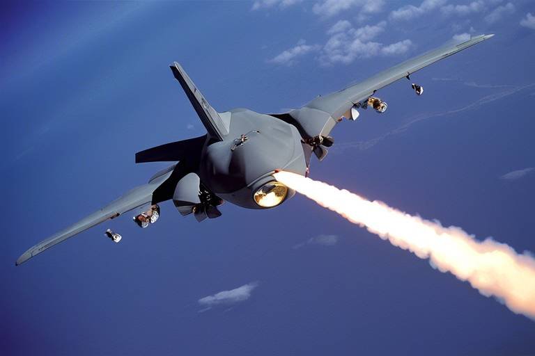
Satellite intelligence plays a pivotal role in shaping national defense strategies. It provides a comprehensive view of potential threats, enabling military and intelligence agencies to formulate effective responses. Through surveillance and reconnaissance, satellite systems gather critical information that informs strategic planning. Imagine having a bird's-eye view of the battlefield; that’s the power of satellite intelligence.
Surveillance technologies employed in satellite intelligence have become increasingly sophisticated. From synthetic aperture radar (SAR) to electro-optical sensors, these tools allow for continuous monitoring of military activities and geopolitical developments. The ability to observe movements in real-time gives nations a significant advantage, enabling them to act swiftly in response to emerging threats.
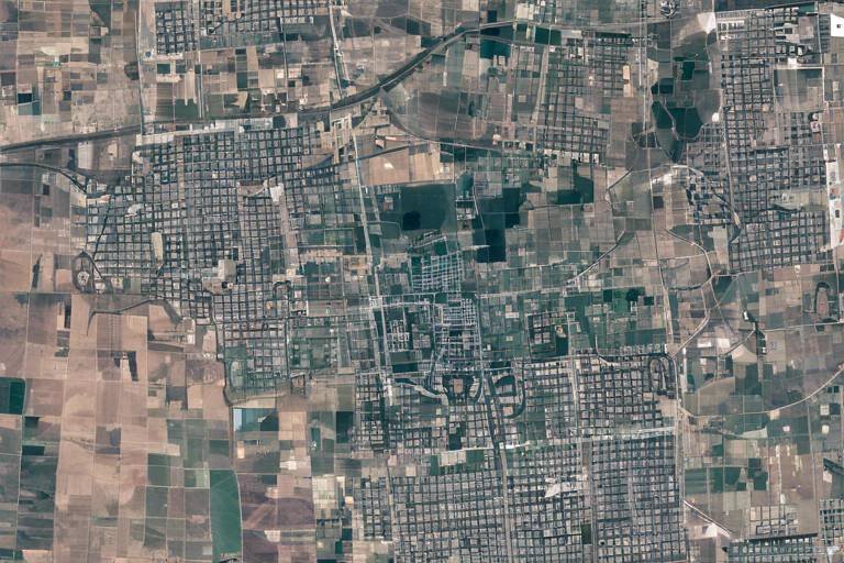
Imagery intelligence is a cornerstone of satellite capabilities. High-resolution satellite images are invaluable for strategic planning, providing decision-makers with the visual context needed to understand complex situations. Whether assessing the aftermath of a natural disaster or monitoring troop deployments, imagery intelligence offers a clear window into events on the ground.
Signals intelligence collected via satellites is equally crucial. By intercepting communications, intelligence agencies can gather insights into enemy plans and capabilities. This type of intelligence not only enhances situational awareness but also plays a significant role in preemptive actions against potential threats.
Reconnaissance missions supported by satellite intelligence are essential for enhancing situational awareness. These operations allow military and intelligence agencies to gather information about enemy positions, capabilities, and intentions. The synergy between satellite intelligence and ground operations creates a comprehensive understanding of the battlefield, enabling informed decision-making.
Satellite intelligence doesn't just influence military strategy; it also shapes international relations. By providing critical insights, it informs diplomatic strategies and helps nations navigate the complexities of global politics. The ability to monitor adversaries and allies alike fosters a sense of transparency, which can be crucial in maintaining peace.
Countries leverage satellite intelligence to inform their diplomatic strategies, using the data to understand the intentions of other nations. This insight allows for more effective negotiations and alliances, as nations can base their discussions on solid intelligence rather than speculation.
Furthermore, satellite intelligence plays a vital role in conflict prevention and resolution. By providing early warnings of potential conflicts, nations can take proactive measures to address tensions before they escalate. The insights gained from satellite data can lead to peaceful negotiations, ultimately saving lives and resources.
The landscape of satellite intelligence is continually evolving, driven by technological advancements. Innovations in artificial intelligence (AI) and machine learning are transforming how data is analyzed and utilized.
Artificial intelligence enhances data processing capabilities, enabling quicker and more accurate analysis of satellite imagery and signals. This technology allows analysts to sift through massive datasets, identifying patterns and anomalies that might otherwise go unnoticed. With AI, the speed and efficiency of intelligence gathering have reached unprecedented levels.
Another exciting trend is the miniaturization of satellites. Smaller, more agile satellites are revolutionizing intelligence-gathering operations, allowing for more frequent launches and cost-effective solutions. These mini-satellites can be deployed in large constellations, providing comprehensive coverage and real-time data collection.
Q: How does satellite intelligence affect national security?
A: Satellite intelligence enhances national security by providing critical data for surveillance, reconnaissance, and threat assessment, enabling informed decision-making.
Q: What are the main types of satellite intelligence?
A: The main types include imagery intelligence (IMINT) and signals intelligence (SIGINT), both of which offer valuable insights for military and civilian applications.
Q: How has technology changed satellite intelligence?
A: Advances in AI, machine learning, and satellite miniaturization have significantly improved data processing capabilities and operational efficiency.
Q: Can satellite intelligence help prevent conflicts?
A: Yes, by providing early warnings and insights, satellite intelligence can aid in conflict prevention and resolution efforts.
The Evolution of Satellite Intelligence
The journey of satellite intelligence is a fascinating tale of innovation, necessity, and strategic foresight. It all began during the Cold War, a period characterized by heightened tensions and the urgent need for reliable information. The first artificial satellite, Sputnik 1, launched by the Soviet Union in 1957, marked the dawn of a new era in intelligence-gathering. This event not only showcased technological prowess but also ignited a race among nations to develop their own satellite capabilities.
As the decades rolled on, the technology behind satellite intelligence evolved dramatically. The 1960s introduced the CORONA program, which utilized reconnaissance satellites to capture high-resolution images of enemy territories. This marked a significant leap forward, as it allowed military planners to gain insights into the movements and capabilities of adversaries without the need for ground troops or risky overflights. The implications were profound, shifting the balance of power and influencing military strategies around the globe.
Fast forward to the 1980s and 1990s, and we see the introduction of digital imaging technologies that further enhanced the clarity and utility of satellite imagery. The integration of advanced sensors and imaging techniques allowed for real-time data collection, making it easier to monitor not just military activities but also environmental changes and humanitarian crises. This transition from analog to digital was akin to moving from black-and-white television to vibrant high-definition broadcasts; it transformed how intelligence was perceived and utilized.
In recent years, the evolution of satellite intelligence has been propelled by the advent of miniaturization and commercialization. Smaller satellites, often referred to as CubeSats, have democratized access to satellite technology, enabling even smaller nations and private entities to participate in intelligence-gathering efforts. This shift has led to an explosion of data, as countless satellites orbit the Earth, collecting a vast array of information. The challenge now lies not just in gathering data but in effectively analyzing and interpreting it.
Moreover, the integration of artificial intelligence (AI) and machine learning into satellite operations has revolutionized the field. AI algorithms can process vast amounts of data at lightning speed, identifying patterns and anomalies that would take human analysts much longer to discern. This technological leap has transformed satellite intelligence from a reactive tool into a proactive asset, capable of predicting potential threats and informing strategic decisions.
The evolution of satellite intelligence is not merely a story of technological advancement; it is also a reflection of the changing dynamics of global security and diplomacy. As nations continue to invest in and refine their satellite capabilities, the implications for national security, international relations, and global stability are profound. Understanding this evolution is crucial for grasping the strategic importance of satellite intelligence in today's world.
- What is satellite intelligence? Satellite intelligence refers to the information gathered through the use of satellites, particularly for military and strategic purposes.
- How has satellite intelligence changed over the years? It has evolved from basic reconnaissance to advanced real-time data collection, incorporating technologies like AI and miniaturization.
- Why is satellite intelligence important for national security? It provides critical information for surveillance, reconnaissance, and threat identification, helping nations protect their interests.
- What role does AI play in satellite intelligence? AI enhances data processing capabilities, allowing for quicker and more accurate analysis of satellite imagery and signals.
The Role of Satellite Intelligence in National Security
In today's complex geopolitical landscape, the role of satellite intelligence in national security cannot be overstated. It serves as a critical backbone for defense strategies, enabling nations to maintain a vigilant eye on potential threats while enhancing their operational capabilities. Imagine having a bird's-eye view of the world, where you can detect military movements, monitor compliance with international treaties, and even assess environmental changes that could impact national interests. This is the power of satellite intelligence.
One of the primary functions of satellite intelligence is surveillance, which encompasses a range of technologies designed to keep tabs on various military activities. From tracking troop movements to monitoring missile launches, satellites provide real-time data that is crucial for informed decision-making. The effectiveness of these surveillance capabilities can be attributed to several advanced technologies:
- High-resolution imaging: Satellites equipped with cutting-edge cameras can capture detailed images of vast areas, allowing intelligence analysts to discern even the smallest details.
- Infrared sensing: This technology enables the detection of heat signatures, making it possible to identify hidden installations or moving vehicles, even in the dark.
- Radar systems: Satellites using synthetic aperture radar (SAR) can penetrate cloud cover and provide continuous surveillance regardless of weather conditions.
Moreover, imagery intelligence plays a pivotal role in strategic planning and decision-making. High-resolution satellite images are not just pictures; they are vital tools that help military leaders assess the battlefield, plan operations, and allocate resources efficiently. For instance, consider a scenario where a country needs to evaluate the readiness of its adversary's military forces. By analyzing satellite imagery, intelligence analysts can determine the number and type of military equipment present, the state of troop readiness, and even the construction of new facilities.
Equally important is signals intelligence (SIGINT), which involves intercepting communications and other electronic signals. Satellites equipped with advanced listening devices can capture a wide array of signals, from military communications to civilian broadcasts. This information is invaluable for understanding the intentions and capabilities of other nations. For example, if a country detects unusual communications patterns from a neighboring state, it may indicate preparations for a military exercise or even a potential conflict.
Furthermore, reconnaissance operations supported by satellite intelligence enhance situational awareness for military and intelligence agencies. These operations allow for a comprehensive understanding of the operational environment, which is essential for effective planning and execution of missions. By leveraging satellite data, agencies can respond proactively to emerging threats and adjust their strategies accordingly.
In summary, satellite intelligence is a cornerstone of national security. Its capabilities in surveillance, imagery intelligence, and signals intelligence provide a comprehensive toolkit for monitoring potential threats and informing military strategies. As technology continues to evolve, the importance of satellite intelligence in safeguarding national interests will only grow.
- What is satellite intelligence? Satellite intelligence refers to the collection and analysis of data gathered from satellites to support military and national security objectives.
- How does satellite intelligence contribute to national security? It enhances surveillance, reconnaissance, and threat assessment capabilities, allowing nations to make informed decisions regarding defense strategies.
- What technologies are used in satellite intelligence? Key technologies include high-resolution imaging, infrared sensing, and radar systems, each providing unique advantages for intelligence gathering.
Surveillance Capabilities
When we think about in the realm of satellite intelligence, we’re diving into a world that’s both fascinating and critical for national security. Imagine being able to observe vast areas of land from thousands of miles up in space, capturing real-time data that can inform military and governmental decisions. This is not science fiction; this is the reality of modern surveillance technology. Satellites equipped with advanced sensors and imaging technologies have transformed the way we monitor activities on the ground, making it easier to keep an eye on potential threats and geopolitical developments.
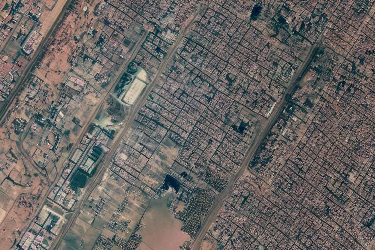
The effectiveness of these surveillance technologies can be attributed to several factors, including high-resolution imaging, synthetic aperture radar (SAR), and electro-optical sensors. These tools allow for detailed monitoring of military installations, troop movements, and even environmental changes that could signal unrest. For instance, high-resolution images can reveal the construction of new military bases or the movement of heavy artillery, providing invaluable intelligence that can shape defense strategies.
Moreover, the ability to conduct persistent surveillance means that countries can keep watch over specific regions continuously. This is particularly useful in volatile areas where military actions can escalate rapidly. By maintaining a constant eye in the sky, intelligence agencies can detect changes in behavior or unusual activities that might indicate an impending conflict or humanitarian crisis.
To give you a clearer picture, let’s break down some of the key technologies that enhance surveillance capabilities:
| Technology | Description | Applications |
|---|---|---|
| High-Resolution Imaging | Captures detailed images of the Earth’s surface. | Military reconnaissance, urban planning, disaster response. |
| Synthetic Aperture Radar (SAR) | Uses radar to create images of landscapes, regardless of weather conditions. | Surveillance in all weather, night-time operations. |
| Electro-Optical Sensors | Utilizes visible light to capture images, similar to a camera. | Target identification, monitoring environmental changes. |
These technologies work in tandem to create a comprehensive surveillance system that is not only efficient but also adaptable to various scenarios. Furthermore, the integration of artificial intelligence (AI) has revolutionized how we analyze the data collected from these satellites. AI algorithms can sift through massive amounts of imagery and signals, identifying patterns and anomalies that human analysts might miss. This rapid processing capability allows for quicker responses to emerging threats, making surveillance a proactive rather than reactive measure.
In summary, the surveillance capabilities offered by satellite intelligence are a game changer in the field of national security. They provide critical insights that help governments protect their interests and maintain stability on the global stage. As technology continues to evolve, we can expect even more sophisticated surveillance tools that will enhance our ability to monitor and respond to threats, ensuring safety and security in an increasingly complex world.
- What are the primary uses of satellite surveillance? Satellite surveillance is primarily used for military reconnaissance, environmental monitoring, and disaster management.
- How does AI enhance satellite surveillance? AI enhances satellite surveillance by enabling faster data processing and analysis, allowing for quicker identification of potential threats.
- Can satellite surveillance operate in all weather conditions? Yes, technologies like Synthetic Aperture Radar (SAR) allow for effective surveillance regardless of weather conditions.
Imagery Intelligence
, often referred to as IMINT, plays a crucial role in modern military and intelligence operations. This form of intelligence relies on high-resolution satellite images to provide a detailed view of geographical areas, military installations, and even civilian infrastructures. Imagine having the ability to see the world from above, capturing every detail with stunning clarity—this is what imagery intelligence offers.
The significance of imagery intelligence cannot be overstated. It serves as a powerful tool for strategic planning and decision-making, allowing military leaders and policymakers to visualize the operational environment. For instance, during conflicts, high-resolution images can reveal troop movements, supply lines, and even the construction of new military bases. This capability enables nations to not only respond to threats but also to anticipate them, creating a proactive defense posture.
One of the most fascinating aspects of imagery intelligence is its adaptability across various domains. Whether it's for military reconnaissance, disaster response, or environmental monitoring, the applications are vast. Here are some key areas where imagery intelligence is particularly impactful:
- Military Operations: Provides real-time data to commanders, enhancing situational awareness.
- Disaster Management: Assists in assessing damage and planning relief efforts after natural disasters.
- Environmental Monitoring: Tracks changes in land use, deforestation, and climate change effects.
Moreover, the integration of advanced technologies such as machine learning and artificial intelligence has propelled imagery intelligence into a new era. These technologies enable analysts to process vast amounts of data quickly and accurately, identifying patterns that may not be immediately visible to the human eye. For instance, AI algorithms can sift through thousands of satellite images to detect changes in infrastructure or troop deployments, providing insights that can significantly influence strategic decisions.
However, the reliance on imagery intelligence also raises critical questions regarding privacy and ethics. As nations enhance their surveillance capabilities, the potential for misuse increases. The balance between national security and individual privacy rights is a delicate one, and it is essential for governments to establish clear guidelines governing the use of such powerful technology.
In conclusion, imagery intelligence is more than just a tool; it is a vital component of modern strategy that shapes military operations, influences diplomatic relations, and enhances our understanding of global dynamics. As technology continues to evolve, the implications of imagery intelligence will undoubtedly expand, making it an area to watch closely in the years to come.
- What is imagery intelligence? Imagery intelligence (IMINT) refers to the collection and analysis of high-resolution images taken from satellites or aerial platforms to support military and strategic operations.
- How does imagery intelligence aid in military operations? It provides critical information about enemy movements, infrastructure, and operational environments, enabling more informed decision-making.
- What technologies enhance imagery intelligence? Technologies such as machine learning and artificial intelligence are increasingly used to analyze satellite images quickly and accurately.
- Are there ethical concerns with imagery intelligence? Yes, the use of imagery intelligence raises privacy and ethical concerns, necessitating careful regulation and oversight.
Signals Intelligence
Signals intelligence, often abbreviated as SIGINT, is a critical component of modern intelligence-gathering operations. It involves the collection, analysis, and exploitation of electronic signals and communications. Think of it as eavesdropping on a conversation, but on a global scale. Whether it's intercepting military communications, monitoring diplomatic exchanges, or gathering data from civilian networks, SIGINT provides invaluable insights that can shape national security strategies and diplomatic efforts.
The significance of signals intelligence cannot be overstated. In a world where information is power, the ability to listen in on adversaries' communications can reveal their intentions, capabilities, and plans. For instance, during military operations, SIGINT can help identify troop movements or detect preparations for an attack, giving decision-makers a crucial advantage. Moreover, in a geopolitical context, understanding the communications between nations can inform diplomatic strategies and conflict resolution efforts.
To put it simply, SIGINT is like having a high-tech listening device that can capture a wide array of electronic signals. This includes:
- Telephone Calls: Intercepting voice communications to gather intelligence on potential threats.
- Text Messages: Analyzing SMS and other messaging platforms to track movements and intentions.
- Emails: Monitoring electronic correspondence for sensitive information.
- Satellite Communications: Capturing data from satellite transmissions, which can include military operations or strategic discussions.
One of the most compelling aspects of SIGINT is its ability to adapt to technological advancements. As communication methods evolve—from traditional telephony to encrypted messaging apps—so too do the techniques used to gather signals intelligence. Agencies have invested heavily in sophisticated technologies that can decrypt and analyze vast amounts of data in real-time. This not only allows for quicker responses to emerging threats but also enhances the accuracy of intelligence assessments.
Furthermore, the integration of artificial intelligence (AI) into SIGINT operations has revolutionized the field. AI algorithms can sift through enormous datasets far more efficiently than human analysts, identifying patterns and anomalies that might otherwise go unnoticed. This capability not only speeds up the processing of information but also improves the overall quality of intelligence analysis.
In summary, signals intelligence serves as a pivotal tool in the arsenal of national security agencies. It empowers them to stay one step ahead of potential adversaries by providing timely and actionable intelligence. As technology continues to advance, the methods and applications of SIGINT will undoubtedly evolve, further enhancing its role in safeguarding national interests and informing global relations.
- What is signals intelligence (SIGINT)? SIGINT is the collection and analysis of electronic signals and communications to gather intelligence.
- How does SIGINT impact national security? It provides critical insights into adversaries' communications, aiding in threat detection and strategic planning.
- What technologies are used in SIGINT? Technologies include advanced listening devices, data processing software, and AI algorithms for analysis.
- Is SIGINT legal? Yes, but it is subject to strict regulations and oversight to protect privacy rights.
Reconnaissance Operations
When it comes to modern warfare and intelligence gathering, play a pivotal role, serving as the eyes and ears of military and intelligence agencies. These operations are not just about gathering data; they are about understanding the battlefield, assessing threats, and making informed decisions that can alter the course of a conflict. Imagine trying to navigate a dense forest without a map; that's what military leaders face without effective reconnaissance. By leveraging satellite intelligence, they gain crucial insights that can mean the difference between victory and defeat.
Satellite reconnaissance operations utilize a variety of technologies to collect information from vast distances. These can include high-resolution imaging systems, synthetic aperture radar, and even advanced sensors capable of detecting changes in the environment. The data gathered is then analyzed and transformed into actionable intelligence. This process is akin to piecing together a complex puzzle where each piece of information contributes to a clearer picture of the situation on the ground.
One of the most significant advantages of satellite reconnaissance is its ability to provide real-time data. This capability allows military forces to monitor enemy movements, assess the effectiveness of their strategies, and adjust their operations accordingly. For instance, if a nation identifies unusual troop movements through satellite imagery, it can quickly deploy resources to counteract potential threats. This timeliness is crucial in a world where decisions must be made rapidly to adapt to changing circumstances.
Moreover, reconnaissance operations are not solely confined to military applications. They also serve vital roles in humanitarian efforts, disaster response, and environmental monitoring. For example, during natural disasters, satellites can provide critical information about affected areas, helping agencies allocate resources effectively. This dual-use nature of reconnaissance demonstrates its versatility and importance in various fields.
To illustrate the impact of reconnaissance operations further, consider the following table that summarizes key technologies used in satellite reconnaissance:
| Technology | Description | Application |
|---|---|---|
| High-Resolution Imaging | Captures detailed images of the Earth's surface. | Military surveillance, urban planning, environmental monitoring. |
| Synthetic Aperture Radar | Uses radar waves to create images of the ground. | Nighttime surveillance, all-weather reconnaissance. |
| Signals Intelligence | Intercepts and analyzes communication signals. | Military operations, counter-terrorism. |
In conclusion, reconnaissance operations supported by satellite intelligence are essential for maintaining situational awareness in an increasingly complex world. They empower decision-makers with the information needed to respond swiftly and effectively to emerging threats. As technology continues to evolve, the capabilities of reconnaissance operations will only enhance, ensuring that nations can stay one step ahead in the realm of national security.
- What is the primary purpose of reconnaissance operations? Reconnaissance operations aim to gather intelligence and assess threats to support military and strategic decision-making.
- How do satellites aid in reconnaissance? Satellites provide high-resolution imagery and real-time data, allowing for comprehensive surveillance and monitoring of activities on the ground.
- Are reconnaissance operations only used for military purposes? No, they are also utilized in humanitarian efforts, disaster response, and environmental monitoring.
The Impact on Global Relations
In today's interconnected world, the significance of satellite intelligence extends far beyond mere data collection; it plays a pivotal role in shaping international relations. As nations grapple with complex geopolitical landscapes, the insights gleaned from satellite imagery and signals intelligence often serve as the backbone of diplomatic strategies. Imagine being able to peek behind the curtain of another country's military activities or political maneuvers—this is the power that satellite intelligence wields. It not only informs national security policies but also acts as a barometer for global stability.
One of the most fascinating aspects of satellite intelligence is its ability to influence diplomatic negotiations. By providing real-time data on troop movements, military exercises, and even humanitarian crises, countries can make informed decisions that affect their foreign policy. For instance, if a nation detects unusual military buildup on its border through satellite surveillance, it can proactively engage in diplomatic discussions to de-escalate tensions. This proactive approach can prevent conflicts before they escalate, showcasing how intelligence can be a tool for peace rather than just a weapon of war.
Furthermore, satellite intelligence plays a crucial role in forming alliances between nations. Countries that share intelligence data often find themselves in stronger positions to negotiate trade agreements, military partnerships, and collaborative efforts in tackling global issues like climate change or terrorism. The sharing of satellite intelligence fosters trust and transparency, which are essential components of any successful alliance. For instance, the Five Eyes alliance—comprising Australia, Canada, New Zealand, the United Kingdom, and the United States—relies heavily on satellite intelligence to coordinate their efforts in intelligence-sharing and security.
However, the implications of satellite intelligence are not solely positive. The same capabilities that can facilitate peace can also exacerbate tensions. Nations may resort to espionage or cyber operations, using satellite intelligence to gain an upper hand in international disputes. The delicate balance between using satellite intelligence for national security and respecting the sovereignty of other nations is a tightrope that many governments must walk. The potential for misinterpretation of data can lead to miscalculations that spark conflicts, making it imperative for nations to approach satellite intelligence with caution and responsibility.
In summary, the impact of satellite intelligence on global relations is profound and multifaceted. It serves as both a shield and a sword, helping nations navigate the treacherous waters of international diplomacy. As technology advances and satellite capabilities expand, the role of satellite intelligence in shaping our world will only continue to grow, making it an essential component of modern strategy.
- What is satellite intelligence? Satellite intelligence refers to the collection and analysis of data obtained from satellites, which can include imagery, signals, and other forms of information crucial for national security and international relations.
- How does satellite intelligence influence diplomacy? It provides real-time insights into military and political activities, enabling nations to make informed decisions that can lead to peaceful negotiations or conflict prevention.
- What are the risks associated with satellite intelligence? While it can enhance security, it also poses risks such as espionage and misinterpretation of data, which can lead to international tensions or conflicts.
Diplomatic Strategies
In the intricate web of international relations, satellite intelligence serves as a pivotal tool that shapes diplomatic strategies across the globe. Imagine being a diplomat with the ability to see the world from above, gaining insights that are otherwise hidden from view. This bird's-eye perspective allows nations to navigate complex political landscapes with greater precision and confidence. The role of satellite intelligence in diplomacy is not just about gathering data; it’s about transforming that data into actionable strategies that can influence negotiations, foster alliances, and even prevent conflicts.
One of the most significant advantages of satellite intelligence is its capability to provide real-time information. This immediacy is crucial when nations are faced with rapid developments that could alter the balance of power. For instance, if a country detects unusual military movements near its borders through satellite imagery, it can quickly engage in diplomatic discussions to address potential threats. This proactive approach can lead to de-escalation and ultimately, a peaceful resolution. The ability to verify claims made by other nations through satellite data strengthens a country’s position in negotiations, making it harder for adversaries to manipulate facts.
Moreover, satellite intelligence fosters transparency among nations. When countries know that their actions can be monitored from space, they are more likely to act responsibly. This transparency can lead to the establishment of trust, which is essential in diplomatic relations. Countries can utilize satellite data to reassure their neighbors about their intentions, thus paving the way for stronger diplomatic ties. For example, arms control treaties often rely on satellite surveillance to ensure compliance, showcasing how intelligence can facilitate cooperation rather than competition.
Additionally, satellite intelligence plays a crucial role in humanitarian efforts. During crises, such as natural disasters or conflicts, satellite imagery can help identify areas in need of assistance. This capability enables nations and international organizations to coordinate their responses more effectively, demonstrating a commitment to global welfare that can enhance diplomatic relations. By providing timely and accurate information, satellite intelligence not only aids in disaster response but also strengthens the diplomatic bonds between nations working together for a common cause.
In conclusion, the strategic implications of satellite intelligence in diplomacy are profound. It equips nations with the tools to engage in informed discussions, build trust, and respond to crises effectively. As we move forward in an increasingly interconnected world, the importance of leveraging satellite intelligence for diplomatic strategies will only continue to grow, shaping the future of international relations.
- What is satellite intelligence? Satellite intelligence refers to the collection and analysis of data obtained from satellites, which can be used for military, civilian, and diplomatic purposes.
- How does satellite intelligence impact national security? It enhances surveillance, reconnaissance, and threat identification, providing critical information that informs defense strategies.
- Can satellite intelligence prevent conflicts? Yes, by providing real-time information and transparency, it can facilitate communication and negotiation between nations, reducing the likelihood of misunderstandings that could lead to conflict.
- What role does technology play in satellite intelligence? Technological advancements, such as AI and miniaturization, have significantly improved the capabilities of satellite intelligence, making data collection and analysis faster and more accurate.
Conflict Prevention and Resolution
In a world often fraught with tension and uncertainty, satellite intelligence plays a pivotal role in conflict prevention and resolution. Imagine being able to look down from the heavens and see the intricate web of global relationships, military movements, and potential flashpoints before they ignite into full-blown conflict. This is precisely what satellite intelligence offers—an eye in the sky that provides critical insights into geopolitical dynamics.
One of the most significant advantages of satellite intelligence is its ability to monitor potential threats in real time. By analyzing satellite imagery, nations can detect troop movements, military buildups, or unusual activities that may signal an impending conflict. This capability allows governments to act proactively rather than reactively, enabling them to diffuse situations before they escalate. For instance, if a country observes suspicious military maneuvers near its borders, it can engage in diplomatic discussions or bolster its defenses without resorting to military action.
Moreover, satellite intelligence facilitates data-driven decision-making. Leaders can rely on accurate and timely information to make informed choices regarding international relations. This data-driven approach reduces the likelihood of misunderstandings or miscalculations, which often lead to conflicts. For example, during a crisis, a nation may utilize satellite data to verify the intentions of another country, thereby clarifying whether a military exercise is a precursor to aggression or merely a routine drill.
Additionally, satellite intelligence enhances the ability to engage in effective diplomacy. By providing a clearer picture of the geopolitical landscape, it aids diplomats in crafting strategies that consider the strengths and weaknesses of their counterparts. This intelligence can be invaluable during negotiations, as it allows nations to understand the stakes involved and the potential consequences of their actions. In this way, the insights gleaned from satellite data can lead to more successful diplomatic outcomes, fostering peace and stability.
Furthermore, the role of satellite intelligence in conflict resolution cannot be overstated. When tensions rise, the ability to monitor and verify compliance with ceasefires or peace agreements is essential. Satellite imagery can confirm whether parties involved in a conflict are adhering to the terms set forth in negotiations. This verification process acts as a deterrent against violations and builds trust among nations. By ensuring that all parties are held accountable, satellite intelligence contributes to a more stable and peaceful international environment.
In summary, the impact of satellite intelligence on conflict prevention and resolution is profound. It not only provides nations with the tools to identify and address potential threats but also fosters an environment conducive to effective diplomacy. As technology continues to evolve, the capabilities of satellite intelligence will only enhance, offering even greater potential for maintaining peace in an increasingly complex world.
- How does satellite intelligence help in conflict prevention? Satellite intelligence provides real-time monitoring of military activities and geopolitical developments, allowing nations to identify potential threats before they escalate.
- Can satellite intelligence verify compliance with peace agreements? Yes, satellite imagery can be used to monitor and verify whether parties involved in conflicts are adhering to the terms of ceasefires or peace agreements.
- What role does satellite intelligence play in diplomacy? It aids diplomats by providing accurate information about the geopolitical landscape, which helps in crafting informed strategies and negotiations.
Technological Advancements in Satellite Intelligence
In recent years, the landscape of satellite intelligence has undergone a remarkable transformation, largely driven by rapid technological advancements. These innovations not only enhance the capabilities of satellites but also revolutionize how intelligence is gathered, analyzed, and utilized. Imagine a world where satellites can process vast amounts of data in real-time, providing insights that were once thought to be the realm of science fiction. This is the reality we are moving towards, thanks to breakthroughs in artificial intelligence (AI) and machine learning.
One of the most significant advancements is the integration of AI into satellite operations. AI algorithms can now analyze satellite imagery at a speed and accuracy that surpasses human capabilities. For instance, the ability to detect changes in terrain, identify vehicles, or monitor environmental changes has never been easier. By employing sophisticated machine learning techniques, satellites can learn from previous data sets, improving their accuracy over time. This means that military and intelligence agencies can make informed decisions faster than ever before, enhancing national security and operational effectiveness.
Another exciting trend is the miniaturization of satellites. Gone are the days when only large, expensive satellites could perform complex tasks. The advent of small satellites, often referred to as CubeSats or SmallSats, has opened new doors for intelligence-gathering operations. These smaller satellites are not only more cost-effective but also more agile, allowing for rapid deployment and the ability to cover areas that were previously challenging to monitor. They can be launched in constellations, working together to provide comprehensive coverage and real-time data analysis.
To illustrate the impact of these advancements, consider the following table that compares traditional satellite capabilities with modern technological innovations:
| Feature | Traditional Satellites | Modern Satellites |
|---|---|---|
| Size | Large and cumbersome | Small and agile |
| Cost | High launch and operational costs | Lower costs due to miniaturization |
| Data Processing | Manual analysis, slow response time | AI-driven, real-time analysis |
| Deployment | Long preparation and launch periods | Rapid deployment, often in swarms |
Moreover, these advancements are not just limited to military applications. Civilian sectors, including agriculture, disaster management, and urban planning, are also reaping the benefits of improved satellite intelligence. For example, farmers can use satellite data to monitor crop health, predict yields, and optimize resource allocation. In disaster management, real-time satellite imagery can assist in assessing damage and coordinating response efforts during natural disasters. The implications are vast and continue to expand as technology evolves.
As we look to the future, the potential for satellite intelligence is boundless. With ongoing research and development, we can expect even more sophisticated tools and methods to emerge, further enhancing our ability to understand and respond to global challenges. The fusion of advanced technologies will not only change how we gather intelligence but will also redefine the very nature of global security and cooperation.
- What are CubeSats? CubeSats are small, cube-shaped satellites that are cost-effective and versatile, often used for a variety of applications, including scientific research and Earth observation.
- How does AI improve satellite intelligence? AI enhances satellite intelligence by automating data analysis, allowing for faster and more accurate interpretation of satellite imagery and signals.
- What are the benefits of miniaturized satellites? Miniaturized satellites are cheaper to launch, easier to deploy, and can work in constellations to provide more comprehensive coverage and real-time data.
AI and Data Processing
In the rapidly evolving world of satellite intelligence, artificial intelligence (AI) has emerged as a game-changer, revolutionizing the way data is processed and analyzed. Imagine having a vast ocean of information at your fingertips, where every pixel of a satellite image or every signal captured holds potential insights. However, sifting through this immense volume of data can be overwhelming for human analysts. This is where AI steps in, acting like a skilled librarian who can instantly find the right book in a massive library.
AI algorithms are designed to identify patterns and anomalies within satellite data, which not only speeds up the analysis process but also enhances accuracy. For instance, machine learning models can be trained to recognize specific military assets or environmental changes, enabling analysts to focus on critical areas of concern. This capability is crucial for national security, as it allows for timely responses to emerging threats. The ability to process data in real-time means that decision-makers can act swiftly, often before a situation escalates.
Furthermore, AI-driven data processing doesn’t just stop at analysis; it also plays a vital role in predictive modeling. By analyzing historical data alongside current trends, AI can forecast potential future events. This predictive capability can be invaluable in areas such as disaster response, where anticipating an event can save lives and resources. For example, AI can analyze weather patterns and satellite imagery to predict the path of a hurricane, allowing for timely evacuations and preparations.
To illustrate the impact of AI on data processing in satellite intelligence, consider the following table:
| AI Application | Description | Impact |
|---|---|---|
| Image Recognition | Identifying objects in satellite images, such as vehicles or buildings. | Improves surveillance accuracy and reduces analysis time. |
| Signal Processing | Analyzing communication signals to extract meaningful data. | Enhances intelligence gathering and threat detection. |
| Predictive Analytics | Forecasting future events based on historical and real-time data. | Enables proactive measures in national security and disaster management. |
As we can see, the integration of AI into satellite intelligence not only optimizes data processing but also leads to more informed decision-making. It’s like having a supercharged brain that can think and analyze at lightning speed, providing insights that are crucial in today’s fast-paced world. However, while AI brings numerous advantages, it also raises questions about ethics and data privacy. As we continue to leverage AI technologies, it’s essential to strike a balance between innovation and responsibility, ensuring that the tools we develop serve the greater good.
In conclusion, the role of AI in data processing within satellite intelligence is transformative. It empowers analysts to make sense of complex data landscapes, enhances situational awareness, and ultimately strengthens national security. As technology advances, we can only expect AI to play an even more significant role in shaping the future of intelligence-gathering methods.
- What is satellite intelligence? Satellite intelligence refers to the collection and analysis of data obtained from satellites to support military, governmental, and civilian operations.
- How does AI improve satellite intelligence? AI enhances satellite intelligence by automating data analysis, recognizing patterns, and providing predictive insights that inform decision-making.
- What are the ethical concerns surrounding AI in satellite intelligence? Ethical concerns include issues of data privacy, potential misuse of information, and the implications of automated decision-making in national security.
- Can AI predict future events based on satellite data? Yes, AI can analyze historical and real-time satellite data to forecast potential future events, aiding in proactive measures for national security and disaster management.
Miniaturization of Satellites
The is nothing short of a revolution in the field of satellite intelligence. Imagine a world where the size of a satellite is comparable to that of a shoebox, yet it possesses capabilities that were once exclusive to its much larger predecessors. This trend has not only made satellite technology more accessible but has also transformed the landscape of intelligence-gathering operations.
One of the most compelling aspects of miniaturization is the cost-effectiveness it brings. Traditional satellites can cost billions of dollars to build and launch, whereas smaller satellites, often referred to as CubeSats or SmallSats, can be developed and deployed for a fraction of that cost. This democratization of satellite technology allows even smaller nations and private companies to participate in space exploration and intelligence activities, leveling the playing field in the realm of national security.
Moreover, the agility of miniaturized satellites is a game changer. Smaller satellites can be launched in groups, creating a constellation of satellites that can work together to provide comprehensive coverage of a specific area. This is akin to having a swarm of bees working in unison to gather pollen; the result is a much more efficient and responsive system for collecting data. The ability to deploy multiple satellites simultaneously also means that if one satellite fails, others can quickly fill the gap, ensuring that intelligence-gathering efforts remain uninterrupted.
Another fascinating aspect of miniaturization is the advancements in technology that have allowed for these smaller satellites to be equipped with sophisticated sensors and communication systems. For instance, the integration of high-resolution imaging technology means that these compact satellites can capture images with clarity comparable to that of larger satellites. Additionally, advances in data compression and transmission technology enable these satellites to send vast amounts of data back to Earth efficiently, facilitating real-time analysis and decision-making.
However, with great power comes great responsibility. The proliferation of miniaturized satellites raises important questions about space debris and the sustainability of space operations. As more small satellites are launched, the risk of collisions and the creation of space debris increases. This is a challenge that the global community must address to ensure that the benefits of miniaturization do not come at the expense of a sustainable space environment.
In summary, the miniaturization of satellites is reshaping the future of satellite intelligence. By making satellite technology more affordable, agile, and capable, we are witnessing a new era of intelligence-gathering that promises to enhance national security while also presenting new challenges. As we continue to innovate and explore the possibilities of smaller satellites, the implications for military strategy, global relations, and technological advancement will undoubtedly be profound.
- What are miniaturized satellites? Miniaturized satellites, often called CubeSats or SmallSats, are compact satellites that are significantly smaller and lighter than traditional satellites, yet equipped with advanced technology for data collection and communication.
- How do miniaturized satellites impact national security? These satellites enhance national security by providing cost-effective surveillance and reconnaissance capabilities, allowing for more agile responses to potential threats.
- What are the challenges associated with miniaturized satellites? The main challenges include the risk of space debris and the need for sustainable practices in satellite deployment and operation.
Frequently Asked Questions
- What is satellite intelligence?
Satellite intelligence refers to the collection and analysis of data gathered from satellites orbiting the Earth. This data can include imagery, signals, and various forms of surveillance that are crucial for military operations, national security, and even civilian applications.
- How has satellite intelligence evolved over the years?
Over the decades, satellite intelligence has seen significant advancements. From the early days of basic reconnaissance satellites to today's high-resolution imagery and sophisticated signals intelligence capabilities, the evolution has been driven by technological innovations that enhance data collection and analysis.
- What role does satellite intelligence play in national security?
Satellite intelligence is vital for national security as it provides critical information for surveillance, reconnaissance, and threat identification. By monitoring military activities and geopolitical developments, it helps governments make informed decisions regarding defense strategies.
- What types of surveillance technologies are used in satellite intelligence?
Various surveillance technologies are employed, including high-resolution cameras for imagery intelligence and sensors for signals intelligence. These technologies enable the monitoring of military movements and other significant activities on the ground.
- How does imagery intelligence contribute to strategic planning?
Imagery intelligence provides high-resolution satellite images that are crucial for strategic planning. These images help military and intelligence agencies assess situations, identify potential threats, and make informed decisions regarding operations.
- What is signals intelligence, and why is it important?
Signals intelligence involves intercepting and analyzing communications and electronic signals. It's important because it provides insights into enemy communications, allowing for better-informed military strategies and operations.
- How does satellite intelligence impact global relations?
Satellite intelligence significantly influences global relations by informing diplomatic strategies and shaping international policies. It allows countries to understand each other's capabilities and intentions, which can help in conflict prevention and resolution.
- What advancements are being made in satellite intelligence technology?
Recent advancements include the integration of artificial intelligence and machine learning for faster data processing, as well as the miniaturization of satellites. These innovations make intelligence-gathering more efficient and accessible.
- How does AI enhance data processing in satellite intelligence?
AI enhances data processing by automating the analysis of vast amounts of satellite data, leading to quicker and more accurate insights. This allows intelligence agencies to respond more rapidly to emerging threats and opportunities.
- What are the benefits of miniaturizing satellites?
Miniaturizing satellites offers several benefits, including reduced launch costs and increased agility. Smaller satellites can be deployed in larger numbers, providing more comprehensive coverage and enabling real-time intelligence gathering.