How Autonomous Drones Are Supporting Smart City Development
In today's rapidly evolving urban landscape, the integration of technology into city planning and management has become essential. One of the most exciting advancements in this realm is the use of autonomous drones. These flying marvels are not just a futuristic concept; they are actively reshaping how cities function and grow. Imagine a city where traffic congestion is minimized, public safety is enhanced, and environmental monitoring is seamless. This is the promise of smart cities powered by autonomous drones.
Autonomous drones are revolutionizing urban infrastructure by providing real-time data and insights that were previously unimaginable. From aerial surveys that inform city planners to emergency response capabilities that save lives, the applications of drone technology are vast and varied. As we delve deeper into this topic, it becomes clear that these drones are not merely tools; they are essential partners in the quest for sustainable urban development.
Moreover, the integration of drones into smart city frameworks fosters a sense of community engagement and transparency. Residents can witness how their cities evolve and adapt to modern challenges, creating a more inclusive environment. As we explore the various roles that autonomous drones play in urban development, it’s important to recognize their potential to transform not just infrastructure, but the very fabric of urban life.
Autonomous drones provide valuable aerial data that aids in effective urban planning, allowing city officials to visualize land use, monitor changes, and optimize zoning regulations for better community outcomes. By capturing high-resolution images and data from above, these drones enable planners to make informed decisions that align with the needs of the community. Imagine being able to see a bird's-eye view of a neighborhood and understanding its dynamics in real-time; this is what drones offer.
Furthermore, drones can assist in identifying areas that require redevelopment or improvement. For instance, they can highlight underutilized spaces or areas with high traffic congestion. By utilizing this data, cities can prioritize projects that enhance livability and accessibility for residents. The ability to analyze trends over time also allows for proactive measures, ensuring that urban development is both sustainable and responsive.
Drones equipped with advanced sensors enhance public safety by monitoring traffic, detecting emergencies, and assisting law enforcement, ultimately contributing to safer urban environments for residents. With the ability to cover large areas quickly, drones can provide real-time updates to authorities, allowing for rapid response to incidents. This capability is especially crucial in high-density urban areas where every second counts.
In crisis situations, drones can quickly assess damage, deliver medical supplies, and provide real-time information to first responders, significantly improving the efficiency of emergency response efforts. Imagine a disaster scenario where traditional methods of assessment are hindered by debris or inaccessible areas. Drones can navigate these challenges, offering a clear view of the situation and enabling responders to strategize effectively.
Autonomous drones play a crucial role in disaster management by conducting aerial surveys, mapping affected areas, and facilitating recovery efforts, ensuring timely assistance to impacted communities. Their ability to gather data from hard-to-reach places can make a significant difference in the aftermath of natural disasters, helping to prioritize resources and aid.
Drones equipped with thermal imaging can locate missing persons in challenging terrains, drastically reducing search times and increasing the likelihood of successful rescues during emergencies. This technology is a game-changer, especially in situations where traditional search methods may be too slow or ineffective.
Drones enhance surveillance capabilities for urban areas, enabling continuous monitoring of public spaces, infrastructure, and environmental conditions to ensure compliance with regulations and enhance security measures. With the ability to provide real-time footage and data analytics, drones can assist in maintaining public order and safety.
Drones facilitate the inspection and maintenance of critical infrastructure, such as bridges and power lines, by providing high-resolution imagery and data analysis, ultimately reducing costs and improving safety. Regular inspections are vital to prevent disasters, and drones streamline this process, making it faster and more efficient.
Using drones for asset management allows city planners to maintain accurate inventories of public assets, streamline maintenance schedules, and allocate resources more effectively for urban development projects. This proactive approach not only saves money but also extends the lifespan of infrastructure.
Autonomous drones contribute to environmental monitoring by collecting data on air quality, noise levels, and urban heat islands, helping cities implement sustainable practices and improve residents' quality of life. By understanding environmental impacts, cities can adopt measures that promote sustainability and enhance the overall well-being of their citizens.
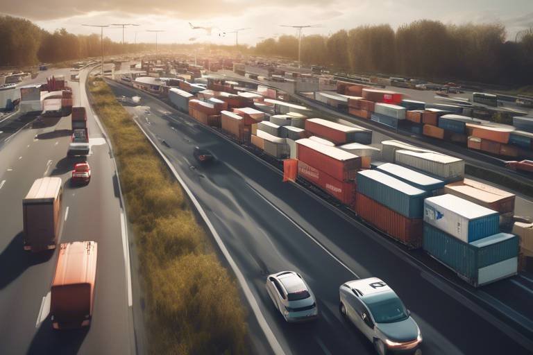
Drones support smart transportation initiatives by providing real-time traffic data, optimizing delivery routes, and integrating with other smart technologies to enhance urban mobility and reduce congestion. Imagine a city where traffic flows smoothly, deliveries are timely, and public transportation is efficient—this is the future that drones are helping to create.
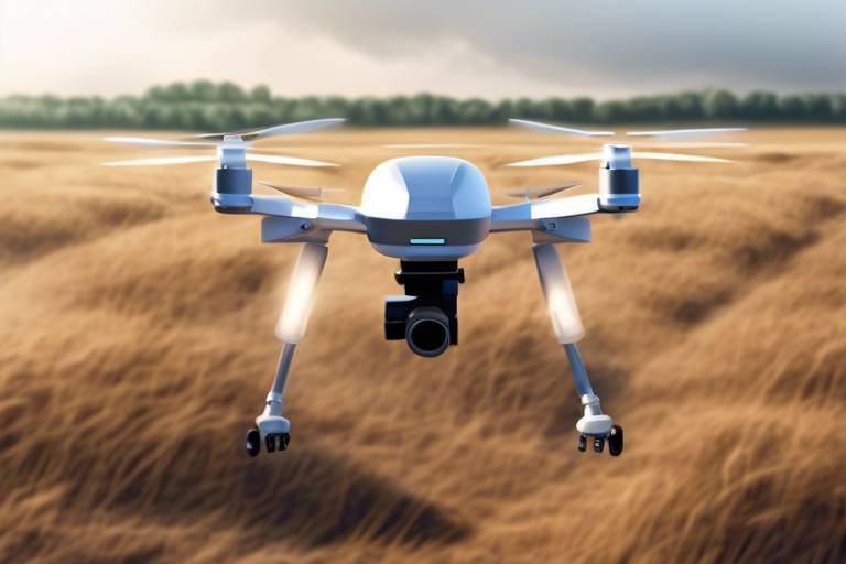
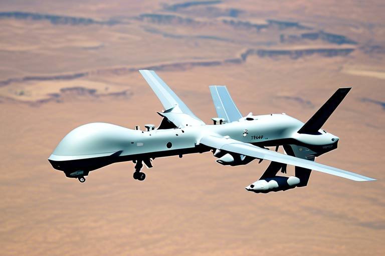
- What are autonomous drones? Autonomous drones are unmanned aerial vehicles that can operate without human intervention, using advanced sensors and software to navigate and perform tasks.
- How do drones improve urban planning? Drones provide aerial data that helps city officials visualize land use, monitor changes, and optimize zoning regulations, leading to better community outcomes.
- Can drones enhance public safety? Yes, drones can monitor traffic, detect emergencies, and assist law enforcement, contributing to safer urban environments.
- What role do drones play in disaster management? Drones conduct aerial surveys, map affected areas, and facilitate recovery efforts, ensuring timely assistance to impacted communities during disasters.
Enhancing Urban Planning
In the rapidly evolving landscape of urban development, autonomous drones are emerging as game-changers, revolutionizing how city planners approach their tasks. Imagine having a bird's-eye view of your city, where you can effortlessly assess land use, monitor ongoing changes, and make informed decisions that shape the future of your community. This is precisely what drones offer, providing invaluable aerial data that enhances the effectiveness of urban planning.
City officials can utilize drones to create high-resolution maps that reveal intricate details about land utilization. These maps allow planners to visualize existing structures, green spaces, and potential development sites. By analyzing this data, urban planners can optimize zoning regulations to ensure that communities are designed for maximum benefit. For instance, they can identify underutilized areas that may benefit from new parks or community centers, fostering a sense of community and improving residents' quality of life.
Moreover, drones can play a pivotal role in monitoring changes over time. With the ability to conduct regular aerial surveys, city officials can track urban sprawl, assess the impact of new developments, and even monitor compliance with zoning laws. This continuous flow of data allows for a more proactive approach to urban planning, enabling cities to adapt to the needs of their residents swiftly. For example, if a particular neighborhood shows signs of overcrowding, planners can respond by adjusting zoning laws to accommodate the growing population.
Not only do drones assist in visualizing and monitoring, but they also promote sustainability in urban planning. By providing data on environmental factors such as air quality and heat islands, drones help city planners make informed decisions that prioritize the health of their communities. This data can be used to implement green initiatives, such as increasing tree cover or enhancing public transportation options, ultimately leading to more sustainable urban environments.
In summary, the integration of autonomous drones into urban planning processes is more than just a technological advancement; it's a transformative approach to creating smarter, more efficient cities. By harnessing the power of aerial data, cities can not only enhance their planning efforts but also create vibrant spaces that cater to the needs of their residents, ensuring a better quality of life for all.
Improving Public Safety
In today's fast-paced urban environments, ensuring public safety has never been more crucial. Autonomous drones are stepping up to the plate, acting as the eyes in the sky that can monitor our streets, neighborhoods, and even crowded events. Imagine a world where emergency situations are detected before they escalate, where traffic flows smoothly, and where law enforcement can respond to incidents in real-time. This is not just a dream; it’s becoming a reality thanks to the innovative capabilities of drones.
Equipped with advanced sensors and cameras, these drones can capture high-definition images and data from above, providing a comprehensive view of urban landscapes. They can monitor traffic patterns, helping to alleviate congestion and reduce the risk of accidents. For instance, if a drone identifies a traffic jam, it can relay this information to traffic management systems, allowing for immediate adjustments to traffic signals or the deployment of officers to manage the situation. This proactive approach not only improves traffic flow but also enhances overall safety for drivers and pedestrians alike.
But the benefits don’t stop there. In case of emergencies, such as fires or medical crises, drones can swiftly assess the situation and provide critical information to first responders. They can deliver essential supplies like defibrillators or medical kits to locations that may be difficult for ground vehicles to access. This quick action can mean the difference between life and death. With the ability to cover large areas in a short amount of time, drones serve as vital tools in emergency response efforts.
When disaster strikes, the role of drones becomes even more pronounced. They are capable of conducting aerial surveys to assess damage, which is invaluable for emergency management teams. By mapping affected areas, drones provide a clear picture of the situation, helping teams prioritize their efforts and allocate resources efficiently. This capability is particularly important during natural disasters like floods, wildfires, or earthquakes, where traditional methods of assessment can be slow and dangerous.
In the realm of disaster management, autonomous drones can be deployed to perform aerial surveys that map out affected areas. This allows for a more structured response strategy. For example, during a flood, drones can identify the most severely impacted neighborhoods, enabling authorities to focus their rescue and recovery efforts where they are needed most. The speed and accuracy of this data collection are vital in ensuring timely assistance to those in need.
Drones equipped with thermal imaging technology are revolutionizing search and rescue operations. In challenging terrains—be it dense forests or rugged mountains—these drones can locate missing persons much faster than ground teams. Imagine searching for a lost hiker in a sprawling wilderness; a drone can quickly scan the area, identify heat signatures, and guide rescuers directly to the person in need. This drastically reduces search times and increases the likelihood of successful rescues.
The integration of drones into public safety initiatives is a game changer. As cities continue to evolve into smart cities, the role of these aerial companions will only grow. By enhancing surveillance capabilities and ensuring a rapid response to emergencies, drones are not just improving public safety; they are redefining it.
Emergency Response Assistance
In the face of emergencies, every second counts. That's where autonomous drones step in, acting as the unsung heroes of crisis situations. Imagine a city struck by a natural disaster—roads are blocked, communication lines are down, and traditional rescue methods are hindered. Drones equipped with advanced technology can swoop in to assess damage from above, providing a bird's-eye view that is invaluable for first responders. They can quickly relay critical information, allowing emergency teams to make informed decisions and prioritize their actions effectively.
One of the most remarkable capabilities of these drones is their ability to deliver essential supplies, such as medical kits or food, directly to those in need. Picture a scenario where a family is trapped in their home due to flooding. Instead of waiting hours for help to arrive, a drone can deliver a life-saving package within minutes. This rapid response not only saves lives but also alleviates the burden on emergency services, allowing them to focus on more complex rescue operations.
Moreover, drones can provide real-time video feeds to command centers, enhancing situational awareness. This technology allows officials to monitor ongoing situations and adapt their strategies on the fly. For instance, if a drone identifies a hotspot of activity or a developing hazard, responders can pivot their efforts accordingly. This dynamic approach is a game-changer in emergency management.
To illustrate the impact of drones in emergency response, consider the following table that outlines their key functionalities:
| Functionality | Description | Benefits |
|---|---|---|
| Damage Assessment | Provides aerial views of affected areas. | Enables quick decision-making and resource allocation. |
| Supply Delivery | Delivers medical and emergency supplies. | Reduces response time and saves lives. |
| Real-time Surveillance | Monitors ongoing situations and hazards. | Enhances situational awareness for responders. |
| Data Collection | Gathers critical information for analysis. | Improves future emergency preparedness and response. |
As cities continue to grow and evolve, the integration of drones into emergency response protocols is not just an innovation—it's a necessity. They offer a level of efficiency and effectiveness that traditional methods simply cannot match. With their ability to navigate challenging terrains and provide real-time assistance, these autonomous devices are transforming how we approach disaster management.
In conclusion, the role of autonomous drones in emergency response is a testament to how technology can enhance our ability to protect and serve communities. As we embrace smart city initiatives, we can expect drones to become a staple in our emergency response toolkit, ensuring that help is always just a flight away.
- How do drones improve emergency response times?
Drones can quickly assess situations and deliver supplies, significantly reducing the time it takes for help to reach those in need. - What types of emergencies can drones assist with?
Drones are effective in various emergencies, including natural disasters, search and rescue operations, and public safety incidents. - Are there regulations governing the use of drones in emergencies?
Yes, there are specific regulations that dictate how drones can be used in emergency situations to ensure safety and compliance.
Disaster Management
In the chaotic aftermath of a disaster, time is of the essence. Autonomous drones have emerged as a game-changer in , offering rapid response capabilities that can significantly enhance recovery efforts. Imagine a scenario where a natural disaster strikes a city—roads are blocked, communication lines are down, and first responders are struggling to assess the extent of the damage. This is where drones swoop in, quite literally, to save the day. Equipped with high-resolution cameras and advanced sensors, these flying marvels can provide aerial surveys of affected areas, allowing emergency services to visualize the situation from above.
One of the key advantages of using drones in disaster management is their ability to conduct real-time assessments. They can quickly map out the affected regions, identifying not only the extent of the damage but also the safest routes for rescue teams. This capability is crucial for ensuring that help reaches those in need as swiftly as possible. For instance, during a flood, drones can fly over submerged areas, pinpointing locations where people might be stranded, and relay this information back to ground crews who can then plan their rescue operations accordingly.
Moreover, drones can assist in the distribution of essential supplies. In a crisis, medical supplies, food, and water are often in high demand. Drones can be deployed to deliver these items to hard-to-reach locations, ensuring that aid gets to those who need it most. This not only speeds up the response but also minimizes the risk to human life, as ground teams can focus on more complex rescue operations.
The integration of drones into disaster management strategies is not just about immediate response; it also plays a vital role in long-term recovery. After the initial chaos has subsided, drones can assist in damage assessments and recovery planning. By providing detailed imagery and data analysis, they help urban planners and recovery teams understand what needs to be rebuilt and how to allocate resources effectively.
In summary, the use of autonomous drones in disaster management is revolutionizing the way we respond to emergencies. Their ability to deliver real-time data, assist in rescue operations, and facilitate recovery efforts makes them an indispensable tool in the modern emergency response toolkit. As technology continues to advance, we can expect drones to play an even more significant role in ensuring communities can recover quickly and effectively from disasters.
- How do drones help in disaster management? Drones provide real-time data, conduct aerial surveys, and assist in delivering supplies, which enhances the efficiency of emergency responses.
- Can drones operate in severe weather conditions? While many drones are designed to withstand various weather conditions, extreme weather can still limit their operational capabilities.
- What types of drones are used in disaster management? Typically, drones equipped with high-resolution cameras, thermal imaging, and GPS technology are used for effective disaster response.
Search and Rescue Operations
In the realm of , autonomous drones have emerged as game-changers, revolutionizing the way we locate and assist individuals in distress. Imagine a scenario where a person goes missing in a dense forest or amidst the chaos of a natural disaster. Traditional search methods can be incredibly time-consuming and labor-intensive, often stretching resources thin. However, with the deployment of drones equipped with thermal imaging technology, the process becomes significantly more efficient.
These drones can soar high above the landscape, scanning vast areas in a fraction of the time it would take a human team on foot. The thermal imaging allows them to detect body heat, making it easier to locate missing persons even in challenging terrains such as mountains, forests, or urban environments. This capability drastically reduces search times, which is crucial when every second counts. As the drone flies, it transmits real-time video and data back to the command center, giving search teams immediate insights and updates on the situation on the ground.
Moreover, the integration of drones into search and rescue operations doesn’t just stop at locating individuals. They can also play a vital role in delivering essential supplies, such as food, water, or medical kits, to those stranded in inaccessible areas. This capability is particularly invaluable during disasters, where roads may be blocked, and traditional emergency services struggle to reach those in need.
To illustrate the impact of drones in search and rescue operations, consider the following advantages:
- Speed: Drones can cover large areas quickly, significantly reducing the time needed for searches.
- Access: They can reach remote or hazardous locations that are difficult for human responders to access safely.
- Real-time data: Drones provide live feeds and data analysis, enhancing decision-making for rescue teams.
- Resource efficiency: Utilizing drones can conserve manpower and resources, allowing teams to focus on critical areas.
As we delve deeper into the future of search and rescue operations, the potential integration of artificial intelligence (AI) with drone technology could further enhance their capabilities. Imagine AI algorithms that can predict where missing persons are likely to be based on environmental factors or past data. The combination of drones and AI could not only revolutionize search and rescue but also save countless lives by ensuring that help arrives faster and more efficiently.
In conclusion, the role of autonomous drones in search and rescue operations cannot be overstated. They are not just tools; they are lifelines that bridge the gap between despair and hope, providing assistance where it is needed most. As technology continues to advance, we can expect these flying heroes to become even more integral to emergency response strategies, making our communities safer and more resilient in the face of adversity.
- How do drones assist in search and rescue operations? Drones equipped with thermal imaging can quickly locate missing persons and deliver supplies in hard-to-reach areas.
- What technology do search and rescue drones use? Most search and rescue drones utilize thermal imaging, GPS, and real-time video transmission to aid in operations.
- Are drones used in all search and rescue operations? While drones are becoming more common, their use depends on the specific circumstances and resources available.
- Can drones operate in bad weather? Many drones are designed to withstand adverse weather conditions, but their effectiveness can be limited in severe weather.
Surveillance and Monitoring
In today's fast-paced urban environments, the need for effective has never been more critical. Autonomous drones are revolutionizing the way cities keep an eye on their public spaces, infrastructure, and environmental conditions. Imagine a bird's-eye view that not only captures stunning visuals but also provides real-time data that can be analyzed for various purposes. This technology empowers city officials and law enforcement agencies to ensure safety and compliance like never before.
Equipped with advanced sensors and high-resolution cameras, these drones can patrol vast areas in a fraction of the time it would take traditional methods. For instance, while a ground team might take hours to survey a park or a busy street, a drone can cover that same area in mere minutes, providing instant feedback on any suspicious activities or potential hazards. This capability is particularly vital in high-traffic urban areas where quick responses can make all the difference.
Moreover, the data collected by these drones can be used to create detailed maps and reports, which are invaluable for urban planning and management. For example, city planners can utilize this aerial data to monitor environmental conditions such as air quality and noise pollution. By analyzing this data, cities can implement changes that improve residents' quality of life. The integration of drones into urban surveillance systems can also lead to better resource allocation, as authorities can identify areas that require more attention or resources.
Consider this: a city plagued by traffic congestion and accidents can deploy drones to monitor traffic flow and accident hotspots. By analyzing the data collected, city planners can identify patterns and devise strategies to mitigate these issues. This proactive approach not only enhances safety but also contributes to a smoother urban experience for residents. In essence, drones are not just tools; they are partners in building smarter, safer cities.
As we move forward, the ethical implications of drone surveillance must also be considered. Striking a balance between public safety and privacy is crucial. Cities need to establish clear guidelines and regulations that govern how drones are used for surveillance, ensuring that they serve the public interest without infringing on individual rights. Transparency in operations and data usage will foster trust between the community and the authorities.
In conclusion, autonomous drones are transforming the landscape of urban surveillance and monitoring. They provide cities with the ability to oversee vast areas efficiently, collect crucial data for planning and safety, and enhance the overall quality of life for residents. As technology continues to evolve, the role of drones in smart city development will only become more significant, paving the way for innovative solutions to urban challenges.
- What are the primary uses of drones in urban surveillance? Drones are primarily used for monitoring public spaces, traffic management, infrastructure inspection, and environmental monitoring.
- How do drones improve public safety? Drones enhance public safety by providing real-time data, enabling quick responses to emergencies, and monitoring for potential hazards.
- Are there privacy concerns associated with drone surveillance? Yes, there are privacy concerns. It is essential for cities to establish regulations to protect citizens' privacy while utilizing drones for surveillance.
- Can drones help in disaster management? Absolutely! Drones can assess damage, locate missing persons, and deliver supplies in disaster situations, improving emergency response efforts.
Supporting Infrastructure Maintenance
When it comes to maintaining our urban infrastructure, the role of autonomous drones is nothing short of revolutionary. Imagine a world where city planners can effortlessly inspect bridges, power lines, and other critical structures without the need for cumbersome scaffolding or costly shutdowns. Drones equipped with high-resolution cameras and advanced sensors can fly over these infrastructures, capturing detailed images and data that are essential for effective maintenance. This not only saves time but also significantly reduces the risks associated with manual inspections.
One of the most impressive benefits of using drones for infrastructure maintenance is their ability to provide real-time data analysis. By utilizing high-definition imagery, city officials can identify potential issues before they escalate into costly repairs. For instance, a small crack in a bridge might go unnoticed during periodic inspections, but a drone can capture detailed images that highlight these vulnerabilities, allowing for timely interventions. This proactive approach not only enhances safety but also extends the lifespan of urban assets.
Furthermore, drones can efficiently cover vast areas in a fraction of the time it would take human inspectors. This efficiency translates to significant cost savings for municipalities. Consider a scenario where a city needs to inspect multiple bridges across a sprawling metropolitan area. Instead of dispatching teams to each location, a single drone can complete the task in one flight, gathering all necessary data and images. This streamlined process allows city planners to allocate their resources more effectively, focusing on critical maintenance needs rather than spending time on logistics.
To illustrate the impact of drone technology on infrastructure maintenance, let's take a look at the following table that highlights key advantages:
| Advantages of Drones in Infrastructure Maintenance | Description |
|---|---|
| Cost-Effective | Drones reduce labor costs and minimize the need for expensive equipment. |
| Time-Saving | Quickly cover large areas and gather data in a fraction of the time. |
| Enhanced Safety | Minimize risks to human inspectors by conducting aerial surveys. |
| Proactive Maintenance | Identify issues before they escalate, reducing long-term repair costs. |
In addition to these advantages, drones also play a crucial role in asset management. By maintaining accurate inventories of public assets, city planners can streamline maintenance schedules and allocate resources more effectively. Imagine a city that can track the condition of its streetlights, benches, and parks with pinpoint accuracy. This level of detail allows for better planning and prioritization, ensuring that public spaces remain safe and enjoyable for residents.
Moreover, the environmental monitoring capabilities of autonomous drones contribute to sustainable urban development. By collecting data on air quality and noise levels, drones help cities identify areas that require immediate attention. This data can inform decisions about where to focus infrastructure improvements, ultimately enhancing the quality of life for residents.
In conclusion, autonomous drones are not just a technological novelty; they are a game-changer for infrastructure maintenance in smart cities. By providing real-time data, enhancing safety, and improving cost-effectiveness, drones empower city planners to create and maintain urban environments that are not only functional but also sustainable and enjoyable for all.
- How do drones improve safety during infrastructure inspections?
Drones reduce the need for human inspectors to work at heights or in hazardous environments, thereby minimizing risks associated with manual inspections. - What types of data can drones collect for infrastructure maintenance?
Drones can capture high-resolution images, thermal data, and other sensor information that help identify structural issues. - Are drones cost-effective for city maintenance projects?
Yes, drones significantly lower labor and equipment costs while providing faster and more accurate inspections. - Can drones be used for environmental monitoring?
Absolutely! Drones can collect data on air quality, noise levels, and other environmental factors, aiding in sustainable urban planning.
Asset Management
In the fast-paced world of urban development, effective asset management is crucial for ensuring that cities run smoothly and efficiently. Autonomous drones have emerged as a game-changer in this arena, offering city planners a bird's-eye view of public assets and enabling them to maintain accurate inventories. Imagine being able to track every streetlight, park bench, and public building with ease—this is exactly what drones facilitate. By capturing high-resolution images and data, drones help city officials identify maintenance needs before they become major issues, ultimately saving time and resources.
One of the most significant advantages of using drones for asset management is their ability to streamline maintenance schedules. Traditionally, city planners would rely on manual inspections or reports from residents, which can often be inconsistent and time-consuming. With drones, the process becomes much more efficient. For instance, drones can fly over large areas, capturing images and data in a fraction of the time it would take a human inspector. This not only enhances the accuracy of asset inventories but also allows for timely interventions when repairs or upgrades are necessary.
Furthermore, the integration of drone technology into asset management systems provides a wealth of data that can be analyzed to make informed decisions. For example, by using drones to monitor the condition of infrastructure such as roads and bridges, city planners can prioritize repairs based on real-time data rather than relying on outdated assessments. This data-driven approach not only improves the safety and longevity of urban infrastructure but also ensures that taxpayer funds are allocated effectively.
To illustrate the impact of drones on asset management, let's take a look at a hypothetical scenario:
| Asset Type | Traditional Inspection Time | Drones Inspection Time | Cost Savings |
|---|---|---|---|
| Bridges | 2 weeks | 2 days | 60% |
| Streetlights | 1 week | 1 day | 85% |
| Parks | 3 weeks | 3 days | 70% |
This table highlights how drones significantly reduce the time required for inspections, leading to substantial cost savings. As cities continue to evolve and grow, the need for efficient asset management becomes more pressing. Drones not only provide a solution but also pave the way for smarter, more sustainable urban environments.
In conclusion, the incorporation of autonomous drones in asset management is a vital step toward modernizing urban infrastructure. By leveraging technology, city planners can ensure that assets are maintained proactively, ultimately enhancing the quality of life for residents and fostering a more sustainable future.
- How do drones improve asset management? Drones provide high-resolution imagery and data analysis, allowing city planners to maintain accurate inventories and streamline maintenance schedules.
- What types of assets can drones inspect? Drones can inspect a variety of assets, including bridges, streetlights, parks, and other public infrastructure.
- Are drones cost-effective for city planning? Yes, using drones can significantly reduce inspection time and costs, making them a cost-effective solution for city planning.
- How does drone data enhance decision-making? Drone data provides real-time insights that help city planners prioritize repairs and allocate resources more effectively.
Environmental Monitoring
In an era where urbanization is rapidly outpacing our ability to manage its effects, has emerged as a crucial aspect of sustainable city management. Autonomous drones are revolutionizing how we gather data about our urban environments, providing insights that were previously difficult or impossible to obtain. Imagine a bird's-eye view of the city, effortlessly capturing data on air quality, noise pollution, and temperature variations. This capability is not just a technological marvel; it's a necessity for fostering healthier communities.
One of the key advantages of using drones for environmental monitoring is their ability to cover vast areas in a fraction of the time it would take traditional methods. These drones are equipped with sophisticated sensors that can measure various environmental parameters, including:
- Air Quality: Drones can detect pollutants and particulate matter, providing real-time data that helps city officials make informed decisions about air quality management.
- Noise Levels: By mapping noise pollution hotspots, drones assist in developing strategies to mitigate sound pollution, enhancing residents' quality of life.
- Urban Heat Islands: Drones can identify areas that are significantly warmer than their surroundings, guiding urban planners in implementing cooling strategies.
Furthermore, the data collected by these drones can be analyzed and visualized in ways that make it easier for city planners and environmentalists to understand trends and patterns. For instance, a heat map generated from drone data can illustrate areas of high pollution and help prioritize interventions. This is akin to having a detailed map of a treasure hunt, where the treasure is a cleaner, healthier environment for all.
Moreover, the integration of drone technology with other smart city initiatives amplifies its impact. For example, when combined with IoT (Internet of Things) devices, drones can provide a comprehensive overview of environmental conditions, enabling real-time responses to issues like air quality deterioration or unexpected spikes in noise levels. This synergy not only enhances monitoring capabilities but also fosters a proactive approach to urban management.
As cities continue to evolve into smart ecosystems, the role of autonomous drones in will only grow more significant. Their ability to provide timely, accurate, and actionable data is essential for creating sustainable urban environments that prioritize both the well-being of residents and the health of the planet. In a world where every breath of fresh air counts, drones are indeed the watchful guardians of our urban landscapes.
Q1: How do drones collect data for environmental monitoring?
A1: Drones are equipped with various sensors that can measure air quality, noise levels, and temperature. They fly over designated areas, collecting data that can be analyzed in real-time.
Q2: What are the benefits of using drones over traditional monitoring methods?
A2: Drones can cover larger areas more quickly, provide real-time data, and can access hard-to-reach locations, making them more efficient than traditional methods.
Q3: How can the data collected by drones be used?
A3: The data can be used to inform urban planning decisions, implement pollution control measures, and enhance public health initiatives.
Q4: Are there any privacy concerns associated with drone monitoring?
A4: Yes, privacy concerns exist, and it is essential for cities to establish regulations and guidelines to ensure that drone usage complies with privacy laws.
Facilitating Smart Transportation
In today's fast-paced urban environments, the need for efficient and intelligent transportation systems has never been greater. Autonomous drones are stepping up to the plate, playing a pivotal role in transforming how we think about mobility in smart cities. Imagine a scenario where traffic congestion is a thing of the past, and deliveries happen in the blink of an eye. This is not just a dream—it's becoming a reality, thanks to the integration of drones into our transportation frameworks.
One of the most significant advantages of using drones in transportation is their ability to provide real-time traffic data. Equipped with advanced sensors and cameras, these drones can collect information on traffic flow, road conditions, and even accidents. This data can then be transmitted to traffic management systems, allowing city planners and traffic authorities to make informed decisions quickly. For instance, if a drone detects a traffic jam forming, it can suggest alternative routes to drivers, helping to alleviate congestion before it spirals out of control.
Moreover, drones can optimize delivery routes for goods and services, significantly reducing travel time and emissions. Think about it: instead of traditional delivery trucks idling in traffic, drones can take to the skies, bypassing ground-level obstacles entirely. This not only speeds up delivery times but also contributes to a more sustainable urban environment. By minimizing the number of vehicles on the road, cities can reduce their carbon footprint and improve air quality.
To illustrate the impact of drones on urban transportation, consider the following table that highlights key benefits:
| Benefit | Description |
|---|---|
| Real-time Traffic Monitoring | Drones provide live updates on traffic conditions, helping to manage congestion effectively. |
| Efficient Deliveries | By flying over traffic, drones can deliver packages faster and with less environmental impact. |
| Data Collection for Urban Planning | Drones gather valuable data that can inform future transportation infrastructure projects. |
Additionally, drones can integrate with other smart technologies, creating a seamless transportation network. For example, they can communicate with autonomous vehicles, coordinating movements to ensure safety and efficiency. This level of integration is crucial for the development of smart cities, where every element of urban life is interconnected.
In conclusion, the role of autonomous drones in facilitating smart transportation cannot be overstated. They are not just a technological novelty; they represent a fundamental shift in how we approach urban mobility. As cities continue to evolve, embracing the potential of drones will be essential for creating more efficient, sustainable, and responsive transportation systems.
- How do drones collect traffic data? Drones are equipped with sensors and cameras that capture real-time information about traffic conditions, which is then analyzed and shared with traffic management systems.
- Can drones deliver packages in all weather conditions? While drones can operate in various weather conditions, extreme weather such as heavy rain or snow may limit their capabilities.
- Are there regulations governing drone use in urban areas? Yes, regulations vary by city and country, but generally, drones must adhere to specific guidelines to ensure safety and privacy.
Frequently Asked Questions
- What are autonomous drones?
Autonomous drones are unmanned aerial vehicles that can operate independently without human intervention. They are equipped with advanced sensors and technologies that allow them to navigate, collect data, and perform various tasks, making them invaluable for smart city development.
- How do drones enhance urban planning?
Drones provide high-resolution aerial imagery and data that help city officials visualize land use, monitor urban changes, and optimize zoning regulations. This information is crucial for making informed decisions that lead to better community outcomes and sustainable development.
- In what ways do drones improve public safety?
Drones enhance public safety by monitoring traffic conditions, detecting emergencies, and assisting law enforcement agencies. By providing real-time data and surveillance, they contribute to creating safer urban environments for residents.
- How do drones assist in emergency response?
During emergencies, drones can quickly assess damage, deliver medical supplies, and provide real-time information to first responders. This capability significantly improves the efficiency and effectiveness of emergency response efforts, ensuring timely assistance to those in need.
- Can drones help in disaster management?
Absolutely! Drones play a crucial role in disaster management by conducting aerial surveys, mapping affected areas, and facilitating recovery efforts. Their ability to gather data quickly helps ensure that impacted communities receive timely assistance and resources.
- What role do drones play in search and rescue operations?
Drones equipped with thermal imaging technology can locate missing persons in challenging terrains much faster than traditional methods. This capability drastically reduces search times and increases the chances of successful rescues during emergencies.
- How do drones support infrastructure maintenance?
Drones facilitate the inspection and maintenance of critical infrastructure like bridges and power lines by providing high-resolution imagery and data analysis. This not only reduces costs but also improves safety by allowing for more frequent and accurate inspections.
- What is asset management with drones?
Using drones for asset management allows city planners to maintain accurate inventories of public assets. This helps streamline maintenance schedules and allocate resources more effectively, ultimately enhancing urban development projects.
- How do drones contribute to environmental monitoring?
Autonomous drones collect data on air quality, noise levels, and urban heat islands, which helps cities implement sustainable practices. This data is vital for improving residents' quality of life and ensuring a healthier urban environment.
- Can drones help with smart transportation initiatives?
Yes! Drones support smart transportation by providing real-time traffic data, optimizing delivery routes, and integrating with other smart technologies. This enhances urban mobility and helps reduce congestion in busy city areas.