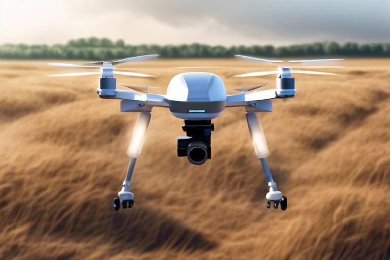
The Use of Drones for Environmental Monitoring and Conservation
Drones are no longer just a novelty for tech enthusiasts or a tool for capturing stunning aerial photographs; they have evolved into powerful instruments for environmental monitoring and conservation. Imagine soaring above vast forests, tracking wildlife from a bird's-eye view, or quickly assessing the health of an ecosystem without ever stepping foot on the ground. This is the reality that drones bring to the table, revolutionizing how we approach environmental challenges. With their ability to gather data efficiently and effectively, drones are becoming indispensable allies in the fight to protect our planet.
As we face pressing environmental issues like climate change, habitat destruction, and declining wildlife populations, the need for innovative solutions has never been more critical. Drones are stepping into this role, offering efficient and cost-effective methods for monitoring ecosystems. They allow researchers and conservationists to assess wildlife populations and enhance data collection, particularly in remote and inaccessible areas where traditional methods fall short. Picture a team of scientists equipped with drones, effortlessly soaring over dense jungles or expansive wetlands, collecting vital data that would take weeks to gather on foot. This is the future of conservation, and it’s happening now.
The advantages of using drones in environmental monitoring are numerous and compelling. First and foremost, they significantly increase data accuracy. Traditional methods often involve human observation, which can be subjective and prone to error. Drones, on the other hand, provide high-resolution imagery and precise data collection that can be analyzed with sophisticated software. Additionally, drones minimize human impact on sensitive habitats. By flying over areas rather than trekking through them, researchers can avoid disturbing wildlife and ecosystems. Finally, drones can cover large areas quickly and efficiently, making them ideal for extensive monitoring tasks.
Drones facilitate the collection of high-resolution imagery and data, enabling researchers to analyze environmental changes, track wildlife movements, and assess habitat conditions with unprecedented precision. For instance, a conservation team can deploy a drone equipped with a camera to capture detailed images of a forest affected by a recent wildfire. These images can then be analyzed to determine the extent of the damage and plan for restoration. Moreover, the ability to gather data from various angles and altitudes allows for a comprehensive understanding of the environment, something that was previously challenging to achieve.
Utilizing remote sensing technology, drones can capture detailed information about vegetation health, soil conditions, and water quality. This capability provides valuable insights into ecosystem dynamics and health. For example, drones can be equipped with multispectral sensors that can detect changes in plant health, allowing researchers to identify areas that may require intervention. The data collected can be used to create detailed maps that visualize the health of an ecosystem, making it easier to prioritize conservation efforts.
Another remarkable feature of drones is their ability for real-time monitoring of environmental conditions. Equipped with advanced sensors, drones can provide immediate feedback on changes or threats, such as illegal logging or poaching activities. Imagine a drone soaring over a national park, sending back live video feeds to park rangers who can respond instantly to any suspicious activity. This capability not only enhances the effectiveness of conservation efforts but also acts as a deterrent against illegal activities.
Drones play a crucial role in wildlife conservation by enabling researchers to monitor animal populations, track movements, and gather data on habitat use without disturbing the animals. For instance, in areas where elephants roam, drones can be used to track their movements and monitor their health without the need for ground-based observers who might disrupt their natural behavior. This non-invasive approach is essential for studying sensitive species and understanding their needs in a rapidly changing environment.
Despite their advantages, the use of drones in conservation is not without challenges. Regulatory restrictions can vary significantly by region, impacting data collection efforts. Navigating the legal landscape surrounding drone usage is essential for conservationists, as they must adhere to local laws that govern airspace and wildlife protection. Additionally, drones have technical limitations, such as battery life and payload capacity, which can affect their operational efficiency. For example, a drone may only be able to fly for a limited time before needing to recharge, which can restrict the duration of data collection missions. Furthermore, the need for trained personnel to operate and analyze drone data effectively can pose additional challenges for conservation teams.
Understanding the regulatory landscape is critical for conservationists using drones. Different countries and regions have specific laws governing drone use, which can include restrictions on where drones can fly, the altitude they can reach, and the types of data that can be collected. This complexity requires conservationists to stay informed and compliant to avoid legal issues that could hinder their efforts.
In addition to regulatory challenges, drones face technical limitations that can impact their effectiveness. Battery life is a significant concern; most consumer drones can only operate for about 20-30 minutes on a single charge. This limitation means that conservationists must plan their missions carefully to ensure they gather all necessary data within this timeframe. Additionally, the payload capacity of drones can restrict the types of sensors that can be used, which may limit the range of data that can be collected during a single flight.
- What types of drones are used for environmental monitoring?
Various types of drones are used, including fixed-wing drones for large area coverage and quadcopters for detailed inspections.
- How do drones help in wildlife conservation?
Drones allow researchers to monitor wildlife populations without disturbing their natural behavior, providing valuable data for conservation efforts.
- Are there any legal restrictions on using drones for conservation?
Yes, regulations vary by region, and it's essential for conservationists to understand and comply with local laws regarding drone use.
Introduction to Drones in Conservation
Drones are becoming essential tools in conservation, providing efficient and cost-effective methods for monitoring ecosystems, assessing wildlife populations, and enhancing data collection in remote and inaccessible areas. Imagine a world where vast forests, sprawling wetlands, and rugged mountains can be surveyed from the sky, allowing conservationists to gather crucial data without setting foot on the ground. This is not a scene from a futuristic movie; it’s the reality we live in today, thanks to the remarkable advancements in drone technology.
These unmanned aerial vehicles (UAVs) have transformed the way we approach environmental challenges. With their ability to fly over difficult terrains and capture high-resolution images, drones enable researchers to monitor changes in ecosystems that were previously difficult to access. They can cover extensive areas in a fraction of the time it would take on foot, making them invaluable for large-scale conservation projects. For instance, in dense jungles or remote mountain ranges, traditional methods of data collection may involve arduous treks, but drones can swiftly gather the necessary information from the air.
The integration of drones into conservation efforts is not just about convenience; it's about enhancing accuracy and reducing human impact. By minimizing the need for on-the-ground presence, drones help protect sensitive habitats from disturbances that could disrupt wildlife. They can fly at various altitudes, allowing for a comprehensive view of the landscape while keeping a safe distance from the flora and fauna. This means that researchers can gather data without intruding on the animals’ natural behaviors, which is crucial for effective wildlife conservation.
Furthermore, the data collected by drones can be processed and analyzed using advanced software, providing insights that were once unimaginable. For example, researchers can utilize machine learning algorithms to identify animal species from aerial imagery, track population dynamics, and even monitor the health of habitats over time. The ability to visualize changes in the environment through detailed mapping and analytics empowers conservationists to make informed decisions and implement timely interventions.
As we delve deeper into the benefits of drone technology in conservation, it’s essential to recognize that this innovation is not a standalone solution. It complements traditional conservation methods, creating a more holistic approach to environmental monitoring. By harnessing the power of drones, we can work towards a future where human activities are balanced with the needs of our planet, ensuring that ecosystems thrive for generations to come.
Benefits of Drone Technology
Drones are not just the latest tech fad; they are revolutionizing the way we approach environmental monitoring and conservation. Imagine being able to survey vast landscapes, dense forests, and remote wetlands without ever stepping foot on the ground. That's one of the most significant . These flying marvels offer a range of advantages that traditional methods simply cannot match. From increased data accuracy to reduced human impact on sensitive habitats, drones are changing the game in conservation.
One of the standout features of drones is their ability to cover large areas quickly and efficiently. Traditional methods of monitoring often involve labor-intensive processes that can be both time-consuming and costly. Drones, on the other hand, can soar over vast terrains in a fraction of the time, collecting data that would take teams of people days, if not weeks, to gather. This efficiency not only saves time but also allows conservationists to allocate their resources more effectively, focusing on areas that need immediate attention.
Moreover, the data collected by drones is often more accurate than that gathered through ground surveys. High-resolution imagery captured by drones allows researchers to analyze environmental changes with unprecedented precision. Whether it's tracking the health of a forest, monitoring the growth of invasive species, or assessing the impact of climate change, drones provide a bird’s-eye view that enhances our understanding of complex ecosystems.
Another critical benefit is the minimal disturbance drones cause to wildlife. Traditional monitoring techniques often involve humans entering habitats, which can stress animals and disrupt their natural behaviors. Drones can observe wildlife from a distance, gathering essential data on populations, movements, and behaviors without intruding on their environment. This non-invasive approach is crucial for protecting vulnerable species and ensuring their habitats remain undisturbed.
Additionally, the real-time data capabilities of drones cannot be overlooked. Equipped with advanced sensors, drones can provide immediate insights into environmental conditions. This means that conservationists can respond swiftly to threats like illegal logging or poaching activities. Imagine a drone flying over a protected area and instantly alerting rangers to suspicious movements—this kind of rapid response can make all the difference in preserving biodiversity.
To put it all together, here’s a brief summary of the benefits of drone technology in conservation:
| Benefit | Description |
|---|---|
| Efficiency | Drones can cover large areas quickly, saving time and resources. |
| Data Accuracy | High-resolution imagery provides precise environmental analysis. |
| Non-Invasive Monitoring | Drones observe wildlife without disturbing their natural behaviors. |
| Real-Time Data | Immediate insights allow for swift responses to environmental threats. |
In conclusion, the integration of drone technology into environmental monitoring and conservation efforts is not just a trend; it is a necessity for the future of our planet. By harnessing the power of drones, we can enhance our understanding of ecosystems, protect wildlife, and respond to environmental challenges more effectively than ever before. The sky is truly the limit when it comes to the potential of drones in conservation!
Data Collection and Analysis
Drones have emerged as a game-changer in the realm of within environmental monitoring. Imagine soaring above dense forests or vast wetlands, capturing high-resolution images and data that were once nearly impossible to obtain. This aerial perspective not only enhances our understanding of ecosystems but also enables researchers to gather vital information with remarkable efficiency. With the ability to cover large areas in a fraction of the time it would take on foot, drones are paving the way for innovative conservation strategies.
One of the most significant advantages of using drones is their capacity to collect detailed imagery and data that can be analyzed to track environmental changes over time. For instance, researchers can monitor deforestation rates, assess the impact of climate change, and evaluate the health of various habitats. The data collected can be processed using sophisticated software to produce 3D models and maps that reveal critical insights into ecosystem dynamics.
Moreover, drones equipped with specialized sensors can capture a range of data types, including:
- Thermal Imaging: This technology detects heat emitted by objects, allowing researchers to monitor wildlife movements and identify areas of thermal stress in habitats.
- Multispectral Imaging: Drones can gather data across different wavelengths, which is essential for assessing vegetation health and water quality.
- LIDAR (Light Detection and Ranging): This advanced technique allows for precise mapping of terrain and vegetation structure, providing insights into habitat complexity.
With the integration of machine learning algorithms, the analysis of this data becomes even more powerful. These algorithms can identify patterns and anomalies that human analysts might miss, enabling quicker responses to environmental threats. For example, if a sudden change in vegetation health is detected, conservationists can investigate the cause, whether it be disease, invasive species, or pollution.
Furthermore, the use of drones facilitates collaborative efforts among researchers, conservationists, and local communities. By sharing high-resolution data and visualizations, stakeholders can make informed decisions about conservation strategies and engage in meaningful discussions about environmental stewardship. This collaborative approach not only enhances data accuracy but also fosters a sense of community ownership over local ecosystems.
In conclusion, the role of drones in data collection and analysis is transforming the landscape of environmental monitoring. With their ability to provide detailed, real-time information, drones are not just tools; they are essential partners in the quest for sustainable conservation practices. As technology continues to evolve, the potential for drones to contribute to our understanding and protection of the environment is virtually limitless.
Q1: How do drones improve data accuracy in environmental monitoring?
A1: Drones provide high-resolution imagery and can cover large areas quickly, reducing human error and improving the precision of data collected.
Q2: What types of sensors can be attached to drones for environmental monitoring?
A2: Drones can be equipped with thermal imaging, multispectral cameras, and LIDAR systems, among others, to gather diverse data types.
Q3: Are there any legal restrictions on using drones for conservation efforts?
A3: Yes, regulations vary by region and may impact how and where drones can be operated. It's essential for conservationists to understand local laws.
Q4: Can drones be used in remote areas for monitoring?
A4: Absolutely! Drones excel in accessing hard-to-reach locations, making them ideal for monitoring remote ecosystems.
Remote Sensing Capabilities
Remote sensing capabilities of drones have transformed the way we observe and understand the environment. Imagine having the ability to monitor vast landscapes from above, capturing intricate details that would be nearly impossible to see from the ground. Drones equipped with advanced sensors and cameras can gather data on various environmental factors, providing a bird's-eye view of ecosystems that helps researchers make informed decisions. For instance, these aerial devices can assess vegetation health by analyzing the reflectance of light, allowing scientists to identify stressed areas in forests or agricultural fields.
One of the most exciting aspects of drone remote sensing is the range of data it can collect. From multispectral images that reveal the health of crops to thermal imaging that detects temperature variations in water bodies, the possibilities are vast. These technologies enable conservationists to monitor changes over time, allowing them to track the effects of climate change, pollution, and human activity on ecosystems. The data collected can be processed and analyzed to create comprehensive maps and models that provide insights into the health of the environment.
Moreover, the integration of LiDAR (Light Detection and Ranging) technology in drones has taken remote sensing to another level. This technology can penetrate through vegetation, allowing for detailed analysis of the forest structure and topography beneath the canopy. This information is invaluable for understanding habitat complexity and biodiversity, as it can reveal how many different species might inhabit a given area.
To illustrate the capabilities of drone remote sensing, consider the following table that summarizes various sensor types and their applications:
| Sensor Type | Application |
|---|---|
| RGB Cameras | High-resolution imagery for land cover mapping |
| Multispectral Sensors | Vegetation health assessment |
| Thermal Cameras | Monitoring water temperatures and wildlife |
| LiDAR | Terrain mapping and forest structure analysis |
In summary, the remote sensing capabilities of drones not only enhance our understanding of environmental conditions but also empower conservationists to take proactive measures in protecting natural habitats. With the ability to collect data quickly and efficiently, drones are paving the way for a more sustainable approach to environmental monitoring and management.
- What types of drones are best for environmental monitoring? Drones equipped with multispectral and thermal sensors are typically the most effective for environmental monitoring as they can capture a variety of data.
- How do drones contribute to wildlife conservation? Drones allow researchers to monitor wildlife populations and movements without disturbing the animals, providing crucial data for conservation efforts.
- Are there regulations for using drones in conservation? Yes, regulations vary by region and it is essential for conservationists to understand and comply with local laws regarding drone usage.
Real-Time Monitoring
In the ever-evolving landscape of environmental conservation, has emerged as a game-changer. Imagine having the ability to observe changes in ecosystems as they happen, like a live feed of nature's pulse. Drones equipped with advanced sensors and cameras are making this a reality, allowing conservationists to respond swiftly to threats and changes in the environment. These aerial devices can cover vast areas in a fraction of the time it would take a human team, providing a bird's-eye view that is both comprehensive and insightful.
One of the most significant advantages of real-time monitoring is its ability to facilitate immediate action. For instance, if a drone detects illegal logging activities or signs of poaching in a protected area, conservation teams can be alerted instantly. This prompt response can make a world of difference in protecting endangered species and preserving delicate habitats. The combination of high-resolution imagery and real-time data feeds enables researchers to track wildlife movements, assess the health of vegetation, and monitor water bodies with unparalleled accuracy.
Moreover, the integration of geospatial technology with drone data has revolutionized how we analyze environmental conditions. By mapping out areas in real-time, conservationists can identify patterns and trends that might indicate underlying issues, such as changes in land use or climate impacts. For example, if a region experiences a sudden drop in vegetation health, it could signal an impending ecological crisis. Drones can quickly gather data across different terrains, providing a comprehensive overview that aids in proactive management.
To illustrate the impact of drones on real-time monitoring, consider the following table that highlights key features and benefits:
| Feature | Benefit |
|---|---|
| High-resolution imaging | Provides detailed visuals for better analysis |
| Advanced sensors | Enables detection of environmental changes |
| Geospatial mapping | Identifies patterns and trends in ecosystems |
| Immediate data transmission | Facilitates quick response to threats |
In summary, the capability of drones to perform is not just a technological advancement; it is a vital tool for the future of conservation. By harnessing this technology, we can better protect our planet's biodiversity and respond to environmental challenges with agility and precision. The world of conservation is changing, and with drones leading the charge, we are better equipped than ever to safeguard our natural treasures.
- How do drones improve wildlife monitoring? Drones provide a non-invasive way to track wildlife, reducing stress on animals while collecting valuable data.
- What types of sensors do drones use for environmental monitoring? Drones can be equipped with cameras, thermal sensors, and multispectral sensors to gather diverse data.
- Are there legal restrictions on using drones for conservation? Yes, regulations vary by region, and it's essential for conservationists to understand local laws regarding drone usage.
- Can drones operate in all weather conditions? While many drones are designed for various conditions, extreme weather can still impact their performance.
Wildlife Conservation Efforts
In the realm of wildlife conservation, drones have emerged as a game-changer. Imagine being able to monitor vast stretches of wilderness without leaving a footprint on the delicate ecosystems you aim to protect. Drones offer this unique capability, allowing conservationists to observe animal populations and their behaviors from above, all while minimizing human disturbance. With the ability to cover large areas quickly, these flying devices can capture vital data that would otherwise take weeks or even months to gather through traditional methods.
One of the most significant advantages of using drones in wildlife conservation is their non-intrusive nature. For instance, researchers can track the movements of endangered species, such as the majestic Snow Leopard or the elusive Sumatran Tiger, without the stress of human presence. This is crucial because many animals alter their behavior when they sense humans nearby, which can lead to inaccurate data collection and potentially harmful consequences for their populations.
Drones equipped with high-resolution cameras and thermal imaging sensors can provide insights into wildlife habitats and behaviors that were previously difficult to obtain. For example, they can detect heat signatures from animals, even in dense forest canopies, allowing researchers to count and track individuals in ways that were once thought impossible. This technology not only enhances data collection but also improves our understanding of species distribution and habitat use.
Moreover, drones can assist in monitoring the health of ecosystems by providing real-time data on the conditions of habitats. By analyzing the collected images and data, conservationists can identify changes in vegetation, water sources, and potential threats to wildlife, such as poaching or illegal logging. This capability allows for prompt action to be taken, ensuring that conservation efforts are both proactive and reactive.
Here are some specific ways drones are making a difference in wildlife conservation:
- Population Monitoring: Drones can help estimate animal populations by capturing aerial images that allow researchers to count individuals from above.
- Behavioral Studies: By observing animals from a distance, researchers can study their natural behaviors without interference.
- Habitat Assessment: Drones can assess the health of habitats, providing data that helps in planning conservation strategies.
- Anti-Poaching Efforts: Equipped with cameras and sensors, drones can patrol protected areas and identify suspicious activities.
In summary, the integration of drone technology into wildlife conservation efforts is not just a trend; it’s a transformative approach that enhances our ability to protect endangered species and their habitats. As technology continues to evolve, we can expect even more innovative uses for drones in the fight against biodiversity loss.
- How do drones help in wildlife conservation?
Drones provide a non-intrusive way to monitor wildlife populations, track movements, and assess habitat conditions, allowing for more accurate data collection. - What types of data can drones collect?
Drones can capture high-resolution imagery, thermal data, and other environmental metrics, which are crucial for understanding ecosystem dynamics. - Are there any regulations regarding drone usage in conservation?
Yes, regulations can vary by region, and it’s important for conservationists to be aware of local laws governing drone flights. - What are the limitations of using drones in conservation?
Limitations include battery life, payload capacity, and the need for trained personnel to effectively operate drones and analyze the data collected.
Challenges and Limitations
While the integration of drones into environmental monitoring and conservation has opened up a world of possibilities, it is not without its . Understanding these hurdles is crucial for conservationists who wish to maximize the potential of drone technology. One of the primary challenges is the regulatory landscape. Different countries and regions have varying laws governing drone usage, which can complicate data collection efforts. For instance, some areas may have strict no-fly zones, while others might require permits that can take time to obtain. This can lead to delays in critical conservation projects, particularly when time is of the essence.
Moreover, the technical limitations of drones also pose significant challenges. For example, most consumer-grade drones have a limited battery life, often ranging from 20 to 30 minutes. This can restrict the distance and area that can be effectively monitored in a single flight. Additionally, the payload capacity of drones can limit the types of sensors that can be attached. Advanced sensors, such as those for thermal imaging or high-resolution cameras, often require more power and weight than the drone can handle. Consequently, conservationists must carefully select the right drone for their specific needs, balancing between flight time and the capabilities of the sensors.
Another important aspect to consider is the need for trained personnel. Operating drones and analyzing the data they collect require a certain level of expertise. Many conservation organizations may not have the necessary resources to train staff or hire skilled drone operators. This gap can lead to underutilization of the technology, as organizations might struggle to interpret the data collected or even fail to deploy drones effectively in the first place. Furthermore, the rapid evolution of drone technology means that ongoing education and training are essential, adding another layer of complexity to the implementation of drone solutions in conservation.
In summary, while drones offer revolutionary benefits for environmental monitoring and conservation, it is essential to navigate the challenges they present. The interplay of regulatory restrictions, technical limitations, and the need for trained personnel can significantly impact the effectiveness of drone deployment. However, with careful planning and the right resources, these challenges can be overcome, paving the way for a more sustainable future.
- What are the main benefits of using drones in conservation?
Drones provide efficient data collection, reduce human disturbance in sensitive habitats, and allow for extensive coverage of large areas. - How do regulations affect drone usage in conservation?
Regulations can vary widely by region, impacting where and how drones can be deployed for conservation efforts. - What types of data can drones collect?
Drones can capture high-resolution images, monitor wildlife movements, and assess habitat conditions through various sensors. - Are there any limitations to drone technology?
Yes, limitations include battery life, payload capacity, and the need for trained personnel to operate drones and analyze data.
Regulatory Considerations
When it comes to deploying drones for environmental monitoring and conservation, understanding the regulatory landscape is crucial. Each country, and often individual regions within countries, has its own set of rules governing the use of drones. These regulations can significantly impact how conservationists collect data and monitor wildlife. For instance, in some areas, drone usage may be heavily restricted to protect wildlife from disturbances, while in others, the rules may be more lenient, allowing for broader applications.
One of the primary concerns is ensuring that drone operations do not infringe on privacy rights. Many regions have laws that protect individuals from being surveilled without their consent, which can complicate conservation efforts, especially in populated areas. Additionally, conservationists must consider airspace regulations, which dictate where drones can fly. For example, flying near airports or military installations is typically prohibited, which can limit access to certain habitats.
Moreover, the type of drone used can also be subject to regulatory scrutiny. Some drones, especially those equipped with advanced sensors or cameras, may require special permits or licenses to operate. This is particularly true in sensitive ecological areas where the potential for disturbance is higher. Conservationists must navigate these legal requirements carefully to avoid fines or legal action.
To give you a clearer picture, here's a brief overview of the regulatory considerations that conservationists need to keep in mind:
| Regulatory Aspect | Description |
|---|---|
| Privacy Laws | Regulations protecting individuals from unauthorized surveillance. |
| Airspace Regulations | Rules governing where drones can be flown, especially near airports. |
| Drone Classification | Different rules may apply based on the type and weight of the drone. |
| Permits | Special permits may be required for certain drone operations. |
In addition to these factors, conservationists also need to stay informed about changes in regulations, as laws can evolve rapidly in response to technological advancements and public concerns. Engaging with local authorities and participating in relevant workshops or training sessions can help ensure compliance and promote responsible drone use.
In summary, while drones offer innovative solutions for environmental monitoring, navigating the regulatory landscape is essential. By understanding and adhering to the relevant laws, conservationists can maximize the benefits of drone technology while minimizing potential legal issues.
- What are the primary regulations governing drone use in conservation? Regulations vary by region, focusing on privacy, airspace, and specific drone classifications.
- Do I need a permit to operate a drone for conservation purposes? It depends on the type of drone and the specific regulations in your area; some operations may require a permit.
- How can I stay updated on drone regulations? Engaging with local authorities and attending workshops can help you stay informed about any changes.
Technical Limitations
While drones have ushered in a new era of possibilities for environmental monitoring and conservation, they are not without their . One of the most significant challenges is battery life. Most drones can only operate for a limited amount of time—typically between 20 to 40 minutes—before needing a recharge. This constraint can be particularly problematic when monitoring vast areas or conducting extensive surveys, as it may necessitate multiple flights or the use of several drones, increasing both time and costs.
Another limitation is the payload capacity. Drones are designed to carry specific weights, and this can restrict the types of sensors or cameras that can be deployed. For instance, while high-resolution cameras can provide stunning imagery, they often require more power and weight than a drone can handle. This means that conservationists must carefully select equipment that balances quality and functionality, which can sometimes result in suboptimal data collection.
Moreover, weather conditions can significantly impact drone operations. High winds, rain, or extreme temperatures can hinder a drone's ability to fly safely and effectively. For example, flying a drone in heavy rain not only risks damaging the equipment but can also lead to unreliable data due to poor visibility. Thus, conservationists must always keep an eye on the weather forecast and plan their operations accordingly, which can complicate fieldwork.
Another aspect worth mentioning is the technical expertise required to operate drones and analyze the data they collect. While many drones are user-friendly, understanding how to interpret the data accurately is a different ball game. This often necessitates training for personnel, which can be a barrier for organizations with limited resources. Additionally, the need for skilled operators can lead to increased costs, as hiring experts may not always be feasible for smaller conservation groups.
Lastly, regulatory restrictions can also impact the efficiency of drone usage in conservation efforts. Depending on the region, there may be strict laws governing where and how drones can be flown. These regulations can limit access to critical areas, making it challenging to gather necessary data. Conservationists must navigate these legal landscapes carefully to ensure compliance while still achieving their monitoring goals.
In summary, while drones offer exciting possibilities for environmental monitoring and conservation, their technical limitations require careful consideration. Addressing these challenges involves innovation, collaboration, and ongoing research to maximize the benefits of drone technology in protecting our planet's precious ecosystems.
- What is the average flight time of conservation drones? Most conservation drones can fly for 20 to 40 minutes on a single charge, depending on the model and payload.
- Can drones fly in bad weather? No, drones are sensitive to weather conditions. High winds, rain, and extreme temperatures can affect their performance and safety.
- Do I need special training to operate a drone for conservation? Yes, while many drones are user-friendly, understanding how to operate them effectively and analyze the data requires training.
- Are there regulations governing drone usage in conservation? Yes, regulations can vary by region and may restrict where and how drones can be flown, impacting data collection efforts.
Frequently Asked Questions
- What are drones used for in environmental monitoring?
Drones are revolutionizing environmental monitoring by providing efficient methods for data collection, assessing wildlife populations, and monitoring ecosystems in remote areas. They can capture high-resolution imagery, track wildlife movements, and assess habitat conditions without disturbing the environment.
- How do drones improve data accuracy in conservation efforts?
Drones enhance data accuracy by utilizing advanced sensors and remote sensing technology to gather detailed information. This allows researchers to analyze environmental changes and monitor conditions with precision, leading to more reliable data for conservation strategies.
- What are the benefits of using drones over traditional methods?
Using drones offers several advantages, including reduced human impact on sensitive habitats, the ability to cover large areas quickly, and lower operational costs compared to traditional methods. This efficiency makes them invaluable tools for conservationists.
- Can drones be used for real-time monitoring?
Absolutely! Drones equipped with advanced sensors allow for real-time monitoring of environmental conditions. This capability enables conservationists to respond promptly to threats like illegal logging or poaching activities, making it a crucial tool for wildlife protection.
- What challenges do drones face in conservation?
Despite their benefits, drones encounter challenges such as regulatory restrictions, technical limitations like battery life, and the need for trained personnel to operate them effectively. These factors can impact their operational efficiency and data collection efforts.
- How do regulations affect drone usage in conservation?
Regulations surrounding drone usage can vary widely by region and can significantly impact conservation efforts. It's essential for conservationists to navigate these legal landscapes to ensure compliance and maximize the effectiveness of their data collection efforts.
- What types of sensors can be used with drones for environmental monitoring?
Drones can be equipped with various sensors, including multispectral cameras, thermal imaging devices, and LiDAR systems. These sensors allow for a comprehensive analysis of vegetation health, soil conditions, and water quality, providing valuable insights into ecosystem dynamics.