Understanding the Impact of Geospatial Intelligence on Defense Operations
In today's rapidly evolving world, the significance of geospatial intelligence (GEOINT) in defense operations cannot be overstated. As military strategies become increasingly complex, the ability to analyze and interpret spatial data is essential for effective decision-making. Imagine trying to navigate a dense forest without a map; you'd be lost, right? Similarly, military planners and commanders rely on GEOINT to gain a clear picture of their operational environment, ensuring they are not just reacting to threats but anticipating them.
GEOINT encompasses a variety of data sources, including satellite imagery, aerial reconnaissance, and ground-based observations. By synthesizing these inputs, military leaders can achieve a level of situational awareness that was once unimaginable. This intelligence is not just about knowing where enemy forces are located; it's about understanding the context of their movements, the terrain they operate in, and the potential challenges they may face. In essence, GEOINT transforms raw data into actionable insights, enabling military operations to be conducted with a precision that enhances both effectiveness and safety.
Furthermore, the integration of advanced technologies has propelled GEOINT into a new era. With the advent of machine learning and artificial intelligence, the speed and accuracy of data analysis have dramatically improved. This means that military personnel can process vast amounts of information in real-time, allowing for quicker responses to dynamic situations on the battlefield. For example, consider a scenario where a drone captures live footage of enemy movements. With GEOINT, analysts can quickly interpret this data, assess potential threats, and relay information to ground troops, all within minutes.
However, the journey of GEOINT is not without its challenges. The sheer volume of data generated can lead to a phenomenon known as data overload. Analysts may find themselves inundated with information, making it difficult to discern what is truly relevant. To combat this, robust data management systems are essential. These systems help filter and prioritize information, ensuring that military planners receive the most pertinent insights to inform their strategies.
Moreover, as the scope of GEOINT expands, ethical considerations regarding privacy and surveillance become increasingly significant. The balance between national security and individual rights is a delicate one, prompting ongoing discussions about how to responsibly utilize geospatial data without infringing on personal freedoms. It's crucial for military operations to maintain transparency and accountability while leveraging the advantages of GEOINT.
As we look to the future, the landscape of geospatial intelligence is poised for further transformation. Innovations in data fusion techniques and collaborative intelligence sharing among allied nations will enhance our collective understanding of global threats. Imagine a network where allies share real-time intelligence seamlessly; this could revolutionize defense strategies, making them more cohesive and effective than ever before.
In summary, the impact of geospatial intelligence on defense operations is profound. It empowers military leaders with the knowledge they need to make informed decisions, enhances situational awareness, and ultimately contributes to the success of defense missions. As technology continues to advance, the potential for GEOINT to shape the future of military operations is boundless, ushering in a new era of strategic superiority.
- What is geospatial intelligence (GEOINT)? GEOINT refers to the collection and analysis of spatial data to inform military operations and decision-making.
- How does GEOINT enhance situational awareness? By providing real-time data and context about operational environments, GEOINT allows military planners to anticipate threats and respond effectively.
- What are the main technologies used in GEOINT? Key technologies include satellite imagery, drones, and advanced data analytics powered by AI and machine learning.
- What challenges does GEOINT face? Challenges include data overload, privacy concerns, and the need for skilled analysts to interpret complex data.
- What does the future hold for GEOINT? Future trends suggest advancements in machine learning, data fusion, and collaborative intelligence sharing among nations.

The Role of Geospatial Intelligence in Defense
Geospatial Intelligence, or GEOINT, is not just a buzzword in the military lexicon; it’s a game-changer in defense operations. Imagine trying to navigate a complex maze without a map. That’s what military planners face without accurate geospatial data. GEOINT provides a detailed, actionable insight into the battlefield, enhancing situational awareness and enabling informed decision-making for commanders. With the ability to analyze spatial data, military leaders can visualize threats, assess risks, and plan operations with a level of precision that was unimaginable just a few decades ago.
At its core, GEOINT integrates various data sources, including satellite imagery, aerial reconnaissance, and ground intelligence, to create a comprehensive picture of the operational environment. This multi-layered approach allows military personnel to not only see where their assets are but also understand the terrain, weather conditions, and even civilian movements. For instance, during operations in urban environments, understanding the geography can mean the difference between success and failure. The strategic advantage gained through GEOINT is akin to having a bird's-eye view of the battlefield, where every detail counts.
Moreover, the role of GEOINT extends beyond just military applications. It plays a critical part in humanitarian missions, disaster relief, and even counter-terrorism efforts. When natural disasters strike, for example, GEOINT can help identify affected areas, assess damage, and coordinate relief efforts. In counter-terrorism, understanding geographical hotspots can aid in targeting operations more effectively. This versatility underscores the importance of GEOINT in not just defense but in broader security contexts as well.
However, the reliance on geospatial intelligence also brings challenges. The vast amounts of data generated can lead to information overload, making it crucial for analysts to have robust systems in place for data management. This is where technology comes into play, allowing for the filtering and prioritization of information to ensure that military leaders receive only the most relevant insights. Additionally, as the use of GEOINT expands, ethical considerations surrounding privacy and surveillance must be addressed. Balancing national security needs with individual rights is a complex issue that requires ongoing dialogue and regulation.
In summary, the role of geospatial intelligence in defense operations is multifaceted and vital. It empowers military leaders with the insights necessary to make informed decisions, enhances operational efficiency, and provides a strategic edge in both combat and non-combat scenarios. As technology continues to evolve, the potential applications and benefits of GEOINT will only expand, shaping the future of defense operations in profound ways.
- What is Geospatial Intelligence (GEOINT)?
GEOINT refers to the collection, analysis, and visualization of spatial data to support decision-making in military and security operations. - How does GEOINT enhance situational awareness?
By providing real-time data on terrain, enemy positions, and environmental conditions, GEOINT allows military planners to understand the battlefield better. - What technologies are used in GEOINT?
Technologies such as satellite imagery, drones, and advanced data analytics are integral to the collection and analysis of geospatial intelligence. - What are the ethical concerns surrounding GEOINT?
The use of GEOINT raises privacy issues, especially regarding surveillance and the potential misuse of data, necessitating careful consideration of individual rights versus national security.

Technological Advancements in GEOINT
In recent years, the realm of Geospatial Intelligence (GEOINT) has witnessed a remarkable transformation, driven by cutting-edge technologies that have redefined the landscape of defense operations. The integration of satellite imagery, drones, and artificial intelligence (AI) has not only enhanced the accuracy of intelligence gathering but has also accelerated the speed at which actionable insights can be derived. Imagine a world where military planners can receive real-time updates about enemy movements while sitting in their command centers; this is the reality that modern GEOINT technologies are making possible.
At the heart of these advancements is satellite imagery, which serves as a cornerstone of GEOINT. High-resolution satellite images provide detailed visual data that are crucial for surveillance, reconnaissance, and mapping. These images allow military strategists to visualize operational landscapes, assess potential threats, and plan missions with unprecedented precision. For instance, the ability to zoom in on specific locations can reveal enemy fortifications or troop concentrations, which can drastically influence strategic decisions.
One of the most significant advancements in satellite technology is the development of high-resolution imaging techniques. These techniques enable analysts to observe terrain and enemy movements in great detail. The clarity of these images can be likened to switching from a blurry photograph to a crystal-clear picture; the difference is astounding. Such detailed observation is essential for mission planning and execution, allowing commanders to make informed decisions based on accurate data.
Moreover, the integration of satellite imagery with other data sources has revolutionized the way military operations are conducted. By combining satellite data with information from social media, weather patterns, and sensor data, military analysts can gain a more nuanced understanding of the operational environment. This fusion of data enhances situational awareness and leads to more effective intelligence assessments. For example, if social media indicates an increase in civilian activity in a specific area, analysts can cross-reference this with satellite data to determine whether it poses a risk or an opportunity.
Equally transformative are drones, which have become indispensable tools in the GEOINT arsenal. These unmanned aerial vehicles (UAVs) facilitate real-time aerial surveillance and reconnaissance missions, providing military forces with critical insights into enemy positions and movements. Unlike traditional aircraft, drones can operate in environments that may be too dangerous for manned missions, allowing for continuous monitoring without risking lives.
The ability of drones to capture high-resolution images and videos in real-time has changed the dynamics of intelligence gathering. Imagine a drone hovering above a battlefield, sending live feeds back to commanders who can make split-second decisions based on what they see. This level of immediacy and detail can be the difference between success and failure in military operations.
In summary, the technological advancements in GEOINT are not just about gathering more data; they are about transforming how that data is used. The combination of satellite imagery, drones, and AI is creating a more connected and informed battlefield, where decisions are based on accurate, timely information. As we look ahead, it’s clear that these innovations will continue to shape military strategies and enhance the effectiveness of defense operations.
- What is Geospatial Intelligence (GEOINT)?
GEOINT refers to the collection and analysis of geospatial data to support military operations and decision-making. - How do drones contribute to GEOINT?
Drones provide real-time surveillance and reconnaissance capabilities, allowing for detailed monitoring of enemy movements and positions. - What role does satellite imagery play in defense operations?
Satellite imagery offers high-resolution visuals crucial for surveillance, reconnaissance, and mission planning, enhancing situational awareness. - What are the challenges faced in GEOINT?
Challenges include data overload, privacy concerns, and the need for skilled analysts to interpret complex spatial data effectively.

Satellite Imagery and Its Applications
When it comes to geospatial intelligence, satellite imagery stands out as a game-changer. Imagine having the ability to observe vast landscapes from space, capturing high-resolution images that reveal critical details about terrain, infrastructure, and even troop movements. This capability is not just a luxury; it’s a necessity for modern defense operations. Satellite imagery provides a bird's-eye view of the battlefield, allowing military planners to make informed decisions based on real-time data.
One of the most significant applications of satellite imagery is in surveillance. Armed forces can monitor enemy activities, track movements, and assess potential threats without putting personnel in harm's way. For instance, during conflicts, satellite images can help identify the positioning of enemy troops or the construction of military installations. This information is invaluable, as it allows for proactive strategies rather than reactive measures.
Another crucial application lies in reconnaissance. Reconnaissance missions, which are essential for gathering intelligence, heavily rely on satellite imagery to create detailed maps and models of operational environments. These maps can highlight features such as roads, bridges, and natural obstacles, which are vital for planning troop movements and logistics. The ability to visualize these elements from space can mean the difference between success and failure in a mission.
Furthermore, satellite imagery plays a pivotal role in disaster response and humanitarian missions. When natural disasters strike, such as earthquakes or hurricanes, satellite images can provide immediate assessments of the affected areas. This information helps military and humanitarian organizations coordinate their responses effectively, ensuring that aid reaches those in need as quickly as possible. The speed and accuracy of satellite data can save lives and facilitate recovery efforts.
To illustrate the versatility of satellite imagery, consider the following table that summarizes its key applications:
| Application | Description |
|---|---|
| Surveillance | Monitoring enemy movements and activities from space. |
| Reconnaissance | Creating detailed maps and models of operational environments. |
| Disaster Response | Assessing damage from natural disasters for effective aid coordination. |
| Environmental Monitoring | Tracking changes in land use, vegetation, and climate impact. |
In addition to these applications, satellite imagery is also instrumental in environmental monitoring. By tracking changes in land use, vegetation, and climate impact, military and government agencies can better understand the ecological factors that may influence security and stability in a region. This holistic view helps in the formulation of strategies that go beyond immediate military concerns, considering the long-term implications of environmental changes.
In summary, satellite imagery is not just a tool but a cornerstone of geospatial intelligence in defense operations. It enhances situational awareness, informs decision-making, and provides a strategic advantage in various military and humanitarian contexts. As technology continues to evolve, the applications of satellite imagery will undoubtedly expand, further solidifying its importance in modern defense strategies.

High-Resolution Imaging Techniques
In the world of geospatial intelligence, have become a game-changer, providing military planners with the ability to see the battlefield in unprecedented detail. Imagine having the capability to discern individual vehicles on a road or even detect the movement of troops through dense foliage. This level of clarity is not just a luxury; it's a necessity for making informed decisions in high-stakes environments.
One of the primary technologies driving high-resolution imaging is synthetic aperture radar (SAR). Unlike traditional optical imaging, SAR uses radar signals to create detailed images regardless of weather conditions or time of day. This means that even when clouds obscure visibility, military operations can continue to gather critical data. The ability to capture images in various spectrums—including infrared and thermal—further enhances situational awareness, allowing analysts to detect heat signatures from vehicles or personnel that would otherwise go unnoticed.
Moreover, the integration of advanced algorithms and machine learning into high-resolution imaging techniques enables automatic object recognition and tracking. This automation significantly reduces the time needed to analyze vast amounts of imagery, allowing military personnel to focus on strategic planning rather than getting bogged down in data interpretation. For example, algorithms can be trained to identify specific types of military equipment, flagging them for review and speeding up the decision-making process.
Another noteworthy aspect of high-resolution imaging is its ability to provide real-time data. With the deployment of low Earth orbit (LEO) satellites, data can be transmitted almost instantaneously back to command centers. This immediacy is crucial in dynamic combat situations where conditions can change rapidly. Military leaders can make timely adjustments to strategies based on the latest intelligence, enhancing operational effectiveness and safety.
To illustrate the impact of high-resolution imaging on military strategies, consider the following table that summarizes its key benefits:
| Benefit | Description |
|---|---|
| Enhanced Detail | Ability to identify individual objects and movements on the battlefield. |
| All-Weather Capability | Effective imaging regardless of weather conditions or time of day. |
| Real-Time Data | Instantaneous data transmission for timely decision-making. |
| Automated Analysis | Use of AI to recognize and track objects, reducing analysis time. |
In conclusion, high-resolution imaging techniques are not just about capturing stunning visuals; they are about transforming the way military operations are conducted. With the ability to gather and analyze data with such precision, military planners can devise strategies that are informed, timely, and ultimately more effective. As technology continues to advance, we can expect even greater enhancements in the capabilities of high-resolution imaging, further solidifying its role as a cornerstone of modern geospatial intelligence.
- What is geospatial intelligence (GEOINT)? GEOINT refers to the collection and analysis of spatial data to support military operations and decision-making.
- How does high-resolution imaging impact military strategies? It provides detailed insights into enemy movements, terrain, and operational environments, allowing for better-informed decisions.
- What technologies are used in high-resolution imaging? Technologies include synthetic aperture radar (SAR), low Earth orbit satellites, and machine learning algorithms.
- Why is real-time data important in defense operations? Real-time data allows military leaders to quickly adapt to changing conditions on the battlefield, enhancing operational effectiveness.

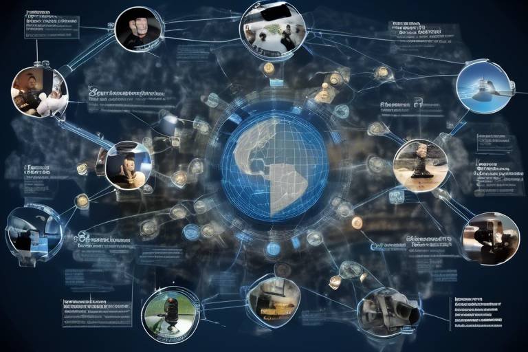
Integration with Other Data Sources
In the ever-evolving landscape of geospatial intelligence (GEOINT), the integration of various data sources has become a game-changer. Imagine trying to solve a complex puzzle; each piece represents a different data source, and when combined, they create a clearer picture of the operational environment. By merging satellite imagery with other data streams, such as social media feeds, sensor data, and even open-source intelligence, military planners can gain a more holistic understanding of the battlefield.
For instance, social media platforms can provide real-time insights into civilian activities and sentiments, which can be crucial for assessing the stability of a region. When combined with high-resolution satellite imagery, analysts can identify patterns that may indicate potential threats or opportunities for engagement. This multi-faceted approach allows for a more nuanced analysis, as it considers not just the physical landscape but also the human element that influences military operations.
Moreover, integrating data from various sources enhances situational awareness. By utilizing advanced data fusion techniques, military strategists can filter out noise and focus on the most relevant information. This is particularly important in high-stakes scenarios where timely and accurate intelligence can mean the difference between success and failure. The synergy created by this integration can lead to more effective decision-making, as commanders are equipped with a comprehensive view of the operational landscape.
To illustrate the impact of data integration, consider the following table that summarizes different data sources and their contributions to GEOINT:
| Data Source | Contribution to GEOINT |
|---|---|
| Satellite Imagery | High-resolution visuals for terrain analysis and enemy movements. |
| Social Media | Real-time insights into public sentiment and potential unrest. |
| Sensor Data | Real-time monitoring of environmental and tactical changes. |
| Open-Source Intelligence | Valuable information from publicly available resources. |
This integration not only enhances the quality of intelligence but also accelerates the analytical process, allowing for quicker responses to emerging threats. As technology continues to advance, the ability to seamlessly integrate diverse data sources will undoubtedly shape the future of GEOINT, making it an indispensable tool for military operations.
- What is geospatial intelligence (GEOINT)? GEOINT refers to the collection, analysis, and dissemination of geospatial information to support national security objectives.
- How does satellite imagery contribute to defense operations? Satellite imagery provides critical visual data that aids in surveillance, reconnaissance, and mission planning.
- What are the challenges faced by GEOINT? Challenges include data overload, privacy concerns, and the need for skilled analysts to interpret complex data.
- How is machine learning impacting GEOINT? Machine learning is streamlining data analysis processes, enabling quicker responses to threats and enhancing predictive capabilities.
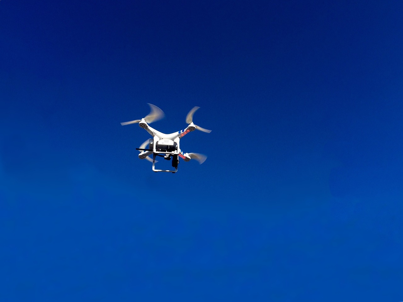
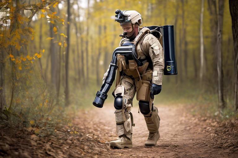
Drones and Aerial Surveillance
Drones have transformed the landscape of geospatial intelligence (GEOINT), becoming indispensable assets in modern defense operations. These unmanned aerial vehicles (UAVs) provide a unique vantage point that enhances situational awareness and operational effectiveness. Imagine having a bird's eye view of a battlefield, where every movement can be monitored in real-time—this is the power that drones bring to military planners and commanders.
Equipped with high-resolution cameras and advanced sensors, drones can capture detailed imagery and data from areas that may be too dangerous or inaccessible for manned aircraft. This capability is particularly crucial in reconnaissance missions, where understanding the enemy's position and movements can dictate the success or failure of an operation. With the ability to fly at various altitudes and angles, drones can gather intelligence that is not only timely but also incredibly precise.
Moreover, the integration of drones into aerial surveillance operations allows for continuous monitoring of specific locations. This persistent surveillance capability means that military forces can track changes in enemy behavior over time, leading to more informed decision-making. For instance, if a drone observes unusual troop movements or the construction of new fortifications, this data can trigger immediate strategic responses and adjustments to operational plans.
However, the use of drones is not without its challenges. The vast amount of data collected can be overwhelming, necessitating sophisticated data analysis tools to extract actionable intelligence. Additionally, the ethical implications of drone surveillance—especially concerning privacy and civilian safety—are hotly debated. Military leaders must navigate these complexities while ensuring that the advantages of drone technology are fully realized.
In summary, drones and aerial surveillance represent a significant leap forward in the realm of geospatial intelligence. They provide military forces with the capability to gather real-time data, enhance situational awareness, and ultimately improve the effectiveness of defense operations. As technology continues to evolve, we can expect drones to play an even more critical role in shaping military strategies and outcomes.
- What are the main advantages of using drones in military operations? Drones offer real-time surveillance, precise data collection, and the ability to access hard-to-reach areas, enhancing situational awareness and operational effectiveness.
- How do drones contribute to geospatial intelligence? Drones collect high-resolution imagery and data, which can be analyzed to provide insights into enemy movements and terrain, aiding in mission planning.
- What are the ethical concerns surrounding drone surveillance? Ethical concerns include privacy violations, civilian safety, and the potential for misuse of surveillance data, which necessitates careful consideration and regulation.
- How is the data collected by drones analyzed? The data is processed using advanced software and algorithms that help filter, prioritize, and interpret the information for actionable intelligence.

Challenges in Geospatial Intelligence
Despite its transformative impact on defense operations, geospatial intelligence (GEOINT) is not without its challenges. One of the most pressing issues is the phenomenon of data overload. As technology advances, the volume of data generated from various sources—satellite imagery, drones, sensors, and even social media—has skyrocketed. This deluge of information can overwhelm analysts, making it difficult to extract actionable insights. Imagine trying to find a needle in a haystack, but the haystack keeps getting bigger! To tackle this, military organizations must develop robust data management systems that can effectively filter, prioritize, and synthesize information. This ensures that the most relevant data reaches decision-makers in a timely manner.
Another significant challenge lies in the realm of privacy and ethical considerations. As the capabilities of GEOINT expand, so do the concerns regarding surveillance and individual rights. The delicate balance between ensuring national security and respecting personal privacy is a hot topic of debate. For instance, how do we safeguard citizens' rights while utilizing advanced surveillance technologies? This ethical dilemma necessitates ongoing discussions and the establishment of clear guidelines to govern the use of geospatial data. Military planners and governments must navigate these murky waters carefully to maintain public trust while effectively addressing security threats.
Furthermore, the need for skilled analysts cannot be overstated. The complexity of spatial data requires trained professionals who can interpret and analyze this information effectively. However, there is a growing shortage of qualified personnel in the field of geospatial intelligence. As technology evolves, so too must the skill sets of these analysts. Continuous training and education are essential to equip them with the latest tools and methodologies. Military organizations must invest in developing talent pipelines to ensure that they have the necessary expertise to harness the full potential of GEOINT.
In summary, while geospatial intelligence offers invaluable benefits to defense operations, it is accompanied by significant challenges that must be addressed. From managing overwhelming data volumes to navigating ethical concerns and ensuring a skilled workforce, the path forward is fraught with obstacles. Nevertheless, with proactive measures and innovative solutions, these challenges can be surmounted, paving the way for even more effective use of GEOINT in the future.
- What is geospatial intelligence (GEOINT)?
GEOINT refers to the collection and analysis of spatial data to provide actionable insights for military and defense operations. - What are the main challenges facing GEOINT?
The primary challenges include data overload, privacy concerns, and the need for skilled analysts. - How does technology impact GEOINT?
Technological advancements such as satellite imagery, drones, and AI have significantly improved the accuracy and speed of intelligence operations. - What ethical considerations are associated with GEOINT?
As surveillance capabilities expand, there are growing concerns about privacy and the need for regulations to protect individual rights.

Data Overload and Management
In the realm of geospatial intelligence (GEOINT), one of the most pressing challenges is data overload. The sheer volume of data generated from various sources—satellite imagery, drone surveillance, social media feeds, and sensor networks—can be staggering. Imagine trying to find a needle in a haystack, but the haystack is constantly growing! This overwhelming influx of information can paralyze analysts, making it difficult to extract actionable intelligence. Therefore, effective data management systems are essential to filter, prioritize, and synthesize this data into coherent insights.
To tackle data overload, military organizations are increasingly investing in advanced data management technologies. These systems utilize algorithms to sort through vast datasets, identifying patterns and anomalies that might otherwise go unnoticed. By employing techniques such as data mining and machine learning, analysts can focus on the most relevant information, thereby enhancing the speed and accuracy of their assessments.
Moreover, data management in GEOINT is not just about sifting through information; it also involves collaboration. Different branches of the military and allied nations must share their data effectively. The integration of various data sources can create a more comprehensive picture of the operational environment. For instance, combining satellite imagery with real-time drone footage and social media updates can lead to richer, more contextual intelligence. This holistic approach is crucial for informing military strategies and ensuring that decision-makers have the most accurate and timely information at their fingertips.
However, the challenge of data overload also brings with it the need for skilled analysts. It's not enough to have the right tools; there must also be a workforce trained to interpret complex spatial data. The demand for professionals skilled in data analysis is on the rise, as the military seeks individuals who can navigate this intricate landscape and draw meaningful conclusions from the data available.
In summary, while data overload poses significant challenges in the field of geospatial intelligence, advancements in technology and a focus on collaboration can help mitigate these issues. By implementing robust data management systems and investing in skilled personnel, military organizations can turn the tide against data overload, transforming it from a burden into a powerful asset for informed decision-making.
- What is geospatial intelligence (GEOINT)? GEOINT refers to the collection and analysis of geographic information to support national security and defense operations.
- Why is data overload a problem in GEOINT? The massive volume of data generated can overwhelm analysts, making it difficult to identify actionable intelligence.
- How can data management systems help in GEOINT? These systems can filter and prioritize data, allowing analysts to focus on the most relevant information.
- What role do skilled analysts play in managing data overload? Skilled analysts are essential for interpreting complex data and extracting meaningful insights from the information available.

Privacy and Ethical Considerations
As the realm of Geospatial Intelligence (GEOINT) expands, so do the ethical dilemmas surrounding its use. The ability to collect and analyze vast amounts of geospatial data raises significant concerns about individual privacy and the potential for misuse of information. Imagine a world where every movement is tracked, every gathering analyzed, and every interaction scrutinized through the lens of advanced technology. It sounds like something out of a dystopian novel, yet it is a reality that we are rapidly approaching.
One of the primary concerns is the balance between national security and personal privacy. Governments argue that the use of GEOINT is essential for protecting citizens from threats, but at what cost? The question lingers: how much surveillance is too much? This tension creates a need for clear guidelines and ethical frameworks to govern the use of geospatial data.
Moreover, the potential for misinterpretation of data poses another ethical challenge. Analysts may unintentionally draw incorrect conclusions based on incomplete or inaccurate information, leading to misguided military actions or policy decisions. This can have dire consequences, not just for the intended targets but also for innocent civilians caught in the crossfire. As technology evolves, so too must our understanding of its implications.
To address these concerns, it is crucial to establish transparent protocols for data collection and usage. This includes:
- Implementing strict regulations on how data is collected and processed.
- Ensuring that individuals are informed about their data being collected.
- Establishing oversight committees to monitor the ethical use of GEOINT.
Furthermore, the conversation around privacy must include the voices of diverse stakeholders, including technology experts, ethicists, and the public. By fostering a dialogue that includes various perspectives, we can work towards solutions that respect individual rights while still addressing national security concerns.
In conclusion, as we delve deeper into the capabilities of geospatial intelligence, we must remain vigilant about the ethical implications of its use. Striking a balance between leveraging technology for defense and protecting individual privacy is not just a challenge; it is a responsibility that we must all share.
Here are some common questions regarding privacy and ethical considerations in geospatial intelligence:
- What are the main privacy concerns related to GEOINT?
Privacy concerns primarily revolve around surveillance, data collection without consent, and potential misuse of information. - How can governments ensure that GEOINT is used ethically?
Establishing clear regulations, oversight committees, and involving diverse stakeholders in discussions can help ensure ethical use. - What role does public awareness play in protecting privacy?
Public awareness can foster accountability and influence policy changes that protect individual rights.

Future Trends in Geospatial Intelligence
The future of Geospatial Intelligence (GEOINT) is poised for transformative changes that will redefine how military operations are conducted. As we look ahead, several key trends are emerging that promise to enhance the effectiveness and efficiency of defense strategies. One of the most exciting developments is the integration of machine learning and artificial intelligence (AI) into GEOINT processes. These technologies are not just buzzwords; they are becoming essential tools that will allow analysts to sift through enormous volumes of data with unprecedented speed and accuracy.
Imagine a scenario where intelligence analysts are inundated with terabytes of data from various sources—satellite imagery, drone footage, and social media feeds. Previously, this would have been a daunting task, but with the power of AI, the analysis can be automated to highlight critical information and detect patterns that a human eye might miss. This capability will enable military planners to respond to emerging threats more swiftly, ultimately saving lives and resources.
Another trend shaping the future of GEOINT is the emphasis on collaborative intelligence sharing among allied nations. In an increasingly interconnected world, the ability to share and analyze data collectively can lead to a more comprehensive understanding of global threats. This collaboration will not only improve situational awareness but also foster stronger alliances, as nations work together to combat shared challenges. For example, joint military exercises could incorporate shared GEOINT resources, leading to more effective and coordinated responses during crises.
| Trend | Description |
|---|---|
| Machine Learning Integration | Utilizing AI to enhance data analysis and predictive capabilities. |
| Collaborative Intelligence Sharing | Joint data analysis and sharing among allied nations for improved defense strategies. |
| Enhanced Data Fusion Techniques | Combining various data sources for a richer operational picture. |
| Real-Time Analytics | Immediate processing of data for timely decision-making. |
Moreover, the development of enhanced data fusion techniques will play a crucial role in the future of GEOINT. By merging data from different sources—such as satellite imagery, ground sensors, and human intelligence—military operations will benefit from a more holistic view of the battlefield. This integration will not only facilitate better decision-making but also reduce the chances of misinterpretation that can arise from analyzing data in isolation.
As we delve deeper into the implications of these trends, it's essential to consider the role of real-time analytics. The capability to analyze data as it is collected can significantly improve situational awareness. Imagine being able to track enemy movements in real-time, allowing for immediate tactical adjustments. This level of responsiveness can be a game-changer in high-stakes military operations.
In conclusion, the future of geospatial intelligence is bright, filled with opportunities for innovation and collaboration. As technology continues to evolve, so too will the methods and strategies employed in defense operations. The integration of AI, collaborative efforts among allies, and advanced data fusion techniques will not only enhance military capabilities but also contribute to a more secure global environment.
- What is Geospatial Intelligence (GEOINT)?
GEOINT refers to the collection and analysis of geospatial data to support military operations and decision-making. - How does AI enhance GEOINT?
AI streamlines data analysis, enabling quicker responses to threats and improving predictive capabilities. - Why is collaborative intelligence sharing important?
It fosters a comprehensive understanding of global threats and strengthens alliances among nations. - What are data fusion techniques?
They involve combining data from various sources to create a more complete operational picture.

Machine Learning and AI Integration
In today's rapidly evolving landscape of geospatial intelligence (GEOINT), the integration of machine learning and artificial intelligence (AI) is not just a trend; it’s a revolution that is reshaping how military operations are conducted. Imagine having the ability to process vast amounts of spatial data at lightning speed, identifying patterns and anomalies that would take human analysts weeks to uncover. This is the promise of machine learning and AI in GEOINT. By leveraging these technologies, defense organizations can enhance their situational awareness, enabling them to respond to threats more swiftly and effectively.
One of the most significant advantages of integrating machine learning into GEOINT is its ability to analyze data from multiple sources simultaneously. For instance, consider a scenario where satellite imagery, drone footage, and real-time sensor data are all being fed into a machine learning model. The model can sift through this data, identifying potential threats or areas of interest much faster than a human could. This not only improves the speed of intelligence gathering but also increases the accuracy of the assessments made.
Moreover, machine learning algorithms can be trained to recognize specific patterns in data, such as unusual troop movements or changes in terrain. As these algorithms learn from historical data, their predictive capabilities improve, allowing military planners to anticipate enemy actions and adapt their strategies accordingly. This is akin to having a crystal ball that offers insights into future events based on past occurrences, giving commanders a strategic advantage on the battlefield.
However, the integration of AI and machine learning in GEOINT is not without its challenges. The need for high-quality, labeled data is paramount; without it, the algorithms cannot learn effectively. This means that defense organizations must invest in data collection and management systems that ensure the accuracy and reliability of the information being fed into these AI systems. Furthermore, as these technologies become more sophisticated, the importance of having skilled personnel who can interpret the results and make informed decisions based on AI insights cannot be overstated.
As we look to the future, the role of machine learning and AI in GEOINT will only continue to expand. With advancements in technology, we can expect to see even more innovative applications, such as automated threat detection systems and enhanced data visualization tools. These tools will empower military leaders to make data-driven decisions with unprecedented speed and precision, ultimately leading to improved mission outcomes.
- What is geospatial intelligence (GEOINT)? GEOINT refers to the collection and analysis of spatial data to support decision-making in defense and other sectors.
- How does machine learning enhance GEOINT? Machine learning improves the speed and accuracy of data analysis, allowing for quicker identification of patterns and potential threats.
- What are the challenges of integrating AI in GEOINT? Challenges include the need for high-quality data, skilled analysts, and ethical considerations regarding privacy.
- What future trends can we expect in GEOINT? Future trends include increased automation, collaborative intelligence sharing, and enhanced data fusion techniques.

Collaborative Intelligence Sharing
In an era where threats are increasingly global and multifaceted, the concept of has emerged as a game changer in the realm of geospatial intelligence (GEOINT). Imagine a scenario where nations, instead of operating in silos, unite their resources and insights to tackle common challenges. This collaboration is not just beneficial; it's becoming essential for effective defense strategies. By pooling together their intelligence, allied nations can create a more comprehensive picture of global threats, enhancing their ability to respond to crises swiftly and effectively.
One of the primary advantages of collaborative intelligence sharing is the ability to enhance situational awareness. When multiple countries share geospatial data, they can identify patterns and trends that might otherwise go unnoticed. For example, if one nation detects unusual troop movements, sharing this information with allies can prompt a collective response, potentially thwarting hostile actions before they escalate. This interconnectedness allows for a more proactive approach to defense, rather than a reactive one.
However, the implementation of collaborative intelligence sharing is not without its challenges. Issues such as data security, trust among nations, and the need for standardized protocols can complicate the sharing process. Nations must ensure that sensitive information is protected while still being accessible to partners. Furthermore, establishing a mutual trust is crucial; countries need to feel confident that their allies will handle shared intelligence responsibly and ethically.
To facilitate effective collaboration, several frameworks and technologies are being developed. For instance, the use of secure communication channels and advanced encryption methods ensures that data remains confidential during transmission. Additionally, platforms that allow for real-time data sharing and visualization can significantly enhance collaborative efforts. These platforms not only streamline the sharing process but also allow for immediate analysis and response, making it easier to act on intelligence.
As we look to the future, the trend towards collaborative intelligence sharing is expected to grow. More nations are recognizing the importance of working together to address shared threats, from terrorism to cyberattacks. The evolution of technologies such as blockchain could further revolutionize this space by providing transparent and tamper-proof records of intelligence exchanges. This would not only bolster trust but also enhance accountability among participating nations.
In conclusion, collaborative intelligence sharing represents a significant shift in how nations approach defense operations. By embracing a culture of cooperation and leveraging advanced technologies, countries can enhance their situational awareness, improve responsiveness to threats, and ultimately create a safer global environment. As we navigate an increasingly complex world, the importance of this collaboration cannot be overstated.
- What is geospatial intelligence (GEOINT)?
GEOINT refers to the collection and analysis of spatial data to provide actionable insights for military and defense operations. - Why is collaborative intelligence sharing important?
It enhances situational awareness, allows for a more proactive defense strategy, and helps nations address common threats more effectively. - What challenges does collaborative intelligence sharing face?
Challenges include data security, trust issues among nations, and the need for standardized protocols for sharing information. - How can technology improve collaborative intelligence sharing?
Secure communication channels, advanced encryption, and real-time data sharing platforms can facilitate more effective collaboration.
Frequently Asked Questions
- What is Geospatial Intelligence (GEOINT)?
Geospatial Intelligence (GEOINT) is the collection and analysis of spatial data to provide insights for decision-making, particularly in defense operations. It involves using various technologies, including satellite imagery and drones, to gather information about physical locations and their characteristics.
- How does GEOINT enhance military operations?
GEOINT enhances military operations by improving situational awareness, enabling informed decision-making, and providing actionable insights. It allows military planners to visualize terrains, assess enemy positions, and plan missions effectively, ultimately leading to more successful outcomes.
- What technologies are used in GEOINT?
Key technologies in GEOINT include satellite imagery, drones, and artificial intelligence (AI). These tools help collect and analyze vast amounts of spatial data, improving the accuracy and speed of intelligence operations.
- What are the challenges faced in Geospatial Intelligence?
GEOINT faces several challenges, including data overload, privacy concerns, and the need for skilled analysts. The vast amount of data generated can be overwhelming, and there are ongoing discussions about balancing national security needs with individual privacy rights.
- How is satellite imagery used in defense?
Satellite imagery is used in defense for surveillance, reconnaissance, and mapping. It provides high-resolution visuals that help military strategists assess operational environments and make informed decisions in real-time.
- What role do drones play in GEOINT?
Drones are essential in GEOINT as they provide real-time aerial surveillance and reconnaissance. They allow for detailed observation of enemy movements and positions, which is crucial for planning and executing military operations.
- What is the future of Geospatial Intelligence?
The future of GEOINT is likely to be influenced by advancements in machine learning, automation, and collaborative intelligence sharing. These innovations will enhance data analysis capabilities and improve responses to emerging threats, leading to more effective defense strategies.
- How does machine learning impact GEOINT?
Machine learning impacts GEOINT by streamlining data analysis processes. It enables quicker responses to threats and enhances predictive capabilities, allowing military operations to be more proactive and efficient.
- What is collaborative intelligence sharing?
Collaborative intelligence sharing refers to the practice of allied nations sharing geospatial intelligence to foster a comprehensive understanding of global threats. This approach improves collective defense strategies and enhances the security of all involved nations.