How Unmanned Systems Are Supporting the Monitoring of Land Degradation
In a world where environmental challenges are escalating at an alarming rate, the role of technology in combating these issues has never been more crucial. Unmanned systems, particularly unmanned aerial vehicles (UAVs), are revolutionizing the way we monitor land degradation. Imagine having the ability to survey vast stretches of land with pinpoint accuracy, all while minimizing human presence in sensitive areas. This article dives deep into how these advanced technologies are not just tools, but essential allies in the fight against land degradation.
Land degradation is a pressing global issue that refers to the decline in land quality and productivity, often resulting from human activities, climate change, and natural disasters. Factors such as deforestation, overgrazing, and unsustainable agricultural practices contribute significantly to this phenomenon. The consequences are dire: loss of biodiversity, reduced agricultural yields, and increased vulnerability to natural disasters. Monitoring land degradation is essential because it helps us identify the problem areas and implement effective strategies for restoration. Without proper monitoring, efforts to combat land degradation can be misinformed or misdirected, leading to wasted resources and further environmental harm.
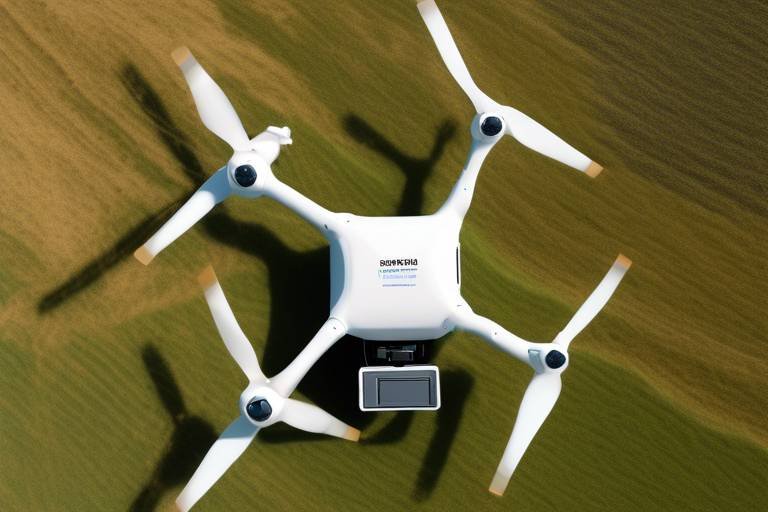
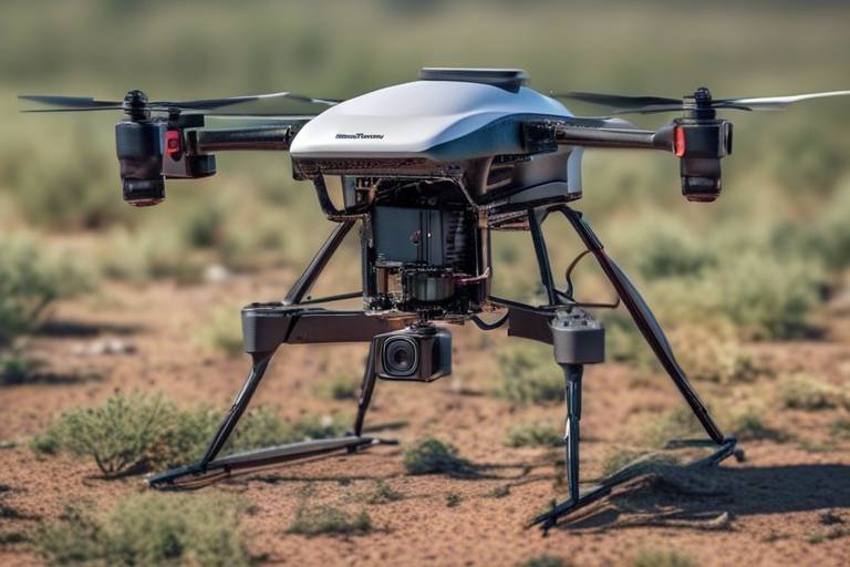
UAVs, commonly known as drones, have emerged as powerful tools for monitoring land degradation. These flying marvels can cover extensive areas in a fraction of the time it would take traditional methods, such as ground surveys. Equipped with advanced sensors and cameras, UAVs collect high-resolution data that provides insights into land conditions. Their operational advantages include the ability to access hard-to-reach locations, operate in various weather conditions, and gather data without disturbing the environment. With UAVs, we can obtain a comprehensive view of land health, enabling timely interventions.
UAVs utilize a variety of data collection techniques that enhance our understanding of land degradation. Two prominent methods are remote sensing and imaging. Remote sensing involves collecting data from a distance, allowing UAVs to gather information about land cover, vegetation health, and soil conditions without physical contact. Imaging techniques, on the other hand, provide visual representations of the land, making it easier to identify changes over time. Together, these methods create a robust framework for monitoring land degradation.
Among the most effective imaging technologies are multispectral and hyperspectral imaging. These methods provide detailed information about land cover and health by capturing data across multiple wavelengths of light. Multispectral imaging focuses on a few specific wavelengths, while hyperspectral imaging captures a much broader spectrum, allowing for the identification of subtle changes in vegetation and soil conditions. This level of detail is critical for identifying degradation patterns, helping land managers make informed decisions.
Another innovative technology utilized by UAVs is Light Detection and Ranging (LiDAR). This method uses laser pulses to measure distances and create highly accurate topographical maps. LiDAR is particularly useful for monitoring changes in land elevation, vegetation structure, and other critical factors that contribute to land degradation. By providing a three-dimensional view of the landscape, LiDAR enhances our ability to analyze land changes over time, making it an invaluable tool for environmental assessments.
The applications of UAVs in land management are vast and varied. From agricultural monitoring to forestry assessments, these unmanned systems are being employed in numerous case studies worldwide. For example, in regions affected by deforestation, UAVs have been used to map and monitor forest health, enabling timely interventions. Similarly, in agricultural settings, UAVs help farmers assess crop health and optimize resource use, ultimately leading to more sustainable practices.
The integration of unmanned systems in monitoring land degradation offers numerous benefits. One of the most significant advantages is improved efficiency. Traditional methods of land assessment can be time-consuming and labor-intensive, whereas UAVs can complete these tasks quickly and accurately. Moreover, the cost-effectiveness of using drones cannot be overstated. By reducing the need for extensive manpower and equipment, UAVs provide a more economical approach to land degradation assessments. Additionally, the enhanced data accuracy obtained from these systems leads to better decision-making, allowing for more effective land management strategies.
Unmanned systems significantly reduce the costs associated with traditional monitoring methods. For instance, deploying a UAV for a land survey can be a fraction of the cost of hiring a team to conduct ground inspections. This economic advantage allows organizations and governments to allocate resources more effectively, focusing on restoration efforts rather than monitoring expenses.
The precision of data collected by unmanned systems leads to better analysis and outcomes. Accurate data is crucial in formulating effective land management strategies. With the ability to monitor changes over time, stakeholders can identify trends and make informed decisions that promote sustainability. In a way, UAVs serve as the eyes in the sky, providing a clear picture of land health that was previously difficult to obtain.
- What are unmanned aerial vehicles (UAVs)? UAVs, or drones, are aircraft that operate without a human pilot on board, often used for data collection and monitoring.
- How do UAVs help in monitoring land degradation? UAVs collect high-resolution data using various sensors and imaging techniques, providing insights into land conditions and degradation patterns.
- What technologies do UAVs use for data collection? UAVs utilize remote sensing, multispectral and hyperspectral imaging, and LiDAR technology to gather information about land health.
- What are the benefits of using UAVs for land management? UAVs offer improved efficiency, cost-effectiveness, and enhanced data accuracy, leading to better decision-making in land management.
Understanding Land Degradation
Land degradation is a pressing global issue that refers to the deterioration of the land's quality, rendering it less productive and less capable of supporting life. This degradation is not just a minor inconvenience; it has far-reaching consequences that affect ecosystems, biodiversity, and human livelihoods. Imagine a once-thriving forest turned into a barren wasteland due to deforestation or a fertile agricultural field rendered useless by soil erosion. Such scenarios are becoming alarmingly common, and understanding the causes and impacts of land degradation is crucial for devising effective solutions.
The causes of land degradation are multifaceted, often stemming from a combination of natural processes and human activities. Key factors include:
- Deforestation: The clearing of trees for agriculture or urban development leads to soil erosion and loss of habitat.
- Overgrazing: Excessive grazing by livestock depletes vegetation, leaving soil exposed and vulnerable to erosion.
- Soil Salinization: Poor irrigation practices can lead to the accumulation of salts in the soil, rendering it infertile.
- Urbanization: The expansion of cities often replaces natural landscapes with concrete, disrupting local ecosystems.
The consequences of land degradation are dire. It can lead to reduced agricultural productivity, threatening food security for millions of people. According to the United Nations, approximately 1.5 billion people are affected by land degradation, with many relying on the land for their livelihoods. Additionally, degraded land can contribute to climate change by releasing stored carbon into the atmosphere, exacerbating global warming.
Monitoring land degradation is essential for several reasons. First, it allows us to track changes over time, helping to identify areas at risk and prioritize interventions. Second, effective monitoring can inform policy decisions, guiding sustainable land management practices. Lastly, understanding the extent of land degradation can raise public awareness and foster community engagement in conservation efforts. Without proper monitoring, we are essentially flying blind, making it difficult to implement effective strategies to combat this global crisis.
In conclusion, grasping the complexities of land degradation is critical for anyone invested in environmental conservation and sustainable land management. As we delve deeper into the role of unmanned systems in monitoring this issue, it becomes clear that technology can play a pivotal role in reversing the tide of degradation and restoring our planet's health.
The Role of Unmanned Aerial Vehicles (UAVs)
Unmanned Aerial Vehicles, commonly known as UAVs or drones, have revolutionized the way we monitor and assess land degradation. Imagine a bird soaring high above the ground, effortlessly capturing images and data that would take teams of people weeks to gather. This is precisely what UAVs do, and they do it with remarkable efficiency and precision. By utilizing advanced technologies, these flying machines provide invaluable insights into the health of our ecosystems, helping us to identify and address land degradation issues before they escalate.
One of the most significant advantages of UAVs is their ability to operate in challenging environments. Whether it's a remote forest, a rugged mountain range, or an urban area, UAVs can navigate these spaces easily, collecting data that would otherwise be difficult to obtain. With the help of GPS and advanced navigation systems, these drones can fly predetermined paths, ensuring comprehensive coverage of the area being monitored.
UAVs are equipped with a variety of sensors and imaging technologies that allow them to collect different types of data. For instance, they can capture high-resolution images, thermal data, and even multispectral information that reveals the health of vegetation. This capability is essential in detecting early signs of land degradation, such as soil erosion, deforestation, and changes in land use. By identifying these issues early, stakeholders can implement corrective measures swiftly, preventing further degradation.
Moreover, the operational advantages of UAVs extend beyond data collection. They can be deployed quickly and can cover large areas in a fraction of the time it would take traditional methods. This rapid deployment is particularly crucial during environmental emergencies, such as wildfires or floods, where timely information can save lives and resources. Instead of waiting for satellite imagery, which can take days to process, UAVs can provide real-time data that is critical for effective response strategies.
To illustrate the impact of UAVs on land degradation monitoring, consider the following table that summarizes their key features and benefits:
| Feature | Benefit |
|---|---|
| High-resolution imaging | Provides detailed insights into land health |
| Rapid deployment | Enables quick assessment of environmental changes |
| Versatile sensors | Allows for diverse data collection (thermal, multispectral) |
| Cost-effective | Reduces monitoring costs compared to traditional methods |
In summary, the role of UAVs in monitoring land degradation is indispensable. Their ability to gather accurate data quickly and efficiently positions them as a critical tool for environmental conservation and sustainable land management. As technology continues to evolve, we can expect UAVs to become even more integral to our efforts in combating land degradation and preserving our planet for future generations.
Data Collection Techniques
When it comes to monitoring land degradation, the choice of data collection techniques is pivotal. Unmanned Aerial Vehicles (UAVs) have revolutionized how we gather and analyze environmental data. These drones are equipped with advanced technologies that allow them to capture high-resolution images and gather critical information about the land's condition. One of the primary methods UAVs use is remote sensing, which involves detecting and measuring reflected or emitted energy from the Earth's surface. This technique enables researchers to assess various land characteristics without the need for direct contact.
Additionally, UAVs utilize imaging techniques that can be categorized into several types, each serving specific purposes. For instance, multispectral imaging captures data across different wavelengths, allowing for the identification of various vegetation types and their health status. On the other hand, hyperspectral imaging goes a step further by providing much more detailed information, enabling scientists to discern subtle differences in land cover and detect early signs of degradation.
Moreover, UAVs often employ LiDAR technology (Light Detection and Ranging), which is a game changer in mapping and monitoring land changes. LiDAR uses laser light to measure distances, creating highly accurate topographical maps that reveal changes in elevation and vegetation structure. This information is invaluable for understanding how land degradation occurs and for planning effective interventions. The combination of these advanced data collection techniques allows for a comprehensive understanding of land conditions, making UAVs an essential tool in environmental monitoring.
To illustrate the effectiveness of these techniques, consider the following table that summarizes the key characteristics of each data collection method:
| Technique | Description | Applications |
|---|---|---|
| Remote Sensing | Detects energy reflected or emitted from the land surface. | Land cover classification, vegetation health assessment. |
| Multispectral Imaging | Captures data across multiple wavelengths. | Identifying vegetation types, monitoring crop health. |
| Hyperspectral Imaging | Provides detailed spectral information for analysis. | Detecting early signs of degradation, analyzing soil conditions. |
| LiDAR | Uses laser light to create accurate topographical maps. | Mapping elevation changes, assessing vegetation structure. |
In summary, the integration of these data collection techniques enhances the accuracy and effectiveness of monitoring land degradation. UAVs, with their ability to gather detailed and precise data, play a crucial role in understanding environmental changes and developing strategies for sustainable land management.
Multispectral and Hyperspectral Imaging
Multispectral and hyperspectral imaging technologies have revolutionized the way we monitor land health and degradation. These imaging techniques capture data across multiple wavelengths of light, which allows us to see beyond the visible spectrum. Imagine looking at a vibrant forest not just in shades of green but in a full spectrum of colors that reveal the health of each plant. This capability is essential for identifying issues such as nutrient deficiencies, pest infestations, or water stress in crops and natural ecosystems.
The key difference between multispectral and hyperspectral imaging lies in the number of wavelengths they capture. Multispectral imaging typically uses a limited number of bands (usually 3 to 10), which are strategically chosen to provide essential information about the land. On the other hand, hyperspectral imaging captures hundreds of bands across the electromagnetic spectrum, offering a much more detailed view of the land's condition. This high level of detail can be compared to having a high-definition television versus a standard one; the former reveals subtleties that the latter simply cannot.
The significance of these technologies in identifying degradation patterns cannot be overstated. By analyzing the data collected, researchers and land managers can pinpoint areas that are at risk of degradation or are already experiencing it. For instance, hyperspectral data can help in detecting subtle changes in vegetation health long before they are visible to the naked eye. This early detection is crucial for implementing timely interventions to mitigate further degradation.
To illustrate the effectiveness of these imaging techniques, consider the following applications:
- Agricultural Monitoring: Farmers can use multispectral imaging to assess crop health and optimize irrigation and fertilization practices.
- Forest Management: Hyperspectral imaging aids in identifying tree species and their health, which is vital for sustainable forestry practices.
- Wetland Conservation: These imaging technologies can monitor changes in wetland vegetation, helping to maintain biodiversity and ecosystem services.
Ultimately, the integration of multispectral and hyperspectral imaging into UAV operations enhances our ability to monitor land degradation effectively. By providing detailed insights into land conditions, these technologies empower decision-makers to take informed actions that promote sustainable land management and conservation efforts. As we continue to face the challenges of land degradation, leveraging such advanced technologies will be key to preserving our planet's resources for future generations.
Q1: What is the difference between multispectral and hyperspectral imaging?
A1: Multispectral imaging captures data in a limited number of bands (3 to 10), while hyperspectral imaging captures hundreds of bands, providing a more detailed view of land conditions.
Q2: How can these imaging technologies help in agricultural practices?
A2: These technologies can help farmers monitor crop health, optimize irrigation and fertilization, and detect issues like pest infestations early, leading to better yields and sustainability.
Q3: Are there any limitations to using UAVs for land monitoring?
A3: While UAVs provide numerous advantages, they can be limited by factors such as battery life, weather conditions, and regulatory restrictions in certain areas.
LiDAR Technology
Light Detection and Ranging, commonly known as LiDAR, is a groundbreaking technology that has transformed the way we monitor land degradation. By emitting rapid pulses of laser light toward the ground and measuring the time it takes for each pulse to bounce back, LiDAR can create incredibly detailed three-dimensional maps of the terrain. This method allows us to capture the subtle changes in land topography that might be missed by traditional surveying techniques. Imagine having a bird's-eye view of the land that not only shows you the surface but also reveals the intricate details beneath it!
One of the most significant advantages of LiDAR technology is its ability to penetrate vegetation. This is particularly vital in densely forested areas where traditional methods struggle to provide accurate data. With LiDAR, we can assess the underlying ground conditions, measure tree heights, and even identify changes in soil composition over time. The precision of LiDAR data enables researchers and land managers to pinpoint areas that are experiencing degradation, allowing for targeted interventions.
The data collected through LiDAR can be processed to produce various outputs, including:
- Digital Elevation Models (DEMs): These provide a clear representation of the terrain's surface.
- Canopy Height Models (CHMs): These help in understanding vegetation structure and health.
- 3D Point Clouds: These intricate datasets offer a detailed view of the landscape, revealing even the smallest changes.
LiDAR technology is not just about collecting data; it's also about enhancing our understanding of land dynamics. For instance, by comparing LiDAR data collected over different time periods, we can observe trends in erosion, sedimentation, and vegetation loss. This temporal analysis is crucial for developing effective land management strategies aimed at combating degradation.
In summary, LiDAR technology stands as a powerful ally in the fight against land degradation. Its ability to provide precise, high-resolution data makes it an indispensable tool for environmental scientists, land managers, and policymakers alike. As we continue to face the challenges posed by climate change and unsustainable land use practices, leveraging LiDAR will be essential for making informed decisions that promote sustainable land management and conservation efforts.
- What is LiDAR technology? LiDAR technology uses laser light to measure distances and create detailed maps of the Earth's surface.
- How does LiDAR help in monitoring land degradation? It provides precise 3D maps that reveal changes in land topography, vegetation structure, and soil conditions.
- Can LiDAR penetrate forest canopies? Yes, LiDAR can penetrate vegetation, allowing for accurate assessments of the ground beneath dense foliage.
- What types of data can be generated from LiDAR? LiDAR can produce Digital Elevation Models, Canopy Height Models, and 3D Point Clouds.
Applications in Land Management
The integration of unmanned aerial vehicles (UAVs) in land management has revolutionized how we monitor and address land degradation issues. These drones are not just flying cameras; they are powerful tools that provide critical data for effective decision-making. With their ability to cover large areas quickly and efficiently, UAVs are increasingly becoming the go-to solution for various applications in land management.
One of the most significant applications of UAVs is in agricultural monitoring. Farmers can use these drones to assess crop health, identify pest infestations, and monitor soil conditions. For instance, a farmer might deploy a UAV equipped with multispectral imaging to analyze crop vigor across their fields. This data allows them to make informed decisions about irrigation, fertilization, and pest control, ultimately leading to increased yields and reduced resource waste.
Moreover, UAVs play a crucial role in environmental conservation efforts. They are used to monitor deforestation, track wildlife populations, and assess the impact of climate change on various ecosystems. For example, conservationists can utilize UAVs to survey remote areas that are difficult to access on foot. By capturing high-resolution images and data, they can identify areas of concern, such as illegal logging or habitat destruction, and take appropriate action to mitigate these threats.
In urban planning, UAVs are also making waves. City planners can leverage drone technology to gather data on land use, infrastructure conditions, and urban heat islands. This information is invaluable for developing sustainable urban environments. By analyzing the data collected, planners can make strategic decisions that promote green spaces, improve public transportation, and enhance overall livability.
Additionally, UAVs are utilized in disaster management and recovery efforts. After natural disasters such as floods or wildfires, drones can quickly assess the damage and provide real-time data to emergency responders. This rapid assessment helps in prioritizing recovery efforts and allocating resources effectively. For instance, a UAV can fly over a wildfire-affected area to map out the extent of the damage, enabling firefighters and rescue teams to strategize their response.
To illustrate the diverse applications of UAVs in land management, consider the following table:
| Application | Description | Benefits |
|---|---|---|
| Agricultural Monitoring | Assessing crop health and soil conditions using multispectral imaging. | Increased yields, reduced resource waste. |
| Environmental Conservation | Monitoring deforestation and wildlife populations. | Enhanced protection of ecosystems, informed conservation strategies. |
| Urban Planning | Gathering data on land use and infrastructure. | Promotes sustainable development and improved urban livability. |
| Disaster Management | Real-time damage assessment after natural disasters. | Efficient resource allocation and prioritization of recovery efforts. |
In conclusion, the applications of UAVs in land management are vast and varied. From agriculture to urban planning, these unmanned systems provide essential data that empowers stakeholders to make informed decisions. The future of land management is undoubtedly intertwined with drone technology, paving the way for more sustainable practices and effective monitoring of land degradation.
- What are unmanned aerial vehicles (UAVs)? UAVs, commonly known as drones, are aircraft that operate without a human pilot on board. They are equipped with various sensors and cameras to collect data.
- How do UAVs help in monitoring land degradation? UAVs provide high-resolution imagery and data that enable accurate assessments of land quality, vegetation health, and changes over time.
- Are UAVs cost-effective for land management? Yes, UAVs reduce costs associated with traditional monitoring methods by covering large areas quickly and minimizing the need for manual labor.
- Can UAVs be used in urban environments? Absolutely! UAVs are increasingly used in urban planning to monitor land use, infrastructure, and environmental impacts.
Benefits of Using Unmanned Systems
The integration of unmanned systems in monitoring land degradation is not just a trend; it’s a revolution in how we approach environmental conservation. These systems, primarily UAVs (Unmanned Aerial Vehicles), are transforming the landscape of land management by providing tools that are not only efficient but also incredibly effective. Imagine having the ability to survey vast areas of land quickly and accurately—this is what unmanned systems bring to the table. The benefits are multifaceted, impacting everything from data collection to cost savings and decision-making processes.
One of the most significant advantages of using unmanned systems is their improved efficiency. Traditional methods of monitoring land degradation often involve extensive manpower and resources. In contrast, UAVs can cover large areas in a fraction of the time, allowing for more frequent assessments. This means that changes in land conditions can be detected sooner, leading to quicker interventions. For instance, if a particular area shows signs of erosion or deforestation, the rapid response facilitated by UAVs can help mitigate further damage.
Moreover, the cost-effectiveness of employing unmanned systems cannot be overstated. When you factor in the costs associated with traditional monitoring—such as labor, equipment, and time—the financial savings of using UAVs become apparent. A recent study highlighted that organizations using UAVs for land assessments reported a reduction in costs by up to 60% compared to conventional methods. This allows more funds to be allocated towards actual conservation efforts rather than monitoring logistics.
Additionally, the enhanced data accuracy provided by unmanned systems is a game-changer. UAVs equipped with advanced sensors and imaging technologies can gather data that is not only comprehensive but also precise. This high level of accuracy is crucial for making informed decisions regarding land management. For example, UAVs can detect subtle changes in vegetation health or soil conditions that might go unnoticed with traditional methods. The ability to analyze this data effectively leads to better outcomes, ensuring that interventions are based on reliable information.
To illustrate the impact of these benefits, consider the following table that summarizes the advantages of using unmanned systems in monitoring land degradation:
| Benefit | Description |
|---|---|
| Improved Efficiency | UAVs can cover large areas quickly, allowing for more frequent monitoring. |
| Cost-Effectiveness | Significantly reduces the costs associated with traditional monitoring methods. |
| Enhanced Data Accuracy | Provides precise data that leads to better decision-making and outcomes. |
In addition to these primary benefits, unmanned systems also facilitate better accessibility to remote or difficult-to-reach areas. Traditional monitoring often requires physical presence, which can be challenging in rugged terrains or hazardous environments. UAVs eliminate these barriers, allowing for comprehensive assessments without the associated risks. This capability is especially vital for monitoring areas affected by natural disasters or extreme weather conditions, where human access may be compromised.
In conclusion, the advantages of using unmanned systems for monitoring land degradation are clear. They enhance efficiency, reduce costs, improve data accuracy, and offer greater accessibility to challenging environments. As we continue to face the pressing issue of land degradation, leveraging these technologies is not just beneficial; it’s essential for sustainable land management and environmental conservation.
Here are some common questions regarding the use of unmanned systems in monitoring land degradation:
- What types of unmanned systems are used for land monitoring? UAVs are the most common, but there are also unmanned ground vehicles (UGVs) and underwater drones that can be utilized in specific contexts.
- How does UAV technology improve monitoring accuracy? UAVs equipped with advanced sensors can capture high-resolution images and multispectral data that provide detailed insights into land conditions.
- Are unmanned systems cost-effective for small-scale land management? Yes, even small-scale operations can benefit from the efficiency and lower costs associated with UAVs, making them accessible for various land management needs.
- Can UAVs operate in adverse weather conditions? While UAVs are designed to be robust, their operational capability can be limited in severe weather conditions. It's essential to assess weather conditions before deployment.
Cost Efficiency
The integration of unmanned systems, particularly Unmanned Aerial Vehicles (UAVs), in monitoring land degradation has revolutionized the way we approach environmental assessments. One of the most compelling advantages of using these systems is their . Traditional methods of monitoring land often involve extensive manpower, expensive equipment, and prolonged timeframes that can drain both financial and human resources. In contrast, UAVs streamline this entire process, making it not only quicker but also considerably more affordable.
Imagine having to send a team of experts to survey a large area of land—this can take days or even weeks, depending on the terrain and size. Now, picture a drone equipped with advanced sensors that can cover the same area in a matter of hours, collecting data that would take a team much longer to gather. This shift not only saves time but also significantly cuts down on labor costs. In fact, studies have shown that utilizing UAVs can reduce monitoring costs by up to 70% compared to traditional methods. This is a game-changer for organizations working with limited budgets, allowing them to allocate resources more effectively.
Moreover, the operational costs of UAVs are remarkably low. Once the initial investment in the drone and its technology is made, the ongoing expenses are minimal. There are no fuel costs associated with piloted aircraft, and maintenance is generally less intensive. This leads to a sustainable model where the savings can be reinvested into other crucial areas of land management and conservation efforts.
Here’s a quick comparison that illustrates the cost advantages of UAVs over traditional methods:
| Monitoring Method | Time Required | Cost Estimate |
|---|---|---|
| Traditional Ground Survey | Days to Weeks | $5,000 - $15,000 |
| UAV Monitoring | Hours | $1,500 - $4,000 |
This table clearly demonstrates the stark contrast in both time and cost between traditional ground surveys and UAV monitoring. The ability to gain quick insights into land conditions without breaking the bank is invaluable, especially for organizations focused on sustainability and conservation.
In conclusion, the cost efficiency of unmanned systems not only makes them a practical choice for monitoring land degradation but also empowers organizations to make informed decisions swiftly. By leveraging these technologies, we can ensure that our environmental efforts are both effective and economically viable, paving the way for a more sustainable future.
- What are UAVs? UAVs, or Unmanned Aerial Vehicles, are drones used for various applications, including environmental monitoring.
- How do UAVs reduce costs? UAVs minimize labor and equipment costs, allowing for quicker assessments at a fraction of the price of traditional methods.
- Can UAVs be used in all types of terrain? Yes, UAVs can be adapted for various terrains, making them versatile tools for monitoring land degradation.
- What kind of data can UAVs collect? UAVs can collect a range of data, including high-resolution images, multispectral and hyperspectral data, and topographical information.
Enhanced Data Accuracy
When it comes to monitoring land degradation, the accuracy of data is paramount. Unmanned systems, particularly UAVs, have revolutionized the way we gather and analyze environmental data. Unlike traditional methods, which often rely on human observation and ground surveys that can be time-consuming and prone to error, UAVs provide a level of precision that is simply unmatched. With the ability to fly at various altitudes and cover large areas in a fraction of the time, these aerial platforms capture high-resolution images and data that allow for detailed analysis of land conditions.
One of the key advantages of using unmanned systems is their ability to collect data across different wavelengths. For instance, UAVs equipped with multispectral and hyperspectral sensors can detect subtle changes in vegetation health and soil conditions that are invisible to the naked eye. This capability is crucial for identifying early signs of land degradation, such as soil erosion or nutrient depletion. By analyzing the data captured, researchers and land managers can pinpoint specific areas that require intervention, ensuring that resources are allocated effectively.
Moreover, the integration of advanced technologies like LiDAR enhances data accuracy even further. LiDAR systems emit laser pulses to measure distances to the Earth's surface, creating precise three-dimensional models of terrain. This technology is particularly beneficial in monitoring topographical changes over time, such as the impact of deforestation or urban development on natural landscapes. The detailed topographical maps generated by LiDAR not only aid in visualizing current land conditions but also serve as a baseline for future comparisons, making it easier to track changes and assess the effectiveness of land management strategies.
In addition to these technologies, the data collected by unmanned systems can be processed using sophisticated software that employs algorithms and machine learning techniques. This processing capability allows for the extraction of meaningful insights from vast datasets, transforming raw information into actionable intelligence. The result is a more comprehensive understanding of land degradation patterns, which can inform policy decisions and conservation efforts.
To illustrate the impact of enhanced data accuracy, consider the following table that summarizes the differences between traditional monitoring methods and unmanned systems:
| Aspect | Traditional Methods | Unmanned Systems |
|---|---|---|
| Data Collection Time | Days to weeks | Hours to days |
| Data Resolution | Low to moderate | High |
| Cost | High due to manpower | Lower operational costs |
| Flexibility | Limited to specific locations | Wide coverage with various altitudes |
As we can see, the advantages of using unmanned systems for monitoring land degradation are clear. The ability to gather accurate, high-resolution data not only improves our understanding of environmental changes but also enhances the effectiveness of our responses to these challenges. In a world where land degradation poses significant threats to ecosystems and human livelihoods, leveraging technology to achieve precise monitoring is not just beneficial; it is essential.
- What are unmanned systems? Unmanned systems refer to vehicles or devices that operate without a human pilot, including drones and robotic systems.
- How do UAVs collect data for land monitoring? UAVs collect data through various sensors, including cameras and LiDAR, capturing images and measurements from the air.
- What is the significance of accurate data in land management? Accurate data allows for informed decision-making, enabling targeted interventions to combat land degradation effectively.
- Can UAVs replace traditional monitoring methods? While UAVs offer significant advantages, they are often used in conjunction with traditional methods to provide a more comprehensive understanding of land conditions.
Frequently Asked Questions
- What is land degradation?
Land degradation refers to the decline in land quality and productivity caused by various factors such as deforestation, soil erosion, and climate change. It affects the land's ability to support agriculture, maintain biodiversity, and provide ecosystem services.
- How do unmanned aerial vehicles (UAVs) help in monitoring land degradation?
UAVs, or drones, are equipped with advanced technology that allows them to collect high-resolution data on land conditions. They can cover large areas quickly and provide real-time information, making them invaluable for assessing land degradation.
- What data collection techniques do UAVs use?
UAVs utilize various data collection techniques including remote sensing, multispectral and hyperspectral imaging, and LiDAR technology. These methods enhance the accuracy of land monitoring by providing detailed insights into land cover, health, and topography.
- What are multispectral and hyperspectral imaging?
These imaging technologies capture data across different wavelengths of light, allowing for detailed analysis of vegetation health and land cover. They help in identifying degradation patterns by providing insights that are not visible to the naked eye.
- What role does LiDAR play in monitoring land degradation?
LiDAR, or Light Detection and Ranging, is a technology that uses laser pulses to create detailed topographical maps. This allows for precise measurements of land changes, helping researchers and land managers understand how degradation is occurring over time.
- What are the benefits of using unmanned systems for land monitoring?
The integration of unmanned systems in land monitoring offers numerous advantages including improved efficiency, cost-effectiveness, and enhanced data accuracy. These benefits lead to better decision-making and more effective land management strategies.
- How do unmanned systems reduce costs in land degradation assessments?
Unmanned systems minimize the need for extensive manpower and costly equipment associated with traditional monitoring methods. By providing a more economical approach, they allow for more frequent assessments without breaking the bank.
- Why is accurate data important in land management?
Accurate data is crucial for formulating effective land management strategies. It enables stakeholders to make informed decisions, prioritize interventions, and monitor the impacts of their actions on land health and sustainability.