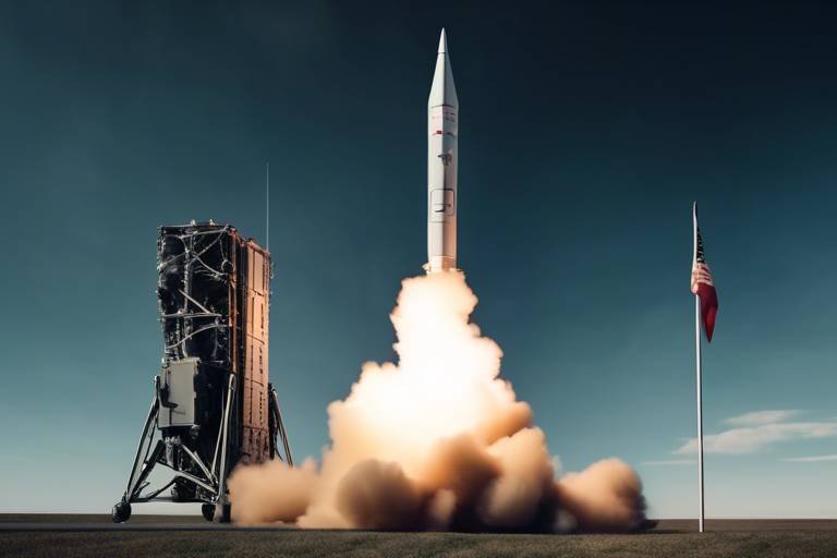
The Use of Satellites in Modern Military Surveillance
In today's world, the role of satellites in military surveillance is nothing short of revolutionary. They have transformed the way armed forces gather intelligence, conduct reconnaissance, and execute operations. Imagine a bird's-eye view of the battlefield, capable of observing enemy movements from thousands of miles away. This is not just a futuristic concept; it's the reality of modern warfare. With the ability to capture high-resolution images and relay real-time data, satellites have become indispensable tools for military strategists. They provide a level of situational awareness that was previously unimaginable, allowing for quick decision-making and effective operational planning.
The integration of satellites into military operations has not only enhanced intelligence gathering but has also changed the dynamics of warfare itself. No longer are troops limited to ground-based intelligence; they can now leverage vast networks of satellites orbiting the Earth. This capability has ushered in a new era of warfare where information is power, and the ability to access and analyze data swiftly can mean the difference between victory and defeat. The modern battlefield is as much about information superiority as it is about firepower.
Furthermore, the strategic advantages offered by military satellites extend beyond mere surveillance. They play a crucial role in communication, navigation, and coordination among units. For instance, during a complex operation, the ability to communicate securely and effectively can enhance the overall efficiency of the mission. This interconnectedness ensures that all units are on the same page, reducing the risk of miscommunication and operational failures.
As we delve deeper into the evolution of military satellites, it becomes evident that their impact is profound and multifaceted. From reconnaissance satellites that provide critical images for planning missions to communication satellites that facilitate seamless interactions among forces, each type serves a unique purpose. The continuous advancement in satellite technology is paving the way for even more sophisticated systems that promise to redefine military capabilities in the years to come.
- How do military satellites differ from commercial satellites?
Military satellites are designed specifically for defense purposes, offering enhanced security, capabilities, and features tailored to meet the needs of armed forces, whereas commercial satellites cater to civilian applications. - What are the main challenges faced by military satellites?
Military satellites encounter challenges such as vulnerability to cyber threats, high operational costs, and limitations in coverage, which can impact their effectiveness in certain situations. - What future trends are expected in military satellite technology?
Future trends include the integration of artificial intelligence for enhanced data processing and increased collaboration with commercial satellite networks to expand military capabilities.

Evolution of Military Satellites
This article explores how satellites have transformed military surveillance, enhancing intelligence gathering, reconnaissance, and operational capabilities in contemporary warfare.
The development of military satellites has significantly evolved over the decades, adapting to technological advancements and changing warfare dynamics, providing critical support to armed forces worldwide. In the early days of space exploration, military satellites were primarily focused on basic reconnaissance and communication. The launch of Sputnik in 1957 marked the beginning of a new era, where nations recognized the strategic importance of space. Fast forward to today, and we see a complex web of satellites that not only gather intelligence but also facilitate real-time communication and navigation.
Initially, military satellites were bulky and limited in functionality. However, advancements in technology have led to the miniaturization of components, allowing for more sophisticated and capable systems to be deployed. For instance, the introduction of high-resolution imaging capabilities has revolutionized how military forces gather intelligence. Moreover, the integration of advanced sensors and data processing technologies has enhanced the ability to analyze vast amounts of information quickly.
One of the most significant milestones in the evolution of military satellites was the transition from optical imaging to radar imaging systems. This shift allowed for surveillance in all weather conditions and during nighttime, which was previously a challenge for optical systems. As a result, military operations became more effective, as commanders could rely on consistent and accurate data regardless of environmental factors.
Furthermore, the advent of communication satellites has transformed military operations by ensuring that units can communicate securely and reliably across vast distances. This capability has been crucial during operations in remote areas where traditional communication methods might fail. The seamless flow of information enables military leaders to make timely decisions, ultimately enhancing operational effectiveness.
As we look to the future, the evolution of military satellites is set to continue. Innovations in artificial intelligence and partnerships with commercial satellite providers are paving the way for even more advanced systems. These developments promise to enhance the ability of military forces to monitor and respond to global threats, ensuring that they remain prepared for the challenges of modern warfare.
- What are military satellites used for? Military satellites are primarily used for reconnaissance, communication, and navigation, providing essential support for armed forces in various operations.
- How have military satellites changed over time? Military satellites have evolved from basic reconnaissance tools to sophisticated systems with advanced imaging and communication capabilities, adapting to technological advancements and operational needs.
- What challenges do military satellites face today? Military satellites face challenges such as cybersecurity threats, high operational costs, and limitations in coverage and resolution, which can impact their effectiveness.
- What is the future of military satellites? The future of military satellites includes advancements in artificial intelligence, miniaturization of technology, and increased collaboration with commercial satellite networks, enhancing their operational capabilities.

Types of Military Satellites
Military satellites are the unsung heroes of modern warfare, each serving a distinct purpose that enhances operational effectiveness. These satellites can be broadly categorized into several types, each tailored to meet the specific needs of military operations. Understanding these types is crucial for grasping how they contribute to the overarching strategy of armed forces worldwide.
One of the primary categories is reconnaissance satellites. These high-tech marvels are equipped with advanced imaging technology that allows them to capture detailed photographs of enemy positions, troop movements, and infrastructure. They play a pivotal role in intelligence gathering, providing military leaders with the information they need to make informed decisions. For example, optical imaging technologies enable these satellites to produce stunningly clear images of the battlefield, while radar imaging systems ensure that surveillance can continue even in adverse weather conditions. This dual capability allows for a comprehensive view of the operational environment, ensuring that no detail goes unnoticed.
Next up, we have communication satellites. These satellites are the backbone of military communication, providing secure and reliable channels for information exchange. Imagine trying to coordinate a large-scale operation without a reliable means of communication; chaos would surely ensue! Communication satellites ensure that military units can stay connected, share intelligence, and execute commands effectively. They are crucial for maintaining command and control, especially in dynamic combat situations where timely information can mean the difference between victory and defeat.
Another essential type is navigation satellites. These satellites are vital for guiding military operations, providing accurate positioning data that enables forces to navigate unfamiliar terrain. They support everything from ground troop movements to aerial operations, ensuring that military assets can reach their destinations safely and efficiently. In an era where precision is paramount, navigation satellites play an indispensable role in operational success.
In summary, the types of military satellites—reconnaissance, communication, and navigation—each serve unique but interconnected functions that enhance the capabilities of armed forces. By leveraging these technological advancements, military leaders can gain a strategic advantage in the ever-evolving landscape of warfare. As we look to the future, the integration of these satellite systems with emerging technologies promises to further revolutionize military operations.
- What are reconnaissance satellites used for?
Reconnaissance satellites are primarily used for gathering intelligence through high-resolution imaging, allowing military forces to monitor enemy activities and assess battlefield conditions effectively.
- How do communication satellites enhance military operations?
Communication satellites facilitate secure and reliable communication among military units, enhancing command and control capabilities during operations and ensuring timely information dissemination.
- What is the role of navigation satellites in military strategy?
Navigation satellites provide accurate positioning data that enables military forces to navigate unfamiliar terrain, supporting ground troop movements and aerial operations.

Reconnaissance Satellites
Reconnaissance satellites are the unsung heroes of modern military operations, acting as the eyes in the sky that provide critical intelligence for strategic planning and battlefield awareness. These high-tech marvels are specially designed to gather a wealth of information through advanced imaging technologies, enabling military forces to keep a close watch on enemy activities and assess the ever-changing conditions on the ground. Imagine trying to navigate a complex maze without a map; that's what military strategists would face without the invaluable data provided by reconnaissance satellites.
Equipped with cutting-edge sensors and imaging systems, reconnaissance satellites can capture stunningly detailed images of the Earth's surface. These images are not just pretty pictures; they are essential for understanding the battlefield landscape, identifying troop movements, and even detecting potential threats before they escalate. For instance, when a reconnaissance satellite passes over an area of interest, it can provide real-time imagery that highlights changes in enemy positions, infrastructure developments, or even natural disasters. This capability is akin to having a bird's-eye view of a chessboard, where every piece's position is crucial for making the next strategic move.
Two primary technologies drive the effectiveness of reconnaissance satellites: optical imaging and radar imaging. Optical imaging technologies capture high-resolution images using visible light, allowing military analysts to see details as fine as a few centimeters. This technology is particularly useful in clear weather conditions, providing crisp visuals that enhance situational awareness. However, the effectiveness of optical systems can be hampered by cloud cover or nighttime conditions.
On the other hand, radar imaging systems operate independently of weather conditions and light, making them invaluable for continuous surveillance. These systems use radio waves to penetrate clouds and darkness, ensuring that military forces can maintain oversight regardless of environmental challenges. This dual capability of optical and radar imaging allows for a comprehensive view of the operational environment, enabling military planners to adapt their strategies in real-time.
In addition to their imaging capabilities, reconnaissance satellites also play a vital role in data collection and intelligence analysis. The information gathered is transmitted back to military command centers, where it undergoes rigorous analysis. This process ensures that military leaders are equipped with the most up-to-date information, allowing them to make informed decisions swiftly. It's like having a dedicated team of analysts working around the clock, ensuring that every piece of information is scrutinized for its strategic value.
As military technology continues to evolve, the role of reconnaissance satellites will only become more critical. With advancements in artificial intelligence and machine learning, the analysis of satellite imagery is becoming faster and more accurate. These innovations promise to enhance the capabilities of reconnaissance satellites, allowing them to predict enemy movements and activities with greater precision. In essence, these satellites are not just tools; they are integral components of modern warfare, shaping the way military operations are conducted and significantly impacting the outcomes of conflicts.
- What is the primary function of reconnaissance satellites? Reconnaissance satellites are designed to gather intelligence through high-resolution imaging, enabling military forces to monitor enemy activities and assess battlefield conditions effectively.
- How do optical imaging and radar imaging differ? Optical imaging captures images using visible light and is best in clear conditions, while radar imaging uses radio waves to operate in any weather and at any time of day.
- What advancements are being made in reconnaissance satellite technology? Future advancements include the integration of artificial intelligence for quicker analysis and improved predictive capabilities regarding enemy movements.

Optical Imaging Technologies
The world of in military reconnaissance satellites is nothing short of fascinating. These advanced systems are designed to capture high-resolution images of the Earth’s surface, providing military forces with critical visual data that can be used for strategic planning and operational execution. Imagine having a bird’s-eye view of the battlefield, where every detail is visible, from troop movements to infrastructure layouts. This capability is vital for commanders who need to make informed decisions based on accurate and timely information.
One of the key features of optical imaging technologies is their ability to produce images with remarkable clarity. This is achieved through sophisticated sensors that can detect light in various wavelengths, allowing for detailed analysis of the terrain and enemy positions. The images generated can be used for a variety of purposes, including:
- Identifying enemy installations and troop concentrations
- Assessing damage assessment after engagements
- Supporting humanitarian missions by providing information on affected areas
Moreover, the integration of multispectral and hyperspectral imaging has taken optical imaging to new heights. These technologies capture data across a range of wavelengths, enabling the identification of materials and substances that are not visible to the naked eye. For instance, they can differentiate between types of vegetation, detect camouflage, and even identify chemical signatures, which can be crucial in assessing enemy capabilities and intentions.
However, it’s essential to acknowledge that while optical imaging technologies provide significant advantages, they are not without their limitations. Factors such as weather conditions and lighting can impact the quality of the images captured. For instance, cloudy skies or nighttime operations can hinder visibility, making it challenging to gather reliable data. To mitigate these challenges, military forces often employ a combination of optical imaging with other technologies, such as radar systems, to ensure comprehensive surveillance capabilities.
In conclusion, optical imaging technologies play a pivotal role in modern military surveillance. By providing high-resolution imagery and enabling detailed analysis, these systems enhance situational awareness and inform strategic decisions on the battlefield. As technology continues to evolve, we can expect even more sophisticated imaging capabilities that will further transform the landscape of military operations.
- What are optical imaging technologies?
Optical imaging technologies are advanced systems used in reconnaissance satellites to capture high-resolution images of the Earth's surface, providing critical visual data for military operations. - How do these technologies enhance military surveillance?
They offer detailed imagery that allows military forces to monitor enemy activities, assess battlefield conditions, and make informed decisions based on accurate information. - What are the limitations of optical imaging?
Weather conditions, such as cloud cover and nighttime, can affect the quality of the images captured, necessitating the use of complementary technologies like radar systems.

Radar Imaging Systems
Radar imaging systems represent a pivotal advancement in the realm of military reconnaissance, allowing satellites to maintain a watchful eye on the battlefield irrespective of weather conditions. Imagine a soldier on the ground, unable to see through a thick fog or torrential rain; this is where radar imaging comes into play, cutting through the obscurity to provide vital intelligence. These systems utilize microwave radar signals that bounce off objects on the Earth's surface, creating detailed images that can be analyzed for strategic insights.
One of the most significant advantages of radar imaging systems is their ability to operate day and night, regardless of cloud cover. This continuous surveillance capability ensures that military forces are never left in the dark, literally and figuratively. In contrast to optical imaging, which can be hindered by poor visibility, radar systems maintain operational effectiveness, offering a clear view of enemy positions, troop movements, and even the layout of terrain.
Moreover, radar imaging systems can penetrate various materials, allowing them to detect objects that might otherwise remain hidden. For example, they can see through foliage, camouflage, and even some structures, giving military analysts a comprehensive understanding of the battlefield landscape. This capability is crucial for assessing enemy capabilities and planning effective countermeasures. The data collected can be processed to create 3D representations of the terrain, enhancing situational awareness and aiding in mission planning.
However, like any technology, radar imaging systems are not without their challenges. They can be susceptible to electronic warfare tactics, where adversaries might deploy jamming techniques to disrupt radar signals. Additionally, the resolution of radar images, while advanced, may not always match that of high-resolution optical images. Nevertheless, the strategic advantages offered by radar imaging systems make them an indispensable tool in modern military operations.
As military technology continues to evolve, radar imaging systems are likely to see further enhancements, including improved resolution and integration with artificial intelligence for real-time data analysis. This evolution promises to bolster the effectiveness of military surveillance, ensuring that armed forces remain one step ahead of their adversaries.
- What are radar imaging systems? - Radar imaging systems are satellite technologies that use microwave radar signals to create images of the Earth's surface, allowing for surveillance regardless of weather conditions.
- How do radar imaging systems differ from optical imaging? - Unlike optical imaging, which relies on visible light and can be affected by weather and time of day, radar imaging can operate in all conditions, providing continuous surveillance capabilities.
- What are the main advantages of using radar imaging in military operations? - The main advantages include 24/7 operational capability, the ability to penetrate through clouds and camouflage, and the production of detailed terrain maps for strategic planning.
- Are radar imaging systems vulnerable to enemy tactics? - Yes, radar systems can be susceptible to electronic warfare techniques, such as jamming, which can disrupt their functionality.

Communication Satellites
Communication satellites are the backbone of modern military operations, acting as the vital link that ensures seamless communication between units, command centers, and allied forces. These satellites facilitate secure and reliable communication, which is crucial during high-stakes operations where every second counts. Imagine trying to coordinate a complex military maneuver without the ability to communicate effectively; it would be akin to conducting a symphony without a conductor. Communication satellites eliminate this chaos, allowing for a synchronized approach to operations.
One of the primary roles of communication satellites is to enable real-time data transmission. This capability allows military leaders to relay orders, share intelligence, and coordinate actions across vast distances, ensuring that all units are on the same page. In contemporary warfare, where the battlefield can change in an instant, having this level of connectivity is not just an advantage; it's a necessity. The ability to transmit voice, video, and data securely means that military forces can respond to threats more swiftly and effectively.
Furthermore, communication satellites are equipped with advanced encryption technologies that protect sensitive information from interception. This is particularly important in military contexts, where the stakes are incredibly high. The confidentiality of communications can mean the difference between mission success and failure. As such, military communication satellites are designed to withstand various forms of electronic warfare, ensuring that they remain operational even in hostile environments.
The architecture of these satellite systems often involves a combination of geostationary and low Earth orbit satellites. Geostationary satellites provide broad coverage and are ideal for stable communication links, while low Earth orbit satellites offer lower latency and faster data transmission. This hybrid approach enhances the overall effectiveness of military communications. The following table outlines the key differences between these two types of satellites:
| Type of Satellite | Orbit Type | Coverage Area | Latency |
|---|---|---|---|
| Geostationary | Geostationary Orbit | Wide Coverage | High |
| Low Earth Orbit | Low Earth Orbit | Narrow Coverage | Low |
In addition to enhancing communication between military units, these satellites also support joint operations with allied nations. In an era where multinational coalitions are common, the ability to share information and coordinate actions across different military branches and nations is essential. Communication satellites facilitate this interoperability, ensuring that all partners can communicate efficiently and securely.
As technology continues to advance, we can expect communication satellites to become even more sophisticated, incorporating features like artificial intelligence for predictive analytics and enhanced cybersecurity measures. The future of military communication lies in the ability to adapt to emerging threats and technological innovations, ensuring that military forces remain one step ahead of potential adversaries.
- What are communication satellites used for in the military?
Communication satellites are used to facilitate secure and reliable communication among military units, enabling real-time data transmission and coordination during operations. - How do communication satellites enhance military operations?
They provide critical connectivity that allows for the swift sharing of intelligence, orders, and operational updates, which is essential for effective decision-making in combat situations. - What types of satellites are used for military communication?
The military uses both geostationary and low Earth orbit satellites to balance coverage and latency needs, ensuring effective communication across various operational scenarios.

Impact on Intelligence Gathering
The integration of satellites into military operations has revolutionized the way intelligence is gathered, analyzed, and utilized in modern warfare. Gone are the days when military strategists relied solely on ground reports and human intelligence; today, satellites provide a bird's-eye view of the battlefield, offering real-time data that can make or break a mission. This transformation has not only enhanced the speed of decision-making but has also significantly increased the accuracy of the intelligence collected.
One of the most significant advantages of satellite technology is its ability to deliver real-time data analysis. Military leaders can now access live feeds from reconnaissance satellites, allowing them to monitor enemy movements and assess battlefield conditions instantaneously. This capability ensures that decisions are based on the most current information available, enabling forces to adapt their strategies dynamically. Imagine being able to see the enemy's every move from above; this level of situational awareness is a game-changer.
Moreover, the concept of geospatial intelligence (GEOINT) has gained prominence in military operations. Derived from satellite imagery, geospatial intelligence allows military forces to visualize operational environments in a way that was previously unimaginable. This visualization includes not only the physical terrain but also the identification of potential threats, enemy positions, and logistical routes. By understanding the landscape, military planners can devise strategies that capitalize on their strengths while mitigating vulnerabilities.
To illustrate the impact of satellites on intelligence gathering, consider the following table that highlights key benefits:
| Benefit | Description |
|---|---|
| Real-Time Monitoring | Access to live feeds enables immediate assessment of situations, allowing for swift decision-making. |
| Enhanced Accuracy | High-resolution imagery provides detailed insights, reducing the chances of misinformation. |
| Comprehensive Situational Awareness | Combining various data sources allows for a holistic view of the operational environment. |
As military operations become increasingly complex, the reliance on satellite technology will only continue to grow. The ability to gather and analyze intelligence from space not only saves time but also enhances the effectiveness of military strategies. In essence, satellites have become the eyes in the sky, providing critical insights that are vital for success on the modern battlefield.
- How do satellites gather intelligence? Satellites use various technologies, including optical and radar imaging, to capture detailed images and data from the Earth's surface.
- What is geospatial intelligence? Geospatial intelligence is derived from satellite imagery and provides a visual representation of operational environments, helping military forces assess threats and plan strategies.
- What challenges do military satellites face? Military satellites face challenges such as cybersecurity threats, budget constraints, and limitations in coverage and resolution.
- How has AI impacted military satellite operations? AI integration into satellite systems enhances data processing capabilities, allowing for quicker analysis and improved predictions of enemy movements.

Real-Time Data Analysis
In the high-stakes world of military operations, the ability to analyze data in real-time can mean the difference between success and failure. harnesses the power of satellite technology to provide military leaders with instantaneous insights into evolving situations on the ground. Imagine being able to see enemy movements and assess battlefield conditions as they happen; this is not just a dream but a reality made possible by modern satellites.
The integration of satellite feeds into command centers allows for a dynamic flow of information. Military personnel can monitor various aspects of operations, from troop movements to potential threats, all in real-time. This capability is crucial for making quick, informed decisions that can adapt to changing circumstances. For instance, if a reconnaissance satellite detects an unexpected enemy formation, military leaders can instantly reroute forces or adjust strategies to counteract the threat effectively.
Moreover, real-time data analysis is not just about speed; it's also about accuracy. With advanced algorithms and data processing techniques, military analysts can filter through vast amounts of data to extract relevant information. This process involves:
- Data Fusion: Combining data from multiple sources, including satellites, drones, and ground intelligence, to create a comprehensive picture of the battlefield.
- Predictive Analytics: Utilizing historical data and trends to predict potential enemy actions and movements, allowing for preemptive strategies.
- Geospatial Analysis: Mapping and analyzing satellite imagery to understand terrain and environmental factors that could impact operations.
As a result, military units can operate with a level of situational awareness that was previously unimaginable. This enhanced capability not only improves operational effectiveness but also minimizes risks to personnel and equipment. When every second counts, having access to real-time data can significantly increase the chances of mission success.
However, the journey towards achieving optimal real-time data analysis is not without its challenges. Issues such as data overload, where the sheer volume of information can overwhelm analysts, and the need for robust cybersecurity measures to protect sensitive data, must be addressed. As technology continues to evolve, so too will the strategies to harness real-time data effectively, ensuring that military forces remain one step ahead of their adversaries.
- What is real-time data analysis in military operations?
Real-time data analysis refers to the immediate processing and interpretation of data collected from various sources, including satellites, to inform military decisions and strategies quickly. - How do satellites contribute to real-time data analysis?
Satellites provide continuous surveillance and monitoring capabilities, allowing military forces to gather crucial information about enemy movements and battlefield conditions as they occur. - What are the challenges of real-time data analysis?
Challenges include data overload, ensuring data accuracy, and protecting sensitive information from cyber threats. - How does predictive analytics enhance military strategies?
Predictive analytics uses historical data to forecast potential enemy actions, allowing military leaders to prepare and adapt their strategies proactively.

Geospatial Intelligence
Geospatial intelligence (GEOINT) has become a cornerstone of modern military strategy, providing a comprehensive understanding of the operational environment. This intelligence type combines various data sources, including satellite imagery, mapping information, and geospatial data, to create a multidimensional view of the battlefield. Imagine being able to see the terrain, enemy positions, and even the weather conditions in real-time—all from space! This capability drastically enhances situational awareness and enables military leaders to make informed decisions quickly.
The power of geospatial intelligence lies in its ability to visualize complex data in a way that is easily digestible. By integrating various data layers, military planners can assess potential threats, identify strategic locations, and optimize resource allocation. For instance, if a commander needs to plan a mission in a mountainous region, GEOINT can provide detailed topographic maps, allowing them to choose the most advantageous routes for troop movement. Furthermore, understanding the geography can help in predicting how weather changes might impact operations, such as how rain might affect ground mobility or visibility.
Moreover, the fusion of geospatial data with other intelligence types, such as signals intelligence (SIGINT) and human intelligence (HUMINT), creates a more robust operational picture. This integration allows military forces to correlate information from multiple sources, leading to more accurate assessments and predictions. For example, if satellite imagery shows unusual troop movements, SIGINT can provide insights into communications that may reveal the intent behind those movements. This holistic approach is crucial for countering asymmetric threats and ensuring that military operations are both effective and efficient.
In terms of practical applications, geospatial intelligence is utilized in various military operations, including:
- Targeting Operations: Identifying and tracking high-value targets.
- Mission Planning: Assessing terrain and weather conditions for strategic advantages.
- Post-Mission Analysis: Evaluating the effectiveness of operations through before-and-after imagery.
As technology continues to advance, the capabilities of geospatial intelligence will only improve. The integration of artificial intelligence (AI) is particularly promising, as it can automate the analysis of vast amounts of data, identifying patterns and anomalies that human analysts might miss. This not only speeds up the decision-making process but also enhances the accuracy of the intelligence gathered. The future of GEOINT is bright, with innovations that will undoubtedly transform how military forces operate and respond to threats on the battlefield.
- What is geospatial intelligence? Geospatial intelligence is the collection and analysis of data related to the Earth's surface, often using satellite imagery and mapping technologies to inform military operations.
- How does geospatial intelligence enhance military operations? It provides a comprehensive view of the battlefield, allowing for better planning, targeting, and situational awareness.
- What technologies are involved in geospatial intelligence? Technologies include satellite imaging, aerial reconnaissance, GIS (Geographic Information Systems), and AI for data analysis.
- What are the future trends in geospatial intelligence? Future trends include increased automation through AI, enhanced data integration, and improved collaboration with commercial satellite networks.

Challenges and Limitations
While military satellites have undeniably transformed modern warfare, they come with a set of that can hinder their effectiveness. One of the most pressing issues is their vulnerability to cyberattacks. As military operations increasingly rely on satellite technology for communication and intelligence, the threat of hostile entities attempting to breach satellite security has escalated. Cybersecurity threats can compromise sensitive data, leading to potentially catastrophic consequences on the battlefield.
Moreover, the high operational costs associated with developing and maintaining advanced satellite systems can be a significant hurdle. Military budgets are often constrained, forcing armed forces to make tough decisions on which technologies to prioritize. This can result in outdated systems that lack the capabilities needed for modern warfare, ultimately affecting military readiness. The table below illustrates the estimated costs associated with various aspects of military satellite operations:
| Category | Estimated Cost (in millions) |
|---|---|
| Development | 500-1500 |
| Launch | 100-400 |
| Maintenance | 50-200 |
| Cybersecurity Measures | 20-100 |
Additionally, despite their advanced capabilities, military satellites often face limitations in coverage and resolution. Factors such as the Earth's curvature, atmospheric conditions, and satellite positioning can affect the quality of the data gathered. For example, while reconnaissance satellites can provide high-resolution images, they may not be able to capture every detail due to these constraints. This can lead to gaps in intelligence that could prove detrimental during critical operations.
In conclusion, while military satellites play a crucial role in enhancing surveillance and operational capabilities, it is essential to acknowledge the challenges they face. From cybersecurity threats to budget constraints and technical limitations, these factors must be addressed to ensure that military satellites continue to serve their intended purpose effectively.
- What are the primary functions of military satellites? Military satellites primarily serve functions such as reconnaissance, communication, and navigation, each contributing to operational effectiveness.
- How do cyberattacks affect military satellites? Cyberattacks can compromise the security of military satellites, leading to data breaches and potential operational failures.
- What are the costs associated with military satellite operations? The costs can vary widely, with development, launch, maintenance, and cybersecurity measures collectively amounting to millions of dollars.
- What limitations do military satellites face? Limitations include vulnerabilities to cyber threats, high operational costs, and challenges in coverage and resolution due to environmental factors.

Cybersecurity Threats
This article explores how satellites have transformed military surveillance, enhancing intelligence gathering, reconnaissance, and operational capabilities in contemporary warfare.
The development of military satellites has significantly evolved over the decades, adapting to technological advancements and changing warfare dynamics, providing critical support to armed forces worldwide.
Various types of military satellites serve different purposes, including reconnaissance, communication, and navigation, each playing a vital role in modern military operations and strategy.
Reconnaissance satellites are designed to gather intelligence through high-resolution imaging, enabling military forces to monitor enemy activities and assess battlefield conditions effectively.
Optical imaging technologies in reconnaissance satellites capture detailed images of the Earth's surface, providing essential visual data for strategic planning and mission execution.
Radar imaging systems allow reconnaissance satellites to operate in all weather conditions, ensuring continuous surveillance capabilities regardless of visibility challenges.
Communication satellites facilitate secure and reliable communication among military units, enhancing command and control capabilities during operations and ensuring timely information dissemination.
The integration of satellites into military operations has revolutionized intelligence gathering, providing real-time data and analysis that inform strategic decisions and operational planning.
Real-time data analysis from satellite feeds enables military leaders to make informed decisions quickly, adapting strategies based on current situational awareness.
Geospatial intelligence derived from satellite imagery enhances situational understanding, allowing military forces to visualize operational environments and identify potential threats effectively.
Despite their advantages, military satellites face challenges such as vulnerability to cyberattacks, high operational costs, and limitations in coverage and resolution, impacting their effectiveness in certain scenarios.
Military satellites are increasingly vulnerable to that can compromise their operational integrity and the sensitive data they collect. As the reliance on satellite technology grows, so does the sophistication of cyber-attacks aimed at these critical systems. Hackers may employ various methods, including phishing, malware, and direct attacks on satellite control systems, to gain unauthorized access. The implications of such breaches can be severe, potentially leading to the disruption of communication channels and the loss of critical intelligence.
To combat these threats, military organizations must implement robust cybersecurity measures. This includes:
- Regular Security Audits: Conducting frequent assessments to identify vulnerabilities in satellite systems.
- Encryption: Utilizing advanced encryption protocols to protect data transmitted between satellites and ground stations.
- Training Personnel: Ensuring that military personnel are well-versed in cybersecurity practices to recognize and respond to potential threats.
Moreover, the collaboration between military and cybersecurity experts is essential. By sharing knowledge and resources, they can develop strategies to mitigate risks and enhance the resilience of satellite systems against cyber threats. As we move forward, the importance of cybersecurity in maintaining the effectiveness of military satellites cannot be overstated.
The future of military satellites is poised for innovation, with advancements in artificial intelligence, miniaturization, and increased collaboration with commercial satellite networks shaping the landscape of military surveillance.
Integrating artificial intelligence into satellite systems promises enhanced data processing, enabling quicker analysis and more accurate predictions of enemy movements and activities.
Collaborating with commercial satellite providers expands military capabilities, offering cost-effective solutions and access to advanced technologies that can augment traditional military satellite systems.
- What are military satellites used for?
Military satellites are primarily used for reconnaissance, communication, navigation, and intelligence gathering. - How do military satellites enhance operational capabilities?
They provide real-time data and analysis, allowing military forces to make informed decisions quickly and effectively. - What are the challenges faced by military satellites?
Challenges include cybersecurity threats, high operational costs, and limitations in coverage and resolution. - What is the future of military satellites?
The future includes advancements in AI, miniaturization, and partnerships with commercial satellite networks.

Budget Constraints
In the realm of military operations, can significantly impact the effectiveness and readiness of armed forces. As nations strive to ensure their defense capabilities remain robust, the financial resources allocated to military satellites often face scrutiny. This means that while the demand for advanced satellite technologies is ever-increasing, the funding to support such innovations may not keep pace. The reality is that military budgets are finite, and prioritizing one area often comes at the expense of another.
For instance, consider the various components of military satellite systems, such as launch costs, maintenance, and upgrades. Each of these areas requires substantial investment, and when budgets tighten, decisions must be made about where to allocate resources. This can lead to a lack of cutting-edge technology in satellite systems, which in turn affects intelligence gathering and operational capabilities. The following table illustrates the typical budget allocation for military satellite systems:
| Budget Category | Percentage of Total Budget |
|---|---|
| Research and Development | 30% |
| Launch Operations | 25% |
| Maintenance and Upgrades | 20% |
| Operational Expenses | 15% |
| Contingency Funds | 10% |
When faced with budget constraints, military leaders often have to make tough choices. They might opt to delay the launch of new satellites or scale back on the number of satellites deployed. This can lead to gaps in coverage and a reduced ability to respond to emerging threats. The impact can be profound; a military force that lacks timely intelligence can find itself at a disadvantage, potentially compromising missions and endangering personnel.
Furthermore, budget constraints can also hinder collaboration with private sector companies, which are essential for innovation in satellite technology. If military budgets do not allow for partnerships with commercial satellite providers, the armed forces may miss out on advanced technologies that could enhance their capabilities. In a world where information is power, this can be a significant setback.
Ultimately, addressing budget constraints requires careful planning and strategic prioritization. Military organizations must continuously assess their needs and the evolving landscape of warfare to ensure they allocate resources effectively. It’s a balancing act that necessitates foresight, innovation, and sometimes, tough sacrifices.
- What are the main factors contributing to budget constraints in military satellite programs?
Budget constraints are primarily driven by overall defense spending limits, competing priorities within the military, and economic conditions that affect national budgets. - How do budget constraints impact military readiness?
Budget constraints can lead to delays in satellite launches, reduced maintenance of existing systems, and limitations on research and development, ultimately affecting military readiness and capabilities. - Can collaboration with commercial satellite providers alleviate budget constraints?
Yes, partnering with commercial satellite companies can provide cost-effective solutions and access to advanced technologies, helping military forces enhance their capabilities without significantly increasing budgets.

Future Trends in Military Satellites
The realm of military satellites is on the brink of a significant transformation, driven by rapid advancements in technology and changing warfare paradigms. As we look toward the future, it's clear that military satellites will not only become more sophisticated but will also play an even more critical role in global security. One of the most exciting trends is the integration of artificial intelligence (AI) into satellite systems. Imagine a world where satellites can analyze vast amounts of data autonomously, identifying patterns and predicting enemy movements with remarkable accuracy. This leap in technology will enable military leaders to make quicker, more informed decisions, ultimately enhancing operational effectiveness.
Another key trend is the miniaturization of satellite technology. Smaller satellites, often referred to as CubeSats, are becoming increasingly popular due to their lower launch costs and the ability to deploy them in swarms. This strategy allows for a more comprehensive coverage of operational areas, providing real-time data that can be crucial in dynamic combat situations. Additionally, these smaller satellites can be launched more frequently, ensuring that military forces have access to the latest intelligence without the long wait times associated with larger, traditional satellites.
Moreover, the future of military satellites will likely see an increase in collaboration with commercial satellite networks. By partnering with private companies that specialize in satellite technology, military organizations can tap into innovative solutions and advanced technologies that may otherwise be out of reach. This collaboration not only enhances military capabilities but also offers cost-effective alternatives that can significantly reduce operational budgets. As commercial satellite technology continues to evolve, the military will benefit from enhanced imaging capabilities, faster data transmission, and improved resilience against potential threats.
To illustrate the potential impact of these trends, consider the following table that highlights the expected advancements in military satellite capabilities:
| Trend | Description | Potential Impact |
|---|---|---|
| AI Integration | Use of AI for data analysis and predictive modeling | Faster decision-making and enhanced operational planning |
| Miniaturization | Deployment of smaller satellites for broader coverage | Increased real-time intelligence and flexibility in operations |
| Commercial Partnerships | Collaborations with private satellite providers | Access to cutting-edge technology and reduced costs |
In summary, the future of military satellites is set to be marked by groundbreaking innovations that will redefine how military operations are conducted. With the integration of AI, the rise of miniaturized satellites, and the expansion of commercial partnerships, the landscape of military surveillance will become more dynamic and responsive than ever before. As these trends unfold, one thing is certain: military satellites will remain an indispensable asset in safeguarding national security and maintaining global stability.
- What role does AI play in military satellites?
AI enhances the data processing capabilities of military satellites, allowing for quicker analysis and more accurate predictions of enemy movements.
- How does miniaturization benefit military satellite operations?
Miniaturization allows for the deployment of smaller satellites that can cover larger areas and provide real-time data at a lower cost.
- Why are commercial partnerships important for military satellites?
Collaborating with commercial providers enables the military to access advanced technologies and innovative solutions that can enhance operational capabilities.

AI Integration
The integration of artificial intelligence (AI) into military satellite systems is not just a trend; it’s a revolutionary leap that promises to reshape how military operations are conducted. Imagine a world where satellites can analyze vast amounts of data in real-time, identifying potential threats before they become imminent dangers. This is the future that AI integration is paving the way for. By harnessing the power of AI, military forces can achieve unprecedented levels of efficiency and effectiveness in their surveillance and reconnaissance missions.
One of the most significant advantages of AI in military satellites is its ability to process and analyze data at lightning speed. Traditional methods of data analysis can be time-consuming and often lead to delays in decision-making. However, with AI, satellite systems can sift through countless images and signals, pinpointing critical information almost instantaneously. For instance, AI algorithms can detect unusual patterns in movement or changes in terrain, providing military leaders with actionable intelligence that can inform tactical decisions.
Furthermore, AI integration enhances the predictive capabilities of military satellites. By employing machine learning techniques, these systems can learn from historical data and trends, allowing them to forecast enemy movements and behaviors accurately. This predictive analysis is akin to having a crystal ball that reveals potential future scenarios, enabling military planners to prepare and strategize effectively. For example, if a satellite detects increased activity in a specific area, AI can analyze past data to predict whether this indicates a potential attack or a simple troop rotation.
Moreover, the fusion of AI with satellite technology opens up new avenues for autonomous operations. Imagine satellites that can operate with minimal human intervention, making real-time adjustments based on the data they collect. This autonomy not only reduces the burden on military personnel but also ensures that responses to threats are swift and decisive. As AI continues to evolve, we can expect satellites to become more self-sufficient, capable of executing complex tasks without constant oversight.
However, the integration of AI into military satellite systems is not without challenges. The reliance on AI raises important questions about security and ethics. As these systems become more advanced, they also become more attractive targets for cyberattacks. Ensuring that AI algorithms are secure and resilient against hacking attempts is crucial for maintaining operational integrity. Additionally, the ethical implications of autonomous decision-making in military operations must be carefully considered. Striking a balance between innovative technology and responsible use is essential as we move forward.
In conclusion, the integration of AI into military satellites represents a paradigm shift in how armed forces gather intelligence and conduct operations. With the ability to analyze data rapidly, predict enemy actions, and operate autonomously, AI-enhanced satellites are set to become indispensable tools in modern warfare. As we embrace these advancements, it is vital to remain vigilant about the associated challenges, ensuring that this powerful technology is used responsibly and effectively.
- What is AI integration in military satellites?
AI integration refers to the incorporation of artificial intelligence technologies into military satellite systems to enhance data analysis, predictive capabilities, and autonomous operations. - How does AI improve military surveillance?
AI improves military surveillance by enabling faster data processing, identifying patterns, and predicting enemy movements, which enhances situational awareness and decision-making. - What are the challenges of integrating AI into military satellites?
Challenges include cybersecurity threats, ethical considerations regarding autonomous decision-making, and ensuring the reliability of AI systems under various conditions. - Will AI replace human operators in military satellites?
While AI can enhance autonomous operations, human oversight will remain crucial for ethical decision-making and strategic planning.

Commercial Partnerships
In today's rapidly evolving technological landscape, the collaboration between military organizations and commercial satellite providers has become increasingly vital. These are reshaping the way military forces gather intelligence, conduct operations, and maintain situational awareness. By leveraging the advancements made in the private sector, military agencies can access cutting-edge satellite technology that would otherwise be cost-prohibitive or time-consuming to develop in-house.
One of the most significant advantages of these partnerships is the ability to tap into the vast resources and expertise of commercial entities. Companies specializing in satellite technology are often at the forefront of innovation, pushing the boundaries of what is possible in terms of data resolution, communication capabilities, and satellite launch efficiency. This synergy not only enhances military capabilities but also leads to a more agile response to emerging threats.
For instance, commercial satellites can provide real-time imagery and data that are crucial during military operations. This enables commanders to adapt their strategies swiftly based on the latest intelligence. Additionally, the cost-effectiveness of using commercial satellites allows military budgets to be allocated more efficiently, focusing on areas that require immediate attention while still maintaining robust surveillance capabilities.
Moreover, the collaboration extends beyond just satellite imagery. It encompasses a range of services, including:
- Data analytics: Commercial partners can offer advanced analytics tools that process satellite data, providing actionable insights.
- Launch services: Access to commercial launch vehicles can expedite the deployment of new satellites, ensuring that military forces remain equipped with the latest technology.
- Maintenance and support: Ongoing support from commercial providers ensures that military satellites operate at peak efficiency.
As military operations become more complex, the need for reliable and timely information continues to grow. By fostering these commercial partnerships, military organizations can not only enhance their operational effectiveness but also ensure that they are prepared for the challenges of modern warfare. The future of military surveillance is undoubtedly intertwined with the innovations and capabilities offered by commercial satellite providers, paving the way for a more secure and responsive defense strategy.
- What are the benefits of commercial partnerships for military satellites?
Commercial partnerships provide access to advanced technology, cost-effective solutions, and timely data that enhance military operations. - How do commercial satellites differ from military satellites?
Commercial satellites are typically designed for a broader range of applications and can often be launched and maintained at a lower cost than military-specific satellites. - Can military forces rely solely on commercial satellites?
While commercial satellites offer significant advantages, military forces often require specialized capabilities that only dedicated military satellites can provide.
Frequently Asked Questions
- What are military satellites used for?
Military satellites play a crucial role in modern warfare, primarily used for reconnaissance, communication, and navigation. They gather intelligence, facilitate secure communication among military units, and help in precise positioning and navigation, which is vital for operational success.
- How have military satellites evolved over time?
The evolution of military satellites has been remarkable. Initially focused on basic imaging and communication, they have adapted to technological advancements, now employing sophisticated optical imaging and radar systems to enhance surveillance capabilities and provide real-time data to military leaders.
- What challenges do military satellites face?
Despite their significant advantages, military satellites encounter several challenges, including cybersecurity threats that can compromise sensitive data, high operational costs that limit their deployment, and coverage limitations that affect their effectiveness in certain scenarios.
- How do satellites impact intelligence gathering?
Satellites revolutionize intelligence gathering by providing real-time data analysis and geospatial intelligence. This allows military forces to quickly adapt strategies based on current situations and gain a comprehensive understanding of operational environments.
- What is the future of military satellites?
The future of military satellites looks promising with advancements in artificial intelligence for enhanced data processing and commercial partnerships that expand capabilities. These innovations will likely lead to quicker analysis and more effective military operations.