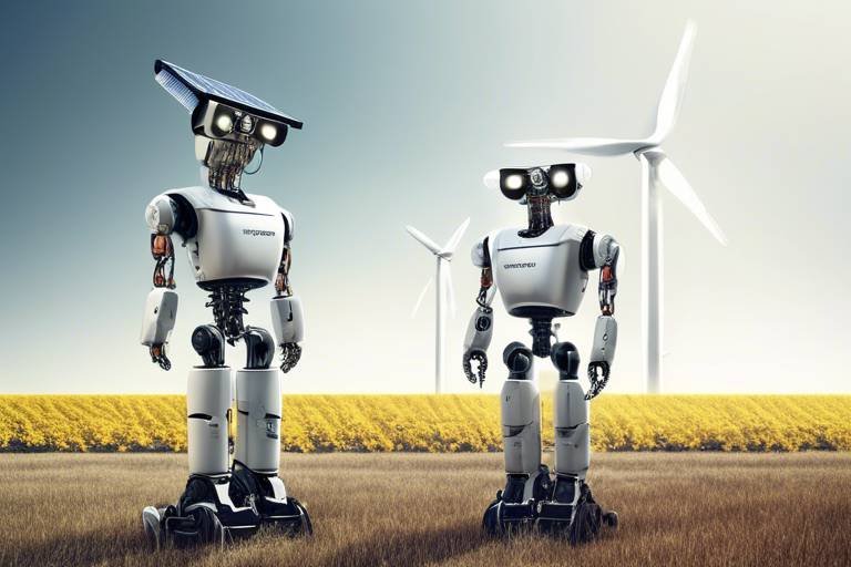
Exploring the Role of Unmanned Systems in Enhancing Flood Control
Flooding is one of nature's most devastating forces, often leaving communities grappling with destruction and uncertainty. However, the advent of unmanned systems, including drones and autonomous vehicles, is transforming the landscape of flood control. These innovative technologies are not just tools; they are game-changers that enhance response times, improve data collection, and ultimately save lives. Imagine having the ability to monitor a flood in real-time, assess damage from above, and deliver emergency supplies to those in need—all without risking human lives. This article delves into how unmanned systems are revolutionizing flood control strategies, providing a detailed look at their evolution, types, integration with existing systems, challenges, and future trends.
The journey of unmanned systems began decades ago, with early experiments in military applications. Over the years, these technologies have evolved significantly, branching out into various fields, including disaster management and flood control. Key milestones in this evolution include the development of remote-controlled aircraft in the 20th century, which laid the groundwork for today's sophisticated drones. As technology advanced, so did the capabilities of unmanned systems, leading to their current use in real-time surveillance, data collection, and emergency response during flooding events. This evolution reflects a broader trend towards automation and remote operations that are increasingly vital in crisis situations.
Unmanned systems come in various forms, each playing a unique role in flood management. The most prominent types include:
- Drones: These aerial vehicles provide unparalleled surveillance capabilities.
- Unmanned Ground Vehicles (UGVs): Designed for on-the-ground assessments, UGVs navigate hazardous environments.
- Remote Sensing Technologies: These systems gather crucial data from afar, aiding in flood prediction and management.
Each of these systems contributes significantly to enhancing flood control efforts, ensuring that emergency responders have the information they need to act swiftly and effectively.
Drones are at the forefront of flood response, offering real-time aerial surveillance capabilities that are invaluable during emergencies. They can rapidly assess flood-affected areas, identify hazards, and monitor water levels, significantly enhancing situational awareness. Imagine being able to fly a drone over a flooded region and instantly gather data that would otherwise take hours or even days to collect. This capability allows emergency services to make informed decisions quickly, potentially saving lives and minimizing property damage.
The ability of drones to collect high-resolution imagery and data is a game-changer in flood management. This data can be analyzed to predict flood patterns, assess damage, and inform response strategies. Think of it as having a crystal ball that provides insights into the unfolding situation. With this information, decision-makers can craft effective strategies that not only address immediate concerns but also lay the groundwork for long-term recovery and resilience.
In addition to surveillance, drones can be deployed to deliver essential supplies, such as food and medical aid, to areas cut off by flooding. This capability ensures that timely assistance reaches affected populations, even when traditional transportation routes are compromised. Picture a family stranded in their home, cut off from help. A drone swoops in, delivering critical supplies right to their doorstep. This kind of rapid response can make all the difference in a disaster.
Unmanned ground vehicles (UGVs) are another vital component of flood response efforts. These robust machines can navigate hazardous environments, providing critical information and support to emergency responders during flood events. Equipped with sensors and cameras, UGVs can traverse flooded streets, delivering real-time data on water levels and infrastructure conditions. They act as the eyes and ears of emergency teams, ensuring that responders have the situational awareness they need to act effectively.
The true power of unmanned systems lies in their ability to integrate seamlessly with traditional flood management strategies. By enhancing existing systems, unmanned technologies provide a comprehensive approach to flood risk reduction. For instance, real-time data sharing among agencies becomes possible, allowing for coordinated responses and improved communication during flood events. This collaboration leads to more effective management and ultimately better outcomes for affected communities.
Unmanned systems facilitate real-time data sharing among various agencies, which is crucial during flood events. This capability allows for coordinated responses and improved communication, ensuring that everyone is on the same page. When agencies can share information instantly, they can deploy resources more efficiently and respond to changing conditions more effectively.
Moreover, the use of unmanned systems enhances predictive modeling capabilities. With the data collected from drones and UGVs, simulations can be run to anticipate flood scenarios and inform proactive measures to mitigate risks. This forward-thinking approach is akin to having a weather forecast that not only tells you it might rain but also predicts how much and where the flooding will occur, allowing communities to prepare accordingly.
Despite their numerous advantages, unmanned systems face challenges that must be addressed to maximize their potential in flood control efforts. Issues such as regulatory hurdles, technical limitations, and public acceptance can hinder their effective deployment. Understanding these challenges is crucial for stakeholders looking to leverage unmanned systems in disaster management.
Navigating the regulatory landscape for unmanned systems can be complex. Varying laws and regulations affect their deployment, which can hinder effective use in flood management scenarios. Policymakers must work to create clear guidelines that facilitate the use of these technologies while ensuring safety and privacy.
While unmanned systems offer significant benefits, technological constraints such as battery life, payload capacity, and data processing capabilities can limit their operational effectiveness in flood situations. Continuous advancements in technology are essential to overcome these limitations and enhance the capabilities of unmanned systems in the field.
Looking ahead, advancements in technology, particularly in AI and machine learning, are expected to further enhance the capabilities of unmanned systems. These innovations will make them even more effective tools for flood management and response. The integration of AI can improve data analysis and predictive capabilities, enabling smarter decision-making processes in flood control and disaster management.
The integration of AI and machine learning into unmanned systems can significantly enhance their data analysis capabilities. Imagine a drone that not only collects data but also learns from it, improving its predictions and responses over time. This evolution will lead to more effective flood management strategies that are tailored to the specific needs of each situation.
Future developments may see unmanned systems collaborating with other emerging technologies, such as IoT and big data analytics. This collaboration can create a more holistic approach to flood risk management and response, allowing for comprehensive strategies that leverage the strengths of multiple technologies. The future of flood control is not just about using one tool but creating an interconnected ecosystem that enhances resilience and response capabilities.
Q: How do drones improve flood response times?
A: Drones provide real-time aerial surveillance and data collection, enabling emergency responders to assess situations quickly and deploy resources effectively.
Q: What are the main challenges faced by unmanned systems in flood control?
A: Key challenges include regulatory hurdles, technological limitations, and public acceptance, which can impact the deployment and effectiveness of these systems.
Q: How can AI enhance the capabilities of unmanned systems?
A: AI can improve data analysis and predictive modeling, allowing unmanned systems to make smarter decisions and anticipate flood scenarios more accurately.
Q: What is the role of unmanned ground vehicles in flood response?
A: UGVs can navigate hazardous environments to gather critical data and support emergency responders, acting as the eyes and ears on the ground during flood events.
The Evolution of Unmanned Systems
The journey of unmanned systems is nothing short of fascinating, marked by significant technological advancements and innovative applications. From the early days of military drones to their current use in flood control and disaster management, these systems have evolved dramatically. Initially, unmanned vehicles were primarily designed for reconnaissance and military operations. However, as technology progressed, their potential expanded into various civilian domains, including agriculture, environmental monitoring, and, notably, flood management.
One of the key milestones in the evolution of unmanned systems was the development of GPS technology, which enabled precise navigation and positioning. This advancement allowed drones and unmanned ground vehicles (UGVs) to operate autonomously, significantly enhancing their operational capabilities. Furthermore, the advent of high-resolution cameras and remote sensing technologies transformed how data is collected and analyzed, making it possible to monitor large areas quickly and efficiently.
As we look back at the timeline of unmanned systems, several pivotal moments stand out:
- 1960s: The first military drones, primarily for reconnaissance, were developed.
- 1990s: The introduction of GPS technology revolutionized navigation for unmanned systems.
- 2000s: Drones began to be utilized in civilian applications, including surveillance and environmental monitoring.
- 2010s: The rise of affordable drones led to widespread adoption in various sectors, including emergency response.
Today, unmanned systems are equipped with advanced features such as artificial intelligence and machine learning, enabling them to analyze data in real-time and make informed decisions. This evolution has made unmanned systems invaluable in flood control, where rapid response and accurate data collection are critical. By leveraging these technologies, emergency responders can assess flood risks more effectively and deploy resources where they are needed most.
As we continue to innovate and improve these systems, the future looks promising. With ongoing research and development, we can expect to see even more sophisticated unmanned systems that will enhance our ability to manage flood risks and respond to emergencies. The integration of unmanned systems into our existing flood management strategies is not just a trend; it's a vital step toward building resilient communities capable of withstanding the challenges posed by climate change and natural disasters.
Types of Unmanned Systems Used in Flood Control
When it comes to tackling the challenges posed by floods, unmanned systems play a crucial role in enhancing our response and management strategies. These systems come in various forms, each designed to address specific needs in flood control. Among the most prominent are drones, unmanned ground vehicles (UGVs), and remote sensing technologies. Each type brings its own unique strengths to the table, effectively transforming how we monitor, respond to, and mitigate flood risks.
Drones are perhaps the most well-known unmanned systems in flood management. With their ability to fly over affected areas, they provide real-time aerial surveillance that is invaluable during emergencies. Imagine being able to capture high-resolution images of a flood-affected region within minutes! Drones can quickly assess the extent of flooding, identify hazards, and monitor water levels, significantly improving situational awareness for emergency responders. This rapid assessment capability can mean the difference between life and death, as it allows for timely interventions.
On the ground, unmanned ground vehicles (UGVs) are making waves in flood response efforts. These vehicles are designed to navigate hazardous environments where traditional vehicles may struggle. Equipped with advanced sensors and cameras, UGVs can gather critical data and provide on-the-ground assessments that are essential for effective decision-making. For instance, they can traverse flooded streets to deliver supplies or relay information back to command centers, ensuring that responders have the most accurate and up-to-date information available.
Another vital component of flood management is remote sensing technologies. These systems utilize satellites and other aerial platforms to gather data about weather patterns, soil moisture levels, and potential flood zones. By analyzing this data, agencies can predict flood risks and develop proactive measures to mitigate them. Remote sensing technologies can provide a broader view of flood-prone areas, allowing for more comprehensive planning and resource allocation.
In summary, the combination of drones, unmanned ground vehicles, and remote sensing technologies creates a powerful toolkit for flood control. Each system contributes uniquely to the overall strategy, enhancing our ability to respond to and manage flood events. As these technologies continue to evolve, we can expect even greater improvements in how we tackle the challenges posed by flooding.
- What are unmanned systems?
Unmanned systems refer to various technologies that operate without a human pilot or operator on board, including drones and unmanned ground vehicles. - How do drones help in flood control?
Drones provide real-time aerial surveillance, allowing for rapid assessment of flood-affected areas and monitoring of water levels. - What role do unmanned ground vehicles play in flood response?
UGVs navigate hazardous environments to gather critical data and support emergency responders on the ground. - Can remote sensing technologies predict floods?
Yes, remote sensing technologies analyze weather and environmental data to predict flood risks and inform management strategies.
Drones for Aerial Surveillance
Drones have emerged as a transformative force in the realm of aerial surveillance, particularly during flood events. Imagine a bird's-eye view of a flooded landscape, where every inch of land can be monitored in real-time. This capability allows emergency responders to assess the situation rapidly and efficiently. With their high-resolution cameras and advanced sensors, drones can capture critical data that traditional methods simply cannot match. They fly over affected areas, providing a comprehensive overview of the damage and helping to identify hazards that may not be visible from the ground.
One of the standout features of drones is their ability to operate in challenging conditions where human access is limited. When floodwaters rise, roads can become impassable, but drones can soar above the chaos, delivering vital information to decision-makers. This real-time aerial surveillance significantly enhances situational awareness, allowing for quicker response times. For instance, emergency teams can use the live feed from drones to pinpoint locations that require immediate attention, such as areas where people may be stranded or where infrastructure is at risk of collapse.
Moreover, drones can be equipped with various technologies that enhance their surveillance capabilities. For example, thermal imaging can detect heat signatures, which is particularly useful for locating individuals who may be trapped in floodwaters. Additionally, drones can be programmed for autonomous flight, allowing them to follow pre-determined paths, ensuring comprehensive coverage of the flood-affected regions without the need for constant human control. This feature is especially beneficial during prolonged flood events, where continuous monitoring is crucial.
In terms of data collection, drones are a powerhouse. They gather an array of information, from water levels to land erosion, which can be analyzed to predict future flood patterns. By employing sophisticated algorithms, the data collected can be transformed into actionable insights that inform emergency response strategies. For instance, if the data indicates that certain areas are at higher risk of flooding, resources can be allocated accordingly to mitigate potential disasters.
To illustrate the impact of drones in flood surveillance, consider the following table that outlines their key advantages:
| Advantage | Description |
|---|---|
| Real-time Monitoring | Provides immediate data on flood conditions and hazards. |
| Access to Hard-to-Reach Areas | Can survey flooded zones that are otherwise inaccessible. |
| Data Collection | Gathers high-resolution imagery and other critical data. |
| Autonomous Operation | Can follow pre-set flight paths for continuous monitoring. |
| Enhanced Decision-Making | Provides data that supports informed and timely response actions. |
As we continue to explore the potential of drones in flood management, it's clear that their role in aerial surveillance is not just beneficial; it's essential. They provide a level of insight and responsiveness that can save lives and property during one of nature's most destructive forces. The future of flood control is undoubtedly intertwined with these unmanned systems, paving the way for more effective disaster management strategies.
- How do drones improve flood response times? Drones provide real-time data and aerial views, allowing emergency responders to quickly assess situations and allocate resources effectively.
- What types of data can drones collect during floods? Drones can collect high-resolution imagery, water level measurements, thermal data, and information on land erosion.
- Are drones safe to use during flood emergencies? Yes, drones are designed to operate in challenging conditions and can access areas that may be too dangerous for human responders.
- Can drones deliver supplies during floods? Absolutely! Drones can be equipped to transport essential supplies, such as food and medical aid, to isolated areas.
Data Collection and Analysis
The advent of unmanned systems, particularly drones, has transformed the landscape of data collection and analysis in flood management. Imagine having the ability to fly over a flood-affected area, capturing high-resolution images and data without putting human lives at risk. This is precisely what drones offer. They can quickly gather vital information that can be processed and analyzed to understand the extent of flooding, identify affected infrastructure, and assess potential hazards. This capability is crucial for emergency responders who need to make informed decisions rapidly.
One of the most significant advantages of using drones for data collection is their real-time capability. Unlike traditional methods that may take hours or even days to gather and analyze data, drones can provide immediate insights. For example, a drone equipped with advanced sensors can track water levels in rivers and streams, providing crucial updates that can prevent disasters. Moreover, the data collected can be seamlessly integrated into geographic information systems (GIS), allowing for detailed mapping and analysis.
Furthermore, the analysis of this data is not just about capturing images or readings; it's about turning that information into actionable insights. By employing sophisticated algorithms and machine learning techniques, analysts can identify patterns and predict future flood scenarios. This predictive capability is essential for developing effective flood management strategies. For instance, by analyzing historical data alongside real-time inputs, authorities can forecast potential flood zones and take preventive measures.
To illustrate the impact of data collection and analysis through unmanned systems, consider the following table that highlights various types of data collected by drones and their applications:
| Type of Data | Application |
|---|---|
| High-resolution imagery | Assessing damage and monitoring recovery efforts |
| Water level measurements | Identifying potential flood risks |
| Infrared data | Detecting changes in land use and vegetation |
| 3D terrain mapping | Planning evacuation routes and emergency response |
In conclusion, the integration of unmanned systems for data collection and analysis is not just a technological advancement; it's a game-changer for flood management. As we continue to refine these technologies and improve our analytical capabilities, we can expect to see even greater enhancements in our ability to respond to and mitigate the impacts of flooding. The future of flood management lies in harnessing the power of data, and unmanned systems are at the forefront of this revolution.
- How do drones collect data during floods? Drones are equipped with various sensors and cameras that allow them to capture high-resolution images and real-time data on water levels and flood extent.
- What are the advantages of using unmanned systems in flood management? They provide rapid data collection, enhance situational awareness, and reduce risks to human life during dangerous flood events.
- Can drones operate in severe weather conditions? While drones are designed to operate in various conditions, severe weather can affect their performance and safety, requiring careful consideration before deployment.
Delivery of Emergency Supplies
When disaster strikes, especially in the form of flooding, time is of the essence. Traditional methods of delivering emergency supplies can be slow and cumbersome, often hampered by impassable roads and rising waters. This is where drones step in as a game-changer. Equipped with advanced navigation systems, drones can swiftly traverse flooded areas, delivering essential supplies directly to those in need. Imagine a situation where a community is cut off from the outside world due to severe flooding. In such scenarios, drones can carry out missions that would otherwise be impossible for ground vehicles.
These unmanned aerial vehicles (UAVs) can transport a variety of critical supplies, including:
- Food and Water: Basic necessities that are crucial for survival during emergencies.
- Medical Supplies: First aid kits, medications, and other health-related items that can save lives.
- Communication Devices: Tools that help maintain contact with emergency services and loved ones.
One of the most remarkable aspects of using drones for emergency supply delivery is their ability to operate in challenging conditions. Unlike traditional vehicles, drones don’t need roads; they can fly over obstacles, ensuring that aid reaches even the most isolated individuals. For instance, during a flood, a drone can quickly assess the safest route and deliver supplies to areas that are otherwise unreachable. This capability not only saves time but also significantly enhances the overall efficiency of disaster response efforts.
Moreover, the integration of real-time tracking technology allows emergency responders to monitor the delivery process. This means that they can see exactly where supplies are being sent and adjust their strategies accordingly. If a particular area is found to be more affected than initially thought, responders can reroute drones to provide additional support where it’s most needed. This level of adaptability is crucial in crisis situations where conditions can change rapidly.
In summary, the use of drones for the delivery of emergency supplies during floods is a revolutionary advancement in disaster management. By leveraging their speed, agility, and ability to bypass obstacles, drones not only ensure timely assistance but also enhance the overall effectiveness of flood response strategies. As technology continues to evolve, we can expect even greater innovations in how unmanned systems contribute to saving lives during emergencies.
- How do drones navigate during floods? Drones are equipped with GPS and advanced sensors that allow them to navigate safely, avoiding obstacles and determining the best routes for delivery.
- What types of supplies can drones deliver? Drones can deliver food, water, medical supplies, and communication devices, among other essential items.
- Are there any limitations to using drones for supply delivery? Yes, limitations include payload capacity, battery life, and regulatory restrictions that vary by region.
- How fast can drones deliver supplies? Delivery times can vary based on distance and conditions, but drones can significantly reduce the time it takes to get supplies to those in need.
Unmanned Ground Vehicles in Flood Response
Unmanned Ground Vehicles (UGVs) are proving to be invaluable assets in the realm of flood response. Imagine a scenario where emergency responders are faced with treacherous conditions, flooded roads, and hazardous debris. In such situations, UGVs can step in as the heroes of the hour. These autonomous or remotely operated vehicles are designed to traverse challenging terrains that would be risky for human operators. Equipped with advanced sensors and cameras, they can gather critical data and relay it back to emergency teams in real-time.
One of the standout features of UGVs is their ability to operate in environments that are otherwise inaccessible. For instance, during a flood, traditional vehicles may struggle to navigate submerged streets or encounter obstacles that could lead to dangerous situations. UGVs, however, can maneuver through these obstacles, providing essential information about the conditions on the ground. This capability not only enhances situational awareness but also ensures that rescue operations can be conducted more safely and efficiently.
Furthermore, UGVs are equipped with various tools and attachments that enable them to perform multiple functions. From surveying flooded areas to delivering supplies, these vehicles are versatile. For example, they can be outfitted with:
- Camera systems for real-time monitoring
- Environmental sensors to assess water quality
- Robotic arms to clear debris or deliver medical supplies
Additionally, the data collected by UGVs can be integrated into existing flood management systems, providing a comprehensive view of the situation on the ground. This integration is crucial for making informed decisions during emergencies. Imagine having a bird's-eye view of the flood's progression, coupled with detailed ground-level data—all thanks to the synergy between UGVs and traditional flood response strategies.
However, the deployment of UGVs is not without its challenges. Factors such as battery life, communication range, and the ability to operate in extreme conditions can limit their effectiveness. Despite these hurdles, advancements in technology are paving the way for more robust UGVs that can withstand the rigors of flood response.
In summary, Unmanned Ground Vehicles are revolutionizing flood response efforts. Their ability to navigate hazardous environments, gather crucial data, and support emergency responders makes them indispensable in managing flood situations. As technology continues to advance, the role of UGVs in disaster management will only grow, leading to improved outcomes for affected communities.
Q: What are Unmanned Ground Vehicles (UGVs)?
A: UGVs are autonomous or remotely operated vehicles designed to operate on land, often used in scenarios where human presence would be risky or impractical.
Q: How do UGVs assist in flood response?
A: UGVs can navigate hazardous terrains, gather critical data, and perform tasks such as delivering supplies or clearing debris, all of which enhance the efficiency of flood response efforts.
Q: What technologies are typically integrated into UGVs?
A: UGVs are often equipped with cameras, environmental sensors, and robotic arms, enabling them to perform a variety of functions in flood management.
Q: What challenges do UGVs face in flood situations?
A: UGVs may encounter limitations such as battery life, communication range, and the ability to function in extreme weather conditions, which can affect their operational effectiveness.
Integration with Existing Flood Management Systems
As we delve deeper into the world of flood management, it becomes increasingly clear that unmanned systems are not just standalone tools; they are essential components that can be seamlessly integrated into existing flood management strategies. Imagine a symphony where every instrument plays in harmony; that’s the kind of coordination we can achieve when we incorporate these advanced technologies into our traditional frameworks. By merging the capabilities of unmanned systems with established practices, we can significantly enhance our ability to respond to and manage flood risks.
One of the most compelling advantages of this integration is the facilitation of real-time data sharing. During flood events, timely and accurate information is crucial for effective decision-making. Unmanned systems, such as drones and unmanned ground vehicles (UGVs), can collect and transmit data instantaneously. This capability allows emergency management agencies to share critical information with one another, fostering a coordinated response. For example, while a drone captures aerial footage of a flooded area, it can simultaneously relay that data to ground teams, ensuring that everyone is on the same page. This real-time communication can drastically reduce response times and improve situational awareness.
Furthermore, the integration of unmanned systems enhances predictive modeling and simulation efforts. By utilizing advanced algorithms and machine learning techniques, these systems can analyze vast amounts of data to forecast potential flood scenarios. This predictive capability allows agencies to conduct simulations that inform proactive measures, such as the placement of resources or evacuation plans. It’s like having a crystal ball that helps us anticipate challenges before they arise, thereby mitigating risks and saving lives.
However, the integration is not without its challenges. It requires a shift in mindset and operational protocols. Agencies must be willing to embrace new technologies and adapt their existing systems to accommodate these innovations. This might involve training personnel to operate unmanned systems effectively or modifying communication channels to ensure that data from these technologies is utilized efficiently. The goal is to create a cohesive system where traditional methods and modern technology complement each other, resulting in a more robust flood management strategy.
In conclusion, the integration of unmanned systems into existing flood management frameworks represents a significant leap forward in our approach to disaster response. By leveraging real-time data sharing and enhancing predictive modeling capabilities, we can create a more effective and agile flood management strategy. As we continue to explore and innovate, the potential for these technologies to transform our response to flooding will only grow.
- What are unmanned systems? Unmanned systems refer to technologies such as drones and autonomous vehicles that operate without a human pilot on board, often used for surveillance, data collection, and delivery tasks.
- How do unmanned systems improve flood management? They enhance data collection, enable real-time monitoring, and facilitate quicker response times during flood events, ultimately improving decision-making processes.
- What challenges do unmanned systems face in flood management? Challenges include regulatory hurdles, technological limitations, and the need for public acceptance and training for effective use.
- Will unmanned systems replace traditional flood management methods? No, they are intended to complement and enhance existing methods, creating a more comprehensive approach to managing flood risks.
Real-time Data Sharing
The advent of unmanned systems has revolutionized the way data is shared during flood events. Imagine a scenario where multiple agencies are involved in flood response, each equipped with their own set of tools and technologies. In the past, this often led to fragmented information and delayed responses. However, with the integration of unmanned systems, real-time data sharing has become a game-changer. These systems can quickly gather and disseminate critical information, ensuring that all stakeholders are on the same page.
By utilizing drones and unmanned ground vehicles (UGVs), data can be collected and transmitted in real time. This includes vital information such as water levels, flood extent, and environmental hazards. For instance, a drone flying over a flooded area can relay images and data back to emergency response teams on the ground, allowing them to make informed decisions rapidly. The speed at which this data is shared can mean the difference between life and death during a disaster.
Furthermore, the use of cloud-based platforms enhances this data-sharing capability. These platforms allow for seamless integration of data from various sources, making it accessible to all authorized personnel. Imagine a centralized dashboard where emergency responders can view live feeds from drones, data from weather stations, and reports from ground teams—all in one place. This not only improves situational awareness but also fosters collaboration among different agencies.
To illustrate the effectiveness of real-time data sharing, consider the following benefits:
- Improved Coordination: Agencies can coordinate their efforts more effectively, reducing redundancy and ensuring that resources are allocated where they are needed most.
- Enhanced Decision-Making: Access to real-time data allows for quicker and more informed decision-making, which is crucial during emergencies.
- Increased Public Safety: With timely information, responders can issue warnings and evacuations, potentially saving lives.
In addition to these benefits, the integration of unmanned systems into existing flood management frameworks allows for predictive analytics. This means that not only can data be shared in real time, but it can also be analyzed to predict future flood scenarios. By utilizing historical data alongside real-time inputs, agencies can create more accurate models that inform proactive measures. This holistic approach to data sharing and analysis is paving the way for smarter flood management strategies.
- What are unmanned systems? Unmanned systems refer to aerial vehicles (drones), ground vehicles (UGVs), and other robotic technologies that operate without a human pilot or operator on board.
- How do drones assist in flood management? Drones provide aerial surveillance, collect data, and can even deliver supplies to areas affected by flooding, significantly enhancing response efforts.
- What challenges do unmanned systems face in flood control? Challenges include regulatory hurdles, technological limitations, and the need for public acceptance of these technologies.
- How can real-time data sharing improve flood response? Real-time data sharing enhances coordination among agencies, improves decision-making, and increases public safety during flood events.
Predictive Modeling and Simulation
In the realm of flood management, have emerged as game-changers, allowing authorities to anticipate flood scenarios and devise effective response strategies. Imagine standing on a high cliff, gazing into the distance, trying to predict the weather. Now, picture having a powerful tool that not only shows you the weather but also how it will impact the landscape below. That’s what predictive modeling does for flood management—it provides a comprehensive view of potential flood events.
By leveraging sophisticated algorithms and historical data, these models can simulate various flood scenarios based on different environmental factors, such as rainfall intensity, soil saturation levels, and river flow rates. For instance, a model might take into account the amount of rain expected over a specific period and simulate how that rain would affect local waterways. This predictive capability is crucial for emergency responders, as it allows them to prepare and allocate resources effectively before a flood strikes.
Moreover, the integration of unmanned systems into this modeling process enhances its accuracy and reliability. Drones equipped with remote sensing technologies can gather real-time data, feeding it back into predictive models. This data collection process is akin to a doctor monitoring a patient’s vital signs; the more accurate the data, the better the diagnosis. As a result, flood management agencies can make informed decisions, such as issuing timely evacuations or deploying resources to vulnerable areas.
To illustrate the impact of predictive modeling and simulation, consider the following table that highlights key benefits:
| Benefit | Description |
|---|---|
| Enhanced Preparedness | Allows agencies to prepare for potential flooding scenarios, ensuring timely deployment of resources. |
| Data-Driven Decisions | Models provide actionable insights based on real-time data, improving response strategies. |
| Risk Assessment | Helps identify high-risk areas, enabling focused mitigation efforts to protect communities. |
As we look to the future, the role of predictive modeling and simulation in flood management will only grow. With advancements in artificial intelligence and machine learning, these models will become even more sophisticated, allowing for real-time adjustments based on changing conditions. This means that instead of static forecasts, flood management can evolve into a dynamic process, continuously adapting to new information and scenarios.
In conclusion, the integration of predictive modeling and simulation with unmanned systems is revolutionizing how we approach flood management. By providing a clearer picture of potential flooding events, these technologies empower decision-makers to act swiftly and effectively, ultimately saving lives and reducing property damage.
- What is predictive modeling in flood management? Predictive modeling involves using historical data and algorithms to forecast potential flood scenarios, allowing for better preparedness and response.
- How do unmanned systems enhance predictive modeling? Unmanned systems, like drones, collect real-time data that can be integrated into predictive models, improving accuracy and reliability.
- What are the main benefits of using predictive modeling for flood control? Benefits include enhanced preparedness, data-driven decision-making, and improved risk assessment for vulnerable areas.
Challenges and Limitations
While unmanned systems, such as drones and autonomous vehicles, offer transformative potential for flood control, they are not without their . Understanding these hurdles is crucial for maximizing their effectiveness in disaster management. One of the primary challenges is navigating the regulatory landscape. Each country has its own set of laws and regulations governing the use of unmanned systems, which can vary significantly. This patchwork of regulations can create confusion and hinder the deployment of these technologies in urgent flood situations. For instance, certain areas may have strict no-fly zones that prevent drones from being utilized, limiting their ability to provide timely assistance.
Additionally, there are technological limitations that must be addressed. Current unmanned systems often face constraints related to battery life, which can restrict their operational range and duration. Imagine sending a drone to survey a flood zone, only to have it return prematurely because it runs out of power. This scenario can severely limit the effectiveness of aerial surveillance. Furthermore, the payload capacity of many drones can restrict the types of supplies they can deliver. In a flood emergency, every ounce counts, and being able to transport larger or heavier items could make a significant difference in relief efforts.
Moreover, the data processing capabilities of unmanned systems can also be a limiting factor. The vast amount of data collected by drones and other unmanned vehicles needs to be processed quickly to inform decision-making. However, if the technology isn't equipped to handle real-time data processing, critical insights may be delayed, potentially leading to ineffective response strategies. This highlights the need for ongoing advancements in technology to ensure that unmanned systems can keep pace with the demands of flood management.
Lastly, there is the issue of public acceptance. Many communities may be wary of unmanned systems flying overhead or operating in their areas, raising concerns about privacy and safety. Building trust and educating the public about the benefits of these technologies is essential for their successful integration into flood control strategies. Without public support, even the most advanced unmanned systems may struggle to be fully utilized during critical moments.
- What are unmanned systems? Unmanned systems refer to technologies such as drones and autonomous vehicles that operate without a human pilot on board.
- How do drones assist in flood control? Drones provide aerial surveillance, collect data, and can even deliver emergency supplies to affected areas.
- What are the main challenges faced by unmanned systems? Key challenges include regulatory hurdles, technological limitations, and public acceptance.
- How can the effectiveness of unmanned systems be improved? Ongoing advancements in technology, particularly in AI and data processing, are essential for enhancing the capabilities of unmanned systems.
Regulatory and Legal Issues
The implementation of unmanned systems in flood control is not without its regulatory and legal challenges. As these technologies evolve, so too does the need for a comprehensive framework that governs their use. One of the primary hurdles is the varying regulations across different regions. For instance, while some countries have embraced drone technology with open arms, others impose stringent restrictions that can stifle innovation and deployment. This inconsistency can create confusion for organizations looking to utilize unmanned systems for flood management.
Moreover, the legal implications surrounding privacy and airspace usage are significant. Drones, for instance, often capture images and data that could infringe on the privacy of individuals. The balance between public safety and personal privacy becomes a delicate dance, and navigating these waters requires clear guidelines and legal frameworks. Additionally, the Federal Aviation Administration (FAA) in the United States, along with similar organizations worldwide, has established rules governing the operation of unmanned aerial vehicles (UAVs). These regulations dictate aspects such as flight altitude, no-fly zones, and the requirement for remote pilots to be certified.
To illustrate the complex landscape of regulations, consider the following table that outlines key regulatory bodies and their respective roles in overseeing unmanned systems:
| Country | Regulatory Body | Key Regulations |
|---|---|---|
| United States | Federal Aviation Administration (FAA) | Part 107 regulations for commercial drone use |
| European Union | European Union Aviation Safety Agency (EASA) | EU Drone Regulation 2019/947 |
| Australia | Civil Aviation Safety Authority (CASA) | CASA regulations for UAVs |
Furthermore, the public acceptance of unmanned systems plays a crucial role in their successful integration into flood management strategies. Communities must be educated about the benefits these technologies bring, such as faster response times and improved data collection. Without public trust and understanding, even the most advanced systems may face pushback, limiting their effectiveness in critical situations.
In summary, while unmanned systems hold immense potential for enhancing flood control efforts, addressing the regulatory and legal challenges is essential for their successful implementation. Stakeholders must work collaboratively to create clear guidelines that ensure safety, privacy, and efficiency, paving the way for the future of flood management.
- What are the main regulatory bodies overseeing unmanned systems?
The main regulatory bodies include the Federal Aviation Administration (FAA) in the U.S., the European Union Aviation Safety Agency (EASA) in Europe, and the Civil Aviation Safety Authority (CASA) in Australia.
- How do regulations differ across countries?
Regulations can vary significantly, with some countries having strict rules while others are more lenient, creating challenges for international operations.
- Why is public acceptance important for unmanned systems?
Public acceptance is crucial because it influences the deployment and use of these technologies. Educating communities about their benefits can foster trust and cooperation.
Technological Limitations
While unmanned systems have revolutionized the way we approach flood control, they are not without their challenges. Technological limitations can significantly impact their operational effectiveness in real-world scenarios. For instance, consider the battery life of drones and unmanned ground vehicles (UGVs). Most drones operate on battery power, and their flight time is typically limited to around 20 to 30 minutes. This constraint can severely restrict their ability to conduct prolonged surveillance or deliver supplies in extensive flood-affected areas.
Moreover, the payload capacity of these systems is another critical factor. Drones, for example, have a limited weight they can carry. This limitation means they can only transport a small number of essential supplies at any given time, which may not be sufficient during large-scale disasters. In scenarios where immediate response is crucial, this can lead to delays in delivering necessary aid to affected populations.
Data processing capabilities also pose a challenge. Many unmanned systems rely on real-time data collection and transmission to make informed decisions. However, the bandwidth limitations in certain areas, especially those hit by floods, can hinder the effective transmission of data. If the data isn’t processed and shared promptly, emergency responders may not receive the critical information they need to act swiftly.
Additionally, environmental factors such as adverse weather conditions can impede the functionality of unmanned systems. Heavy rain, strong winds, or fog can affect a drone's ability to fly safely, limiting its operational window during a flood event. Similarly, UGVs may struggle to navigate through flooded roads or debris-laden environments, which can further complicate rescue efforts.
In summary, while unmanned systems offer immense potential in enhancing flood control strategies, addressing these technological limitations is essential to maximize their effectiveness. As advancements in technology continue to evolve, overcoming these hurdles will be crucial in ensuring that unmanned systems can play a pivotal role in emergency response and disaster management.
- What are unmanned systems? Unmanned systems refer to technologies that operate without a human pilot or operator on board, including drones and autonomous vehicles.
- How do drones assist in flood control? Drones provide real-time aerial surveillance, collect data, and can deliver essential supplies to areas affected by floods.
- What are the main challenges faced by unmanned systems? Key challenges include battery life, payload capacity, data processing limitations, and environmental factors that can hinder their operation.
- How can technology improve unmanned systems for flood response? Advancements in AI, machine learning, and battery technology can enhance the capabilities of unmanned systems, making them more effective in disaster management.
Future Trends in Unmanned Systems for Flood Control
The future of unmanned systems in flood control is not just a glimpse into advanced technology; it’s a promise of a safer, more efficient response to natural disasters. As we look ahead, the integration of cutting-edge technologies like artificial intelligence (AI) and machine learning is set to revolutionize the way we manage flood risks. Imagine a scenario where drones are not only surveying flood-affected areas but also predicting the next potential flood event with remarkable accuracy. This is not just science fiction; it’s the direction in which we are headed.
One of the most exciting trends is the ability of unmanned systems to analyze vast amounts of data in real-time. By harnessing the power of AI, these systems can learn from past flood events, identify patterns, and provide actionable insights. For instance, they can predict how water levels will rise based on current weather conditions and historical data, allowing emergency services to react proactively rather than reactively.
Moreover, the collaboration between unmanned systems and other emerging technologies is poised to create a more comprehensive approach to flood management. The Internet of Things (IoT) is a game-changer in this regard. Imagine a network of sensors placed in flood-prone areas, constantly feeding data to a central system. Drones equipped with remote sensing technology can then access this data, enhancing their situational awareness and operational effectiveness. This synergy between unmanned systems and IoT can lead to a more integrated flood management strategy, where every piece of technology works in harmony.
In addition, the future may also see the development of hybrid unmanned systems that combine the strengths of both aerial and ground vehicles. These systems could be deployed in tandem, with drones performing aerial surveillance while ground vehicles navigate hazardous terrains to provide on-the-ground assessments. This multi-faceted approach can significantly enhance response times and improve the overall effectiveness of flood management efforts.
However, it’s crucial to acknowledge that with innovation comes responsibility. As we advance, ethical considerations and public acceptance of these technologies must be at the forefront of our discussions. Engaging communities and stakeholders in the development and deployment of unmanned systems will be essential to ensure that these technologies are used effectively and responsibly.
To summarize, the future of unmanned systems in flood control is bright and full of potential. With advancements in AI, machine learning, and collaboration with other technologies, we can expect to see a significant improvement in our ability to predict, manage, and respond to flood events. The integration of these systems will not only enhance operational efficiency but also save lives and protect communities from the devastating impacts of floods.
- What are unmanned systems? Unmanned systems refer to vehicles or devices that operate without a human pilot on board, including drones and autonomous ground vehicles.
- How do drones contribute to flood control? Drones provide real-time aerial surveillance, collect data for analysis, and can deliver emergency supplies to affected areas.
- What role does AI play in flood management? AI enhances data analysis and predictive capabilities, allowing for smarter decision-making and proactive flood management strategies.
- What challenges do unmanned systems face in flood control? Challenges include regulatory hurdles, technological limitations, and the need for public acceptance.
AI and Machine Learning Integration
As we venture deeper into the realm of technology, the integration of Artificial Intelligence (AI) and Machine Learning (ML) with unmanned systems is proving to be a game-changer in flood control and disaster management. Imagine a world where drones and autonomous vehicles not only gather data but also learn from it, adapting their responses based on real-time information. This is not just a futuristic dream; it’s happening now, and it’s revolutionizing how we approach flood risks.
AI and ML algorithms can analyze vast amounts of data collected from various sources, including satellite imagery, weather patterns, and historical flood data. By recognizing patterns and predicting potential flood scenarios, these technologies enable emergency responders to make informed decisions faster than ever before. For instance, if a certain area has historically flooded during heavy rainfall, AI can alert authorities to take preemptive measures, potentially saving lives and minimizing property damage.
Furthermore, the real-time data processing capabilities of AI allow for dynamic adjustments during flood events. As conditions change, unmanned systems equipped with AI can update their operational parameters, ensuring that they remain effective under varying circumstances. This adaptability is crucial in emergency situations where every second counts. For example, if floodwaters begin to rise more rapidly than anticipated, AI can automatically recalibrate the drone’s flight path to focus on the most affected areas, ensuring that resources are allocated where they are needed most.
Another fascinating aspect of AI integration is its ability to enhance predictive modeling. By utilizing historical data and current conditions, machine learning models can simulate various flood scenarios, providing insights into potential impacts. This predictive capability allows for better planning and resource allocation before a flood occurs, ultimately leading to a more resilient community. Imagine being able to visualize the extent of flooding in different neighborhoods before it happens; this foresight can guide infrastructure improvements and emergency preparedness initiatives.
However, it’s important to recognize that while AI and ML offer remarkable benefits, they also come with challenges. The quality of the data fed into these systems is paramount. Inaccurate or incomplete data can lead to faulty predictions, which could have dire consequences during a flood event. Therefore, ensuring that unmanned systems are equipped with reliable data sources is essential for maximizing their effectiveness.
In conclusion, the integration of AI and machine learning into unmanned systems is not just enhancing flood control strategies; it is fundamentally transforming them. By improving data analysis, predictive modeling, and real-time responsiveness, these technologies are paving the way for a future where flood management is more proactive and less reactive. As we continue to innovate and refine these systems, we can look forward to a world where our communities are better prepared to face the challenges posed by flooding.
- How do AI and machine learning improve flood predictions? AI and machine learning analyze historical data and real-time conditions to identify patterns and simulate potential flood scenarios.
- Can drones deliver supplies during a flood? Yes, drones can be deployed to deliver essential supplies like food and medical aid to areas that are cut off due to flooding.
- What are the challenges of using unmanned systems in flood control? Challenges include regulatory hurdles, technological limitations, and the need for high-quality data to ensure accurate predictions.
- How does real-time data sharing enhance flood response? Real-time data sharing allows agencies to coordinate their responses more effectively, improving communication and decision-making during emergencies.
Collaboration with Other Technologies
As we look to the future of flood control, the collaboration between unmanned systems and other emerging technologies is set to transform the landscape of disaster management. Imagine a world where drones equipped with AI can communicate seamlessly with Internet of Things (IoT) devices, creating a network of real-time data that enhances situational awareness and response times during flood events. This synergy not only improves the efficiency of flood management but also provides a comprehensive approach to risk assessment and mitigation.
For instance, consider how drones can gather aerial data on flood zones while IoT sensors installed in rivers and drainage systems monitor water levels and flow rates. The data collected from these sensors can be relayed back to a central system, where machine learning algorithms analyze the information to predict potential flooding scenarios. This predictive capability allows emergency responders to take proactive measures, such as deploying resources or issuing evacuations before the situation escalates.
Moreover, the integration of big data analytics with unmanned systems can lead to the development of sophisticated models that simulate various flood scenarios. By analyzing historical data alongside real-time inputs, these models can provide insights into how different factors, such as rainfall intensity and land use changes, might impact flooding. This level of foresight is invaluable for urban planners and disaster management agencies as they devise strategies to mitigate flood risks.
Additionally, the collaboration between unmanned systems and other technologies can enhance community engagement. For example, mobile applications can be developed that allow citizens to report flooding incidents or hazardous conditions directly to local authorities. This grassroots data collection complements the information gathered by drones and sensors, creating a more robust understanding of the flood situation on the ground.
As we embrace this collaborative approach, it’s essential to consider the challenges that may arise. Issues such as data privacy, cybersecurity, and the need for standardized protocols will need to be addressed to ensure that these technologies work together effectively. However, the potential benefits of integrating unmanned systems with other technologies far outweigh the hurdles, paving the way for a more resilient future in flood management.
- What are unmanned systems? Unmanned systems refer to vehicles and devices that operate without a human pilot or operator on board, including drones and autonomous ground vehicles.
- How do drones assist in flood control? Drones provide real-time aerial surveillance, collect high-resolution imagery, and can deliver emergency supplies to areas affected by floods.
- What role does AI play in flood management? AI enhances data analysis and predictive modeling, allowing for smarter decision-making in flood response and risk mitigation.
- Can unmanned systems work with existing flood management systems? Yes, unmanned systems can integrate with traditional flood management strategies to improve data collection, response coordination, and overall effectiveness.
Frequently Asked Questions
- What are unmanned systems and how do they contribute to flood control?
Unmanned systems, such as drones and autonomous vehicles, play a vital role in flood control by providing real-time data collection, aerial surveillance, and efficient delivery of emergency supplies. They enhance situational awareness, allowing responders to assess flood-affected areas quickly and make informed decisions.
- How do drones improve flood response efforts?
Drones improve flood response by offering high-resolution imagery and data analysis capabilities. They can monitor water levels, identify hazards, and assess damages, which helps emergency teams to strategize their actions effectively and allocate resources where they are most needed.
- What challenges do unmanned systems face in flood management?
Unmanned systems encounter several challenges, including regulatory hurdles that complicate their deployment, technological limitations such as battery life and payload capacity, and the need for public acceptance. These factors can restrict their operational effectiveness during flood events.
- How can unmanned systems be integrated with existing flood management strategies?
Unmanned systems can be integrated with traditional flood management strategies by facilitating real-time data sharing among agencies, enhancing predictive modeling, and improving communication during emergencies. This integration leads to more coordinated and effective flood responses.
- What future trends can we expect in unmanned systems for flood control?
Future trends in unmanned systems for flood control include the integration of AI and machine learning, which will enhance data analysis and predictive capabilities. Additionally, collaboration with emerging technologies, such as IoT and big data analytics, is expected to create a more comprehensive approach to flood risk management.