The Future of Space-Based Early Warning Systems
This article explores the advancements, challenges, and implications of space-based early warning systems designed to detect threats like natural disasters and military actions, shaping the future of global security and disaster management.
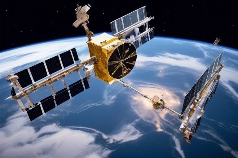
Recent breakthroughs in satellite technology and data processing have significantly enhanced the capabilities of space-based early warning systems, enabling faster and more accurate detection of potential threats and environmental changes. Imagine a world where satellites orbiting miles above us can detect the slightest tremor of an earthquake or the first signs of a hurricane forming in the ocean. This isn't science fiction; it's rapidly becoming our reality. The integration of AI and machine learning into satellite systems allows for real-time data analysis, transforming raw data into actionable insights.
International partnerships are vital for the development and implementation of effective space-based early warning systems. By fostering information sharing and resource pooling among nations, we can enhance global security and disaster preparedness. Think of it as a global safety net, where countries work together to watch over each other. This collaboration is essential not just for military threats but also for natural disasters that can strike anywhere, anytime.
Establishing data sharing agreements among countries can facilitate timely access to critical information, enhancing the effectiveness of early warning systems in predicting and responding to potential threats. For instance, if one nation detects unusual seismic activity, sharing that data with neighboring countries can prevent loss of life and property. However, this requires a level of trust and transparency that can sometimes be challenging to achieve.
Despite the benefits, numerous challenges exist in implementing data sharing agreements. Political tensions can create barriers, making countries hesitant to share sensitive information. Privacy concerns also arise, as nations may fear that sharing data could expose vulnerabilities. Additionally, the need for standardized protocols among nations complicates the process further. It's like trying to coordinate a group project where everyone has a different set of rules.
Several successful collaborations have already demonstrated the effectiveness of data sharing. Countries that have joined forces to improve early warning capabilities have shown that cooperation can lead to better disaster management. For example, joint efforts in monitoring weather patterns have allowed nations to provide timely warnings for severe storms, saving countless lives. These success stories serve as a beacon of hope, proving that when countries work together, they can tackle even the most daunting challenges.
Conducting joint training exercises among nations can improve coordination and response times. Just like athletes train together to enhance their performance, countries can simulate crisis scenarios to ensure that early warning systems are effectively utilized during real disasters. These exercises not only build trust but also create a shared understanding of protocols, leading to a more cohesive response when it matters most.
Space-based early warning systems play a crucial role in environmental monitoring. They help detect natural disasters, climate change impacts, and other ecological threats that require immediate attention. With the ability to monitor vast areas of the planet, satellites provide vital data that can inform decision-makers about impending disasters, such as floods or wildfires, allowing for timely evacuations and resource allocation.
Advancements in satellite technology have made it possible to monitor environmental changes with unprecedented accuracy. These satellites can track deforestation, ocean temperatures, and even air quality. The data collected is invaluable for early warning systems, enabling them to predict natural disasters before they occur. Imagine knowing a hurricane is brewing days in advance, allowing communities to prepare and evacuate if necessary. This level of foresight can be a game-changer in disaster management.
By utilizing space-based systems, scientists can better understand the effects of climate change. This understanding leads to more effective strategies for mitigation and adaptation in vulnerable regions. For instance, satellite data can identify areas at risk of drought or flooding, helping governments and organizations allocate resources more efficiently. It's like having a crystal ball that not only shows us the future but also guides us in making better decisions today.
- What are space-based early warning systems?
Space-based early warning systems are technologies that use satellites to detect potential threats such as natural disasters and military actions. - How do these systems improve disaster management?
They provide real-time data that helps in predicting disasters, allowing for timely evacuations and resource allocation. - What challenges do countries face in implementing these systems?
Challenges include political tensions, privacy concerns, and the need for standardized data sharing protocols. - Can space-based systems help with climate change?
Yes, they enable better monitoring of environmental changes, which is crucial for developing effective climate strategies.
Technological Innovations
Recent breakthroughs in satellite technology and data processing have significantly enhanced the capabilities of space-based early warning systems. Imagine a world where we can predict natural disasters with pinpoint accuracy, or detect military threats before they escalate. This is no longer a distant dream; it's becoming a reality thanks to innovations in technology. The integration of artificial intelligence and machine learning has enabled these systems to analyze vast amounts of data in real-time, allowing for quicker and more reliable threat detection.
One of the most exciting advancements is the deployment of small satellites, which are cost-effective and can be launched in swarms to cover larger areas. These tiny powerhouses are equipped with advanced sensors that can monitor environmental changes, track weather patterns, and even detect seismic activity. For instance, the PlanetScope satellites can capture images of the Earth daily, providing invaluable data for early warning systems.
Moreover, the development of hyperspectral imaging technology allows satellites to capture data across a wide range of wavelengths. This capability is crucial for identifying changes in vegetation health, water quality, and even pollution levels. By analyzing this data, scientists can detect environmental threats before they become catastrophic. For example, early indicators of drought or flooding can be identified, giving communities time to prepare and respond accordingly.
To illustrate the impact of these technological innovations, consider the following table showcasing the key advancements in space-based early warning systems:
| Technology | Description | Impact |
|---|---|---|
| Artificial Intelligence | Algorithms that analyze data for patterns and predictions. | Faster and more accurate threat detection. |
| Small Satellites | Low-cost satellites launched in groups. | Wider coverage and real-time monitoring. |
| Hyperspectral Imaging | Captures data across multiple wavelengths. | Identifies environmental changes and threats. |
In addition, the integration of cloud computing in data processing has revolutionized how information is shared and analyzed. With the ability to store and process massive datasets remotely, early warning systems can operate more efficiently, ensuring that critical information reaches decision-makers quickly. This is particularly vital during emergencies when every second counts.
As we look to the future, the potential for further advancements in space-based early warning systems is immense. The combination of innovative technologies and international collaboration will not only enhance our ability to predict natural disasters but also strengthen our global security framework. The sky is literally the limit!
Global Collaboration
In an increasingly interconnected world, the importance of cannot be overstated, especially when it comes to the development and implementation of space-based early warning systems. These systems are designed to detect a myriad of threats, from natural disasters to military actions, and their effectiveness hinges on the ability of nations to work together seamlessly. Imagine a world where countries share real-time data, pooling their resources and expertise to tackle challenges that transcend borders. This kind of collaboration not only enhances global security but also fosters a sense of shared responsibility among nations.
One of the key components of successful global collaboration is the establishment of data sharing agreements. These agreements allow countries to access critical information swiftly, which is essential for the timely prediction and response to potential threats. For instance, if one nation detects an impending natural disaster, sharing that information with neighboring countries can significantly improve preparedness and response efforts. In this way, a robust network of information sharing can act as a lifeline for vulnerable populations.
However, the path to effective collaboration is not without its hurdles. Political tensions often complicate the establishment of data sharing agreements, as nations may be hesitant to share sensitive information. Additionally, privacy concerns can arise, making it crucial to develop standardized protocols that respect individual nations' sovereignty while promoting transparency and cooperation. To illustrate, consider the following table that outlines some common challenges and potential solutions:
| Challenge | Potential Solution |
|---|---|
| Political Tensions | Establish diplomatic channels for dialogue and negotiation |
| Privacy Concerns | Create frameworks that prioritize data protection and anonymity |
| Lack of Standardization | Develop international standards for data sharing protocols |
Despite these challenges, there have been notable success stories that highlight the power of collaboration in enhancing early warning capabilities. For example, the partnership between several countries in the Pacific region has led to the creation of a comprehensive disaster management system that integrates satellite data, local knowledge, and real-time communication. This collaboration has not only improved response times during crises but has also built trust among nations, proving that working together can yield remarkable results.
Furthermore, conducting joint training exercises is another effective way to bolster international collaboration. These exercises simulate crisis scenarios, allowing countries to practice their response strategies in a controlled environment. By doing so, nations can refine their coordination and response times, ensuring that when a real disaster strikes, they are ready to act swiftly and efficiently. In essence, joint training not only enhances the functionality of early warning systems but also strengthens the bonds between nations, fostering a spirit of camaraderie and shared purpose.
In conclusion, the future of space-based early warning systems relies heavily on global collaboration. By overcoming challenges and embracing the opportunities that come with shared information and resources, nations can create a safer, more resilient world. The stakes are high, and the need for cooperation is more pressing than ever. As we look to the stars, let us also look to each other, united in our quest for a secure and sustainable future.
Data Sharing Agreements
In today's interconnected world, the importance of cannot be overstated. These agreements serve as the backbone for effective collaboration among nations, especially when it comes to utilizing space-based early warning systems. Imagine a scenario where a natural disaster is brewing—without timely and accurate data, countries may be left in the dark, unable to respond effectively. But with robust data sharing agreements in place, nations can pool their resources and knowledge, leading to a more coordinated and effective response.
These agreements facilitate the exchange of crucial information, enabling countries to access real-time data that can help predict and respond to potential threats. For instance, consider a situation where a satellite detects unusual seismic activity. If the data is shared promptly between countries, they can prepare for the possibility of an earthquake, issuing warnings and mobilizing resources to minimize impact. The essence of these agreements lies in their ability to enhance the effectiveness of early warning systems, making them indispensable in today's global landscape.
However, establishing these agreements is not without challenges. Political tensions can often create barriers to information sharing, as countries may be hesitant to disclose sensitive data. Moreover, privacy concerns arise when discussing the extent of information that can be shared, particularly when it involves tracking environmental changes or military movements. To navigate these complexities, nations must work together to create standardized protocols that ensure both security and transparency.
One of the most significant aspects of data sharing agreements is the potential for joint training exercises. By participating in these exercises, countries can practice how to share data effectively during a crisis, improving coordination and response times. This practice not only builds trust among nations but also prepares them for real-world scenarios where every second counts.
To illustrate the impact of data sharing agreements, consider the following table that outlines successful collaborations:
| Collaboration | Countries Involved | Outcome |
|---|---|---|
| Pacific Tsunami Warning Center | USA, Japan, Australia, Indonesia | Enhanced tsunami detection and response |
| European Space Agency's Copernicus Program | EU Member States | Improved environmental monitoring and disaster response |
| North Atlantic Treaty Organization (NATO) Initiatives | NATO Member Countries | Streamlined military response and intelligence sharing |
As we look toward the future, it’s clear that establishing effective data sharing agreements will be pivotal in enhancing global security and disaster preparedness. By fostering an environment of collaboration and trust, nations can leverage their collective strengths to create a safer, more resilient world.
- What are data sharing agreements?
Data sharing agreements are formal arrangements between countries to exchange critical information, particularly for early warning systems in disaster management. - Why are these agreements important?
They enhance the effectiveness of early warning systems, allowing for timely responses to potential threats, such as natural disasters. - What challenges do countries face in establishing these agreements?
Challenges include political tensions, privacy concerns, and the need for standardized protocols. - How do joint training exercises contribute to data sharing?
They help improve coordination and response times, ensuring that nations can effectively utilize shared data during crises.
Challenges in Implementation
The journey towards establishing effective space-based early warning systems is not without its hurdles. While the technological advancements are impressive, the implementation phase reveals a landscape filled with challenges that can hinder progress. One of the primary obstacles is the political tension that often exists between nations. When countries are at odds, sharing critical data can feel like handing over the keys to a vault. Trust is a rare commodity in international relations, and without it, the collaborative spirit needed for these systems to thrive can falter.
Another significant challenge is the issue of privacy concerns. Countries are understandably cautious about sharing sensitive information that could expose vulnerabilities. Imagine if your neighbor had access to your home security system; you would likely feel uneasy about the potential for misuse. Similarly, nations must navigate the delicate balance between transparency and security when forming data-sharing agreements.
Moreover, the lack of standardized protocols among nations complicates the situation further. Each country may have its own systems, processes, and regulations regarding data handling and sharing. This diversity can lead to confusion and inefficiency. To illustrate, consider a group of musicians trying to play a symphony without a conductor; without a unified approach, the resulting discord can be chaotic rather than harmonious.
To effectively address these challenges, nations must engage in open dialogues and negotiations to build trust. This can be achieved through a series of initiatives, including:
- Establishing bilateral agreements to foster cooperation.
- Creating frameworks that ensure data privacy while allowing for necessary sharing.
- Implementing standardized protocols that all parties can agree upon.
In conclusion, while the challenges in implementing space-based early warning systems are formidable, they are not insurmountable. With a concerted effort towards collaboration and trust-building, these systems can become a powerful tool in enhancing global security and disaster preparedness.
Q1: What are space-based early warning systems?
A1: Space-based early warning systems are advanced technologies designed to detect potential threats, such as natural disasters or military actions, using satellites and data processing capabilities.
Q2: Why is international collaboration important?
A2: International collaboration is crucial for sharing information and resources, which enhances the effectiveness of early warning systems and improves global disaster preparedness.
Q3: What challenges do countries face in sharing data?
A3: Countries face political tensions, privacy concerns, and the lack of standardized protocols, which can hinder effective data sharing and collaboration.
Q4: How can countries improve their early warning systems?
A4: Countries can improve their early warning systems by establishing trust through bilateral agreements, ensuring data privacy, and implementing standardized protocols for data handling.
Success Stories
When we talk about in the realm of space-based early warning systems, it's essential to highlight how collaboration among nations has led to remarkable advancements in disaster detection and response. One shining example is the partnership between the United States and Japan, which has significantly improved earthquake detection capabilities. Utilizing satellite data and ground-based sensors, these two countries have been able to share critical information in real time, allowing for quicker alerts and better preparedness in the face of seismic events.
Another notable success story comes from the European Space Agency (ESA) and its Copernicus program. This initiative has revolutionized the way we monitor our planet’s environment, providing invaluable data on natural disasters such as floods and wildfires. The program's satellites collect vast amounts of information, which is then shared with member states, enabling them to respond more effectively to environmental threats. For instance, during the devastating wildfires in Greece in 2021, Copernicus satellites provided timely imagery that helped emergency responders assess the situation and allocate resources efficiently.
Moreover, the Global Disaster Alert and Coordination System (GDACS) showcases the power of international collaboration. This platform integrates data from various space-based systems, allowing countries to access real-time alerts about natural disasters. When a significant earthquake struck Haiti in 2010, GDACS played a crucial role in coordinating international relief efforts, demonstrating how timely data sharing can save lives and mitigate damage.
These examples illustrate that when countries come together, the potential for effective early warning systems increases exponentially. The pooling of resources, expertise, and technology not only enhances individual nations' capabilities but also strengthens global resilience against disasters. The success stories serve as a reminder that collaboration is key in facing the challenges posed by natural threats, and they set a precedent for future partnerships aimed at improving early warning systems worldwide.
- What are space-based early warning systems?
Space-based early warning systems are technologies that utilize satellites to detect and monitor potential threats such as natural disasters and military actions. They provide critical information that helps in timely responses and disaster management. - How do these systems improve disaster response?
By providing real-time data and alerts, space-based early warning systems enhance the ability of governments and organizations to prepare for and respond to disasters, ultimately saving lives and reducing damage. - What role does international collaboration play?
International collaboration is vital for the effectiveness of early warning systems. By sharing data and resources, countries can improve their detection capabilities and response times during crises. - Can space-based systems help with climate change?
Yes, space-based systems provide essential data for monitoring climate change impacts, helping scientists develop strategies for mitigation and adaptation in vulnerable regions.
Joint Training Exercises
Joint training exercises among nations are not just a routine; they are a vital strategy in enhancing the effectiveness of space-based early warning systems. Imagine a world where countries can seamlessly coordinate their responses to crises, much like a well-rehearsed orchestra playing in perfect harmony. These exercises provide an opportunity for nations to come together, share knowledge, and refine their operational strategies in real-time scenarios. By simulating various disaster situations, participants can test their systems, identify weaknesses, and develop robust response plans that can be activated when real threats emerge.
Moreover, these exercises foster a culture of collaboration and trust among nations. When countries engage in joint training, they are not only practicing their technical skills but also building relationships that can prove invaluable during actual emergencies. For instance, a country that has trained with another is likely to respond more swiftly and effectively when a crisis arises, knowing the capabilities and protocols of their partner. This synergy can be particularly crucial in scenarios where time is of the essence, such as natural disasters or military threats.
To give you a clearer picture, consider the following table that outlines the key benefits of joint training exercises:
| Benefit | Description |
|---|---|
| Improved Coordination | Enhances the ability of countries to work together during crises, leading to quicker and more effective responses. |
| Knowledge Sharing | Facilitates the exchange of best practices, technologies, and strategies among nations, improving overall preparedness. |
| Trust Building | Fosters trust and understanding between nations, which can be crucial during high-stress situations. |
| Realistic Scenarios | Allows participants to practice in simulated environments that mimic real-life challenges, enhancing readiness. |
In addition to these structured exercises, informal interactions and discussions during training can lead to innovative ideas and solutions. This is where the magic happens; nations can brainstorm together, addressing common challenges and devising creative strategies to enhance their early warning capabilities. Just as athletes train together to perfect their performance, countries can learn from each other’s experiences and insights, making their systems more resilient and responsive.
Ultimately, joint training exercises are not just about practicing protocols; they are about building a global community that prioritizes safety and security. As we face increasingly complex threats—from natural disasters exacerbated by climate change to geopolitical tensions—the need for collaborative preparedness has never been more critical. By investing in these exercises, nations are essentially investing in a safer future for all, where the collective strength of global partnerships can be harnessed to mitigate risks and respond effectively to crises.
- What are joint training exercises?
Joint training exercises are collaborative drills conducted by multiple countries to practice and improve their response to various crises and disasters. - Why are these exercises important?
They enhance coordination, build trust, and allow nations to share knowledge and best practices, ultimately improving their early warning systems. - How often do these exercises take place?
The frequency varies by region and the specific agreements between nations, but they are typically held annually or biannually. - What types of scenarios are practiced?
Scenarios can include natural disasters such as earthquakes and floods, as well as military threats or humanitarian crises.
Environmental Monitoring
Space-based early warning systems are not just about military surveillance; they are crucial for as well. Imagine a world where satellites orbiting high above our heads act like vigilant sentinels, constantly scanning the Earth for signs of trouble. These advanced systems are designed to detect natural disasters, climate change impacts, and other ecological threats that require immediate attention. With the ability to monitor vast areas in real-time, they provide invaluable data that can save lives and protect our planet.
One of the most significant benefits of space-based monitoring is its capacity to provide early warnings for natural disasters. For instance, satellites equipped with advanced sensors can detect changes in temperature, humidity, and atmospheric pressure, which are critical indicators of impending weather events like hurricanes or floods. By analyzing this data, meteorologists can issue warnings much earlier than traditional methods allow, giving communities more time to prepare and respond. This capability is especially vital in regions prone to natural disasters, where every second counts.
Moreover, the role of satellite technology extends beyond immediate disaster response. It plays a pivotal role in tracking climate change. By continuously monitoring changes in polar ice caps, sea levels, and forest cover, scientists can gain insights into the long-term effects of climate change. These observations help in formulating effective strategies for mitigation and adaptation, particularly in vulnerable regions. For example, data collected from satellites can reveal patterns of deforestation, helping environmentalists advocate for better land management practices.
Furthermore, the integration of artificial intelligence (AI) with satellite data is revolutionizing environmental monitoring. AI algorithms can analyze vast amounts of data quickly, identifying trends and anomalies that human analysts might miss. This means that not only can we detect environmental changes more accurately, but we can also predict potential future impacts. For instance, AI can help model how climate change might affect agricultural yields in different regions, allowing for proactive measures to ensure food security.
To illustrate the effectiveness of space-based early warning systems in environmental monitoring, consider the following table showcasing some key satellite missions and their contributions:
| Satellite Mission | Purpose | Key Contributions |
|---|---|---|
| NASA's Landsat | Earth observation | Monitoring land use changes over decades |
| ESA's Copernicus | Environmental monitoring | Tracking air quality and water pollution |
| NOAA's GOES | Weather forecasting | Real-time monitoring of severe weather events |
In conclusion, the role of space-based early warning systems in environmental monitoring cannot be overstated. They are essential tools that help us understand and manage our planet's health. As technology continues to advance, we can expect even more sophisticated systems that will enhance our ability to predict and respond to environmental threats. The future of our planet may very well depend on these high-tech guardians watching over us from above.
- What are space-based early warning systems?
These are advanced satellite systems designed to detect and monitor various threats, including natural disasters and environmental changes.
- How do these systems help in disaster management?
They provide real-time data and early warnings that allow communities to prepare for and respond to disasters more effectively.
- Can space-based systems track climate change?
Yes, they monitor key indicators of climate change, such as ice melting and sea level rise, contributing to our understanding of its impacts.
Satellite Technology Advancements
The landscape of satellite technology is evolving at a breathtaking pace, transforming the way we monitor our planet and respond to emerging threats. With each leap forward, we inch closer to a world where early warning systems can predict disasters with remarkable precision. Imagine a future where satellites orbiting our Earth can detect the slightest shifts in tectonic plates or the subtle changes in weather patterns, alerting us to potential catastrophes before they unfold. This is not just science fiction; it is becoming our reality.
Recent innovations in satellite technology have introduced numerous advancements that significantly enhance the capabilities of space-based early warning systems. For instance, high-resolution imaging allows us to capture detailed images of the Earth's surface, enabling scientists to monitor environmental changes with unprecedented accuracy. This level of detail is crucial when it comes to assessing the risk of natural disasters such as floods, hurricanes, and wildfires. By analyzing these images, researchers can identify vulnerable areas and deploy resources effectively.
Moreover, the integration of machine learning algorithms into satellite data processing is another game-changer. These algorithms can analyze vast amounts of data in real-time, identifying patterns and anomalies that might indicate an impending disaster. For example, if a region shows unusual temperature spikes or changes in vegetation, the system can automatically alert authorities, allowing them to take preventative measures. This proactive approach can save lives and mitigate damage, showcasing the power of technology in disaster preparedness.
Additionally, advancements in communication technologies have improved the speed and efficiency of data transmission from satellites to ground stations. High-throughput satellites can now relay information faster than ever before, ensuring that critical data reaches decision-makers without delay. This rapid communication is essential during crises when every second counts. As we continue to enhance our satellite networks, the potential for real-time monitoring and response becomes increasingly viable.
To illustrate the impact of these advancements, consider the following table that outlines some of the key technologies reshaping satellite capabilities:
| Technology | Description | Impact on Early Warning Systems |
|---|---|---|
| High-Resolution Imaging | Captures detailed images of the Earth’s surface. | Improves disaster risk assessment and resource deployment. |
| Machine Learning Algorithms | Analyzes data to identify patterns and anomalies. | Enables proactive disaster alerts and responses. |
| High-Throughput Communication | Enhances speed of data transmission from satellites. | Facilitates real-time monitoring and decision-making. |
As we look to the future, the potential of satellite technology to revolutionize early warning systems is vast. It empowers us to not only predict but also prepare for the unexpected. However, with great power comes great responsibility. We must ensure that these technologies are used ethically and effectively, fostering international collaboration to maximize their benefits. The advancements in satellite technology are not just about monitoring our planet; they are about safeguarding our future.
- What are space-based early warning systems?
Space-based early warning systems are technologies designed to detect potential threats such as natural disasters and military actions using satellite data. - How do satellite advancements improve disaster response?
Advancements in satellite technology, such as high-resolution imaging and machine learning, enhance the accuracy and speed of data transmission, allowing for faster response times during disasters. - What role does international collaboration play in these systems?
International collaboration is crucial for sharing data and resources, improving the effectiveness of early warning systems across borders.
Impact on Climate Change
The impact of climate change is a pressing issue that affects every corner of our planet. As we grapple with rising temperatures, shifting weather patterns, and increasing natural disasters, the role of space-based early warning systems becomes increasingly vital. These systems are not just a technological marvel; they represent a lifeline for vulnerable communities facing the harsh realities of climate change. By harnessing the power of satellites, we can monitor environmental changes with unprecedented accuracy, allowing us to predict natural disasters before they wreak havoc.
Imagine being able to foresee a hurricane's path days in advance or detecting a wildfire's early signs from space. This is not science fiction; it's the reality enabled by advancements in satellite technology. With real-time data collection and analysis, space-based systems provide critical information that can help governments and organizations respond swiftly to impending disasters. For instance, when a cyclone is detected forming over the ocean, early warning systems can alert coastal communities, giving them precious time to evacuate and prepare. This proactive approach can save lives and reduce economic losses significantly.
Furthermore, these systems play a crucial role in understanding the broader implications of climate change. By continuously monitoring the Earth's surface, atmosphere, and oceans, satellites can track changes in temperature, sea levels, and even vegetation health. This data is essential for scientists who are working to unravel the complexities of climate change. For example, satellite observations have revealed alarming trends in glacial melting, which contributes to rising sea levels. Such insights not only inform policymakers but also help in crafting effective strategies for mitigation and adaptation.
To illustrate the importance of satellite data in climate change research, consider the following table that outlines key satellite missions and their contributions:
| Satellite Mission | Primary Focus | Contribution |
|---|---|---|
| NASA's Landsat Program | Land Use and Change | Provides data for monitoring deforestation, urban growth, and agricultural practices. |
| Copernicus Sentinel-1 | Earth Observation | Monitors land subsidence and flood risks, enhancing disaster response. |
| NOAA's GOES-R | Weather Monitoring | Offers real-time data on severe weather events, improving forecasting accuracy. |
In summary, the integration of space-based early warning systems into our climate change strategies is not just beneficial; it is essential. These systems empower us to make informed decisions, respond to emergencies, and ultimately, protect our planet. As we continue to advance our technological capabilities, the synergy between space exploration and environmental monitoring will be crucial in our fight against climate change. Together, we can pave the way for a more resilient future, equipped to handle the challenges that lie ahead.
- What are space-based early warning systems?
Space-based early warning systems are satellite technologies designed to detect and monitor potential threats, including natural disasters and climate changes, providing timely information for response and preparedness.
- How do these systems help in disaster management?
They provide critical data that allows for early detection of disasters, enabling timely evacuations and resource allocation to minimize damage and save lives.
- Can these systems predict climate change impacts?
Yes, by continuously monitoring environmental changes, these systems help scientists understand climate trends and their potential impacts on ecosystems and human populations.
Frequently Asked Questions
- What are space-based early warning systems?
Space-based early warning systems are advanced technologies utilizing satellites to detect and monitor potential threats, such as natural disasters or military actions. They provide real-time data that can help governments and organizations respond swiftly to emergencies, potentially saving lives and resources.
- How do technological innovations enhance these systems?
Recent breakthroughs in satellite technology, including improved sensors and data processing capabilities, have significantly boosted the accuracy and speed of threat detection. This means that systems can identify environmental changes or military movements much faster than before, allowing for timely responses.
- Why is global collaboration important for these systems?
Global collaboration is essential because threats often transcend national borders. By partnering with other countries, nations can share critical information and resources, enhancing overall security and improving disaster preparedness. This collective effort ensures that everyone is better equipped to handle crises.
- What are data sharing agreements?
Data sharing agreements are formal arrangements between countries that facilitate the exchange of vital information related to early warning systems. These agreements are crucial for ensuring that all parties have timely access to data that can help predict and respond to potential threats effectively.
- What challenges exist in implementing these agreements?
Implementing data sharing agreements can be tricky due to political tensions, privacy concerns, and the need for standardized protocols among different nations. These challenges can hinder the quick sharing of information that is essential for effective early warning systems.
- Can you provide examples of successful collaborations?
Yes! Several countries have successfully collaborated on early warning systems, showcasing how sharing data and resources can lead to improved capabilities. These success stories illustrate that when nations work together, they can significantly mitigate risks associated with natural disasters and other threats.
- How do joint training exercises improve early warning systems?
Joint training exercises among nations enhance coordination and response times during crises. By practicing together, countries can ensure that their early warning systems are utilized effectively, making it easier to respond quickly and efficiently when real emergencies arise.
- What role do space-based systems play in environmental monitoring?
Space-based systems are crucial for environmental monitoring as they help detect natural disasters and track climate change impacts. By providing accurate data, these systems enable scientists and policymakers to address ecological threats promptly and develop effective strategies for mitigation and adaptation.
- How have advancements in satellite technology impacted climate change research?
Advancements in satellite technology have revolutionized climate change research by allowing for more precise monitoring of environmental changes. This improved understanding helps scientists devise better strategies for addressing climate change, particularly in vulnerable regions that are most at risk.