The Use of Autonomous Drones for Enhancing Air Quality Monitoring
The world we live in is constantly evolving, and so are the technologies we use to understand and protect it. Among these advancements, autonomous drones are making waves, particularly in the field of air quality monitoring. Imagine flying robots equipped with sophisticated sensors, soaring through the skies, collecting data that can help us breathe easier. This article dives into how these remarkable machines are revolutionizing the way we monitor air quality, providing real-time data, enhancing accuracy, and paving the way for more effective environmental management strategies.
So, what exactly are autonomous drones? These unmanned aerial vehicles (UAVs) are not just fancy gadgets; they are equipped with cutting-edge technology that allows them to operate independently, collecting valuable data without the need for constant human control. Their integration into air quality monitoring is like adding a turbocharger to a car—suddenly, you have a powerful tool that can tackle challenges in ways we never thought possible. With advanced sensors onboard, these drones can measure various pollutants and provide insights that were previously difficult to obtain.
The benefits of using drone technology in air quality monitoring are nothing short of astounding. For starters, they are cost-effective. Traditional monitoring methods often require extensive ground infrastructure and manpower, which can be expensive and time-consuming. Drones, on the other hand, can cover vast areas in a fraction of the time and cost. Additionally, they enhance data accuracy. By minimizing human error and providing consistent data collection across different geographical areas, drones ensure that the information we gather is reliable and actionable.
One of the standout features of autonomous drones is their ability to facilitate real-time data collection. Picture this: a drone flies over a bustling city, capturing air quality parameters as it goes. This timely information allows for immediate analysis, which can lead to quicker responses to pollution events. In situations where every second counts, having access to real-time data can significantly improve public health outcomes. It’s like having a weather radar for air quality—knowing when a storm of pollution is brewing allows us to take action before it hits.
Equipped with advanced sensor technology, these drones can measure a variety of pollutants, including particulate matter and harmful gases. This capability provides a detailed understanding of air quality in specific locations. Think of it as having a personal air quality detective on the job, pinpointing exactly what’s in the air we breathe. This level of detail is crucial for identifying pollution hotspots and understanding their impact on public health.
Once the data is collected, drones utilize sophisticated communication systems to transmit this information instantly to monitoring stations. This rapid data transmission enables swift analysis and decision-making regarding environmental policies. Imagine being able to adjust traffic patterns or industrial regulations based on the most current air quality data—this is the power of drone technology in action.
Accuracy is paramount when it comes to air quality monitoring, and autonomous drones excel in this area. By minimizing human error and providing consistent data collection across different geographical areas, these drones enhance the reliability of air quality measurements. It’s like having a meticulous accountant who never misses a detail, ensuring that every bit of information is accounted for.
In urban environments, where air quality can vary dramatically, drones play a crucial role in monitoring. They help identify pollution hotspots and assess the effectiveness of environmental regulations and initiatives. By deploying drones in these areas, city planners and environmentalists can gain invaluable insights into the air quality challenges their communities face.
One of the most significant advantages of using drones is their ability to trace pollution sources. Whether it's industrial emissions or traffic congestion, drones can be deployed to pinpoint exactly where the pollution is coming from. This information is vital for targeted regulatory measures and community awareness. It’s like having a GPS for pollution—knowing where the problem lies allows us to tackle it head-on.
Moreover, by sharing the data collected by drones, communities can be better informed about local air quality issues. This transparency fosters public engagement and encourages proactive measures to improve environmental health. When people understand the air quality challenges they face, they are more likely to take action, whether it’s advocating for cleaner transportation options or supporting local environmental initiatives.
Looking ahead, the future of drone technology in air quality monitoring is incredibly promising. Advancements in artificial intelligence, machine learning, and sensor technology are expected to enhance capabilities and broaden applications significantly. Imagine drones that can not only collect data but also analyze it on the fly, providing immediate recommendations for improving air quality. The possibilities are endless, and as technology continues to evolve, so too will our ability to monitor and manage the air we breathe.
- How do autonomous drones improve air quality monitoring?
Drones provide real-time data collection, enhance measurement accuracy, and can access hard-to-reach areas, making them invaluable for monitoring air quality. - What types of pollutants can drones measure?
Drones can measure a variety of pollutants, including particulate matter, carbon dioxide, nitrogen dioxide, and other harmful gases. - Can drones help in identifying pollution sources?
Yes! Drones can be deployed to trace pollution sources, enabling targeted regulatory actions and community awareness. - What is the future of drone technology in environmental monitoring?
The future looks bright, with advancements in AI and sensor technology expected to enhance capabilities and broaden applications significantly.
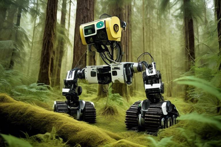
Introduction to Autonomous Drones
Autonomous drones are not just flying machines; they are the future of technology, equipped with cutting-edge sensors and artificial intelligence that allow them to operate without human intervention. Imagine a bird gliding effortlessly through the sky, gathering information that can change the way we understand our environment. These unmanned aerial vehicles (UAVs) are revolutionizing various fields, and air quality monitoring is one of the most exciting applications. By integrating sophisticated technology into their design, these drones can collect data in real-time, offering insights that were previously unattainable.
So, what makes these drones so special? First off, they are designed for versatility. Whether it's surveying a vast forest, monitoring an industrial area, or checking air quality in a bustling city, autonomous drones can adapt to different environments and tasks. They can be programmed to fly specific routes, ensuring that they cover all necessary areas without the need for constant human oversight. This capability not only saves time but also enhances the accuracy of the data collected.
Moreover, the use of autonomous drones in air quality monitoring significantly reduces the risks associated with traditional methods. Typically, environmental scientists would need to access potentially hazardous locations, which could pose health risks. Drones eliminate this danger by providing a safe alternative to gather essential data from hard-to-reach areas. For instance, they can hover over industrial zones or urban traffic hotspots, capturing real-time data without putting anyone at risk.
Another compelling aspect of these drones is their ability to collect a wide range of data. Equipped with advanced sensors, they can measure various pollutants, including particulate matter, carbon dioxide, and nitrogen oxides. This capability allows for a comprehensive understanding of air quality in specific locations. The data collected can be invaluable for researchers, policymakers, and the general public, as it provides a clearer picture of the air we breathe.
In summary, autonomous drones are changing the game in air quality monitoring. Their ability to operate independently, coupled with advanced sensor technology, makes them a powerful tool for environmental management. As we continue to face challenges related to air pollution and climate change, these drones offer innovative solutions to track and improve air quality, ensuring a healthier environment for future generations.
Benefits of Drone Technology in Monitoring
The integration of drone technology into air quality monitoring is not just a trend; it's a game changer. Imagine having a bird's-eye view of pollution levels in your city, all thanks to these autonomous flying machines. One of the most significant advantages is their cost-effectiveness. Traditional air quality monitoring methods often require extensive infrastructure, including fixed monitoring stations that can be expensive to install and maintain. Drones, on the other hand, can be deployed quickly and at a fraction of the cost, making it easier to gather data across various locations without breaking the bank.
Moreover, drones enhance the accuracy of air quality measurements. With advanced sensors onboard, they can capture real-time data on various pollutants, such as particulate matter and harmful gases. This capability minimizes human error and ensures that the data collected is consistent and reliable. For example, a drone can fly over a specific industrial area and provide precise readings of emissions, helping to identify problem areas that need immediate attention.
Another remarkable benefit is the ability of drones to access difficult-to-reach areas. Think about it—there are places in urban environments, like rooftops or remote industrial sites, where traditional monitoring equipment might not be feasible. Drones can glide into these spaces, collecting valuable data without the logistical challenges associated with ground-based monitoring. This accessibility allows for a more comprehensive assessment of air quality across various terrains.
Furthermore, drones facilitate real-time data collection. This means that as soon as they gather information, it can be transmitted instantaneously to monitoring stations. Imagine the impact of being able to respond to pollution events as they happen! This immediacy not only aids in public health responses but also helps policymakers make informed decisions swiftly. In a world where time is of the essence, having access to real-time data can be the difference between a proactive and reactive approach to environmental management.
To summarize, the benefits of drone technology in air quality monitoring can be encapsulated in the following points:
- Cost-Effectiveness: Reduced expenses in data collection and monitoring.
- Enhanced Accuracy: Consistent and reliable data collection minimizes human error.
- Accessibility: Ability to reach challenging locations for comprehensive assessments.
- Real-Time Data Collection: Immediate transmission of data leads to quicker responses.
As we continue to explore the potential of drone technology, it's clear that these flying machines are not just about capturing stunning aerial footage. They're about creating a healthier environment for all of us by providing accurate and timely air quality data. The future of environmental monitoring is indeed looking up!
Real-Time Data Collection
Imagine a world where air quality data is available at the snap of your fingers—well, that world is here, thanks to autonomous drones! These high-tech flying machines are equipped with sophisticated sensors that allow them to collect air quality data in real-time, providing invaluable insights into pollution levels and environmental health. This ability to gather data on-the-fly means that we can react to air quality issues as they happen, rather than waiting for outdated reports that may not reflect the current situation.
When a pollution event occurs, every second counts. Drones can swoop in and measure various air quality parameters such as particulate matter, carbon monoxide, and nitrogen dioxide almost instantaneously. The data is then relayed back to monitoring stations, allowing environmental agencies to analyze the situation and implement solutions quickly. This rapid response capability can be the difference between a minor air quality issue and a full-blown public health crisis.
To illustrate the impact of real-time data collection, consider the following table that compares traditional air quality monitoring methods with drone technology:
| Aspect | Traditional Monitoring | Drone Technology |
|---|---|---|
| Data Collection Speed | Delayed (weekly/monthly) | Immediate (real-time) |
| Geographical Coverage | Limited (fixed stations) | Extensive (flexible flight paths) |
| Cost | High (station maintenance) | Cost-effective (lower operational costs) |
| Data Accuracy | Subject to human error | High precision (automated sensors) |
This table clearly demonstrates how drones are not just a technological upgrade; they represent a paradigm shift in how we approach air quality monitoring. With their ability to gather data in real-time, drones empower cities and communities to make informed decisions that can lead to healthier living environments. Furthermore, by utilizing drones for data collection, we can cover areas that are typically difficult to access, such as industrial zones or regions impacted by natural disasters, ensuring a comprehensive understanding of air quality across diverse landscapes.
In conclusion, the integration of real-time data collection through autonomous drones is a game-changer in the field of air quality monitoring. It enhances our ability to respond to pollution events swiftly, improves public health outcomes, and fosters a more informed community. As we embrace this technology, we move closer to a future where clean air is not just a dream but a reality.
Advanced Sensor Technology
When we talk about in autonomous drones, we're diving into a world where innovation meets necessity. Imagine a drone soaring high above a bustling city, equipped with an arsenal of sensors that can detect even the faintest traces of pollutants in the air. These sensors are not just ordinary gadgets; they are sophisticated devices designed to measure various air quality parameters with remarkable precision. The ability of drones to carry these advanced sensors allows them to gather data that was previously difficult to obtain, especially in urban environments where pollution levels can vary significantly.
One of the standout features of these sensors is their capability to measure a range of pollutants, including particulate matter (PM), nitrogen dioxide (NO2), sulfur dioxide (SO2), and ozone (O3). Each of these pollutants has distinct health impacts, making their accurate measurement crucial for public health monitoring. For instance, particulate matter can penetrate deep into the lungs, leading to serious respiratory issues. By deploying drones equipped with these sensors, environmental scientists can acquire real-time data that provides a clearer picture of air quality in specific locations.
Moreover, the integration of sensor technology with drones enhances the spatial resolution of air quality data. Traditional monitoring stations often provide data at fixed points, which can lead to a lack of comprehensive coverage in certain areas. In contrast, drones can easily navigate through hard-to-reach locations, such as industrial zones or congested urban areas, capturing data that would otherwise be overlooked. This flexibility not only improves the accuracy of air quality assessments but also helps in identifying pollution hotspots.
To give you a better idea of how these sensors work, consider the following table that outlines some of the key sensor types used in drone technology:
| Sensor Type | Pollutants Measured | Applications |
|---|---|---|
| Optical Sensors | Particulate Matter (PM) | Real-time monitoring of air quality in urban areas |
| Chemical Sensors | Nitrogen Dioxide (NO2), Sulfur Dioxide (SO2) | Identifying sources of industrial emissions |
| Electrochemical Sensors | Ozone (O3) | Monitoring ground-level ozone levels |
With the rapid advancements in technology, these sensors are becoming increasingly sensitive and capable of detecting lower concentrations of pollutants. This is crucial for early detection and response to air quality issues. For example, if a drone detects a spike in nitrogen dioxide levels, it can alert local authorities to investigate potential sources of pollution, leading to timely interventions that protect public health.
In summary, the role of advanced sensor technology in autonomous drones is nothing short of revolutionary. It not only enhances the accuracy of air quality monitoring but also empowers communities and policymakers with the information they need to make informed decisions. As technology continues to evolve, we can expect even greater advancements that will further improve our understanding of air quality and its impact on our health and environment.
- What types of pollutants can drones measure? Drones can measure various pollutants including particulate matter, nitrogen dioxide, sulfur dioxide, and ozone.
- How do drones improve air quality monitoring? Drones provide real-time data, reach difficult locations, and minimize human error in data collection.
- Are drones cost-effective for monitoring air quality? Yes, drones can reduce costs associated with traditional monitoring methods by covering larger areas more efficiently.
Data Transmission and Analysis
The integration of autonomous drones in air quality monitoring has not only transformed how we collect data but has also significantly enhanced the efficiency of data transmission and analysis. Imagine a scenario where a drone, equipped with state-of-the-art sensors, gathers real-time data about pollutants in the air. Once this data is collected, the drone doesn't just sit idle; it swiftly transmits the information back to monitoring stations almost instantaneously. This rapid data transmission is made possible through advanced communication technologies, such as 5G networks and satellite communication systems, which ensure that the data flows seamlessly and without delay.
This quick relay of information is crucial, especially in situations where air quality can change dramatically within short periods. For instance, during a wildfire or an industrial accident, having real-time data allows authorities to respond promptly, potentially saving lives and protecting public health. By employing drones, we can achieve a level of situational awareness that was previously unattainable with traditional monitoring methods.
Furthermore, the analysis of the transmitted data is equally important. Once the data reaches the monitoring stations, it undergoes a series of sophisticated analytical processes. These processes can include:
- Data Validation: Ensuring that the collected data is accurate and reliable.
- Data Correlation: Comparing the new data with historical records to identify trends.
- Predictive Analysis: Using algorithms to forecast future air quality based on current data.
The ability to analyze data rapidly enables environmental scientists and policymakers to make informed decisions. For example, if a spike in particulate matter is detected in a specific area, authorities can quickly investigate the source and implement necessary measures to mitigate the impact. This proactive approach not only addresses immediate concerns but also aids in long-term environmental planning and policy formulation.
Moreover, the data collected by drones can be integrated into larger environmental monitoring systems, creating a comprehensive overview of air quality across various regions. This integration is essential for understanding the broader implications of air pollution and for developing strategies to combat it effectively. In essence, the combination of real-time data transmission and advanced analytical capabilities positions drones as invaluable tools in the fight for cleaner air and healthier communities.
- How do drones collect air quality data? Drones are equipped with advanced sensors that measure various pollutants, including particulate matter and gases, while flying over specific areas.
- What are the advantages of using drones for monitoring air quality? Drones provide real-time data, enhance measurement accuracy, and can access hard-to-reach areas, making them more effective than traditional monitoring methods.
- Can drones help in emergency situations? Yes, drones can quickly gather and transmit air quality data during emergencies, allowing for timely responses to pollution events.
- What future advancements can we expect in drone technology? Future trends may include improvements in AI, machine learning, and sensor technology, leading to enhanced capabilities in air quality monitoring.
Improving Accuracy in Measurements
One of the standout features of autonomous drones is their ability to significantly enhance the accuracy of air quality measurements. Traditional methods often rely on stationary monitoring stations, which can lead to data that is either too localized or too generalized, missing out on the nuances of air quality variations across different areas. Drones, however, can traverse various terrains and altitudes, capturing data from multiple locations within a short period. This mobility is akin to having a team of researchers equipped with portable labs, gathering information from the air as they fly.
By minimizing human error, drones ensure that the data collected is more consistent and reliable. For instance, when a human operator manually collects air samples, factors such as fatigue, judgment errors, or even environmental conditions can skew the results. In contrast, drones operate autonomously, following programmed paths and utilizing advanced sensors to collect data without the influence of human error. This leads to a more accurate representation of air quality, as the data is gathered systematically and uniformly across various locations.
Moreover, the integration of cutting-edge sensor technology into drones allows for the precise measurement of a wide range of pollutants. From particulate matter to harmful gases, these sensors can detect minute concentrations that might be overlooked by traditional methods. To illustrate this point, consider the following table showcasing the types of pollutants that drones can effectively measure compared to standard ground-based methods:
| Pollutant Type | Drones | Traditional Methods |
|---|---|---|
| Particulate Matter (PM2.5) | High Sensitivity | Moderate Sensitivity |
| Nitrogen Dioxide (NO2) | Real-Time Detection | Delayed Results |
| Ozone (O3) | Wide Area Coverage | Limited Coverage |
| Carbon Monoxide (CO) | Instantaneous Measurements | Sampling-Based |
In addition to improved measurement accuracy, drones can also operate in hard-to-reach areas, such as industrial zones or densely populated urban environments, where traditional monitoring stations may be scarce. This capability allows for a more comprehensive understanding of air quality across different landscapes, ensuring that regulatory bodies have access to accurate data that reflects the true state of the environment.
As we look to the future, the role of drones in air quality monitoring will likely expand even further. With advancements in machine learning and data analytics, the accuracy of measurements will only improve. Imagine drones equipped with AI that can not only collect data but also analyze it in real time, providing actionable insights that can lead to immediate interventions in pollution management. The potential is enormous, and it all starts with the accuracy that these autonomous drones bring to the table.
- How do autonomous drones collect air quality data?
Drones are equipped with advanced sensors that measure various pollutants in the air. They fly predetermined routes, collecting data at different altitudes and locations. - What types of pollutants can drones measure?
Drones can measure a wide range of pollutants, including particulate matter, nitrogen dioxide, ozone, and carbon monoxide, among others. - Are the data collected by drones reliable?
Yes, the data collected by drones is highly reliable due to their automated operation, which minimizes human error and ensures consistent data collection. - How does drone technology compare to traditional air quality monitoring methods?
Drones offer greater flexibility, real-time data collection, and the ability to cover hard-to-reach areas, making them more effective than traditional stationary monitoring stations.
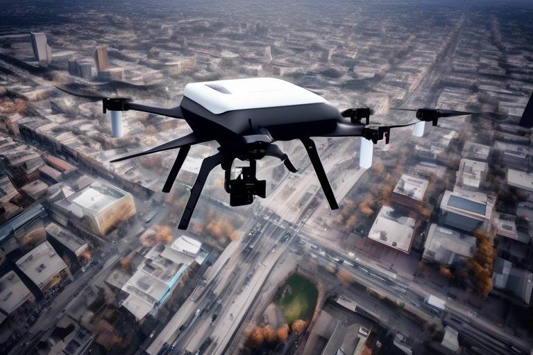
Applications in Urban Environments
In today's bustling cities, the air quality can often be a cause for concern, and that’s where autonomous drones come into play. These high-tech aerial vehicles are not just flying gadgets; they are powerful tools designed to monitor our environment from above. Imagine having the ability to pinpoint pollution hotspots in real-time, all while hovering above the urban landscape. This capability is revolutionizing how we approach air quality management in urban settings.
One of the most significant advantages of using drones in cities is their ability to identify pollution sources. Whether it's emissions from factories, traffic congestion, or even construction sites, drones can be deployed to gather data that helps trace these pollutants back to their origins. This targeted approach allows city planners and environmental agencies to implement measures that directly address the sources of pollution. For instance, if a drone identifies a spike in particulate matter near a busy intersection, city officials can then investigate traffic patterns and consider changes to improve air quality.
Moreover, drones are instrumental in community engagement and awareness. By collecting and sharing air quality data, these unmanned vehicles empower local communities to take charge of their environmental health. Imagine a neighborhood receiving real-time updates about air quality changes due to nearby construction or seasonal changes. This transparency fosters a sense of responsibility among residents, encouraging them to take proactive measures to protect their health. For example, if the data shows elevated levels of ozone on hot summer days, community leaders can inform residents to limit outdoor activities during peak hours.
To illustrate the impact of drones in urban air quality monitoring, consider the following table that outlines their key applications:
| Application | Description |
|---|---|
| Identifying Pollution Sources | Drones can trace pollutants back to their origins, aiding in targeted regulatory measures. |
| Real-Time Data Sharing | Instantaneous transmission of air quality data to communities enhances public awareness. |
| Monitoring Compliance | Drones can monitor industrial sites to ensure compliance with environmental regulations. |
| Public Health Alerts | Timely alerts about air quality can help communities take necessary precautions. |
As urban areas continue to grow, the integration of drones in air quality monitoring will become increasingly vital. The ability to collect and analyze data efficiently not only helps in managing current air quality issues but also aids in developing long-term strategies for sustainable urban living. With the help of drones, cities can become more responsive to environmental challenges, ultimately leading to healthier and more vibrant communities.
- How do drones collect air quality data?
Drones are equipped with advanced sensors that measure various pollutants in the air. They fly over designated areas and gather real-time data, which is then transmitted to monitoring stations. - What types of pollutants can drones measure?
Drones can measure a variety of pollutants, including particulate matter (PM), nitrogen dioxide (NO2), sulfur dioxide (SO2), and ozone (O3). - Are drones safe to use in urban areas?
Yes, when operated by trained professionals and following local regulations, drones are safe and effective tools for monitoring air quality in cities. - How can communities benefit from drone-collected data?
Communities can use this data to stay informed about local air quality issues, enabling them to take proactive measures to protect public health.
Identifying Pollution Sources
In the quest for cleaner air, identifying pollution sources is akin to finding the needle in a haystack. With the rise of autonomous drones, this task has become significantly more manageable and precise. Drones are equipped with advanced sensors that can detect a variety of pollutants, making them invaluable tools for environmental monitoring.
Imagine a drone soaring over a bustling city, its sensors actively collecting data on air quality. It can pinpoint areas where harmful emissions are prevalent, whether they stem from industrial facilities, heavy traffic, or even construction sites. By analyzing the data collected, authorities can identify specific sources of pollution and implement targeted interventions.
For instance, if a drone reveals elevated levels of nitrogen dioxide (NO2) near a busy intersection, city planners can take action by adjusting traffic flow or increasing public transport options. This proactive approach not only helps in mitigating air pollution but also promotes a healthier urban environment.
Moreover, the ability of drones to cover vast areas quickly allows for comprehensive assessments that would be challenging to achieve through traditional monitoring methods. Drones can fly over neighborhoods, parks, and industrial zones, gathering data that helps in creating detailed pollution maps. These maps can then be used to inform local communities about air quality issues, fostering a sense of awareness and engagement.
To illustrate the impact of drone technology on identifying pollution sources, consider the following table:
| Pollutant | Source | Drone Application |
|---|---|---|
| Particulate Matter (PM2.5) | Construction Sites | Mapping dust levels |
| Nitrogen Dioxide (NO2) | Traffic Congestion | Monitoring emissions near roads |
| Sulfur Dioxide (SO2) | Industrial Emissions | Tracking emissions from factories |
By combining aerial surveillance with sophisticated data analysis, drones empower communities and policymakers to take informed action against pollution. They serve as the eyes in the sky, revealing the hidden culprits behind air quality issues. As these technologies continue to evolve, the potential for drones to contribute to environmental health will only grow stronger.
- How do drones identify pollution sources? Drones use advanced sensors to detect specific pollutants in the air, allowing them to pinpoint areas with high levels of emissions.
- What types of pollutants can drones measure? Drones can measure a variety of pollutants, including particulate matter, nitrogen dioxide, sulfur dioxide, and more.
- Can drones help in reducing air pollution? Yes, by identifying pollution sources, drones enable targeted interventions that can help reduce emissions and improve air quality.
- Are drones safe to use for air quality monitoring? Yes, drones are designed to operate safely and are equipped with technology to avoid obstacles and ensure secure flights.
Community Engagement and Awareness
Community engagement is at the heart of effective environmental management, and autonomous drones are paving the way for a more informed public. Imagine a world where residents are not just passive recipients of information but active participants in monitoring their own air quality. By utilizing the data collected by drones, communities can gain insights into their local environments, empowering them to take action. For instance, if a drone identifies a spike in pollution levels due to nearby construction or traffic congestion, residents can rally together to address the issue, whether by contacting local authorities or organizing community clean-up events.
Moreover, the transparency offered by drone-collected data fosters trust between the community and regulatory bodies. When people have access to real-time air quality information, they can hold industries and local governments accountable for their environmental impact. This kind of engagement creates a feedback loop where communities not only receive information but also contribute to the dialogue about air quality and environmental policies.
To facilitate this engagement, many organizations are developing user-friendly platforms that allow residents to visualize air quality data easily. These platforms often include interactive maps and dashboards that reveal pollution hotspots and trends over time. For example, a community might use a simple web interface to track air quality changes during different times of the day or in response to specific events, such as festivals or heavy traffic days. This kind of data visualization can make the information more relatable and actionable for everyday citizens.
Furthermore, educational initiatives that leverage drone technology can significantly enhance community awareness. Workshops and seminars can be organized to teach residents about the importance of air quality, how drones work, and how they can use the data to advocate for healthier living conditions. By demystifying the technology and its applications, communities can become more engaged and proactive in environmental stewardship.
In summary, the integration of autonomous drones in air quality monitoring is not just a technological advancement; it’s a catalyst for community engagement and awareness. By making air quality data accessible and understandable, drones empower citizens to take ownership of their environment, leading to healthier communities and a more sustainable future.
- How do drones collect air quality data? Drones are equipped with advanced sensors that measure various pollutants in the air, such as particulate matter and gases, and transmit this data in real-time.
- What are the benefits of using drones for air quality monitoring? Drones provide cost-effective, accurate, and timely data collection, especially in hard-to-reach areas, enhancing the overall understanding of air quality issues.
- How can communities use drone data? Communities can use drone data to identify pollution sources, advocate for environmental changes, and engage with local authorities about air quality issues.
- What future advancements can we expect in drone technology? Future advancements may include improved AI and machine learning capabilities, enabling drones to analyze data more efficiently and broaden their applications in environmental monitoring.
Future Trends in Drone Technology
The future of drone technology in air quality monitoring is not just bright; it's practically glowing with potential! As we stand on the brink of a technological revolution, autonomous drones are set to become even more sophisticated, thanks to advancements in artificial intelligence, machine learning, and sensor technology. Imagine drones that can not only collect data but also analyze it in real-time, adjusting their flight paths based on the environmental conditions they encounter. This is not science fiction; it's the near future.
One of the most exciting trends is the integration of AI algorithms that can predict air quality fluctuations based on historical data and real-time inputs. This means that drones could potentially forecast pollution spikes before they happen, allowing cities to implement preventive measures. Think of it as having a weather forecast, but for air quality! With this capability, authorities can proactively manage air quality, rather than merely responding to problems after they arise.
Moreover, advancements in sensor technology will allow drones to measure a wider range of pollutants with greater precision. For instance, the development of miniaturized sensors will enable drones to detect not only common pollutants like nitrogen dioxide and sulfur dioxide but also more elusive compounds like volatile organic compounds (VOCs). This comprehensive data collection will provide a clearer picture of air quality, allowing for more effective environmental policies.
Another trend to watch is the expansion of drone networks. Picture a fleet of drones working together, sharing data in real-time to create a detailed map of air quality across an entire city. This collaborative approach will enhance the accuracy of measurements and provide a more holistic understanding of pollution patterns. The data collected can be displayed in user-friendly formats, such as interactive maps, making it easier for the public and policymakers to grasp the situation.
As drone technology continues to evolve, we can also expect improvements in battery life and range. Longer-lasting drones will be able to cover larger areas without needing to recharge, making them invaluable for extensive monitoring projects. This means that even the most remote and hard-to-reach areas can be assessed for air quality, ensuring that no spot is left unchecked.
Lastly, the future of drones in air quality monitoring will likely see increased regulatory support. As governments recognize the importance of clean air, they are likely to establish frameworks that encourage the use of drones for environmental monitoring. This could lead to funding opportunities for research and development, fostering innovation in this field. The symbiotic relationship between regulation and technology will pave the way for smarter, more efficient air quality monitoring solutions.
- What types of pollutants can drones measure? Drones can measure a variety of pollutants, including particulate matter, nitrogen dioxide, sulfur dioxide, and volatile organic compounds.
- How do drones collect and transmit data? Drones are equipped with advanced sensors that collect air quality data, which is then transmitted in real-time to monitoring stations for analysis.
- Can drones operate in urban environments? Yes, drones are particularly effective in urban areas, where they can identify pollution hotspots and monitor the effectiveness of environmental regulations.
- What advancements can we expect in drone technology? Future advancements may include improved AI for predictive analytics, enhanced sensor capabilities, and longer battery life for extended monitoring.
Frequently Asked Questions
- What are autonomous drones?
Autonomous drones are unmanned aerial vehicles that operate without direct human control. They are equipped with advanced sensors and technology, allowing them to perform various tasks, including air quality monitoring. Think of them as flying robots that can gather data from the sky!
- How do drones improve air quality monitoring?
Drones enhance air quality monitoring by providing real-time data collection, which allows for immediate analysis of air quality parameters. They can reach difficult-to-access areas and offer a level of accuracy that traditional methods may lack. Imagine having a bird’s-eye view of pollution levels that helps us respond faster to environmental issues!
- What types of pollutants can drones measure?
Drones are equipped with advanced sensors that can measure a variety of pollutants, including particulate matter, carbon dioxide, and nitrogen oxides. This means they can give us a detailed picture of air quality in specific locations, helping to identify pollution hotspots.
- Can drones help in identifying pollution sources?
Absolutely! Drones can be deployed to trace pollution sources, such as emissions from factories or traffic congestion. By pinpointing these sources, we can implement targeted regulatory measures and raise community awareness about air quality issues.
- How does data transmission work with drones?
Drones utilize advanced communication systems to transmit collected data instantly to monitoring stations. This rapid data transmission allows for quick analysis and decision-making regarding environmental policies, making it easier to address air quality concerns in real-time.
- What role do drones play in community engagement?
Drones can share valuable data with communities, helping residents understand local air quality issues. This transparency fosters public engagement and encourages proactive measures to improve environmental health, creating a more informed and active community.
- What future advancements can we expect in drone technology?
The future of drone technology in air quality monitoring looks bright! We can expect advancements in artificial intelligence, machine learning, and sensor technology that will significantly enhance their capabilities and broaden their applications. This means even better data collection and analysis in the years to come!