
The Role of VR in Enhancing Remote Sensing Skills
In today's rapidly evolving technological landscape, Virtual Reality (VR) stands out as a transformative force, particularly in enhancing remote sensing skills. Imagine stepping into a digital world where you can explore the Earth from a bird's-eye view, analyze vast datasets, and simulate real-world scenarios—all without leaving your room! This is not just a dream; it's the reality that VR technology offers. By providing immersive experiences, VR not only makes learning more engaging but also significantly improves the way we visualize and apply remote sensing data across various fields.
Remote sensing, at its core, involves collecting data about the Earth's surface from a distance, often using satellites or aerial imagery. It plays a crucial role in numerous applications such as environmental monitoring, agriculture, and urban planning. However, understanding and interpreting this data can be challenging. That's where VR comes into play. By immersing learners in a virtual environment, they can interact with the data in a way that traditional methods simply cannot match.
Picture this: rather than studying a static map or a two-dimensional image, learners can don a VR headset and navigate through a 3D landscape, pinpointing areas of interest and analyzing changes over time. This kind of engagement not only enhances retention but also fosters a deeper understanding of complex concepts. Furthermore, VR can simulate various environmental scenarios, allowing users to experiment with different variables and see the potential outcomes in real time. This hands-on approach is invaluable for developing practical skills in remote sensing.
Moreover, the integration of VR in remote sensing education is not just about enhancing learning experiences; it also opens up new avenues for collaboration and innovation. By creating shared virtual spaces, teams can work together on projects regardless of their physical locations. This collaborative aspect is particularly beneficial in fields like environmental science, where interdisciplinary approaches are essential for tackling complex challenges.
As we delve deeper into this fascinating intersection of VR and remote sensing, we'll explore the various technologies available, the benefits they bring to training, and real-world applications that are already making waves in industries. Get ready to embark on a journey where technology meets nature, and learning becomes an adventure!
- What is remote sensing? Remote sensing is the process of collecting data about the Earth's surface using sensors mounted on satellites or aircraft.
- How does VR enhance remote sensing skills? VR provides immersive experiences that improve understanding and retention of complex data through interactive simulations.
- What are the real-world applications of VR in remote sensing? VR is used in fields such as environmental monitoring, agriculture, and urban planning to analyze and visualize data effectively.
- What challenges does VR face in remote sensing? Challenges include high costs, technical limitations, and the need for specialized training to effectively implement VR technologies.

Understanding Remote Sensing
Remote sensing is a fascinating field that involves collecting data about the Earth's surface without making physical contact. Imagine being able to observe and analyze vast landscapes from miles away, all thanks to advanced technologies! This ability to gather information remotely is crucial in various sectors, including environmental monitoring, agriculture, and urban planning. By utilizing sensors mounted on satellites, aircraft, or drones, we can capture images and data that provide insights into our planet's health and changes over time.
The principles of remote sensing revolve around the interaction of electromagnetic radiation with objects on the Earth's surface. When we think about it, everything we see—be it forests, lakes, or urban areas—reflects and emits radiation differently. Remote sensing technologies exploit these differences to gather data. For instance, multispectral and hyperspectral sensors can capture images in various wavelengths, allowing scientists to detect specific features like vegetation health or water quality. This capability is not just a technological marvel; it's a lifeline for decision-makers who rely on accurate data to address pressing issues.
Remote sensing has a multitude of applications that highlight its significance across different fields:
- Environmental Monitoring: Keeping track of changes in ecosystems, tracking wildlife habitats, and assessing the impacts of climate change.
- Agriculture: Farmers utilize remote sensing to monitor crop health, optimize irrigation, and enhance yield predictions.
- Urban Planning: City planners rely on remote sensing data to analyze land use patterns, plan infrastructure, and manage resources effectively.
These applications demonstrate how remote sensing is not just a technological tool; it’s a powerful resource that can influence policy and drive sustainable practices. By providing a bird's-eye view of our planet, remote sensing equips professionals with the information they need to make informed decisions that affect our environment and society.
As we delve deeper into the intersection of remote sensing and Virtual Reality (VR), it's essential to understand how these two technologies can complement each other. By enhancing remote sensing skills through immersive VR experiences, we can not only improve data visualization but also foster a deeper understanding of complex spatial relationships. This synergy opens up exciting possibilities for training and practical applications in various fields.
The Basics of Virtual Reality
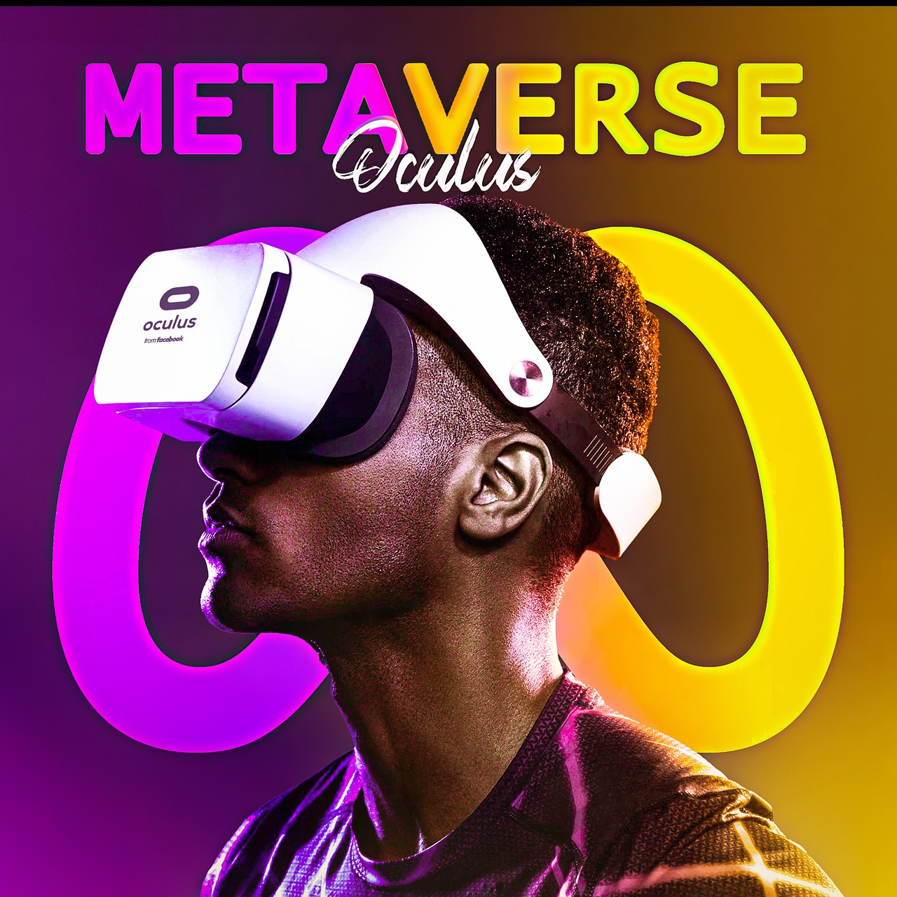
Virtual Reality (VR) is not just a buzzword; it's a revolutionary technology that creates a simulated environment, allowing users to immerse themselves in a different world. Imagine slipping on a headset and suddenly finding yourself walking on the surface of Mars or exploring the depths of the ocean without ever leaving your living room. That's the magic of VR! At its core, VR combines hardware and software to craft experiences that can replicate or enhance reality, making it a powerful tool for various applications, including remote sensing.
To truly grasp the impact of VR, it's essential to understand its fundamental components. The hardware typically includes VR headsets, which house screens and lenses that deliver high-resolution visuals. Alongside headsets, controllers allow users to interact with the virtual environment, making the experience feel more tangible. Sensors track the user's movements, ensuring that the virtual world responds in real-time, creating a seamless experience. This combination of elements is what makes VR so engaging and effective.
On the software side, VR applications are designed to create immersive experiences tailored to specific needs. For instance, in remote sensing, software can simulate satellite imagery, allowing users to visualize large datasets in an interactive manner. This not only enhances understanding but also aids in decision-making processes. The software's ability to create dynamic environments enables learners to experiment, explore, and engage with data in ways that traditional methods simply cannot offer.
Moreover, VR can be categorized into several types, each offering unique features. Here are a few:
- Fully Immersive VR: This type uses advanced headsets and motion tracking to create a completely immersive experience.
- Non-Immersive VR: This is often experienced through a computer screen, where the user interacts with a virtual environment using a mouse or keyboard.
- Augmented Reality (AR): Unlike VR, AR overlays digital information onto the real world, enhancing the user's perception of their environment.
Understanding these basics is crucial as we dive deeper into how VR can enhance remote sensing skills. The potential applications are vast, and as technology continues to evolve, so too will the opportunities for integrating VR into various fields. By harnessing the power of VR, we can not only improve our understanding of complex data but also foster a more engaging and effective learning environment.

Types of VR Technologies
When we talk about Virtual Reality (VR), it's essential to understand that not all VR experiences are created equal. There are various types of VR technologies, each designed to cater to different needs and applications. From fully immersive environments that transport users to entirely new worlds, to augmented reality (AR) systems that overlay digital information onto the real world, the spectrum of VR technologies is broad and fascinating.
At the core of these technologies are two main categories: fully immersive VR and non-immersive VR. Fully immersive VR typically requires specialized hardware, such as headsets and motion-tracking devices, to create a sense of presence within a virtual environment. In contrast, non-immersive VR can be experienced through standard computers or mobile devices, where users interact with virtual elements on a screen without the immersive experience.
Let’s break down some of the most common types of VR technologies:
- Fully Immersive VR: This type utilizes advanced headsets, such as the Oculus Rift or HTC Vive, to provide users with a 360-degree view of a virtual world. These systems often include motion controllers that allow users to interact with the environment physically.
- Augmented Reality (AR): AR enhances the real world by overlaying digital information onto it. Devices like Microsoft HoloLens exemplify this technology, allowing users to see virtual objects in their physical surroundings.
- Mixed Reality (MR): MR combines elements of both VR and AR, enabling users to interact with both real and virtual objects in real-time. This technology is particularly useful in fields like remote sensing, where data visualization is crucial.
- Desktop VR: This is a more accessible form of VR that can be experienced on standard computers. While it lacks the immersive qualities of headsets, it still allows users to explore virtual environments through a screen.
Each of these technologies has its unique features and potential applications in remote sensing. For instance, fully immersive VR is fantastic for training simulations, allowing users to practice their skills in a risk-free environment. On the other hand, augmented reality can be incredibly beneficial for fieldwork, where real-time data overlays can enhance decision-making processes.
Moreover, the choice of VR technology often depends on the specific requirements of the task at hand. For instance, in remote sensing, the ability to visualize complex data sets in an immersive manner can significantly improve understanding and retention of information. In contrast, AR applications can provide immediate context and data analysis in situ, making them invaluable for on-the-ground assessments.
In conclusion, the variety of VR technologies available today offers exciting possibilities for enhancing remote sensing skills. By understanding the different types and their applications, educators and professionals can select the most appropriate tools to facilitate learning and practical application in their respective fields.
Q1: What is the difference between VR and AR?
A1: Virtual Reality (VR) creates a completely immersive digital environment, while Augmented Reality (AR) overlays digital information onto the real world, enhancing the user's perception of their surroundings.
Q2: How can VR enhance remote sensing training?
A2: VR provides immersive simulations that allow learners to visualize and interact with remote sensing data, improving engagement and retention of skills.
Q3: Are there any limitations to using VR in remote sensing?
A3: Yes, challenges include high costs, technical barriers, and the need for specialized training to effectively implement VR technologies.

Hardware Components
When diving into the world of Virtual Reality (VR), understanding the that power these immersive experiences is essential. Think of VR hardware as the backbone that supports the entire ecosystem, allowing users to engage with digital environments in a way that feels incredibly real. At the heart of any VR setup are the headsets, which serve as the primary interface between the user and the virtual world. These headsets come equipped with high-resolution displays and advanced optics that create a lifelike experience. Popular models like the Oculus Rift, HTC Vive, and PlayStation VR have set the standard, each offering unique features that cater to different preferences and use cases.
In addition to headsets, controllers play a crucial role in enhancing user interaction. These handheld devices allow users to manipulate objects, navigate environments, and engage in various activities within the virtual space. Imagine wielding a virtual tool in a simulated agricultural field, analyzing crop data, or adjusting environmental parameters with a flick of your wrist. This level of interaction not only makes learning more engaging but also reinforces practical skills that are vital in remote sensing.
Moreover, sensors are integral to capturing the user's movements and translating them into the virtual realm. They track everything from head rotations to hand movements, ensuring a seamless experience. Some systems utilize external sensors placed around the room to create a more expansive play area, while others rely on built-in sensors within the headset itself. This technology allows users to explore their virtual environments freely, providing a sense of presence that traditional learning methods simply cannot match.
Here’s a quick overview of the essential hardware components that contribute to an effective VR setup:
| Component | Description | Examples |
|---|---|---|
| Headset | Device worn on the head to deliver immersive visual experiences. | Oculus Quest, HTC Vive, PlayStation VR |
| Controllers | Handheld devices that allow users to interact with the virtual environment. | Oculus Touch, Vive Controllers |
| Sensors | Devices that track user movements and enhance interaction. | External base stations, built-in sensors |
In conclusion, the hardware components of VR are not just tools; they are gateways to a new realm of learning and exploration. By investing in quality equipment, educators and professionals in the field of remote sensing can unlock the full potential of VR, creating experiences that are not only educational but also profoundly engaging. As technology continues to evolve, we can expect even more innovative hardware solutions that will further enhance the capabilities of VR in remote sensing and beyond.
- What is the most important hardware for VR? The headset is typically considered the most critical component, as it directly affects the visual experience.
- Do I need specialized hardware for remote sensing training? While basic VR setups can suffice, specialized hardware may enhance the experience and effectiveness of training.
- Can I use VR without controllers? Yes, some VR experiences can be navigated using head movements alone, but controllers provide a more interactive experience.

Software Applications
When it comes to enhancing remote sensing skills through Virtual Reality (VR), the choice of software applications plays a pivotal role. These applications are designed to create immersive environments that allow users to interact with complex data sets in a way that traditional methods simply cannot match. Imagine stepping into a digital landscape where you can visualize satellite imagery, manipulate 3D models of terrain, or simulate environmental changes in real-time. This is the power of VR software in remote sensing.
Several software applications have emerged as leaders in the field, each offering unique features that cater to different aspects of remote sensing. For instance, applications like ESRI's ArcGIS Pro and Google Earth VR allow users to visualize and analyze geographical data in a 3D space. These platforms facilitate an understanding of spatial relationships and patterns, making it easier for users to draw insights from complex datasets.
Moreover, specialized VR tools such as VRTS (Virtual Reality Training Simulator) are tailored specifically for training purposes. These applications provide realistic scenarios where users can practice their skills in a controlled environment. For example, users can engage in simulated missions that involve disaster response, land use planning, or environmental monitoring, thereby gaining hands-on experience without the risks associated with real-world applications.
Another noteworthy software is Unity, a versatile game engine that has been adapted for scientific visualization. With Unity, developers can create custom VR applications that suit specific remote sensing needs, allowing for tailored training programs that align with organizational goals. This flexibility is crucial in a field where the requirements can vary widely depending on the industry and the specific project at hand.
To summarize, the integration of VR software applications into remote sensing training not only enhances engagement but also significantly improves the retention of complex concepts. As users navigate through interactive simulations, they develop a deeper understanding of the material, which translates into better decision-making skills in real-world applications. The future of remote sensing education is undoubtedly intertwined with advancements in VR software, paving the way for more effective learning experiences.
- What is the primary benefit of using VR in remote sensing? VR provides an immersive learning experience that enhances understanding and retention of complex data.
- Are there specific software applications recommended for beginners? Yes, applications like Google Earth VR and ESRI's ArcGIS Pro are user-friendly and great for beginners.
- Can VR training replace traditional remote sensing education? While VR training is a powerful tool, it is best used as a complement to traditional education methods.
- What industries can benefit from VR in remote sensing? Industries such as environmental monitoring, agriculture, urban planning, and disaster management can greatly benefit from VR applications.

Benefits of VR in Remote Sensing Training
Integrating Virtual Reality (VR) into remote sensing training is not just a trend; it’s a game-changer. Imagine stepping into a world where you can explore satellite imagery and aerial data as if you were right there in the field! VR offers a unique platform that transforms traditional learning into an immersive experience. This technology allows students and professionals alike to visualize complex data in ways that are both engaging and enlightening.
One of the most significant benefits of VR in remote sensing training is the enhanced engagement it fosters. Traditional methods of teaching often rely on textbooks and static images, which can be dry and uninspiring. In contrast, VR immerses learners in realistic environments where they can interact with 3D models of landscapes, weather patterns, and even urban developments. This level of engagement not only makes learning more enjoyable but also aids in better retention of information.
Furthermore, VR allows for practical skill development in a safe and controlled environment. For instance, trainees can practice interpreting remote sensing data without the risk of making real-world mistakes. They can simulate various scenarios, such as natural disasters or agricultural assessments, and learn how to respond effectively. This hands-on approach is crucial for developing the critical thinking and decision-making skills necessary in the field.
Another noteworthy advantage is the flexibility that VR provides. With VR training modules, learners can access content anytime and anywhere, making it easier for busy professionals to fit training into their schedules. This accessibility can significantly broaden the reach of remote sensing education, allowing individuals from diverse backgrounds to gain essential skills.
Moreover, VR facilitates collaborative learning. Multiple users can enter the same virtual environment, enabling teamwork and communication skills to flourish. This is particularly beneficial for remote sensing projects that require input from various stakeholders. By working together in a virtual space, teams can analyze data collectively, brainstorm solutions, and make informed decisions, all while enhancing camaraderie and collaboration.
In summary, the incorporation of VR into remote sensing training offers a multitude of benefits, including:
- Enhanced Engagement: Makes learning interactive and enjoyable.
- Practical Skill Development: Provides safe environments for practicing real-world scenarios.
- Flexibility: Allows for on-demand access to training resources.
- Collaborative Learning: Encourages teamwork and communication among users.
As we continue to explore the potential of VR in education, it’s clear that this technology is not just a passing fad. It’s an essential tool that can revolutionize how we train in remote sensing, making the process more effective and enjoyable for everyone involved.
Q1: How does VR enhance the learning experience in remote sensing?
A1: VR enhances learning by providing immersive environments where users can interact with data, making complex concepts easier to understand and retain.
Q2: Are there any specific VR tools recommended for remote sensing training?
A2: Yes, tools like Unity and ArcGIS VR are popular for creating immersive training experiences tailored for remote sensing applications.
Q3: What are the costs associated with implementing VR in education?
A3: The costs can vary significantly based on the hardware and software used, but many educational institutions are finding ways to integrate VR within their budgets through grants and partnerships.
Q4: Can VR training be accessed remotely?
A4: Absolutely! One of the advantages of VR training is that it can be accessed from various locations, allowing for flexibility in learning.
Real-World Applications of VR in Remote Sensing
Virtual Reality (VR) is not just a buzzword; it’s revolutionizing how we approach remote sensing across various industries. The immersive capabilities of VR allow professionals to visualize complex data in ways that traditional methods simply cannot achieve. Imagine standing in a virtual environment where you can manipulate and analyze data from satellite imagery as if you were physically there—this is the power of VR. By simulating real-world scenarios, VR enhances understanding and decision-making processes, making it an invaluable tool in fields like environmental monitoring, agriculture, and urban planning.
One of the most fascinating applications of VR in remote sensing is in environmental monitoring. Researchers and scientists can immerse themselves in virtual landscapes to visualize ecological changes over time. For instance, they can simulate the effects of climate change on a specific region, examining how rising sea levels might impact coastal areas. This kind of visualization not only aids in research but also helps in communicating findings to stakeholders and the public. Furthermore, VR allows for interactive scenarios where users can explore different outcomes based on varying environmental policies or conservation efforts.
In the realm of agricultural management, VR is proving to be a game-changer. Farmers can use VR technology to simulate crop growth under different conditions, such as varying soil types, weather patterns, and irrigation methods. This capability enables them to make informed decisions about crop management and resource allocation. For example, a farmer could visualize how a drought might affect their yield and adjust their strategies accordingly. By integrating VR with remote sensing data, farmers can achieve precision farming, leading to increased productivity and sustainability.
Moreover, urban planners are harnessing the power of VR to create detailed models of cities. By incorporating remote sensing data, they can visualize urban growth patterns and assess the impact of new developments on existing infrastructure. Imagine walking through a virtual version of your city, observing how new buildings or parks will fit into the landscape. This immersive experience can facilitate better community engagement, as residents can provide feedback on proposed projects in a more tangible way.
To illustrate the diverse applications of VR in remote sensing, consider the following table that highlights specific uses across different sectors:
| Industry | Application | Benefits |
|---|---|---|
| Environmental Monitoring | Visualizing ecological changes | Enhanced understanding of climate impacts |
| Agriculture | Simulating crop growth | Improved decision-making for resource management |
| Urban Planning | Modeling city developments | Better community engagement and feedback |
As we can see, the real-world applications of VR in remote sensing are vast and varied. The technology not only helps professionals visualize and interpret data more effectively but also fosters collaboration and communication among stakeholders. The future of remote sensing is undoubtedly intertwined with VR, offering exciting possibilities for innovation and improved outcomes in numerous fields.
- What are the main benefits of using VR in remote sensing? VR enhances data visualization, improves engagement, and aids in decision-making processes across various industries.
- How does VR contribute to environmental monitoring? VR allows researchers to visualize ecological changes and simulate the effects of climate change, facilitating better understanding and communication of findings.
- Can VR be used in agriculture? Yes, VR helps farmers simulate different agricultural scenarios, leading to improved crop management and precision farming.
- What challenges does VR face in remote sensing? The main challenges include high costs, technical limitations, and the need for specialized training to effectively implement VR technology.

Environmental Monitoring
In recent years, the integration of Virtual Reality (VR) technology into environmental monitoring has revolutionized the way scientists and researchers visualize and analyze ecological data. Imagine standing in a virtual forest, surrounded by trees, while simultaneously observing data about air quality, soil moisture, and wildlife activity. This immersive experience not only enhances understanding but also allows for more informed decision-making regarding environmental issues.
One of the primary benefits of using VR in environmental monitoring is its ability to present complex data in an easily digestible format. Traditional methods of data visualization, such as graphs and charts, often fail to convey the full scope of environmental changes. In contrast, VR enables users to interact with three-dimensional models of ecosystems, providing a clearer picture of how various elements interact with one another.
For instance, a VR simulation can illustrate the effects of climate change on a specific habitat. By manipulating variables such as temperature and precipitation, users can observe potential outcomes in real-time. This hands-on approach not only enhances learning but also fosters a deeper emotional connection to the environment, encouraging individuals to take action to protect it.
Moreover, VR can facilitate collaborative efforts among scientists, policymakers, and the public. By creating shared virtual environments, stakeholders can engage in discussions and develop strategies based on a common understanding of environmental data. This collaborative aspect is crucial, as environmental issues often require multi-disciplinary approaches and collective action.
To further illustrate the impact of VR on environmental monitoring, consider the following table showcasing various applications:
| Application | Description | Benefits |
|---|---|---|
| Wildlife Tracking | Simulating animal movements and habitats | Improved conservation strategies |
| Pollution Visualization | Mapping pollution sources and impacts | Enhanced public awareness and policy-making |
| Climate Change Modeling | Visualizing future climate scenarios | Informed decision-making and preparedness |
In summary, the role of VR in environmental monitoring is not just about technology; it's about creating a profound understanding of our planet and the challenges it faces. As we continue to explore the potential of VR, it is essential to embrace these innovations to foster a more sustainable future. By making environmental data accessible and engaging, we empower individuals and communities to make informed decisions that can lead to positive change.
- What is environmental monitoring? Environmental monitoring refers to the systematic collection of data related to the environment, aimed at assessing its quality and changes over time.
- How does VR enhance environmental monitoring? VR provides immersive experiences that allow users to visualize complex data, making it easier to understand and analyze environmental issues.
- What are some applications of VR in environmental monitoring? Applications include wildlife tracking, pollution visualization, and climate change modeling, among others.
- Is VR technology expensive to implement? While the initial investment can be significant, the long-term benefits of improved data visualization and decision-making can outweigh the costs.

Agricultural Management
Agricultural management is an ever-evolving field that is continually seeking innovative solutions to enhance productivity and sustainability. With the advent of Virtual Reality (VR) technology, farmers and agricultural managers are now equipped with tools that go beyond traditional methods. Imagine being able to visualize your entire farm from a bird's-eye view, analyzing crop health and soil conditions in real-time, all while sitting in a comfortable office chair! This is precisely what VR brings to the table, transforming how we approach agricultural management.
One of the most significant advantages of VR in agriculture is its ability to facilitate precision farming. By simulating various scenarios, farmers can assess how different factors—such as weather conditions, soil types, and crop varieties—affect yield outcomes. For instance, a VR simulation might allow a farmer to visualize how a specific crop would perform in varying soil moisture levels. This immersive experience helps in making informed decisions that can lead to improved crop management and resource allocation.
Moreover, VR can assist in training agricultural workers. Imagine a new worker stepping into a virtual environment where they can practice operating machinery, managing pest control, or even learning about crop rotation without the risks associated with real-world farming. This hands-on learning approach not only boosts confidence but also enhances skill retention. According to recent studies, learners who engage in VR training retain information significantly better than those who rely solely on traditional methods.
Furthermore, the integration of VR with data analytics can provide a comprehensive view of agricultural operations. By overlaying real-time data onto a virtual landscape, farmers can identify trends and make proactive decisions. For example, using VR, a farmer can visualize yield data from previous seasons alongside current crop conditions, allowing them to strategize effectively. The synergy between VR and big data analytics is a game-changer for agricultural management, paving the way for smarter farming practices.
However, it's essential to recognize that while VR offers remarkable benefits, it also poses challenges. The initial investment in VR technology can be daunting for small-scale farmers. Additionally, the need for robust internet connectivity and technical expertise can create barriers to entry. To address these issues, stakeholders in the agricultural sector must collaborate to develop affordable solutions and training programs that make VR accessible to all. By doing so, we can ensure that the advantages of this technology are not just reserved for large agribusinesses but are available to farmers of all sizes.
In summary, the role of VR in agricultural management is transformative. It not only enhances decision-making and training but also fosters a deeper understanding of the agricultural ecosystem. As we continue to explore the potential of VR, it is crucial to tackle the challenges head-on, ensuring that its benefits are widespread and sustainable. The future of agriculture may very well depend on how effectively we can integrate these cutting-edge technologies into our existing frameworks.
- How does VR improve training for agricultural workers?
VR provides a safe and controlled environment for workers to practice essential skills, leading to better retention and confidence in their abilities. - What are the cost implications of implementing VR in agriculture?
The initial investment can be significant, but the long-term benefits in efficiency and productivity often outweigh these costs. - Can small-scale farmers benefit from VR technology?
Yes, with the right support and affordable solutions, small-scale farmers can leverage VR to enhance their management practices. - What types of data can be visualized using VR in agriculture?
VR can visualize a variety of data, including crop health, soil conditions, weather patterns, and historical yield data.

Challenges and Limitations
While the integration of Virtual Reality (VR) into remote sensing holds immense potential, it is not without its challenges and limitations. One of the most significant hurdles is the cost implications associated with acquiring and maintaining VR technology. For educational institutions and organizations, the financial burden can be substantial. This includes not only the initial investment in hardware and software but also ongoing costs related to updates, maintenance, and training personnel. Many institutions may find it difficult to justify the expense, especially when budgets are tight and competing priorities exist.
Another critical challenge is the technical barriers that can impede the effective implementation of VR in remote sensing. These barriers often manifest in two primary forms: software compatibility and hardware limitations. For instance, not all VR software is compatible with existing systems, which can lead to frustrations and inefficiencies. Moreover, the hardware required for high-quality VR experiences can be demanding in terms of specifications, necessitating powerful computers and robust internet connections. This can create a divide, where only well-funded organizations can fully harness the capabilities of VR technology.
Additionally, the need for specialized training cannot be overlooked. While VR can enhance learning experiences, it also requires users to have a certain level of familiarity with the technology. This can pose a challenge, particularly for those who are not tech-savvy. Training programs must be developed to ensure that users can effectively navigate and utilize VR systems, which can further add to the overall cost and complexity of implementation.
Despite these challenges, there are potential solutions that could facilitate wider adoption of VR in remote sensing. For instance, collaborative funding models could be explored, where multiple institutions share the costs of acquiring VR technology. Additionally, developing open-source software solutions that are compatible with a range of hardware could help mitigate some of the technical barriers. Finally, creating comprehensive training programs that are accessible and user-friendly could empower a broader audience to engage with VR technology.
- What are the primary challenges of implementing VR in remote sensing?
The main challenges include high costs, technical barriers, and the need for specialized training. - How can organizations overcome the cost implications of VR technology?
Organizations can explore collaborative funding models and prioritize budget allocations for VR technology. - What types of training are necessary for effective VR use in remote sensing?
Comprehensive training programs that focus on both technical skills and practical applications are essential for effective use.

Cost Implications
When it comes to integrating Virtual Reality (VR) into remote sensing training, one cannot overlook the financial implications. The initial investment for VR technology can be daunting, especially for educational institutions and organizations that are already operating on tight budgets. This cost encompasses not only the hardware—such as headsets and controllers—but also the necessary software and ongoing maintenance. In many cases, the expenses can accumulate rapidly, leading to a significant financial burden.
To put things into perspective, let’s break down the typical costs associated with implementing VR in remote sensing:
| Item | Estimated Cost |
|---|---|
| VR Headset | $300 - $1,500 |
| Controllers | $100 - $300 |
| Software Licenses | $500 - $2,000 |
| Maintenance and Support | $200 - $1,000/year |
As you can see, the costs can vary widely, depending on the quality and capabilities of the technology chosen. Moreover, many institutions may find themselves needing to allocate additional funds for training staff on how to effectively use VR technology. This aspect is often overlooked but is essential for maximizing the potential benefits of VR in remote sensing.
Another factor to consider is the return on investment. While the upfront costs may seem high, the long-term benefits can outweigh these initial expenses. By enhancing learning experiences and improving data visualization, VR can lead to better decision-making and more effective remote sensing practices. This can ultimately save organizations time and resources in the long run.
In conclusion, while the cost implications of adopting VR in remote sensing training are significant, they should be weighed against the potential advantages. Institutions must carefully evaluate their budgets and consider the long-term gains that come from investing in this innovative technology.
- What are the primary costs associated with VR technology? The main costs include hardware, software, maintenance, and training.
- Is VR worth the investment for remote sensing? Yes, while the initial costs can be high, the long-term benefits in terms of enhanced learning and data visualization can justify the investment.
- How can organizations minimize costs when implementing VR? Organizations can look for grants, partnerships, or phased implementation to spread out the costs.
Technical Barriers
As exciting as the world of Virtual Reality (VR) is, integrating it into remote sensing training isn't without its hurdles. One of the primary technical barriers is software compatibility. Different VR systems often run on varied software platforms, which can create a patchwork of challenges when trying to unify training programs. Imagine trying to fit a square peg into a round hole—this is what many educators and trainers face when attempting to merge existing remote sensing applications with new VR technologies.
Another significant barrier is the hardware limitations. Not all institutions or organizations have access to the latest VR headsets or the powerful computers necessary to run sophisticated simulations. This can lead to a situation where only a select few can benefit from VR training, leaving others at a disadvantage. For instance, a university may have top-notch software but lack the hardware to implement it effectively, creating a disconnect between potential and reality.
Additionally, the requirement for specialized training can be daunting. While VR is designed to be user-friendly, understanding how to effectively use VR tools for remote sensing requires a learning curve. This can be particularly challenging for those who are not tech-savvy or who are accustomed to traditional methods of data analysis. The need for ongoing support and training can also strain resources, particularly in smaller organizations that may not have the budget for extensive training programs.
To illustrate these challenges, consider the following table that outlines some of the key technical barriers faced when implementing VR in remote sensing:
| Technical Barrier | Description |
|---|---|
| Software Compatibility | Challenges in integrating various software platforms with VR systems. |
| Hardware Limitations | Inaccessibility of advanced VR hardware for many institutions. |
| Specialized Training | The need for dedicated training programs to effectively use VR tools. |
In summary, while the potential of VR in enhancing remote sensing skills is immense, addressing these technical barriers is crucial for successful implementation. By investing in compatible technologies, upgrading hardware, and providing comprehensive training, organizations can pave the way for a more inclusive and effective learning environment.
- What are the main technical barriers to implementing VR in remote sensing? The main barriers include software compatibility issues, hardware limitations, and the need for specialized training.
- How can organizations overcome these challenges? Organizations can invest in compatible technologies, upgrade their hardware, and provide comprehensive training programs to enhance user experience.
- Is VR technology accessible for all educational institutions? Not all institutions can afford the latest VR technology, which can create disparities in access to training.
Frequently Asked Questions
- What is remote sensing?
Remote sensing is the process of collecting data about the Earth's surface from a distance, often using satellites or aircraft. It plays a crucial role in monitoring environmental changes, managing resources, and planning urban development.
- How does Virtual Reality enhance remote sensing skills?
Virtual Reality (VR) enhances remote sensing skills by providing immersive experiences that allow learners to visualize complex data and practice real-world applications in a controlled environment. This hands-on approach boosts engagement and retention of information.
- What types of VR technologies are used in remote sensing?
There are several types of VR technologies used in remote sensing, including fully immersive headsets, augmented reality applications, and mixed reality systems. Each type offers unique features that cater to different aspects of remote sensing training and data interpretation.
- What are the hardware requirements for VR in remote sensing?
To effectively utilize VR for remote sensing, essential hardware components include VR headsets, motion controllers, and sensors. These devices work together to create an immersive experience that simulates real-world scenarios and enhances learning.
- What software applications are commonly used in VR for remote sensing?
Popular software applications for VR in remote sensing include simulation tools and data visualization platforms that allow users to interact with geographical data. These applications are designed to create realistic environments for training and analysis.
- What are the benefits of using VR in remote sensing training?
Using VR in remote sensing training offers numerous benefits, such as increased engagement, improved retention of knowledge, and enhanced practical skill development. Learners can experiment with real-time data in a risk-free setting, making the learning process more effective.
- Can you provide examples of real-world applications of VR in remote sensing?
Yes! VR is being used in various industries for remote sensing tasks, including environmental monitoring, where it helps visualize ecological data, and agricultural management, where it aids in precision farming by allowing farmers to analyze crop data efficiently.
- What challenges does VR face in remote sensing?
Despite its potential, VR in remote sensing faces challenges such as high costs, technical limitations, and the need for specialized training. Addressing these issues is essential for broader adoption and effective implementation in various sectors.
- How significant are the cost implications of implementing VR?
The financial investment required for VR technology can be substantial, especially for educational institutions and organizations. It's important to weigh these costs against the potential benefits and improved learning outcomes that VR can provide.
- What technical barriers exist for VR in remote sensing?
Technical barriers such as software compatibility issues and hardware limitations can hinder the effective implementation of VR. Overcoming these challenges may require ongoing support, updates, and training for users to fully utilize the technology.


