How Satellites Improve Ground Troop Coordination
In today's fast-paced military landscape, the effectiveness of ground troops hinges on their ability to adapt and respond to rapidly changing situations. One of the most revolutionary tools that have emerged in this regard is satellite technology. Imagine being on the battlefield, surrounded by chaos, yet having the clarity and communication that satellites provide. This article explores the vital role of satellites in enhancing communication, navigation, and operational efficiency for ground troops in modern military operations, showcasing their impact on strategy and effectiveness.
Communication is the backbone of any successful military operation, and satellites are at the forefront of this essential function. With real-time communication capabilities, ground troops can stay connected no matter where they are deployed. This connectivity allows soldiers to share intelligence and coordinate movements seamlessly, significantly improving operational efficiency and responsiveness in dynamic combat environments. Just think about it: in the heat of battle, the ability to send and receive messages instantly can mean the difference between success and failure. Satellites ensure that every soldier is on the same page, no matter how far apart they may be.
Gone are the days when ground troops relied solely on maps and compasses. With satellite-based navigation systems like GPS, soldiers can accurately determine their positions, plan routes, and execute maneuvers with remarkable precision. This technology not only reduces the risk of getting lost but also increases mission success rates. Imagine a soldier navigating through dense forests or urban environments with confidence, knowing exactly where they are and where they need to go. The clarity provided by satellite navigation is akin to having a personal guide in an unfamiliar territory, ensuring that troops can focus on their mission rather than their surroundings.
The ability to track troop movements in real-time is a game-changer for military operations. Commanders can make informed decisions, allocate resources effectively, and respond swiftly to changing battlefield conditions. This enhanced coordination is crucial during high-stakes situations where every second counts. For instance, if a unit is under attack, commanders can quickly deploy reinforcements based on the exact location of their troops. The real-time data provided by satellites creates a dynamic battlefield environment where adaptability is key.
Integrating satellite navigation with ground systems allows troops to utilize advanced mapping and tracking technologies. This integration facilitates better situational awareness and operational planning during missions. Picture a commander in a control center, analyzing live data feeds from satellites and making strategic decisions based on comprehensive maps and troop movements. This level of integration transforms the battlefield into a well-coordinated operation, where every element works in harmony to achieve a common goal.
One of the most critical aspects of military operations is ensuring the safety of personnel. Precise navigation reduces the likelihood of friendly fire incidents and enhances troop safety, allowing for more strategic movements. By minimizing risks during complex operations, soldiers can focus on their objectives rather than worrying about potential hazards. The technology acts as a safety net, providing a layer of security that is essential in high-pressure scenarios.
Satellites also play a crucial role in facilitating the sharing of critical data and intelligence among units. This ensures that all ground troops have access to the information they need to make timely and informed decisions. Imagine a scenario where a unit discovers enemy positions or potential threats; with satellite technology, this information can be disseminated instantly to all relevant troops. This rapid data sharing fosters a culture of collaboration and enhances the overall effectiveness of military operations.
The use of satellite technology streamlines logistics and supply chain management for ground troops. By ensuring that resources are delivered where needed, when needed, satellites improve overall operational effectiveness. No longer do commanders have to rely on outdated methods of tracking supplies; instead, they can utilize real-time data to optimize logistics operations and ensure that ground troops are well-equipped to carry out their missions. This efficiency is akin to a well-oiled machine, where every part works seamlessly to achieve a common objective.
Satellites enable real-time tracking of supplies and equipment, allowing commanders to optimize logistics operations. This capability ensures that troops are not only well-equipped but also have the right resources at the right time. Imagine a scenario where a unit is running low on ammunition during a critical engagement. With satellite logistics coordination, commanders can swiftly reroute supplies, ensuring that troops remain combat-ready. This level of coordination is essential for maintaining operational momentum and achieving mission success.
Satellite data plays a crucial role in planning missions by providing detailed terrain analysis and environmental conditions. This information allows ground troops to anticipate challenges and execute strategies effectively. Think of it as having a tactical advantage; with the right data, commanders can devise plans that take into account the terrain, weather, and potential enemy movements. This foresight is invaluable in military operations, where preparation can mean the difference between victory and defeat.
- How do satellites improve communication for ground troops?
Satellites provide real-time communication capabilities, allowing troops to stay connected and share intelligence instantly. - What role does GPS play in military operations?
GPS enables precise navigation, helping troops determine their positions and plan routes effectively. - How does satellite technology enhance safety for soldiers?
By providing accurate navigation and real-time tracking, satellite technology reduces the risk of friendly fire and enhances troop safety. - Can satellites assist in logistics and supply chain management?
Yes, satellites enable real-time tracking of supplies, ensuring that resources are delivered efficiently to ground troops.
Enhanced Communication
This article explores the vital role of satellites in enhancing communication, navigation, and operational efficiency for ground troops in modern military operations, showcasing their impact on strategy and effectiveness.
In the chaotic world of modern warfare, where every second counts and the stakes are incredibly high, effective communication can be the difference between success and failure. Satellites provide a lifeline for ground troops, enabling them to stay connected in real-time, regardless of their location. Imagine being in the midst of a battlefield, surrounded by noise and confusion, yet having the ability to communicate seamlessly with your command center and fellow soldiers. This is the power of satellite technology.
With satellite communication systems, ground troops can share intelligence quickly and efficiently. Whether it's sending vital information about enemy movements or coordinating troop movements, the ability to communicate instantly enhances operational efficiency and responsiveness. Soldiers can receive updates about changing conditions on the battlefield, allowing them to adapt their strategies on the fly. This level of connectivity is crucial in dynamic combat environments where split-second decisions can save lives.
Moreover, satellite communication is not just about voice calls; it encompasses a wide range of data transmission, including video feeds and encrypted messages. This ensures that sensitive information remains secure while being shared among units. For instance, reconnaissance teams can send live feeds of enemy positions back to command, allowing for real-time analysis and decision-making. The integration of satellite technology in communication systems ensures that ground troops are always in the loop, fostering a more cohesive and coordinated approach to military operations.
Additionally, the reliability of satellite communication is a game-changer. Traditional communication methods, such as radio, can be jammed or intercepted, leading to potential vulnerabilities. However, satellites operate above the fray, providing a more secure and resilient communication channel. This is especially important in high-stakes scenarios where the risk of misinformation can lead to disastrous outcomes.
To illustrate the importance of enhanced communication through satellites, consider the following table that outlines key benefits:
| Benefit | Description |
|---|---|
| Real-Time Updates | Troops receive immediate information about battlefield conditions and enemy movements. |
| Secure Communication | Encrypted channels protect sensitive information from interception. |
| Increased Coordination | Units can effectively synchronize their actions, leading to improved mission outcomes. |
| Adaptability | Troops can quickly adjust strategies based on real-time intelligence. |
In conclusion, the role of satellites in enhancing communication for ground troops is indispensable. They not only provide a means to stay connected but also empower soldiers with the information they need to make informed decisions on the battlefield. As military operations continue to evolve, the reliance on satellite technology will only grow, ensuring that ground troops are always one step ahead in their missions.
- How do satellites improve communication for ground troops?
Satellites provide real-time communication capabilities, allowing troops to share intelligence and coordinate movements seamlessly. - What types of data can be transmitted via satellite?
Satellite communication can transmit voice calls, video feeds, and encrypted messages, ensuring secure and efficient communication. - Why is satellite communication more reliable than traditional methods?
Satellites operate above the battlefield, making them less susceptible to jamming and interception compared to ground-based communication methods.
Precision Navigation
In the realm of modern military operations, is not just a luxury; it’s a necessity. The advent of satellite-based navigation systems, particularly the Global Positioning System (GPS), has revolutionized how ground troops maneuver in the field. Imagine trying to navigate a dense forest or an urban battlefield without a reliable map or compass. It’s like trying to find your way in a labyrinth without any clues. With satellites overhead, troops can pinpoint their exact location with remarkable accuracy, allowing them to plan their routes and execute maneuvers that were once fraught with uncertainty.
But how does this enhanced navigation actually work? At its core, GPS relies on a network of satellites orbiting the Earth. Each satellite continuously transmits signals that are picked up by GPS receivers on the ground. By calculating the time it takes for the signals to travel from the satellites to the receiver, the system can determine the receiver's location within a matter of meters. This level of precision not only reduces the risk of getting lost but also significantly increases mission success rates. Ground troops can confidently navigate through challenging terrains, whether they are traversing rocky mountains or navigating through urban landscapes.
One of the standout features of satellite navigation is the ability to track troop movements in real-time. This capability is a game changer for commanders on the battlefield. Imagine being able to see where every unit is located at any given moment. This level of situational awareness allows leaders to make informed decisions, allocate resources effectively, and respond swiftly to changing battlefield conditions. It’s akin to playing a game of chess where you can see all the pieces moving on the board, giving you a strategic advantage over your opponent.
Additionally, real-time tracking can be crucial during high-stakes operations. For instance, if a unit encounters unexpected resistance, commanders can quickly redirect nearby troops to provide support. This agility is vital in dynamic combat environments where every second counts. Moreover, with the integration of satellite technology, commanders can visualize troop movements on advanced mapping systems, enhancing their ability to plan and execute strategies effectively.
To maximize the benefits of precision navigation, it is essential to integrate satellite systems with ground-based technologies. This integration facilitates the use of advanced mapping and tracking tools that provide troops with better situational awareness. For example, using Geographic Information Systems (GIS) alongside GPS data allows for a comprehensive analysis of the battlefield. Troops can assess terrain features, identify potential hazards, and plan their movements accordingly. This synergy between satellite navigation and ground systems transforms the way missions are conducted, enabling more precise and coordinated actions.
Another significant advantage of precise navigation is its impact on troop safety. With accurate positioning, the likelihood of friendly fire incidents decreases dramatically. Troops can move strategically, knowing their exact locations relative to one another. This precision is particularly important in complex operations where multiple units are engaged in close proximity. By minimizing the risks associated with navigation errors, ground forces can focus on their primary objectives rather than worrying about potential mishaps.
In conclusion, the role of precision navigation in modern military operations cannot be overstated. It empowers ground troops with the tools they need to navigate confidently, coordinate effectively, and operate safely. As technology continues to evolve, the integration of satellite navigation with other systems will only enhance the capabilities of military forces, ensuring that they remain a step ahead in the ever-changing landscape of warfare.
- How does GPS work for military operations?
The Global Positioning System (GPS) uses a network of satellites that send signals to ground receivers, allowing troops to determine their precise location. - What are the benefits of real-time location tracking?
Real-time tracking allows commanders to make informed decisions, allocate resources efficiently, and respond quickly to changing battlefield conditions. - How does satellite navigation improve troop safety?
By providing accurate positioning, satellite navigation reduces the risk of friendly fire incidents and enhances overall troop safety during operations.
Real-Time Location Tracking
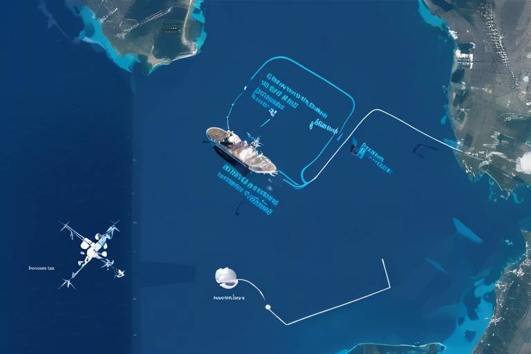
Imagine being in a high-stakes game of chess, where every move counts, and the outcome could mean victory or defeat. Now, picture this scenario on the battlefield, where the stakes are even higher. is like having a bird's-eye view of the entire chessboard, allowing commanders to see where every piece is positioned and how to maneuver for maximum effectiveness. With satellite technology, ground troops can be tracked in real-time, providing a continuous flow of information that is crucial for operational success.
This capability allows military leaders to make informed decisions based on the current positions of their troops. For instance, if a unit is advancing towards a target, commanders can monitor their progress and adjust strategies in real-time. This dynamic adaptability is essential in combat situations, where conditions can change in an instant. By knowing exactly where each unit is located, leaders can allocate resources more effectively, ensuring that support arrives exactly when and where it’s needed.
Moreover, the integration of satellite systems with advanced mapping technologies enhances situational awareness. Troops are equipped with devices that display their positions on digital maps, providing a clear visual representation of the battlefield. This is particularly beneficial in complex environments where landmarks may be scarce or obscured. Real-time data not only aids in navigation but also helps in identifying potential threats and opportunities, allowing ground troops to react swiftly.
To illustrate the impact of real-time location tracking, consider the following benefits:
- Swift Decision-Making: Commanders can react to battlefield developments almost instantaneously, ensuring that strategies are always aligned with current realities.
- Resource Allocation: Knowing the precise location of units allows for optimal deployment of resources, such as reinforcements or medical support.
- Enhanced Coordination: Units can coordinate movements with greater precision, reducing the risk of miscommunication and enhancing overall effectiveness.
In conclusion, real-time location tracking is not just a technical advancement; it's a game changer for ground troops. By leveraging satellite technology, military operations become more coordinated, responsive, and effective, ultimately leading to increased mission success rates. The ability to track troop movements in real-time transforms how commanders strategize and execute plans, ensuring that they stay one step ahead in the ever-evolving landscape of modern warfare.
- How does real-time location tracking work? It utilizes satellite signals to determine the precise location of troops and assets, which is then relayed to command centers for analysis and decision-making.
- What are the benefits of using satellites for ground troop coordination? Satellites enhance communication, improve navigation, and streamline logistics, leading to more effective military operations.
- Can real-time tracking prevent friendly fire incidents? Yes, precise location data helps in minimizing the risk of friendly fire by ensuring that all units are aware of each other's positions.
Integration with Ground Systems
Integrating satellite navigation with ground systems is akin to giving ground troops a high-tech compass that not only points north but also helps them understand the entire landscape around them. This integration is crucial for modern military operations, as it enhances situational awareness and operational planning. With the ability to access real-time data from satellites, ground forces can utilize advanced mapping technologies that provide a comprehensive view of the battlefield. Imagine being able to see not just where you are, but also where your teammates are, where the enemy might be lurking, and what obstacles lie ahead—all at the same time!
This integration allows troops to make strategic decisions based on accurate, up-to-date information. For instance, with satellite imagery and data, commanders can analyze terrain features and identify the best routes for their missions. This is particularly vital in complex environments where every second counts, and the margin for error is razor-thin. The combination of satellite data with ground systems creates a powerful tool that enhances coordination and efficiency.
Moreover, integrating satellite systems with ground units facilitates seamless communication. Troops can share critical information instantly, whether it’s about enemy movements, supply needs, or changes in mission objectives. This real-time data sharing fosters teamwork and ensures that everyone is on the same page, which is essential for success in high-stakes situations. The ability to visualize troop movements and resources on a digital map enhances decision-making and allows for quick adjustments to plans as situations evolve.
In essence, the integration of satellite navigation with ground systems transforms how military operations are conducted. It empowers ground troops with the tools they need to navigate complex environments confidently, ultimately leading to more successful missions and improved safety for all involved. As technology continues to advance, we can expect even more sophisticated integrations that will further enhance the capabilities of ground forces.
Improving Safety and Security
In the realm of modern warfare, the safety and security of ground troops are paramount. One of the most significant advancements in achieving this goal is the use of satellite technology. By providing precise navigation capabilities, satellites play a crucial role in reducing the likelihood of friendly fire incidents, which have historically led to unnecessary casualties. Imagine being on the battlefield, where the chaos of combat can cloud judgment; satellite systems act as a guiding light, ensuring that troops know exactly where they are and where their comrades are positioned.
Moreover, the integration of satellite data into military operations enhances operational security. Troops can maneuver with greater confidence, knowing that their movements are tracked and monitored in real-time. This capability allows commanders to devise strategies that minimize risks while maximizing effectiveness. For instance, when planning an operation, commanders can utilize satellite imagery to identify potential threats and obstacles, ensuring that troops can navigate safely through hostile environments.
The real-time updates provided by satellites also empower ground forces to respond swiftly to unexpected changes in the battlefield. For example, if enemy forces suddenly reposition themselves, satellite systems can quickly relay this information, allowing troops to adjust their tactics without delay. This agility not only improves the chances of mission success but also significantly enhances the safety of personnel on the ground.
Additionally, the data collected from satellites can be used to create comprehensive situational awareness. By analyzing information regarding troop movements, enemy positions, and environmental conditions, military leaders can make informed decisions that prioritize the safety of their units. This holistic view of the battlefield is akin to having a detailed map in a dense forest; it allows troops to navigate safely and avoid potential dangers.
In conclusion, the integration of satellite technology into military operations is a game-changer for improving safety and security. By ensuring precise navigation, real-time tracking, and enhanced situational awareness, satellites not only protect lives but also contribute to the overall success of military missions. As technology continues to evolve, we can expect even greater advancements in how satellites support ground troops, ultimately leading to safer and more effective operations on the battlefield.
- How do satellites improve communication for ground troops?
Satellites provide real-time communication capabilities, allowing troops to stay connected and share intelligence seamlessly, which is vital in dynamic combat environments. - What role does GPS play in troop navigation?
GPS technology enables ground troops to accurately determine their positions, plan routes, and execute maneuvers, significantly reducing the risk of getting lost. - How does satellite technology enhance operational efficiency?
By streamlining logistics and supply chain management, satellites ensure that resources are delivered efficiently, improving overall operational effectiveness. - What are the benefits of real-time location tracking?
Real-time tracking allows commanders to make informed decisions, allocate resources effectively, and respond swiftly to changing battlefield conditions.
Data Sharing and Intelligence
In the fast-paced world of modern warfare, are not just advantageous; they are essential. Satellites play a pivotal role in ensuring that ground troops have access to real-time information that can make or break a mission. Imagine being in a chaotic battlefield where every second counts; having immediate access to critical data can be the difference between success and failure. Satellites enable seamless communication channels that allow units to share intelligence quickly and efficiently, ensuring that everyone is on the same page, no matter where they are located.
One of the most significant benefits of satellite technology is its ability to integrate various data sources into a cohesive operational picture. This integration allows commanders to analyze information from multiple units and make informed decisions that enhance situational awareness. For instance, if one unit detects enemy movements, that information can be relayed via satellite to other units in the vicinity, facilitating coordinated responses. Such real-time updates can include:
- Enemy positions
- Troop movements
- Environmental conditions
- Logistical needs
This level of intelligence sharing not only enhances communication but also fosters a culture of collaboration among ground troops. It encourages units to work together, sharing insights and strategies that can lead to more effective outcomes. Moreover, the integration of satellite data with ground-based systems allows for a more comprehensive understanding of the battlefield landscape. Commanders can visualize troop movements and enemy positions on detailed maps, enabling them to devise strategies that capitalize on their strengths while mitigating weaknesses.
Furthermore, the ability to share intelligence across various platforms—be it drones, ground vehicles, or command centers—ensures that all units operate with the same information. This connectivity is crucial, especially in dynamic environments where conditions can change rapidly. For example, if a reconnaissance drone identifies a new threat, that information can be instantly disseminated to ground troops, allowing them to adjust their tactics accordingly.
In conclusion, the role of satellites in data sharing and intelligence cannot be overstated. They provide the backbone for modern military operations, ensuring that ground troops have the information they need to act decisively and effectively. As technology continues to evolve, the integration of satellite systems into military strategy will only become more sophisticated, paving the way for even greater operational success.
- How do satellites improve communication for ground troops?
Satellites enable real-time communication, allowing troops to share intelligence and coordinate movements seamlessly, even in remote areas. - What is the role of GPS in troop navigation?
GPS provides precise location data, helping troops plan routes and execute maneuvers accurately, reducing the risk of getting lost. - How does data sharing enhance mission success?
Real-time data sharing allows for informed decision-making, enabling troops to respond quickly to changing battlefield conditions. - What impact does satellite technology have on logistics?
Satellites streamline logistics by providing real-time tracking of supplies, ensuring that resources are delivered efficiently to ground troops.
Operational Efficiency
This article explores the vital role of satellites in enhancing communication, navigation, and operational efficiency for ground troops in modern military operations, showcasing their impact on strategy and effectiveness.
Satellites provide real-time communication capabilities that allow ground troops to stay connected, share intelligence, and coordinate movements seamlessly, significantly improving operational efficiency and responsiveness in dynamic combat environments.
With satellite-based navigation systems like GPS, ground troops can accurately determine their positions, plan routes, and execute maneuvers, reducing the risk of getting lost and increasing mission success rates.
The ability to track troop movements in real-time allows commanders to make informed decisions, allocate resources effectively, and respond swiftly to changing battlefield conditions, enhancing overall mission coordination.
Integrating satellite navigation with ground systems enables troops to utilize advanced mapping and tracking technologies, facilitating better situational awareness and operational planning during missions.
Precise navigation reduces the likelihood of friendly fire incidents and enhances troop safety, allowing for more strategic movements and minimizing risks during complex operations.
Satellites facilitate the sharing of critical data and intelligence among units, ensuring that all ground troops have access to the information they need to make timely and informed decisions.
The use of satellite technology streamlines logistics and supply chain management for ground troops, ensuring that resources are delivered where needed, when needed, thereby improving overall operational effectiveness. Imagine a well-oiled machine; every part needs to work in harmony to achieve the desired outcome. Similarly, the integration of satellite systems into military operations acts like the oil that keeps the gears turning smoothly. This technology allows for seamless communication between different units and command centers, ensuring that everyone is on the same page.
One of the most significant advantages of satellite technology is its ability to provide real-time data. This means that commanders can monitor troop movements, supply statuses, and even environmental conditions instantaneously. For instance, if a supply truck is delayed due to unexpected terrain challenges, the command can quickly reroute other resources to ensure that the ground troops are not left without essential supplies. This agility in logistics not only enhances mission success but also boosts troop morale, knowing that support is always just a call away.
Moreover, satellite systems allow for detailed terrain analysis, which is crucial for mission planning. By understanding the landscape, weather patterns, and potential hazards, ground troops can strategize more effectively. For example, if a unit is tasked with moving through a mountainous region, satellite data can help identify the safest and most efficient routes, minimizing the risk of ambush or getting lost in unfamiliar territory.
To illustrate the impact of operational efficiency brought by satellites, consider the following table that highlights key benefits:
| Benefit | Description |
|---|---|
| Real-Time Tracking | Allows commanders to monitor troop and supply movements continuously. |
| Enhanced Logistics | Optimizes resource allocation and delivery, ensuring troops are well-equipped. |
| Mission Planning | Provides critical data for strategic planning, enhancing mission success rates. |
| Increased Safety | Reduces risks associated with navigation and logistics, safeguarding troops. |
In conclusion, operational efficiency in military operations is significantly enhanced through the use of satellite technologies. By improving logistics coordination, mission planning, and real-time tracking, ground troops can operate more effectively and safely in high-pressure environments. This synergy between technology and strategy is what sets modern military operations apart, making them more responsive and adaptable to the complexities of the battlefield.
- How do satellites improve communication for ground troops? Satellites enable real-time communication, allowing troops to share intelligence and coordinate movements effectively.
- What role does GPS play in troop navigation? GPS provides accurate positioning, helping troops plan routes and execute maneuvers safely.
- How does satellite technology enhance logistics? It allows for real-time tracking of supplies, ensuring timely delivery and optimal resource allocation.
- Can satellite data help in mission planning? Yes, it provides critical terrain analysis and environmental conditions that inform strategic planning.
Logistics Coordination
In the fast-paced world of military operations, stands as a critical pillar that can make or break a mission. Imagine a complex puzzle where every piece must fit perfectly; that's what logistics is all about. With the integration of satellite technology, this puzzle becomes a lot easier to solve. Satellites allow for real-time tracking of supplies and equipment, ensuring that commanders have a finger on the pulse of their operations. This level of awareness means that resources can be allocated swiftly and efficiently, thus enhancing the effectiveness of ground troops.
Consider a scenario where ground troops are stationed in a remote area, far from their supply base. Without effective logistics coordination, they could find themselves running low on essential supplies like food, ammunition, or medical kits. However, with satellite technology, commanders can monitor the status of supplies in real-time, allowing them to make timely decisions about resupply missions. This capability not only ensures that troops are well-equipped but also boosts their morale, knowing that support is just a call away.
Moreover, logistics coordination through satellite technology enables the optimization of transportation routes. By analyzing data on terrain and weather conditions, commanders can plan the most efficient paths for supply convoys. This information can be particularly vital in combat zones where time is of the essence. For example, if a convoy is delayed due to bad weather or enemy activity, commanders can quickly reroute them to ensure they arrive at their destination safely and on time.
To illustrate the impact of logistics coordination, let's take a look at a simple table that outlines the key benefits of using satellite technology in logistics:
| Benefit | Description |
|---|---|
| Real-Time Tracking | Allows for immediate updates on supply status and location, reducing delays. |
| Optimized Routes | Enables planning of the most efficient paths for supply convoys, saving time and resources. |
| Resource Allocation | Facilitates better decision-making regarding when and where to send supplies. |
| Enhanced Safety | Improves the safety of supply missions by allowing for real-time monitoring of threats. |
In summary, logistics coordination is no longer just about moving boxes from point A to point B; it's a sophisticated operation that requires precise timing and coordination. Thanks to satellites, ground troops can navigate the complexities of logistics with greater ease and efficiency, ensuring that they are always ready for whatever challenges come their way.
- How do satellites improve logistics coordination for ground troops? Satellites provide real-time tracking, allowing for immediate updates on supply status and optimal routing for resupply missions.
- What are the key benefits of using satellite technology in military logistics? Key benefits include real-time tracking, optimized routes, better resource allocation, and enhanced safety during supply missions.
- Can satellite technology help in emergency situations? Yes, it allows commanders to quickly assess the situation and reroute supplies to areas in need, ensuring timely support.
Mission Planning and Execution
When it comes to , satellite technology is like the secret sauce that makes everything come together seamlessly. Imagine trying to navigate a complex maze without a map; that’s what military operations would be like without satellite data. By providing detailed terrain analysis and real-time environmental conditions, satellites empower ground troops to foresee potential challenges and craft strategies that are not just effective but also adaptable to the ever-changing battlefield.
One of the most significant advantages of satellite data is its ability to deliver high-resolution imagery of the operational area. This imagery helps commanders visualize the terrain, identify obstacles, and plan routes that minimize risk. It’s like having a bird’s eye view of the battlefield, allowing for a comprehensive understanding of the landscape. Additionally, satellite data can provide crucial information about weather conditions, which can drastically impact troop movements and operational effectiveness. For example, heavy rainfall or fog can hinder visibility and affect the performance of equipment, making it vital to have this information at hand.
Moreover, the integration of satellite technology with ground systems enhances the overall planning process. Troops can utilize advanced mapping software that incorporates satellite data to create detailed operational plans. This integration not only streamlines the planning process but also ensures that all units are on the same page. Imagine a sports team where every player knows their role and the game plan; that’s how coordinated and effective military operations become with proper satellite support.
But wait, there’s more! The ability to execute missions efficiently is just as important as planning them. During an operation, real-time updates from satellites allow commanders to adjust their strategies on the fly. If a troop’s position changes or if unexpected obstacles arise, satellite data provides the necessary information to adapt quickly. This flexibility is crucial in modern warfare, where the situation can evolve in the blink of an eye.
To illustrate the impact of satellite technology on mission planning and execution, consider the following table that outlines key benefits:
| Benefit | Description |
|---|---|
| Terrain Analysis | High-resolution imagery provides insights into the operational area, identifying potential obstacles and advantageous routes. |
| Weather Monitoring | Real-time data on environmental conditions helps troops prepare for adverse weather effects on operations. |
| Real-Time Updates | Continuous data feeds allow for immediate adjustments to strategies based on battlefield developments. |
| Integrated Planning Tools | Advanced mapping software utilizes satellite data for cohesive and effective operational planning. |
In conclusion, satellite technology is not just a luxury; it’s a necessity for modern military operations. From planning to execution, the capabilities provided by satellites ensure that ground troops can operate with a level of precision and effectiveness that was once unimaginable. As we continue to advance in technology, the role of satellites will only grow, further enhancing our military’s ability to adapt and respond to the complexities of warfare.
- How do satellites improve communication for ground troops? Satellites enable real-time communication, allowing troops to share vital information and coordinate movements seamlessly, even in remote areas.
- What is the role of GPS in military operations? GPS provides accurate positioning, helping troops navigate effectively and plan their routes, which is crucial for mission success.
- How does satellite data enhance mission planning? Satellite data offers detailed terrain analysis and weather conditions, helping commanders anticipate challenges and develop effective strategies.
- Can satellites help prevent friendly fire incidents? Yes, precise navigation and real-time location tracking reduce the risk of friendly fire by improving situational awareness.
Frequently Asked Questions
- How do satellites enhance communication for ground troops?
Satellites provide real-time communication capabilities that allow ground troops to stay connected, share intelligence, and coordinate movements seamlessly. This connectivity is crucial in dynamic combat environments, significantly improving operational efficiency and responsiveness.
- What role does GPS play in troop navigation?
GPS, a satellite-based navigation system, enables ground troops to accurately determine their positions and plan routes. This precision reduces the risk of getting lost and increases the chances of mission success, allowing troops to execute maneuvers effectively.
- How does real-time location tracking benefit commanders?
Real-time location tracking allows commanders to make informed decisions, allocate resources effectively, and respond swiftly to changing battlefield conditions. This capability enhances overall mission coordination and improves the likelihood of achieving objectives.
- What are the safety benefits of satellite navigation?
Precise navigation significantly reduces the likelihood of friendly fire incidents and enhances troop safety. With accurate positioning, troops can move strategically, minimizing risks during complex operations.
- How do satellites facilitate data sharing among units?
Satellites enable the sharing of critical data and intelligence among different units. This ensures that all ground troops have access to the information they need to make timely and informed decisions, which is vital for mission success.
- In what ways do satellites improve logistics coordination?
Satellites provide real-time tracking of supplies and equipment, allowing commanders to optimize logistics operations. This ensures that ground troops are well-equipped to carry out their missions, ultimately improving operational effectiveness.
- How does satellite data assist in mission planning?
Satellite data plays a crucial role in mission planning by providing detailed terrain analysis and environmental conditions. This information helps ground troops anticipate challenges and execute strategies effectively, leading to better mission outcomes.


