How Robotics Are Supporting the Monitoring of Polar Ice Melt
The rapid melting of polar ice is a pressing concern in today's world, and understanding its implications is crucial for climate science. Robotics are stepping in as powerful allies in this battle against climate change, offering innovative solutions to monitor and analyze ice melt in the most extreme environments on Earth. Imagine having a fleet of autonomous machines traversing the icy terrains of the Arctic and Antarctic, gathering data that was once difficult, if not impossible, to collect. This is not science fiction; it’s happening right now! By employing cutting-edge technologies, researchers can obtain real-time data that enhances our understanding of the dynamics of ice melt and its broader implications for global sea levels and climate patterns.
Robotics technologies such as drones and autonomous underwater vehicles are revolutionizing the way scientists monitor polar ice melt, providing real-time data and enhancing research capabilities in extreme environments. These machines are designed to withstand harsh conditions, making them perfect for the unforgiving polar regions. Drones equipped with high-resolution cameras can fly over vast expanses of ice, capturing detailed images that reveal changes in ice thickness and coverage. Meanwhile, underwater vehicles can dive beneath the ice, collecting vital data about ocean temperatures and salinity that directly affect ice stability. The synergy of these technologies allows for a comprehensive approach to studying ice melt, combining aerial and underwater perspectives for a more complete picture.
Various data collection methods employed by robotic systems include remote sensing, in-situ measurements, and satellite imagery, which together provide a comprehensive understanding of ice dynamics and climate change effects. Each method has its unique strengths, and when combined, they create a robust framework for monitoring ice melt. For instance, remote sensing techniques allow researchers to gather data over large areas quickly, while in-situ measurements provide the ground-truthing necessary to validate remote observations. This multi-faceted approach ensures that scientists have a reliable dataset to analyze, which is essential for making informed decisions regarding climate action.
Remote sensing techniques utilize satellite data and aerial imagery to assess ice cover, thickness, and movement, allowing researchers to monitor large areas of polar regions efficiently. This technology enables scientists to visualize changes over time, providing a bird's-eye view of how ice is responding to climate change. The ability to track these changes can be likened to having a time-lapse video of a glacier melting, giving researchers insights into seasonal variations and long-term trends.
Satellite imagery analysis helps identify changes in ice extent over time, offering valuable insights into the rate of melting and its correlation with rising global temperatures. By comparing images taken at different times, scientists can quantify the reduction in ice area and thickness. This data is crucial for understanding the broader impacts of polar ice melt on global sea levels and climate patterns.
Aerial drone surveys enable close-up inspections of ice formations, capturing high-resolution images and data that contribute to a better understanding of ice melt patterns. These drones can navigate tight spaces and difficult terrains, allowing researchers to gather information that would be challenging to obtain using traditional methods. The data collected from these surveys can help pinpoint areas of significant melting and provide insights into the underlying causes.
In-situ measurements involve deploying robots to collect physical samples and environmental data directly from the ice, providing ground-truthing for remote sensing observations and enhancing data accuracy. This hands-on approach allows scientists to gather critical information about the ice's physical properties, such as density and temperature, which are essential for understanding how ice interacts with its environment. By combining in-situ data with remote sensing, researchers can create a more comprehensive model of ice dynamics.
The integration of robotics in climate research significantly improves our understanding of polar ecosystems, contributing to more accurate climate models and effective environmental policies aimed at mitigating climate change. The data gathered through robotic monitoring is helping to fill gaps in our knowledge, leading to better predictions about the future of our planet.
Robotic data enhances predictive models by providing critical information on ice melt rates, helping scientists forecast future climate scenarios and their potential impacts on global sea levels. These models are essential for policymakers and conservationists as they work to develop strategies to combat the effects of climate change. The more accurate our models are, the better equipped we are to take action.
Collaboration between robotics engineers and climate scientists fosters innovation, leading to the development of advanced robotic systems tailored specifically for polar research and monitoring initiatives. This teamwork is vital for pushing the boundaries of what is possible in climate monitoring, ensuring that the tools and techniques used are as effective as possible.
Despite their advantages, robotic monitoring systems face challenges such as harsh environmental conditions, technical limitations, and the need for continuous maintenance, which can affect data reliability and operational efficiency. These challenges must be addressed to maximize the effectiveness of robotic systems in polar research.
Robots deployed in polar regions must withstand extreme cold, ice, and unpredictable weather, necessitating robust designs and materials to ensure operational longevity and data integrity. Engineers are constantly innovating to create machines that can endure these conditions, but it remains a significant hurdle.
Technical limitations, including battery life, communication issues, and data processing capabilities, can hinder the effectiveness of robotic monitoring, requiring ongoing advancements and innovations in technology. As researchers push the envelope of what robotic systems can do, they are also finding new ways to overcome these limitations, ensuring that data collection remains efficient and reliable.
The future of robotics in climate monitoring looks promising, with ongoing advancements in AI, machine learning, and sensor technology poised to enhance data collection and analysis for polar ice melt. As these technologies continue to evolve, they will provide even more powerful tools for scientists working to understand and combat climate change.
Integrating AI and machine learning into robotic systems will enable more sophisticated data analysis, improving the accuracy of predictions related to ice melt and climate change impacts. These advancements could revolutionize how we interpret data, allowing scientists to identify patterns and trends that were previously undetectable.
Next-generation robotic designs aim to improve mobility, autonomy, and data collection efficiency, paving the way for more comprehensive monitoring of polar regions and their responses to climate change. These innovations will not only enhance our understanding of ice dynamics but also contribute to the development of effective strategies for environmental conservation.
- How do robots collect data in polar regions? Robots use a variety of methods, including remote sensing, in-situ measurements, and aerial surveys, to gather data on ice melt and environmental conditions.
- What are the main challenges faced by robotic systems in polar monitoring? The main challenges include harsh environmental conditions, technical limitations, and the need for regular maintenance.
- How does robotic data improve climate models? Robotic data provides critical information on ice melt rates and environmental changes, enhancing the accuracy of climate predictions.
- What is the future of robotics in climate research? The future looks bright, with advancements in AI, machine learning, and sensor technologies set to improve data collection and analysis capabilities.
Innovative Robotics Technologies
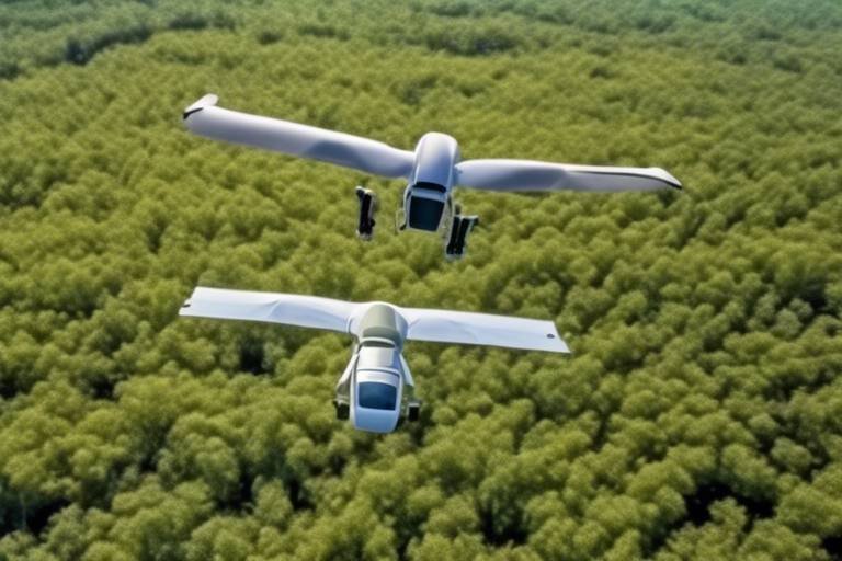
In the ever-evolving landscape of climate science, robotics technologies such as drones and autonomous underwater vehicles are playing a pivotal role in monitoring polar ice melt. These innovative tools are not just gadgets; they are revolutionary instruments that enable scientists to gather real-time data from some of the most extreme environments on Earth. Imagine being able to send a drone soaring over vast expanses of ice, capturing stunning aerial imagery while simultaneously collecting critical environmental data. This is not science fiction; it's happening right now!
One of the most exciting aspects of these technologies is their ability to operate in conditions that would be perilous for human researchers. With temperatures plummeting to extreme lows and unpredictable weather patterns, traditional methods of monitoring ice melt are often inadequate. However, robotic systems can be designed to withstand these harsh conditions, providing a reliable means of data collection. For instance, drones equipped with thermal cameras can detect temperature variations in ice, while autonomous underwater vehicles (AUVs) can navigate beneath the surface, gathering data on water temperature, salinity, and even ice thickness.
Moreover, the integration of advanced sensors into these robotic systems enhances their capabilities. These sensors can measure a variety of parameters, including:
- Ice Thickness: Essential for understanding the stability of ice sheets.
- Surface Temperature: Crucial for assessing melting rates.
- Water Quality: Important for studying the impact of melting ice on marine ecosystems.
As we delve deeper into the realm of robotics, the potential applications seem almost limitless. For example, the development of swarm robotics—where multiple drones or AUVs coordinate their efforts—can significantly enhance data collection efficiency. This approach allows for a more comprehensive analysis of large areas, ensuring that no ice formation goes unmonitored. Additionally, the use of machine learning algorithms in processing the data collected by these robots can lead to breakthroughs in understanding the complex dynamics of ice melt.
In conclusion, the role of robotics in monitoring polar ice melt is not just about gathering data; it's about transforming our understanding of climate change. With each technological advancement, we edge closer to unraveling the mysteries of our planet's changing climate, providing invaluable insights that can inform environmental policies and conservation efforts. The future looks bright, and as we harness the power of robotics, we take significant strides toward protecting our polar regions and, ultimately, our planet.
Data Collection Methods
When it comes to understanding the complexities of polar ice melt, the employed by robotic systems are nothing short of revolutionary. These methods not only enhance our grasp of ice dynamics but also provide critical insights into the broader implications of climate change. The combination of remote sensing, in-situ measurements, and satellite imagery creates a multi-faceted approach that allows scientists to monitor vast and often inaccessible areas of the polar regions.
Remote sensing techniques are particularly fascinating. They utilize satellite data and aerial imagery to assess various parameters such as ice cover, thickness, and movement. This allows researchers to efficiently monitor extensive regions that would otherwise be challenging to access. Imagine trying to take a photograph of a massive iceberg from a boat—you'd need to be close enough to capture the details, but remote sensing allows you to take that picture from miles away, offering a bird's-eye view of the ice's status.
The use of remote sensing techniques has transformed how we perceive changes in polar ice. For instance, satellite imagery analysis has become a cornerstone in identifying changes in ice extent over time. By examining historical satellite data, researchers can observe the rate of melting and correlate it with rising global temperatures. This is akin to looking at a time-lapse video of a glacier retreating; it provides a clear visual representation of the alarming pace at which our planet's ice is disappearing.
Satellite imagery analysis not only helps in tracking the extent of ice but also offers valuable insights into the intricate relationship between ice melt and climate variables. For example, researchers can analyze changes in ice thickness using advanced algorithms that process satellite data. This analysis is crucial for understanding the feedback loops that contribute to further warming—essentially, as ice melts, it exposes darker ocean water that absorbs more heat, leading to even more melting.
In addition to satellites, aerial drone surveys have emerged as a game-changer in polar research. Drones can be deployed for close-up inspections of ice formations, capturing high-resolution images and data that contribute to a better understanding of ice melt patterns. They act as the eyes in the sky, providing detailed snapshots of the ice's condition that satellites might miss. Drones can also navigate through challenging terrains and weather conditions, making them invaluable for researchers working in extreme environments.
While remote sensing provides a broad overview, in-situ measurements add depth to our understanding of ice dynamics. By deploying robots directly onto the ice, scientists can collect physical samples and environmental data. This ground-truthing process is essential for validating remote sensing observations. Think of it as having a friend verify what you see in a photo; it ensures that the data collected remotely truly reflects reality. In-situ measurements can include temperature readings, salinity levels, and ice core samples that reveal historical climate data.
In summary, the integration of these diverse data collection methods not only enhances our understanding of polar ice melt but also equips scientists with the tools needed to address the pressing challenges posed by climate change. As technology continues to advance, the synergy between robotics and climate science will undoubtedly lead to even more profound insights into our planet's delicate systems.
- What are the main types of data collection methods used in polar research?
The primary methods include remote sensing, in-situ measurements, and satellite imagery analysis. - How do drones contribute to polar ice monitoring?
Drones provide high-resolution images and data through close-up inspections, enabling detailed analysis of ice formations. - Why are in-situ measurements important?
They validate remote sensing observations by providing direct physical samples and environmental data from the ice.
Remote Sensing Techniques
Remote sensing techniques have become a cornerstone in the study of polar ice melt, providing researchers with the ability to gather extensive data without the need for direct contact with the ice itself. By leveraging advanced satellite technology and aerial imagery, scientists can monitor vast areas of the polar regions efficiently, capturing critical information that contributes to our understanding of climate change. Imagine being able to survey an entire continent from space, identifying changes in ice cover and thickness as if you were looking at a live feed. That's the power of remote sensing!
One of the most significant advantages of remote sensing is its ability to cover large geographical expanses quickly. Satellite systems, such as NASA's Landsat and ESA's Sentinel satellites, are equipped with high-resolution sensors that can capture detailed images of ice formations over time. These images allow researchers to track the extent of ice melt, assess the thickness of ice sheets, and observe movement patterns in real-time. This technology is not just about gathering data; it's about transforming how we understand the dynamics of the polar environment.
To illustrate the effectiveness of remote sensing, let's take a closer look at two primary methods: satellite imagery analysis and aerial drone surveys. Both methods complement each other, offering a comprehensive view of the ice melt phenomenon:
| Method | Description | Advantages |
|---|---|---|
| Satellite Imagery Analysis | Utilizes satellite data to assess large-scale ice cover changes. | Can monitor extensive areas, providing historical data for trend analysis. |
| Aerial Drone Surveys | Employs drones for close-up inspections of ice formations. | Captures high-resolution images and detailed data, enhancing understanding of local conditions. |
Satellite imagery analysis plays a crucial role in identifying changes in ice extent over time. By comparing images taken at different intervals, researchers can quantify the rate of melting and correlate it with rising global temperatures. This data is invaluable for understanding how quickly the polar regions are responding to climate change and what that means for global sea levels.
On the other hand, aerial drone surveys provide a unique perspective. Drones can fly low over ice formations, capturing high-resolution images and environmental data that satellites simply cannot. This close-up inspection allows scientists to observe intricate details of ice melt patterns, such as the formation of melt ponds and the structural integrity of ice shelves. The combination of both methods creates a robust dataset that significantly enhances our understanding of polar ice dynamics.
In conclusion, remote sensing techniques are revolutionizing how we monitor polar ice melt. By integrating satellite and aerial data, researchers can gain a comprehensive view of the changes occurring in these critical environments. As technology continues to evolve, we can expect even more sophisticated methods to emerge, further enriching our knowledge and ability to respond to the challenges posed by climate change.
- What are remote sensing techniques? Remote sensing techniques involve collecting data about an object or area from a distance, typically using satellites or drones, to monitor changes in the environment.
- How do satellites help in studying polar ice melt? Satellites provide high-resolution images that allow researchers to assess ice cover, thickness, and movement over large areas, making it easier to track changes over time.
- What is the role of drones in ice monitoring? Drones can perform close-up inspections of ice formations, capturing detailed images and data that enhance our understanding of local ice melt patterns.
Satellite Imagery Analysis
Satellite imagery analysis plays a pivotal role in understanding the dynamics of polar ice melt. By leveraging advanced satellite technology, scientists can capture comprehensive images of ice cover, thickness, and movement over vast areas. This capability is crucial because the polar regions are not only remote but also challenging to access. With high-resolution images, researchers can track changes in ice extent over time, providing a clearer picture of how global warming is affecting these delicate ecosystems.
One of the most significant advantages of using satellite imagery is the ability to monitor large expanses of ice without the need for extensive fieldwork, which can be both time-consuming and costly. For instance, satellites equipped with synthetic aperture radar (SAR) can penetrate cloud cover and capture detailed images regardless of weather conditions, ensuring that data collection is not hindered by the unpredictable polar climate.
Moreover, satellite imagery allows for the analysis of historical data, enabling scientists to compare current conditions with past records. This comparative analysis is essential for identifying trends in ice melt and understanding the implications for global sea levels. For example, studies have shown that the Arctic ice extent has decreased significantly over the past few decades, correlating with rising global temperatures.
To illustrate the importance of satellite imagery in climate research, consider the following aspects:
- Temporal Resolution: Satellites can capture images at regular intervals, allowing researchers to observe seasonal changes and long-term trends in ice melt.
- Geospatial Analysis: The geolocation capabilities of satellites enable precise mapping of ice dynamics, which is crucial for developing effective climate models.
- Data Integration: Satellite imagery can be combined with data from other sources, such as in-situ measurements and aerial surveys, to create a holistic view of the polar environment.
In conclusion, satellite imagery analysis is an invaluable tool in the fight against climate change. It empowers scientists with the capability to monitor and analyze polar ice melt in ways that were previously unimaginable. As technology continues to advance, the accuracy and detail of satellite imagery will only improve, further enhancing our understanding of the critical changes occurring in polar regions.
- What is satellite imagery? Satellite imagery refers to images of the Earth collected by satellites orbiting the planet, which can capture detailed visuals of land, water, and ice.
- How does satellite imagery help in climate research? It helps by providing data on ice cover, thickness, and movement, allowing researchers to track changes over time and analyze trends related to climate change.
- Can satellite imagery be used in bad weather? Yes, satellites equipped with synthetic aperture radar can capture images even under cloudy or stormy conditions.
- What are the limitations of satellite imagery? While satellite imagery is powerful, it may lack the fine detail provided by in-situ measurements and can be affected by factors such as satellite resolution and data processing capabilities.
Aerial Drone Surveys
Aerial drone surveys have transformed the way scientists study polar ice melt, offering a unique perspective that traditional methods simply can't match. Imagine soaring above the vast, icy expanses, capturing high-resolution images and data that reveal the hidden dynamics of these frozen landscapes. Drones equipped with cutting-edge technology allow researchers to conduct close-up inspections of ice formations, providing critical insights into the processes driving ice melt. This innovative approach not only enhances data quality but also significantly increases the efficiency of research efforts in these remote and challenging environments.
One of the remarkable advantages of using drones is their ability to cover large areas quickly while maintaining precision. Equipped with advanced cameras and sensors, these aerial vehicles can gather data on ice thickness, surface temperature, and even the presence of meltwater pools. This information is invaluable for understanding how climate change is impacting polar regions. For instance, researchers can analyze the data to identify patterns in ice melt and correlate them with rising global temperatures.
Furthermore, the flexibility of drone deployment allows scientists to conduct surveys at various times throughout the year, capturing seasonal changes that are crucial for long-term studies. These surveys can be conducted in areas that are otherwise difficult to access, such as crevasses or unstable ice shelves. By flying over these regions, drones can collect data that would be risky or impossible for human researchers to gather directly.
To illustrate the impact of aerial drone surveys, consider the following table that summarizes key benefits:
| Benefit | Description |
|---|---|
| High-Resolution Data | Drones capture detailed images and measurements, enhancing the understanding of ice dynamics. |
| Increased Efficiency | Surveys can cover large areas quickly, saving time and resources for researchers. |
| Access to Remote Areas | Drones can reach locations that are difficult or dangerous for humans to access, ensuring comprehensive data collection. |
| Seasonal Monitoring | Flexible deployment allows for continuous monitoring of ice conditions throughout different seasons. |
In conclusion, aerial drone surveys are not just a technological marvel; they are a vital tool in the fight against climate change. By providing real-time data and fostering a deeper understanding of polar ecosystems, drones play a crucial role in shaping our response to environmental challenges. As technology continues to advance, the potential for drones in climate monitoring will only grow, paving the way for more effective conservation strategies and policies.
- What types of drones are used for polar ice melt surveys?
Researchers typically use quadcopters and fixed-wing drones, which are equipped with high-resolution cameras and sensors to collect various types of data.
- How do drones improve data accuracy in ice melt studies?
Drones provide detailed, high-resolution images and measurements that allow for more precise assessments of ice thickness and surface conditions, enhancing the reliability of remote sensing data.
- Can drones operate in extreme weather conditions?
While drones are designed to withstand cold temperatures, extreme weather conditions like heavy snowfall or high winds can limit their operational capabilities.
- What is the future of drone technology in climate research?
Future advancements may include improved battery life, enhanced sensors, and AI integration, allowing for more sophisticated data analysis and monitoring capabilities.
In-Situ Measurements
In-situ measurements play a crucial role in understanding the dynamics of polar ice melt. By deploying advanced robotic systems directly onto the ice, scientists can collect physical samples and environmental data that are pivotal for validating remote sensing observations. This direct approach allows researchers to gather real-time information about the ice's properties, such as its thickness, density, and temperature, which are essential for creating accurate models of ice dynamics.
One of the most exciting aspects of in-situ measurements is the use of autonomous robots that can navigate the harsh polar environment. These robots are equipped with various sensors and instruments to monitor conditions that are otherwise challenging to measure accurately. For instance, they can analyze the composition of the ice and the underlying ocean water, providing insights into how melting ice is affecting marine ecosystems. This data is invaluable, as it helps scientists understand the broader implications of ice melt on global sea levels and climate patterns.
Moreover, in-situ measurements contribute significantly to the calibration and validation of satellite data. By providing ground-truthing for remote sensing observations, these measurements enhance the accuracy of climate models. For example, if a satellite detects a certain rate of ice melt, in-situ measurements can confirm or adjust these findings based on direct observations. This synergy between robotic systems and satellite data is essential for developing reliable climate forecasts.
To illustrate the importance of in-situ measurements, consider the following table that highlights the types of data collected by robotic systems:
| Data Type | Description | Significance |
|---|---|---|
| Ice Thickness | Measurement of the ice layer's depth. | Helps assess the volume of ice and predict melting rates. |
| Temperature Profiles | Temperature readings at various depths of the ice. | Indicates thermal dynamics affecting melting processes. |
| Salinity Levels | Measurement of salt concentration in the water beneath the ice. | Influences ocean circulation and marine life. |
In summary, in-situ measurements are indispensable for enhancing our understanding of polar ice melt. By utilizing robotic technology to capture detailed, on-the-ground data, scientists can bridge the gap between satellite observations and real-world conditions. This comprehensive approach not only improves the reliability of climate models but also aids in formulating effective environmental policies aimed at combating climate change.
- What are in-situ measurements? In-situ measurements involve collecting data directly from the environment, such as ice thickness and temperature, using robotic systems deployed in polar regions.
- How do in-situ measurements improve climate models? They provide ground-truthing for remote sensing data, enhancing the accuracy of predictions related to ice melt and climate change impacts.
- What types of robots are used for in-situ measurements? Various autonomous robots and drones are employed, equipped with sensors to gather data on ice properties and environmental conditions.
Impact on Climate Research
The integration of robotics in climate research is not just a technological advancement; it represents a paradigm shift in how we understand our planet's delicate ecosystems. By providing real-time data and unprecedented access to remote polar regions, robotic systems are enhancing our ability to study the effects of climate change on ice dynamics. This wealth of information is essential for developing more accurate climate models, which are crucial for predicting future environmental scenarios. Imagine trying to solve a complex puzzle without all the pieces—this is what climate scientists faced before the advent of robotic monitoring.
With the help of robotics, researchers can now gather data that was previously difficult or impossible to obtain. For example, autonomous underwater vehicles (AUVs) can dive beneath the ice to collect samples and measure water temperature, salinity, and other critical factors that influence ice melt. This direct measurement approach complements traditional methods, allowing for a more comprehensive understanding of how ice interacts with the ocean and atmosphere.
Moreover, the data collected by these robotic systems is not just beneficial for academic research; it also plays a vital role in shaping environmental policies. Accurate data on ice melt rates and their implications for global sea levels can influence governmental decisions and international agreements aimed at combating climate change. In essence, robotics is providing the evidence needed to drive policy changes that could protect our planet.
To illustrate the impact of robotics on climate research, consider the following table that summarizes key contributions:
| Robotic Technology | Contribution to Climate Research |
|---|---|
| Autonomous Underwater Vehicles (AUVs) | Collects in-situ data on ocean conditions affecting ice melt. |
| Drones | Conducts aerial surveys to capture high-resolution images of ice formations. |
| Remote Sensing Satellites | Monitors large areas of ice cover and thickness over time. |
This synergy between robotics and climate science is fostering a collaborative environment where engineers and scientists work hand-in-hand to innovate and improve monitoring techniques. As we face the pressing challenges of climate change, the role of robotics will only become more significant. It’s like having a new set of eyes that can see what was once hidden beneath layers of ice and snow, revealing the secrets of our planet's climate system.
- How do robotics contribute to climate research? Robotics provide real-time data and access to remote areas, enhancing our understanding of polar ecosystems and climate change impacts.
- What types of robots are used in polar research? Common robotic technologies include drones, autonomous underwater vehicles, and remote sensing satellites.
- Why is accurate climate data important? Accurate data is crucial for developing effective climate models and informing policy decisions aimed at mitigating climate change.
Enhanced Predictive Models
The integration of robotics in climate research has led to the development of that are crucial for understanding the implications of polar ice melt on global sea levels. These models are not just educated guesses; they are sophisticated tools that utilize real-time data gathered from various robotic systems, allowing scientists to make informed predictions about future climate scenarios. Imagine having a crystal ball that provides insights into the future of our planet based on current trends—this is essentially what these predictive models aim to achieve.
By analyzing data on ice melt rates, temperature fluctuations, and ocean currents, researchers can forecast how polar regions will respond to ongoing climate change. For instance, the data collected from autonomous underwater vehicles (AUVs) and drones can reveal patterns that were previously undetectable. This is akin to piecing together a giant puzzle; each piece of data contributes to a clearer picture of what is happening in these remote areas. As the models evolve, they incorporate more variables and refine their algorithms, resulting in predictions that are not only more accurate but also more reliable.
One of the key advantages of these enhanced predictive models is their ability to simulate different scenarios. For example, scientists can model how different levels of greenhouse gas emissions might impact ice melt and, consequently, global sea levels. This capability is crucial for policymakers who need to make decisions based on potential future conditions. The models can answer questions like:
- What happens to sea levels if the Arctic ice continues to melt at its current rate?
- How will coastal cities be affected in the next few decades?
- What mitigation strategies can be most effective in slowing down this process?
Furthermore, the collaboration between robotics engineers and climate scientists enhances the development of these models. By sharing insights and data, they can create algorithms that are specifically designed to interpret the unique challenges of polar environments. This interdisciplinary approach ensures that the models are not only scientifically sound but also tailored to the complexities of climate dynamics.
In conclusion, enhanced predictive models powered by robotic data are transforming our understanding of climate change and its effects on polar ice melt. They provide a roadmap for future research and policy decisions, highlighting the urgent need for action in the face of climate change. As technology continues to advance, we can expect these models to become even more precise, offering deeper insights into the challenges we face and guiding us toward effective solutions.
Q: How do robotic systems improve climate models?
A: Robotic systems collect real-time data from polar regions, which enhances the accuracy and reliability of climate models by providing critical information about ice melt rates and environmental conditions.
Q: What are the main challenges faced by robotic monitoring systems?
A: The main challenges include harsh environmental conditions, technical limitations such as battery life and communication issues, and the need for continuous maintenance to ensure data reliability.
Q: How can predictive models help in policymaking?
A: Predictive models simulate different climate scenarios, allowing policymakers to understand potential future impacts and make informed decisions about mitigation strategies and environmental policies.
Collaboration with Research Institutions
The synergy between robotics engineers and climate scientists is not just a partnership; it’s a powerful alliance that fuels innovation in the field of polar research. As the urgency to understand climate change intensifies, these collaborations have become essential for developing advanced robotic systems tailored specifically for monitoring and analyzing polar ice melt. Imagine scientists equipped with cutting-edge drones and autonomous underwater vehicles, all working in tandem to gather data that was once difficult, if not impossible, to obtain. This integration of expertise allows for a multidimensional approach to research, merging the technical prowess of robotics with the intricate knowledge of climate science.
One of the standout aspects of these collaborations is the sharing of resources and knowledge. Research institutions often provide the necessary funding and logistical support, while robotics engineers contribute their technical skills and innovative designs. This relationship not only accelerates the pace of research but also enhances the overall quality of data collected. For instance, the development of specialized sensors that can withstand extreme cold and harsh conditions is a direct result of engineers working closely with climate scientists to understand the specific needs of their research.
Moreover, collaborative projects often lead to groundbreaking discoveries that can reshape our understanding of polar ecosystems. For example, when engineers and scientists team up to deploy drones for aerial surveys, they can capture high-resolution imagery that reveals intricate details about ice formations and melt patterns. These insights can then be analyzed to improve predictive models of climate change, making the partnership even more impactful.
In addition to advancing technology, collaboration fosters a culture of innovation. Research institutions become hubs of creativity where ideas can flow freely between disciplines. This cross-pollination of ideas can lead to unexpected breakthroughs, such as the development of new methodologies for data collection or enhanced algorithms for data analysis. As an example, a recent project combined machine learning techniques with real-time data from robotic sensors, resulting in a significant improvement in the accuracy of ice melt predictions.
Ultimately, the collaboration between robotics engineers and research institutions is not just about technology; it’s about creating a comprehensive understanding of our planet’s changing climate. As these partnerships continue to evolve, they hold the promise of unlocking new insights that can inform policies aimed at mitigating climate change and protecting our fragile polar ecosystems.
- What role do robotics play in monitoring polar ice melt? Robotics provide real-time data and enhance research capabilities, allowing scientists to monitor ice melt more effectively.
- How do researchers collect data using robotics? Researchers employ various methods, including remote sensing, in-situ measurements, and aerial surveys, to gather comprehensive data on ice dynamics.
- What challenges do robotic systems face in polar environments? Harsh weather conditions, technical limitations, and maintenance needs can affect the reliability and efficiency of robotic monitoring systems.
- What is the future of robotics in climate research? The integration of AI and machine learning into robotic systems is expected to enhance data analysis and improve the accuracy of climate predictions.
Challenges in Robotic Monitoring
While the integration of robotics in monitoring polar ice melt represents a significant leap forward in climate research, it is not without its challenges. The extreme environments of the polar regions present unique hurdles that robotic systems must overcome to ensure accurate and reliable data collection. One of the primary challenges is the harsh environmental conditions that robots face. Temperatures can plummet to levels that are not only uncomfortable but also detrimental to electronic components. Ice and snow can obstruct sensors, while unpredictable weather can disrupt operations, making it essential for robotic designs to be robust and resilient.
Moreover, the technical limitations of these robotic systems can hinder their effectiveness. For instance, battery life remains a critical issue; many robotic devices struggle to maintain power in freezing temperatures, which can significantly reduce their operational time. Additionally, communication issues often arise in remote polar locations where traditional networks may be absent. Data processing capabilities also vary, and many systems require advanced algorithms to interpret the vast amounts of information they collect. These limitations necessitate ongoing research and development to enhance the reliability and efficiency of robotic monitoring systems.
The combination of these factors means that while robotics offer innovative solutions for monitoring polar ice melt, they also require continuous improvement and adaptation. Researchers must develop new materials and technologies that can withstand the rigors of polar conditions, as well as improve data transmission methods to ensure that valuable information is not lost. As scientists and engineers work together to tackle these challenges, the future of robotic monitoring in climate research will likely become more promising and effective.
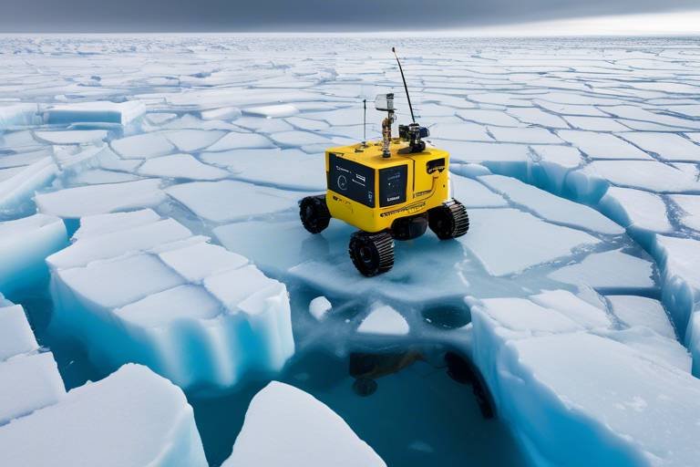
Robots deployed in polar regions must be designed to endure extreme cold, ice, and unpredictable weather. This necessitates the use of robust materials and innovative engineering solutions to ensure operational longevity and data integrity. For instance, many robotic systems are now being constructed with specialized coatings that prevent ice accumulation, while others are equipped with heating elements to maintain optimal operating temperatures.
The technical limitations of robotic monitoring systems are not just a minor inconvenience; they can significantly affect the reliability of the data collected. Battery life can be severely impacted by the cold, leading to shorter operational periods. Communication issues also pose a challenge, as the remote locations often make it difficult to transmit data back to researchers in real-time. Continuous advancements in technology are essential to overcoming these challenges and enhancing the effectiveness of robotic monitoring.
- What types of robots are used for monitoring polar ice melt?
Scientists primarily utilize drones and autonomous underwater vehicles (AUVs) for monitoring polar ice melt. These robots are equipped with advanced sensors to collect data on ice thickness, movement, and environmental conditions.
- How do robots withstand extreme temperatures?
Robots designed for polar environments often incorporate specialized materials and insulation to protect their electronic components. Some models even have built-in heating systems to maintain functionality in freezing conditions.
- What data do these robots collect?
Robots gather various types of data, including ice thickness, temperature, salinity, and other environmental parameters that help scientists understand the dynamics of ice melt and its implications for climate change.
Environmental Conditions
The polar regions are some of the most extreme environments on Earth, presenting unique challenges for robotic monitoring systems. When we think of the Arctic and Antarctic, images of vast, icy landscapes come to mind, but the reality is that these areas are fraught with unpredictable weather patterns and harsh conditions that can hinder even the most advanced robotic technologies. For instance, temperatures can plummet to below -30 degrees Celsius (-22 degrees Fahrenheit), and fierce winds can create blizzards that obscure visibility and disrupt communication systems.
Robots deployed in these regions must be designed to endure not only frigid temperatures but also the abrasive nature of ice and snow. This necessitates the use of robust materials and engineering techniques to ensure that the robots can withstand these harsh conditions without succumbing to wear and tear. Furthermore, the ice itself is not static; it shifts and cracks, creating a constantly changing landscape that can pose risks to robotic navigation and data collection efforts.
One of the most significant factors affecting robotic performance in polar regions is the unpredictability of weather. Researchers often face challenges such as:
- Whiteouts: Sudden snowstorms can reduce visibility to near zero, making navigation difficult.
- Ice Movement: The shifting ice can create obstacles or even trap robots, making retrieval a challenge.
- Temperature Variability: Fluctuations in temperature can affect battery life and the functionality of onboard systems.
Moreover, the need for continuous maintenance becomes critical in such environments. Robotic systems often require regular checks and repairs to ensure they remain operational. This maintenance can be logistically challenging, as the remote nature of polar regions means that access is limited, and resources are scarce. As a result, engineers are constantly innovating, striving to develop robots that can operate autonomously for extended periods while minimizing the need for human intervention.
In summary, while the integration of robotics in monitoring polar ice melt offers remarkable potential for advancing our understanding of climate change, the environmental conditions in these regions present formidable challenges. Engineers and scientists must collaborate closely to create resilient robotic systems capable of withstanding the rigors of the polar environment, ensuring that they can effectively gather the critical data needed to inform climate research and policy.
- What types of robots are used in polar monitoring?
Various robots, including drones and autonomous underwater vehicles, are employed to gather data on ice melt and environmental changes.
- How do robots withstand extreme cold?
Robots are designed with specialized materials and insulation to protect their components from freezing temperatures.
- What data do robots collect in polar regions?
Robots collect data on ice thickness, temperature, and movement, as well as environmental samples to analyze climate changes.
- Are robots able to operate autonomously?
Yes, many robotic systems are equipped with advanced navigation and data collection capabilities that allow them to operate with minimal human intervention.
Technical Limitations
While robotics have revolutionized the way we monitor polar ice melt, they are not without their challenges. One of the most pressing issues is the that can hinder the effectiveness of these systems. For instance, the harsh conditions of the polar regions, including extreme cold and unpredictable weather, can severely impact the performance and reliability of robotic devices.
Battery life is a significant concern; many robotic systems rely on batteries that can drain quickly in frigid temperatures. This limitation often necessitates frequent recharging or replacement, which is not always feasible in remote polar environments. Additionally, the communication capabilities of these robots can be compromised due to the vast distances and the presence of ice, which can obstruct signals. This results in intermittent data transmission, making it difficult for researchers to obtain real-time information.
Furthermore, the processing capabilities of these robots can also pose challenges. Many robotic systems are equipped with sensors that generate large amounts of data, but their ability to process this information on-site is often limited. This can lead to delays in data analysis, which is critical for timely decision-making in climate research. To address these issues, ongoing advancements in technology are essential. Researchers are continually working to develop more robust systems that can withstand the rigors of polar environments while improving battery efficiency and data processing capabilities.
In summary, while robotics offer exciting possibilities for monitoring polar ice melt, addressing these technical limitations is crucial for enhancing their operational efficiency. As technology evolves, we can expect to see innovations that will not only overcome these challenges but also push the boundaries of what is possible in climate monitoring.
- What types of robots are used for monitoring polar ice melt?
Various types of robots, including drones, autonomous underwater vehicles, and ground-based robots, are employed to monitor polar ice melt. Each type has its unique advantages in data collection.
- How do robots withstand harsh polar conditions?
Robots designed for polar environments are built with robust materials and insulation to withstand extreme cold and ice, ensuring they can operate effectively in these challenging conditions.
- What advancements are being made to improve robotic monitoring?
Advancements include integrating AI and machine learning for better data analysis, enhancing battery technology, and improving communication systems to ensure reliable data transmission.
Future Prospects of Robotics in Climate Monitoring
The landscape of robotics in climate monitoring is evolving at a breathtaking pace, and the future holds even more exciting possibilities. As we look ahead, the integration of advanced technologies such as artificial intelligence (AI) and machine learning into robotic systems is set to revolutionize how we collect and analyze data related to polar ice melt. Imagine a world where robots not only gather information but also learn from it, adapting their methods to improve the accuracy of their findings. This is not science fiction; it's the future of climate monitoring.
One of the most promising aspects of this evolution is the potential for next-generation robotic designs. These robots will likely feature enhanced mobility, allowing them to navigate the challenging terrains of polar regions with greater ease. With advancements in sensor technology, these robots will be able to collect a wider array of data, from temperature readings to ice thickness measurements, all in real-time. This multifaceted approach will provide researchers with a comprehensive understanding of the changing climate.
Furthermore, the incorporation of AI and machine learning will enable these robotic systems to analyze data more effectively. For instance, they can identify patterns in ice melt that humans might overlook, leading to more accurate predictions about future climate scenarios. The ability to process vast amounts of data quickly and efficiently means that scientists can respond to changes in the environment more rapidly than ever before.
However, with great promise comes significant challenges. As we develop these sophisticated robotic systems, we must also consider the need for ongoing innovation to overcome technical limitations. For example, enhancing battery life and improving communication capabilities in harsh environments are critical for the success of these initiatives. Continuous collaboration between robotics engineers and climate scientists will be essential to address these challenges and ensure that the technology remains reliable in the field.
In summary, the future of robotics in climate monitoring is bright and full of potential. As we harness the power of AI, machine learning, and next-generation designs, we can look forward to a more accurate and comprehensive understanding of polar ice melt. This knowledge will not only contribute to climate science but also inform effective environmental policies aimed at mitigating the impacts of climate change. The journey is just beginning, and with each advancement, we move closer to unveiling the mysteries of our planet's changing climate.
- What role do robotics play in monitoring polar ice melt?
Robotics play a crucial role by providing real-time data, enhancing research capabilities, and allowing scientists to monitor large areas efficiently. - How does AI improve robotic data collection?
AI enables robots to analyze data more effectively, identifying patterns and improving the accuracy of predictions related to climate change. - What are some challenges faced by robotic systems in polar regions?
Robotic systems face challenges such as extreme environmental conditions, technical limitations like battery life, and the need for continuous maintenance. - What advancements are expected in robotic designs for climate monitoring?
Next-generation robotic designs will focus on improved mobility, autonomy, and data collection efficiency to enhance monitoring capabilities.
AI and Machine Learning Integration
As we delve deeper into the realm of climate monitoring, the integration of Artificial Intelligence (AI) and Machine Learning (ML) with robotic systems is proving to be a game-changer. Imagine a world where robots not only gather data but also learn from it, adapting their methods and improving their efficiency over time. This is not just a futuristic dream; it’s happening now! By leveraging AI and ML, robotic systems can analyze vast amounts of data collected from polar regions, identifying patterns and trends that would be nearly impossible for humans to discern on their own.
One of the most exciting aspects of this integration is the ability to process real-time data. For instance, AI algorithms can evaluate ice melt rates by analyzing satellite imagery and drone data, allowing scientists to gain insights into how quickly our polar ice caps are disappearing. The ability to predict future scenarios based on current trends is invaluable, especially as we face the looming threat of climate change. With enhanced predictive capabilities, researchers can simulate various climate scenarios, helping policymakers make informed decisions that could mitigate the impacts of rising sea levels.
Moreover, the incorporation of deep learning techniques enables robotic systems to improve their accuracy over time. By continuously learning from new data, these systems can refine their algorithms, leading to more precise measurements of ice thickness, movement, and temperature fluctuations. For example, a robotic platform could initially struggle to differentiate between ice types but, through machine learning, it can become adept at recognizing subtle differences, thereby enhancing the reliability of its findings.
In addition to improving data analysis, AI and ML can also optimize the operational aspects of robotic monitoring. Robots equipped with intelligent navigation systems can autonomously adjust their paths based on environmental conditions, ensuring that they remain effective even in the face of unpredictable weather or shifting ice formations. This level of adaptability is crucial for conducting research in the harsh polar environments, where traditional methods may fail.
As we look toward the future, the potential for AI and ML in robotic systems is immense. The ongoing development of next-generation sensors and advanced algorithms will likely lead to even more sophisticated monitoring capabilities. Imagine fleets of drones and underwater vehicles working in tandem, sharing data in real-time and collaboratively analyzing the impacts of climate change on polar ice. This synergy could revolutionize our understanding of these critical ecosystems and drive significant advancements in environmental conservation efforts.
- What role does AI play in climate monitoring?
AI enhances data analysis, allowing for more accurate predictions about climate change impacts, particularly in polar regions. - How do machine learning algorithms improve data collection?
Machine learning algorithms learn from existing data, enabling robotic systems to adapt and refine their methods for better accuracy over time. - What challenges do robotic systems face in polar environments?
Robotic systems must withstand extreme cold and unpredictable weather, which can impact their performance and data reliability. - What are the future prospects for robotics in climate monitoring?
The future looks promising with advancements in AI, machine learning, and sensor technology, which will enhance data collection and analysis capabilities.
Next-Generation Robotic Designs
The future of robotic designs in climate monitoring is not just about making robots that can withstand harsh conditions; it's about creating intelligent systems that can adapt and respond to the dynamic environment of polar regions. These next-generation robots are being engineered with advanced materials and technologies that enhance their performance and durability. Imagine a robot that can navigate through thick ice, communicate with other devices, and analyze data in real-time—all while being powered by renewable energy sources. This is not science fiction; it's the direction in which robotic design is heading.
One of the most exciting aspects of these designs is their mobility. Engineers are focusing on creating robots that can traverse various terrains, from slippery ice sheets to uneven snowdrifts. This mobility is crucial for effective data collection, as it allows robots to reach remote areas that are otherwise inaccessible. For instance, some designs incorporate artificial intelligence to enhance navigation capabilities, enabling robots to make decisions on the fly, such as avoiding obstacles or optimizing their routes based on real-time environmental data.
Moreover, the integration of sensor technology is a game changer. Next-generation robots are equipped with a suite of sensors that can measure temperature, ice thickness, and even the chemical composition of the ice and water. This multi-sensor approach provides a comprehensive understanding of the polar environment, allowing scientists to gather more accurate data. For example, a robot might use thermal sensors to identify areas of melting ice while simultaneously using sonar to measure the thickness of the ice beneath the surface.
In addition to mobility and sensors, these robots are designed for autonomy. With advancements in machine learning, future robotic systems can operate with minimal human intervention. This autonomy is particularly beneficial in polar regions, where conditions can be unpredictable and dangerous for human researchers. Imagine deploying a fleet of autonomous robots that can work together, sharing data and findings in real-time, thus creating a network of information that enhances the overall understanding of climate change impacts.
Another key aspect is the focus on energy efficiency. Next-generation robots are being designed to utilize renewable energy sources, such as solar panels or wind turbines, to power their operations. This not only reduces their carbon footprint but also allows them to operate for extended periods without the need for frequent recharging. The goal is to create self-sustaining systems that can monitor ice melt continuously without significant downtime, providing a steady stream of valuable data.
As we look to the future, the collaboration between robotics engineers and climate scientists will be essential in driving these innovations. By working together, they can ensure that the designs meet the specific needs of climate research, ultimately contributing to a more sustainable and informed approach to environmental conservation. The next generation of robotic designs promises to be a pivotal tool in the fight against climate change, offering unprecedented opportunities to monitor and understand the critical changes occurring in our polar regions.
- What are next-generation robotic designs?
Next-generation robotic designs refer to advanced robots engineered with improved mobility, autonomy, and sensor technology specifically for monitoring polar environments. - How do these robots collect data?
These robots use a combination of sensors to measure various environmental factors such as temperature, ice thickness, and chemical composition, providing comprehensive data for climate research. - What role does artificial intelligence play in robotic monitoring?
Artificial intelligence enhances the robots’ ability to navigate and make autonomous decisions, allowing them to operate effectively in unpredictable conditions. - Are these robots environmentally friendly?
Yes, many next-generation robots are designed to utilize renewable energy sources, minimizing their carbon footprint while maximizing operational efficiency.
Frequently Asked Questions
- What types of robotics are used to monitor polar ice melt?
Robotics technologies such as drones and autonomous underwater vehicles are at the forefront of monitoring polar ice melt. These innovative tools allow scientists to collect real-time data and conduct research in some of the most extreme environments on Earth.
- How do remote sensing techniques work in ice monitoring?
Remote sensing techniques utilize satellite data and aerial imagery to assess various aspects of ice, including cover, thickness, and movement. This enables researchers to monitor large areas of polar regions efficiently, making it easier to track changes over time.
- What are in-situ measurements, and why are they important?
In-situ measurements involve deploying robots to collect physical samples and environmental data directly from the ice. These measurements are crucial as they provide ground-truthing for remote sensing observations, enhancing the overall accuracy of the data collected.
- How do robotics contribute to climate research?
The integration of robotics in climate research significantly enhances our understanding of polar ecosystems. By providing critical information on ice melt rates, robotic data helps scientists develop more accurate climate models and formulate effective environmental policies aimed at combating climate change.
- What challenges do robotic monitoring systems face?
Robotic monitoring systems encounter several challenges, including harsh environmental conditions, technical limitations, and the need for continuous maintenance. These factors can affect data reliability and operational efficiency, making it necessary to continuously innovate and improve these systems.
- What advancements are expected in the future of robotics for climate monitoring?
The future of robotics in climate monitoring looks promising, with ongoing advancements in AI, machine learning, and sensor technology. These innovations are expected to enhance data collection and analysis, leading to better predictions related to ice melt and climate change impacts.