How Satellites Enhance Disaster Response for Military Operations
In today's rapidly changing world, the impact of natural disasters can be devastating, particularly for military operations that must respond swiftly and effectively. Satellites have become indispensable tools in this arena, offering a wide array of capabilities that enhance disaster response. From real-time data collection to advanced communication systems, these orbital technologies are revolutionizing how military forces operate in crisis situations. Imagine being able to see the entire battlefield from above, pinpointing the exact locations where help is needed, and coordinating efforts seamlessly regardless of the chaos below. This article dives deep into the critical role satellites play in disaster response during military operations, highlighting their incredible capabilities, cutting-edge technologies, and the profound impact they have on strategic decision-making.
One of the most significant advantages satellites provide is real-time data collection. When a disaster strikes, every second counts, and having access to up-to-the-minute information can make all the difference. Satellites equipped with various sensors can assess the situation on the ground, capturing images and data that allow military forces to make informed decisions quickly and effectively. For instance, imagine a hurricane barreling towards a coastal city; satellites can monitor its path and intensity, enabling military planners to deploy resources where they are needed most. This capability is crucial in high-pressure scenarios, offering a clear view of the evolving situation and helping to prioritize responses.
Another pivotal aspect of satellite technology is its ability to enhance communication systems during disasters. Traditional communication networks often fail in the wake of catastrophic events, but satellite communication systems ensure reliable and uninterrupted connectivity. This means that military units can coordinate their efforts seamlessly, even in remote or heavily affected areas. Imagine a team of soldiers on the ground, surrounded by chaos, yet they can communicate directly with their command center without interruption. This level of connectivity is vital for effective disaster response.
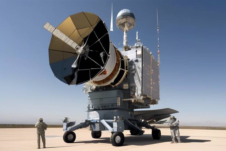
To further bolster communication capabilities, mobile satellite communication units can be deployed rapidly to support operations. These units are designed to be set up quickly in the field, ensuring that troops remain connected and can relay critical information back to command centers. This adaptability is essential in dynamic disaster environments where conditions can change rapidly.
In disaster zones, satellite phones serve as a lifeline for military personnel. When traditional networks are compromised or unavailable, these phones provide a reliable means of communication. They allow soldiers to maintain contact with their teams and command structures, ensuring that vital information flows freely even in the most challenging conditions.
Moreover, data relay satellites facilitate the transfer of information between ground units and command centers. This capability enhances situational awareness and operational efficiency during disaster response efforts. By relaying data in real-time, military planners can adjust strategies on the fly, responding to new developments as they arise.
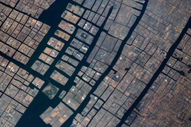
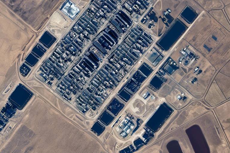
Satellites equipped with advanced imaging technology provide geospatial intelligence that is crucial for military planners. Understanding the terrain and infrastructure affected by disasters is key to formulating effective response strategies. A satellite's ability to capture high-resolution images allows military leaders to visualize the extent of damage and identify key areas that require immediate attention. This intelligence is invaluable for planning operations that are both efficient and effective.
In the aftermath of a disaster, search and rescue operations become a top priority, and satellites play a crucial role in this process. By offering aerial imagery and tracking capabilities, satellites assist in locating survivors and assessing damage. The ability to see the big picture from above can guide rescue teams to areas where people may be trapped or in need of assistance.
One of the standout features of satellite technology is thermal imaging. Satellites equipped with thermal sensors can detect heat signatures, which is invaluable for locating individuals trapped under debris or in remote areas following a disaster. Imagine a satellite scanning a devastated landscape and identifying the faint heat of a survivor, allowing rescuers to focus their efforts precisely where they are needed.
Satellite mapping technologies provide detailed visualizations of affected areas. This capability allows military responders to prioritize resources and plan their operations effectively. By analyzing maps generated from satellite data, military planners can identify critical infrastructure, such as hospitals and evacuation routes, ensuring that aid reaches those who need it most.
Beyond immediate response efforts, satellite data enables military organizations to engage in predictive analytics. By analyzing historical data and current conditions, military planners can forecast potential disaster scenarios, enabling proactive measures to mitigate risks and enhance readiness. This forward-thinking approach can save lives and resources in the face of impending disasters.
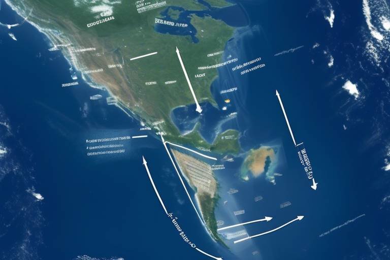
Satellites also play a significant role in weather monitoring. By tracking weather patterns, they provide critical information that can influence military operations and disaster response strategies, especially in rapidly changing environments. Understanding weather forecasts allows military leaders to adjust their plans accordingly, ensuring that they are prepared for any eventuality.
Finally, satellite data assists in understanding the impacts of climate change. As environmental threats evolve, military planners must adapt their disaster response strategies to emerging risks. Satellites provide the necessary insights to inform these adaptations, ensuring that military operations remain effective in the face of changing climate conditions.
- How do satellites gather real-time data during disasters?
Satellites use various sensors and imaging technologies to capture data from the ground, which is then transmitted back to military command centers for analysis. - What are the benefits of using satellite communication during military operations?
Satellite communication provides reliable connectivity, ensuring that military units can coordinate their efforts seamlessly, even in remote or disaster-affected areas. - Can satellites help in predicting future disasters?
Yes, by analyzing historical and current data, satellites enable military organizations to forecast potential disaster scenarios and prepare accordingly.
Real-Time Data Collection
When disaster strikes, every second counts. This is where satellites come into play, acting as the military’s eyes in the sky. They provide real-time data that is absolutely essential for assessing disaster situations. Imagine being in a chaotic environment where communication is spotty, and traditional data sources are compromised. Satellites swoop in to offer a lifeline, delivering critical information that enables military forces to make informed decisions quickly and effectively. This capability is vital in high-pressure scenarios where the stakes are incredibly high.
Satellites utilize advanced technologies, such as remote sensing and synthetic aperture radar, to gather data from vast areas. They can capture images and collect data on various environmental factors, including weather conditions, terrain changes, and even the movement of people. This is not just about gathering information; it’s about transforming that data into actionable insights. For instance, during a natural disaster like a hurricane or earthquake, satellites can help identify the most affected areas, allowing military planners to allocate resources more effectively.
Furthermore, the integration of artificial intelligence and machine learning with satellite data has revolutionized the way military operations are conducted during disasters. By analyzing patterns and predicting outcomes based on real-time data, military units can enhance their response strategies. This predictive capability is crucial; it allows for a proactive approach rather than a reactive one. For example, if satellite data indicates rising floodwaters in a particular region, military forces can mobilize resources ahead of time to assist affected communities.
To illustrate the significance of real-time data collection, consider the following table that outlines the types of data collected by satellites and their applications in disaster response:
| Type of Data | Application in Disaster Response |
|---|---|
| Imagery Data | Assessing damage and identifying affected areas |
| Weather Data | Forecasting severe weather conditions |
| Thermal Data | Locating survivors through heat signatures |
| Geospatial Data | Mapping infrastructure and planning routes for aid delivery |
In conclusion, real-time data collection through satellites not only enhances situational awareness but also empowers military operations to respond effectively to disasters. The ability to access and analyze data in real time can be the difference between life and death, making satellites an invaluable asset in disaster response efforts.
Enhanced Communication Systems
In the chaotic aftermath of a disaster, communication is not just important; it’s absolutely critical. Military operations rely heavily on that can withstand the pressures of unpredictable environments. Traditional communication networks often fail during disasters, leaving military units isolated and unable to coordinate effectively. This is where satellite communication systems come into play, ensuring that communication remains reliable and uninterrupted, no matter the circumstances.
Imagine a situation where a natural disaster has struck a remote area, cutting off all conventional lines of communication. In such scenarios, military forces can deploy mobile satellite communication units that can be set up within minutes. These units are equipped with advanced technology that allows troops to remain connected to command centers, providing real-time updates and receiving critical instructions. This capability is akin to having a lifeline in a stormy sea, ensuring that every soldier can navigate their way through the chaos with clear guidance.
Moreover, satellite phones have become essential tools for military personnel operating in disaster zones. These devices function independently of ground-based networks, making them invaluable when traditional communication infrastructures are compromised. With a satellite phone in hand, a soldier can reach out for help or relay vital information about the situation on the ground, even from the most isolated locations. It’s a bit like having a direct line to the command center—no matter where you are, help is just a call away.
In addition to mobile units and satellite phones, data relay satellites play a pivotal role in enhancing communication. These satellites facilitate the transfer of information between ground units and command centers, significantly improving situational awareness. When military responders can see the big picture, they can make better decisions. For instance, if a unit reports a sudden change in the landscape due to a landslide, the command center can quickly analyze the data and adjust their response accordingly. This is not just about communication; it’s about creating a comprehensive operational strategy that saves lives.
The integration of these advanced communication technologies equips military forces to operate efficiently in disaster-stricken areas. The ability to communicate effectively can mean the difference between life and death, making these systems indispensable in military operations. As the world becomes increasingly unpredictable, the reliance on enhanced communication systems will only grow, ensuring that military units can respond swiftly and effectively to any crisis.
Mobile Communication Units
In the chaotic aftermath of a disaster, every second counts, and that’s where come into play. These units are like the Swiss Army knives of military communication, designed to be deployed rapidly and efficiently in any environment. Imagine being in a situation where traditional communication lines are down, and you need to coordinate rescue operations or relay critical information back to your command center. Mobile Communication Units ensure that military personnel can stay connected, no matter how dire the circumstances.
These units are equipped with advanced satellite communication technology that can be set up in minutes, allowing for seamless communication even in the most remote or devastated areas. The setup typically includes portable satellite dishes, ruggedized communication equipment, and sometimes even mobile command centers. This versatility means that they can adapt to various terrains and operational needs, making them invaluable in disaster response scenarios.
One of the standout features of Mobile Communication Units is their ability to provide a robust network that can support multiple users simultaneously. This is crucial during emergencies when numerous teams may need to communicate at once. The technology allows for voice, video, and data transmission, which means that military units can share real-time updates, coordinate logistics, and make informed decisions on the fly. Here’s a quick look at the key components of these units:
| Component | Description |
|---|---|
| Satellite Dish | Portable and quickly deployable for establishing satellite links. |
| Communication Equipment | Includes radios, intercoms, and other devices for voice and data transmission. |
| Mobile Command Center | A vehicle or tent equipped to manage operations on-site. |
Moreover, the integration of with existing military infrastructure enhances overall operational efficiency. These units can connect with data relay satellites, ensuring that information flows smoothly from the ground to the command center and vice versa. This capability is crucial for maintaining situational awareness and making strategic decisions based on the latest data available.
In conclusion, Mobile Communication Units are not just a luxury; they are a necessity in disaster response. They are the backbone of military operations in times of crisis, ensuring that communication remains intact when it matters the most. With their ability to adapt to challenging environments and provide reliable connectivity, these units empower military personnel to act swiftly and effectively, ultimately saving lives and mitigating the impact of disasters.
- What are Mobile Communication Units?
Mobile Communication Units are portable communication systems that can be rapidly deployed in disaster zones to maintain communication between military personnel and command centers. - How quickly can these units be set up?
Mobile Communication Units can typically be set up within minutes, allowing for immediate communication capabilities in emergencies. - What technologies do these units use?
They use advanced satellite communication technology, including portable satellite dishes and ruggedized communication equipment. - Can multiple users communicate at once?
Yes, these units can support multiple users simultaneously, facilitating efficient coordination during operations.
Satellite Phones
are indispensable tools for military personnel operating in disaster zones. When traditional communication networks fail—whether due to infrastructure damage, power outages, or overwhelming demand—these devices remain operational, ensuring that troops can maintain contact with command centers and coordinate their efforts effectively. Imagine being in a situation where every second counts, and the only lifeline to your base is through a robust satellite phone. That’s the reality for many military units deployed in crisis situations.
Equipped with advanced technology, satellite phones utilize satellites orbiting the Earth to transmit signals, allowing users to make calls from virtually anywhere on the globe. This capability is crucial in disaster-stricken areas where conventional cell towers may be down or non-existent. Moreover, the reliability of satellite communication systems means that military operators can share vital information, such as troop movements, resource needs, and situational updates, without the fear of losing connectivity.
But what makes satellite phones particularly unique? Here are a few key features:
- Global Coverage: Unlike regular mobile phones that rely on local towers, satellite phones can connect from remote locations, even in the most challenging environments.
- Durability: Designed to withstand harsh conditions, these phones are often ruggedized to endure extreme temperatures, moisture, and impacts.
- Emergency Features: Many satellite phones come equipped with emergency SOS functions that can alert authorities or command centers in critical situations.
In addition to their primary function of voice communication, satellite phones can also facilitate data transfer, enabling troops to send and receive messages, images, and other critical information. This capability is particularly valuable for intelligence gathering and operational planning, as it allows military leaders to make informed decisions based on real-time data. With the ability to stay connected, military personnel can adapt their strategies swiftly, ensuring that they are always a step ahead, even in the chaos of disaster response.
In conclusion, satellite phones are not just communication devices; they are lifelines that empower military operations during disasters. As technology continues to evolve, these phones are becoming more accessible and feature-rich, further enhancing their role in ensuring the safety and efficiency of military teams in the field.
Q1: How do satellite phones work?
A1: Satellite phones work by connecting directly to satellites orbiting the Earth, allowing for communication from virtually any location, regardless of terrestrial infrastructure.
Q2: Are satellite phones expensive to use?
A2: Yes, satellite phones can be costly, not only in terms of the initial purchase but also due to higher call rates compared to traditional mobile networks. However, their reliability in emergencies justifies the expense.
Q3: Can satellite phones send text messages?
A3: Yes, many satellite phones have the capability to send and receive text messages, in addition to voice calls, which is crucial for operational communication.
Q4: Do satellite phones work in all countries?
A4: Satellite phones generally work globally, but some countries have regulations regarding their use, so it’s essential to check local laws before deployment.
Data Relay Satellites
Data relay satellites are a cornerstone of modern military operations, especially in the context of disaster response. These satellites act as vital conduits, facilitating the seamless flow of information between ground units and command centers. Imagine a bustling command center, where decisions must be made at lightning speed; data relay satellites ensure that every piece of critical information is transmitted quickly and accurately, allowing military leaders to respond effectively to evolving situations.
One of the most impressive aspects of data relay satellites is their ability to operate in environments where traditional communication networks may be compromised. When a disaster strikes, the infrastructure that typically supports communication can be severely damaged, leaving ground troops isolated. This is where data relay satellites shine, providing a reliable means of communication that transcends the limitations of terrestrial networks. They ensure that frontline personnel can share vital updates, coordinate efforts, and receive instructions without delay.
Furthermore, these satellites are equipped with advanced technologies that enhance their capabilities. For instance, they can transmit data in various formats, including voice, video, and telemetry. This versatility allows military units to choose the most effective way to communicate based on the situation at hand. Whether it’s sending live video feeds from a disaster zone or relaying critical sensor data, data relay satellites adapt to meet the needs of military operations.
To illustrate their importance, consider the following table that highlights the key features and benefits of data relay satellites:
| Feature | Description | Benefits |
|---|---|---|
| Real-Time Communication | Facilitates instant communication between ground units and command centers. | Enables quick decision-making and response. |
| Multi-Format Data Transmission | Supports voice, video, and telemetry data. | Enhances situational awareness and operational efficiency. |
| Robust Connectivity | Operates independently of terrestrial networks. | Ensures communication remains intact during disasters. |
In summary, data relay satellites are indispensable tools for military operations, particularly during disaster response scenarios. They not only enhance communication but also bolster situational awareness, allowing military personnel to navigate the complexities of disaster-stricken areas. By providing a reliable link between ground units and command centers, these satellites play a crucial role in ensuring that every decision is informed and timely, ultimately saving lives and resources in the process.
- What are data relay satellites?
Data relay satellites are communication satellites that facilitate the transfer of information between ground units and command centers, especially in remote or disaster-affected areas. - How do data relay satellites improve military operations?
They enhance communication, provide real-time data transmission, and ensure that military units can coordinate effectively even in challenging environments. - Can data relay satellites operate without terrestrial networks?
Yes, data relay satellites function independently of terrestrial networks, making them essential during disasters when traditional communication lines are down.
Geospatial Intelligence
When it comes to disaster response, (GEOINT) stands as a pillar of effective military operations. Imagine being in a chaotic environment, where every second counts, and you need to make crucial decisions based on the most accurate and timely information available. This is where satellites equipped with advanced imaging technology come into play, transforming raw data into actionable insights. By capturing high-resolution images of affected areas, these satellites provide military planners with a comprehensive understanding of the terrain, infrastructure, and the extent of the damage caused by disasters.
One of the remarkable aspects of geospatial intelligence is its ability to offer a bird's-eye view of the situation on the ground. This perspective is invaluable for several reasons:
- Terrain Analysis: Military planners can assess the geographical features that may impact rescue operations, such as mountains, rivers, and urban layouts. This knowledge enables them to devise strategies that navigate these challenges effectively.
- Infrastructure Assessment: Understanding the state of critical infrastructure—like roads, bridges, and hospitals—helps in prioritizing areas for immediate assistance. For instance, if a major road is blocked, alternative routes can be identified quickly.
- Resource Allocation: By visualizing the most severely affected regions, military units can allocate resources more efficiently, ensuring that help reaches those in dire need without unnecessary delays.
Moreover, the integration of with other data sources enhances situational awareness. For example, combining satellite imagery with real-time weather data can provide insights into how environmental conditions may change and affect ongoing operations. This synergy not only improves response times but also increases the chances of successful outcomes.
To illustrate the importance of geospatial intelligence in military disaster response, consider a recent scenario where a natural disaster struck a coastal region. The military utilized satellite imagery to identify flooded areas, assess damage to infrastructure, and locate stranded individuals. With this information in hand, they were able to deploy rescue teams efficiently, ultimately saving lives and minimizing further complications.
In conclusion, geospatial intelligence is more than just a technological marvel; it's a critical component of military operations during disasters. By leveraging satellite capabilities, military planners can enhance their decision-making processes, ensuring they are well-prepared to face the challenges of disaster response head-on.
- What is geospatial intelligence?
Geospatial intelligence is the collection and analysis of data related to geographic locations and features, often utilized for military planning and disaster response. - How do satellites contribute to geospatial intelligence?
Satellites capture high-resolution images and data that help military planners assess terrain, infrastructure, and the impact of disasters. - Why is real-time data important in disaster response?
Real-time data allows military forces to make informed decisions quickly, which is crucial in high-pressure situations where every second counts.
Search and Rescue Operations
In the chaotic aftermath of a disaster, time is of the essence. become a race against the clock, where every second counts. This is where satellites step in as unsung heroes, providing critical support that can mean the difference between life and death. Imagine a vast landscape, devastated by an earthquake or a hurricane, with debris scattered everywhere. How do military responders efficiently locate survivors amid such destruction? The answer lies in the powerful capabilities of satellite technology.
Satellites equipped with advanced imaging technology offer aerial imagery that is invaluable for search and rescue missions. These satellites can capture high-resolution images of affected areas, allowing military planners to assess the extent of damage and identify potential hotspots where survivors might be trapped. By analyzing these images, teams can prioritize their efforts, directing resources to the most critical locations first. This strategic approach not only saves time but also maximizes the chances of successful rescues.
Moreover, satellites are not just passive observers; they actively contribute to the search efforts through their tracking capabilities. Utilizing GPS technology, satellites can help pinpoint the locations of distress signals emitted by individuals in need of assistance. For instance, if a group of hikers is stranded in a remote area after a landslide, their emergency beacons can be detected by satellites, allowing military units to swiftly navigate to their location. This fusion of technology and human effort creates a powerful synergy that enhances the effectiveness of rescue operations.
One of the standout features of satellite technology in search and rescue operations is thermal imaging. This capability allows satellites to detect heat signatures from a distance, which is particularly useful for locating individuals trapped under rubble or in hard-to-reach areas. Picture a scene where a building has collapsed, leaving survivors buried beneath the debris. Traditional search methods may take hours or even days, but with thermal imaging, rescuers can spot the heat emitted by a person’s body, guiding them to the exact location in a fraction of the time. This technology is a game-changer, turning what could be a desperate wait into a swift rescue.
Another significant advantage of satellite technology is its ability to create detailed maps of affected regions. Using satellite mapping technologies, military responders can visualize the landscape and understand the challenges they face. These maps can highlight critical infrastructure, such as roads, bridges, and hospitals, enabling teams to plan their operations effectively. For example, if a bridge is damaged, responders can reroute their efforts to ensure they reach those in need without unnecessary delays. The clarity and precision of satellite maps empower military personnel to make informed decisions on the ground, enhancing their operational efficiency.
In conclusion, the role of satellites in search and rescue operations cannot be overstated. They provide essential data that helps military units navigate the complexities of disaster response. With the ability to capture aerial imagery, track distress signals, and create detailed maps, satellites enhance situational awareness and operational effectiveness. As technology continues to evolve, we can only expect these capabilities to improve, further solidifying the role of satellites as vital assets in saving lives during disasters.
- How do satellites assist in locating survivors?
Satellites provide aerial imagery and tracking capabilities that help identify potential survivor locations, enabling military units to prioritize their search efforts. - What is thermal imaging, and how is it used in rescue operations?
Thermal imaging detects heat signatures, allowing rescuers to locate individuals trapped under debris or in remote areas quickly. - Can satellites help in planning rescue operations?
Yes, satellites create detailed maps of affected areas, highlighting critical infrastructure and guiding responders in their operational planning.
Thermal Imaging
In the chaotic aftermath of a disaster, every second counts, and the ability to locate survivors can mean the difference between life and death. This is where thermal imaging satellites shine. These advanced satellites are equipped with technology that detects heat signatures, allowing military personnel to identify individuals trapped under rubble or in remote locations. Imagine a scene where traditional search methods are hampered by debris or darkness. Thermal imaging cuts through the confusion, revealing hidden life signs that would otherwise remain invisible.
Thermal imaging works by picking up the infrared radiation emitted by objects, which is particularly useful in disaster scenarios. For instance, when buildings collapse, the temperature difference between the human body and the surrounding debris becomes a beacon for rescue teams. The technology can detect even the faintest heat signature, making it an invaluable asset in search and rescue operations. In essence, it acts like a superhero's x-ray vision, allowing rescuers to see what lies beneath the surface.
Moreover, the integration of thermal imaging into military operations enhances situational awareness significantly. Military planners can utilize the data obtained from thermal satellites to create detailed maps of affected areas, highlighting hotspots where survivors might be located. This capability not only streamlines the search process but also aids in resource allocation, ensuring that every available asset is directed toward the most critical needs.
To further illustrate the impact of thermal imaging, consider the following table that summarizes its key benefits:
| Benefit | Description |
|---|---|
| Rapid Detection | Identifies heat signatures quickly, allowing for faster rescue operations. |
| Visibility in Darkness | Operates effectively in low-light conditions, making it ideal for nighttime rescues. |
| Remote Monitoring | Can cover vast areas from space, reducing the need for ground search teams in hazardous environments. |
| Data Integration | Works in conjunction with other technologies, such as drones and ground units, for comprehensive situational analysis. |
As we look to the future, the role of thermal imaging in military disaster response will only grow. With advancements in satellite technology, we can expect even greater accuracy and efficiency in locating survivors. The combination of thermal imaging with other data analytics tools will enable military planners to anticipate challenges and devise strategies that save lives. In essence, thermal imaging is not just a tool; it is a lifeline that connects hope with action in the direst of circumstances.
- What is thermal imaging?
Thermal imaging is a technology that detects infrared radiation emitted by objects, allowing for the visualization of heat signatures. - How does thermal imaging help in disaster response?
It enables rescue teams to locate survivors under debris or in remote areas by identifying their heat signatures, especially in low visibility conditions. - Can thermal imaging be used at night?
Yes, thermal imaging is particularly effective at night as it does not rely on visible light, making it invaluable for nighttime rescue operations. - How do military planners use thermal imaging data?
Military planners utilize thermal imaging data to create maps of affected areas, prioritize rescue efforts, and allocate resources effectively.
Mapping Affected Areas
When disaster strikes, the ability to visualize the impact on the ground can mean the difference between life and death. Satellite mapping technologies provide military responders with detailed visualizations of affected areas, allowing them to assess damage, prioritize resources, and formulate effective response strategies. Imagine trying to navigate a maze blindfolded; without a clear map, it would be nearly impossible to find your way. This is precisely why satellite imagery is so crucial in disaster scenarios.
By leveraging high-resolution images captured from space, military planners can identify key infrastructure that may have been compromised, such as roads, bridges, and hospitals. This information is vital for determining the best routes for rescue operations and logistics. Furthermore, satellite mapping can highlight areas that are still accessible versus those that are completely cut off, enabling a more strategic allocation of resources.
One of the most significant advantages of satellite mapping is its ability to provide a comprehensive overview of a disaster zone in a short amount of time. For instance, after a hurricane, satellite images can reveal the extent of flooding and the locations of landslides or debris fields. This rapid assessment allows military units to deploy personnel and equipment where they are needed most, rather than wasting time on areas that are less affected. In addition, satellite data can be integrated with other technologies, such as Geographic Information Systems (GIS), to create interactive maps that can be updated in real-time as new information comes in.
Moreover, the use of geospatial intelligence derived from satellite mapping can enhance collaboration between various military units and civilian organizations involved in disaster response. By sharing maps and data, all parties can operate with a unified understanding of the situation, which is critical for effective coordination. The result is a more cohesive and efficient response effort that can save lives and reduce suffering.
In summary, mapping affected areas through satellite technology is not just about drawing lines on a map; it's about creating a lifeline for those in need. It empowers military responders with the information they need to make informed decisions swiftly and effectively, ultimately leading to better outcomes in disaster situations.
- How do satellites capture images of disaster zones?
Satellites use a variety of imaging technologies, including optical and radar systems, to capture detailed images of the Earth's surface. These images are then processed and analyzed to provide valuable insights into affected areas. - Can satellite data be used in real-time?
Yes, many satellite systems are capable of providing near real-time data, which is essential for timely decision-making during disaster response operations. - What other technologies complement satellite mapping?
Technologies such as Geographic Information Systems (GIS), drones, and ground-based sensors can complement satellite mapping by providing additional layers of data and enhancing situational awareness.
Predictive Analytics
In the realm of military operations, has emerged as a game-changer, especially when it comes to disaster response. Imagine being able to anticipate the next big storm or earthquake before it strikes! This capability is not just a fantasy; it’s a vital tool that allows military organizations to prepare and respond effectively to potential disasters. By leveraging satellite data, military planners can engage in predictive modeling to understand various disaster scenarios. This involves analyzing historical data, current trends, and environmental factors to forecast potential threats.
One of the key benefits of predictive analytics is its ability to enhance readiness. With accurate forecasts, military units can mobilize resources, conduct training exercises, and establish contingency plans, all before a disaster even occurs. This proactive approach not only saves time but also significantly improves the chances of successful intervention when disaster strikes. For instance, if satellite data indicates an impending hurricane, military planners can pre-position assets and personnel in strategic locations to ensure rapid response.
Moreover, the integration of real-time satellite data with predictive analytics allows for dynamic adjustments to strategies as situations evolve. This means that if conditions change suddenly—like a shift in the path of a storm—military leaders can quickly adapt their plans. The synergy between predictive analytics and satellite technology creates a powerful framework for decision-making.
To give you a clearer picture, let’s look at how predictive analytics can be applied in various scenarios:
| Scenario | Predictive Analytics Application | Expected Outcome |
|---|---|---|
| Hurricane Forecasting | Analyzing wind patterns and sea temperatures | Pre-positioning of relief supplies and personnel |
| Earthquake Preparedness | Studying fault lines and historical seismic activity | Enhanced building codes and emergency drills |
| Flood Risks | Monitoring rainfall and river levels | Evacuation orders issued in a timely manner |
Additionally, weather monitoring plays a crucial role in predictive analytics. Satellites equipped with advanced sensors can track weather patterns and provide military planners with critical information that influences their operational strategies. For example, if a satellite detects a sudden drop in temperature and increased snow accumulation in a mountainous region, military units can prepare for potential avalanches or difficult travel conditions. This kind of foresight is invaluable, particularly in rapidly changing environments where every second counts.
As climate change continues to impact our planet, predictive analytics is also essential for adapting military strategies. Understanding how shifting climate patterns affect disaster frequency and intensity allows military organizations to refine their response tactics. By analyzing satellite data on changing weather trends, military planners can better prepare for the emerging threats posed by climate change. This foresight not only enhances operational readiness but also ensures that military forces can effectively support civilian authorities during disasters.
In conclusion, predictive analytics powered by satellite data is revolutionizing the way military operations respond to disasters. By anticipating threats, adapting strategies, and improving readiness, military organizations can significantly enhance their effectiveness in disaster response scenarios. The future of military disaster response relies heavily on this innovative approach, ensuring that when the next crisis arises, they are more prepared than ever.
- What is predictive analytics in military operations?
Predictive analytics involves using historical data and satellite information to forecast potential disaster scenarios, enabling proactive measures for military response.
- How do satellites contribute to predictive analytics?
Satellites provide real-time data on weather patterns, environmental changes, and other critical factors that inform predictive models.
- Can predictive analytics improve disaster response times?
Yes, by anticipating disasters and preparing resources in advance, predictive analytics can significantly reduce response times during emergencies.
Weather Monitoring
When it comes to military operations, is not just a matter of convenience; it's a matter of survival and success. Imagine preparing for a critical mission, only to be blindsided by an unexpected storm or adverse weather conditions. This is where satellites come into play, offering a comprehensive view of weather patterns that can significantly impact military strategies. By utilizing advanced satellite technology, military planners can access real-time data on atmospheric conditions, which is crucial for making informed decisions in the field.
Satellites equipped with meteorological instruments can track various weather phenomena, including hurricanes, tornadoes, and precipitation patterns. This data not only helps in understanding current conditions but also aids in forecasting future scenarios. For example, the ability to predict the path of a storm allows military units to adjust their plans accordingly, ensuring that personnel and resources are not caught off guard. This predictive capability is akin to having a crystal ball that reveals the weather's intentions, allowing for proactive measures to be implemented.
Moreover, the integration of satellite data with ground-based weather stations enhances the accuracy of forecasts. By combining information from multiple sources, military operations can gain a clearer picture of the environmental landscape. This is particularly important in regions where traditional weather monitoring is limited or non-existent. With satellites, military forces can maintain situational awareness, which is vital for mission success.
To illustrate the impact of weather monitoring on military operations, consider the following table that highlights key weather-related factors and their implications:
| Weather Factor | Implications for Military Operations |
|---|---|
| Severe Storms | Can delay missions and endanger personnel. |
| High Winds | Affect air support and the use of drones. |
| Temperature Extremes | Impact equipment functionality and troop health. |
| Visibility Issues | Hinder reconnaissance and movement. |
In summary, the role of satellites in for military operations cannot be overstated. They provide the critical data needed to adapt to changing conditions, ensuring that military planners can devise effective strategies that account for the unpredictable nature of the environment. Just as a ship captain relies on navigational charts to steer through treacherous waters, military leaders depend on satellite data to guide their operations through the storms of uncertainty.
- How do satellites collect weather data? Satellites collect weather data through various instruments that measure temperature, humidity, cloud cover, and other atmospheric conditions.
- What are the benefits of satellite weather monitoring for military operations? The benefits include real-time data access, improved forecasting accuracy, and the ability to make informed decisions that enhance operational effectiveness.
- Can satellites predict severe weather events? Yes, satellites can track and predict severe weather events, allowing military forces to prepare and adapt their strategies accordingly.
Climate Change Adaptation
As the landscape of global challenges evolves, climate change stands out as a formidable adversary, especially for military operations. It's not just about the battlefield anymore; it's about adapting to a world where environmental conditions can shift drastically and unexpectedly. Satellites play a pivotal role in this adaptation process, providing insights that help military planners navigate the complexities posed by climate change.
Utilizing satellite data, military organizations can gather invaluable information about changing weather patterns, rising sea levels, and shifting ecosystems. This data is crucial for understanding how these changes can impact operational readiness and the safety of personnel. For instance, the ability to monitor and predict severe weather events allows military forces to prepare for potential disruptions in logistics and supply chains. Imagine being able to foresee a hurricane's path and adjust your operations accordingly—this is the power of satellite technology.
Moreover, satellites contribute to the analysis of long-term climate trends, helping military strategists recognize emerging threats that may affect national security. By assessing data on factors such as droughts, floods, and wildfires, military planners can develop comprehensive strategies that not only address immediate needs but also prepare for future challenges. In this context, the following areas become critical:
- Resource Allocation: Understanding environmental changes helps prioritize resources effectively, ensuring that aid reaches the most affected areas swiftly.
- Infrastructure Resilience: Satellite data can inform the design and construction of military bases and facilities that are better equipped to withstand climate-related events.
- Training and Readiness: Military personnel can be trained to operate in diverse and changing environments, enhancing adaptability and operational effectiveness.
In summary, the integration of satellite technology into climate change adaptation strategies is not just a luxury; it is a necessity for modern military operations. By leveraging real-time data and predictive analytics, military forces can enhance their readiness and resilience in the face of an uncertain future. This proactive approach not only safeguards lives but also ensures that military operations can continue to function effectively, even amidst the challenges posed by a changing climate.
- How do satellites monitor climate change?
Satellites use various sensors to collect data on temperature, precipitation, and other environmental factors, which helps in tracking climate trends over time. - What specific satellite technologies are used for disaster response?
Technologies such as thermal imaging, radar, and optical imaging are commonly used to assess damage and locate survivors during disasters. - Can satellites predict natural disasters?
While satellites cannot predict disasters with absolute certainty, they can provide critical data that helps in forecasting severe weather events and other potential threats. - How does climate change impact military operations?
Climate change can lead to more frequent and severe weather events, affecting logistics, troop deployment, and overall operational readiness.
Frequently Asked Questions
- How do satellites collect real-time data during disasters?
Satellites utilize advanced sensors and imaging technologies to gather real-time data about the affected areas. This information is transmitted back to military command centers, enabling quick assessments and informed decision-making in critical situations.
- What role do satellite communication systems play in military operations during disasters?
Satellite communication systems provide a reliable and uninterrupted means of communication, essential for coordinating military efforts. They ensure that units can stay connected and relay vital information, even in remote locations where traditional communication networks might fail.
- What are mobile satellite communication units?
Mobile satellite communication units are portable systems that can be rapidly deployed to support military operations. They allow troops in the field to maintain communication with command centers, ensuring that critical information is shared promptly and effectively.
- How do thermal imaging satellites assist in search and rescue operations?
Thermal imaging satellites can detect heat signatures, which helps locate individuals trapped under debris or in remote areas after a disaster. This technology is invaluable for search and rescue missions, allowing military personnel to find survivors more efficiently.
- What is geospatial intelligence and how is it used in disaster response?
Geospatial intelligence involves analyzing satellite imagery to understand the terrain and infrastructure impacted by disasters. This information aids military planners in developing effective response strategies and prioritizing resource allocation.
- How does predictive analytics improve disaster readiness for military operations?
Predictive analytics uses satellite data to forecast potential disaster scenarios. By anticipating risks, military organizations can implement proactive measures that enhance their readiness and response capabilities during emergencies.
- What types of satellite data are used for weather monitoring?
Satellites monitor various weather patterns, including temperature, precipitation, and storm systems. This data is crucial for military operations as it influences planning and decision-making during disaster response efforts.
- How does satellite data help in adapting to climate change?
Satellite data provides insights into the impacts of climate change, helping military planners understand emerging threats. This information is vital for adapting disaster response strategies to address the challenges posed by environmental changes.

