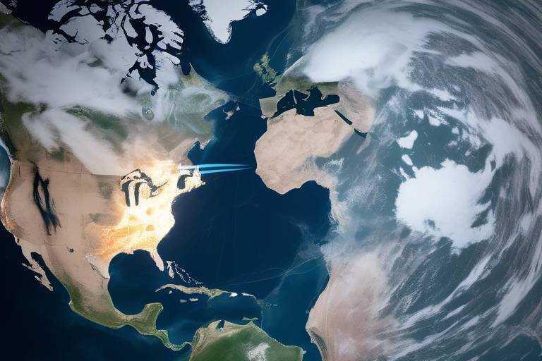
How Satellites Enhance National Security Decision-Making
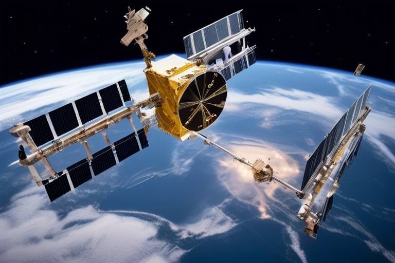
In today's fast-paced world, the importance of satellites in enhancing national security cannot be overstated. These technological marvels orbiting our planet play a crucial role in gathering intelligence, providing surveillance capabilities, and influencing strategic decision-making processes in defense and security sectors. Imagine satellites as the eyes in the sky, constantly monitoring and assessing global situations, ensuring that nations are prepared to respond to any threats that may arise. With the ability to collect real-time data, satellites empower governments to make informed decisions, thereby safeguarding their interests and maintaining peace.
Satellites are vital for collecting intelligence, acting as the backbone of modern national security strategies. They provide real-time data that aids in understanding global threats and monitoring potential adversaries. This capability is particularly important in a world where information is power. For instance, satellites can track troop movements, monitor missile launches, and even gather data on economic activities in hostile nations. By analyzing this information, security agencies can devise strategies to counteract threats before they escalate. It's like having a crystal ball that reveals the intentions of other nations, allowing for proactive rather than reactive measures.
The advanced surveillance capabilities of satellites allow for continuous monitoring of strategic areas, enabling governments to respond swiftly to emerging threats and maintain situational awareness. Imagine a watchful guardian, always on alert, ready to sound the alarm at the first sign of trouble. This is precisely what surveillance satellites do. They provide a comprehensive view of military installations, border regions, and even urban areas, ensuring that no suspicious activity goes unnoticed. With the ability to capture high-resolution images and gather data across various spectrums, these satellites are indispensable tools for national security.
Earth observation satellites provide critical data for environmental monitoring, disaster response, and assessing military activities, contributing significantly to national security assessments and planning. These satellites are equipped with sensors that can detect changes in land use, track natural disasters, and monitor environmental conditions. By analyzing this data, governments can prepare for natural disasters, assess the impact of climate change, and even evaluate the potential for conflict over resources. It's an intricate dance of data and strategy, where every piece of information can lead to a more secure nation.
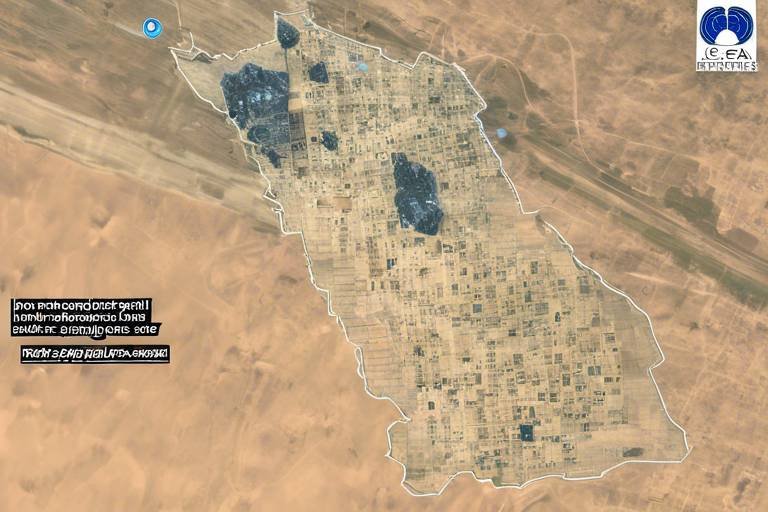
Remote sensing technology enables detailed analysis of geographical and infrastructural changes, which is essential for strategic military operations and environmental security. This technology allows for the collection of data without physical contact, making it possible to monitor areas that are otherwise inaccessible. For example, during a conflict, remote sensing can reveal hidden military installations or changes in troop deployments, providing critical insights that inform military strategy. The ability to visualize these changes in real-time is akin to having a tactical map that updates itself as the situation evolves.
The interpretation of satellite data is crucial for actionable intelligence, requiring advanced analytical tools and skilled personnel to transform raw data into strategic insights. It's not just about collecting data; it's about making sense of it. Analysts sift through mountains of information, looking for patterns and anomalies that could indicate a potential threat. This process is akin to piecing together a puzzle, where each piece of data adds clarity to the bigger picture. The more accurately this data is interpreted, the better equipped decision-makers will be to respond to threats and challenges.
Communication satellites facilitate secure and reliable communication channels for military operations, ensuring that decision-makers remain connected during critical missions and operations. In the heat of battle or during a crisis, effective communication can mean the difference between success and failure. These satellites enable real-time communication between troops on the ground and command centers, allowing for coordinated responses to threats. It's like having a lifeline that connects every piece of the military puzzle, ensuring that everyone is on the same page, no matter where they are located.
The integration of satellite data into national security frameworks significantly influences strategic decision-making, providing leaders with the information necessary to make informed choices. In an era where every second counts, timely and accurate data is invaluable. Leaders rely on satellite intelligence to assess threats, allocate resources, and develop contingency plans. This data-driven approach ensures that decisions are based on facts rather than speculation, ultimately leading to more effective national security strategies.
Real-time satellite data supports timely decision-making, allowing national security leaders to respond effectively to threats and coordinate resources efficiently. Imagine being able to see a threat as it unfolds and having the ability to respond immediately. This capability is vital in preventing conflicts from escalating and ensuring that national interests are protected. With instant access to critical information, leaders can make quick decisions that can avert disasters or capitalize on opportunities.
Satellite capabilities also inform long-term strategic planning, helping to identify emerging threats and opportunities, ultimately shaping national defense policies and strategies. By analyzing trends and patterns over time, governments can anticipate future challenges and adapt their strategies accordingly. It's like having a roadmap that guides nations through the complexities of international relations, ensuring they are prepared for whatever lies ahead.
- How do satellites collect data? Satellites collect data through various sensors that capture images and gather information across different spectrums, including visible light, infrared, and radar.
- What role do communication satellites play in national security? Communication satellites provide secure channels for military communication, ensuring that decision-makers can coordinate effectively during operations.
- How does satellite data influence military strategy? Satellite data provides real-time insights into enemy movements and capabilities, allowing military leaders to make informed strategic decisions.
Role of Satellites in Intelligence Gathering
Satellites have become the backbone of modern intelligence gathering, acting as the eyes and ears of national security agencies across the globe. Imagine trying to understand the complex chess game of international relations without a clear view of the board—this is where satellites come into play. They provide real-time data that is crucial for monitoring global threats and assessing the capabilities of potential adversaries. By orbiting high above the Earth, these technological marvels can gather intelligence that is not only timely but also incredibly detailed.
For instance, satellites equipped with advanced imaging technology can capture high-resolution images of military installations, troop movements, and even infrastructure developments in hostile territories. This capability allows national security agencies to stay one step ahead, making informed decisions based on the most current information available. The data collected can be used to create comprehensive threat assessments, ensuring that leaders have a clear understanding of the geopolitical landscape. Furthermore, the use of satellites enables intelligence agencies to monitor compliance with international treaties and agreements, enhancing global stability.
Moreover, satellites play a pivotal role in disaster response and humanitarian efforts. When natural disasters strike, satellite imagery can provide critical information about affected areas, helping emergency responders to allocate resources effectively. For example, during a hurricane, satellites can track the storm's path, assess damage, and identify areas in need of immediate assistance. This dual role of satellites—as both tools for national security and humanitarian aid—highlights their importance in our interconnected world.
To illustrate the various types of intelligence gathered through satellites, consider the following table:
| Type of Intelligence | Description |
|---|---|
| Imagery Intelligence (IMINT) | High-resolution images of terrain, infrastructure, and military assets. |
| Signals Intelligence (SIGINT) | Intercepted communications and electronic signals from military and civilian sources. |
| Measurement and Signature Intelligence (MASINT) | Data collected from sensors that detect physical phenomena, such as radar and infrared signatures. |
| Geospatial Intelligence (GEOINT) | Information derived from satellite and aerial imagery, including maps and terrain analysis. |
In conclusion, the role of satellites in intelligence gathering cannot be overstated. They are essential tools that provide critical insights into global threats, support disaster response efforts, and inform strategic military operations. As technology continues to evolve, the capabilities of satellites will only expand, further enhancing their role in national security and intelligence operations.
Surveillance Capabilities of Satellites
In today's fast-paced world, the have become a cornerstone of national security. These high-tech marvels orbiting our planet provide a vital lens through which governments and defense agencies can monitor activities across vast distances. Imagine the ability to observe a potential threat from space, gathering data that can be analyzed and acted upon in real-time. This is not just science fiction; it's a reality that enhances our security framework.
One of the most significant advantages of satellite surveillance is its continuous monitoring capability. Unlike traditional ground-based systems, satellites can keep an eye on strategic locations without interruption, providing a constant flow of information. This is particularly crucial when it comes to understanding and responding to emerging threats. For instance, countries can monitor military movements, track the development of missile sites, or even observe large-scale troop deployments, all from the comfort of their command centers thousands of miles away.
To illustrate the impact of satellite surveillance, consider the following key areas where these capabilities shine:
- Geopolitical Monitoring: Satellites enable nations to keep tabs on potential adversaries, ensuring they are aware of any hostile actions or intentions.
- Disaster Response: In the event of natural disasters, satellites can provide critical data to aid in relief efforts, helping to assess damage and coordinate resources effectively.
- Environmental Security: Monitoring environmental changes, such as deforestation or illegal fishing, can help protect natural resources and maintain ecological balance.
Earth observation satellites play a particularly crucial role in this surveillance landscape. They are equipped with advanced sensors that can capture high-resolution images and data about the Earth's surface. This information is invaluable for military planners, as it allows them to analyze geographical features and infrastructure developments that could impact strategic operations.
At the heart of satellite surveillance is remote sensing technology. This technology allows satellites to collect data from a distance, making it possible to monitor changes in land use, urban development, and even agricultural practices. By employing various sensors, satellites can detect changes in temperature, vegetation health, and soil moisture levels, providing insights into both environmental conditions and potential military activities.
However, it's not enough to simply collect this data; it must be analyzed and interpreted effectively. This is where skilled personnel and advanced analytical tools come into play. The raw data obtained from satellites needs to be transformed into actionable intelligence. Analysts sift through vast amounts of information, identifying patterns and anomalies that could indicate a potential threat. This process is crucial for national security, as it ensures that decision-makers have the most relevant and timely information at their fingertips.
Moreover, the role of communication satellites cannot be overlooked. These satellites provide secure and reliable channels for military operations, ensuring that commanders can communicate effectively during critical missions. In a world where every second counts, having a dependable communication network can mean the difference between success and failure in national security operations.
In conclusion, the surveillance capabilities of satellites represent a leap forward in how nations approach security. By leveraging advanced technology, governments can maintain a watchful eye over their territories and beyond, ensuring they are prepared to respond to any threat that may arise. As we continue to advance in satellite technology, the potential for enhancing national security through effective surveillance will only grow, providing a safer environment for all.
- How do satellites collect surveillance data? Satellites collect data using various sensors that capture images and other information about the Earth's surface.
- What is the difference between Earth observation satellites and communication satellites? Earth observation satellites monitor environmental and military activities, while communication satellites facilitate secure communications for military operations.
- How is satellite data analyzed for national security? Analysts use advanced tools and techniques to interpret raw satellite data, transforming it into actionable intelligence for decision-makers.
Earth Observation Satellites
Earth observation satellites are a cornerstone of modern national security strategies, providing a wealth of information that is crucial for understanding our planet and its dynamics. These satellites are equipped with advanced sensors that capture high-resolution images and data, allowing governments to monitor environmental changes, track natural disasters, and assess military activities across the globe. Imagine having a bird's-eye view of the Earth, capable of spotting changes in infrastructure, land use, and even troop movements! This capability is not just fascinating; it's essential for making informed decisions that can impact national security.
One of the most significant advantages of earth observation satellites is their ability to provide real-time data. Whether it’s monitoring the aftermath of a natural disaster or observing the buildup of military forces at a border, these satellites offer a constant stream of information that can be analyzed and acted upon swiftly. For example, during a natural disaster, satellite imagery can help emergency responders assess damage and allocate resources effectively, ensuring that aid reaches the areas that need it most.
Moreover, the data collected from these satellites can be categorized into various types, each serving a unique purpose:
- Optical Imaging: Captures detailed images of the Earth's surface, useful for urban planning and environmental monitoring.
- Radar Imaging: Penetrates clouds and darkness, allowing for continuous observation regardless of weather conditions.
- Thermal Imaging: Measures heat emitted from the Earth, which can be invaluable for detecting wildfires or monitoring industrial activities.
These capabilities not only enhance situational awareness but also play a critical role in strategic military operations. For instance, military planners can utilize satellite data to identify potential threats and devise countermeasures before a situation escalates. Additionally, the ability to observe changes over time helps in understanding long-term trends that could affect national security, such as climate change or geopolitical shifts.
In conclusion, earth observation satellites are not just tools for observation; they are vital instruments that provide actionable intelligence and foster informed decision-making. As technology advances, the potential for these satellites to contribute to national security will only grow, making them indispensable in our ever-evolving world.
Remote Sensing Technology
Remote sensing technology is a game-changer in the realm of national security, acting as the eyes in the sky that provide invaluable insights into our world. At its core, this technology involves collecting data from a distance, typically using satellites equipped with advanced sensors. Imagine being able to survey vast areas of land or monitor military installations without ever setting foot on the ground. That's the power of remote sensing!
This technology allows analysts to gather information on a variety of elements, including land use, vegetation cover, and even urban development. For instance, by utilizing high-resolution imagery, governments can detect changes in infrastructure that might indicate military build-up or the movement of troops. This is crucial in maintaining a strategic advantage over potential adversaries.
Moreover, remote sensing technology plays a pivotal role in environmental security. For example, it can help monitor natural disasters like wildfires or floods, providing real-time data that can be crucial for disaster response teams. By analyzing satellite imagery, responders can assess the extent of damage and coordinate their efforts more effectively. In this way, remote sensing not only enhances military operations but also contributes to humanitarian efforts.
To further illustrate the impact of remote sensing technology, consider the following applications:
- Geographical Analysis: Understanding terrain features for military strategy.
- Resource Management: Monitoring natural resources to prevent conflicts.
- Environmental Monitoring: Tracking changes in ecosystems that might affect national security.
In summary, remote sensing technology is not just a tool; it’s a vital component in the national security toolkit. It empowers decision-makers with the information they need to act swiftly and strategically, ultimately enhancing the safety and security of nations around the globe.
- What is remote sensing technology? Remote sensing technology involves collecting data from a distance, typically using satellites equipped with sensors to monitor and analyze the Earth's surface.
- How does remote sensing contribute to national security? It provides critical information for military operations, disaster response, and resource management, enabling informed decision-making and strategic planning.
- What types of data can be collected through remote sensing? Data can include imagery of land use, vegetation cover, infrastructure changes, and environmental conditions, among others.
- Are there any limitations to remote sensing technology? Yes, factors such as weather conditions, satellite resolution, and data interpretation can impact the effectiveness of remote sensing.
Data Analysis and Interpretation
This article explores the critical role satellites play in national security, focusing on intelligence gathering, surveillance capabilities, and their impact on strategic decision-making processes in defense and security sectors.
Satellites are vital for collecting intelligence, providing real-time data that aids in understanding global threats and monitoring potential adversaries, thereby enhancing national security strategies.
The advanced surveillance capabilities of satellites allow for continuous monitoring of strategic areas, enabling governments to respond swiftly to emerging threats and maintain situational awareness.
Earth observation satellites provide critical data for environmental monitoring, disaster response, and assessing military activities, contributing significantly to national security assessments and planning.
Remote sensing technology enables detailed analysis of geographical and infrastructural changes, which is essential for strategic military operations and environmental security.
In the realm of national security, of satellite information is not just an option; it's a necessity. The raw data collected from satellites is often vast and complex, requiring sophisticated analytical frameworks to transform it into actionable intelligence. Think of it like sifting through a mountain of sand to find the few precious gems hidden within. Without proper analysis, the valuable insights that can inform critical decisions might go unnoticed.
To effectively interpret satellite data, analysts utilize a combination of advanced software tools and human expertise. These tools can automate the processing of large datasets, but the human element is crucial for contextualizing the information and understanding its implications. Here’s a brief overview of the key components involved in the analysis process:
- Data Collection: Gathering satellite images and signals from various sources.
- Data Processing: Using algorithms and software to clean and organize the data.
- Analysis: Applying statistical methods and machine learning techniques to identify patterns and anomalies.
- Interpretation: Drawing conclusions from the analyzed data and translating them into strategic insights.
Moreover, the interpretation of satellite data often involves collaboration among various agencies and experts. This collaborative approach ensures that the insights derived from the data are comprehensive and consider multiple perspectives. For instance, military analysts might work alongside environmental scientists to assess how changes in terrain could impact both military operations and disaster response efforts.
Ultimately, the ability to analyze and interpret satellite data effectively can make the difference between a proactive response to a threat and a reactive one. In a world where every second counts, having the right information at the right time can be the key to maintaining national security.
Communication satellites facilitate secure and reliable communication channels for military operations, ensuring that decision-makers remain connected during critical missions and operations.
The integration of satellite data into national security frameworks significantly influences strategic decision-making, providing leaders with the information necessary to make informed choices.
Real-time satellite data supports timely decision-making, allowing national security leaders to respond effectively to threats and coordinate resources efficiently.
Satellite capabilities also inform long-term strategic planning, helping to identify emerging threats and opportunities, ultimately shaping national defense policies and strategies.
- How do satellites gather intelligence? Satellites gather intelligence through various sensors and imaging technologies that capture data from the Earth's surface, atmosphere, and beyond.
- What is remote sensing technology? Remote sensing technology involves collecting data from satellites or aircraft to analyze and monitor physical characteristics of an area.
- Why is data analysis important in national security? Data analysis transforms raw satellite data into actionable intelligence, enabling informed decision-making and timely responses to threats.
- How do communication satellites enhance military operations? Communication satellites provide secure and reliable channels for communication, ensuring that military personnel can coordinate effectively during operations.
Communication Satellites
Communication satellites are the unsung heroes of modern military operations. Imagine being in a high-stakes game of chess, where every move counts, and the pieces are scattered across the globe. Now, think about how crucial it is to have a reliable way to communicate with your pieces, ensuring that every strategy is executed flawlessly. That's precisely what communication satellites do for national security. They provide secure and instantaneous communication channels that are vital for coordinating military operations, intelligence sharing, and decision-making processes.
These satellites operate in various orbits, primarily in geostationary and low Earth orbit, allowing them to cover vast areas and maintain continuous contact with ground stations. The technology behind communication satellites has evolved remarkably, enabling high-bandwidth transmissions that support voice, data, and video communications. This capability ensures that military leaders and personnel can share critical information in real-time, which can be the difference between success and failure in a mission.
One of the standout features of communication satellites is their ability to operate in challenging environments, where traditional communication methods may fail. For instance, during natural disasters or in conflict zones, terrestrial communication infrastructure can be compromised. In such scenarios, communication satellites become a lifeline, providing essential connectivity that enables emergency response teams to coordinate efforts and keep the flow of information intact.
Additionally, communication satellites play a crucial role in enhancing the security of military communications. They use advanced encryption techniques to safeguard sensitive information from potential adversaries. This level of security is paramount, as it prevents unauthorized access and ensures that strategic plans remain confidential. The integration of satellite communications into military operations not only enhances operational effectiveness but also provides a strategic advantage over potential threats.
To illustrate the significance of communication satellites in military operations, consider the following table that highlights their key functions:
| Function | Description |
|---|---|
| Real-Time Communication | Enables instant communication between military units and command centers. |
| Data Transmission | Facilitates the transfer of large volumes of data, including video feeds and intelligence reports. |
| Secure Channels | Provides encrypted communication pathways to protect sensitive information. |
| Global Coverage | Offers connectivity across vast geographic areas, including remote and inaccessible regions. |
In summary, communication satellites are indispensable for national security. They ensure that military operations run smoothly and that decision-makers have the information they need at their fingertips. As technology continues to advance, we can expect even more sophisticated communication capabilities, further enhancing the effectiveness of national defense strategies.
- What are communication satellites used for? Communication satellites are primarily used for facilitating secure and reliable communication channels for military operations, intelligence sharing, and coordination during critical missions.
- How do communication satellites enhance military operations? They provide real-time communication, secure data transmission, and global coverage, allowing military units to stay connected and informed during operations.
- What technologies do communication satellites use to ensure security? Communication satellites utilize advanced encryption techniques to protect sensitive information from unauthorized access.
- Can communication satellites operate in disaster scenarios? Yes, they are designed to function in challenging environments, providing essential connectivity when terrestrial infrastructure is compromised.
Impact on Strategic Decision-Making
The integration of satellite data into national security frameworks significantly influences strategic decision-making. Imagine a world where leaders are navigating through complex global threats without the clarity that satellite imagery and data provide. It’s like trying to find your way in a dense fog without a compass. Satellites serve as that essential compass, offering a clear view of the landscape, which is crucial for informed decision-making. By providing timely and accurate information, satellites empower national security leaders to assess situations more effectively, ensuring that they are not just reacting to threats but anticipating them.
Real-time satellite data supports timely decision-making, allowing national security leaders to respond effectively to threats and coordinate resources efficiently. For instance, when a natural disaster strikes, satellites can quickly assess the extent of damage, helping leaders prioritize response efforts. This capability is not just limited to environmental disasters; it extends to military operations as well. Imagine a scenario where a conflict is escalating. The ability to monitor troop movements and infrastructure changes in real-time allows for rapid adjustments in strategy, ensuring that decision-makers are always one step ahead.
Moreover, the long-term strategic planning benefits from satellite capabilities cannot be overstated. By analyzing historical satellite data, leaders can identify patterns and trends that may indicate emerging threats or opportunities. This foresight is crucial in shaping national defense policies and strategies. For example, if satellite data reveals a buildup of military assets in a particular region, it may prompt a reassessment of diplomatic relations or military readiness in that area. In this way, satellites not only enhance immediate responses but also contribute to a broader understanding of global security dynamics.
To illustrate the profound impact of satellite data on strategic decision-making, consider the following table that outlines key benefits:
| Benefit | Description |
|---|---|
| Real-Time Monitoring | Continuous observation of strategic locations, allowing for immediate responses to threats. |
| Data-Driven Insights | Transforming raw satellite data into actionable intelligence for informed decision-making. |
| Long-Term Planning | Identifying trends and potential threats to shape future defense strategies. |
| Enhanced Communication | Facilitating secure communication channels during critical missions. |
In conclusion, the impact of satellites on strategic decision-making in national security is profound and multifaceted. They provide a framework for understanding the complexities of global threats and enable leaders to make decisions that are not just reactive but also proactive. In a world where the stakes are constantly rising, the ability to harness satellite data effectively can mean the difference between success and failure in national defense.
- How do satellites collect data for national security? Satellites use various technologies, including imaging and remote sensing, to gather data about the Earth's surface and atmosphere.
- What types of satellites are used for national security? Earth observation satellites and communication satellites are primarily used for intelligence gathering and secure communications.
- Can satellite data be used in real-time? Yes, satellite data can be processed and analyzed in real-time, allowing for immediate decision-making in critical situations.
- How does satellite data influence military strategy? Satellite data provides insights into enemy movements, infrastructure changes, and environmental conditions, which are essential for military planning and operations.
Real-Time Decision Support
When it comes to national security, the stakes are incredibly high. Imagine a situation where a nation faces an unexpected threat; the ability to make swift and informed decisions can mean the difference between success and failure. This is where powered by satellite technology comes into play. Satellites provide a continuous stream of data that is not only timely but also incredibly detailed, allowing decision-makers to assess situations as they unfold.
For instance, during a crisis, military leaders can access live feeds from surveillance satellites, which offer insights into troop movements, potential enemy activities, and even environmental conditions. This immediate access to information enables them to make informed choices quickly, ensuring that responses are both effective and appropriate. The ability to see the battlefield in real-time is akin to having a bird's eye view of a chessboard—every piece is visible, and every move can be calculated with precision.
Moreover, the integration of satellite data into command and control systems means that military operations can be coordinated seamlessly. Imagine a scenario where multiple branches of the armed forces need to collaborate on a mission. With real-time satellite support, they can share information instantly, making adjustments on the fly. This level of coordination is crucial in dynamic situations where conditions can change rapidly, and a delayed response could lead to catastrophic outcomes.
To illustrate the importance of real-time decision support, consider the following table that highlights key benefits:
| Benefit | Description |
|---|---|
| Immediate Data Access | Decision-makers receive timely information about potential threats or changes in the operational environment. |
| Enhanced Coordination | Different military branches can synchronize their efforts effectively, reducing the risk of miscommunication. |
| Informed Tactical Decisions | Real-time data allows for better tactical decisions, leading to more successful outcomes in operations. |
In addition to military applications, real-time satellite data is also invaluable for humanitarian efforts during crises such as natural disasters. For example, when a hurricane strikes, satellites can monitor the situation, providing data on the storm's path and intensity. This information is crucial for evacuation plans, resource allocation, and overall disaster response strategies. Without such data, decision-making would be based on outdated information, potentially putting lives at risk.
In conclusion, real-time decision support enabled by satellites is not just a technological advancement; it's a game-changer in national security. The ability to access and interpret real-time data allows leaders to act decisively and strategically, ensuring that they are always one step ahead of potential threats.
- How do satellites gather real-time data? Satellites use a combination of sensors and imaging technologies to collect data on various phenomena, including weather patterns, military activities, and environmental changes.
- What types of satellites are used for national security? There are primarily two types: Earth observation satellites for surveillance and monitoring, and communication satellites for secure data transmission.
- How does satellite data influence military strategy? Satellite data provides insights that inform tactical and strategic decisions, helping military leaders plan operations based on real-time intelligence.
- Can satellite data be used for humanitarian efforts? Absolutely! Satellites play a crucial role in disaster response by providing timely data that helps coordinate relief efforts and assess damage.
Long-Term Strategic Planning
When it comes to , satellites are not just shiny objects floating in space; they are the backbone of modern defense strategies. Imagine trying to navigate a vast ocean without a map or compass. That’s what military leaders would face without the insights provided by satellite technology. By leveraging the extensive data collected from satellites, nations can forecast potential threats and identify opportunities that may arise over the horizon.
One of the key advantages of satellite technology is its ability to provide a comprehensive view of geopolitical landscapes. For instance, satellites can monitor troop movements, track military installations, and assess the development of infrastructure in hostile regions. This information is crucial for strategic military planning and allows nations to adjust their defense postures accordingly. In essence, satellites transform raw data into a strategic asset, enabling leaders to make informed decisions that could have significant implications for national security.
Additionally, the integration of satellite data into long-term planning processes helps in identifying emerging threats. For example, climate change and its effects on national security are now more apparent than ever. Satellites equipped with remote sensing technology can monitor environmental changes, such as rising sea levels or deforestation, providing critical insights that inform defense strategies. By understanding how these factors can impact regional stability, military planners can devise strategies that not only address current threats but also anticipate future challenges.
Moreover, the collaboration between different nations in satellite technology has led to the sharing of vital intelligence. This collaboration fosters a sense of global security as countries work together to monitor threats that transcend borders. For instance, satellite data can be utilized to track illegal activities such as arms smuggling or human trafficking, which are often difficult to monitor through traditional means. In this way, satellites not only enhance national security but also contribute to international cooperation.
In summary, the role of satellites in long-term strategic planning cannot be overstated. They provide the necessary tools for nations to assess their security environment, anticipate future threats, and develop effective defense strategies. As technology continues to evolve, the integration of satellite data will only become more sophisticated, further enhancing our ability to navigate the complex landscape of national security.
- How do satellites gather intelligence? Satellites gather intelligence through advanced imaging and sensing technologies that capture data about the Earth's surface and atmosphere.
- What types of data do Earth observation satellites provide? Earth observation satellites provide data related to environmental changes, military activities, urban development, and disaster monitoring.
- How do communication satellites enhance military operations? Communication satellites provide secure and reliable channels for military communications, ensuring that decision-makers can coordinate effectively during operations.
- What is the significance of remote sensing technology? Remote sensing technology allows for detailed analysis of geographical changes, which is critical for strategic military operations and environmental assessments.
- How does satellite data influence national security policies? Satellite data influences national security policies by providing actionable intelligence that helps leaders make informed decisions regarding defense strategies and resource allocation.
Frequently Asked Questions
- How do satellites gather intelligence for national security?
Satellites gather intelligence by collecting real-time data from various parts of the world. They monitor potential threats and adversaries, providing crucial information that helps governments understand global security dynamics and formulate effective strategies.
- What are the surveillance capabilities of satellites?
Satellites possess advanced surveillance capabilities that allow for continuous monitoring of strategic areas. This capability ensures that governments can respond quickly to emerging threats, maintaining a high level of situational awareness at all times.
- What role do Earth observation satellites play?
Earth observation satellites are essential for environmental monitoring, disaster response, and military activity assessments. They provide critical data that significantly contributes to national security assessments and planning, enabling informed decision-making.
- How does remote sensing technology enhance national security?
Remote sensing technology allows for detailed analysis of geographical and infrastructural changes. This information is vital for strategic military operations and environmental security, helping to identify potential threats before they escalate.
- Why is data analysis important in satellite intelligence?
Data analysis is crucial because it transforms raw satellite data into actionable intelligence. Skilled personnel use advanced analytical tools to interpret this data, which is essential for making strategic decisions in national security.
- How do communication satellites support military operations?
Communication satellites provide secure and reliable communication channels for military operations. They ensure that decision-makers remain connected during critical missions, facilitating effective coordination and response to threats.
- What is the impact of satellite data on strategic decision-making?
The integration of satellite data into national security frameworks significantly influences strategic decision-making. It provides leaders with timely and accurate information necessary to make informed choices and respond effectively to threats.
- How does real-time satellite data assist in decision-making?
Real-time satellite data supports timely decision-making by allowing national security leaders to quickly assess situations and coordinate resources efficiently. This capability is vital for effective response to evolving threats.
- How do satellites inform long-term strategic planning?
Satellites help identify emerging threats and opportunities, which are essential for long-term strategic planning. This information ultimately shapes national defense policies and strategies, ensuring that nations are prepared for future challenges.


