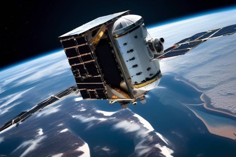
How Satellites Support Military Exercises and Training
In today's rapidly evolving military landscape, the integration of technology is more critical than ever. One of the most significant advancements has been the use of satellites in military exercises and training. These orbiting marvels play a pivotal role in enhancing operational readiness, allowing military forces to communicate, gather intelligence, and navigate with precision. Imagine conducting a military exercise where every move is coordinated in real-time, every decision is backed by comprehensive data, and every soldier is equipped with the best possible information. This is the reality that satellites help create, transforming traditional training into a modern, high-tech operation.
Satellites serve as the backbone of military communication, providing a reliable link between units that might be spread over vast distances. Without this technology, coordinating maneuvers and sharing critical information would be akin to trying to conduct an orchestra without a conductor—chaotic and ineffective. Communication satellites ensure that commanders can issue orders, receive updates, and maintain situational awareness no matter where they are located. This seamless exchange of information not only enhances command and control but also fosters a culture of collaboration among military personnel.
Furthermore, the role of satellites extends well beyond communication. They are essential for surveillance and reconnaissance, providing military forces with the ability to monitor activities and gather intelligence in real-time. This capability is crucial for strategic planning, as it allows military planners to anticipate enemy movements and adapt their strategies accordingly. With high-resolution imagery and advanced sensors, satellites can capture detailed information about the battlefield, enabling forces to assess terrain and enemy positions with unparalleled accuracy.
As we delve deeper into the capabilities of satellites, we find that they offer various types of imagery, such as optical and radar. Each type has its unique advantages, enhancing situational awareness in different scenarios. For instance, optical imagery provides clear visuals of the ground, while radar can penetrate through clouds and darkness, ensuring that military planners have access to information regardless of environmental conditions. This diverse range of data sources empowers military leaders to make informed decisions during training exercises, ultimately leading to more effective outcomes.
However, the processing and analysis of satellite imagery is where the magic truly happens. With the help of advanced algorithms and machine learning techniques, raw data is transformed into actionable intelligence. This process not only accelerates decision-making but also significantly improves the quality of the information available to military planners. Imagine sifting through mountains of data to find a single piece of gold; that’s what these technologies do for military operations, turning chaos into clarity.
In addition to imagery intelligence, satellites also facilitate signals intelligence (SIGINT). This capability enables the capture of electronic communications, providing invaluable insights into enemy movements and capabilities. By intercepting signals, military forces can gain a clearer picture of the battlefield, allowing them to adapt their strategies and maintain the upper hand. This intelligence is particularly crucial during training exercises, where understanding the enemy's capabilities can make or break a mission.
Another critical aspect of satellite technology is its role in navigation and timing. The Global Navigation Satellite Systems (GNSS) are indispensable for precise navigation, enabling military units to operate effectively in diverse environments. The Global Positioning System (GPS) is a prime example of this technology, supporting various military applications, including guided munitions, troop movements, and logistics planning. By ensuring that every unit knows its exact location, GPS enhances operational effectiveness and reduces the risk of miscommunication.
Despite the numerous advantages that satellites offer, it is essential to acknowledge the challenges and limitations they face. Issues such as signal interference and vulnerability to adversarial actions pose significant risks that military planners must address. Just as a knight must protect his armor before heading into battle, military forces must ensure that their satellite systems are secure and reliable. This ongoing challenge requires constant innovation and adaptation, as the landscape of warfare continues to evolve.
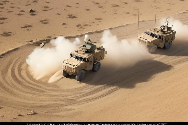
Moreover, satellites play a vital role in training simulations. By providing data that mirrors real-world conditions, they enable military personnel to practice decision-making in a controlled environment. This realistic training is crucial for preparing soldiers for the complexities of actual combat situations. The integration of satellite data with virtual reality technologies further enhances these training experiences, allowing soldiers to engage in immersive scenarios that closely mimic the battlefield.
Finally, the importance of feedback and assessment cannot be overstated. Post-exercise analysis using satellite data allows for detailed feedback on performance, helping to refine tactics and improve future training outcomes. By understanding what worked and what didn’t, military leaders can make informed adjustments, ensuring that their forces are always prepared for the challenges ahead.
- How do satellites improve military communication?
Satellites provide a reliable link for real-time data exchange, ensuring seamless coordination among units and enhancing command and control capabilities. - What types of imagery do satellites provide?
Satellites offer various types of imagery, including optical and radar, each with unique advantages for military applications. - What role does GPS play in military operations?
The Global Positioning System (GPS) supports precise navigation and timing, which are crucial for effective troop movements and logistics planning. - What challenges do satellite systems face?
Challenges include signal interference and vulnerability to adversarial actions, which military planners must address to maintain operational readiness.
Role of Communication Satellites
Communication satellites have transformed the landscape of military operations, serving as the backbone for real-time data exchange during military exercises. Imagine a vast battlefield where multiple units are spread out over miles, each with its own mission and objectives. How do these units communicate efficiently? The answer lies in the sky, where satellites orbit the Earth, providing a crucial link that enhances coordination and command capabilities. These satellites facilitate seamless communication, enabling troops to share vital information instantaneously, which is essential for making quick decisions that can alter the course of an operation.
During military exercises, the ability to communicate in real-time is not just a luxury; it is a necessity. Communication satellites ensure that commanders can relay orders, receive updates, and maintain situational awareness across all levels of command. This connectivity is particularly vital in joint exercises involving multiple branches of the military, where diverse units must work in harmony. Without these satellites, the risk of miscommunication increases, potentially leading to catastrophic outcomes.
Furthermore, the role of communication satellites extends beyond mere voice communication. They enable the transmission of video feeds, data files, and intelligence reports that are critical for operational success. For instance, consider a scenario where ground forces need to receive aerial reconnaissance data during an exercise. Communication satellites can transmit high-resolution images directly to commanders on the ground, allowing them to adjust their strategies in real-time based on the latest intelligence.
To illustrate the impact of communication satellites, consider the following table that summarizes their key functions:
| Function | Description |
|---|---|
| Real-time Communication | Facilitates immediate information exchange between units. |
| Data Transmission | Allows for the sharing of critical intelligence and operational updates. |
| Video Conferencing | Enables commanders to conduct briefings and strategy sessions remotely. |
Moreover, the integration of advanced technologies into communication satellites has further enhanced their capabilities. For example, the use of secure communication protocols ensures that sensitive military information remains protected from adversaries. This security feature is paramount, especially in an age where cyber threats are prevalent. By employing encryption techniques, communication satellites safeguard the integrity of the data being transmitted, allowing military personnel to operate with confidence.
In conclusion, the role of communication satellites in military exercises cannot be overstated. They serve as a vital link that not only enhances coordination among units but also improves overall operational effectiveness. As military strategies evolve and the complexity of operations increases, the reliance on these satellites will only grow stronger. In a world where every second counts, having the ability to communicate instantly can make all the difference between success and failure.
Surveillance and Reconnaissance
In the realm of military operations, surveillance and reconnaissance are paramount. Satellites play a crucial role in these areas, providing military forces with the ability to gather intelligence and monitor activities in real-time. Imagine trying to navigate a dense fog without a guiding light; that’s what military planners face without satellite support. The information gathered from satellites allows for strategic planning, ensuring that decisions are made based on the most current and accurate data available.
One of the most significant advantages of satellite surveillance is the ability to conduct operations without being physically present in potentially hostile environments. This capability not only enhances safety for military personnel but also allows for a broader scope of observation. For instance, satellites can monitor large geographical areas, detecting movements and changes that would be impossible to capture on the ground. This real-time data is essential for making informed decisions during training exercises and actual combat scenarios.
High-resolution imagery from satellites provides invaluable insights into the battlefield. When military forces conduct training exercises, they need to understand the terrain and enemy positions thoroughly. Satellite imagery acts like a bird's eye view, offering a detailed perspective that helps commanders devise effective strategies. The clarity and precision of this imagery allow for quick assessments and adaptations, which are critical in fast-paced military operations.
There are various types of satellite imagery, each serving a unique purpose in military applications. The most common types include:
- Optical Imagery: Captured in the visible spectrum, this type of imagery provides clear pictures of the terrain and any objects on it, making it ideal for reconnaissance missions.
- Radar Imagery: This type uses radar waves to capture images, which can penetrate cloud cover and provide data even in adverse weather conditions.
By leveraging both optical and radar imagery, military planners can gain a comprehensive understanding of the operational environment, enhancing their situational awareness.
The real magic happens when satellite imagery is processed and analyzed. Advanced algorithms and machine learning techniques transform raw data into actionable intelligence. This process involves several steps:
- Data Collection: Satellites collect vast amounts of data, which is then transmitted to ground stations.
- Image Processing: The data undergoes processing to enhance clarity and detail.
- Analysis: Analysts interpret the processed imagery, identifying key features and potential threats.
This meticulous process ensures that military planners have access to the most relevant information, allowing them to make timely and informed decisions during exercises and operations.
In addition to imagery, satellites facilitate signals intelligence (SIGINT), which involves capturing electronic communications. This capability is vital for understanding enemy movements and capabilities. By intercepting signals, military forces can gain insights into the plans and intentions of adversaries. This information can be the difference between success and failure in both training and real-world scenarios.
In conclusion, the integration of satellites into military surveillance and reconnaissance not only enhances operational effectiveness but also significantly improves the safety and preparedness of military personnel. As technology continues to advance, the capabilities of satellite systems will undoubtedly evolve, providing even greater support to military exercises and training.
Imagery Intelligence
When it comes to military operations, the ability to see the battlefield from above is nothing short of a game-changer. , or IMINT, provides military forces with high-resolution images that are crucial for assessing terrain, identifying enemy positions, and making informed tactical decisions. Imagine being able to spot a hidden enemy bunker or track troop movements from miles away; that's the power of satellite imagery in action!
One of the standout features of imagery intelligence is its ability to offer a comprehensive view of the battlefield. With satellites orbiting the Earth, military planners can gather detailed images that reveal not just the physical landscape but also the activities taking place within it. This is particularly vital during training exercises, where understanding the operational environment can significantly impact the effectiveness of strategies employed. For instance, if a unit knows the layout of the land and the location of potential threats, they can devise plans that leverage their strengths while mitigating risks.
Moreover, the types of imagery collected can vary, offering unique advantages for different military applications. For instance, optical imagery provides clear, detailed pictures under ideal weather conditions, while radar imagery can penetrate clouds and darkness, making it invaluable during adverse weather. Each type serves a specific purpose, allowing military forces to adapt to varying operational scenarios. Here’s a quick comparison:
| Type of Imagery | Advantages | Applications |
|---|---|---|
| Optical Imagery | High resolution, detailed visuals | Terrain assessment, enemy position identification |
| Radar Imagery | Works in poor weather, day/night capability | Surveillance in adverse conditions, tracking moving targets |
But it doesn't stop there! The processing of satellite imagery involves sophisticated algorithms and machine learning techniques that transform raw data into actionable intelligence. This means that military planners can quickly analyze vast amounts of information and derive insights that would take humans much longer to uncover. It’s like having a super-smart assistant who can sift through mountains of data and present the most critical findings right when you need them.
In summary, imagery intelligence is a cornerstone of modern military operations, providing vital information that enhances situational awareness and tactical planning. The combination of advanced imaging technologies and data processing capabilities ensures that military units are not only prepared but also capable of responding swiftly and effectively to any situation on the battlefield.
- What is imagery intelligence? Imagery intelligence (IMINT) involves gathering and analyzing images from satellites to provide critical information about the battlefield.
- How does satellite imagery help in military training? It allows military personnel to assess terrain and enemy positions, leading to better tactical decisions during training exercises.
- What types of satellite imagery are used? The main types include optical imagery, which provides clear images, and radar imagery, which can be used in poor weather conditions.
- How is satellite imagery processed? Advanced algorithms and machine learning techniques are used to analyze raw data and generate actionable intelligence.
Types of Imagery
When it comes to military operations, the type of satellite imagery used can significantly impact the effectiveness of missions. Different types of imagery serve unique purposes, each offering distinct advantages that cater to various military needs. Understanding these types can help military planners choose the right tools for their operational requirements.
One of the primary types of satellite imagery is optical imagery. This type captures images similar to what the human eye would see. It can provide high-resolution photographs of the Earth's surface, which are essential for assessing terrain, identifying enemy positions, and planning troop movements. However, optical imagery can be limited by weather conditions such as cloud cover or rain, which can obscure visibility.
In contrast, radar imagery utilizes microwave signals to capture images, making it less susceptible to weather interference. This capability is crucial for operations in adverse conditions where optical imagery might fail. Radar imagery can penetrate clouds and even darkness, providing valuable information about surface conditions and movements. For instance, it can detect vehicles or troop formations even in poor visibility, offering a tactical advantage.
Additionally, infrared imagery plays a vital role in military surveillance. This type of imagery detects heat emissions, allowing military forces to identify and track moving objects, such as vehicles or personnel, based on their heat signatures. Infrared imagery is particularly useful during nighttime operations or in situations where stealth is crucial.
To further illustrate the differences, here’s a quick comparison table:
| Type of Imagery | Advantages | Limitations |
|---|---|---|
| Optical Imagery | High resolution, easy to interpret | Weather-dependent, limited at night |
| Radar Imagery | Weather-resistant, can operate at night | Lower resolution compared to optical |
| Infrared Imagery | Effective for detecting heat signatures | Limited in interpretation without context |
In summary, the choice of imagery type is not merely a technical decision; it’s a strategic one. Each type of imagery contributes uniquely to the overall situational awareness and operational planning of military forces. By leveraging the strengths of optical, radar, and infrared imagery, military planners can enhance their tactical decisions, ensuring they are well-prepared for any scenario they may face.
- What is the main advantage of using satellite imagery in military operations? Satellite imagery provides real-time data that enhances situational awareness, allowing for informed decision-making and strategic planning.
- How does weather affect satellite imagery? Weather conditions can significantly impact optical imagery, as cloud cover can obscure visibility, while radar imagery remains effective in adverse weather.
- Can satellites operate at night? Yes, certain types of satellite imagery, such as radar and infrared, can operate effectively at night, providing crucial data when visibility is low.
Processing and Analysis
When it comes to transforming raw satellite imagery into actionable intelligence, the process of is nothing short of remarkable. Imagine standing on a mountain peak, peering through binoculars at a vast landscape. You see the details, but without the right tools, interpreting that view can be challenging. Similarly, satellites capture immense amounts of data, but it's the sophisticated algorithms and machine learning techniques that allow military planners to extract meaningful insights from this information.
At the heart of this process lies the use of advanced software that can analyze high-resolution images. These tools sift through layers of data, identifying patterns and anomalies that might escape the naked eye. For instance, in a recent military exercise, satellite imagery was analyzed to detect changes in enemy positions. The ability to quickly process this data meant that commanders could adapt their strategies in real-time, making decisions that could potentially save lives and resources.
Moreover, the integration of machine learning into satellite data analysis has revolutionized the field. By training algorithms on historical data, these systems can predict future movements and behaviors based on past patterns. This predictive capability is akin to having a crystal ball that helps military planners foresee potential challenges and opportunities on the battlefield.
To give you a clearer picture, let’s break down the key components involved in the processing and analysis of satellite data:
| Component | Description |
|---|---|
| Data Acquisition | Collecting raw satellite imagery through various sensing technologies. |
| Image Processing | Enhancing image quality and correcting distortions for better analysis. |
| Feature Extraction | Identifying and isolating significant elements within the imagery. |
| Data Interpretation | Transforming processed images into actionable intelligence through analysis. |
In essence, the process of is like piecing together a complex puzzle. Each step builds upon the last, leading to a comprehensive understanding of the operational environment. This capability is indispensable for military exercises, where the stakes are high, and the margin for error is minimal. With the right tools and techniques, military forces can ensure they are always one step ahead, ready to adapt and respond to any situation that arises.
- What role do satellites play in military training? Satellites enhance military training by providing real-time data, improving communication, and offering critical intelligence for strategic planning.
- How does satellite imagery improve decision-making? High-resolution satellite imagery allows military planners to assess terrain and enemy positions, leading to more informed tactical decisions.
- What are the challenges faced in satellite data processing? Challenges include signal interference, data overload, and the need for advanced algorithms to interpret complex datasets.
Signals Intelligence
Signals Intelligence, often abbreviated as SIGINT, plays a pivotal role in modern military operations. It refers to the collection and analysis of electronic signals, which can include anything from radio communications to radar emissions. Imagine trying to navigate through a dense fog without a map; that’s how challenging military operations can be without the clarity provided by SIGINT. By intercepting and analyzing these signals, military forces gain critical insights into enemy movements, intentions, and capabilities, which can significantly influence the outcome of operations.
One of the most fascinating aspects of SIGINT is its ability to provide a real-time picture of the battlefield. For instance, if an enemy unit is preparing to mobilize, SIGINT can pick up on their communications, alerting friendly forces to potential threats. This capability not only enhances situational awareness but also supports strategic planning and decision-making. In a world where information is power, having access to the right signals at the right time can mean the difference between success and failure.
Moreover, SIGINT can be categorized into different types, each serving a unique purpose in military operations. Here are some key categories:
- Communications Intelligence (COMINT): Involves intercepting and analyzing voice and data communications.
- Electronic Intelligence (ELINT): Focuses on gathering information from electronic signals, primarily radar.
- Foreign Instrumentation Signals Intelligence (FISINT): Deals with signals from foreign weapons systems.
Each of these categories provides valuable data that can be leveraged during military exercises and training. For example, during a training exercise, SIGINT can help simulate real-world scenarios where troops must respond to unexpected enemy communications. By incorporating such realistic elements, military personnel can refine their tactical skills and improve their response times.
However, the effectiveness of SIGINT is not without its challenges. The rapid advancement of technology means that adversaries are constantly developing new methods to secure their communications. This cat-and-mouse game necessitates that military planners remain vigilant and adaptive, continuously upgrading their SIGINT capabilities to stay ahead of potential threats. In essence, SIGINT is like a double-edged sword—while it can provide invaluable insights, it also requires constant innovation to maintain its effectiveness.
In conclusion, Signals Intelligence is an indispensable component of military operations, enhancing situational awareness and supporting strategic decision-making. As technology evolves, so too will the methods and tools used in SIGINT, ensuring that military forces remain prepared for any challenge that may arise.
Q1: What is Signals Intelligence?
A1: Signals Intelligence, or SIGINT, is the collection and analysis of electronic signals to gather information about enemy movements and capabilities.
Q2: How does SIGINT enhance military operations?
A2: SIGINT provides real-time insights into enemy communications and activities, allowing military forces to make informed decisions and improve operational effectiveness.
Q3: What are the main types of SIGINT?
A3: The main types of SIGINT include Communications Intelligence (COMINT), Electronic Intelligence (ELINT), and Foreign Instrumentation Signals Intelligence (FISINT).
Q4: What challenges does SIGINT face?
A4: SIGINT faces challenges such as signal encryption and adversaries developing new technologies to secure their communications, requiring continuous adaptation and innovation.
Navigation and Timing
In the realm of modern military operations, Global Navigation Satellite Systems (GNSS) have emerged as indispensable tools for ensuring precise navigation and timing. These systems, which include well-known networks like the Global Positioning System (GPS), provide military units with the ability to operate effectively across diverse environments. Imagine a soldier navigating through dense forests or urban landscapes, relying on satellite signals to pinpoint their exact location. This capability not only enhances operational effectiveness but also significantly reduces the risk of friendly fire and miscommunication.
One of the most remarkable aspects of GNSS is its ability to deliver real-time positioning data. This means that military forces can coordinate movements with pinpoint accuracy, ensuring that troops are always where they need to be. For instance, during joint exercises involving multiple units, GNSS enables seamless synchronization of movements, allowing for complex maneuvers that would be nearly impossible without such technology. The integration of GNSS into military operations is akin to having a highly skilled navigator on board, guiding forces through the fog of war.
The applications of GPS in military contexts are vast and varied. They include:
- Guided Munitions: Precision-guided weapons rely on GPS for accurate targeting, significantly increasing their effectiveness.
- Troop Movements: GPS allows for real-time tracking of troop positions, facilitating better command and control.
- Logistics Planning: Timely delivery of supplies and reinforcements is made possible through accurate navigation.
However, the reliance on satellite systems for navigation and timing does not come without challenges. One major concern is the vulnerability of GNSS signals to interference and jamming. Adversaries can exploit these weaknesses, potentially leading to catastrophic consequences on the battlefield. Military planners must therefore develop robust countermeasures to mitigate these risks, ensuring that their forces can maintain operational readiness even in contested environments.
Moreover, the increasing sophistication of enemy technology means that military units must continually adapt and innovate. This could involve the integration of alternative navigation methods, such as inertial navigation systems, which can provide backup capabilities in case GNSS is compromised. Just as a ship captain would rely on both GPS and traditional navigation charts, military forces must be prepared to navigate without sole dependence on satellite signals.
In summary, the role of navigation and timing facilitated by satellites is critical for modern military operations. As technology evolves, the importance of these systems will only grow, shaping the future of military strategy and tactics. The challenge lies not only in leveraging these advancements but also in safeguarding them against potential threats. The battlefield of tomorrow will demand a blend of innovation, adaptability, and resilience, where navigation and timing remain at the forefront of operational success.
Q: How does GPS enhance military operations?
A: GPS provides real-time positioning data, allowing for precise navigation, coordination of troop movements, and effective targeting of munitions.
Q: What are the vulnerabilities of satellite navigation systems?
A: Satellite systems can be susceptible to signal interference, jamming, and spoofing, which military planners must address to ensure operational effectiveness.
Q: Are there alternatives to GPS for military navigation?
A: Yes, military forces can use inertial navigation systems and other technologies as backups in case GPS is compromised.
GPS Applications
The Global Positioning System (GPS) is a game-changer for military operations, acting as the backbone for a myriad of applications that enhance both effectiveness and efficiency. Imagine trying to navigate a vast, unfamiliar terrain without a map or compass; that’s the challenge military units face without GPS. This technology not only provides precise location data but also plays a crucial role in various military applications that can mean the difference between success and failure on the battlefield.
One of the primary applications of GPS in the military is in the realm of guided munitions. These advanced weapons systems rely on GPS data to strike targets with pinpoint accuracy, minimizing collateral damage and maximizing operational impact. The precision offered by GPS ensures that munitions can be deployed effectively, even in complex environments where traditional targeting methods may falter.
Another vital application is in troop movements. GPS technology enables commanders to track the real-time location of their forces, ensuring that units can maneuver quickly and efficiently. This capability not only enhances coordination among different military branches but also allows for rapid response to changing battlefield conditions. For example, if a unit encounters unexpected resistance, GPS allows them to adjust their route swiftly, maintaining the element of surprise against the enemy.
Furthermore, logistics planning has been revolutionized by GPS technology. Supply chains in military operations are often complex, involving multiple units and vast geographic areas. GPS allows for precise tracking of supplies and equipment, ensuring that they reach their destination on time. This is essential for maintaining operational readiness, as delays in logistics can severely hinder a unit’s effectiveness. Imagine a scenario where troops are in dire need of ammunition, and the supply convoy gets lost—GPS mitigates such risks by providing accurate routes and real-time updates.
To illustrate the various applications of GPS in military contexts, consider the following table:
| Application | Description |
|---|---|
| Guided Munitions | Utilizes GPS for precise targeting, reducing collateral damage. |
| Troop Movements | Enables real-time tracking and efficient maneuvering of forces. |
| Logistics Planning | Improves supply chain management through accurate tracking of resources. |
In addition to these applications, GPS also plays a crucial role in search and rescue operations. When military personnel are deployed in hostile environments, GPS technology can be vital for locating and extracting them in emergency situations. The ability to pinpoint exact locations means that rescue teams can respond quickly, potentially saving lives.
However, it’s important to note that while GPS applications are incredibly beneficial, they are not without challenges. Signal interference, whether from natural obstacles or adversarial actions, can disrupt GPS functionality. Military planners must consider these vulnerabilities and develop contingency plans to ensure that operations can continue smoothly, even in the face of potential GPS disruptions. This highlights the need for a multi-layered approach to navigation and situational awareness in modern military operations.
In summary, the applications of GPS in military contexts are vast and varied, encompassing everything from guided munitions to logistics planning. As technology continues to evolve, we can expect to see even more innovative uses of GPS that will further enhance military effectiveness and operational success.
- What is GPS and how does it work?
GPS, or Global Positioning System, is a satellite-based navigation system that allows users to determine their exact location anywhere on Earth. - How is GPS used in military operations?
GPS is used for navigation, targeting, troop movements, logistics, and search and rescue operations, providing critical data for decision-making. - What are the limitations of GPS?
GPS can be affected by signal interference, natural obstacles, and adversarial actions, which can disrupt its functionality in military operations.
Challenges and Limitations
While satellites have revolutionized military operations, they are not without their . One of the primary issues is signal interference. Various factors, including environmental conditions such as weather and physical obstructions like mountains, can disrupt satellite signals. This disruption can lead to delays in communication and hinder real-time data exchange, which is crucial during military exercises and operations.
Moreover, satellites are also vulnerable to adversarial actions. In an age where electronic warfare is becoming increasingly sophisticated, adversaries can employ jamming techniques to hinder satellite communications. This vulnerability can compromise operational readiness and effectiveness, making it essential for military planners to develop robust countermeasures.
Another significant challenge is the high cost associated with launching and maintaining satellite systems. The development and deployment of these technologies require substantial financial investments, which can strain military budgets. Additionally, as technology evolves, older satellites may become obsolete, necessitating further expenditure on upgrades or replacements.
Furthermore, the complexity of data processing poses another hurdle. With the vast amounts of data collected by satellites, the need for advanced algorithms and machine learning techniques becomes paramount. However, this complexity can lead to delays in data analysis, potentially impacting decision-making processes during critical operations.
Lastly, the reliance on satellite systems can create a single point of failure. If a satellite system experiences a malfunction or is compromised, it can significantly affect military operations. Therefore, it is vital for military planners to incorporate redundancy and alternative systems to mitigate these risks.
In summary, while satellites play an indispensable role in enhancing military exercises and training, addressing these challenges is crucial for maintaining operational effectiveness. The military must continuously adapt and innovate to ensure that satellite technology remains a reliable asset in the face of evolving threats.
- What are the primary challenges faced by military satellites?
Military satellites face challenges such as signal interference, vulnerability to adversarial actions, high costs, data processing complexities, and the risk of becoming a single point of failure.
- How does signal interference affect military operations?
Signal interference can disrupt real-time communication and data exchange, leading to delays that hinder effective coordination among military units.
- What measures can be taken to counter satellite vulnerabilities?
Developing robust countermeasures, such as anti-jamming technologies and alternative communication systems, can help mitigate the risks associated with satellite vulnerabilities.
- Why is the cost of satellite systems a concern?
The high cost of developing and maintaining satellite systems can strain military budgets, making it essential to prioritize spending and seek cost-effective solutions.
Training Simulations
Training simulations in the military realm have evolved dramatically, thanks in large part to the integration of satellite technology. Imagine being able to replicate real-world combat scenarios without ever stepping foot on a battlefield. That's the magic of modern training simulations! By utilizing data from satellites, military forces can create highly realistic environments that mirror actual conditions. This not only enhances the training experience but also ensures that troops are well-prepared for any situation they may encounter in the field.
One of the standout features of satellite-enabled training simulations is their ability to provide real-time data. This data allows military personnel to practice decision-making under pressure, simulating the chaos and unpredictability of combat. For example, a unit might engage in a training exercise where they must respond to a simulated enemy attack. The satellite feeds them information about enemy movements, terrain changes, and even weather conditions, all in real-time. This level of detail transforms training from a static experience into a dynamic one, fostering better preparedness.
Moreover, the integration of virtual reality (VR) technologies with satellite data takes these simulations to the next level. Picture a soldier donning a VR headset and being transported to a virtual battlefield, where they can interact with their environment and make tactical decisions based on real satellite imagery. This immersive experience not only keeps soldiers engaged but also enhances their ability to learn and adapt quickly. The combination of VR and satellite data allows trainers to create scenarios that are as close to reality as possible, making the training both effective and memorable.
After each training exercise, the analysis of performance becomes crucial. This is where satellite data shines again. By reviewing the data collected during the simulation, military planners can provide detailed feedback to participants. This feedback can cover various aspects, such as decision-making speed, accuracy in following protocols, and overall teamwork. The insights gained from this analysis help refine tactics and strategies, ensuring that each training session builds on the last. It's a continuous cycle of improvement that enhances operational readiness.
In conclusion, the role of satellites in military training simulations cannot be overstated. They not only provide the necessary data to create realistic scenarios but also enhance the overall learning experience through advanced technologies like VR. As military strategies continue to evolve, the importance of these simulations will only grow, ensuring that troops are always prepared for the challenges that lie ahead.
- How do satellites enhance military training simulations?
Satellites provide real-time data that mirrors actual combat conditions, allowing for more realistic and effective training scenarios. - What technologies are integrated with satellite data for training?
Virtual reality (VR) technologies are commonly used to create immersive training environments that enhance soldier engagement and learning. - Why is post-exercise analysis important?
Analyzing performance using satellite data helps refine tactics and improve future training outcomes, ensuring continuous improvement.
Virtual Reality Integration
Integrating satellite data with virtual reality (VR) technologies has revolutionized the way military training is conducted. Imagine a training environment where soldiers can experience real-world scenarios without stepping onto a battlefield. This is the power of VR, combined with the vast information provided by satellites. By utilizing real-time data, military personnel can engage in simulations that are not only immersive but also incredibly realistic. For instance, a soldier can navigate through a virtual landscape that mirrors a specific geographical area, complete with accurate terrain features and environmental conditions derived from satellite imagery.
The beauty of this integration lies in its ability to create a dynamic training experience. As soldiers train, the VR system can pull in live satellite data to adjust scenarios on the fly. If a unit is practicing urban warfare, the VR environment can reflect changes in the battlefield, such as enemy movements or even weather conditions, all sourced from satellite feeds. This not only enhances the training realism but also prepares soldiers for the unpredictability of actual combat situations.
Furthermore, the use of VR allows for a risk-free environment where soldiers can make mistakes without real-world consequences. They can learn from their actions, refine their tactics, and develop critical decision-making skills. Imagine a soldier making a tactical error during a simulation; with VR, they can immediately analyze what went wrong and try different approaches without any physical danger. This iterative learning process is invaluable in building a more competent and confident military force.
To illustrate the effectiveness of VR integration in military training, consider the following table that outlines some key benefits:
| Benefit | Description |
|---|---|
| Enhanced Realism | Training scenarios that closely mimic real-life situations, improving preparedness. |
| Immediate Feedback | Real-time analysis of decisions and actions, allowing for quick adjustments. |
| Cost-Effectiveness | Reduces the need for physical resources and live training exercises. |
| Safe Environment | Allows for risk-free training, where mistakes can be analyzed and learned from. |
In addition to these benefits, integrating VR with satellite data fosters collaboration among units. Soldiers can train together in a shared virtual space, regardless of their physical location, thanks to the connectivity provided by communication satellites. This not only enhances teamwork but also allows for joint exercises between different branches of the military, fostering a unified approach to operations.
In conclusion, the integration of satellite data with virtual reality technology is not just a trend; it is a game-changer for military training. By creating realistic, adaptable, and immersive training environments, it prepares soldiers for the complexities of modern warfare. As technology continues to evolve, one can only imagine the further advancements that will enhance military readiness and operational effectiveness.
- What is the role of satellites in military training? Satellites provide crucial data for communication, surveillance, and navigation, enhancing training exercises.
- How does virtual reality enhance military training? VR creates immersive training environments that mimic real-world scenarios, allowing soldiers to practice without risks.
- Can satellite data be used in real-time during training? Yes, satellite data can be integrated into training simulations to reflect live conditions and scenarios.
- What are the benefits of using VR in military exercises? Benefits include enhanced realism, immediate feedback, cost-effectiveness, and a safe training environment.
Feedback and Assessment
In the realm of military training, the importance of cannot be overstated. After each exercise, the ability to analyze performance critically is paramount for continuous improvement. Satellites play a pivotal role in this process by providing detailed data that can be used to evaluate various aspects of military operations. This data not only highlights what went well but also reveals areas needing enhancement, making it an essential component of effective training.
Imagine a scenario where a military unit conducts a simulation exercise. Once the exercise concludes, the real work begins. Utilizing satellite data, commanders can scrutinize troop movements, communication efficiency, and tactical decisions made during the exercise. The information gathered allows for a comprehensive assessment of how well units performed under pressure, which is vital for refining strategies.
Moreover, the integration of satellite imagery and real-time data analytics facilitates a more nuanced understanding of the battlefield dynamics. For instance, commanders can compare the planned maneuvers against actual movements captured by satellites, identifying discrepancies that could indicate tactical flaws. This comparison is crucial for adjusting future training protocols to ensure that military personnel are better prepared for real-world challenges.
To further enhance the assessment process, military planners often employ advanced analytical tools. These tools can process vast amounts of satellite data, transforming it into actionable insights. For example, machine learning algorithms can identify patterns in troop behavior or communication that human analysts might overlook. This technological edge allows for a more thorough evaluation of training exercises, ultimately leading to improved operational readiness.
In addition to individual assessments, feedback can be aggregated across units to identify broader trends. This holistic view can reveal systemic issues that might not be apparent when looking at individual performances. By understanding these trends, military leaders can implement organization-wide changes to training protocols, ensuring that all units benefit from the lessons learned.
In conclusion, the feedback and assessment phase following military exercises is a critical step in the training continuum. With the support of satellite technology, military forces can achieve a level of insight that enhances both individual and collective performance. This continuous cycle of feedback not only bolsters the effectiveness of training programs but also ensures that military personnel are always ready to adapt and respond to the ever-evolving landscape of modern warfare.
- How do satellites improve military training?
Satellites enhance military training by providing real-time data, facilitating communication, and offering advanced surveillance capabilities that allow for comprehensive feedback and assessment. - What types of data do satellites provide for military exercises?
Satellites provide various data types, including high-resolution imagery, signals intelligence, and navigation information, which are crucial for effective training and operational planning. - How is satellite data analyzed post-exercise?
Post-exercise analysis involves using advanced algorithms and machine learning techniques to process satellite data, turning raw information into actionable insights for military planners. - What role does feedback play in military training?
Feedback is essential for identifying strengths and weaknesses in military performance, allowing for adjustments in training protocols and strategies to enhance operational readiness.
Frequently Asked Questions
- How do satellites improve military communication during exercises?
Satellites enhance military communication by providing real-time data exchange, which is crucial for seamless coordination among units. This ensures that commands can be relayed quickly and accurately, allowing for better decision-making and operational effectiveness.
- What role do satellites play in surveillance and reconnaissance?
Satellites are vital for surveillance and reconnaissance as they gather intelligence and monitor activities in real-time. This capability allows military forces to assess enemy positions and movements, which is essential for strategic planning and tactical decisions during exercises.
- What types of imagery do satellites provide for military operations?
Satellites provide various types of imagery, including optical and radar. Each type offers unique advantages, such as high-resolution images for terrain assessment or radar data that can penetrate cloud cover, enhancing situational awareness for military planners.
- How is satellite imagery processed for military use?
The processing of satellite imagery involves advanced algorithms and machine learning techniques. This transforms raw data into actionable intelligence, allowing military planners to make informed decisions based on accurate and timely information.
- What is signals intelligence (SIGINT) and how do satellites facilitate it?
Signals intelligence (SIGINT) involves capturing electronic communications to gain insights into enemy movements and capabilities. Satellites play a crucial role in this by intercepting signals that can provide valuable information for military operations.
- How do Global Navigation Satellite Systems (GNSS) support military operations?
Global Navigation Satellite Systems, like GPS, are essential for precise navigation and timing. They enable military units to operate effectively in diverse environments, supporting applications such as guided munitions, troop movements, and logistics planning.
- What challenges do satellites face in military applications?
Despite their advantages, satellite systems encounter challenges such as signal interference and vulnerability to adversarial actions. Military planners must address these issues to maintain the effectiveness and reliability of satellite operations.
- How do satellites enhance military training simulations?
Satellites enable realistic training simulations by providing data that mirrors real-world conditions. This allows military personnel to practice decision-making in a controlled environment, which is crucial for preparing for actual combat situations.
- What is the role of virtual reality in military training with satellite data?
Integrating satellite data with virtual reality technologies enhances training experiences by allowing soldiers to engage in immersive scenarios. This combination creates realistic training environments that closely mimic actual combat situations, improving readiness.
- How does post-exercise analysis using satellite data improve training outcomes?
Post-exercise analysis utilizing satellite data provides detailed feedback on performance. This assessment helps refine tactics and strategies, leading to improved training outcomes and better preparedness for future military operations.