The Future of Military Intelligence through Satellite Technology
The landscape of military intelligence is undergoing a profound transformation, largely driven by the rapid advancements in satellite technology. As we navigate the complexities of modern warfare, the role of satellites has become increasingly pivotal. Imagine being able to monitor enemy movements from space, gather critical data in real-time, and make informed decisions that can turn the tide of battle—all thanks to the power of satellites. This article delves into the evolving role of satellite technology in enhancing military intelligence, exploring its applications, benefits, challenges, and future prospects.
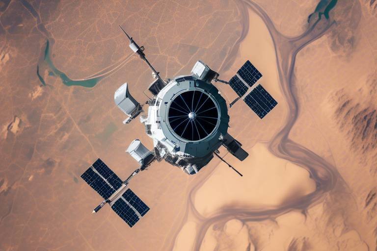
Recent advancements in satellite technology have significantly improved data collection and analysis capabilities. These innovations allow military forces to enhance situational awareness and operational efficiency on the battlefield. With the introduction of high-resolution imaging, data analytics, and improved communication systems, military planners can now access a wealth of information that was once unimaginable. It's akin to upgrading from a flip phone to a smartphone—suddenly, you have a world of information and capabilities at your fingertips.
Satellite technology has a wide range of applications in military intelligence, including reconnaissance, surveillance, and communication. Each of these applications plays a critical role in informed decision-making and strategic planning. For instance, reconnaissance missions utilize satellites to gather critical information about enemy positions and movements. This enables military planners to develop effective strategies and responses to potential threats. Furthermore, the ability to communicate securely via satellite ensures that troops remain connected, even in the most remote areas.
Reconnaissance missions are a cornerstone of military intelligence, utilizing satellites to gather crucial information. By employing advanced imaging techniques, military forces can monitor enemy positions and movements from a safe distance. This capability is invaluable, allowing for the development of effective strategies and timely responses to potential threats. Imagine being able to see the battlefield from above, identifying enemy troop movements and supply lines before they even know you're watching.
The ability to transmit data in real-time from satellites is a game-changer for military operations. It allows military units to receive and analyze information instantly, facilitating timely responses to evolving situations on the ground. This immediacy can mean the difference between success and failure in critical operations. With real-time data, commanders can make informed decisions, deploy resources efficiently, and adapt to changing circumstances.
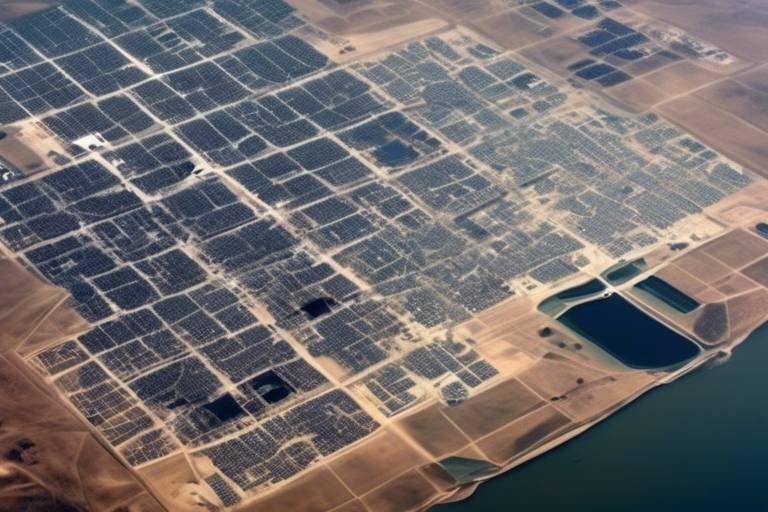
Image analysis techniques leverage satellite imagery to detect changes in terrain and infrastructure. This capability provides valuable insights for military operations and resource allocation. For example, detecting changes in roads or buildings can indicate shifts in enemy activity or the establishment of new supply routes. The precision of modern imaging technology allows military planners to visualize the battlefield in ways that were previously impossible, enhancing their ability to anticipate and counter threats.
The surveillance capabilities provided by satellites enhance the ability to monitor activities in specific regions. This ensures that military forces maintain a strategic advantage over adversaries. By keeping a watchful eye on potential hotspots, military leaders can stay one step ahead, ready to act at a moment’s notice. The integration of advanced sensors and imaging technologies means that surveillance can be conducted around the clock, providing continuous coverage of critical areas.
Despite their advantages, satellite technology also faces significant challenges. Issues such as vulnerability to cyber attacks, space debris, and limitations in resolution and coverage can impact military operations. As military forces become increasingly reliant on satellite systems, it is crucial to address these challenges head-on to ensure the effectiveness of military intelligence.
The increasing reliance on satellite systems exposes military intelligence to cybersecurity threats. Hackers and hostile nations may seek to disrupt communications or steal sensitive data, necessitating robust security measures to protect military assets. This is akin to locking the doors of a fortress—if the defenses are weak, intruders can easily gain access. Therefore, investing in cybersecurity is paramount to safeguarding military intelligence.
The growing issue of space debris poses risks to satellite operations. With thousands of defunct satellites and debris orbiting the Earth, there is a real danger that collisions could disrupt critical military communications and surveillance efforts. Just as a traffic jam can delay your journey, space debris can hinder military operations, making it essential to find solutions to mitigate these risks.
Looking ahead, the future of military intelligence through satellite technology promises exciting innovations. Enhanced AI integration, improved miniaturization, and collaborative efforts among nations will play crucial roles in ensuring global security. The potential for satellites to gather and analyze data autonomously is on the horizon, making intelligence gathering faster and more efficient than ever before.
The integration of artificial intelligence in satellite systems is set to revolutionize intelligence gathering. Imagine a system that can process vast amounts of data in seconds, identifying threats and anomalies with pinpoint accuracy. This capability will enable military operations to be more proactive rather than reactive, allowing forces to anticipate and neutralize threats before they materialize.
International collaboration in satellite technology development will be essential for enhancing global security. By fostering partnerships that promote shared intelligence and collective defense strategies, nations can work together to address common threats. Just as a team is stronger than an individual, collaboration in military intelligence will create a more formidable defense against adversaries.
- What role do satellites play in military intelligence? Satellites provide crucial data for reconnaissance, surveillance, and communication, enhancing situational awareness and operational efficiency.
- What are the main challenges facing military satellites? Key challenges include cybersecurity threats, space debris, and limitations in resolution and coverage.
- How is AI expected to change military intelligence? AI will enable faster data processing and more accurate threat assessments, revolutionizing intelligence gathering.
- Why is international collaboration important in satellite technology? Collaborative efforts enhance global security by promoting shared intelligence and collective defense strategies.
Advancements in Satellite Technology
Recent advancements in satellite technology have dramatically transformed the landscape of military intelligence. Gone are the days when gathering information was a slow and cumbersome process, often reliant on ground troops or outdated aerial reconnaissance methods. Today, satellites orbiting our planet are equipped with cutting-edge sensors and imaging devices that provide a wealth of data in real-time, enhancing situational awareness for military forces. Imagine having a bird’s-eye view of the battlefield, where every movement and change can be monitored instantly. This capability not only improves operational efficiency but also allows for a more proactive approach to military strategy.
One of the most significant improvements has been in the resolution and clarity of satellite imagery. Modern satellites can capture images with astonishing detail, enabling military planners to discern even the smallest changes in enemy positions or infrastructure. For instance, a satellite can detect the construction of a new military base or the movement of troops with a level of precision that was unimaginable just a decade ago. This capability is further enhanced by advanced image analysis techniques, which utilize artificial intelligence to process and interpret vast amounts of data quickly. As a result, military leaders can make informed decisions based on accurate and timely information.
Moreover, the integration of real-time data transmission has revolutionized how military units operate. No longer do commanders have to wait for reports from the field; they can receive live updates directly from satellites, allowing them to adapt their strategies on the fly. This immediacy is crucial in modern warfare, where the difference between success and failure can hinge on seconds. With satellite technology, military forces can respond to threats as they emerge, rather than relying on outdated intelligence.
In addition to these advancements, the miniaturization of satellite technology has made it possible to deploy smaller, more agile satellites that can be launched quickly and at a lower cost. This flexibility enables military forces to maintain a robust presence in various regions without the logistical challenges associated with larger satellites. The ability to launch a constellation of smaller satellites means that military planners can cover more ground and gather intelligence from multiple angles, enhancing overall situational awareness.
As we look to the future, the continuous evolution of satellite technology promises even greater innovations. The integration of artificial intelligence into satellite systems is set to streamline data processing and enhance threat assessment capabilities. Imagine a scenario where AI algorithms can predict enemy movements based on historical data, allowing military forces to preemptively counter potential threats. This level of foresight could redefine the rules of engagement in modern warfare.
In conclusion, the advancements in satellite technology have not only enhanced military intelligence but have also reshaped the way military forces operate on the battlefield. The combination of high-resolution imagery, real-time data transmission, and the ongoing integration of AI is paving the way for a new era of warfare where information is power, and timely intelligence is the key to success.
Key Applications in Military Intelligence
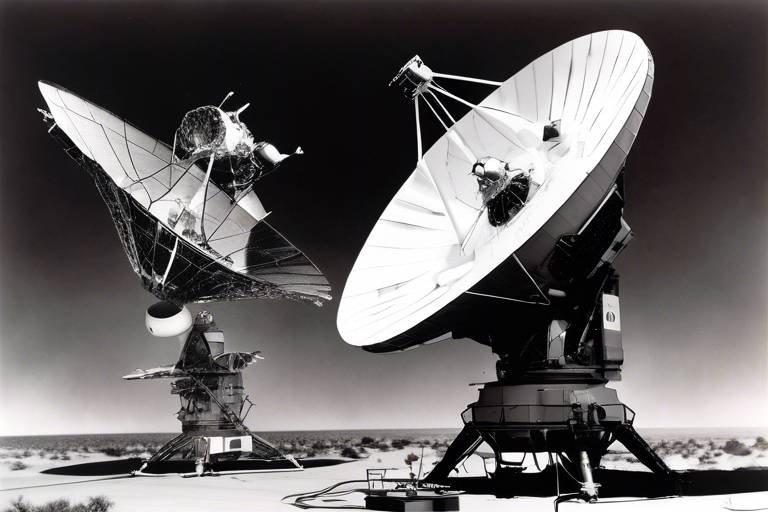
Satellite technology has become a cornerstone in the realm of military intelligence, serving as a powerful tool that enhances operational capabilities and strategic decision-making. The applications of satellite technology in this field are vast and varied, encompassing several critical areas that are essential for modern warfare. From reconnaissance to surveillance and communication, satellites provide a multi-faceted approach to gathering and analyzing intelligence.
One of the most significant applications of satellite technology is in reconnaissance missions. These missions utilize advanced satellite systems to collect vital information about enemy positions, troop movements, and other strategic assets. By employing high-resolution imaging and advanced sensors, military planners can develop effective strategies based on real-time data. This capability not only enhances situational awareness but also allows for proactive measures against potential threats.
In addition to reconnaissance, satellites play a crucial role in surveillance capabilities. They enable continuous monitoring of specific regions, ensuring that military forces can keep a watchful eye on adversaries. This persistent surveillance capability is vital for identifying patterns of behavior and potential threats, allowing for timely and informed responses. The ability to track movements and gather intelligence over vast areas provides military leaders with a strategic advantage, making it more difficult for adversaries to operate undetected.
Moreover, the communication capabilities provided by satellite technology cannot be overstated. Secure and reliable communication channels are essential for coordinating operations, sharing intelligence, and maintaining command and control. Satellites facilitate seamless communication between units deployed in different geographic locations, ensuring that information flows freely and quickly. This connectivity is particularly crucial in joint operations where multiple branches of the military or allied forces need to work together efficiently.
To illustrate the various applications of satellite technology in military intelligence, consider the following table that summarizes key functions and their impacts:
| Application | Description | Impact on Military Operations |
|---|---|---|
| Reconnaissance | Gathering intelligence on enemy positions and movements. | Informed strategic planning and threat assessment. |
| Surveillance | Continuous monitoring of specific regions. | Enhanced situational awareness and timely responses. |
| Communication | Secure channels for coordination among military units. | Improved command and control in operations. |
In conclusion, the key applications of satellite technology in military intelligence are diverse and integral to modern warfare. By leveraging these advanced capabilities, military forces can enhance their operational efficiency, maintain a strategic advantage, and respond effectively to emerging threats. As technology continues to advance, the potential for even greater applications in the future is promising, ensuring that military intelligence remains a step ahead in the complex landscape of global security.
Reconnaissance Missions
are a cornerstone of military strategy, serving as the eyes and ears of armed forces on the ground. In an age where information is power, the ability to gather real-time data from above provides a significant tactical advantage. Satellites equipped with advanced imaging technology can capture detailed images of enemy positions, movements, and even terrain changes that might go unnoticed by ground troops. This capability not only enhances situational awareness but also allows military planners to devise effective strategies tailored to the evolving battlefield landscape.
Imagine a chess game where each move is crucial. Just as a chess player anticipates the opponent's strategies, military leaders rely on reconnaissance to predict enemy actions. Satellites play a vital role in this scenario, offering a bird's-eye view of the battlefield. They can monitor large areas quickly, providing vital intelligence that informs decisions on troop deployments and resource allocation. For instance, high-resolution satellite imagery can reveal hidden enemy installations or movements, allowing for preemptive actions that could alter the course of engagements.
One of the most exciting aspects of reconnaissance missions is the real-time data transmission capability. This technology enables military units to receive critical information almost instantaneously. In a world where every second counts, being able to act on fresh intelligence can mean the difference between success and failure. For example, if a satellite detects an enemy convoy on the move, military commanders can quickly analyze the data and make informed decisions on whether to intercept or monitor the situation further.
Furthermore, the use of image analysis techniques allows for a deeper understanding of the captured data. By employing sophisticated algorithms, military analysts can detect changes in the landscape, such as the construction of new facilities or the movement of troops. This analysis is crucial for planning operations and ensuring that resources are allocated effectively. For instance, if satellite imagery shows an increase in activity at a particular location, it could signal an impending attack, prompting preemptive measures.
In summary, reconnaissance missions powered by satellite technology are transforming the landscape of military intelligence. They provide a comprehensive view of the battlefield, enabling informed decision-making and strategic planning. As technology continues to advance, we can expect even more sophisticated tools that will enhance these missions, making them an indispensable part of modern warfare.
- What is the primary purpose of reconnaissance missions?
The primary purpose is to gather intelligence on enemy positions and movements, which helps inform military strategies and decisions. - How do satellites improve reconnaissance?
Satellites provide high-resolution imagery and real-time data transmission, allowing for quick analysis and response to evolving situations. - What are some challenges faced in satellite reconnaissance?
Challenges include cybersecurity threats, space debris, and limitations in resolution and coverage that can affect data accuracy.
Real-time Data Transmission
In the fast-paced world of military operations, the ability to receive and analyze information in real-time is nothing short of revolutionary. Imagine a battlefield where intelligence is not just gathered but transmitted instantaneously, allowing decision-makers to act on the latest developments without delay. This is the power of through satellite technology. It transforms how military forces operate, turning them into agile and responsive entities capable of adapting to rapidly changing situations.
Real-time data transmission enables military units to receive crucial updates from satellites that are orbiting the Earth. These satellites collect a plethora of information, from enemy troop movements to environmental changes, and relay it back to command centers within moments. This immediacy is vital for several reasons:
- Enhanced Situational Awareness: Commanders can make informed decisions based on the latest intelligence, significantly improving their situational awareness.
- Timely Strategic Responses: With up-to-the-minute data, military forces can respond to threats as they arise, rather than relying on outdated information.
- Resource Optimization: Real-time insights allow for better allocation of resources, ensuring that troops and equipment are deployed where they are needed most.
Furthermore, the integration of advanced communication technologies ensures that data is not only transmitted quickly but also securely. Military operations demand the highest levels of security, and the risk of interception or jamming is ever-present. That's why systems are designed with robust encryption protocols, ensuring that sensitive information remains protected from adversaries.
As we look to the future, the potential for real-time data transmission will only grow. Innovations in satellite technology, such as the development of low Earth orbit (LEO) satellites, promise to enhance the speed and reliability of data transmission. These satellites can provide lower latency connections, which is crucial for operations that require immediate feedback.
In summary, real-time data transmission is a game-changer for military intelligence. It empowers forces with the information they need, when they need it, allowing them to maintain an edge over adversaries in an increasingly complex battlefield environment.
- What is real-time data transmission in military intelligence?
Real-time data transmission refers to the immediate transfer of information from satellites to military units, allowing for quick decision-making based on the latest intelligence. - How does real-time data transmission improve military operations?
It enhances situational awareness, enables timely responses to threats, and optimizes resource allocation, making military operations more effective. - What technologies support real-time data transmission?
Advanced satellite communication technologies, including encryption protocols and low Earth orbit satellites, play a crucial role in supporting real-time data transmission.
Image Analysis Techniques
Image analysis techniques have become a cornerstone of modern military intelligence, transforming the way armed forces gather and interpret data from satellite imagery. With the rapid advancement of technology, these techniques allow analysts to extract critical information from vast amounts of visual data, turning pixels into actionable intelligence. Imagine a vast tapestry of land and infrastructure, where every thread tells a story of movement, change, and potential threat. This is the power of satellite imagery, and the analysis techniques applied to it are what bring that tapestry to life.
One of the most significant methodologies in image analysis is change detection. This technique involves comparing satellite images taken at different times to identify alterations in the landscape. For instance, if a military base has expanded or if new construction is underway in a previously barren area, change detection can reveal these developments. This capability is essential for assessing enemy capabilities and intentions, enabling military planners to adapt their strategies accordingly.
Moreover, machine learning algorithms are increasingly being integrated into image analysis processes. These algorithms can learn from previous data and improve their accuracy over time, making them invaluable for identifying patterns and anomalies in imagery. For example, these systems can be trained to recognize specific vehicles, troop movements, or even changes in vegetation that might indicate covert activities. The ability to automate such analyses not only saves time but also enhances the precision of intelligence assessments.
In addition to these techniques, geospatial analysis plays a vital role in interpreting satellite images. By overlaying various data layers—such as topography, infrastructure maps, and demographic information—analysts can gain deeper insights into the operational environment. This multi-faceted approach allows military leaders to visualize potential scenarios and make informed decisions based on comprehensive intelligence.
Furthermore, the use of advanced visualization tools enhances the interpretative process. Tools that allow for 3D modeling of terrain and structures enable analysts to simulate various military operations and predict potential outcomes. Imagine being able to walk through a virtual battlefield before ever setting foot in it; this is the future of military planning, facilitated by sophisticated image analysis techniques.
In summary, the evolution of image analysis techniques in military intelligence is not just about collecting data—it's about transforming that data into a strategic advantage. As technology continues to advance, the integration of artificial intelligence, machine learning, and geospatial analysis will further refine these techniques, ensuring that military forces remain one step ahead of their adversaries.
- What is image analysis in military intelligence?
Image analysis in military intelligence refers to the techniques used to interpret satellite imagery, extracting valuable information for strategic decision-making. - How does change detection work?
Change detection works by comparing satellite images taken at different times to identify changes in the landscape, such as new constructions or troop movements. - What role does machine learning play in image analysis?
Machine learning enhances image analysis by automating the identification of patterns and anomalies in satellite imagery, improving accuracy and efficiency. - Why is geospatial analysis important?
Geospatial analysis integrates various data layers to provide a comprehensive understanding of the operational environment, aiding in military planning and strategy.
Surveillance Capabilities
Surveillance capabilities provided by satellites are nothing short of revolutionary in the realm of military intelligence. Imagine having a bird's-eye view of an entire battlefield, where every movement can be tracked and analyzed in real-time. This is the power that modern satellite technology brings to military operations. With the ability to monitor vast areas from space, military forces can maintain a strategic advantage over their adversaries, ensuring that they are always a step ahead.
One of the most significant advantages of satellite surveillance is its ability to gather data without the need for physical presence on the ground. This capability allows military planners to observe enemy activities, troop movements, and even changes in infrastructure without exposing personnel to danger. For instance, satellites equipped with advanced imaging technologies can capture high-resolution images that reveal critical information about enemy positions and logistics.
Additionally, satellites can be deployed for various types of surveillance operations, including:
- Electro-Optical Surveillance: Utilizing visible light and infrared sensors, these satellites can detect heat signatures and monitor activities even in low-light conditions.
- Radar Imaging: Synthetic Aperture Radar (SAR) satellites can penetrate cloud cover and provide detailed images of the ground, making them invaluable during adverse weather conditions.
- Signals Intelligence (SIGINT): Satellites can intercept and analyze electronic communications, offering insights into enemy plans and capabilities.
The integration of these various surveillance techniques allows for a comprehensive understanding of the operational environment. Data collected from satellite surveillance can be analyzed using sophisticated algorithms and artificial intelligence, leading to more accurate threat assessments and strategic planning. For example, if a satellite detects unusual troop movements, military analysts can quickly evaluate the situation and decide on the best course of action, whether that involves deploying additional forces or engaging in diplomatic efforts.
Moreover, the real-time nature of satellite surveillance means that military leaders can make informed decisions based on the most current information available. This capability is crucial in fast-paced conflict scenarios where every second counts. Imagine a situation where a sudden enemy advance is detected; with satellite surveillance, commanders can respond immediately, adjusting their tactics to counteract the threat effectively.
However, it's important to note that while satellite surveillance provides unparalleled advantages, it is not without its challenges. The reliance on satellite technology can create vulnerabilities, such as susceptibility to electronic warfare tactics that aim to jam or spoof satellite signals. Therefore, continuous advancements in satellite technology and cybersecurity measures are essential to ensure that military forces can maintain their surveillance capabilities in contested environments.
In conclusion, the surveillance capabilities offered by satellite technology are a game-changer for military intelligence. They provide comprehensive, real-time insights that empower military planners to make informed decisions and stay ahead of potential threats. As technology continues to evolve, we can expect even greater enhancements in satellite surveillance, further solidifying its role as a cornerstone of modern military strategy.
- What are the main advantages of satellite surveillance in military operations? Satellite surveillance offers real-time data collection, the ability to monitor large areas without physical presence, and advanced imaging technologies that provide critical information about enemy activities.
- How does satellite surveillance enhance decision-making in military contexts? By providing timely and accurate information, satellite surveillance allows military leaders to make informed decisions quickly, adapting strategies to changing conditions on the battlefield.
- What are the challenges associated with satellite surveillance? Challenges include vulnerabilities to electronic warfare, the potential for signal jamming, and the need for robust cybersecurity measures to protect sensitive data.
Challenges and Limitations
Despite the remarkable advancements in satellite technology, there are significant challenges and limitations that military forces must navigate. One of the most pressing issues is the vulnerability to cyber attacks. As militaries increasingly rely on satellite systems for communication and intelligence, the risk of cyber threats grows. Hackers and hostile nations can potentially disrupt satellite operations, leading to compromised data and undermined military strategies. This reality necessitates the implementation of robust cybersecurity measures to safeguard sensitive information and ensure the integrity of military operations.
Another challenge is the issue of space debris. As more satellites are launched into orbit, the risk of collisions increases. Space debris can damage operational satellites, disrupting critical communications and surveillance efforts. This is particularly concerning in contested environments where maintaining a strategic advantage is crucial. Military planners must consider these risks and develop contingency plans to mitigate the impact of space debris on their operations.
Moreover, there are inherent limitations in resolution and coverage that can affect military effectiveness. While satellite technology has made significant strides, certain areas may still lack adequate coverage, leaving gaps in intelligence. High-resolution imagery is essential for accurate assessments, yet not all satellites can provide the level of detail required for effective reconnaissance. This can lead to situations where military forces operate with incomplete information, potentially jeopardizing mission success.
To illustrate these challenges, consider the following
| Challenge | Description | Impact on Military Operations |
|---|---|---|
| Cybersecurity Threats | Increased risk of hacking and data breaches | Compromised intelligence and communication |
| Space Debris | Collision risk with non-functional satellites | Disruption of satellite services |
| Resolution Limitations | Inadequate detail in satellite imagery | Incomplete situational awareness |
In summary, while satellite technology is a game-changer for military intelligence, it is not without its challenges. The combination of cybersecurity threats, space debris, and limitations in resolution and coverage creates a complex landscape that military planners must navigate. Addressing these issues is crucial for maximizing the effectiveness of satellite systems and ensuring that military forces maintain their strategic advantages in an increasingly technology-driven battlefield.
- What are the main challenges faced by military satellites?
The main challenges include cybersecurity threats, space debris, and limitations in resolution and coverage.
- How does space debris affect military operations?
Space debris poses collision risks that can disrupt satellite services critical for communication and surveillance.
- Why is cybersecurity important for military satellites?
Cybersecurity is vital to protect sensitive military data from potential breaches and ensure operational integrity.
Cybersecurity Threats
The increasing reliance on satellite systems in military intelligence has opened up a Pandora's box of cybersecurity threats that can jeopardize national security. Imagine a scenario where an enemy hacker gains access to critical satellite data, leading to disastrous consequences on the battlefield. This is not just a hypothetical situation; it is a looming reality that military organizations around the world must confront. As satellite technology evolves, so do the methods employed by cyber adversaries. These threats can manifest in various forms, including data breaches, signal jamming, and even spoofing, where false information is sent to deceive military operations.
To better understand the gravity of these threats, let's consider the following key points:
- Data Breaches: Unauthorized access to sensitive military data can lead to the exposure of strategic plans and operational capabilities. This not only undermines the element of surprise but also endangers the lives of military personnel.
- Signal Jamming: By disrupting satellite signals, adversaries can hinder communication and coordination among military units, leading to chaos and confusion during critical missions.
- Spoofing Attacks: In these attacks, malicious actors send false signals that can mislead military forces regarding enemy positions or movements, potentially resulting in catastrophic miscalculations.
Given these threats, it becomes imperative for military organizations to invest in robust cybersecurity measures. The integration of advanced encryption techniques, continuous monitoring of satellite networks, and regular security audits can help mitigate risks. Moreover, fostering a culture of cybersecurity awareness among personnel is essential. Just as soldiers train for physical combat, they must also be equipped to handle the cyber battlefield.
In conclusion, the intersection of satellite technology and cybersecurity presents both opportunities and challenges. While satellites enhance military intelligence capabilities, they also expose forces to new vulnerabilities. As we march toward a future where satellite technology becomes even more integral to military operations, addressing cybersecurity threats must remain a top priority. Only then can we truly harness the full potential of satellite technology in safeguarding national security.
Q: What are the main cybersecurity threats to military satellites?
A: The primary threats include data breaches, signal jamming, and spoofing attacks, all of which can severely impact military operations.
Q: How can military organizations protect their satellite systems?
A: They can implement advanced encryption methods, conduct regular security audits, and foster cybersecurity awareness among personnel.
Q: Why is cybersecurity important for military intelligence?
A: Cybersecurity is crucial because it protects sensitive information and ensures the integrity of communication and operations, which are vital for national security.
Space Debris Concerns
As we venture deeper into the cosmos, the issue of space debris has become a pressing concern for military operations reliant on satellite technology. Space debris, which includes defunct satellites, spent rocket stages, and fragments from collisions, poses a significant risk to operational satellites. Imagine navigating a busy highway where not only are there cars, but also abandoned vehicles and debris scattered everywhere—this is akin to the current state of space. With thousands of pieces of debris orbiting the Earth, even a tiny fragment can cause catastrophic damage to a satellite, jeopardizing critical military communications and intelligence-gathering efforts.
The implications of space debris extend beyond just physical damage; they can also lead to disruptions in military operations. For instance, if a satellite is struck by debris, it may not only lose its functionality but could also create more debris, further complicating the orbital environment. This creates a hazardous cycle that could hinder the ability of military forces to maintain surveillance and execute operations effectively. The potential for collisions increases in areas of high satellite density, particularly in low Earth orbit, where many military and civilian satellites operate.
To illustrate the scale of this issue, consider the following statistics:
| Category | Number of Objects |
|---|---|
| Active Satellites | 3,300+ |
| Defunct Satellites | 2,000+ |
| Space Debris (Fragments) | 34,000+ |
Given these alarming numbers, military organizations must prioritize the development of space traffic management systems to mitigate the risks associated with space debris. These systems would monitor and predict potential collisions, allowing for timely maneuvers to avoid debris. Moreover, international cooperation is essential to address the growing threat of space debris. Just as countries work together to manage air traffic, a similar approach is needed for space. The establishment of global guidelines and protocols for satellite launches and end-of-life disposal can significantly reduce the creation of new debris.
In conclusion, the concerns surrounding space debris are not just technical challenges; they pose real threats to national security and military effectiveness. As we look to the future, addressing these challenges will require innovative solutions and collaborative efforts across nations. The safety of our satellite systems, and consequently our military operations, hinges on our ability to manage and mitigate the risks posed by this growing problem.
- What is space debris? Space debris refers to non-functional spacecraft, abandoned satellites, and fragments from collisions that orbit the Earth.
- How does space debris affect military satellites? Space debris can collide with operational satellites, causing damage that disrupts military communications and intelligence operations.
- What measures are being taken to manage space debris? Efforts include developing space traffic management systems and international guidelines for satellite launches and disposal.
The Future of Satellite Military Intelligence
As we gaze into the horizon of military strategy, it becomes increasingly clear that satellite technology will play a pivotal role in shaping the future of military intelligence. The integration of advanced technologies, such as artificial intelligence (AI) and improved satellite miniaturization, is set to revolutionize how military forces collect and analyze data. Imagine a battlefield where decisions are made not just on gut feelings but on precise data delivered in real-time from space. This isn't science fiction; it's the future of warfare.
One of the most exciting prospects is the integration of AI in satellite systems. By leveraging AI, military intelligence can process vast amounts of data at lightning speed, enabling quicker and more accurate threat assessments. For instance, AI algorithms can analyze satellite imagery to identify patterns that human analysts might miss. This not only enhances situational awareness but also significantly reduces the time it takes to formulate responses to potential threats. Just think about it—what if a military unit could receive actionable intelligence within minutes of a significant event occurring on the ground?
Moreover, the future of satellite military intelligence will likely see a shift towards miniaturization of satellite technology. Smaller, more agile satellites can be deployed in greater numbers, providing enhanced coverage and flexibility. This means that military forces will have access to a more comprehensive view of the battlefield, allowing for better strategic planning. For example, instead of relying on a few large satellites, a network of small satellites can provide continuous surveillance, ensuring that no corner of the operational theater is left unmonitored.
Another crucial aspect of the future landscape is international collaboration. As military threats become more globalized, nations will need to work together to enhance security through shared intelligence. Collaborative efforts in satellite technology development can lead to a more unified approach to defense, where information is exchanged seamlessly among allies. This not only strengthens individual nations but also fortifies global security. Imagine a scenario where multiple countries share satellite data to track a hostile force, allowing for a coordinated response that is both timely and effective.
However, the road ahead is not without challenges. As we embrace these advancements, we must also contend with issues such as cybersecurity threats and the growing problem of space debris. Protecting sensitive military data from cyber attacks will be paramount. This means investing in robust security measures and protocols to safeguard the information flowing through these advanced systems. Additionally, the increasing amount of space debris presents risks to satellite operations, which could disrupt critical military communications and surveillance efforts. Thus, while the future holds great promise, it also demands careful navigation through its complexities.
In conclusion, the future of satellite military intelligence is bright, filled with potential for innovation and enhanced operational capabilities. As we continue to explore the possibilities of AI integration, miniaturization, and international collaboration, we must remain vigilant about the challenges that lie ahead. The battlefield of tomorrow will be defined by those who can harness the power of technology to make informed decisions quickly and effectively.
- What role does AI play in satellite military intelligence?
AI enhances data processing and threat assessment, allowing military forces to respond more swiftly to emerging situations. - How does miniaturization affect satellite technology?
Miniaturization allows for more satellites to be deployed, providing better coverage and flexibility on the battlefield. - What are the cybersecurity risks associated with satellite technology?
Increased reliance on satellite systems exposes military intelligence to potential cyber attacks, necessitating strong security measures. - Why is international collaboration important for military satellite technology?
Collaborative efforts foster shared intelligence and collective defense strategies, enhancing global security.
AI Integration in Intelligence Gathering
The integration of artificial intelligence (AI) into military satellite systems is not just a trend; it's a game changer in the realm of intelligence gathering. Imagine having the ability to process vast amounts of data in real-time, identifying threats and opportunities faster than ever before. With AI, military forces can harness the power of machine learning to analyze satellite imagery, detect patterns, and predict enemy movements with remarkable accuracy.
One of the most exciting aspects of AI integration is its capacity for automated image analysis. Traditional methods of analyzing satellite images can be time-consuming and often require human intervention. However, AI algorithms can sift through thousands of images in minutes, identifying key changes in landscapes, infrastructure, and troop movements. This capability not only speeds up the decision-making process but also enhances the precision of military operations. For instance, if a satellite captures an image of a military base, AI can quickly compare it to previous images and highlight any significant changes, such as the arrival of new equipment or troop deployments.
Furthermore, AI can significantly improve the predictive analytics capabilities of military intelligence. By analyzing historical data and current trends, AI systems can forecast potential threats and suggest strategic responses. This predictive power is akin to having a crystal ball that provides military planners with insights into future scenarios, enabling them to prepare and react proactively rather than reactively. For example, if AI detects an unusual buildup of resources in a specific region, military leaders can take preemptive measures, potentially averting conflict before it escalates.
However, the integration of AI is not without its challenges. As military forces increasingly rely on these advanced technologies, they must also address concerns related to data security and ethical considerations. The potential for AI systems to make autonomous decisions raises questions about accountability and the risk of unintended consequences. Additionally, as AI becomes more prevalent, adversaries may also seek to exploit these technologies, leading to an arms race in AI capabilities.
In conclusion, the future of military intelligence is undeniably intertwined with AI integration. As technology continues to evolve, we can expect to see even more sophisticated applications of AI in satellite systems, enhancing situational awareness and operational effectiveness. The journey toward a fully integrated AI-driven military intelligence framework is just beginning, and the possibilities are as vast as the skies above us.
- What role does AI play in military intelligence?
AI enhances data analysis, automates image processing, and improves predictive analytics, allowing for faster and more accurate intelligence gathering. - Are there risks associated with AI in military applications?
Yes, risks include data security concerns, ethical dilemmas regarding autonomous decision-making, and the potential for adversaries to exploit AI technologies. - How can AI improve satellite imagery analysis?
AI can analyze vast amounts of satellite imagery quickly, identifying significant changes and patterns that human analysts may miss, thus enhancing situational awareness.
International Collaboration and Security
As we venture into an era where global threats are increasingly complex and interconnected, the importance of international collaboration in military satellite technology cannot be overstated. Countries around the world are recognizing that in order to effectively address these challenges, they must work together, sharing resources and intelligence. This collaboration not only enhances the capabilities of individual nations but also strengthens global security as a whole.
One of the most significant aspects of this collaboration is the pooling of data from various satellite systems. For instance, nations can share satellite imagery and analysis, providing a more comprehensive view of potential threats. Imagine a network of satellites, each contributing unique data points to a global security puzzle. This cooperative approach allows for a rapid response to emerging threats, as military planners have access to a wealth of information that would be impossible to gather independently.
Furthermore, joint military exercises that incorporate satellite technology foster a deeper understanding and trust among allied nations. These exercises simulate real-world scenarios where countries can practice utilizing satellite data in tandem, enhancing coordination and effectiveness during actual operations. As military forces become more accustomed to working with their counterparts from other nations, the potential for successful collaboration increases exponentially.
However, international collaboration in satellite technology isn't without its challenges. Issues such as data privacy, sovereignty concerns, and the potential for technology transfer can complicate partnerships. Countries must navigate these hurdles carefully to ensure that collaborative efforts are both effective and respectful of national interests. Establishing clear guidelines and protocols for data sharing can help mitigate these concerns, paving the way for more robust alliances.
In addition to enhancing operational capabilities, international collaboration can also lead to the development of new technologies. By pooling resources, nations can invest in cutting-edge research and development initiatives that may be beyond the reach of any single country. This collaborative innovation can result in breakthroughs in satellite technology that improve everything from data resolution to processing speed, ultimately benefiting military operations across the globe.
In summary, the future of military intelligence through satellite technology is brightened by the prospects of international collaboration. As nations continue to work together, sharing intelligence and resources, they will not only enhance their own security but also contribute to a safer world. The fusion of military might and cooperative spirit is essential in the face of evolving threats, and satellite technology stands at the forefront of this crucial partnership.
- What is the role of satellite technology in military intelligence?
Satellite technology plays a crucial role in gathering data for reconnaissance, surveillance, and communication, which are essential for informed decision-making in military operations. - How does international collaboration enhance military satellite capabilities?
By sharing data and resources, countries can improve their situational awareness and response times, leading to more effective military strategies. - What are the challenges of international collaboration in satellite technology?
Challenges include data privacy, sovereignty issues, and the potential for technology transfer, which must be navigated carefully to maintain effective partnerships. - How can artificial intelligence improve satellite military intelligence?
AI can enhance data processing speeds and accuracy, enabling quicker and more precise threat assessments for military operations.
Frequently Asked Questions
- What is the role of satellite technology in military intelligence?
Satellite technology plays a crucial role in military intelligence by providing enhanced reconnaissance, surveillance, and communication capabilities. It allows military forces to gather real-time data, analyze enemy movements, and make informed decisions, ultimately improving operational efficiency on the battlefield.
- How do satellites contribute to reconnaissance missions?
Satellites are essential for reconnaissance missions as they can collect critical information about enemy positions and movements from a distance. This data helps military planners devise effective strategies and respond to potential threats swiftly, ensuring a tactical advantage.
- What are the challenges faced by satellite technology in military applications?
Despite their benefits, satellite systems face several challenges, including vulnerability to cyber attacks, the growing issue of space debris, and limitations in resolution and coverage. These factors can impact the effectiveness of military operations and necessitate robust security measures to protect sensitive data.
- How is AI transforming military intelligence gathering through satellites?
The integration of artificial intelligence in satellite systems is revolutionizing intelligence gathering by enabling faster data processing and more accurate threat assessments. AI can analyze vast amounts of satellite imagery and data, providing military commanders with actionable insights in real-time.
- What is the future of military intelligence with satellite technology?
The future looks promising with advancements like enhanced AI integration and improved miniaturization of satellite systems. Additionally, international collaboration in satellite technology development will be vital for global security, fostering partnerships that enhance shared intelligence and collective defense strategies.