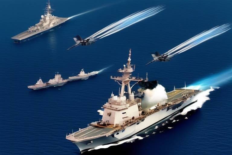
How Satellites Enhance Tactical Operations
In the fast-paced world of modern warfare and emergency response, the role of satellites has become increasingly vital. Imagine a chess game where every piece is equipped with real-time intelligence; this is essentially what satellites provide for tactical operations. By enhancing communication, surveillance, and navigation capabilities, satellites have revolutionized how military and emergency response teams operate. Their ability to deliver critical information in real-time can mean the difference between success and failure in high-stakes situations. So, how exactly do these orbiting marvels contribute to tactical operations? Let’s dive deeper into the myriad benefits they offer.
When it comes to tactical operations, communication is key. Satellites offer secure and reliable channels that enable seamless coordination among various tactical units, no matter where they are located. Picture a group of soldiers in a dense forest, cut off from traditional communication lines; without satellites, their ability to coordinate would be severely hampered. With satellite communication, they can maintain contact, share critical updates, and adjust their strategies on the fly. This capability not only enhances operational effectiveness but also significantly improves response times during emergencies.
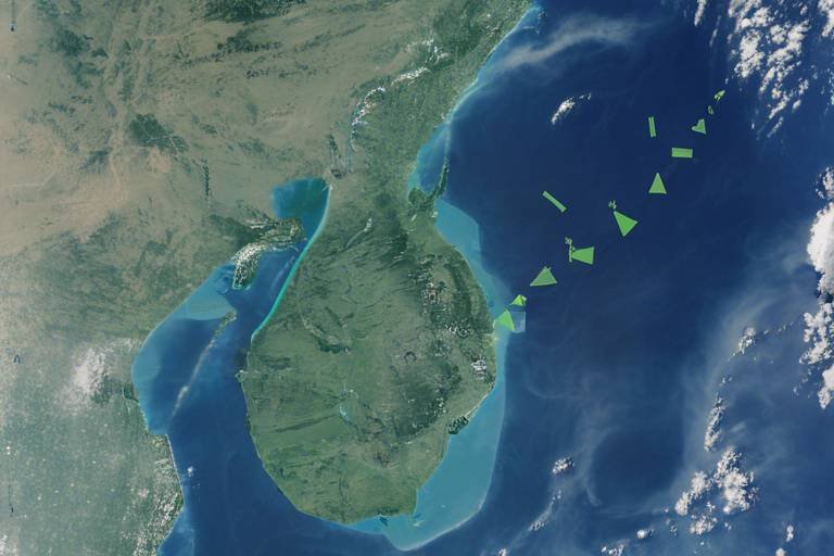
One of the most significant advantages of satellites is their advanced surveillance capabilities. With cutting-edge satellite imagery and reconnaissance systems, military forces can monitor terrain and enemy movements in real-time. This level of situational awareness is crucial for strategic planning. Imagine being able to see a battlefield from above, identifying not just where the enemy is, but also their movements and potential weaknesses. This is made possible by the high-resolution imaging capabilities of modern satellites.
The ability to transmit data in real-time from satellites to ground units ensures that decision-making is timely and informed. In critical missions where every second counts, having access to up-to-the-minute information can be a game-changer. For instance, during a rescue operation, ground teams can receive live updates on weather conditions or enemy positions, allowing them to adapt their plans without delay.
High-resolution satellite imagery provides commanders with detailed views of specific areas, enabling them to assess situations accurately. This is akin to having a high-definition camera focused on the battlefield, allowing for precise analysis and informed tactical decisions. The clarity of these images can reveal hidden threats or opportunities that would otherwise go unnoticed.
Moreover, utilizing multi-spectral imaging, satellites can detect various elements that are invisible to the naked eye. This includes identifying camouflage or heat signatures, which enhances the ability to spot threats that conventional observation methods might miss. Imagine trying to find a needle in a haystack; multi-spectral analysis turns that needle into a bright, flashing beacon, simplifying the search process.
Integrating satellite data with ground-based systems creates a comprehensive operational picture. This integration allows ground forces to leverage satellite intelligence effectively during missions. Think of it as combining a GPS with a detailed map; the synergy between the two provides a clearer understanding of the operational landscape, allowing for better planning and execution.
Another critical area where satellites shine is in navigation and positioning. Accurate navigation is essential for tactical operations, especially in complex environments. Satellites ensure that units can maneuver effectively, maintaining coordination even in the most challenging conditions.
Global Positioning System (GPS) technology, powered by satellites, delivers precise location data. This is crucial for mission planning, whether in urban settings or the wilderness. Imagine trying to navigate through a dense jungle with no map; GPS technology acts as a lifeline, guiding teams safely to their objectives.
Furthermore, satellite-based terrain mapping plays a significant role in understanding geographical features. By analyzing satellite data, tactical teams can devise strategic routes and anticipate challenges during operations. This foresight is akin to studying a topographical map before embarking on a hiking expedition; knowing the terrain can make all the difference in successfully completing the mission.
Satellites are not just invaluable in military contexts; they also play a critical role in disaster response. In the aftermath of natural disasters, satellites provide essential data for assessing damage, coordinating relief efforts, and ensuring the safety of both responders and affected populations.
After a disaster strikes, rapid damage assessment is crucial. Satellite imagery allows agencies to prioritize response efforts based on the severity and extent of destruction. This capability can significantly speed up the recovery process, helping communities get back on their feet faster.
By identifying affected areas through satellite data, organizations can allocate resources more efficiently. This ensures that aid reaches those in need promptly and effectively. Imagine a relief team trying to distribute supplies without knowing where the most affected areas are; satellite data eliminates guesswork, making operations much more effective.
- How do satellites improve communication in tactical operations?
Satellites provide secure and reliable channels that enable seamless coordination among tactical units, ensuring effective communication even in remote areas. - What role do satellites play in surveillance?
Satellites offer advanced imagery and reconnaissance systems that allow for real-time monitoring of terrain and enemy movements, significantly enhancing situational awareness. - How does GPS technology aid in navigation?
GPS technology, powered by satellites, provides accurate location data essential for effective navigation and mission planning. - Can satellites assist in disaster response?
Yes, satellites play a critical role in disaster response by providing essential data for damage assessment and resource allocation.
Communication Improvements
In the ever-evolving landscape of tactical operations, communication stands as a cornerstone of success. Imagine a complex military operation unfolding in a remote area, where every second counts. This is where satellites come into play, providing secure and reliable communication channels that are absolutely vital for seamless coordination among tactical units. Without these advanced systems, the risk of miscommunication or delayed responses could spell disaster. Thanks to satellite technology, teams can operate effectively in diverse environments, whether they’re navigating urban jungles or vast wilderness areas.
One of the most impressive aspects of satellite communication is its ability to maintain connectivity even in the most challenging conditions. Traditional communication methods often falter in remote locations or during natural disasters, but satellites ensure that tactical units remain in touch with command centers and each other. This capability significantly enhances operational effectiveness and response times, allowing teams to make informed decisions on the fly. Imagine trying to coordinate a rescue mission in a disaster-stricken area without reliable communication; it would be akin to sailing a ship without a compass.
Furthermore, the integration of secure communication protocols within satellite systems adds an extra layer of protection against potential threats. In the realm of military operations, safeguarding sensitive information is paramount. With encrypted channels, tactical units can share critical intelligence without the fear of interception. This not only boosts confidence among team members but also ensures that strategic plans remain confidential.
To illustrate the impact of satellite communication, consider the following table that outlines key advantages:
| Advantage | Description |
|---|---|
| Reliability | Consistent connectivity in remote or challenging environments. |
| Security | Encrypted communication channels protect sensitive information. |
| Real-time Coordination | Facilitates immediate decision-making and response. |
| Global Reach | Connects units across vast distances, regardless of terrain. |
In conclusion, the advancements in satellite technology have revolutionized communication in tactical operations. By providing reliable, secure, and real-time communication channels, satellites empower military and emergency response teams to operate with greater efficiency and effectiveness. As we continue to push the boundaries of technology, the role of satellites in enhancing communication will only grow, ensuring that our tactical units are always one step ahead.
- How do satellites improve communication in tactical operations? Satellites provide secure and reliable communication channels that enable seamless coordination among tactical units, even in challenging environments.
- What are the security features of satellite communication? Satellite communication systems often include encrypted channels to protect sensitive information from interception.
- Can satellite communication work in remote areas? Yes, satellite communication is particularly effective in remote or disaster-stricken areas where traditional communication methods may fail.
- How does satellite communication enhance decision-making? By providing real-time data transmission, satellite communication allows teams to make timely and informed decisions during critical missions.
Surveillance Capabilities
This article explores the vital role satellites play in modern tactical operations, enhancing communication, surveillance, and navigation capabilities for military and emergency response teams.
Satellites provide secure and reliable communication channels, enabling seamless coordination among tactical units in diverse environments, thereby enhancing operational effectiveness and response times.
When it comes to , satellites are nothing short of revolutionary. They offer advanced imaging and reconnaissance systems that allow military and emergency response teams to monitor terrain and enemy movements in real-time. Imagine having a bird's-eye view of an entire battlefield or disaster area; that’s the power satellites bring to the table. This capability significantly enhances situational awareness and strategic planning, which are crucial for success in tactical operations.
One of the most impressive features of satellite technology is its ability to transmit data in real-time. This means that information gathered from satellites can be sent directly to ground units almost instantaneously. In high-stakes situations, like military engagements or natural disasters, this rapid flow of information is vital for timely decision-making. Imagine a commander on the ground receiving live updates about enemy positions or changing weather conditions; this kind of immediacy can make all the difference.
High-resolution satellite imagery takes this a step further by providing detailed views of specific areas. This capability allows commanders to assess situations with precision. For instance, if a tactical team is planning an operation in a city, having access to high-resolution images can help them identify key locations, potential threats, and safe routes. The clarity and detail offered by modern satellite imaging are akin to having a detailed map of a maze before you even step inside.
Another fascinating aspect of satellite surveillance is multi-spectral analysis. This technology enables satellites to detect various elements beyond just visible light. For example, they can identify heat signatures or even camouflage that might otherwise go unnoticed. This capability is crucial for uncovering hidden threats and ensuring that tactical teams are well-informed about their surroundings. It’s like having a pair of superhuman eyes that can see things the naked eye cannot.
Furthermore, the integration of satellite data with ground-based systems creates a comprehensive operational picture. This synergy allows ground forces to leverage satellite intelligence effectively during missions. By combining satellite surveillance with local intelligence, teams can enhance their strategic planning and execution. It’s like having a GPS that not only tells you where you are but also provides insights into the best paths to take based on current conditions.
Satellites facilitate precise navigation and positioning, crucial for tactical operations, ensuring units can maneuver effectively and maintain coordination in complex environments.
Global Positioning System (GPS) technology, powered by satellites, provides accurate location data, essential for navigation and mission planning in both urban and wilderness settings.
Satellite-based terrain mapping helps in understanding geographical features, allowing tactical teams to devise strategic routes and anticipate challenges during operations.
Satellites play a critical role in disaster response, providing essential data for assessing damage, coordinating relief efforts, and ensuring the safety of both responders and affected populations.
Satellite imagery enables rapid damage assessment after natural disasters, helping agencies prioritize response efforts based on the severity and extent of destruction.
By identifying affected areas through satellite data, organizations can allocate resources more efficiently, ensuring that aid reaches those in need promptly and effectively.
- How do satellites improve communication in tactical operations?
Satellites provide secure and reliable channels that allow for seamless coordination among units, even in remote or hostile environments. - What types of data can satellites collect for surveillance?
Satellites can gather high-resolution imagery, multi-spectral data, and real-time updates on terrain and enemy movements. - How does GPS technology assist in tactical operations?
GPS provides accurate location data, essential for navigation and effective mission planning. - Can satellites help in disaster response?
Yes, satellites play a crucial role in assessing damage, coordinating relief efforts, and ensuring the safety of responders and affected populations.
Real-Time Data Transmission
In the fast-paced world of tactical operations, is nothing short of a game-changer. Imagine a scenario where every second counts—when decisions need to be made at lightning speed, having access to real-time data can mean the difference between success and failure. Satellites play a crucial role in this context, providing a steady stream of information that keeps ground units informed and ready to act.
With the ability to transmit data instantly, satellite technology ensures that tactical teams receive critical updates without delay. This capability is particularly vital during high-stakes missions, where commanders must respond to evolving situations on the ground. For instance, when a reconnaissance satellite captures a sudden enemy movement, that information can be relayed to troops in the field within moments, allowing them to adjust their strategies accordingly.
Furthermore, the integration of with advanced communication systems enhances operational efficiency. Ground units equipped with mobile devices can receive satellite feeds directly, allowing them to visualize the battlefield in a way that was previously unimaginable. This not only aids in situational awareness but also fosters seamless collaboration among different units, ensuring that everyone is on the same page. As a result, tactical operations become more coordinated and effective.
To illustrate the impact of real-time data transmission, consider the following table that highlights key advantages:
| Advantage | Description |
|---|---|
| Timely Decision-Making | Access to live data enables commanders to make informed decisions quickly. |
| Enhanced Coordination | Units can synchronize their actions based on real-time intelligence. |
| Increased Safety | Immediate updates reduce the risk of surprise attacks and ambushes. |
In essence, the ability to transmit data in real-time transforms how tactical operations are conducted. It empowers military and emergency response teams to act swiftly, adapt to changing circumstances, and ultimately achieve their objectives more efficiently. As technology continues to evolve, we can only expect this capability to become even more sophisticated, further enhancing the effectiveness of tactical operations worldwide.
- What role do satellites play in tactical operations?
Satellites are crucial for communication, surveillance, and navigation, providing real-time data that enhances operational effectiveness. - How does real-time data transmission improve decision-making?
It allows commanders to receive immediate updates, enabling them to make informed decisions quickly based on the latest information. - Can satellite data be integrated with ground systems?
Yes, integrating satellite data with ground-based systems creates a comprehensive operational picture, enhancing coordination among units.
High-Resolution Imaging
High-resolution imaging is a game-changer in the world of tactical operations. Imagine being able to see the details of a battlefield from space, as if you were standing right there. This technology allows military commanders to have an eagle-eye view of their operational environment, providing them with crucial information that can mean the difference between success and failure in missions. With high-resolution satellite imagery, every detail counts—be it the positioning of enemy forces, the layout of terrain, or even the presence of obstacles that could hinder movement.
One of the most significant advantages of high-resolution imaging is its ability to provide accurate situational awareness. When commanders receive detailed images, they can assess the battlefield and make informed decisions swiftly. This capability is especially critical during dynamic situations where conditions can change rapidly. For instance, if a commander needs to decide whether to advance or retreat, having access to real-time, high-resolution imagery can help them evaluate potential risks and opportunities effectively.
Furthermore, high-resolution satellite imagery can be used to create detailed maps that highlight various features of the terrain. These maps can be essential for planning tactical movements and identifying strategic positions. By analyzing these images, military units can determine the best routes to take while avoiding potential ambushes or difficult landscapes. The clarity and detail provided by high-resolution imaging allow for precision planning, ensuring that every step taken is calculated and deliberate.
In addition to military applications, high-resolution imaging is also vital in emergency response scenarios. For example, after a natural disaster, responders can utilize these images to assess damage and prioritize areas that require immediate attention. The ability to see the extent of destruction helps organizations allocate resources effectively and ensure that aid reaches those who need it most. In this way, high-resolution imaging not only enhances tactical operations but also plays a critical role in saving lives during crises.
To illustrate the capabilities of high-resolution imaging, consider the following table that highlights its key features and benefits:
| Feature | Benefit |
|---|---|
| Detailed Terrain Analysis | Enables strategic planning and route optimization. |
| Real-Time Monitoring | Facilitates quick decision-making in dynamic situations. |
| Damage Assessment | Helps prioritize response efforts after disasters. |
| Enhanced Target Identification | Improves accuracy in identifying enemy positions. |
In conclusion, high-resolution imaging is an indispensable tool for modern tactical operations. It empowers military and emergency response teams with the information they need to act decisively and effectively. Whether it’s planning a mission or responding to a crisis, the ability to view detailed images from above ensures that operations are conducted with the utmost precision and awareness.
- What is high-resolution imaging?
High-resolution imaging refers to satellite imagery that provides detailed and clear pictures of the Earth's surface, allowing for precise analysis and assessment. - How does high-resolution imaging benefit military operations?
It enhances situational awareness, aids in strategic planning, and improves target identification, leading to more effective mission execution. - Can high-resolution imaging be used in disaster response?
Yes, it plays a crucial role in assessing damage and prioritizing resource allocation during emergencies.
Multi-Spectral Analysis
When it comes to tactical operations, the ability to see beyond the visible spectrum can be a game changer. leverages satellite technology to capture data across various wavelengths, allowing military and emergency response teams to detect elements that are often hidden from plain sight. Imagine trying to find a needle in a haystack; now, imagine having a magnet that can pull out that needle effortlessly. That’s the power of multi-spectral imaging!
This technology works by utilizing different bands of light, including infrared and ultraviolet, to gather information about the environment. For instance, infrared imaging can reveal heat signatures, making it easier to spot vehicles or personnel that are camouflaged within the landscape. This capability is particularly useful in dense forests or urban environments where traditional visual surveillance might fail.
Moreover, multi-spectral analysis enhances the ability to identify threats by detecting subtle differences in materials and textures. Consider the following:
- Camouflage Detection: Certain materials reflect light differently, and multi-spectral imaging can reveal these differences, allowing for the detection of camouflaged equipment or personnel.
- Environmental Monitoring: This analysis can also be applied to monitor changes in vegetation, which might indicate the presence of hidden structures or enemy movements.
- Counter-IED Operations: In countering improvised explosive devices (IEDs), multi-spectral analysis can help identify changes in ground patterns that suggest the presence of buried explosives.
In essence, this advanced imaging technology acts like a pair of superhuman eyes, providing commanders with a wealth of information that aids in making informed decisions. By integrating multi-spectral data into their operational framework, tactical teams can significantly enhance their situational awareness, allowing them to respond more effectively to threats.
As we continue to advance technologically, the applications of multi-spectral analysis are becoming increasingly sophisticated. It's not just about what we can see; it's about what we can infer from the unseen. This powerful tool is revolutionizing the way tactical operations are conducted, ensuring that teams are better prepared for any challenge that may arise.
- What is multi-spectral analysis? Multi-spectral analysis is a technique that uses satellite technology to capture data across various wavelengths, allowing for the detection of elements that are not visible to the naked eye.
- How does it help in tactical operations? It enhances situational awareness by detecting threats like camouflaged personnel or vehicles, as well as monitoring environmental changes that could indicate enemy movements.
- Can multi-spectral analysis be used in disaster response? Yes, it can help assess damage and identify affected areas, improving the efficiency of resource allocation during disaster response efforts.
Integration with Ground Systems
In the realm of tactical operations, the integration of satellite data with ground systems is nothing short of revolutionary. Imagine a symphony where every instrument plays in perfect harmony; that’s how ground forces operate when they have access to satellite intelligence. With the seamless flow of information between satellites and ground units, commanders can create a comprehensive operational picture that enhances situational awareness. This integration is not just a luxury; it's a necessity in modern warfare and emergency response scenarios.
When ground forces receive real-time data from satellites, they can make informed decisions quickly. For instance, during a mission, if a unit encounters unexpected resistance, they can instantly access satellite imagery to assess the situation. This capability allows them to adapt their strategies on the fly, ensuring that they remain one step ahead of potential threats. The information provided by satellites can include everything from troop movements to environmental conditions, enabling ground units to plan their routes effectively and minimize risks.
Moreover, the integration of satellite data enhances communication among different tactical units. Just like a well-oiled machine, each component must work together to achieve the desired outcome. Ground forces can share critical information with each other, ensuring that everyone is on the same page. This level of coordination is vital, especially in complex environments where miscommunication can lead to dire consequences.
To illustrate the importance of this integration, consider the following table that outlines key benefits:
| Benefit | Description |
|---|---|
| Enhanced Situational Awareness | Real-time satellite data provides a clear picture of the battlefield, allowing for better decision-making. |
| Improved Coordination | Units can communicate effectively and share intelligence, reducing the chances of friendly fire. |
| Rapid Response | Timely access to satellite information allows ground forces to adapt to changing situations swiftly. |
| Strategic Planning | Data from satellites aids in devising effective strategies based on current conditions. |
In addition to these benefits, the integration of satellite systems with ground operations also supports training and simulation exercises. By using satellite data in training scenarios, military and emergency response teams can prepare for real-world situations in a controlled environment. This not only enhances their skills but also builds confidence in their ability to respond to emergencies effectively.
In conclusion, the integration of satellite data with ground systems transforms tactical operations into a more efficient and responsive endeavor. Just as a well-coordinated dance troupe captivates an audience, ground forces equipped with satellite intelligence can execute missions with precision and agility. The future of tactical operations will undoubtedly rely on this synergy, paving the way for smarter, more effective responses in times of need.
- How do satellites improve communication in tactical operations?
Satellites provide secure and reliable communication channels that enable seamless coordination among tactical units, regardless of their location. - What role does satellite imagery play in surveillance?
Advanced satellite imagery allows for real-time monitoring of terrain and enemy movements, significantly enhancing situational awareness. - Can satellite data be integrated with existing ground systems?
Yes, satellite data can be integrated with ground-based systems, providing a comprehensive operational picture for ground forces. - How does GPS technology aid in navigation?
GPS technology, powered by satellites, offers accurate location data essential for navigation and mission planning. - What is the significance of satellite data in disaster response?
Satellites provide critical data for assessing damage, coordinating relief efforts, and ensuring the safety of responders and affected populations.
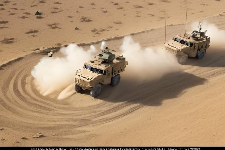
Navigation and Positioning
In the fast-paced world of tactical operations, play a pivotal role in the success of missions. Imagine being in a dense forest or an urban jungle where every turn could lead to unexpected challenges. This is where satellites come into play, acting like a guiding star in the night sky. They facilitate precise navigation and positioning, ensuring that tactical units can maneuver effectively and maintain coordination, even in the most complex environments.
One of the most significant advancements in this area is the Global Positioning System (GPS). Powered by a constellation of satellites orbiting the Earth, GPS technology provides accurate location data that is essential for navigation and mission planning. Think of GPS as your personal compass, but far more advanced. It allows military units to pinpoint their location to within a few meters, which is crucial when every second counts during operations. Whether troops are navigating through rugged terrains or crowded city streets, GPS ensures they stay on the right path.
Furthermore, satellites contribute to terrain mapping, which is invaluable for understanding geographical features. This satellite-based mapping helps tactical teams devise strategic routes and anticipate challenges they might face during operations. For instance, if a unit is approaching a mountain range, satellite imagery can reveal not just the elevation but also the type of terrain—rocky, wooded, or open fields. This information is crucial for planning the safest and most efficient routes, ultimately saving time and resources.
To illustrate the impact of satellite navigation, consider the following table that outlines the key benefits:
| Benefit | Description |
|---|---|
| Precision | GPS provides accurate location data, ensuring units can navigate effectively. |
| Real-Time Updates | Satellites offer real-time data, allowing for dynamic mission adjustments. |
| Enhanced Coordination | Units can maintain better communication and coordination through satellite data. |
| Strategic Planning | Terrain mapping enables informed decision-making regarding routes and tactics. |
In summary, the integration of satellite technology in navigation and positioning transforms how tactical operations are conducted. It empowers military and emergency response teams with the tools they need to make informed decisions, adapt to changing conditions, and ultimately, achieve their objectives with greater efficiency. As we continue to rely on these technological advancements, the future of tactical operations looks more precise and coordinated than ever before.
- How do satellites improve navigation for military operations? Satellites offer precise GPS data that allows military units to determine their exact location and navigate effectively, even in challenging environments.
- What role does terrain mapping play in tactical operations? Terrain mapping provides crucial insights into geographical features, helping teams plan strategic routes and anticipate potential obstacles during missions.
- Can satellite data be used in emergency response situations? Yes, satellite data is invaluable in emergency response, allowing agencies to assess damage and coordinate relief efforts more efficiently.
GPS Technology
The Global Positioning System (GPS) has revolutionized the way tactical operations are conducted, providing an unparalleled level of accuracy and reliability for military and emergency response teams. Imagine navigating through dense forests or urban jungles without a map—GPS is like having a personal guide that knows every twist and turn. With satellites orbiting the Earth, GPS technology offers precise location data that is crucial for both navigation and mission planning.
At its core, GPS operates by triangulating signals from at least four satellites. Each satellite transmits a signal that includes its location and the exact time the signal was sent. By measuring how long it takes for the signals to reach a GPS receiver, the device can calculate its distance from each satellite. This process is akin to measuring the echo of a sound in a room to determine how far away the walls are. The more satellites involved, the more accurate the positioning becomes, allowing tactical units to pinpoint their location within a few meters.
In tactical scenarios, the benefits of GPS technology are manifold. For instance, it enables:
- Real-Time Tracking: Commanders can monitor the movements of their units in real-time, ensuring that everyone is on the same page and can react swiftly to changing conditions.
- Route Optimization: GPS can help in planning the most efficient routes to objectives, avoiding obstacles and minimizing exposure to enemy fire.
- Coordination of Air and Ground Forces: Accurate positioning allows for better coordination between air support and ground troops, enhancing overall operational effectiveness.
Moreover, GPS technology is not just limited to military applications. In disaster response scenarios, it plays a pivotal role in ensuring that help reaches those in need. For example, rescue teams can use GPS to navigate to affected areas quickly, even in chaotic environments. The technology can also assist in mapping out safe zones and evacuation routes, which is essential for maintaining public safety.
As we look to the future, the integration of GPS technology with other systems, such as unmanned aerial vehicles (UAVs) and advanced mapping software, promises to enhance tactical operations even further. Just like a conductor brings together various instruments to create a harmonious symphony, the combination of GPS with other technologies can lead to more effective and efficient operations. The ability to access real-time data and share it across platforms will ensure that tactical units are always one step ahead, ready to respond to any challenge that comes their way.
- How does GPS work? GPS works by receiving signals from satellites to determine the user's location based on the time it takes for the signals to arrive.
- Can GPS be used in remote areas? Yes, GPS is effective in remote areas as long as there is a clear line of sight to the satellites.
- What are the limitations of GPS technology? GPS can be affected by factors such as signal blockage from buildings or trees, and its accuracy can decrease in urban environments.
Terrain Mapping
When it comes to tactical operations, understanding the lay of the land can be the difference between success and failure. through satellite technology provides a detailed overview of geographical features, which is crucial for military and emergency response teams. Imagine trying to navigate a dense forest or an urban jungle without a reliable map; it would be like trying to find a needle in a haystack! With satellite terrain mapping, these teams gain access to high-resolution images that reveal not just the topography, but also potential obstacles and routes that could be taken during operations.
One of the most significant benefits of satellite terrain mapping is its ability to offer a comprehensive view of the environment. This includes information about elevation changes, water bodies, and even urban infrastructure. For instance, when planning a mission in a mountainous region, commanders can analyze elevation data to determine the best approach routes, avoiding steep cliffs or hazardous areas that could hinder movement. Furthermore, this mapping technology can help identify strategic locations for setting up bases or staging areas, ensuring that troops are positioned advantageously.
Moreover, satellite terrain mapping is not just about visuals; it also incorporates geospatial data that can be analyzed for various tactical applications. For example, by utilizing GIS (Geographic Information Systems), military planners can overlay different types of data—like weather patterns or enemy movement—to create a multi-dimensional operational picture. This integration of information allows for smarter, data-driven decisions that can significantly enhance mission effectiveness.
To illustrate the importance of terrain mapping, consider the following table that highlights key aspects of how this technology impacts tactical operations:
| Aspect | Impact on Tactical Operations |
|---|---|
| Route Planning | Identifies the safest and most efficient paths for troop movement. |
| Obstacle Detection | Pinpoints natural and man-made obstacles that could impede progress. |
| Strategic Positioning | Helps in selecting optimal locations for operations and resource allocation. |
| Environmental Awareness | Enhances understanding of climate and terrain interactions, aiding in planning. |
In essence, terrain mapping via satellite technology is like having a superpower for tactical teams. It allows them to see the battlefield from a bird's-eye view, making informed decisions that can save lives and ensure mission success. As technology continues to advance, the integration of more sophisticated mapping tools will only enhance operational capabilities, making it an indispensable part of modern tactical planning.
- How does satellite terrain mapping work? Satellite terrain mapping uses advanced imaging technology to capture high-resolution images of the Earth's surface, which are then analyzed for various geographical features.
- What are the benefits of using satellite terrain mapping in military operations? It provides detailed insights into the terrain, aids in route planning, obstacle detection, and helps in strategic positioning of forces.
- Can satellite terrain mapping be used in disaster response? Absolutely! It helps responders understand the affected areas and plan their operations effectively.
Disaster Response Applications
In today's world, where natural disasters can strike with little warning, the role of satellites in disaster response has become increasingly vital. These high-tech marvels orbiting our planet provide an array of data that can be instrumental in assessing damage, coordinating relief efforts, and ensuring the safety of both responders and affected populations. Imagine a bird's-eye view of a disaster zone, capturing real-time images that reveal the extent of destruction—this is the power of satellite technology.
One of the most significant advantages of using satellites in disaster response is their ability to perform damage assessments quickly and accurately. After a natural disaster, such as an earthquake or hurricane, satellite imagery allows agencies to rapidly evaluate the situation. This capability is crucial because it helps prioritize response efforts based on the severity and extent of destruction. For example, agencies can identify which areas are most affected and require immediate assistance, thereby optimizing the deployment of resources and personnel.
Furthermore, satellites assist in resource allocation. By analyzing satellite data, organizations can pinpoint the hardest-hit areas and allocate resources more effectively. This ensures that aid, whether it be food, medical supplies, or rescue teams, reaches those in need promptly. The ability to visualize the affected regions through satellite imagery is akin to having a map that highlights the most critical spots to address first, making the response more efficient and effective.
To illustrate this point, consider the following table that summarizes the key applications of satellite technology in disaster response:
| Application | Description |
|---|---|
| Damage Assessment | Rapid evaluation of the extent of destruction to prioritize response efforts. |
| Resource Allocation | Identifying affected areas to ensure efficient distribution of aid. |
| Real-Time Monitoring | Continuous observation of disaster zones to track changes and needs. |
| Coordination of Relief Efforts | Facilitating communication and logistics for effective response operations. |
Moreover, the integration of satellite data with ground-based systems enhances the overall operational effectiveness of disaster response teams. By combining satellite imagery with local intelligence, responders can develop a comprehensive understanding of the situation on the ground. This synergy is particularly important in chaotic environments where traditional communication methods may be disrupted.
To further emphasize the importance of satellites in disaster response, consider the following frequently asked questions that highlight common inquiries about their role:
- How do satellites assist in disaster response?
Satellites provide timely images and data that help assess damage, prioritize response efforts, and allocate resources effectively. - What types of disasters can satellites help monitor?
Satellites can monitor a wide range of disasters, including hurricanes, earthquakes, floods, and wildfires. - Are satellite images available to the public?
Yes, many satellite images are available to the public through various government and commercial platforms. - How quickly can satellites provide data after a disaster?
Satellites can often provide data within hours of a disaster event, allowing for rapid assessment and response.
In conclusion, the integration of satellite technology into disaster response operations not only saves time but also saves lives. By providing critical data that enhances situational awareness, satellites enable responders to act swiftly and effectively, ensuring that help reaches those in need as quickly as possible. As technology continues to evolve, the potential for satellites to further enhance disaster response capabilities is boundless, making them an indispensable tool in our modern world.
Damage Assessment
After a natural disaster strikes, the immediate need for efficient damage assessment becomes paramount. Satellites, with their advanced imaging capabilities, provide a bird's-eye view of the affected areas, allowing agencies to quickly evaluate the extent of destruction. This rapid assessment is crucial, as it enables first responders to prioritize their efforts based on the severity of the damage. Imagine being a first responder on the ground, trying to navigate through debris and chaos. Now, picture having access to real-time satellite data that shows you the most affected zones. This is where the power of satellites truly shines.
One of the key advantages of using satellite imagery for damage assessment is the ability to cover vast areas in a short amount of time. Traditional methods, such as ground surveys, can be time-consuming and may not provide a comprehensive overview of the situation. In contrast, satellites can capture high-resolution images of entire cities or regions, identifying critical infrastructure that has been compromised. For instance, roads, bridges, and hospitals can be quickly evaluated, guiding rescue operations and resource allocation.
To illustrate how effective satellite imagery can be in damage assessment, consider the following table that highlights various types of damage and how satellite technology can assist in their evaluation:
| Type of Damage | Satellite Capability | Impact on Response |
|---|---|---|
| Structural Damage | High-resolution imaging | Identifies buildings at risk of collapse |
| Flooding | Multi-spectral analysis | Maps flooded areas for evacuation |
| Road Blockages | Real-time monitoring | Guides rerouting of emergency vehicles |
| Environmental Hazards | Thermal imaging | Detects hotspots and potential fire risks |
Moreover, the integration of satellite data with ground-based systems enhances the overall response strategy. By combining satellite imagery with local knowledge, agencies can create a more comprehensive operational picture. This synergy not only improves decision-making but also ensures that help reaches those in need more effectively. The ability to visualize the damage in real-time allows for a quicker mobilization of resources, ensuring that aid is delivered promptly to the most affected areas.
In conclusion, satellites are not just tools for communication or navigation; they are vital assets in the realm of disaster response. Their role in damage assessment cannot be overstated. They provide a level of situational awareness that is critical for effective response and recovery efforts. As technology continues to advance, the capabilities of satellites will only grow, further enhancing our ability to respond to disasters swiftly and efficiently.
- How do satellites assess damage after a disaster?
Satellites use high-resolution imagery and multi-spectral analysis to quickly evaluate affected areas, identifying critical infrastructure and assessing the extent of damage. - What are the benefits of using satellites for damage assessment?
Satellites provide a comprehensive overview of large areas in a short time, allowing for efficient resource allocation and prioritization of response efforts. - Can satellite data be integrated with ground systems?
Yes, integrating satellite data with ground-based systems enhances situational awareness and improves decision-making during disaster response.
Resource Allocation
In the chaotic aftermath of a disaster, the race against time is palpable. Every second counts, and the efficiency of can mean the difference between life and death. Satellites play a pivotal role in this process, acting as the eyes in the sky that help identify the most affected areas. By utilizing satellite imagery, emergency response teams can quickly assess the extent of the damage and prioritize their efforts accordingly.
Imagine a scenario where a massive earthquake strikes a densely populated city. The immediate challenge for responders is to determine which neighborhoods are hit hardest and require urgent assistance. Here, satellite imagery provides a comprehensive overview of the situation, revealing damaged infrastructure, blocked roads, and areas where people may be trapped. This real-time data allows agencies to deploy resources—such as medical teams, food supplies, and rescue operations—where they are needed most.
Moreover, the integration of satellite data with ground-based systems enhances the overall effectiveness of relief efforts. By combining satellite imagery with geographic information systems (GIS), responders can create detailed maps that highlight critical areas. These maps can include:
- Locations of shelters and hospitals
- Road conditions and accessibility
- Areas with the highest population density
This information is invaluable for coordinating logistics and ensuring that resources are dispatched efficiently. For instance, if a satellite image reveals a blocked road leading to a shelter, responders can quickly reroute their supplies through alternative paths, minimizing delays. The ability to visualize the disaster zone in such detail empowers teams to make informed decisions swiftly and effectively.
Additionally, satellites can assist in monitoring the ongoing situation as recovery efforts unfold. By continuously providing updated imagery, they help agencies track the progress of relief initiatives, ensuring that resources are not only allocated effectively but also adjusted as the situation evolves. For example, if a previously unaffected area begins to show signs of distress, satellite data can alert responders to redirect their efforts accordingly.
In conclusion, the role of satellites in resource allocation during disaster response is nothing short of revolutionary. They provide crucial data that enhances situational awareness, enabling agencies to respond more efficiently and effectively. As we continue to face natural disasters and emergencies, the integration of satellite technology into our response strategies will undoubtedly save countless lives and streamline recovery efforts.
- How do satellites help in disaster response? Satellites provide real-time imagery and data that help responders assess damage and prioritize resource allocation effectively.
- Can satellite data be accessed quickly during an emergency? Yes, satellite data can be accessed rapidly, allowing agencies to make timely decisions during critical situations.
- What types of satellite imagery are most useful for disaster response? High-resolution imagery and multi-spectral analysis are particularly useful for identifying damage and assessing needs in affected areas.
Frequently Asked Questions
-
How do satellites improve communication in tactical operations?
Satellites enhance communication by providing secure and reliable channels that allow tactical units to coordinate seamlessly, even in challenging environments. This capability is crucial for ensuring that teams can respond quickly and effectively during missions.
-
What role does satellite imagery play in surveillance?
Satellite imagery is vital for real-time monitoring of terrain and enemy movements. It significantly boosts situational awareness, enabling commanders to make informed decisions based on accurate and timely information about the battlefield.
-
Can satellites transmit data in real-time?
Absolutely! Satellites are equipped to transmit data in real-time to ground units, ensuring that decision-makers have the latest information to respond rapidly to emerging threats during critical missions.
-
What is high-resolution imaging?
High-resolution imaging refers to the capability of satellites to capture detailed images of specific areas. This allows military commanders to assess situations accurately, which is essential for making tactical decisions on the ground.
-
How does multi-spectral analysis enhance threat detection?
Multi-spectral analysis allows satellites to detect various elements such as heat signatures or camouflage. This advanced capability enhances the identification of hidden threats that might not be visible through conventional observation methods.
-
What is the significance of GPS technology in tactical operations?
GPS technology, powered by satellites, is crucial for providing accurate location data. This is essential for navigation and mission planning, allowing units to maneuver effectively in both urban and wilderness settings.
-
How do satellites assist in disaster response?
Satellites play a critical role in disaster response by providing essential data for assessing damage and coordinating relief efforts. They help ensure the safety of both responders and affected populations by delivering timely and accurate information.
-
What is damage assessment through satellite imagery?
Damage assessment using satellite imagery allows agencies to quickly evaluate the extent of destruction after natural disasters. This rapid assessment helps prioritize response efforts based on the severity of the impact.
-
How do satellites aid in resource allocation during emergencies?
By identifying affected areas through satellite data, organizations can allocate resources more efficiently. This ensures that aid reaches those in need promptly and effectively, optimizing the overall response efforts during crises.