How Satellites Aid in Monitoring Environmental Security
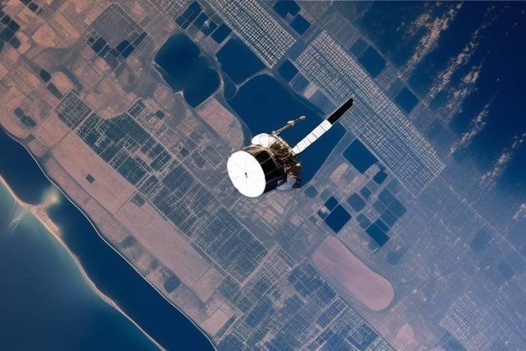
In today's world, the role of satellites in monitoring environmental security has become increasingly vital. Imagine looking down from space and having a bird's-eye view of our planet's health. This is precisely what satellites do—they provide a comprehensive perspective on environmental changes that are often invisible from the ground. With their advanced technology, these orbiting marvels gather data that helps us understand everything from deforestation to urban sprawl, giving scientists and policymakers the tools they need to make informed decisions. But how exactly do they contribute to our understanding of environmental security? Let's dive deeper into this fascinating topic.
Satellites serve as our eyes in the sky, offering essential data for tracking environmental changes. They enable scientists to monitor ecosystems, land use, and resource management effectively. For instance, through remote sensing technology, satellites can capture images of vast areas, providing insights into how land is being utilized and whether it's being exploited sustainably. This capability is crucial for managing resources wisely and ensuring that we do not deplete our planet's natural wealth. By analyzing satellite imagery, researchers can detect shifts in vegetation, water bodies, and urban areas, helping to create a clearer picture of our environmental landscape.
When disaster strikes, every second counts. Satellites are vital in disaster management, offering real-time data for assessing damage and coordinating response efforts during natural disasters like hurricanes, floods, and wildfires. For example, during a hurricane, satellites can track its path and intensity, providing crucial information that can save lives. This data allows emergency services to deploy resources more effectively, ensuring that aid reaches those in need quickly. Moreover, after a disaster, satellites help assess the extent of damage, guiding recovery efforts and rebuilding strategies.
As the world grapples with climate change, satellites play a significant role in tracking its impact. They measure atmospheric conditions, greenhouse gas emissions, and changes in land and ocean temperatures over time. This data is invaluable for understanding how climate change is affecting different regions and ecosystems. For instance, satellites can monitor the melting of polar ice caps and rising sea levels, providing concrete evidence of climate change's effects. With this information, scientists can model future climate scenarios and help governments develop strategies to mitigate its impacts.
Using satellite imagery, researchers can monitor biodiversity and habitat changes, helping to identify endangered species and assess the health of ecosystems globally. The ability to track changes in habitats from space means that conservation efforts can be more targeted and effective. For instance, if a particular area is identified as a critical habitat for an endangered species, conservationists can prioritize it for protection. This proactive approach can make a significant difference in preserving biodiversity.
Water is a precious resource, and satellites assist in managing it by monitoring precipitation patterns, river flows, and groundwater levels. This information is crucial for ensuring sustainable water usage and conservation efforts. For example, satellites can detect changes in water availability, helping farmers make informed decisions about irrigation and crop management. Additionally, by monitoring water bodies, satellites can help identify pollution sources, enabling quicker responses to contamination events.
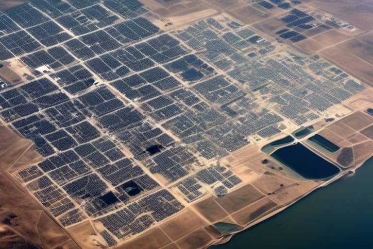
As cities grow, understanding urbanization trends and land use changes becomes essential. Satellites provide insights into these dynamics, helping policymakers make informed decisions about urban planning and environmental protection. By analyzing satellite data, urban planners can identify areas that are rapidly developing and assess the environmental impacts of such growth. This information is critical for creating sustainable cities that balance development with ecological preservation.
Pollution is a pressing environmental issue, and satellites can detect and monitor air and water pollution levels. This capability provides critical data for environmental agencies to implement effective pollution control measures. For instance, satellites can track emissions from industrial areas, helping authorities enforce regulations and protect public health. By understanding pollution patterns, we can work towards cleaner air and water, ultimately enhancing our quality of life.
Satellite data fosters international collaboration among countries, allowing for shared insights and coordinated efforts in addressing global environmental challenges and security concerns. In an increasingly interconnected world, no single nation can tackle environmental issues alone. By sharing satellite data, countries can work together to monitor and respond to crises, whether it's tracking deforestation in the Amazon or monitoring coral bleaching in the Great Barrier Reef. This collaborative approach strengthens global environmental security and promotes sustainable practices worldwide.
- What types of satellites are used for environmental monitoring? There are various types, including Earth observation satellites, weather satellites, and communication satellites, each serving different purposes in monitoring the environment.
- How often do satellites collect data? Satellites can collect data continuously or at regular intervals, depending on their mission and orbit. Some may take daily images, while others may do so weekly or monthly.
- Can satellite data be accessed by the public? Yes, many satellite data are available to the public and can be accessed through various platforms and agencies, promoting transparency and research.
- How do satellites help in climate change research? Satellites provide critical data on atmospheric conditions, greenhouse gas concentrations, and temperature changes, which are essential for understanding and modeling climate change.
The Role of Satellites in Environmental Monitoring
Satellites have become the unsung heroes in the realm of environmental monitoring. Imagine having a bird’s-eye view of the Earth, constantly observing and collecting data that is crucial for understanding our planet’s health. These high-tech marvels orbiting above us are equipped with advanced sensors and cameras that capture a plethora of information, making it possible to track environmental changes with remarkable precision. From assessing deforestation rates to monitoring the health of coral reefs, satellites are indispensable tools for scientists and researchers alike.
One of the most significant advantages of satellite technology is its ability to provide comprehensive data over vast areas. Unlike ground-based observations, which can be limited in scope and often affected by accessibility issues, satellites can cover thousands of square kilometers in a single pass. This capability is particularly beneficial for monitoring ecosystems and land use changes. For instance, when we think about deforestation, satellites can detect changes in forest cover over time, allowing for timely interventions and policy-making to protect these vital resources.
Moreover, satellites are equipped to monitor various environmental parameters, including temperature, humidity, and vegetation indices. This data is critical for understanding the intricate relationships within ecosystems. For example, the Normalized Difference Vegetation Index (NDVI) is a popular satellite-derived metric used to assess vegetation health. By analyzing NDVI data, researchers can gauge agricultural productivity, track seasonal changes, and even predict crop yields. This information is invaluable not only for farmers but also for governments and organizations focused on food security and sustainability.
Another fascinating aspect of satellite technology is its ability to provide real-time data. During environmental crises, such as wildfires or oil spills, satellites can deliver immediate information about the extent of the damage. This rapid response capability is crucial for coordinating relief efforts and implementing effective management strategies. For example, in the aftermath of a major natural disaster, satellite imagery can help assess the impacted areas, enabling emergency responders to allocate resources more efficiently.
To illustrate the impact of satellites on environmental monitoring, consider the following table that summarizes key satellite missions and their contributions:
| Satellite Mission | Key Contributions |
|---|---|
| MODIS (Moderate Resolution Imaging Spectroradiometer) | Monitors land cover changes, vegetation health, and ocean color. |
| Sentinel-2 | Provides high-resolution optical imagery for land monitoring and disaster management. |
| Landsat Program | Offers long-term data on land use changes and environmental conditions since the 1970s. |
| GOES (Geostationary Operational Environmental Satellites) | Tracks weather patterns and severe storms in real-time. |
In conclusion, the role of satellites in environmental monitoring cannot be overstated. They provide the essential data needed to understand and respond to the myriad challenges facing our planet today. As technology continues to advance, the capabilities of satellites will only expand, offering even more detailed insights into our environment. It’s as if we’ve been given a powerful pair of glasses that allow us to see the world in a whole new way, helping us to make informed decisions that can lead to a more sustainable future.
Q1: How do satellites collect data?
Satellites collect data through various sensors and instruments that capture images and measurements of the Earth's surface, atmosphere, and oceans. These instruments can include cameras, radar, and spectrometers.
Q2: Can satellites monitor climate change?
Yes, satellites play a crucial role in monitoring climate change by measuring greenhouse gas emissions, tracking temperature changes, and observing shifts in land and ocean conditions over time.
Q3: Are satellite data accessible to the public?
Many satellite data sources are publicly accessible, allowing researchers, policymakers, and the general public to utilize this information for various applications, including environmental research and disaster management.
Disaster Management and Response
When disaster strikes, time is of the essence. Satellites have become the unsung heroes in the realm of disaster management and response, providing critical data that can mean the difference between chaos and coordinated relief efforts. Imagine a hurricane barreling towards a coastline; within moments, satellites can capture real-time images that reveal the storm's path and intensity. This information is invaluable for emergency services and government agencies as they strategize evacuation plans and allocate resources.
Moreover, satellites offer a bird's-eye view of the affected areas, enabling responders to assess damage quickly and accurately. For instance, after a natural disaster like an earthquake or a flood, satellite imagery can help identify the most severely impacted regions, allowing for a more effective distribution of aid. By analyzing changes in land cover and infrastructure, responders can prioritize their efforts where they are needed most.
One of the most impressive capabilities of satellites is their ability to monitor environmental conditions in real-time. They can track various factors such as rainfall, temperature changes, and even the movement of tectonic plates. This data can be crucial in predicting disasters before they happen. For example, satellites equipped with radar can detect changes in soil moisture levels, indicating potential flooding. By providing early warnings, satellites can save lives and reduce the economic impact of disasters.
In addition to monitoring, satellites also play a significant role in coordinating disaster response efforts. They can facilitate communication between different agencies and organizations involved in relief efforts. For instance, during a wildfire, satellite data can help fire crews understand the spread of the fire, allowing them to deploy resources effectively. This level of coordination is essential in ensuring that help reaches those in need as quickly as possible.
To illustrate the impact of satellite technology in disaster management, consider the following table that highlights some key satellite missions dedicated to this purpose:
| Satellite Mission | Purpose | Key Features |
|---|---|---|
| GOES (Geostationary Operational Environmental Satellites) | Weather Monitoring | Real-time weather data, storm tracking |
| Sentinel-1 | Flood Monitoring | Radar imaging, land deformation detection |
| MODIS (Moderate Resolution Imaging Spectroradiometer) | Wildfire Detection | Thermal imaging, vegetation health analysis |
In summary, satellites are not just tools for observation; they are vital assets in the fight against natural disasters. By providing timely data and facilitating communication, they empower responders to act swiftly and efficiently. As technology continues to evolve, the role of satellites in disaster management will only become more pronounced, paving the way for a future where we can better anticipate and respond to environmental threats.
- How do satellites predict natural disasters? Satellites use various sensors to monitor environmental conditions like temperature, moisture levels, and atmospheric pressure, which can indicate the likelihood of disasters.
- What types of disasters can satellites help manage? Satellites can assist in managing a wide range of disasters, including hurricanes, floods, wildfires, and earthquakes.
- Are satellite images available to the public? Yes, many satellite images and data are available to the public through various government and research organizations.
Climate Change Tracking
When it comes to understanding the intricate puzzle of our planet's climate, satellites are like the watchful eyes in the sky, constantly gathering vital data that informs our understanding of climate change. They play a significant role in tracking climate change by providing comprehensive measurements of atmospheric conditions, greenhouse gas emissions, and fluctuations in land and ocean temperatures over time. Imagine having a bird's-eye view of Earth’s climate system; that’s precisely what satellites do, offering a panoramic perspective that ground-based observations simply cannot match.
One of the most impressive aspects of satellite technology is its ability to monitor greenhouse gas concentrations. Satellites equipped with specialized sensors can detect gases such as carbon dioxide and methane, which are crucial indicators of human impact on the environment. For instance, the Orbiting Carbon Observatory-2 (OCO-2) has been instrumental in identifying carbon dioxide sources and sinks, helping scientists understand how these gases are distributed across the globe. By analyzing this data, researchers can pinpoint areas where emissions are highest and track the effectiveness of policies aimed at reducing greenhouse gas outputs.
Moreover, satellites are essential in observing changes in land and ocean temperatures, which are critical indicators of climate change. The Advanced Very High Resolution Radiometer (AVHRR) and various other satellite systems continuously monitor surface temperatures, allowing scientists to detect warming trends over time. This data is crucial for understanding how climate change affects weather patterns, sea level rise, and even the frequency of extreme weather events. For instance, the data collected can show alarming trends, such as the gradual warming of the Arctic, which has far-reaching implications for global weather systems.
To visualize the impact of climate change, consider the following table that illustrates the rise in average global temperatures over the past century:
| Year | Average Global Temperature (°C) |
|---|---|
| 1900 | 13.7 |
| 1950 | 14.0 |
| 2000 | 14.5 |
| 2020 | 15.0 |
This data clearly shows a concerning trend: as the years progress, so does the average temperature of our planet. The implications of this warming are profound, affecting everything from agriculture to biodiversity. For example, warmer temperatures can lead to altered growing seasons for crops, which can impact food security worldwide.
In addition to temperature monitoring, satellites also track changes in ice cover and sea levels, providing crucial insights into the effects of climate change on polar regions. The European Space Agency's CryoSat satellite, for example, measures the thickness of ice sheets and sea ice, helping scientists understand how quickly these vital components of our planet are melting. This information is vital for predicting future sea level rise and its potential impact on coastal communities.
Ultimately, the data collected from satellites is not just numbers and charts; it drives policy decisions and informs global climate agreements. By providing accurate and timely information, satellites empower governments, organizations, and individuals to take action against climate change. They serve as a reminder that we are all part of a larger system, and that our actions have consequences that reach far beyond our immediate surroundings.
As we continue to face the challenges posed by climate change, the role of satellites will only become more critical. They are our allies in the fight for a sustainable future, providing the insights we need to make informed decisions and take meaningful action. In this age of information, satellites are our best hope for understanding and mitigating the impacts of climate change.
- How do satellites measure greenhouse gases? Satellites use specialized sensors to detect and analyze the concentration of gases like carbon dioxide and methane in the atmosphere.
- What is the significance of tracking land and ocean temperatures? Monitoring temperature changes helps scientists understand global warming trends and their effects on weather patterns and ecosystems.
- Can satellite data influence climate policy? Yes, accurate satellite data is essential for informing policymakers and guiding international agreements on climate action.
Biodiversity and Habitat Monitoring
Biodiversity is the backbone of our planet's health, and monitoring it is crucial for maintaining ecological balance. Satellites have revolutionized how we observe and understand the intricate web of life on Earth. With their advanced imaging capabilities, they allow scientists to gather data on vast areas that would be impossible to cover on the ground. Imagine trying to count every tree in a forest or every coral reef in an ocean—it's a monumental task! But with satellite technology, we can capture these landscapes from above, providing a bird's-eye view of our planet's biodiversity.
One of the most significant contributions of satellites is their ability to track changes in habitats over time. For instance, by analyzing satellite imagery, researchers can detect deforestation, urban encroachment, and habitat fragmentation. This data is invaluable for conservation efforts, helping to identify critical areas that require protection. Think of it as having a time machine that allows us to witness the changes our environment undergoes, enabling us to respond proactively rather than reactively.
Moreover, satellites can help monitor endangered species and their habitats. By using high-resolution images, scientists can assess the health of specific ecosystems and understand how different species interact with their surroundings. For example, satellite data can reveal how climate change affects migration patterns or breeding grounds, which is vital for developing effective conservation strategies. The ability to visualize these changes helps policymakers and conservationists make informed decisions, ensuring that our efforts to protect biodiversity are data-driven and targeted.
In addition to direct observations, satellites facilitate the collection of environmental data that can be correlated with biodiversity metrics. By monitoring variables such as temperature, precipitation, and land use, scientists can create models that predict how changes in the environment might impact various species. This predictive capability is essential for developing strategies to mitigate adverse effects on biodiversity.
To illustrate the impact of satellite monitoring on biodiversity, consider the following table, which highlights some key satellite missions and their contributions to habitat monitoring:
| Satellite Mission | Purpose | Key Contributions |
|---|---|---|
| Sentinel-2 | Earth observation | High-resolution imagery for land cover and habitat mapping |
| Landsat | Long-term land use monitoring | Data on land cover changes since the 1970s |
| MODIS | Global monitoring | Vegetation health and land surface temperature data |
In conclusion, satellites are not just tools for observing our planet; they are essential allies in the fight to protect biodiversity and habitats. By providing comprehensive data and insights, they empower scientists and conservationists to make informed decisions that can lead to effective strategies for preserving our planet's rich biological heritage. As we continue to develop and refine satellite technology, the potential for enhancing our understanding of biodiversity and its conservation will only grow stronger.
- How do satellites help in monitoring endangered species? Satellites provide high-resolution images that allow researchers to assess habitat health and track changes in species' distributions over time.
- Can satellite data be used for local conservation efforts? Absolutely! Satellite imagery can be analyzed to identify critical habitats and inform local conservation strategies.
- What types of satellites are best for biodiversity monitoring? Earth observation satellites, such as Sentinel-2 and Landsat, are particularly effective due to their ability to capture detailed images of land cover and ecosystems.
Water Resource Management
Water is the essence of life, and managing it effectively is crucial for sustainability. Satellites have revolutionized the way we monitor and manage this precious resource. By providing a bird's-eye view of our planet, satellites enable us to track various parameters that influence water availability and quality. For instance, they can monitor precipitation patterns, river flows, and groundwater levels, offering insights that are vital for effective water resource management.
Imagine trying to manage a garden without knowing how much rain has fallen or how much water is in the soil. That’s precisely the challenge faced by water resource managers before the advent of satellite technology. Now, with real-time data streaming in from space, they can make informed decisions that lead to sustainable water usage. This technology allows for the identification of drought conditions before they escalate into crises, enabling proactive measures to be taken.
Moreover, satellites play a significant role in assessing the impact of climate change on water resources. They help track changes in snowpack levels, which are critical for understanding water supply in many regions. For example, in areas where snowmelt contributes significantly to river flows, monitoring snow levels can provide early warnings about potential water shortages. This data is essential for agricultural planning, urban water supply management, and ensuring that ecosystems receive the water they need to thrive.
Another fascinating aspect of satellite technology is its ability to monitor water quality. By detecting changes in surface temperature and chlorophyll concentrations, satellites can help identify pollution sources and track harmful algal blooms. This information is crucial for protecting both human health and aquatic ecosystems. For instance, if a satellite detects an unusual spike in chlorophyll levels in a lake, environmental agencies can investigate further to determine if it’s due to agricultural runoff or wastewater discharge.
To illustrate the impact of satellite data on water resource management, consider the following table that summarizes key satellite missions and their contributions:
| Satellite Mission | Key Contributions |
|---|---|
| NASA's GRACE | Monitors groundwater levels and changes over time. |
| Sentinel-2 | Provides high-resolution imagery for assessing land cover and water quality. |
| MODIS (Moderate Resolution Imaging Spectroradiometer) | Tracks surface temperatures and vegetation health, aiding in drought assessments. |
In conclusion, the integration of satellite technology in water resource management is a game-changer. It not only enhances our understanding of water systems but also empowers us to make better decisions for the future. As we continue to face challenges such as climate change and population growth, the role of satellites will only become more critical in ensuring that we manage our water resources sustainably.
- How do satellites measure precipitation? Satellites use various sensors to detect cloud patterns and rainfall rates, providing accurate data on precipitation levels across different regions.
- Can satellites help in drought prediction? Yes, by analyzing soil moisture levels and precipitation data, satellites can identify potential drought conditions before they become severe.
- What role do satellites play in water quality monitoring? Satellites can detect changes in temperature and chlorophyll levels in water bodies, helping identify pollution sources and monitor algal blooms.
Urbanization and Land Use Change
The rapid pace of urbanization across the globe is reshaping our landscapes and redefining how we interact with the environment. As cities expand and populations grow, the need for effective land use management becomes increasingly critical. Satellites, with their ability to capture high-resolution imagery and data, play a pivotal role in understanding these changes. Imagine looking down from space and seeing how patches of green transform into sprawling urban areas, or how once-bustling industrial zones become abandoned lots. This bird's-eye view allows researchers and policymakers to visualize the impacts of urban sprawl, making it easier to devise strategies for sustainable development.
One of the most significant contributions of satellite technology is its capacity to monitor land use changes over time. By analyzing satellite images from different periods, scientists can track how land is converted from agricultural use to urban settings or how forests are cleared for development. This information is invaluable for urban planners and environmentalists alike, as it helps them understand the dynamics of land use and its implications on local ecosystems. For instance, a study might reveal that a specific city has lost 30% of its green spaces over the last decade due to urban expansion, prompting immediate action to preserve what remains.
Furthermore, satellites can provide data on the infrastructure that supports urban areas. By mapping roads, buildings, and other essential services, satellites help city planners identify areas that are overdeveloped or lacking in resources. This information can lead to better resource allocation, ensuring that urban growth does not come at the expense of environmental health. For example, if satellite data indicates that a particular area is experiencing increased traffic congestion, planners can prioritize public transport solutions to alleviate pressure on the roads.
Moreover, the integration of satellite data with other sources, such as ground surveys and demographic information, enhances our understanding of urbanization's impact on social structures. It can reveal patterns of inequality, such as how certain communities might be disproportionately affected by pollution or lack of access to green spaces. This holistic approach to data analysis is crucial for creating equitable urban environments where all residents can thrive.
In addition to monitoring changes, satellites also facilitate public engagement in urban planning. By making satellite imagery accessible to the public, communities can visualize the changes happening in their neighborhoods. This transparency fosters a sense of ownership and encourages citizen participation in decision-making processes. Imagine a local community meeting where residents can pull up satellite images and discuss what they want their neighborhood to look like in the future. This kind of engagement is essential for ensuring that urban development aligns with the needs and desires of the people who live there.
In conclusion, satellites are not just tools for observation; they are vital instruments for understanding and managing the complexities of urbanization and land use change. As urban areas continue to expand, the insights gained from satellite data will be crucial for developing sustainable solutions that balance growth with environmental stewardship. The future of our cities depends on our ability to harness this technology effectively, ensuring that urbanization leads to vibrant, healthy, and resilient communities.
- How do satellites monitor land use changes? Satellites capture high-resolution images of the Earth's surface, allowing researchers to analyze changes in land use over time.
- What role do satellites play in urban planning? Satellites provide essential data for understanding urban growth patterns, infrastructure needs, and environmental impacts, aiding in informed decision-making.
- Can satellite data help in disaster management? Yes, satellite data can be used to assess damage after disasters and coordinate response efforts effectively.
- How does urbanization affect biodiversity? Urbanization often leads to habitat loss and fragmentation, impacting local biodiversity and ecosystem health.
Pollution Tracking and Management
Pollution is one of the most pressing issues facing our planet today, and satellites are stepping up to the plate in a big way. Imagine having a bird's-eye view of the Earth that allows us to track pollution levels from space—this is precisely what satellites enable us to do. By capturing real-time data on air and water quality, satellites serve as our eyes in the sky, helping scientists and policymakers understand the extent of pollution and its impacts on both human health and the environment.
One of the most significant contributions of satellites in pollution management is their ability to monitor air quality across vast regions. Through sophisticated sensors, satellites can detect various pollutants, including carbon dioxide, nitrogen dioxide, and particulate matter. This data is crucial for identifying pollution hotspots and understanding how pollutants disperse in the atmosphere. For instance, the Copernicus Sentinel-5P satellite provides detailed information on air quality, enabling authorities to issue timely warnings and take necessary actions to protect public health.
Water pollution is another area where satellites shine. By utilizing remote sensing technology, satellites can measure the color of water bodies, which often indicates the presence of harmful substances like algae blooms or oil spills. The MODIS (Moderate Resolution Imaging Spectroradiometer) onboard NASA's Terra and Aqua satellites offers invaluable insights into water quality by detecting changes in chlorophyll levels, which can signal an increase in toxic algae. This information is essential for managing aquatic ecosystems and ensuring safe drinking water for communities.
Furthermore, the integration of satellite data with ground-based monitoring systems creates a comprehensive pollution tracking network. This synergy allows for a more nuanced understanding of pollution sources and trends over time. For example, by combining satellite observations with local weather data, scientists can model how pollutants travel and disperse, which is vital for effective pollution management strategies. The table below summarizes the key pollutants monitored by satellites and their potential sources:
| Pollutant | Source | Health Impact |
|---|---|---|
| Carbon Dioxide (CO2) | Fossil fuel combustion, deforestation | Respiratory issues, climate change |
| Nitrogen Dioxide (NO2) | Vehicle emissions, industrial processes | Respiratory problems, lung infections |
| Particulate Matter (PM) | Construction, agriculture, combustion | Heart disease, stroke, lung cancer |
| Chlorophyll-a | Algal blooms | Water toxicity, ecosystem disruption |
In addition to monitoring pollution levels, satellites play a pivotal role in assessing the effectiveness of pollution control measures. By analyzing satellite data before and after the implementation of environmental regulations, researchers can evaluate changes in pollution levels and their implications for public health. This feedback loop is invaluable for refining policies and ensuring that efforts to combat pollution are based on solid evidence.
As we continue to face the challenges of pollution, the importance of satellite technology cannot be overstated. They not only provide critical data but also foster international collaboration in addressing pollution on a global scale. Countries can share satellite data to track transboundary pollution, enabling coordinated efforts to combat issues that affect multiple nations. This collaborative approach is essential for creating a cleaner, healthier planet for future generations.
- How do satellites measure air pollution? Satellites use sensors to detect specific pollutants in the atmosphere, measuring their concentration and distribution over large areas.
- Can satellites help in predicting pollution events? Yes, by analyzing weather patterns and historical data, satellites can help predict pollution events, allowing for timely interventions.
- What is the role of satellite data in environmental policy? Satellite data provides evidence-based insights that inform policymakers, helping them to create effective environmental regulations and initiatives.
- Are satellite monitoring systems expensive? While the initial investment can be significant, the long-term benefits of improved pollution management and public health make it a worthwhile investment.
International Collaboration and Data Sharing
This article explores the crucial role satellites play in monitoring environmental security, examining their contributions to data collection, disaster response, climate change tracking, and more.
Satellites provide essential data for tracking environmental changes, enabling scientists to monitor ecosystems, land use, and resource management effectively.
Satellites are vital in disaster management, offering real-time data for assessing damage and coordinating response efforts during natural disasters like hurricanes, floods, and wildfires.
Satellites play a significant role in tracking climate change by measuring atmospheric conditions, greenhouse gas emissions, and changes in land and ocean temperatures over time.
Using satellite imagery, researchers can monitor biodiversity and habitat changes, helping to identify endangered species and assess the health of ecosystems globally.
Satellites assist in managing water resources by monitoring precipitation patterns, river flows, and groundwater levels, ensuring sustainable water usage and conservation efforts.
Satellites provide insights into urbanization trends and land use changes, helping policymakers make informed decisions about urban planning and environmental protection.
Satellites can detect and monitor air and water pollution levels, providing critical data for environmental agencies to implement effective pollution control measures.
The significance of international collaboration in environmental monitoring cannot be overstated. As environmental issues transcend borders, the sharing of satellite data fosters a cooperative approach to tackling these challenges. Countries can pool resources and expertise, leading to more effective responses to global concerns such as climate change, deforestation, and pollution. For instance, initiatives like the Global Climate Observing System emphasize the importance of sharing satellite data among nations to enhance our understanding of the planet's health.
One of the most compelling aspects of this collaboration is the ability to access real-time data, which can be crucial in times of crisis. When a natural disaster strikes, countries can quickly share satellite imagery and information, allowing for a coordinated response. This is akin to a relay race where each participant passes the baton seamlessly to ensure the team moves forward quickly and efficiently. The data shared can include:
- Weather patterns that could affect disaster response.
- Damage assessments to prioritize aid and resources.
- Environmental changes that may impact recovery efforts.
Moreover, international organizations like the United Nations and the European Space Agency play pivotal roles in facilitating data sharing agreements and collaborative projects. They ensure that satellite data is accessible not just to governments but also to researchers, NGOs, and even the general public. This open-access model promotes transparency and encourages innovative solutions to pressing environmental issues.
In conclusion, the power of satellites in fostering international collaboration and data sharing is transformative. By working together and leveraging shared data, nations can enhance their environmental security, improve disaster response strategies, and ultimately, contribute to a healthier planet.
Q1: How do satellites contribute to environmental monitoring?
Satellites provide comprehensive data on various environmental parameters, including land use, vegetation cover, and atmospheric conditions, enabling scientists to monitor changes effectively.
Q2: What role do satellites play in disaster management?
Satellites offer real-time data that assist in assessing damage and coordinating response efforts during natural disasters, enhancing the effectiveness of relief operations.
Q3: How does international collaboration benefit environmental monitoring?
International collaboration allows countries to share satellite data, leading to more coordinated responses to global environmental challenges and improved resource management.
Q4: Can satellite data help in tracking climate change?
Yes, satellites are essential for monitoring climate change by measuring greenhouse gas emissions and observing changes in land and ocean temperatures over time.
Frequently Asked Questions
- What is the primary role of satellites in environmental monitoring?
Satellites play a crucial role in environmental monitoring by providing essential data that helps scientists track changes in ecosystems, land use, and resource management. They enable real-time observation of our planet, giving us insights into how our environment is evolving.
- How do satellites assist in disaster management?
During natural disasters like hurricanes, floods, and wildfires, satellites offer real-time data that helps assess damage and coordinate response efforts. This information is vital for emergency services to act quickly and effectively, potentially saving lives and resources.
- Can satellites track climate change?
Absolutely! Satellites are instrumental in tracking climate change by measuring atmospheric conditions, greenhouse gas emissions, and shifts in land and ocean temperatures. They provide a comprehensive view of how our climate is changing over time, helping scientists predict future trends.
- How do satellites help monitor biodiversity?
Using advanced satellite imagery, researchers can monitor changes in biodiversity and habitats. This technology helps identify endangered species and assess the overall health of ecosystems on a global scale, which is essential for conservation efforts.
- What role do satellites play in water resource management?
Satellites are crucial for managing water resources by monitoring precipitation patterns, river flows, and groundwater levels. This information ensures that water usage is sustainable and helps in conservation efforts, which is increasingly important in a world facing water scarcity.
- How do satellites contribute to urban planning?
Satellites provide valuable insights into urbanization trends and land use changes. This data helps policymakers make informed decisions about urban planning and environmental protection, ensuring that cities grow sustainably and responsibly.
- Can satellites detect pollution?
Yes, satellites can effectively detect and monitor levels of air and water pollution. This critical data allows environmental agencies to implement effective pollution control measures, helping to protect public health and the environment.
- How does satellite data promote international collaboration?
Satellite data fosters international collaboration by allowing countries to share insights and coordinate efforts in addressing global environmental challenges. This collaboration is essential in tackling issues that transcend borders, such as climate change and pollution.

