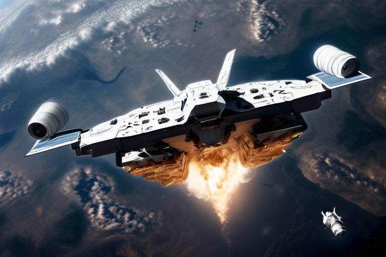
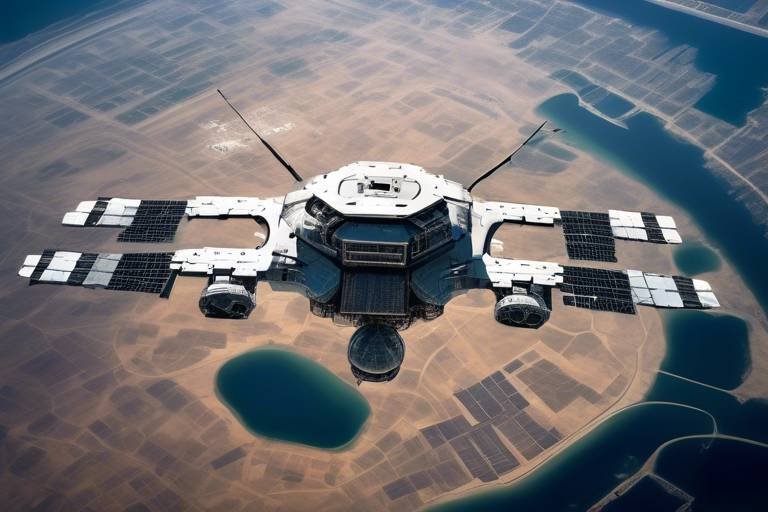
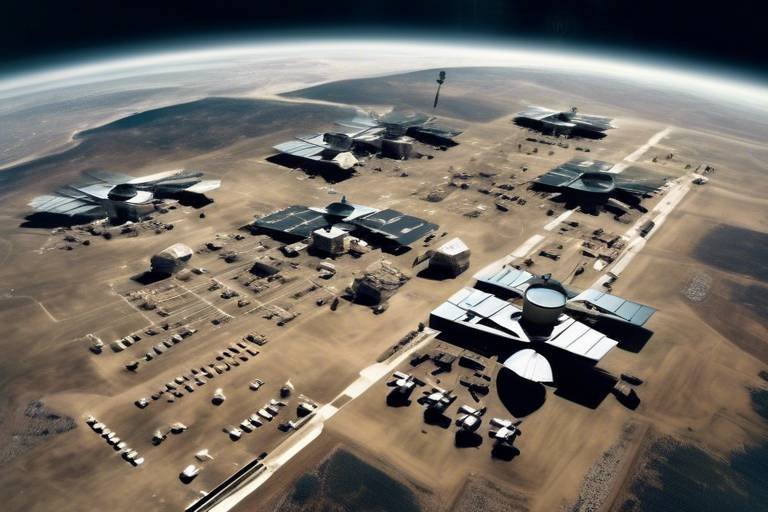
The Role of Military Satellites in Enhancing Air Power
In the ever-evolving landscape of modern warfare, the integration of technology has become a game-changer. Among the most significant advancements are military satellites, which play a pivotal role in enhancing air power. These orbiting marvels are not just floating pieces of machinery; they are the backbone of communication, navigation, and reconnaissance systems that ensure operational effectiveness. Imagine a battlefield where every move is monitored, every decision is informed, and every mission is executed with precision. This is the reality that military satellites help create.
Military satellites provide a secure communication framework that is crucial for real-time data exchange between air and ground forces. This capability is essential for coordinated operations, allowing different branches of the military to work together seamlessly. Think of it as a well-orchestrated symphony, where each musician knows their part and plays in harmony with others. Without these satellites, the chaos of war could lead to miscommunication and disastrous outcomes.
Moreover, military satellites enhance navigation capabilities through Global Positioning Systems (GPS), ensuring that aircraft can navigate accurately, even in the most challenging environments. These systems are not just about getting from point A to point B; they are about precise targeting and efficient route planning for both manned and unmanned aircraft. The integration of satellite data into air operations significantly boosts targeting accuracy, minimizing collateral damage and increasing the effectiveness of missions. By providing precise coordinates for airstrikes, these satellites allow military personnel to make informed decisions that can save lives and resources.
Real-time data integration is another critical aspect of military satellites. Pilots can adjust their strategies on the fly, responding to changing battlefield conditions with agility and foresight. This flexibility is akin to a chess player anticipating their opponent’s moves, allowing for proactive rather than reactive strategies. Furthermore, satellite systems facilitate joint operations among various military branches, ensuring seamless collaboration and information sharing during complex missions. This interconnectedness is vital for success in modern warfare, where every second counts.
Surveillance and reconnaissance capabilities provided by military satellites are indispensable. They offer high-resolution imagery that aids in intelligence gathering and threat assessment for air operations. Just as a hawk surveys its surroundings from above, military satellites provide a bird's-eye view of potential threats, allowing air forces to plan their actions with greater accuracy and insight.
Weather monitoring and forecasting are also critical functions of military satellites. They provide essential weather data that allows air forces to plan missions effectively while avoiding adverse weather conditions that could jeopardize operations. Understanding weather patterns through satellite data helps military planners optimize flight paths and timing for air missions, enhancing overall mission success. Adverse weather avoidance is crucial; satellites assist in delivering real-time weather updates, enabling pilots to navigate around severe weather, ensuring both safety and mission integrity.
As we look to the future, emerging technologies in satellite systems promise to further enhance air power. Advancements in miniaturization, artificial intelligence, and increased satellite constellations will improve coverage and capabilities, making military operations even more efficient. The horizon is bright for military satellites, and their role in shaping the future of air power is undeniable.
- What are military satellites used for? Military satellites are primarily used for communication, navigation, reconnaissance, and weather monitoring, enhancing operational effectiveness in warfare.
- How do military satellites improve targeting accuracy? They provide precise coordinates and real-time data, allowing for informed decision-making and reducing collateral damage during airstrikes.
- Can military satellites assist in joint operations? Yes, they facilitate seamless collaboration and information sharing among different military branches during complex missions.
- What future technologies are expected in military satellites? Advancements in miniaturization, artificial intelligence, and increased satellite constellations are anticipated to enhance capabilities and coverage.
Satellite Communication Systems
In the realm of modern warfare, the significance of military satellite communication systems cannot be overstated. These advanced systems serve as the backbone of secure communication, enabling seamless and real-time data exchange between air and ground forces. Imagine a conductor leading an orchestra; without a clear signal, the music would be chaotic. Similarly, without robust communication channels, military operations would face confusion and inefficiency.
Military satellites are equipped with sophisticated technology that allows them to transmit encrypted messages across vast distances, ensuring that sensitive information remains protected from prying eyes. This secure communication is essential for coordinated operations and mission success. For instance, when an airstrike is planned, the ability to communicate instantly between pilots and ground control can mean the difference between success and failure.
One of the most remarkable features of satellite communication systems is their ability to operate in remote and challenging environments. Whether it's the deserts of the Middle East or the icy terrains of the Arctic, these satellites maintain connectivity. This capability is crucial for military operations that often take place far from established infrastructure. In fact, military planners rely heavily on these systems to ensure that every unit, from air to ground, is synchronized and aware of the evolving battlefield dynamics.
Furthermore, satellite communication systems are not just about sending messages; they also facilitate the sharing of vital data, including intelligence reports, reconnaissance images, and real-time updates. This information is critical for making informed decisions on the fly. For example, if a pilot encounters unexpected enemy movement, the ability to relay that information back to command can lead to immediate strategic adjustments.
To illustrate the importance of satellite communication, consider the following table that highlights key features and benefits:
| Feature | Benefit |
|---|---|
| Secure Communication | Protects sensitive information from interception |
| Real-Time Data Exchange | Enables quick decision-making and operational adjustments |
| Global Coverage | Supports operations in remote or hostile environments |
| Joint Operations Support | Facilitates coordination among different military branches |
In conclusion, the role of military satellite communication systems is pivotal in enhancing air power capabilities. They not only ensure that forces are connected but also empower them with the information necessary to execute complex operations effectively. As technology advances, we can expect these systems to become even more integral to military strategy, providing unprecedented levels of communication and operational efficiency.
Global Positioning Systems (GPS)
The significance of in modern military operations cannot be overstated. These systems are the backbone of navigation for air assets, transforming how air forces plan and execute missions. Imagine trying to find your way in an unfamiliar city without a map or GPS; that’s how challenging it would be for pilots without these advanced satellite systems. GPS satellites orbit the Earth, sending signals that allow aircraft to pinpoint their exact location, speed, and direction with unparalleled accuracy. This capability is crucial, especially when missions require precise targeting and coordination with ground forces.
Moreover, the integration of GPS technology has revolutionized the way military operations are conducted. For instance, consider a scenario where multiple aircraft are involved in a coordinated strike. Each pilot needs to know not only their own position but also the locations of their comrades and the target. Thanks to GPS, this information is available in real-time, allowing for seamless communication and collaboration. The ability to share precise coordinates ensures that airstrikes hit their intended targets, significantly reducing the risk of collateral damage.
One of the most profound impacts of GPS technology is its role in enhancing targeting accuracy. With the help of satellite data, pilots can receive precise coordinates for their targets, ensuring that every bomb dropped is as accurate as possible. This level of precision not only increases the effectiveness of missions but also minimizes the risk to civilian lives and infrastructure. In a world where the consequences of military actions can be far-reaching, this capability is invaluable.
In addition to accuracy, GPS allows for real-time data integration. Pilots can adjust their flight paths and strategies based on the latest intelligence and battlefield conditions. This flexibility is critical in fast-paced combat scenarios where conditions can change in an instant. For example, if new intelligence indicates a shift in enemy positions, pilots can quickly recalibrate their routes to ensure mission success. The ability to adapt on the fly is a game-changer in military operations.
Furthermore, GPS systems facilitate joint operations coordination among different branches of the military. In today's complex battlefields, air, land, and sea forces must work together seamlessly. GPS provides a common framework for all branches to share information and coordinate their actions effectively. This collaboration ensures that every unit is on the same page, reducing the chances of miscommunication and enhancing overall operational effectiveness.
In summary, the role of GPS in military aviation is a testament to how technology can enhance air power capabilities. From improving targeting accuracy to enabling real-time adjustments and fostering joint operations, GPS systems are indispensable in modern warfare. As technology continues to evolve, the potential for even greater advancements in GPS capabilities is on the horizon, promising to further revolutionize military operations.
- What is GPS and how does it work?
GPS, or Global Positioning System, is a satellite-based navigation system that provides accurate location and time information anywhere on Earth. It works by triangulating signals from multiple satellites to determine a receiver's location. - How has GPS changed military operations?
GPS has significantly improved the accuracy of navigation and targeting in military operations, allowing for more effective mission planning and execution. - Are there any limitations to GPS?
While GPS is highly accurate, its effectiveness can be impacted by environmental factors such as dense urban areas or heavy cloud cover, which can interfere with satellite signals.
Impact on Targeting Accuracy
The integration of satellite data into military operations has revolutionized targeting accuracy in air power. Imagine trying to hit a bullseye in a game of darts while blindfolded—now picture having a high-definition camera that not only shows you the target but also gives you real-time updates on wind speed and direction. That's what military satellites do for pilots and commanders alike. By providing precise coordinates and detailed imagery, satellites significantly reduce the chances of collateral damage, leading to more effective missions.
One of the key benefits of satellite-assisted targeting is the ability to gather intelligence from multiple sources, which enhances decision-making. For instance, when a pilot is equipped with satellite imagery that displays enemy positions, troop movements, and even civilian structures, they can make informed choices about where to strike. This level of situational awareness is crucial, especially in complex urban environments where the risk of civilian casualties is high. The combination of real-time data and advanced targeting systems ensures that strikes can be executed with pinpoint accuracy.
The role of satellite data extends beyond just providing coordinates; it also includes the integration of various technologies, such as laser targeting systems and intelligent munitions. These advanced systems rely on satellite inputs to adjust their trajectories mid-flight, ensuring they hit their intended targets. This synergy between satellite technology and weaponry is a game-changer, as it allows for a level of precision that was previously unimaginable.
Furthermore, the impact of satellite data on targeting accuracy can be illustrated through a few key metrics:
| Metric | Before Satellite Integration | After Satellite Integration |
|---|---|---|
| Collateral Damage Rate | 15% | 5% |
| Target Acquisition Time | 30 minutes | 5 minutes |
| Mission Success Rate | 70% | 90% |
As shown in the table above, the integration of satellite data has led to a dramatic decrease in collateral damage and an increase in mission success rates. These improvements not only save lives but also enhance operational effectiveness, allowing military forces to achieve their objectives with greater efficiency.
In conclusion, the impact of satellite technology on targeting accuracy cannot be overstated. As military operations become increasingly complex, the need for precise, reliable, and real-time data is paramount. With advancements in satellite technology continuing to evolve, we can expect even greater enhancements in targeting capabilities, ultimately leading to more successful missions and safer operations.
Real-Time Data Integration
In the fast-paced world of modern warfare, the ability to integrate real-time data is nothing short of revolutionary. Imagine a pilot soaring through the skies, armed not just with weapons but with an arsenal of information streamed directly from military satellites orbiting the Earth. This allows airmen to make informed decisions almost instantaneously. Whether it’s adjusting flight paths, coordinating with ground troops, or responding to unexpected threats, the integration of satellite data transforms the battlefield into a dynamic environment where every second counts.
One of the most significant advantages of real-time data integration is its impact on tactical flexibility. Pilots can receive updates on enemy movements, weather changes, and even shifting mission parameters while en route. This level of situational awareness is critical; it’s akin to playing chess where you can see your opponent’s next move before they make it. By having access to live feeds from reconnaissance satellites, pilots can adjust their strategies on the fly, improving their chances of mission success.
Moreover, the integration of satellite data into cockpit systems enhances communication between various military branches. For instance, if an airstrike is planned, ground forces can communicate their real-time observations directly to the pilots. This ensures that everyone is on the same page, reducing the risk of miscommunication that could lead to catastrophic consequences. The ability to share data seamlessly across platforms is a game-changer, making joint operations more effective than ever before.
To further illustrate the importance of this integration, consider the following table that outlines the key benefits:
| Benefit | Description |
|---|---|
| Enhanced Situational Awareness | Pilots receive live updates on enemy movements and battlefield conditions. |
| Tactical Flexibility | Ability to adjust strategies based on real-time information. |
| Improved Coordination | Seamless communication between air and ground forces. |
| Reduced Response Time | Quick decision-making leads to faster responses to threats. |
In conclusion, real-time data integration through military satellites is not just a technological advancement; it’s a fundamental shift in how air power is wielded in modern warfare. The ability to adapt and respond to the ever-changing dynamics of the battlefield is what separates success from failure. As technology continues to evolve, we can only anticipate even greater enhancements in the capabilities of our air forces.
- What is real-time data integration? Real-time data integration refers to the ability to receive and process information instantly as it becomes available, allowing for immediate decision-making.
- How do military satellites enhance air power? Military satellites improve air power by providing secure communication, precise navigation, and real-time reconnaissance data, all of which are crucial for mission success.
- What role does weather data play in military operations? Weather data helps military planners avoid adverse conditions, optimize flight paths, and ensure the safety of air missions.
Joint Operations Coordination
When it comes to modern warfare, the phrase "" has become a game-changer. Think of it like a well-rehearsed orchestra, where each musician plays their part in harmony to create a beautiful symphony. In the military context, this harmony translates to seamless collaboration among various branches of the armed forces, and military satellites are the conductors that make it all possible.
One of the most significant advantages of military satellites is their ability to provide real-time data sharing. Imagine a scenario where air, land, and sea forces are all working towards a common objective. Without the ability to communicate effectively, chaos could ensue. However, with satellite communication systems in place, each unit can receive vital information about enemy movements, weather conditions, and operational changes almost instantaneously. This timely exchange of information is crucial for making quick decisions on the battlefield.
Moreover, the integration of satellite systems allows for a level of situational awareness that was previously unimaginable. For example, a ground unit may spot enemy activity and relay that information to an air force unit via satellite. The air unit can then adjust its flight path and mission objectives based on this real-time intelligence. This dynamic response capability not only enhances the effectiveness of air strikes but also minimizes the risk of collateral damage.
To illustrate the importance of joint operations coordination, consider the following table that highlights key benefits:
| Benefit | Description |
|---|---|
| Enhanced Communication | Secure channels for real-time data exchange between branches. |
| Increased Situational Awareness | Access to comprehensive battlefield information for informed decision-making. |
| Improved Mission Success Rates | Coordinated efforts lead to more effective operations and reduced risks. |
Additionally, military satellites facilitate joint training exercises, where different branches can practice working together under simulated conditions. These exercises are crucial for identifying potential weaknesses in coordination and communication, allowing for adjustments before real-world operations commence. By fostering a culture of collaboration, the armed forces can ensure that when the time comes to act, they do so as a unified front.
In conclusion, joint operations coordination, powered by military satellites, is not just a luxury; it is a necessity in today’s complex warfare environment. The ability to share information swiftly and accurately can mean the difference between mission success and failure. As technology continues to evolve, we can expect further enhancements in this area, making joint operations even more effective and efficient.
- What is the primary role of military satellites? Military satellites provide essential communication, navigation, and reconnaissance capabilities that enhance air power and operational effectiveness.
- How do satellites improve targeting accuracy? By providing real-time data and precise coordinates, satellites help reduce collateral damage and increase the effectiveness of airstrikes.
- Why is joint operations coordination important? It ensures seamless collaboration among different military branches, leading to improved mission success rates and enhanced situational awareness.
Surveillance and Reconnaissance
In the evolving landscape of modern warfare, military satellites have emerged as indispensable tools for surveillance and reconnaissance. These high-tech marvels orbiting our planet provide military forces with the capability to gather crucial intelligence from vast distances, enhancing their situational awareness and operational effectiveness. Imagine having a bird's-eye view of the battlefield, where every movement and detail is captured in real-time. This is the power that satellites bring to the table, allowing for a comprehensive understanding of enemy positions, troop movements, and potential threats.
One of the standout features of military satellites is their ability to capture high-resolution imagery. This imagery is not just a pretty picture; it's a critical asset for military planners and decision-makers. With the ability to zoom in on specific locations, these satellites can provide detailed information about enemy installations, supply routes, and even the types of equipment being used. The intelligence gathered through satellite reconnaissance can significantly influence the planning and execution of air operations, ensuring that missions are based on accurate and timely information.
Additionally, satellites play a pivotal role in real-time surveillance. By continuously monitoring designated areas, military satellites can detect changes in the environment, alerting commanders to potential threats before they escalate. This capability is akin to having a vigilant watchdog that never sleeps, constantly on the lookout for any signs of danger. The integration of satellite data with other intelligence sources creates a comprehensive picture of the battlefield, allowing military leaders to make informed decisions swiftly.
To illustrate the impact of satellite surveillance on military operations, consider the following table that highlights key advantages:
| Advantage | Description |
|---|---|
| Real-Time Intelligence | Immediate access to updated information enables timely decision-making. |
| High-Resolution Imagery | Detailed visuals enhance the understanding of enemy capabilities and movements. |
| Comprehensive Coverage | Satellites can monitor vast areas, providing a broader perspective than ground forces alone. |
| Reduced Risk | Gathering intelligence from space minimizes exposure to enemy fire. |
Furthermore, the synergy between satellite technology and data analytics has revolutionized the way military forces conduct reconnaissance. Advanced algorithms can process the vast amounts of data collected, identifying patterns and anomalies that might go unnoticed by human analysts. This integration of technology not only speeds up the analysis but also enhances the accuracy of the intelligence produced, leading to more effective mission planning and execution.
In conclusion, the role of military satellites in surveillance and reconnaissance cannot be overstated. They provide a crucial layer of intelligence that enhances air power capabilities, allowing for more strategic planning and execution of missions. As technology continues to advance, the potential for satellites to transform military operations will only grow, ensuring that armed forces remain one step ahead in the ever-changing landscape of warfare.
- How do military satellites gather information? Military satellites use advanced imaging technology to capture high-resolution photos and data, which are then transmitted to ground stations for analysis.
- What is the difference between surveillance and reconnaissance? Surveillance involves continuous monitoring of an area, while reconnaissance is a more focused effort to gather specific information about enemy forces or terrain.
- Can satellites operate in all weather conditions? While many military satellites can gather data in various weather conditions, their effectiveness may be reduced in severe weather, which is why multiple data sources are often used.
Weather Monitoring and Forecasting
In the realm of military operations, having the upper hand often hinges on understanding the environment in which forces operate. via military satellites play a crucial role in this regard, acting as the eyes in the sky that provide vital information about atmospheric conditions. Imagine planning a crucial airstrike only to be thwarted by unexpected storms or heavy winds; this is where satellite technology steps in to save the day. By gathering real-time data about weather patterns, military satellites enable air forces to make informed decisions that can drastically influence the outcome of missions.
Satellites equipped with advanced sensors collect data on various meteorological factors, including temperature, humidity, wind speed, and precipitation. This data is then analyzed to produce accurate forecasts, which are essential for effective mission planning. For instance, if a satellite detects a developing storm system, military planners can reroute flights, adjust timing, or even postpone missions altogether. This capability not only enhances the safety of personnel but also increases the likelihood of mission success.
Moreover, the integration of satellite data into operational planning allows commanders to visualize weather conditions across vast areas. This is particularly important in joint operations where multiple branches of the military must coordinate their actions. By having access to the same weather information, air, land, and naval forces can synchronize their movements, ensuring that everyone is on the same page. The result? A more cohesive and effective military effort.
To illustrate the impact of weather forecasting on military operations, consider the following table that outlines key weather factors and their implications for air missions:
| Weather Factor | Implication for Air Missions |
|---|---|
| High Winds | Can affect flight stability and landing procedures. |
| Low Visibility | Complicates navigation and targeting accuracy. |
| Severe Storms | May necessitate mission delays or rerouting. |
| Temperature Extremes | Affects aircraft performance and fuel efficiency. |
In addition to enhancing safety and operational effectiveness, weather monitoring from satellites also allows for adverse weather avoidance. Pilots can receive real-time updates about changing weather conditions, enabling them to navigate around severe weather systems. This capability is akin to having a GPS for weather—guiding pilots through the clouds and ensuring they maintain mission integrity. Just as a sailor relies on a lighthouse to avoid rocky shores, military pilots rely on satellite data to steer clear of dangerous weather, making their missions not only more successful but also safer.
As we look to the future, the role of satellites in weather monitoring will only grow. With advancements in technology, we can expect even more precise forecasting models and quicker data transmission. This means that military forces will be better equipped than ever to face the challenges posed by the weather, allowing them to operate with confidence in any conditions.
- How do military satellites collect weather data? Military satellites use a combination of sensors and imaging technologies to gather real-time meteorological information.
- What is the importance of weather forecasting in military operations? Accurate weather forecasting helps military planners optimize mission timing and routes, ensuring safety and effectiveness.
- Can weather data from satellites be shared with other military branches? Yes, satellite weather data can be shared across different military branches, facilitating joint operations.
Impact on Mission Planning
When it comes to military operations, the phrase “time is of the essence” takes on a whole new meaning, especially in the context of mission planning. The integration of satellite data into military strategies has revolutionized how missions are planned, executed, and adjusted. Imagine trying to navigate a stormy sea without a compass; that’s what mission planning would look like without the precise insights provided by satellites. By utilizing real-time satellite data, military planners can forecast weather conditions, assess potential threats, and optimize flight paths, ensuring that every mission is executed with the highest chance of success.
One of the most significant aspects of satellite data is its ability to provide comprehensive and accurate weather forecasts. This information allows planners to make informed decisions about when and where to conduct operations. For example, if a satellite indicates that a storm is brewing in a target area, the mission can be rescheduled or rerouted, thus avoiding unnecessary risks. Such foresight is invaluable, as it not only protects personnel and equipment but also enhances the overall effectiveness of military operations.
Additionally, satellite data supports mission planning by offering detailed intelligence about the operational environment. This includes everything from enemy troop movements to geographical obstacles. By analyzing this data, military strategists can develop tailored approaches that account for various factors, ensuring that air assets are deployed in the most advantageous positions. Here's a quick overview of how satellite data influences mission planning:
- Weather Forecasting: Real-time updates on weather conditions help avoid adverse weather.
- Threat Assessment: High-resolution imagery aids in identifying potential threats before deployment.
- Route Optimization: Satellite data allows for the planning of the most efficient and safe flight paths.
Moreover, the ability to reroute missions based on new intelligence is a game-changer. Imagine a pilot in the cockpit receiving updated information about enemy positions mid-flight; this capability allows for dynamic adjustments that can turn the tide of an operation. In this way, satellite data acts as the backbone of modern military strategy, enabling forces to be agile and responsive.
As we look to the future, the role of satellites in mission planning will only continue to grow. With advancements in technology, we can expect even more sophisticated systems that integrate artificial intelligence and machine learning. These technologies will analyze vast amounts of data in real time, providing military planners with insights that are not only quicker but also more accurate. In essence, the future of military operations is bright, and satellites will be at the forefront of this evolution.
- How do military satellites enhance communication? Military satellites create secure channels for real-time communication between air and ground forces, facilitating coordinated operations.
- What role does GPS play in military air operations? GPS satellites provide precise navigation for aircraft, ensuring accurate targeting and efficient route planning.
- How do satellites assist in weather monitoring? Satellites provide critical data on weather patterns, helping military planners avoid adverse conditions during missions.
Adverse Weather Avoidance
When it comes to military operations, the weather can be a formidable adversary. Imagine planning a critical airstrike only to have your mission thwarted by an unexpected thunderstorm or blizzard. This is where military satellites truly shine, acting as the eyes in the sky that provide real-time weather data. With their ability to monitor atmospheric conditions continuously, these satellites allow pilots and mission planners to make informed decisions that can significantly enhance mission safety and success.
Through advanced meteorological satellites, air forces can receive up-to-the-minute updates on weather patterns, including temperature fluctuations, wind speeds, and precipitation levels. This data is crucial for avoiding adverse weather conditions that could jeopardize operations. For instance, if a pilot discovers that a severe storm is developing along their flight path, they can quickly adjust their course to navigate around it, ensuring both their safety and the integrity of the mission.
Moreover, the integration of satellite data into mission planning software enables military strategists to visualize weather forecasts in conjunction with operational objectives. This synergy allows for a more comprehensive understanding of how weather will impact various missions. For example, a weather monitoring table can be used to highlight critical weather factors that might affect flight operations:
| Weather Factor | Impact on Flight Operations | Recommended Action |
|---|---|---|
| Heavy Rain | Reduced visibility, potential for icing | Delay mission or reroute |
| Strong Winds | Increased turbulence, difficulty in landing | Adjust flight altitude and approach |
| Fog | Severely limited visibility | Postpone operations until conditions improve |
In addition to avoiding adverse weather, satellites also assist in forecasting potential weather disruptions that could arise during a mission. This foresight is invaluable; it empowers military leaders to devise contingency plans, ensuring that air operations can proceed smoothly regardless of the weather. Think of it as having a weather-savvy co-pilot who alerts you to impending storms well in advance.
As technology continues to evolve, the capabilities of weather-monitoring satellites are expected to expand even further. Innovations in artificial intelligence and machine learning are paving the way for predictive analytics that can anticipate weather changes with greater accuracy. This means that in the near future, military forces could have access to hyper-localized weather data that informs not just the overall mission planning, but also real-time adjustments during flight.
In conclusion, the role of military satellites in adverse weather avoidance cannot be overstated. They serve as a crucial lifeline for air forces, enabling them to navigate the unpredictable nature of weather while executing their missions. By leveraging satellite data, military operations can enhance their effectiveness and ensure the safety of their personnel, ultimately leading to greater operational success.
- How do military satellites gather weather data?
Military satellites use a variety of sensors and imaging technologies to monitor atmospheric conditions, capturing data on temperature, humidity, wind patterns, and precipitation. - Can military satellites predict weather changes?
Yes, advanced military satellites can analyze weather patterns and provide forecasts, helping to anticipate changes that could impact flight operations. - What happens if adverse weather is detected during a mission?
If adverse weather is detected, pilots can receive real-time updates and adjust their flight paths accordingly to avoid dangerous conditions.
Future Trends in Military Satellites
As we look toward the horizon of military technology, the future of military satellites is shaping up to be nothing short of revolutionary. The integration of emerging technologies is set to redefine the capabilities of air power, enhancing operational effectiveness in ways we could only dream of a few decades ago. One of the most exciting trends is the miniaturization of satellite technology. Smaller satellites can be deployed more rapidly, at a lower cost, and can work in conjunction with larger systems to provide a more comprehensive view of the battlefield.
Additionally, advancements in artificial intelligence (AI) are poised to play a crucial role in how military satellites operate. AI can process vast amounts of data in real-time, allowing for quicker decision-making and more effective analysis of surveillance information. Imagine a scenario where AI assists in identifying potential threats before they even surface, providing a significant edge in preemptive strikes and defensive maneuvers.
Another key trend is the expansion of satellite constellations. The more satellites we have in orbit, the better the coverage and capabilities we can achieve. This means that military forces can maintain constant surveillance and communication, ensuring that no corner of a battlefield is left unmonitored. The increased number of satellites also enhances redundancy; if one satellite fails, others can take over its functions, ensuring uninterrupted operations.
Moreover, the rise of commercial satellite technology is also making waves in military applications. The military can leverage the advancements made by private companies in satellite technology, often at a fraction of the cost of developing their own systems. This creates a dynamic where military and commercial sectors collaborate, leading to innovative solutions that benefit both parties.
To summarize, the future of military satellites is bright and filled with promise. With miniaturization, AI integration, and the expansion of satellite constellations, we can expect to see a significant enhancement in air power capabilities. The collaboration between military and commercial sectors will only serve to accelerate these advancements, ensuring that our armed forces remain at the forefront of technology.
- What role do satellites play in military operations?
Satellites are essential for communication, navigation, reconnaissance, and weather monitoring, greatly enhancing the effectiveness of military operations. - How does AI improve satellite functionality?
AI enables real-time data analysis and decision-making, allowing military forces to respond more swiftly to emerging threats and changes in the battlefield environment. - What is the significance of satellite constellations?
Satellite constellations provide extensive coverage and redundancy, ensuring that military operations can continue smoothly even if one or more satellites fail.
Frequently Asked Questions
- What is the primary role of military satellites in air power?
Military satellites play a crucial role in enhancing air power by providing secure communication, navigation, and reconnaissance capabilities. They allow for real-time data exchange between air and ground forces, which is essential for coordinated operations and mission success.
- How do military satellites improve communication during operations?
Military satellites offer secure communication channels that enable instant data sharing among various military units. This connectivity ensures that all forces involved in a mission are on the same page, facilitating coordinated actions that are critical in high-stakes environments.
- What is the significance of GPS satellites in military operations?
GPS satellites are vital for navigation, providing precise location data that helps in targeting and route planning for both manned and unmanned aircraft. This accuracy is essential for effective mission execution and minimizing collateral damage.
- How do satellites enhance targeting accuracy?
By integrating satellite data, military operations achieve higher targeting accuracy. This reduces the risk of collateral damage and increases mission effectiveness by providing precise coordinates for airstrikes, ensuring that targets are hit accurately while minimizing unintended harm.
- Can military satellites assist in real-time adjustments during missions?
Absolutely! Real-time data from satellites enables pilots to adapt their strategies instantly. This responsiveness is crucial for dealing with rapidly changing battlefield conditions, ensuring that air forces can react effectively to new threats or opportunities.
- What role do satellites play in joint military operations?
Satellites facilitate seamless collaboration among different military branches by providing a platform for information sharing. This coordination is essential during complex missions where multiple units must work together to achieve a common objective.
- How do military satellites contribute to surveillance and reconnaissance?
Military satellites provide high-resolution imagery that is invaluable for intelligence gathering and threat assessment. This capability allows for better planning and execution of air operations by offering insights into enemy movements and positions.
- What is the impact of weather monitoring satellites on military missions?
Weather monitoring satellites provide critical data that helps air forces plan missions effectively. By understanding weather patterns, military planners can optimize flight paths and timing, ensuring that operations are conducted safely and successfully.
- How do satellites help pilots avoid adverse weather conditions?
Satellites offer real-time updates on weather conditions, allowing pilots to navigate around severe weather. This capability is essential for maintaining mission integrity and ensuring the safety of aircrew and aircraft.
- What future trends can we expect in military satellite technology?
Emerging technologies are set to revolutionize military satellites, with advancements in miniaturization, artificial intelligence, and increased satellite constellations. These innovations promise to enhance air power capabilities, offering improved coverage and operational effectiveness.