How Satellites Aid in Evaluating Military Readiness
In today's fast-paced world, the importance of military readiness cannot be overstated. As conflicts evolve and new threats emerge, the ability to assess and respond to these challenges is crucial for national security. Enter satellites—those seemingly distant, high-tech marvels orbiting our planet. They play a pivotal role in evaluating military readiness by providing essential tools for surveillance, communication, and data analysis. Imagine them as the eyes and ears of military forces, offering a comprehensive view of the battlefield and enabling strategic decision-making like never before.
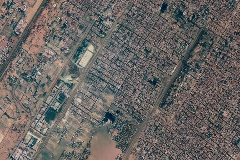
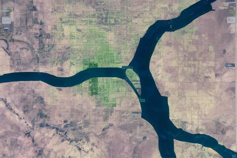
Satellite surveillance is akin to having a bird's-eye view of military operations. It provides real-time intelligence on troop movements, equipment status, and even environmental conditions. With this information at their fingertips, military leaders can make informed decisions that directly impact readiness levels. For instance, if a satellite detects an unusual concentration of enemy forces, commanders can swiftly adjust their strategies to counter potential threats. This capability is invaluable in a landscape where every second counts, and hesitation can lead to disastrous consequences.
Imagine trying to coordinate a complex operation without reliable communication—it's like trying to conduct an orchestra with no conductor. Satellites enhance military communication by providing secure and reliable channels for information exchange. This ensures that commands are executed efficiently, even in remote or hostile environments. Whether it's coordinating airstrikes or managing troop movements, satellites act as the backbone of military communication, enabling seamless interaction among various units.
The beauty of satellite technology lies in its global coverage. Military operations can be monitored and coordinated from virtually anywhere on the planet. This level of accessibility increases the flexibility and responsiveness of armed forces. For example, a command center located thousands of miles away can still effectively oversee operations in a distant conflict zone. The ability to gather and disseminate information quickly and efficiently is a game-changer in modern warfare.
Real-time data transmission via satellites allows for immediate updates on battlefield conditions. Picture this: a drone captures footage of enemy movements, and within moments, that information is relayed back to command centers. This enables military leaders to react swiftly to emerging situations and adjust strategies accordingly. The speed at which information flows can make all the difference in the heat of battle, often determining the outcome of engagements.
Satellites also play a crucial role in facilitating joint operations among allied forces. By providing a shared communication platform, they enhance collaboration and coordination during multinational military exercises and missions. This is particularly important in today's interconnected world, where alliances and partnerships are vital for addressing global security challenges. The ability to share critical information in real-time fosters trust and efficiency among allied nations, ultimately strengthening military readiness.
Advanced data analysis capabilities from satellite imagery help military analysts interpret complex situations. It's not just about gathering data; it's about making sense of it. Analysts can identify potential threats and assess the overall readiness levels of forces by examining satellite images and data trends. This analytical prowess allows military leaders to develop informed strategies and allocate resources effectively, ensuring that troops are prepared for any scenario.
GPS technology, enabled by satellites, is crucial for navigation and targeting. Think of it as a digital compass that guides military operations with pinpoint accuracy. This capability improves the effectiveness of military operations, ensuring that forces can effectively reach their objectives. In a world where precision is key, GPS technology is a game-changer.
Precision targeting through GPS capabilities allows for more effective engagement of enemy assets while minimizing collateral damage. Imagine being able to strike a target with surgical precision—this not only contributes to mission success but also enhances overall military readiness. The ability to hit targets accurately means that resources can be utilized more efficiently, leading to better outcomes on the battlefield.
Logistical support is another area where GPS shines. It enhances supply chain management by optimizing routes and tracking equipment movement. This ensures that troops are well-equipped and ready for deployment when needed. In military operations, timing is everything, and having the right resources in the right place at the right time can significantly impact mission success.
- How do satellites improve military readiness? Satellites provide real-time surveillance, secure communication, and advanced data analysis, enabling military leaders to make informed decisions and respond swiftly to emerging threats.
- What role does GPS play in military operations? GPS technology enhances navigation and targeting accuracy, allowing military forces to engage targets effectively while minimizing collateral damage.
- Can satellites facilitate joint operations among allied forces? Yes, satellites provide a shared communication platform that enhances collaboration and coordination during multinational military exercises and missions.
Importance of Satellite Surveillance
When it comes to military readiness, satellite surveillance stands as a cornerstone of modern defense strategy. Imagine a vast chessboard where every move counts; satellites act as the eyes in the sky, providing real-time intelligence that can dictate the course of operations. They monitor everything from troop movements to equipment status, allowing military leaders to make informed decisions swiftly. This capability is not just about gathering data; it’s about transforming that data into actionable insights that can enhance operational effectiveness.
One of the most significant advantages of satellite surveillance is its ability to deliver real-time updates. Picture a scenario where a commander needs to know the location of friendly forces or the movements of an adversary. Satellite systems can provide this information almost instantaneously, enabling leaders to assess readiness levels and make strategic decisions on the fly. This immediacy can be the difference between success and failure in a military operation.
Moreover, satellite surveillance plays a vital role in risk assessment. By continuously monitoring areas of interest, military analysts can identify potential threats before they materialize. For example, if a satellite detects an unusual concentration of enemy troops in a specific region, commanders can prepare defensive measures or plan counter-offensives. This proactive approach to threat detection significantly enhances military readiness.
To illustrate the impact of satellite surveillance, consider the following key functions:
- Monitoring troop movements: Satellites provide a bird's-eye view of troop deployments, allowing for detailed analysis of their positioning and readiness.
- Equipment status tracking: Real-time data on the condition and location of military assets ensures that forces are always prepared for action.
- Environmental assessments: Satellites can also monitor weather patterns and terrain conditions, which are critical for planning operations.
In summary, the importance of satellite surveillance in evaluating military readiness cannot be overstated. It empowers military leaders with the information they need to make informed decisions, enhances risk assessment, and allows for dynamic responses to changing conditions on the battlefield. As technology continues to evolve, the capabilities of satellite surveillance will only become more sophisticated, further solidifying its role as an essential component of military strategy.
Communication Enhancements through Satellites
In today's fast-paced and ever-evolving military landscape, communication plays a pivotal role in ensuring that operations run smoothly and effectively. Satellites have revolutionized how military forces communicate, providing a backbone for secure and reliable information exchange. Imagine being in a remote desert, far away from any base, yet having the ability to send and receive critical updates in real-time. This is not just a dream; it's a reality made possible by satellite technology.
One of the most significant advantages of satellite communication is its ability to transcend geographical barriers. Traditional communication methods can falter in challenging terrains, but satellites maintain a consistent connection, ensuring that military leaders can relay commands and receive feedback without interruption. This is especially vital during operations where every second counts. For instance, during a critical mission, a commander can instantly inform troops of a change in strategy or alert them to unexpected threats. This level of responsiveness can mean the difference between success and failure on the battlefield.
Furthermore, satellite communication systems are designed to be secure, protecting sensitive information from potential adversaries. With the rise of cyber threats, ensuring that communication channels are fortified against interception is paramount. Military satellites employ advanced encryption techniques, making it exceedingly difficult for unauthorized entities to access or disrupt communications. This security measure not only safeguards operational integrity but also boosts the confidence of military personnel as they engage in missions.
Moreover, satellites facilitate communication among allied forces, creating a unified command structure during joint operations. When multiple nations collaborate, having a shared communication platform is essential. It fosters collaboration and enhances coordination, allowing for seamless exchanges of information. For example, during multinational exercises, troops from different countries can share intelligence and updates in real-time, ensuring that everyone is on the same page and ready to act as one cohesive unit.
To illustrate the impact of satellite communication on military readiness, consider the following table showcasing key benefits:
| Benefit | Description |
|---|---|
| Global Reach | Provides communication capabilities in remote and hostile environments. |
| Real-time Updates | Ensures immediate transmission of critical information. |
| Secure Channels | Protects sensitive data from interception and cyber threats. |
| Joint Operations | Enhances collaboration among allied forces through shared platforms. |
In conclusion, the enhancements in communication through satellites have transformed military operations, making them more efficient, secure, and adaptable. As technology continues to advance, we can only expect these systems to become even more sophisticated, further solidifying the role of satellites in maintaining military readiness. The ability to communicate effectively in any situation is not just a luxury; it's a necessity that ensures the safety and success of military personnel worldwide.
- How do satellites improve military communication?
Satellites provide secure, reliable communication channels that function in remote or hostile environments, ensuring military leaders can relay commands and receive updates without interruption. - What are the security measures in satellite communication?
Military satellites use advanced encryption techniques to protect sensitive information from interception and cyber threats, maintaining the integrity of operational communications. - Can satellites assist in joint military operations?
Yes, satellites facilitate communication among allied forces, enabling seamless information exchange and enhancing collaboration during multinational military exercises and missions.
Global Coverage and Accessibility
The concept of global coverage and accessibility in military operations is akin to having a bird's-eye view of the entire battlefield. Imagine being able to see every movement, every piece of equipment, and every troop deployment from a vantage point high above the Earth. This is precisely what satellites offer to military leaders around the world. With a vast network of satellites orbiting our planet, military forces can monitor activities and coordinate operations in real-time, no matter where they are located. This capability significantly enhances the flexibility and responsiveness of armed forces, allowing them to adapt quickly to changing situations.
One of the most significant advantages of satellite technology is its ability to provide seamless communication and surveillance across vast distances. Whether in urban environments or remote wilderness, satellites ensure that military units can stay connected and informed. The global reach of these satellites means that even the most isolated units can receive crucial updates and directives without delay. This is particularly important during times of crisis when every second counts.
Moreover, the accessibility of satellite data allows for a more comprehensive understanding of the battlefield. Military analysts can access high-resolution imagery and real-time data to assess situations accurately. This capability is not just about having information; it's about having the right information at the right time. For instance, if a troop movement is detected in a hostile region, military leaders can quickly analyze the data and decide on the best course of action, whether it be reinforcement, retreat, or engagement.
To illustrate the benefits of global coverage, consider the following table that outlines key advantages of satellite technology in military operations:
| Advantage | Description |
|---|---|
| Real-time Monitoring | Continuous surveillance of troop movements and equipment status, enabling informed decision-making. |
| Enhanced Coordination | Facilitates better collaboration among different military branches and allied forces. |
| Rapid Response | Immediate access to data allows for quick adjustments to strategies based on battlefield conditions. |
In conclusion, the global coverage and accessibility provided by satellites are indispensable for modern military operations. They not only enhance situational awareness but also ensure that forces can operate effectively in any environment. As technology continues to evolve, the role of satellites in military readiness will only become more critical, shaping the future of warfare and defense strategies.
- How do satellites improve military communication?
Satellites provide secure and reliable channels for information exchange, ensuring that commands are executed efficiently, even in remote or hostile environments. - What is the significance of real-time data transmission?
Real-time data transmission allows military leaders to receive immediate updates on battlefield conditions, enabling them to react swiftly to emerging situations. - How does GPS technology contribute to military readiness?
GPS technology improves navigation and targeting, enhancing the accuracy of military operations and ensuring forces can effectively reach their objectives.
Real-time Data Transmission
In the fast-paced world of military operations, via satellites is nothing short of a game changer. Imagine being in a high-stakes chess match where every move counts, and your opponent is constantly shifting strategies. This is what military leaders face on the battlefield, and satellites provide them with the critical information they need to stay one step ahead. With the ability to transmit data instantaneously, military forces can gain insights into battlefield conditions, troop movements, and equipment status without the delays that can come from traditional communication methods.
Consider this: when a satellite captures imagery of enemy positions, that data can be relayed back to command centers almost immediately. This immediacy allows commanders to make informed decisions based on the latest information rather than outdated reports. In essence, it's like having a bird's-eye view of the battlefield, enabling leaders to react swiftly to emerging situations. Whether it's detecting a sudden troop buildup or identifying a new threat, the ability to receive and analyze data in real-time can be the difference between success and failure in military operations.
Moreover, the integration of real-time data transmission into military operations enhances the overall strategic response. For instance, if a unit encounters unexpected resistance, commanders can quickly assess the situation and deploy reinforcements or adjust tactics accordingly. This agility not only improves operational effectiveness but also boosts the morale of the troops who know that they have the latest intelligence at their fingertips.
To illustrate the impact of real-time data transmission, consider the following table that outlines its key benefits:
| Benefit | Description |
|---|---|
| Immediate Updates | Real-time information allows for instant updates on battlefield conditions. |
| Enhanced Decision-Making | Commanders can make quicker, data-driven decisions that can alter the course of operations. |
| Increased Agility | Forces can adapt to changing scenarios on the fly, maintaining operational momentum. |
| Improved Coordination | Real-time data fosters better collaboration among different military branches and allied forces. |
In conclusion, the role of real-time data transmission in military readiness cannot be overstated. It empowers commanders with the information they need to make swift, informed decisions that can save lives and ensure mission success. As technology continues to evolve, the reliance on satellite communication for real-time data will only increase, further transforming how military operations are conducted around the globe.
- How does real-time data transmission work? Real-time data transmission works through satellite communication systems that relay information from the battlefield directly to command centers, allowing for instantaneous updates and decision-making.
- What are the advantages of using satellites for military communication? Satellites provide secure, reliable communication channels that are essential for maintaining contact in remote or hostile environments, enhancing coordination and operational effectiveness.
- Can real-time data transmission be disrupted? While satellite communication is generally robust, it can be vulnerable to interference or attacks, which is why military forces have contingency plans in place to ensure continued operations.
Impact on Joint Operations
In the realm of modern warfare, the ability to cooperate with allied forces is paramount. Satellites play a crucial role in ensuring that joint operations among different military branches and nations are executed smoothly and effectively. Imagine trying to coordinate a complex dance performance where each dancer is in a different location; without a shared rhythm, chaos would ensue. Similarly, satellites provide that essential rhythm in military operations, allowing for seamless communication and coordination.
One of the most significant advantages of satellite technology is its ability to create a shared communication platform. This platform enables forces from various countries to exchange vital information in real-time, ensuring everyone is on the same page. For instance, during multinational military exercises, commanders can share intelligence reports, troop movements, and logistical needs instantly. This immediate access to information allows for quick decision-making and adjustments, which are critical in high-stakes environments.
Moreover, the integration of satellite systems into joint operations enhances situational awareness. Military leaders can monitor the battlefield from a bird's eye view, gaining insights that ground troops may not be able to see. For example, if an allied unit encounters unexpected resistance, satellite imagery can provide a comprehensive overview of enemy positions, helping to formulate a more effective response. This capability is akin to having a tactical map that updates in real-time, allowing for informed strategic planning.
Furthermore, the flexibility offered by satellite technology cannot be overstated. In joint operations, forces may be deployed in various terrains and environments, from deserts to urban landscapes. Satellites ensure that communication remains intact, even in remote or hostile areas where traditional communication methods may fail. This reliability fosters trust and collaboration among allied forces, as they can depend on consistent communication channels to relay critical information.
In summary, the impact of satellites on joint operations is profound. By facilitating real-time communication, enhancing situational awareness, and providing flexibility in various environments, satellites have revolutionized how military forces collaborate. As we look towards the future of military engagements, the role of satellite technology will undoubtedly continue to grow, ensuring that allied forces can operate effectively and efficiently together.
- How do satellites enhance military communication?
Satellites provide secure and reliable channels for information exchange, ensuring that commands are executed efficiently, even in remote or hostile environments.
- What is the role of satellites in joint military operations?
Satellites facilitate real-time communication and provide shared situational awareness, allowing allied forces to coordinate effectively and respond quickly to emerging situations.
- Can satellites operate in all weather conditions?
Yes, modern satellites are designed to function in various weather conditions, ensuring consistent communication and data transmission regardless of environmental challenges.
Data Analysis and Interpretation
In the dynamic landscape of military operations, the ability to analyze and interpret data from satellite imagery is nothing short of revolutionary. Imagine having a bird's-eye view of the battlefield, where every movement, every piece of equipment, and every tactical decision is laid out before you. This is the power of satellite data analysis, which provides military analysts with the tools to decipher complex scenarios and assess overall readiness levels of forces. By leveraging advanced algorithms and machine learning techniques, military experts can sift through vast amounts of information, identifying patterns and anomalies that would be impossible to detect with the naked eye.
One of the most significant advantages of satellite data analysis is its ability to deliver actionable insights in real-time. For instance, when satellite imagery reveals unusual troop concentrations or unexpected equipment deployments, military leaders can swiftly adapt their strategies. This capability is akin to having a chessboard where you can see all the pieces in play, allowing for strategic moves that can outmaneuver the opponent.
Furthermore, the integration of Artificial Intelligence (AI) enhances the interpretation process. AI algorithms can analyze historical data and predict potential future movements, which is crucial for proactive decision-making. This predictive analysis is vital for anticipating threats and preparing responses before situations escalate. For example, if data indicates a buildup of enemy forces near a border, military planners can mobilize resources or conduct reconnaissance missions to gather more information.
To illustrate the impact of data analysis, let's take a look at a simple table that summarizes the key benefits of satellite data interpretation:
| Benefit | Description |
|---|---|
| Real-time Insights | Immediate updates on troop movements and equipment status. |
| Pattern Recognition | Identifying trends and anomalies in military activity. |
| Predictive Analysis | Forecasting potential enemy actions based on historical data. |
| Enhanced Decision-Making | Informed strategic planning and resource allocation. |
Moreover, the collaborative aspect of satellite data analysis cannot be overlooked. When multiple allied forces share satellite imagery, they can create a comprehensive picture of the operational environment. This collaboration enhances situational awareness and fosters trust among allied nations, which is essential for successful joint operations. It’s like having a group of friends working together to solve a puzzle, where each piece of information contributes to a clearer understanding of the bigger picture.
In conclusion, the role of data analysis and interpretation in military readiness cannot be overstated. As technology continues to evolve, the capabilities of satellite data will only expand, providing military forces with an unprecedented advantage in assessing readiness and responding to threats. With the right tools and insights, military leaders can navigate the complexities of modern warfare, ensuring that they are always one step ahead of the competition.
- How do satellites gather data for military analysis?
Satellites use advanced sensors and imaging technology to capture high-resolution images and data from the Earth's surface, which are then transmitted to military analysts for interpretation. - What role does AI play in satellite data analysis?
AI algorithms assist in analyzing large datasets, identifying patterns, and making predictions about potential military movements or threats. - Can satellite data be used for non-military purposes?
Yes, satellite data has a wide range of applications, including environmental monitoring, disaster response, and urban planning.
Role of GPS in Military Readiness
The role of GPS technology in military readiness is nothing short of revolutionary. Imagine trying to navigate a vast battlefield without a reliable map or compass; chaos would undoubtedly ensue. GPS, or Global Positioning System, has transformed how military forces operate, ensuring that every troop and piece of equipment knows its exact location at any given moment. This precision not only enhances operational efficiency but also significantly boosts the overall effectiveness of military strategies.
One of the most critical aspects of GPS technology is its ability to provide **real-time navigation** and targeting information. When troops are deployed, they need to know exactly where they are and where they need to go. GPS allows for pinpoint accuracy in navigation, which is vital during fast-paced operations. This means that military units can move swiftly and effectively towards their objectives, minimizing the risk of getting lost in unfamiliar terrain. Furthermore, with the integration of GPS into various military systems, troops can now receive precise coordinates for enemy positions, allowing for more strategic planning and execution of operations.
Another significant benefit of GPS in military readiness is its impact on precision targeting. In modern warfare, the ability to strike accurately is paramount. GPS technology enables military forces to engage enemy assets with remarkable accuracy while minimizing collateral damage. This capability not only enhances mission success rates but also ensures that military operations are conducted with a level of responsibility that is increasingly demanded in today’s conflict scenarios. The precision targeting afforded by GPS means that military leaders can make tactical decisions with greater confidence, knowing that their forces can hit their marks without unnecessary harm to civilians or infrastructure.
Moreover, GPS plays a pivotal role in logistical support. The military relies heavily on a well-coordinated supply chain to ensure that troops are adequately equipped and ready for deployment. GPS technology enhances logistical operations by optimizing supply routes and tracking the movement of equipment. For instance, military planners can utilize GPS data to determine the quickest and most efficient routes for transporting supplies, thereby reducing wait times and ensuring that troops receive what they need when they need it. This capability is especially crucial in combat situations where every second counts.
In addition to navigation and targeting, GPS technology also supports coordination among allied forces. In joint operations, where multiple nations collaborate, having a unified system for tracking positions and movements is essential. GPS provides a shared framework that allows allied forces to communicate their locations and movements effectively, fostering a collaborative environment that enhances overall mission success. This level of coordination is vital in complex military operations, where the stakes are high, and the margin for error is slim.
As we delve deeper into the implications of GPS technology in military readiness, it's essential to recognize that the benefits extend beyond just navigation and targeting. The integration of GPS into military operations is a game-changer that enhances operational efficiency, improves logistical support, and fosters international collaboration. In a world where military engagements are becoming increasingly complex, the reliance on GPS technology is only set to grow, ensuring that armed forces are always prepared and ready to respond to any challenge that comes their way.
- How does GPS improve military operations?
GPS enhances military operations by providing accurate navigation and targeting, allowing for efficient troop movements and precise strikes on enemy positions. - What role does GPS play in logistics?
GPS optimizes supply routes and tracks equipment movement, ensuring that troops are well-equipped and ready for deployment. - Can GPS be used by allied forces?
Yes, GPS technology facilitates coordination among allied forces, providing a shared platform for tracking positions and movements during joint operations.
Precision Targeting
In the realm of modern warfare, stands as a game changer, fundamentally altering how military operations are conducted. Imagine a world where every strike is executed with pinpoint accuracy, minimizing the risk of collateral damage while maximizing operational effectiveness. This is the reality enabled by GPS technology and satellite systems, which have become the backbone of contemporary military strategies.
At the core of precision targeting is the ability to gather and analyze real-time data from various sources. Satellites play a crucial role by providing detailed imagery and coordinates that inform military planners about enemy positions and movements. This information allows commanders to make strategic decisions that are not only timely but also incredibly accurate. For instance, rather than relying on outdated maps or intelligence, military forces can access up-to-the-minute data, ensuring that their targeting efforts are as precise as possible.
Moreover, the integration of satellite technology with advanced weapon systems has revolutionized targeting methodologies. With the use of smart munitions, which are guided by GPS, forces can engage specific targets with remarkable accuracy. This capability is particularly vital in urban warfare scenarios where the risk of civilian casualties is heightened. By employing precision targeting, militaries can neutralize threats while safeguarding non-combatants, a feat that was much harder to achieve in previous conflicts.
To illustrate the effectiveness of precision targeting, consider the following table that compares traditional targeting methods with GPS-enabled targeting:
| Aspect | Traditional Targeting | GPS-Enabled Targeting |
|---|---|---|
| Accuracy | Low to Moderate | High |
| Risk of Collateral Damage | High | Low |
| Response Time | Slow | Immediate |
| Operational Flexibility | Limited | Enhanced |
This comparison clearly highlights how GPS-enabled targeting not only enhances accuracy but also significantly reduces the risks associated with military operations. As a result, forces can achieve their objectives while adhering to strict rules of engagement, ultimately leading to greater operational success.
In conclusion, precision targeting is a critical component of military readiness, driven by the advancements in satellite technology. By harnessing the power of GPS and satellite data, armed forces can execute missions with unprecedented accuracy and efficiency. The future of military operations lies in these sophisticated targeting capabilities, ensuring that they remain effective in an ever-evolving battlefield landscape.
- What is precision targeting? Precision targeting refers to the use of advanced technology, such as GPS and satellite systems, to accurately identify and engage military targets while minimizing collateral damage.
- How do satellites enhance precision targeting? Satellites provide real-time intelligence and detailed imagery, allowing military forces to make informed decisions and execute strikes with high accuracy.
- What are the benefits of GPS in military operations? GPS technology improves navigation, targeting accuracy, and logistical support, enabling military forces to operate more effectively in various environments.
Logistical Support
When it comes to military operations, having the right resources at the right time can mean the difference between success and failure. This is where comes into play, and satellites are the unsung heroes of this critical function. Imagine a vast network of roads, airways, and waterways, all bustling with activity, and you’ll start to grasp the complexity involved in moving troops and supplies. Satellites provide a comprehensive view of these logistics, ensuring that everything runs smoothly.
One of the most significant advantages of using satellite technology for logistical support is the ability to optimize supply chain routes. By analyzing real-time data from satellites, military planners can identify the most efficient paths for transporting goods. This not only saves time but also reduces fuel costs and minimizes the risk of delays. Think of it like navigating through a busy city; knowing the best routes can help avoid traffic jams and get you to your destination faster. Similarly, satellite data allows military logistics teams to avoid potential bottlenecks, ensuring that supplies reach their intended locations without unnecessary interruptions.
Furthermore, the tracking of equipment movement is another critical aspect of logistical support that satellites excel at. With satellite tracking, military units can monitor the status and location of their assets in real-time. This capability is akin to having a GPS for every piece of equipment, from tanks to medical supplies. It provides commanders with a clear picture of what resources are available and where they are positioned. In situations where rapid deployment is essential, such as responding to natural disasters or conflicts, this information can be invaluable.
To illustrate the importance of logistical support, consider the following table that highlights the key benefits of satellite technology in military logistics:
| Benefit | Description |
|---|---|
| Route Optimization | Identifies the most efficient paths for transporting supplies, saving time and costs. |
| Real-time Tracking | Monitors equipment movement, providing commanders with up-to-date information on resource status. |
| Enhanced Coordination | Facilitates better communication between different branches of the military, ensuring cohesive operations. |
| Risk Mitigation | Helps avoid potential logistical bottlenecks and risks by providing timely data and insights. |
In addition to these benefits, satellites also enable enhanced coordination among various military branches. When all units are on the same communication platform, it becomes much easier to synchronize efforts. This is especially crucial during joint operations where multiple forces must work together seamlessly. Just like a well-rehearsed orchestra, each section must know its part and timing to create a harmonious outcome. Satellites provide that synchronization, ensuring that every logistical element aligns perfectly with the overall mission objectives.
In summary, the role of satellites in logistical support cannot be overstated. They not only streamline operations but also enhance the military's ability to respond to dynamic situations. By leveraging satellite technology, armed forces can ensure that their troops are always well-equipped and ready for deployment when the need arises. In the fast-paced world of military operations, having reliable logistical support is not just an advantage; it is a necessity.
- How do satellites improve military logistics? Satellites provide real-time data for route optimization and equipment tracking, enhancing overall efficiency.
- What are the key benefits of satellite technology in military operations? Key benefits include route optimization, real-time tracking, enhanced coordination, and risk mitigation.
- Can satellites assist in joint military operations? Yes, they facilitate communication and coordination among different military branches, ensuring seamless collaboration.
Frequently Asked Questions
- How do satellites improve military readiness?
Satellites enhance military readiness by providing real-time surveillance, secure communication, and advanced data analysis. They allow military leaders to monitor troop movements, assess equipment status, and make informed decisions quickly, ensuring that forces are always prepared for action.
- What role does satellite surveillance play in military operations?
Satellite surveillance offers critical intelligence that helps military leaders track enemy movements and assess the readiness of their own forces. This capability enables them to respond to threats swiftly and allocate resources effectively, enhancing overall operational effectiveness.
- How do satellites facilitate communication in the military?
Satellites provide secure and reliable communication channels that ensure military commands can be executed efficiently, even in remote or hostile environments. This connectivity is vital for maintaining coordination among troops and for effective decision-making during operations.
- What is the significance of GPS technology in military readiness?
GPS technology, powered by satellites, is essential for accurate navigation and targeting in military operations. It enhances mission success by allowing precise engagement of targets and ensuring that forces can reach their objectives effectively.
- How does satellite data analysis contribute to military strategies?
Advanced data analysis from satellite imagery helps military analysts interpret complex battlefield situations, identify potential threats, and assess overall readiness levels. This capability allows for better strategic planning and resource allocation, ultimately improving military effectiveness.
- Can satellites support joint military operations?
Absolutely! Satellites provide a shared communication platform that enhances collaboration and coordination among allied forces. This is particularly crucial during multinational military exercises and missions, where seamless communication can make all the difference.
- How does real-time data transmission impact military operations?
Real-time data transmission via satellites allows military leaders to receive immediate updates on battlefield conditions. This capability enables them to react swiftly to emerging situations, adjust strategies on the fly, and maintain a tactical advantage.