The Role of Satellites in Preventing Military Conflicts
In today's rapidly evolving world, the role of satellites in maintaining global peace has become more critical than ever. These technological marvels orbiting our planet are not just tools for communication or navigation; they are pivotal in enhancing surveillance, intelligence, and communication. By providing real-time data and insights, satellites help nations assess potential threats, avoid misunderstandings, and ultimately foster international cooperation. Imagine a world where conflicts can be anticipated and averted before they escalate—this is the promise that satellite technology holds for us.
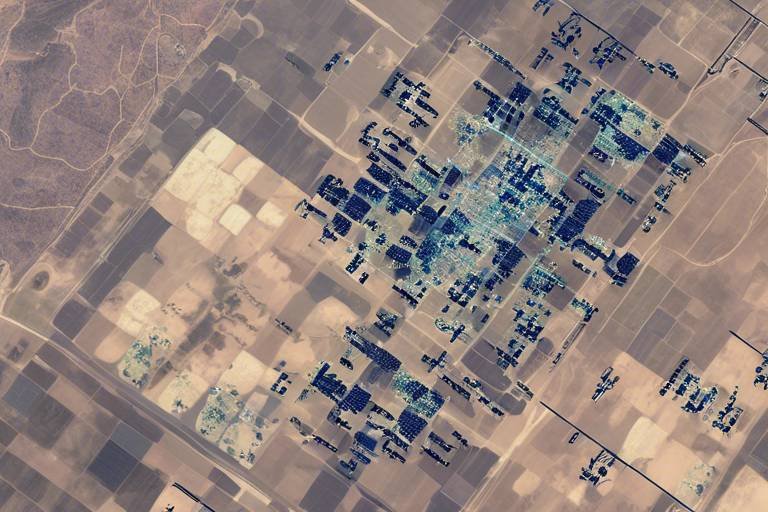
Satellite surveillance plays a crucial role in monitoring military activities and troop movements across the globe. With the ability to capture high-resolution images and gather data in real-time, satellites provide nations with the necessary information to assess potential threats. This capability is akin to having a bird’s-eye view of the battlefield, allowing military strategists to make informed decisions. By keeping an eye on troop deployments and military exercises, nations can avoid misunderstandings that could lead to conflict. For instance, if one country observes unusual troop movements near its border, it can analyze the situation and determine whether these movements are a genuine threat or simply routine exercises.
Intelligence gathered from satellites is invaluable for nations as they formulate their defense strategies. The accuracy of this information reduces the likelihood of escalation by providing a clearer picture of adversaries’ capabilities and intentions. When nations have access to reliable data, they can avoid knee-jerk reactions that might otherwise lead to military confrontations. For example, if satellite imagery reveals that a neighboring country is not amassing troops as initially feared, diplomatic channels can remain open, thereby preventing unnecessary tensions.
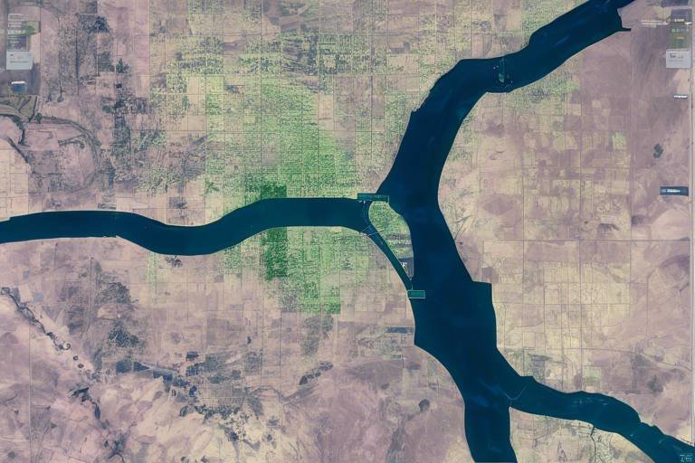
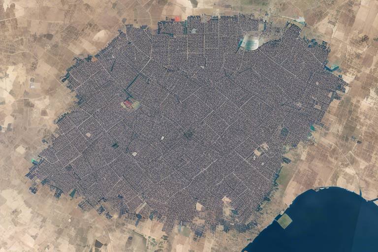
Geospatial analysis using satellite imagery enables military planners to visualize conflict zones effectively. This visualization is crucial for strategic planning and resource allocation, allowing nations to deter potential aggressors. By mapping out areas of tension, military leaders can identify hotspots and prioritize their responses. It’s like having a map that highlights not just the terrain but also the emotional landscape of international relations, guiding countries in their diplomatic efforts.
Mapping conflict zones through satellite data helps identify areas where tensions are rising. This information is essential for timely diplomatic interventions and peacekeeping missions. By understanding where conflicts are likely to erupt, nations can deploy peacekeeping forces or engage in dialogue before situations spiral out of control. For example, if satellite data indicates increased military buildup in a volatile region, nations can coordinate efforts to mediate and prevent escalation.
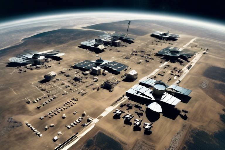
Assessing critical infrastructure via satellites aids in understanding the vulnerabilities of nations. This knowledge enables proactive measures to safeguard against potential attacks and mitigate conflict risks. By analyzing infrastructure, such as military bases and communication networks, nations can identify weaknesses and bolster their defenses. This proactive approach is akin to fortifying a castle before an enemy siege, ensuring that nations are prepared for any eventuality.
Data sharing between nations enhances collaborative efforts in conflict prevention. By fostering transparency and trust, satellite technology helps maintain peace and stability in volatile regions. When countries share satellite data, they create a network of information that can be invaluable in crisis situations. Imagine a scenario where two rival nations can access the same satellite imagery; this shared perspective can lead to mutual understanding and, ultimately, collaboration.
Satellites significantly improve communication capabilities between military and civilian leaders. During crises, rapid dissemination of information can de-escalate tensions and promote dialogue. In a world where miscommunication can lead to catastrophic outcomes, having reliable communication channels is essential. Satellites serve as the backbone of these channels, ensuring that leaders can connect and discuss issues in real-time.
Real-time communication facilitated by satellites allows for immediate responses to emerging threats. This capability drastically reduces the chances of miscalculations that could lead to armed conflict. For instance, if a nation detects an unauthorized military exercise near its borders, immediate communication can clarify intentions and prevent a potential misunderstanding from escalating into a full-blown crisis.
Satellites support diplomatic channels by providing reliable communication links. These links enable negotiations and discussions that can resolve disputes before they escalate into military confrontations. In an age where every second counts, having the ability to communicate effectively can mean the difference between war and peace.
Monitoring compliance with international treaties and agreements through satellite technology ensures accountability among nations. This oversight helps prevent military conflicts by verifying disarmament and arms control efforts. When nations know they are being watched, they are more likely to adhere to agreements, fostering a culture of trust.
Verification of treaties using satellite imagery helps maintain trust between nations. By providing concrete evidence of compliance or violations, satellites play a crucial role in preventing misunderstandings that could lead to conflict. It’s like having a referee in a game, ensuring that all players follow the rules and play fair.
Early warning systems powered by satellite data can detect unusual military activities. This capability allows nations to respond proactively to prevent potential conflicts before they escalate into violence. By acting on early warnings, countries can address issues diplomatically rather than militarily, reinforcing the importance of communication and collaboration in international relations.
- How do satellites help prevent military conflicts? Satellites provide real-time surveillance, intelligence gathering, and communication capabilities that allow nations to assess potential threats and avoid misunderstandings.
- What role does data sharing play in conflict prevention? Data sharing fosters transparency and trust among nations, enhancing collaborative efforts to prevent conflicts.
- Can satellites monitor compliance with international treaties? Yes, satellites can monitor compliance by providing evidence of adherence to treaties, thereby maintaining accountability among nations.
- What is the significance of early warning systems? Early warning systems enable nations to detect unusual military activities and respond proactively, preventing conflicts before they escalate.
Satellite Surveillance
In today's world, where tensions can escalate in the blink of an eye, emerges as a powerful tool for monitoring military activities and troop movements across the globe. Imagine being able to observe the movements of nations from thousands of miles above the Earth, gathering real-time data that can make or break diplomatic relations. This capability is not just a technological marvel; it serves as a crucial element in maintaining global peace. By providing nations with the ability to assess potential threats accurately, satellite surveillance helps to avoid misunderstandings that could lead to military conflicts.
With satellites orbiting our planet, they can capture high-resolution images and collect intelligence that is invaluable for national security. For instance, when a country begins to mobilize troops near a border, satellite imagery can reveal these movements almost instantaneously. This real-time data allows governments to make informed decisions, ensuring they respond appropriately to emerging threats without resorting to hasty military action. Furthermore, the ability to monitor military installations and exercises can act as a deterrent against aggressive posturing, as nations are aware that their activities are being observed.
Moreover, the significance of satellite surveillance extends beyond mere observation. It plays a vital role in geospatial analysis, which enables military planners and defense analysts to visualize conflict zones effectively. By creating detailed maps that highlight troop concentrations, military assets, and potential hotspots, decision-makers can allocate resources strategically. This proactive approach is essential in preventing conflicts before they escalate into violence. For example, in regions where tensions are high, such as border disputes or areas with historical animosities, understanding the geographical landscape through satellite data can inform diplomatic strategies and peacekeeping missions.
To illustrate the impact of satellite surveillance, consider the following table that summarizes its key benefits:
| Benefit | Description |
|---|---|
| Real-Time Monitoring | Immediate observation of military movements, reducing the chances of miscalculations. |
| Enhanced Decision-Making | Accurate data allows for informed strategic planning and resource allocation. |
| Conflict Prevention | Identifying potential threats helps to avert military confrontations. |
| Geospatial Analysis | Visualizing conflict zones aids in strategic military planning. |
In conclusion, satellite surveillance is not just about watching from above; it’s about fostering a more peaceful world by enhancing transparency and trust among nations. When countries can see what others are doing, it diminishes the chances of surprise attacks and misinterpretations. Just like having a clear view of the road ahead can prevent accidents, satellite surveillance helps nations navigate the complex landscape of international relations, steering clear of conflicts that could have devastating consequences.
- How do satellites gather data for surveillance? Satellites utilize advanced imaging technology, including infrared and radar, to capture detailed images of the Earth's surface and monitor military activities.
- Can satellite surveillance prevent conflicts entirely? While it significantly reduces the chances of misunderstandings and escalations, it cannot completely eliminate the potential for conflict.
- What are the limitations of satellite surveillance? Weather conditions, satellite positioning, and the need for advanced technology can limit the effectiveness of satellite surveillance.
Intelligence Gathering
When it comes to maintaining peace on a global scale, through satellite technology is nothing short of revolutionary. Imagine having a bird’s-eye view of the world, where you can monitor activities and movements that could potentially escalate into conflict. Satellites provide nations with the ability to collect crucial data that informs their defense strategies. This data is not just numbers and images; it’s the lifeblood of informed decision-making that can prevent misunderstandings and, ultimately, military confrontations.
One of the most significant advantages of satellite intelligence is that it reduces uncertainty. In the fog of potential conflict, nations often operate on assumptions that can lead to miscalculations. By utilizing satellite imagery and data, countries can gain a clearer understanding of their adversaries' military capabilities and intentions. This clarity allows them to respond appropriately, whether that means ramping up defenses or engaging in diplomatic dialogue. For example, if a nation detects unusual troop movements via satellite, it can assess the situation accurately rather than jumping to conclusions that could escalate tensions.
Moreover, the power of geospatial analysis cannot be overstated. By analyzing satellite images, military planners can visualize conflict zones in a way that was previously unimaginable. This analysis enables them to strategize and allocate resources effectively, ensuring that they are prepared to deter potential aggressors. Here’s how it works:
| Aspect | Importance |
|---|---|
| Troop Movements | Identifying unusual activities that could indicate potential aggression. |
| Infrastructure | Assessing critical infrastructure to understand vulnerabilities. |
| Geographical Analysis | Mapping terrain to facilitate strategic planning. |
By mapping conflict zones, nations can pinpoint areas of tension that require immediate attention. This proactive approach allows for timely diplomatic interventions and peacekeeping missions, which can prevent military confrontations before they escalate. The ability to assess infrastructure via satellites also plays a vital role in understanding a nation’s vulnerabilities. For instance, if a country realizes that its energy grid is susceptible to attacks, it can take steps to fortify that infrastructure, thereby mitigating risks that could lead to conflict.
In essence, intelligence gathering through satellite technology transforms the way nations perceive and respond to potential threats. It fosters a climate of transparency and trust, as countries can share satellite data to monitor each other’s activities. This collaboration is essential in today’s interconnected world, where a single misstep can lead to catastrophic consequences. By leveraging satellite intelligence, nations can work together to maintain peace and stability, ensuring that the world remains a safer place for everyone.
- How do satellites gather intelligence? Satellites gather intelligence by capturing high-resolution images and data regarding military activities, troop movements, and infrastructure across the globe.
- What role does satellite intelligence play in diplomacy? Satellite intelligence provides accurate information that can inform diplomatic discussions and negotiations, reducing the chances of misunderstandings that could lead to conflict.
- Can satellite data be shared between countries? Yes, satellite data can be shared between countries to promote transparency and collaboration in conflict prevention efforts.
Geospatial Analysis
When it comes to understanding the complex dynamics of military conflicts, emerges as a powerful tool. This technique utilizes satellite imagery to create detailed maps that reveal crucial information about conflict zones. Imagine being able to visualize the landscape of a potential battleground from space, pinpointing not just geographical features but also troop concentrations and logistical routes. This level of insight is invaluable for military planners who need to make informed decisions quickly.
Through geospatial analysis, nations can assess the strategic value of various locations, which aids in resource allocation and planning. For instance, if a country identifies a buildup of military forces near its border, it can respond appropriately—whether that means increasing its own troop presence or engaging in diplomatic discussions to alleviate tensions. The ability to visualize these scenarios in real-time can be the difference between a peaceful resolution and a military confrontation.
Moreover, geospatial analysis doesn’t just stop at troop movements. It extends to understanding the socio-political landscape of an area. By analyzing patterns in population density, infrastructure, and even historical conflict data, military strategists can gain a comprehensive view of the potential for conflict. This can lead to proactive measures, such as:
- Establishing peacekeeping operations in high-tension areas.
- Identifying and supporting local governance structures to mitigate unrest.
- Deploying humanitarian aid to address underlying issues before they escalate.
In essence, geospatial analysis acts as a preventive shield against conflicts. It empowers nations to act before a situation spirals out of control, allowing them to engage in strategic diplomacy and conflict resolution efforts. The implications of this technology are profound, as it not only saves lives but also fosters international cooperation by providing a shared understanding of potential threats.
To better illustrate the impact of geospatial analysis, consider the following table that outlines its key benefits:
| Benefit | Description |
|---|---|
| Enhanced Decision-Making | Provides accurate, real-time data for informed military and diplomatic strategies. |
| Conflict Prevention | Identifies potential hotspots for intervention before they escalate. |
| Resource Allocation | Helps in the strategic deployment of military and humanitarian resources. |
| International Cooperation | Fosters trust and transparency among nations through shared data. |
In conclusion, geospatial analysis is not just a technological marvel; it is a game changer in the realm of military strategy and conflict prevention. By harnessing the power of satellite imagery, nations can better prepare for, respond to, and ultimately prevent conflicts, paving the way for a more peaceful world.
Q: What is geospatial analysis?
A: Geospatial analysis is the process of gathering and interpreting data related to geographical locations, often using satellite imagery to visualize and analyze conflict zones.
Q: How does geospatial analysis help in conflict prevention?
A: It provides valuable insights into troop movements and socio-political conditions, enabling nations to take proactive measures before conflicts escalate.
Q: What technologies are involved in geospatial analysis?
A: Technologies include satellite imagery, Geographic Information Systems (GIS), and data analytics tools that help interpret geographical data.
Q: Can geospatial analysis be used for purposes other than military?
A: Yes, it is widely used in urban planning, disaster management, environmental monitoring, and various fields that require spatial data analysis.
Mapping Conflict Zones
Mapping conflict zones is like creating a detailed roadmap of potential hotspots around the globe. With the incredible advancements in satellite technology, we can now visualize areas of tension with unparalleled precision. Imagine having a bird's-eye view of the world, where you can pinpoint not just geographical features but also the movements of military assets and the build-up of forces. This capability is vital for understanding where conflicts might erupt and why.
Satellites equipped with high-resolution imaging sensors can capture real-time data that reveals troop movements, military installations, and even logistical support routes. By analyzing this data, military planners and policymakers can identify regions that are on the brink of conflict. For instance, if a nation begins to mobilize troops near a disputed border, satellite imagery can provide immediate insight into the scale and nature of this military activity. This allows for timely diplomatic interventions, which can be crucial in preventing misunderstandings that could spiral into larger conflicts.
Moreover, mapping conflict zones through satellite data enables nations to:
- Identify Patterns: Recognizing recurring military activities in specific regions can help in forecasting potential escalations.
- Facilitate Strategic Planning: Understanding the geographical layout allows for better resource allocation and deployment of peacekeeping forces.
- Enhance International Cooperation: Sharing satellite data with allied nations fosters transparency and strengthens collective security measures.
Furthermore, this mapping process is not just limited to military movements. It also encompasses socio-political factors that might contribute to unrest. By integrating various data layers, such as population density, economic conditions, and historical grievances, analysts can develop a comprehensive picture of why certain areas are prone to conflict. This holistic approach is essential for crafting effective conflict prevention strategies.
In addition to military applications, mapping conflict zones also plays a critical role in humanitarian efforts. During crises, humanitarian organizations can use satellite imagery to assess damage, identify displaced populations, and plan aid distribution effectively. This dual-use of satellite data for both military and humanitarian purposes exemplifies how technology can be leveraged to foster peace rather than exacerbate conflict.
In conclusion, the ability to map conflict zones using satellite technology is a game-changer in the realm of global peacekeeping. By providing accurate, real-time information, satellites empower nations to act swiftly and decisively, thus preventing conflicts before they escalate into violence. The future of conflict prevention lies in our ability to harness these technological advancements, ensuring that we not only understand the battlegrounds of today but also work towards a more peaceful tomorrow.
Q1: How do satellites help in conflict prevention?
A1: Satellites provide real-time surveillance and intelligence data that help nations monitor military activities and troop movements, enabling timely interventions to prevent misunderstandings and conflicts.
Q2: Can satellite imagery be used for humanitarian purposes?
A2: Yes, satellite imagery is used by humanitarian organizations to assess damage, locate displaced populations, and plan effective aid distribution during crises.
Q3: What role does geospatial analysis play in conflict mapping?
A3: Geospatial analysis allows military planners to visualize conflict zones, facilitating strategic planning and resource allocation to deter potential aggressors.
Q4: How does data sharing enhance international cooperation?
A4: Data sharing fosters transparency and trust among nations, which are essential for maintaining peace and stability in volatile regions.
Infrastructure Assessment
In today's world, understanding a nation's infrastructure is like peering into its soul. The assessment of critical infrastructure through satellite technology is pivotal in grasping the vulnerabilities and strengths of nations. Imagine satellites as the all-seeing eyes in the sky, providing a bird's-eye view of everything from military bases to transportation networks. This information is not just useful; it’s essential for maintaining peace and stability.
Satellites can monitor key infrastructures such as roads, bridges, power plants, and communication networks. By analyzing this data, nations can identify potential weak spots that could be targeted in a conflict. For instance, if a country knows that its energy grid is susceptible to attacks, it can take proactive measures to reinforce these structures, thereby mitigating the risk of conflict. This proactive stance is akin to a homeowner reinforcing their doors and windows before a storm hits, ensuring that they are prepared for any potential threats.
Moreover, infrastructure assessment through satellites also aids in understanding the economic capabilities of a nation. A nation with a robust transportation network is often seen as a formidable player on the global stage. Conversely, a country with crumbling infrastructure may be perceived as weak, thus attracting unwanted attention or aggression. By keeping tabs on these developments, nations can better position themselves diplomatically and militarily.
To illustrate the importance of infrastructure assessment, consider the following table that outlines key infrastructure components and their significance:
| Infrastructure Component | Significance |
|---|---|
| Roads and Highways | Critical for troop movements and logistics |
| Bridges | Essential for connectivity and transportation of resources |
| Power Plants | Vital for sustaining military operations and civilian life |
| Communication Networks | Necessary for coordination and command during crises |
Ultimately, infrastructure assessment via satellite technology not only helps in identifying vulnerabilities but also fosters a sense of accountability among nations. When countries are aware that their infrastructures are being monitored, they are less likely to engage in aggressive actions that could lead to military conflicts. This transparency serves as a deterrent, encouraging nations to adhere to international norms and maintain peace.
- How do satellites assess infrastructure? Satellites use high-resolution imagery and geospatial analysis to monitor and evaluate critical infrastructure components.
- What are the benefits of infrastructure assessment? It helps nations identify vulnerabilities, reinforce defenses, and maintain accountability, ultimately contributing to global peace.
- Can satellite technology prevent conflicts? While it cannot prevent conflicts outright, it provides essential data that allows nations to make informed decisions and avoid misunderstandings.
Data Sharing and Collaboration
In today's interconnected world, between nations have become paramount in the quest for global peace. Satellites serve as the backbone of this collaboration, providing essential data that can be shared across borders. Imagine a vast network of eyes in the sky, all working together to monitor potential hotspots and assess military activities. This collective effort is not just about gathering information; it's about fostering an environment of transparency and trust among nations.
When countries share satellite data, they create a rich tapestry of information that enhances the understanding of regional dynamics. This process can significantly reduce the chances of misunderstandings or miscalculations that might otherwise lead to conflict. For instance, if one nation detects unusual troop movements near its borders, sharing this information with neighboring countries can help clarify intentions and prevent unnecessary escalations. By working together, nations can piece together a clearer picture of the geopolitical landscape, much like solving a jigsaw puzzle where each piece represents vital data.
Moreover, collaboration through data sharing can pave the way for joint initiatives aimed at conflict prevention. Countries can engage in joint military exercises, humanitarian missions, or even disaster response efforts, all facilitated by the insights gained from satellite imagery. This not only strengthens diplomatic ties but also builds a sense of camaraderie among nations, reinforcing the idea that we are all in this together. In a world where tensions can flare up in an instant, having reliable communication channels and shared data can make all the difference.
To illustrate the impact of data sharing, consider the following table that highlights some key benefits:
| Benefit | Description |
|---|---|
| Enhanced Trust | Sharing data fosters mutual understanding and reduces suspicion among nations. |
| Timely Interventions | Access to real-time data allows for quicker diplomatic responses to emerging threats. |
| Joint Security Initiatives | Collaboration can lead to joint efforts in peacekeeping and humanitarian assistance. |
| Reduced Miscommunication | Clear data sharing minimizes the likelihood of misunderstandings that could escalate into conflict. |
In essence, the role of satellites in promoting cannot be overstated. They act as a bridge, connecting nations and enabling them to work together towards a common goal: preventing military conflicts and fostering a peaceful coexistence. As we continue to advance technologically, the potential for enhanced collaboration through satellite data will only grow, offering hope for a more harmonious world.
- How do satellites help in conflict prevention? Satellites provide real-time surveillance and intelligence, allowing nations to monitor military activities and assess potential threats.
- What is the significance of data sharing among nations? Data sharing enhances transparency and trust, enabling nations to collaborate effectively in preventing conflicts.
- Can satellite data be used for humanitarian purposes? Yes, satellite data can be utilized for disaster response, humanitarian missions, and assessing critical infrastructure in conflict zones.
- How does satellite imagery assist in treaty verification? Satellite imagery offers concrete evidence of compliance or violations, helping maintain trust between nations regarding disarmament and arms control.
Communication Enhancement
In today's fast-paced world, where tensions can escalate in the blink of an eye, the role of satellites in enhancing communication cannot be overstated. These remarkable technological marvels act as the backbone of global communication systems, ensuring that military and civilian leaders can share vital information swiftly and efficiently. Imagine a scenario where two nations are on the brink of conflict; a single miscommunication could lead to disastrous consequences. This is where satellites step in, bridging the communication gap and providing a lifeline for dialogue.
Satellites facilitate real-time communication, enabling leaders to respond to emerging threats almost instantaneously. With satellite technology, information can be transmitted across vast distances in mere seconds. This immediacy is crucial during crises, as it allows for rapid decision-making and reduces the chances of miscalculations that could spiral into armed conflict. For instance, during a military standoff, having the ability to communicate in real-time can mean the difference between peace and war.
Moreover, satellites bolster diplomatic channels by establishing reliable communication links between nations. These links ensure that discussions and negotiations can occur without interruptions, fostering an environment where disputes can be resolved amicably. When leaders can communicate directly and clearly, misunderstandings are minimized, and trust can be built. In many cases, it is the conversations that happen behind closed doors, supported by satellite communication, that prevent conflicts from escalating.
To illustrate the significance of satellite-enhanced communication, consider the following table that outlines the key benefits:
| Benefit | Description |
|---|---|
| Real-Time Information Sharing | Allows for immediate response to threats, reducing the chances of miscalculation. |
| Reliable Communication Links | Supports diplomatic efforts by ensuring uninterrupted communication between nations. |
| Enhanced Decision-Making | Facilitates informed decisions during crises, promoting peaceful resolutions. |
Furthermore, the ability to maintain open lines of communication during a crisis is essential for de-escalation. When military leaders can communicate with one another, they can clarify intentions and reassure each other, which is vital in preventing misunderstandings that might otherwise lead to conflict. The presence of a satellite communication system can act as a stabilizing factor, allowing nations to engage in discussions that might otherwise be too risky without such technology.
In conclusion, the enhancement of communication through satellites is a game-changer in the realm of international relations. By ensuring that information flows seamlessly between nations, satellites play a pivotal role in fostering dialogue, preventing conflicts, and ultimately contributing to global peace. As we continue to advance technologically, the importance of these communication systems will only grow, making them essential tools in our quest for a more peaceful world.
- How do satellites improve communication during military crises?
Satellites provide real-time communication capabilities, allowing military and civilian leaders to exchange information quickly and accurately, which can de-escalate tensions. - Can satellites help prevent misunderstandings between nations?
Yes, satellites facilitate direct communication between nations, reducing the likelihood of misinterpretations that could lead to conflict. - What role do satellites play in diplomatic negotiations?
Satellites support reliable communication links that enable uninterrupted discussions, fostering trust and collaboration among nations.
Real-Time Communication
In an age where information travels at lightning speed, facilitated by satellites has become indispensable for military and civilian leaders alike. Imagine a world where decisions can be made in a heartbeat, where the flicker of a satellite signal can mean the difference between peace and conflict. This technology enables leaders to communicate instantly, sharing crucial information that can de-escalate tense situations before they spiral out of control.
When a crisis unfolds, every second counts. With satellite technology, leaders can engage in immediate dialogue without the delays that traditional communication methods might impose. For instance, if a military buildup is detected near a border, satellite communication allows for rapid discussions among defense ministers to assess the situation. This swift exchange of information is vital in preventing misunderstandings that could lead to miscalculations and, ultimately, armed conflict.
Moreover, the reliability of satellite communication strengthens diplomatic ties. By ensuring that leaders can reach each other at any moment, satellites foster an environment of trust. Consider the scenario where two nations are on the brink of conflict due to a territorial dispute. With a direct line of communication established through satellite links, leaders can negotiate terms and clarify intentions without the fear of misinterpretation. This openness can transform potential confrontations into opportunities for dialogue.
Furthermore, the integration of real-time communication with early warning systems enhances overall security. When unusual military activities are detected, leaders can quickly convene and evaluate the threat level, allowing for a coordinated response. This proactive approach not only helps in averting conflict but also showcases the power of technology in maintaining global peace.
In summary, the role of real-time communication via satellites cannot be overstated. It acts as a lifeline that connects leaders, promotes transparency, and facilitates quick decision-making. As we look to the future, the importance of this technology in preventing military conflicts will only continue to grow, emphasizing the need for enhanced satellite capabilities and international cooperation.
- How do satellites enhance communication during military crises?
Satellites provide immediate and reliable communication channels, allowing leaders to share vital information and make quick decisions to de-escalate tensions. - What role does satellite technology play in international diplomacy?
Satellite technology strengthens diplomatic ties by ensuring that leaders can communicate effectively, fostering trust and collaboration to resolve disputes peacefully. - Can satellite communication prevent misunderstandings between nations?
Yes, real-time communication helps clarify intentions and reduce the likelihood of misinterpretations that could lead to conflict. - How does satellite communication integrate with early warning systems?
Satellite communication supports early warning systems by enabling swift discussions among leaders in response to detected military activities, allowing for coordinated actions to prevent escalation.
Diplomatic Channels
In the intricate dance of international relations, effective communication is paramount. Satellites play a pivotal role in establishing and maintaining that can make or break peace efforts. Imagine a world where leaders can communicate instantly, bypassing the delays and uncertainties of traditional communication methods. This is the power that satellite technology brings to the table. By providing reliable communication links, satellites ensure that critical discussions can happen in real-time, especially during times of heightened tension.
When conflicts arise, the ability to communicate swiftly and clearly can prevent misunderstandings that might escalate into military confrontations. For instance, during a crisis, leaders can quickly relay messages, share intelligence, and negotiate terms without the fear of interception or delay. This immediacy is crucial in situations where every second counts. In fact, it can be the difference between a peaceful resolution and a catastrophic miscalculation.
Moreover, satellites enhance the capability of nations to engage in multilateral diplomacy. Countries can collaborate on issues that affect global security, such as arms control or climate change, by utilizing satellite communications to coordinate their efforts. This collaborative approach not only fosters trust among nations but also builds a framework for addressing conflicts before they escalate. By sharing data and insights gathered from satellites, nations can work together to create solutions that are beneficial for all parties involved.
To illustrate the impact of satellite communication on diplomacy, consider the following table that outlines key benefits:
| Benefit | Description |
|---|---|
| Instant Communication | Leaders can communicate in real-time, reducing the risk of misunderstandings. |
| Enhanced Collaboration | Countries can work together on global issues, fostering trust and cooperation. |
| Conflict Prevention | Timely discussions can avert military confrontations by addressing disputes early. |
In summary, satellites are not just tools for surveillance or intelligence gathering; they are vital instruments for diplomacy. By enhancing communication between nations, they create a foundation for dialogue and negotiation, which is essential for maintaining peace in a world rife with potential conflicts. The power of satellites in bolstering diplomatic channels cannot be overstated, as they pave the way for a more stable and cooperative international landscape.
- How do satellites improve diplomatic communication? Satellites provide reliable, real-time communication links that enable leaders to discuss critical issues without delays.
- Can satellites help prevent military conflicts? Yes, by facilitating timely discussions and negotiations, satellites can help avert misunderstandings that might lead to conflict.
- What role do satellites play in international treaties? Satellites help verify compliance with treaties, ensuring accountability and building trust among nations.
Monitoring Compliance
Monitoring compliance with international treaties and agreements is a pivotal aspect of maintaining global peace, and satellites play a crucial role in this process. By utilizing advanced satellite technology, nations can ensure that they adhere to their commitments, particularly in areas related to disarmament and arms control. Imagine a world where countries can verify each other's actions without the need for ground inspections; this is the reality that satellite monitoring can help create. It not only fosters accountability among nations but also acts as a deterrent against potential aggressors who might consider violating treaties.
The ability to monitor compliance through satellite imagery provides a transparent view of military activities worldwide. For instance, countries can track missile silos, troop movements, and even the construction of military infrastructure. This real-time data is invaluable, as it allows nations to respond swiftly to any signs of treaty violations. When nations know they are being watched, they are less likely to engage in actions that could lead to military conflicts. The transparency offered by satellite monitoring builds trust, which is essential in international relations.
One of the most significant aspects of monitoring compliance is the verification of treaties. This process involves analyzing satellite imagery to confirm whether nations are following the terms of their agreements. For example, the Strategic Arms Reduction Treaty (START) requires both the United States and Russia to limit their nuclear arsenals. Satellites equipped with high-resolution cameras can provide concrete evidence of compliance or violations, helping to maintain trust and prevent misunderstandings. Here’s a brief overview of how satellite verification works:
| Step | Description |
|---|---|
| 1 | Data Collection: Satellites capture high-resolution images of military sites. |
| 2 | Data Analysis: Analysts interpret the images to assess compliance. |
| 3 | Reporting: Findings are reported to relevant international bodies. |
| 4 | Diplomatic Engagement: If violations are detected, diplomatic channels are activated. |
Moreover, early warning systems powered by satellite data can detect unusual military activities, such as troop buildups or missile launches. This capability allows nations to respond proactively, preventing potential conflicts before they escalate into violence. For instance, if a satellite detects an unusual increase in military presence near a border, countries can engage in diplomatic discussions to address the situation before it spirals out of control. Without such monitoring, misunderstandings could lead to military confrontations, escalating tensions unnecessarily.
In conclusion, monitoring compliance through satellite technology is not just about keeping an eye on potential adversaries; it's about fostering a culture of transparency and trust among nations. By ensuring accountability and providing concrete evidence of compliance, satellites play a vital role in preventing military conflicts and promoting international cooperation.
- How do satellites monitor military compliance? Satellites capture high-resolution images of military sites, which are then analyzed to verify adherence to international treaties.
- What role do satellites play in early warning systems? Satellites can detect unusual military activities, providing early warnings that allow nations to engage in diplomatic discussions.
- Why is transparency important in international relations? Transparency fosters trust among nations, reducing the likelihood of misunderstandings that could lead to conflict.
Verification of Treaties
Verification of treaties is a fundamental aspect of maintaining global peace and security, and satellites play a pivotal role in this process. When nations come together to sign treaties, especially those related to arms control and disarmament, the need for trust and transparency becomes paramount. Satellites provide a unique vantage point, allowing countries to monitor compliance with these agreements effectively. Imagine trying to keep an eye on a neighbor who promises not to build a fence; without a clear view, misunderstandings can arise. Similarly, satellites offer that clear view, ensuring that all parties adhere to their commitments.
Through the use of high-resolution satellite imagery, nations can gather concrete evidence regarding military installations and activities. This technology allows for the detection of changes in infrastructure that may indicate a violation of a treaty. For instance, if a country is supposed to dismantle certain missile silos, satellite imagery can reveal whether those silos are still operational or have been destroyed as promised. This capability not only aids in verifying compliance but also fosters an environment of accountability among nations.
Moreover, the ability to share satellite data enhances international cooperation. When countries have access to the same information, it reduces the likelihood of misunderstandings and miscalculations. For example, if one nation observes unusual troop movements, it can quickly cross-reference that data with satellite imagery and determine whether it is a legitimate threat or simply a routine exercise. This immediate access to accurate information allows for swift diplomatic responses, preventing potential conflicts from escalating.
To illustrate the effectiveness of satellite verification, consider the following table that outlines key treaties and the role of satellite technology in their verification:
| Treaty | Purpose | Satellite Role |
|---|---|---|
| Strategic Arms Reduction Treaty (START) | Limit nuclear weapons | Monitoring missile silos and launch facilities |
| Comprehensive Nuclear-Test-Ban Treaty (CTBT) | Prohibit nuclear tests | Detecting signs of nuclear explosions |
| Intermediate-Range Nuclear Forces Treaty (INF) | Eliminate intermediate-range missiles | Verifying destruction of missile sites |
In summary, the verification of treaties through satellite technology not only enhances trust among nations but also acts as a deterrent against potential violations. By providing real-time, reliable data, satellites ensure that nations are held accountable for their commitments, ultimately contributing to a more peaceful world. The transparency created by satellite monitoring fosters an atmosphere where diplomatic solutions can flourish, reducing the likelihood of military conflicts.
- How do satellites verify compliance with treaties? Satellites provide high-resolution imagery that allows nations to monitor military installations and activities, ensuring adherence to treaty agreements.
- What types of treaties benefit from satellite verification? Treaties related to arms control and disarmament, such as the START and CTBT, significantly benefit from satellite monitoring.
- Can satellite data be shared between nations? Yes, sharing satellite data enhances international cooperation and reduces misunderstandings, fostering accountability.
Early Warning Systems
This article explores how satellites contribute to global peace by enhancing surveillance, intelligence, and communication, ultimately helping to prevent military conflicts and fostering international cooperation.
Satellite surveillance plays a crucial role in monitoring military activities and troop movements, providing real-time data that helps nations assess potential threats and avoid misunderstandings that could lead to conflict.
Intelligence gathered from satellites allows nations to make informed decisions regarding defense strategies, reducing the likelihood of escalation by providing accurate information about adversaries' capabilities and intentions.
Geospatial analysis using satellite imagery enables military planners to visualize conflict zones, facilitating strategic planning and resource allocation to deter potential aggressors and maintain peace.
Mapping conflict zones through satellite data helps identify areas of tension, allowing for timely diplomatic interventions and peacekeeping missions to prevent military confrontations.
Assessing critical infrastructure via satellites aids in understanding the vulnerabilities of nations, enabling proactive measures to safeguard against potential attacks and mitigate conflict risks.
Data sharing between nations enhances collaborative efforts in conflict prevention, fostering transparency and trust, which are essential for maintaining peace and stability in volatile regions.
Satellites improve communication capabilities between military and civilian leaders, ensuring rapid dissemination of information that can de-escalate tensions and promote dialogue during crises.
Real-time communication facilitated by satellites allows for immediate response to emerging threats, reducing the chances of miscalculations that could lead to armed conflict.
Satellites support diplomatic channels by providing reliable communication links, enabling negotiations and discussions that can resolve disputes before they escalate into military confrontations.
Monitoring compliance with international treaties and agreements through satellite technology ensures accountability among nations, helping to prevent military conflicts by verifying disarmament and arms control efforts.
Verification of treaties using satellite imagery helps maintain trust between nations, as it provides concrete evidence of compliance or violations, thus preventing misunderstandings that could lead to conflict.
Early warning systems powered by satellite data are like the canaries in the coal mine, alerting nations to unusual military activities before they spiral out of control. Imagine a world where satellites act as vigilant sentinels, constantly scanning the horizon for signs of impending conflict. By detecting unusual troop movements or military buildups, these systems enable nations to respond proactively, allowing for diplomatic solutions before tensions escalate into violence. For instance, when a satellite spots an increase in military aircraft near a border, it can trigger alerts that lead to immediate diplomatic engagement.
The importance of these systems cannot be overstated. They provide a crucial layer of security, ensuring that nations are not caught off guard. In fact, many countries have established joint early warning systems that utilize satellite data to monitor potential threats collaboratively. This not only enhances their own security but also fosters a sense of trust among nations, as they share critical information that can prevent misunderstandings. Below is a table highlighting key features of early warning systems:
| Feature | Description |
|---|---|
| Real-Time Monitoring | Continuous surveillance of military activities to detect unusual patterns. |
| Data Integration | Combining satellite data with other intelligence sources for comprehensive analysis. |
| Alert Mechanisms | Systems that notify decision-makers of potential threats immediately. |
| Collaborative Framework | Partnerships between nations to share data and enhance collective security. |
In conclusion, early warning systems leverage satellite technology to create a safety net against military conflicts. By providing timely information, they empower nations to act decisively and diplomatically, ensuring that the world remains a safer place.
- How do satellites detect military activities? Satellites use advanced imaging technology to monitor troop movements, missile launches, and other military activities, providing real-time data to decision-makers.
- What is the importance of data sharing among nations? Data sharing fosters transparency and trust, allowing nations to collaboratively address potential threats and prevent conflicts.
- Can early warning systems prevent all conflicts? While they significantly reduce the risk of misunderstandings and escalation, early warning systems cannot guarantee the prevention of all conflicts; they are, however, a crucial tool in conflict management.
Frequently Asked Questions
- How do satellites enhance surveillance to prevent military conflicts?
Satellites provide real-time data and imagery that allow nations to monitor military activities and troop movements. This capability helps countries assess potential threats accurately and avoid misunderstandings that could lead to conflict. By keeping an eye on what’s happening around the globe, satellites act as the watchful eyes in the sky, ensuring that nations stay informed and can respond appropriately.
- What role does intelligence gathering from satellites play in conflict prevention?
Intelligence gathered from satellites equips nations with the information necessary to make informed decisions regarding defense strategies. This reduces the likelihood of escalation by providing accurate insights into adversaries' capabilities and intentions. Think of it as having a high-tech magnifying glass that allows countries to see the bigger picture before jumping to conclusions.
- How does geospatial analysis contribute to military planning?
Geospatial analysis utilizes satellite imagery to visualize conflict zones, which aids military planners in strategic planning and resource allocation. By mapping out these areas, planners can identify potential flashpoints and allocate resources effectively to deter aggressors, much like a chess player anticipating their opponent's moves before making their own.
- In what ways can satellites improve communication during crises?
Satellites enhance communication capabilities by ensuring rapid dissemination of information between military and civilian leaders. This real-time communication is crucial for de-escalating tensions and promoting dialogue, allowing leaders to respond swiftly to emerging threats and prevent misunderstandings that could spiral into armed conflict.
- How do satellites help in monitoring compliance with international treaties?
Satellites play a vital role in monitoring compliance with international treaties by providing concrete evidence of disarmament and arms control efforts. This transparency fosters trust between nations and helps prevent conflicts by ensuring that all parties adhere to their commitments, much like a referee ensuring fair play in a game.
- What are early warning systems, and how do satellites support them?
Early warning systems powered by satellite data can detect unusual military activities, enabling nations to respond proactively before conflicts escalate into violence. These systems serve as an early alarm bell, alerting countries to potential threats and allowing them to take necessary precautions to maintain peace.


