The Strategic Use of Remote Sensing in Military Applications
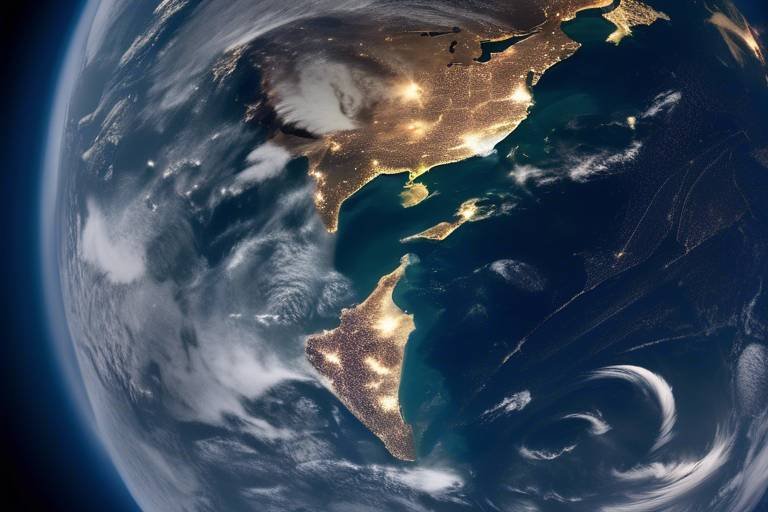
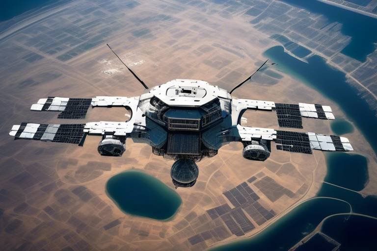
In today's rapidly evolving military landscape, the integration of remote sensing technologies has become a game-changer. Imagine being able to see the battlefield from a bird's-eye view, not just from the ground but from space! This revolutionary approach enhances situational awareness, making it easier for military operations to adapt and respond to threats in real-time. Remote sensing encompasses a variety of technologies, including satellites and aerial drones, which collect data about the Earth's surface. By leveraging this data, military strategists can make informed decisions that could mean the difference between success and failure on the battlefield.
The strategic use of remote sensing is not just about gathering information; it's about transforming that information into actionable intelligence. With capabilities like real-time surveillance and intelligence gathering, remote sensing equips military forces with the tools they need to stay one step ahead of their adversaries. Imagine being able to monitor enemy movements and assess terrain from thousands of miles away—this is the power of remote sensing, and it is reshaping how military operations are conducted.
Furthermore, the evolution of remote sensing technology has led to significant advancements in military capabilities. In the past, military planners relied on basic aerial photography, which provided limited insights. Today, they have access to sophisticated satellite systems that deliver high-resolution imagery and real-time data. This evolution has not only enhanced operational effectiveness but has also broadened the scope of military planning. The ability to visualize and analyze data through advanced algorithms and Geographic Information Systems (GIS) has made it possible to create detailed maps and models of conflict zones.
As we explore the various applications of remote sensing in military operations, it becomes clear that this technology is not just a tool but a vital component of modern warfare. From reconnaissance missions to strategic planning, remote sensing enables military forces to operate more efficiently and effectively. In this article, we will delve deeper into the evolution of remote sensing technology, its applications in intelligence gathering, the challenges it faces, and its promising future in military operations.
- What is remote sensing? Remote sensing refers to the acquisition of information about an object or area from a distance, typically using satellite or aerial imagery.
- How does remote sensing enhance military operations? It provides real-time data and situational awareness, allowing for informed decision-making and effective strategic planning.
- What are some challenges associated with remote sensing? Challenges include data interpretation complexities and environmental factors that can affect image quality.
- What is the future of remote sensing in military applications? The future looks promising with advancements in artificial intelligence and machine learning, enhancing data processing and analysis capabilities.
The Evolution of Remote Sensing Technology
Remote sensing technology has come a long way since its inception, evolving from rudimentary techniques to cutting-edge systems that play a pivotal role in military operations today. Initially, military strategists relied on basic aerial photography, which involved capturing images from planes flying at low altitudes. This method, while groundbreaking at the time, was limited by factors such as weather conditions and the availability of aircraft. However, as technology advanced, so did the capabilities of remote sensing, leading us to the sophisticated satellite systems we depend on now.
Today, military forces utilize a variety of remote sensing technologies that provide real-time data and enhance operational effectiveness on the battlefield. The transition from aerial photography to satellite imagery marked a significant shift. Satellites orbiting the Earth can capture high-resolution images across vast areas, allowing for comprehensive monitoring of enemy movements and terrain analysis. This capability is essential for military planners who need to make informed decisions based on accurate and timely information.
To give you an idea of how far we've come, consider the following timeline of remote sensing evolution:
| Year | Technology | Milestone |
|---|---|---|
| 1858 | Aerial Photography | First aerial photograph taken from a hot air balloon. |
| 1960 | Satellite Imagery | First successful satellite, TIROS-1, launched for weather observation. |
| 1972 | Earth Resources Technology Satellite | Launch of Landsat 1, providing continuous Earth observation. |
| 1999 | Advanced Sensor Technology | Introduction of high-resolution commercial satellites like QuickBird. |
| Present | Integrated Systems | Utilization of AI and machine learning for data analysis. |
This timeline highlights the remarkable advancements in remote sensing technology, illustrating how each step has contributed to the military's ability to gather intelligence and enhance situational awareness. The integration of artificial intelligence and machine learning into remote sensing systems is particularly noteworthy. These technologies allow for faster data processing, enabling military personnel to analyze vast amounts of information quickly and accurately. As a result, military operations can be more agile and responsive to changing conditions on the ground.
Moreover, the evolution of remote sensing has also led to the development of multi-spectral and hyper-spectral imaging techniques, which capture data across various wavelengths of light. This capability allows for the identification of materials and objects that are not visible to the naked eye, further enhancing the military's ability to assess threats and make strategic decisions. As we look to the future, it is evident that remote sensing technology will continue to evolve, providing even greater advantages to military operations around the globe.
Applications of Remote Sensing in Intelligence Gathering
Remote sensing is a game-changer in the realm of military intelligence gathering. Imagine having the ability to see vast areas from the sky, pinpointing enemy positions and movements without ever stepping foot on the battlefield. This is precisely what remote sensing technologies offer. By harnessing data from satellites and aerial platforms, military forces can obtain a comprehensive picture of the operational environment. This capability is invaluable for ensuring that strategic decisions are based on accurate, timely information.
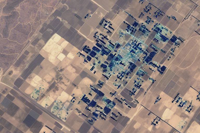
One of the most significant applications of remote sensing in military intelligence is the analysis of satellite imagery. High-resolution images can reveal crucial details about enemy installations, troop concentrations, and even logistical routes. For instance, if a military planner receives satellite images showing an increase in vehicle movement near a border, they can infer that a potential threat is developing. This kind of insight is pivotal for proactive decision-making, allowing forces to prepare and respond effectively.
The analysis of satellite imagery is not just about observing; it's about interpreting the data to extract meaningful intelligence. Military analysts utilize advanced software tools to sift through vast amounts of imagery, identifying patterns and anomalies that may indicate enemy activities. For example, a sudden change in the layout of a military base could signal the arrival of reinforcements or the preparation for an offensive operation. Such insights can make the difference between success and failure in military operations.
Change detection techniques are essential in this context. By comparing images taken at different times, analysts can identify changes in the landscape or infrastructure. These techniques often employ sophisticated algorithms that highlight differences in pixel values, allowing for quick identification of alterations. For example, if a new structure appears in a previously empty area, it could indicate the establishment of a new base or supply depot. This capability is vital for ongoing situational awareness and strategic planning.
Moreover, the integration of remote sensing data with Geographic Information Systems (GIS) enhances the military's ability to visualize and analyze spatial information. GIS allows for the layering of various data types, such as terrain features, weather conditions, and enemy movements, creating a comprehensive operational picture. This synergy enables military planners to make more informed decisions, as they can assess the implications of various factors on their strategies. For instance, understanding the terrain can help in determining the most effective routes for troop movements or supply chains.
In summary, the applications of remote sensing in military intelligence gathering are vast and varied. From satellite imagery analysis to the integration with GIS technologies, these tools empower military forces to maintain a strategic edge. As the battlefield evolves, the ability to gather and interpret intelligence quickly and accurately becomes increasingly critical. The future of military operations will undoubtedly rely heavily on these sophisticated technologies.
- What is remote sensing? Remote sensing is the process of obtaining information about objects or areas from a distance, typically using satellite or aerial imagery.
- How does remote sensing aid military operations? It enhances situational awareness, enabling military forces to monitor enemy movements, assess terrain, and identify potential threats.
- What are the key technologies used in remote sensing? Key technologies include satellites, drones, and advanced imaging techniques that provide high-resolution data for analysis.
- What challenges does remote sensing face? Challenges include data interpretation complexities and environmental factors such as weather conditions that can affect image quality.
- How is AI impacting remote sensing? Advancements in artificial intelligence are enhancing data processing capabilities, leading to more efficient and effective military strategies.
Satellite Imagery Analysis
The analysis of satellite imagery serves as a cornerstone of modern military strategy, providing a window into the ever-changing landscape of conflict zones. Imagine being able to see the battlefield from above, where every movement, every deployment, and every change in terrain can be captured in stunning detail. This capability is not just a luxury; it’s a necessity for military planners who need to make informed decisions swiftly and effectively.
High-resolution satellite images can reveal critical information about enemy positions and infrastructure. For instance, a single image might show the construction of new facilities or the movement of troops, which can be pivotal in assessing the enemy's capabilities. By utilizing advanced imaging techniques, military forces can dissect these images to extract valuable insights, transforming raw data into actionable intelligence. The ability to analyze these images in real-time means that commanders can adjust their strategies dynamically, responding to threats as they arise.
Furthermore, the integration of machine learning algorithms into the analysis process enhances the accuracy and speed of data interpretation. These algorithms can sift through vast amounts of imagery, identifying patterns and changes that might be missed by the human eye. For example, an algorithm might detect a subtle shift in the landscape indicative of troop movements or logistical changes, providing a tactical edge. This technology not only streamlines the analysis process but also reduces the likelihood of human error, which can be disastrous in military operations.
To illustrate the impact of satellite imagery analysis, consider the following table that outlines key benefits:
| Benefit | Description |
|---|---|
| Enhanced Situational Awareness | Provides real-time insights into enemy movements and terrain changes. |
| Informed Decision-Making | Supports commanders in making timely and strategic decisions. |
| Resource Allocation | Helps in optimizing the deployment of military resources. |
| Risk Assessment | Allows for better evaluation of potential threats and vulnerabilities. |
In addition to these benefits, satellite imagery analysis is complemented by change detection techniques. These techniques utilize sophisticated algorithms to monitor alterations in landscapes over time, providing military planners with a historical perspective on enemy activities. By analyzing a series of images, military forces can identify trends, such as the buildup of assets or the establishment of new defensive positions, which are crucial for anticipating enemy actions.
In conclusion, satellite imagery analysis is not merely a technological advancement; it is a game-changer in military operations. With the ability to gather, analyze, and interpret vast amounts of data quickly and accurately, military forces can maintain a strategic advantage on the battlefield. As technology continues to evolve, the potential for even greater insights from satellite imagery will only enhance military effectiveness, ensuring that commanders have the tools they need to navigate the complexities of modern warfare.
- What is satellite imagery analysis? Satellite imagery analysis involves examining high-resolution images captured by satellites to gather intelligence about enemy movements, terrain, and infrastructure.
- How does satellite imagery benefit military operations? It enhances situational awareness, supports informed decision-making, and improves resource allocation and risk assessment.
- What are change detection techniques? Change detection techniques use algorithms to identify alterations in landscapes over time, helping to monitor enemy activity and assess military impacts.
- How does machine learning play a role in satellite imagery analysis? Machine learning algorithms can analyze large volumes of imagery quickly, identifying patterns and changes that may be missed by human analysts.
Change Detection Techniques
Change detection techniques are pivotal in the realm of remote sensing, especially when it comes to military applications. These methods are designed to identify and analyze alterations in landscapes over time, providing military planners with crucial insights into enemy movements and environmental impacts. Imagine being able to see how a battlefield transforms over days or weeks, revealing troop deployments, infrastructure changes, and even the effects of military operations on the terrain. This capability is not just about gathering data; it's about turning that data into actionable intelligence.
One of the most effective ways to implement change detection is through the use of sophisticated algorithms that analyze satellite imagery. These algorithms can compare images taken at different times, highlighting differences that may not be immediately visible to the naked eye. For instance, a sudden increase in vehicle traffic in a previously quiet area could indicate an impending military operation. The ability to spot such changes allows for timely responses and strategic adjustments, enhancing operational effectiveness.
Moreover, the integration of these techniques with Geographic Information Systems (GIS) takes change detection to another level. By layering change detection data over existing maps and spatial information, military planners can visualize trends and patterns in a more intuitive way. This not only aids in understanding the current situation but also helps in forecasting future developments. For example, if a particular region shows consistent changes in vegetation due to enemy activity, planners can predict potential hiding spots or ambush locations.
In summary, change detection techniques represent a dynamic tool in military operations. They provide a continuous stream of information that is essential for maintaining situational awareness and making informed decisions. As technology continues to advance, the accuracy and efficiency of these techniques will undoubtedly improve, further solidifying their role in modern warfare.
- What is change detection in remote sensing?
Change detection in remote sensing refers to the process of identifying differences in the state of an object or phenomenon by observing it at different times. This is crucial for tracking changes in military operations and the environment. - How are algorithms used in change detection?
Algorithms analyze satellite images taken at various times to detect changes in the landscape, such as troop movements or infrastructure development, enabling military planners to make informed decisions. - What role does GIS play in change detection?
GIS enhances the visualization of change detection data, allowing military planners to overlay this information onto existing maps, which aids in strategic planning and operational decision-making. - What are some limitations of change detection techniques?
Limitations include the need for high-quality images, potential inaccuracies due to environmental factors, and the complexity of data interpretation.
Integration with GIS Technology
The integration of remote sensing data with Geographic Information Systems (GIS) is a game-changer in military operations. This powerful combination allows military planners to visualize and analyze spatial data in ways that enhance their strategic capabilities. Imagine having a map that not only shows you where everything is but also provides real-time updates on enemy movements, terrain changes, and environmental conditions. This is precisely what GIS technology achieves when paired with remote sensing.
By overlaying satellite imagery onto GIS platforms, military analysts can create detailed maps that highlight critical information. For instance, they can identify key infrastructure such as bridges, roads, and supply routes, which are essential for planning operations. The ability to visualize this data in a geographic context allows for better situational awareness and informed decision-making. Moreover, GIS tools can facilitate spatial analysis, enabling military forces to assess potential risks and opportunities based on geographical factors.
One of the most significant advantages of integrating remote sensing with GIS is the ability to perform what-if analyses. This means military strategists can simulate various scenarios to evaluate how different factors might impact their operations. For example, they can assess how weather conditions or enemy troop movements could affect the success of a mission. This predictive capability is invaluable for developing contingency plans and ensuring that military operations are as effective as possible.
Furthermore, the integration fosters collaboration among different military branches and units. By sharing GIS data and remote sensing imagery, forces can work together more effectively, ensuring that everyone has access to the same information. This collaboration can lead to quicker decision-making and a more unified approach to operations. In essence, the synergy between remote sensing and GIS technology not only enhances military efficiency but also improves the overall effectiveness of strategic planning and execution.
In summary, the integration of remote sensing with GIS technology is revolutionizing military operations. It empowers military planners with enhanced visualization, real-time data analysis, and collaborative capabilities, ultimately leading to more informed and effective strategic decisions.
- What is remote sensing? Remote sensing is the acquisition of information about an object or phenomenon without making physical contact, often using satellite or aerial imagery.
- How does GIS enhance military operations? GIS enhances military operations by providing a framework for visualizing, analyzing, and interpreting spatial data, which aids in strategic decision-making.
- What are the benefits of integrating remote sensing with GIS? The integration allows for real-time updates, improved situational awareness, predictive analysis, and enhanced collaboration among military units.
- What challenges exist in interpreting remote sensing data? Challenges include environmental factors affecting image quality and the complexity of data interpretation, which requires specialized knowledge.
Real-time Surveillance and Reconnaissance
In the ever-evolving landscape of military operations, have become indispensable tools for modern warfare. Imagine being able to have a bird's-eye view of the battlefield at any moment, with the capability to track movements and detect threats as they happen. This is not just a fantasy; it's a reality made possible through advanced remote sensing technologies. These systems provide military forces with up-to-the-minute information, allowing them to make swift decisions that can change the course of engagements.
One of the key benefits of real-time surveillance is the ability to continuously monitor conflict zones. With technologies like unmanned aerial vehicles (UAVs) and satellite systems, military planners can gather critical data on enemy positions, troop movements, and even logistical operations. This information is vital for formulating effective strategies and executing operations with precision. When every second counts, having access to real-time data can mean the difference between success and failure on the battlefield.
Moreover, the integration of real-time data analytics with remote sensing technologies enhances the overall situational awareness of military forces. By utilizing sophisticated algorithms and machine learning, military analysts can quickly process vast amounts of data, identifying patterns and anomalies that might indicate emerging threats. This capability allows for rapid response times, enabling forces to adapt to changing conditions and respond to threats before they escalate.
To illustrate the impact of real-time surveillance, consider the following table that outlines the key technologies used in military reconnaissance:
| Technology | Description | Benefits |
|---|---|---|
| Unmanned Aerial Vehicles (UAVs) | Remotely piloted aircraft that can gather data from above. | Cost-effective, flexible, and can operate in hostile environments. |
| Satellite Imagery | Images taken from satellites orbiting the Earth. | Provides a comprehensive view of large areas, unaffected by ground conditions. |
| Ground Surveillance Radars | Radar systems that detect and track ground movements. | Effective in all weather conditions, providing 24/7 monitoring capabilities. |
In addition to these technologies, the role of data fusion cannot be overstated. By combining information from multiple sources—such as UAVs, satellites, and ground sensors—military forces can achieve a more holistic view of the operational environment. This fusion of data enhances decision-making processes, allowing commanders to visualize the battlefield in ways that were previously unimaginable.
As we look towards the future, the importance of real-time surveillance and reconnaissance in military operations will only continue to grow. With advancements in technology, such as artificial intelligence and machine learning, the capabilities of remote sensing are set to become even more sophisticated. Imagine a future where military forces can predict enemy movements with pinpoint accuracy, or where automated systems can analyze data in real-time to provide actionable insights. This is the direction in which military operations are heading, and it promises to revolutionize how conflicts are managed.
- What is remote sensing? Remote sensing refers to the acquisition of information about an object or area from a distance, typically using satellite or aerial imagery.
- How does real-time surveillance benefit military operations? It enables immediate access to critical information, allowing for quick decision-making and enhanced situational awareness.
- What technologies are commonly used in military reconnaissance? Technologies include UAVs, satellite imagery, and ground surveillance radars.
- Can weather affect remote sensing data? Yes, environmental factors such as cloud cover and atmospheric disturbances can impact the quality of the data collected.
Challenges and Limitations of Remote Sensing
While remote sensing technology has revolutionized military operations, it is not without its challenges and limitations. One of the primary issues is the complexity of data interpretation. Military analysts often face difficulties when trying to make sense of the vast amounts of data collected from various remote sensing sources. The intricacies of interpreting this data can be exacerbated by differing environmental conditions that affect the quality and clarity of the images. For instance, factors such as atmospheric disturbances or seasonal changes can obscure critical information, leading to potential misinterpretations that could impact military decisions.
Moreover, the environmental factors influencing remote sensing capabilities cannot be overlooked. Weather conditions, such as cloud cover or heavy rainfall, can significantly hinder the effectiveness of satellite imagery. When the skies are overcast, the data collected may be incomplete or inaccurate, making it challenging for military planners to rely on this information for strategic operations. Understanding these limitations is crucial for military forces, as it allows them to develop contingency plans and alternative sources of intelligence when remote sensing data is compromised.
Another limitation is the cost and resource allocation associated with advanced remote sensing technologies. The development, deployment, and maintenance of high-resolution satellites and aerial platforms require significant financial investment and skilled personnel. This can strain military budgets, especially in times of economic uncertainty. As a result, military organizations must carefully consider how to allocate resources effectively while still enhancing their remote sensing capabilities.
Additionally, there are ethical considerations surrounding the use of remote sensing technology. Issues related to privacy and surveillance can arise, particularly when military operations intersect with civilian areas. Striking a balance between effective military intelligence and respecting the rights of individuals is a delicate task that requires ongoing dialogue and regulation.
To summarize, while remote sensing provides invaluable insights for military operations, it also presents several challenges that must be addressed:
- Complexities in data interpretation due to environmental variances
- Weather-related limitations affecting data quality
- High costs associated with advanced remote sensing technologies
- Ethical concerns regarding privacy and surveillance
As military forces continue to leverage remote sensing technologies, understanding and mitigating these challenges will be essential for maximizing their effectiveness in strategic planning and operational execution.
Q: What are the main challenges faced in remote sensing for military applications?
A: The main challenges include data interpretation complexities, environmental factors affecting image quality, high costs of technology, and ethical issues regarding privacy.
Q: How does weather impact remote sensing data?
A: Weather conditions, such as cloud cover and rain, can obscure images and reduce the clarity of data collected, making it difficult to obtain accurate information.
Q: Why is data interpretation complex in remote sensing?
A: Data interpretation can be complex due to varying environmental conditions and the need for specialized knowledge to analyze the vast amounts of data collected.
Q: What ethical concerns are associated with remote sensing?
A: Ethical concerns primarily revolve around privacy issues and the potential for surveillance in civilian areas, necessitating a balance between military intelligence and individual rights.
Data Interpretation Challenges
Interpreting remote sensing data is not as straightforward as it might seem. While the technology has made vast strides in providing high-resolution imagery and detailed information, the complexities of data interpretation pose significant challenges for military analysts. One of the primary hurdles is the variability of environmental conditions that can affect the quality of the data collected. For instance, factors such as shadows cast by clouds, seasonal changes in vegetation, and even atmospheric disturbances can obscure critical details. This variability necessitates a deep understanding of both the technology and the environment to extract accurate insights.
Moreover, the need for specialized knowledge cannot be overstated. Analysts must be well-versed in various techniques and methodologies to accurately interpret the data. This includes understanding how to apply different algorithms for image processing, as well as being familiar with the terrain and the operational context. Without this expertise, the risk of misinterpretation increases, which can lead to faulty strategic decisions.
To illustrate the importance of proper interpretation, consider the potential consequences of misreading troop movements. A slight miscalculation in identifying enemy positions could result in a missed opportunity for a strategic advantage or, worse, an unnecessary escalation of conflict. Therefore, military forces often invest in training their personnel to ensure they are equipped with the necessary skills to tackle these challenges effectively.
Additionally, the sheer volume of data generated by remote sensing technologies can be overwhelming. Analysts may struggle to sift through vast amounts of information to find relevant insights. This challenge is compounded by the need for real-time analysis, as military operations often require quick decision-making based on the most current data available. To address this, many military organizations are beginning to implement advanced data analytics and machine learning algorithms, which can help automate the interpretation process and highlight critical information more efficiently.
In summary, while remote sensing technologies offer powerful tools for military operations, the challenges of data interpretation remain significant. By investing in training, technology, and methodologies, military forces can enhance their capabilities and ensure that they are making informed decisions based on accurate and timely data.
- What is remote sensing?
Remote sensing is the acquisition of information about an object or area from a distance, typically using satellite or aerial imagery. - How does remote sensing benefit military operations?
It enhances situational awareness, facilitates intelligence gathering, and aids in strategic planning by providing real-time data and analytics. - What are some challenges associated with remote sensing?
Challenges include data interpretation complexities, environmental factors affecting image quality, and the need for specialized knowledge. - How is artificial intelligence used in remote sensing?
AI and machine learning can automate data interpretation, improve accuracy, and help analysts focus on critical information.
Environmental Factors Impacting Remote Sensing
When it comes to remote sensing, the environment can be both a friend and a foe. While these technologies provide invaluable insights from above, they are not impervious to the whims of nature. Factors such as weather conditions, atmospheric disturbances, and even seasonal changes can significantly impact the quality and reliability of remote sensing data.
For instance, cloud cover can obscure satellite imagery, making it difficult to capture clear and actionable data. Imagine trying to take a photo of a beautiful landscape, but a thick fog rolls in, blocking your view. This is akin to what military planners face when clouds obscure their satellite's line of sight. Furthermore, factors like rain, snow, and even dust storms can degrade image quality, leading to potential misinterpretations of the data.
Another critical aspect to consider is the atmospheric conditions that can distort the signals captured by remote sensing technologies. Variations in humidity, temperature, and pressure can affect how light and other electromagnetic waves travel through the atmosphere. This can lead to inaccuracies in the data collected, which, in a military context, could result in poor strategic decisions. Therefore, it's crucial for military analysts to account for these variables when interpreting remote sensing data.
To better illustrate the impact of these environmental factors, consider the following table:
| Environmental Factor | Impact on Remote Sensing |
|---|---|
| Cloud Cover | Obscures visibility, leading to incomplete data |
| Rain/Snow | Reduces image clarity and detail |
| Atmospheric Disturbances | Causes signal distortion, impacting data accuracy |
| Seasonal Changes | Affects vegetation and landscape visibility |
In conclusion, while remote sensing technologies are powerful tools for military operations, they are not without their challenges. Understanding how environmental factors can impact data quality is essential for military planners. By recognizing these limitations, they can better prepare for potential issues and develop strategies that account for the unpredictable nature of the environment.
- What are the main environmental factors affecting remote sensing? Cloud cover, rain, snow, atmospheric disturbances, and seasonal changes are the primary factors.
- How does cloud cover impact military operations? It can obscure visibility, leading to incomplete or inaccurate data collection, which can affect strategic decisions.
- Why is atmospheric distortion a concern for remote sensing? It can lead to inaccuracies in the data, which may result in poor decision-making in military contexts.
- Can remote sensing data still be useful during adverse weather conditions? Yes, but military planners need to account for these conditions and interpret the data with caution.
The Future of Remote Sensing in Military Operations
The landscape of military operations is on the brink of a transformation, largely driven by the advancements in remote sensing technologies. As we look to the future, it’s exciting to consider how innovations like artificial intelligence (AI) and machine learning (ML) are reshaping the way military forces gather and analyze data. Imagine a battlefield where every movement is tracked in real-time, where data is processed at lightning speed, and where decisions are made based on precise, actionable intelligence. This is not science fiction; it’s the future of military operations.
One of the most significant changes we can expect is the integration of AI algorithms with remote sensing data. These algorithms can sift through enormous amounts of data, identifying patterns and anomalies that human analysts might miss. For instance, AI can help in recognizing troop movements or changes in enemy fortifications by analyzing satellite images faster and more accurately than ever before. This not only enhances situational awareness but also allows military commanders to respond to threats with unprecedented speed.
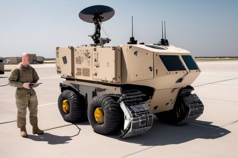
Moreover, the development of autonomous drones equipped with remote sensing capabilities is set to revolutionize reconnaissance missions. These drones can operate in hostile environments, gathering intelligence without putting human lives at risk. Imagine a fleet of drones capable of flying over enemy territory, gathering high-resolution imagery, and relaying that information back to command centers in real-time. The implications for strategic planning and operational execution are immense.
Additionally, the future will likely see an increased reliance on cloud computing for data storage and processing. This approach allows for greater collaboration among military units dispersed across different locations. With cloud-based systems, real-time data can be accessed from anywhere, enabling seamless communication and coordination during operations. The ability to share high-resolution images and analysis instantly can make the difference between success and failure in critical missions.
However, with all these advancements come challenges. As military operations become more reliant on sophisticated technologies, the potential for cyber threats increases. Protecting sensitive remote sensing data from adversaries will require robust cybersecurity measures and constant vigilance. Moreover, as we integrate these technologies, the importance of training personnel to effectively use and interpret remote sensing data cannot be overstated. The human element remains crucial, even in an increasingly automated landscape.
In conclusion, the future of remote sensing in military operations is not just about technology; it’s about enhancing the effectiveness and efficiency of military strategies. As we embrace these innovations, we must also be mindful of the challenges they bring. The military landscape is evolving, and those who harness the power of remote sensing will undoubtedly gain a strategic advantage in the years to come.
- What is remote sensing in military operations?
Remote sensing refers to the acquisition of information about an object or area from a distance, typically via satellite or aerial imagery, which is crucial for military intelligence and reconnaissance. - How does AI enhance remote sensing?
AI algorithms can analyze vast amounts of data quickly, identifying patterns and anomalies that improve situational awareness and decision-making in military contexts. - What are the challenges of using remote sensing?
Challenges include data interpretation complexities, environmental factors affecting image quality, and the need for robust cybersecurity measures to protect sensitive information.
Frequently Asked Questions
- What is remote sensing in military applications?
Remote sensing refers to the use of technology to collect data about objects or areas from a distance, typically through satellites or aerial systems. In military applications, it enhances situational awareness, reconnaissance, and strategic planning by providing real-time data on enemy movements and terrain.
- How has remote sensing technology evolved over time?
Remote sensing technology has significantly evolved from basic aerial photography to advanced satellite systems. This transformation has enabled military forces to gather real-time information, enhancing operational effectiveness and decision-making on the battlefield.
- What role does satellite imagery play in military intelligence gathering?
Satellite imagery is crucial for military intelligence as it provides high-resolution images that reveal enemy positions, troop deployments, and changes in the landscape. This information is vital for effective mission planning and execution.
- What are change detection techniques?
Change detection techniques involve using algorithms to identify alterations in landscapes over time. This capability is essential for monitoring enemy activity and assessing the impact of military operations on the environment.
- How does remote sensing integrate with GIS technology?
Integrating remote sensing data with Geographic Information Systems (GIS) allows military planners to visualize and analyze spatial information more effectively. This synergy enhances strategic planning and operational decision-making in military contexts.
- What are the challenges faced in interpreting remote sensing data?
Interpreting remote sensing data can be complex due to varying environmental conditions and the need for specialized knowledge. These challenges can impact the effectiveness of remote sensing in military operations, making it essential to have trained personnel for accurate analysis.
- How do environmental factors affect remote sensing?
Weather conditions such as cloud cover, fog, and atmospheric disturbances can significantly degrade the quality of remote sensing data. Military planners must consider these factors to ensure the accuracy and reliability of the information gathered.
- What does the future hold for remote sensing in military operations?
The future of remote sensing in military operations looks promising, with advancements in artificial intelligence and machine learning set to enhance data processing capabilities. These innovations will likely lead to more efficient and effective military strategies, allowing for quicker and more informed decision-making.

