Understanding the Role of Satellites in Special Operations
In today’s fast-paced world, the effectiveness of special operations heavily relies on advanced technology, and satellites are at the forefront of this revolution. Imagine a vast chessboard where every move is meticulously calculated, every piece is in perfect alignment, and the outcome hinges on split-second decisions. This is the reality of modern warfare, where satellites play a pivotal role in enhancing the operational capabilities of military forces. From providing real-time intelligence to ensuring secure communications, satellites are the unsung heroes that enable special operations to achieve their objectives with precision and efficiency.
The integration of satellite technology into military operations has transformed the way special forces conduct missions. With the ability to gather and relay critical information from the skies, satellite systems empower military strategists to assess threats, plan operations, and execute missions with a level of accuracy previously unimaginable. This article delves into the multifaceted applications of satellites in special operations, highlighting their significance in intelligence gathering, navigation, communication, and surveillance. Furthermore, we will explore the challenges that come with this reliance on satellite technology and the exciting future developments on the horizon.
As we navigate through the complexities of modern warfare, it’s essential to recognize that the role of satellites extends beyond mere observation. They act as the backbone of operational success, providing a comprehensive view of the battlefield and enabling real-time responses to evolving situations. Whether it’s pinpointing enemy locations or coordinating troop movements, satellites have become indispensable tools in the arsenal of special operations forces.
In the following sections, we will uncover the various dimensions of satellite technology and its implications for special operations. From the intricacies of GPS technology to the challenges posed by satellite surveillance limitations, we aim to provide a thorough understanding of how satellites enhance military effectiveness. So, buckle up as we embark on this enlightening journey through the skies!
The Importance of Satellite Intelligence
Satellite intelligence is not just a fancy term thrown around in military circles; it is a game-changer that has revolutionized how special operations are conducted. Imagine being able to gather critical information from space that can inform every move of a military operation. That's the power of satellite intelligence. It enables military forces to assess threats, monitor enemy movements, and make informed decisions based on real-time data. This capability is akin to having a bird's-eye view of the battlefield, allowing commanders to see the bigger picture while focusing on the finer details.
One of the most significant advantages of satellite intelligence is its ability to provide real-time data. This means that special operations teams are not just reacting to events as they unfold; they are anticipating them. For example, if a special forces team is planning a mission to capture a high-value target, satellite intelligence can help identify the target's location, movements, and even the presence of potential threats in the vicinity. This level of detail is crucial for mission success and helps to minimize risks to personnel.
Moreover, satellite intelligence plays a vital role in strategic planning. Before any operation, a comprehensive analysis of the area of interest is conducted. This includes examining the terrain, identifying potential escape routes, and assessing the likelihood of enemy encounters. With the help of high-resolution satellite imagery, military planners can create detailed maps that highlight key features of the landscape, allowing for a more informed and tactical approach to operations.
However, it's essential to recognize that satellite intelligence is not without its challenges. For instance, while satellites can provide extensive coverage, they can also be limited by factors such as weather conditions. Cloud cover can obscure visibility, making it difficult to gather accurate information. Additionally, the latency in data transmission can hinder real-time decision-making, as there may be a delay between data collection and its availability to ground troops.
In summary, satellite intelligence serves as a backbone for special operations, providing critical insights that enhance situational awareness and operational effectiveness. The ability to gather and analyze data from space empowers military forces to make informed decisions, ultimately leading to greater mission success. As technology continues to evolve, the role of satellite intelligence in special operations is expected to grow even more significant, paving the way for new tactics and strategies in modern warfare.
Navigation and Targeting Systems
In the realm of special operations, navigation and targeting systems are nothing short of lifelines. Imagine a complex maze where every turn could lead to success or failure; this is the reality for special forces deployed in unfamiliar terrains. The integration of satellite technology into navigation systems has revolutionized how these elite units operate, ensuring they can pinpoint their locations with remarkable precision and navigate through challenging environments seamlessly. With satellites overhead, operatives can access critical data that allows them to make informed decisions in real-time, ultimately enhancing their effectiveness on the ground.
At the heart of this navigation prowess lies the Global Positioning System (GPS). It’s like having a personal guide that never gets lost, providing coordinates that help special operations teams find their way even in the most hostile landscapes. The beauty of GPS technology is its ability to deliver real-time positioning data, which is essential for maintaining situational awareness. This means that as the battlefield evolves, so too does the information available to commanders and operatives. They can track movements, adjust plans, and respond swiftly to unforeseen challenges, much like a chess player anticipating their opponent’s next move.
However, it’s important to recognize that this dependence on GPS also comes with its own set of challenges. Just as a ship can be vulnerable to storms at sea, special operations teams can face vulnerabilities such as jamming and signal loss. These disruptions can jeopardize missions and compromise safety. To counteract these issues, teams are increasingly exploring alternative navigation methods, including inertial navigation systems and advanced mapping technologies. This diversification not only mitigates risks but also broadens the operational capabilities of special forces.
To illustrate the significance of these systems, consider the following table that highlights the key features of satellite navigation and targeting systems used in special operations:
| Feature | Description |
|---|---|
| Real-Time Data | Provides immediate feedback on location and movements. |
| Precision Targeting | Enables accurate strikes and mission planning. |
| Situational Awareness | Helps teams understand their environment and enemy positions. |
| Redundancy Systems | Alternative navigation methods to ensure mission success if GPS fails. |
In conclusion, navigation and targeting systems powered by satellite technology are indispensable for special operations. They not only provide the necessary tools for precision and efficiency but also enhance the overall safety of operatives in the field. As technology continues to evolve, we can expect even more sophisticated systems to emerge, further augmenting the capabilities of these elite forces. The journey ahead is exciting, and the potential for innovation in this area is boundless.
GPS Technology in Operations
The Global Positioning System (GPS) is nothing short of a game changer for special operations. Imagine being in a dense forest or a sprawling urban environment where every corner looks the same. Without GPS, navigating through such terrain would be like trying to find a needle in a haystack. This technology is not just about finding your way; it’s about precision and timeliness in the heat of action. Special operations forces rely on GPS to ensure that they can coordinate movements with pinpoint accuracy, which is crucial for mission success.
One of the standout features of GPS technology is its ability to provide real-time positioning. This means that operatives can constantly update their location and adjust their plans accordingly. For instance, if a team is tasked with infiltrating a high-security area, they can monitor their position on a digital map, ensuring they stay on course and avoid detection. This real-time data allows for quick decision-making, which can be the difference between success and failure in critical situations.
Moreover, GPS technology integrates seamlessly with various military systems, providing a comprehensive operational picture. Here’s how it enhances special operations:
- Enhanced Coordination: Teams can synchronize their movements, ensuring that everyone is on the same page.
- Efficient Resource Allocation: Commanders can allocate resources more effectively by knowing the exact locations of their teams and equipment.
- Improved Targeting: GPS aids in accurately targeting enemy positions, reducing collateral damage and increasing mission effectiveness.
However, it's essential to recognize that while GPS is a powerful tool, it does come with its challenges. The technology relies on a network of satellites orbiting the Earth, and any disruption—be it from natural phenomena or deliberate jamming—can lead to significant navigational errors. This vulnerability has led special operations teams to develop alternative navigation methods, ensuring they are never solely dependent on GPS. Techniques such as dead reckoning, terrain association, and the use of traditional maps remain relevant, especially in environments where GPS signals may be compromised.
In summary, GPS technology is a cornerstone of modern military operations, providing unparalleled support in navigation and coordination. Its ability to deliver real-time data enhances situational awareness and operational success, allowing special operations forces to navigate complex environments with confidence. As technology continues to evolve, the integration of GPS with other systems will likely become even more sophisticated, further improving the capabilities of special operations.
Real-Time Positioning
Imagine you're deep in an unfamiliar jungle, the sounds of nature surrounding you, and the mission at hand demands precision. This is where becomes a game changer for special operations forces. Utilizing satellite technology, real-time positioning allows operatives to pinpoint their exact location with incredible accuracy, ensuring they can navigate through treacherous terrains without losing their way. It's not just about reaching a destination; it's about doing so with confidence and speed.
Real-time data feeds from satellites enable teams to maintain a comprehensive situational awareness. Picture this: a special operations unit is deployed to secure a target area. As they move, they receive continuous updates on their location and the positions of friendly and enemy forces. This dynamic flow of information is crucial for making split-second decisions that can mean the difference between mission success and failure. The ability to see their movements on a digital map, updated every second, empowers these operatives to adapt to changing battlefield conditions.
Moreover, the integration of real-time positioning with advanced mapping technologies has revolutionized operational planning. Special operations teams can visualize their routes, identify potential hazards, and even simulate various scenarios before stepping foot on the ground. This level of preparation is akin to having a detailed roadmap in a maze, guiding them through complexities that would otherwise be overwhelming. However, the reliance on real-time positioning isn't without its challenges.
While the advantages are clear, special operations must also be aware of the limitations that come with this technology. For instance, in environments where satellite signals can be disrupted—such as urban canyons or dense forests—teams may face difficulties in maintaining their position. This is why it's essential to have backup navigation methods in place, such as traditional maps or inertial navigation systems, to ensure that operatives are never left in the dark.
In conclusion, real-time positioning is not just a tool; it's a lifeline for special operations. It enhances their ability to navigate, adapt, and execute missions with a level of precision that was unimaginable just a few decades ago. As technology continues to evolve, the future holds even more promise for improving these capabilities, making special operations even more effective in their critical roles.
- What is real-time positioning? Real-time positioning refers to the ability to determine the exact location of a person or object using satellite technology, updated continuously to reflect changes in position.
- How does real-time positioning benefit special operations? It provides operatives with accurate location data, enhances situational awareness, and allows for quick decision-making during missions.
- What are the challenges of relying on real-time positioning? Challenges include potential signal disruptions in certain environments and the need for alternative navigation methods to ensure operatives can still find their way.
Challenges of GPS Dependence
While the Global Positioning System (GPS) has revolutionized how special operations teams navigate and execute missions, it is not without its challenges. Imagine relying on a compass that can sometimes point you in the wrong direction; that’s the reality of GPS dependence. The very technology that provides precise location data can also become a double-edged sword. One of the most significant challenges is the vulnerability of GPS signals to jamming. Adversaries can deploy jamming devices that disrupt GPS signals, rendering navigation systems ineffective. This can lead to confusion, misdirection, and ultimately jeopardize mission success.
Moreover, GPS signals can be obstructed by various natural and man-made structures. Urban environments, dense forests, and even mountainous terrains can interfere with signal reception. This means that on the battlefield, where every second counts, a soldier may find themselves in a situation where their GPS device is providing inaccurate or no information at all. To illustrate, consider a special operations team trying to infiltrate a heavily guarded area. If their GPS fails, they may have to rely on outdated maps or visual navigation, which can be both time-consuming and risky.
Another challenge lies in the time delay associated with data transmission. Although satellites can provide real-time data, there can still be lag in receiving that information on the ground. This delay can be critical in fast-paced combat scenarios, where every moment can change the outcome of a mission. For example, if a team is tracking enemy movements and the data takes too long to arrive, they might miss the opportunity to act while the enemy is vulnerable.
To mitigate these challenges, special operations forces must develop alternative navigation methods. Training in traditional navigation techniques, such as map reading and celestial navigation, becomes essential. Additionally, integrating multiple systems can enhance reliability. For instance, combining GPS with inertial navigation systems (INS) allows for more accurate positioning even when GPS signals are compromised. This layered approach to navigation ensures that special operations teams can maintain their edge, regardless of the technological hurdles they face.
In summary, while GPS technology is undeniably a game-changer for special operations, its dependence comes with a set of challenges that military forces must navigate. Understanding these limitations and preparing for them is crucial in ensuring mission success in the ever-evolving landscape of modern warfare.
- What are the main challenges of GPS technology in special operations?
GPS technology faces challenges such as signal jamming, obstruction by terrain, and data transmission delays, which can affect navigation and mission success. - How do special operations forces mitigate GPS vulnerabilities?
They train in traditional navigation techniques and use alternative systems like inertial navigation to ensure reliable positioning. - Is GPS the only navigation system used in special operations?
No, while GPS is crucial, special operations forces often integrate multiple navigation systems for enhanced reliability.
Satellite Communication Systems
When it comes to special operations, the backbone of successful missions often lies in robust satellite communication systems. These systems are not just about relaying information; they are about creating a lifeline that connects operatives on the ground with their command centers, ensuring that every move is calculated and informed. Imagine being in a high-stakes game of chess where every player needs to know the position of their pieces in real-time. That’s the kind of precision and immediacy that satellite communications provide. Without them, the chaos of the battlefield could quickly spiral out of control.
One of the most significant advantages of satellite communication is its ability to maintain secure and reliable connections across vast distances. Unlike traditional communication methods that may falter due to terrain or distance, satellites orbiting high above the Earth can transmit signals to remote locations, enabling seamless communication even in the most challenging environments. This capability is crucial for special operations teams who often find themselves in isolated or hostile territories where conventional communication lines are either unreliable or non-existent.
The technology behind satellite communications has evolved considerably over the years. Modern systems utilize advanced encryption methods to protect sensitive information from interception. This is akin to having a secure vault for your most prized possessions; it ensures that only authorized personnel can access critical data. Furthermore, the integration of mobile satellite communication units allows teams to stay connected while on the move, enhancing their operational flexibility. These units can be quickly deployed and set up, providing instant communication capabilities wherever needed.
However, it’s important to recognize that satellite communication systems are not without their challenges. For instance, they can be susceptible to interference from various sources, including weather conditions and hostile actions aimed at disrupting signals. Additionally, the reliance on these systems means that if a satellite were to be compromised or damaged, it could severely impact mission success. Therefore, special operations forces must always have contingency plans in place, which may include alternative communication methods such as radio or mesh networks.
In conclusion, satellite communication systems are a vital component of modern special operations. They provide the necessary infrastructure for real-time coordination and information sharing, which can be the difference between mission success and failure. As technology continues to advance, we can expect these systems to become even more sophisticated, offering enhanced capabilities that will further empower special operations forces in their critical missions.
- What are satellite communication systems?
Satellite communication systems are technologies that use satellites to transmit data and facilitate communication over long distances, ensuring secure and reliable connections for military operations. - How do satellite communications benefit special operations?
They provide real-time connectivity between operatives and command centers, enabling informed decision-making and coordination during missions, even in remote or hostile environments. - What challenges do satellite communication systems face?
Challenges include susceptibility to signal interference, weather conditions, and the risk of satellites being compromised, necessitating alternative communication methods as backups.
Surveillance and Reconnaissance
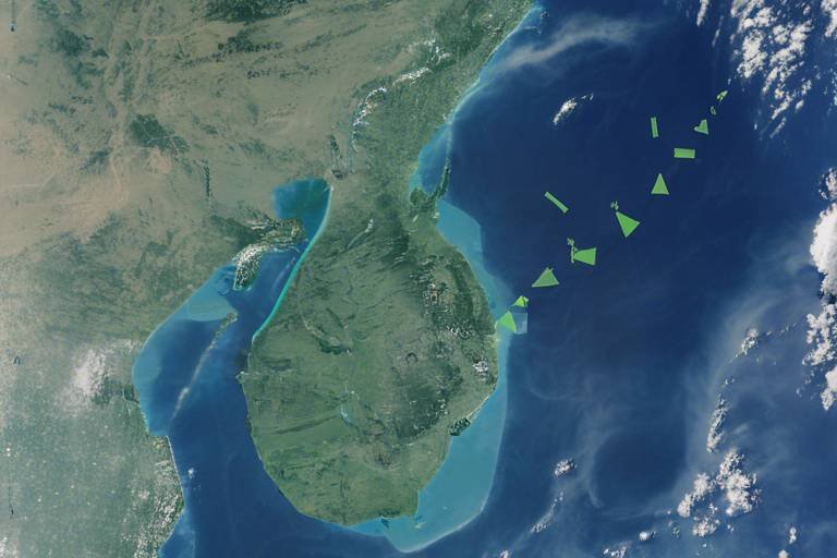
In the realm of modern warfare, have become the backbone of successful special operations. Imagine trying to navigate a dense forest without a map or a compass; that’s how challenging it can be for military forces without the aid of satellite technology. Satellites provide a bird's-eye view of the battlefield, allowing commanders to gather crucial intelligence that can make or break a mission. This capability not only enhances the situational awareness of troops on the ground but also gives them the upper hand by monitoring enemy movements and assessing potential threats from afar.
One of the standout features of satellite surveillance is its ability to cover vast areas quickly. Unlike traditional reconnaissance methods, which may involve ground patrols or aerial surveys, satellites can capture high-resolution images and data over large swathes of territory in real-time. This is akin to having a high-definition camera that can zoom in on a specific target while simultaneously providing a panoramic view of the surroundings. For special operations teams, this means they can plan their maneuvers with a level of precision that was previously unimaginable.
Moreover, satellite technology has evolved significantly, providing enhanced capabilities for imagery and data analysis. Today's satellites can capture images with incredible detail, allowing analysts to identify not just structures but also the activities occurring within them. For instance, a satellite can differentiate between a civilian vehicle and a military truck, providing invaluable insights into enemy logistics and troop movements. This level of detail is essential for special operations, where the success of a mission often hinges on accurate intelligence.
However, despite the impressive advantages of satellite surveillance, there are inherent limitations that must be acknowledged. Weather conditions can play a significant role; for instance, cloud cover can obscure visibility, rendering satellite images less effective. Additionally, the time it takes to process and transmit data can delay decision-making, which is critical in fast-paced combat situations. In this light, it's crucial for military strategists to develop contingency plans that incorporate alternative surveillance methods to ensure that operations can proceed smoothly, even when satellite data is compromised.
To illustrate the balance between the advantages and limitations of satellite surveillance, consider the following table:
| Advantages | Limitations |
|---|---|
| Comprehensive coverage of vast areas | Cloud cover can obstruct visibility |
| High-resolution imagery for detailed analysis | Potential delays in data transmission |
| Real-time monitoring of enemy movements | Vulnerability to cyber attacks |
| Enhanced situational awareness | Dependence on weather conditions |
In conclusion, via satellite technology have revolutionized the way special operations are conducted. The ability to gather and analyze intelligence from space provides an unparalleled advantage, enabling military forces to execute their missions with greater confidence and effectiveness. Yet, as we move forward, it's essential to remain cognizant of the challenges that accompany this technology, ensuring that our strategies are as adaptable as the environments in which we operate.
- How do satellites improve surveillance for military operations?
Satellites provide real-time, high-resolution imagery that enables military forces to monitor enemy movements and assess threats from a distance. - What are the limitations of satellite surveillance?
Limitations include cloud cover that can obstruct visibility and potential delays in data transmission affecting real-time decision-making. - Why is real-time data important for special operations?
Real-time data allows for quick responses to changing battlefield conditions, significantly improving mission success rates. - How do military forces address the challenges of satellite reliance?
They develop contingency plans that incorporate alternative navigation and surveillance methods to ensure operational continuity.
Imagery and Data Analysis
High-resolution imagery from satellites has revolutionized the way special operations teams conduct their missions. Imagine having the ability to see every detail of the battlefield from space, providing a bird's-eye view that was once the stuff of science fiction. This capability allows military forces to analyze terrain, enemy positions, and even potential threats with incredible accuracy. With the advent of advanced imaging technologies, such as Synthetic Aperture Radar (SAR) and multispectral imaging, the clarity and detail of satellite images have improved dramatically, enabling analysts to make informed decisions based on comprehensive data.
One of the most significant advantages of satellite imagery is its ability to provide real-time data. This means that special operations teams can receive up-to-date information about enemy movements and changes in the environment, which is crucial for mission planning and execution. For instance, if a reconnaissance team identifies a shift in enemy troop positioning, they can quickly adapt their strategy to exploit vulnerabilities. The speed of this information transfer can often mean the difference between success and failure in high-stakes operations.
However, the analysis of satellite imagery is not just about collecting data; it's also about interpreting it effectively. Analysts employ sophisticated software tools that utilize artificial intelligence (AI) and machine learning algorithms to sift through vast amounts of data. These tools can identify patterns, detect anomalies, and even predict potential enemy actions. The result is a more nuanced understanding of the battlefield landscape, allowing special operations forces to operate with a level of precision that was previously unattainable.
To illustrate the impact of imagery and data analysis, consider the following table showcasing the benefits of satellite imagery in special operations:
| Benefit | Description |
|---|---|
| Enhanced Situational Awareness | Provides a comprehensive overview of the operational environment. |
| Timely Intelligence | Delivers real-time updates on enemy movements and terrain changes. |
| Improved Planning | Allows for detailed mission planning based on accurate data. |
| Reduced Risk | Minimizes the chances of unexpected enemy encounters. |
Despite these advantages, it's important to acknowledge some limitations of satellite imagery. Factors such as cloud cover can obstruct visibility, making it challenging to gather accurate data during certain weather conditions. Additionally, the time delay in data transmission can hinder real-time decision-making. Special operations teams must be prepared to adapt to these challenges, often relying on a combination of satellite data and other intelligence sources to form a complete picture of the operational landscape.
In conclusion, the integration of satellite imagery and data analysis into special operations has transformed military strategy. With the ability to gather and interpret vast amounts of information quickly, forces can execute missions with a level of efficiency and accuracy that enhances their overall effectiveness. As technology continues to advance, we can expect even greater capabilities in the realm of satellite intelligence, further solidifying its importance in modern warfare.
- What is satellite imagery? Satellite imagery refers to images of Earth or other planets collected by satellites, often used for reconnaissance and intelligence purposes.
- How does satellite imagery aid in special operations? It provides real-time data on enemy positions, terrain analysis, and situational awareness, helping teams plan and execute missions effectively.
- What are the limitations of satellite imagery? Limitations include weather interference, such as cloud cover, and potential delays in data transmission.
- How is satellite data analyzed? Analysts use advanced software tools that employ AI and machine learning to interpret vast amounts of satellite data for actionable intelligence.
Limitations of Satellite Surveillance
While satellite surveillance has revolutionized how special operations gather intelligence, it is not without its limitations. One of the most significant challenges is the issue of cloud cover. Imagine trying to take a photograph of a beautiful landscape, only to have it obscured by a thick layer of clouds. Similarly, satellites can struggle to capture clear images when weather conditions are less than ideal. This can hinder the ability of military forces to monitor enemy movements or assess situations accurately, potentially impacting mission outcomes.
Another limitation lies in the time delay associated with data transmission. Although satellites can provide near real-time information, there can still be a lag between the moment an image is captured and when it reaches the command center. This delay can be critical in fast-paced scenarios where decisions need to be made swiftly. For instance, if a special operations team is monitoring a target and the satellite data takes too long to arrive, they might miss an opportunity to act, allowing the target to escape or regroup.
Moreover, the resolution of satellite imagery can vary. While many modern satellites boast high-resolution capabilities, there are still instances where the details are insufficient for precise intelligence gathering. This is particularly true when trying to identify small objects or movements on the ground. The reliance on satellite imagery can lead to misinterpretations or incomplete assessments, which can jeopardize the effectiveness of missions.
Additionally, satellites are vulnerable to jamming and other forms of interference. Adversaries may employ tactics to disrupt satellite signals, rendering them ineffective when they are needed most. This vulnerability highlights the necessity for special operations forces to develop alternative navigation and communication methods to mitigate risks associated with reliance on satellite technology.
In summary, while satellite surveillance is a powerful tool for special operations, it has limitations that can affect mission success. From weather-related challenges to data transmission delays and potential vulnerabilities, understanding these constraints is essential for military strategists. As technology continues to advance, finding ways to address these limitations will be crucial for enhancing the effectiveness of satellite-based intelligence in the future.
- What are the main limitations of satellite surveillance? Satellite surveillance can be hindered by cloud cover, time delays in data transmission, resolution issues, and vulnerability to jamming.
- How does cloud cover affect satellite imagery? Cloud cover can obscure visibility, making it difficult for satellites to capture clear images of the ground.
- What alternatives exist for navigation besides GPS? Special operations forces often rely on traditional navigation methods, such as maps and compasses, as well as other technologies like inertial navigation systems.
Future Trends in Satellite Technology
As we look towards the horizon of military operations, the are not just exciting; they are revolutionary. The landscape of warfare is evolving, and with it, the tools that special operations forces rely on. One of the most significant trends is the miniaturization of satellites. This advancement means that we can now deploy smaller, more agile satellites that can be launched in swarms. Imagine a fleet of tiny satellites working together to create a comprehensive picture of the battlefield, providing real-time data that can change the course of a mission.
Moreover, as technology continues to evolve, we are witnessing an increase in connectivity among satellites. This interconnectedness allows for seamless data sharing between multiple satellites and ground units, enhancing situational awareness. For example, if one satellite detects an enemy movement, it can instantly relay that information to other satellites and ground forces, creating a cohesive response strategy. This networked approach not only boosts operational efficiency but also significantly reduces response times in critical situations.
Another exciting trend is the integration of artificial intelligence (AI) in satellite operations. AI can analyze vast amounts of data far quicker than human operators, identifying patterns and anomalies that might go unnoticed. This capability is invaluable for intelligence gathering, where speed and accuracy are paramount. Imagine having an AI system that can sift through thousands of images and pinpoint potential threats in real-time—this is the future we are heading towards.
Furthermore, advancements in hyperspectral imaging technology are set to revolutionize reconnaissance. Unlike traditional imaging, hyperspectral imaging captures data across a wide spectrum of wavelengths, allowing for detailed analysis of materials and environmental conditions. This means that special operations forces can detect hidden threats, such as chemical weapons or concealed enemy installations, with unprecedented clarity.
However, with these advancements come challenges. The increasing reliance on satellite technology raises concerns about cybersecurity. As satellites become more interconnected, they also become more vulnerable to cyberattacks. Protecting sensitive data and maintaining operational integrity in the face of potential threats will be critical. This necessitates a robust framework for cybersecurity measures that can adapt to the evolving landscape of satellite technology.
In conclusion, the future of satellite technology in special operations is bright, filled with potential for enhanced capabilities and improved mission outcomes. As we embrace these innovations, it’s essential to remain vigilant about the challenges they bring. The balance between leveraging cutting-edge technology and ensuring operational security will define the next chapter in military strategy.
- What is miniaturization in satellite technology?
Miniaturization refers to the development of smaller, lighter satellites that can be launched in larger quantities, allowing for more comprehensive coverage and data collection. - How does artificial intelligence improve satellite operations?
AI enhances satellite operations by analyzing data quickly, identifying patterns, and making real-time recommendations, which improves the speed and accuracy of intelligence gathering. - What are the risks associated with increased satellite connectivity?
Increased connectivity can lead to vulnerabilities in cybersecurity, making satellites more susceptible to hacking and data breaches.
Frequently Asked Questions
-
What role do satellites play in special operations?
Satellites are crucial for enhancing the effectiveness of special operations. They provide essential intelligence, navigation, and communication capabilities that allow military forces to make informed decisions and execute missions with precision.
-
How does satellite intelligence benefit military operations?
Satellite intelligence allows military forces to gather vital information in real-time, assess threats, and maintain situational awareness. This capability is critical for planning and executing missions effectively, as it enables teams to adapt to changing conditions on the battlefield.
-
What is the significance of GPS technology in special operations?
GPS technology is indispensable for special operations, providing precise navigation and targeting capabilities. It helps teams coordinate movements and reach objectives accurately, even in unfamiliar or challenging environments.
-
Are there challenges associated with GPS dependence?
Yes, while GPS is invaluable, it comes with challenges such as vulnerability to jamming and signal loss. This necessitates the development of alternative navigation methods to ensure mission success, especially in contested environments.
-
How do satellite communication systems support special operations?
Robust satellite communication systems are vital for maintaining secure and reliable communication among team members and command centers during special operations. They enable effective coordination and information sharing, which are essential for mission success.
-
What are the limitations of satellite surveillance?
Despite their advantages, satellite surveillance has limitations, including potential obstructions from cloud cover and time delays in data transmission. These factors can affect real-time decision-making, making it necessary to have backup systems in place.
-
What future trends are emerging in satellite technology?
Emerging trends in satellite technology, such as miniaturization and increased connectivity, are set to enhance the capabilities of special operations. These advancements promise to provide new tools for intelligence gathering and operational planning, making missions more efficient and effective.