How Satellites Aid in Monitoring International Relations
In today's interconnected world, the significance of satellites in monitoring international relations cannot be overstated. These remarkable pieces of technology orbiting our planet have transformed the landscape of diplomacy, conflict resolution, and humanitarian efforts. Imagine having a bird's-eye view of global interactions, where you can monitor military movements, environmental changes, and even humanitarian crises in real-time. This is precisely what satellites enable us to do, providing critical insights that shape our understanding of international relations.
Satellites are not just tools for navigation or communication; they are essential for national security and global cooperation. By gathering data from various regions, satellites play a pivotal role in identifying potential conflicts before they escalate into full-blown crises. Whether it’s observing troop deployments along a border or tracking the movements of naval vessels in contested waters, satellites serve as the eyes and ears of governments worldwide. The real-time information they provide is invaluable for decision-makers, allowing them to respond swiftly to emerging threats.
Moreover, the impact of satellites extends beyond military applications. They are instrumental in monitoring environmental changes that have far-reaching implications for international diplomacy. For instance, as climate change continues to pose challenges globally, satellites provide accurate and timely data on deforestation, ice melt, and other critical environmental indicators. This data is not merely for academic purposes; it fosters cooperation among nations, encouraging them to come together to tackle global environmental challenges collaboratively. Just as a well-tuned orchestra relies on each instrument to create harmony, international relations rely on accurate data to achieve consensus on pressing issues.
As we delve deeper into the myriad ways satellites influence international relations, it's essential to recognize their role in humanitarian efforts. In times of disaster, satellites become lifelines, offering crucial information about affected areas. This data is essential for coordinating humanitarian aid, ensuring that assistance reaches vulnerable populations promptly. For example, during natural disasters such as earthquakes or floods, satellite imagery can reveal the extent of damage, helping organizations prioritize their response efforts. In this context, satellites act as both eyes and hands, guiding aid workers to where they are needed most.
Another vital aspect of satellite technology is its ability to map refugee movements. In an era where displacement due to conflict and climate change is rampant, understanding these patterns is crucial for planning effective humanitarian responses. By tracking the movements of refugees, organizations can better allocate resources and design resettlement strategies that meet the needs of those fleeing danger. It's akin to putting together a puzzle; each piece of data helps create a clearer picture of the situation on the ground.
Furthermore, satellites play a significant role in assessing the impact of natural disasters. After a catastrophe strikes, the ability to evaluate damage and recovery efforts is paramount for international aid coordination. Satellites provide the data needed to understand the scale of destruction, enabling countries and organizations to respond effectively. In this way, satellites not only monitor current conditions but also pave the way for future resilience.
As we navigate the complexities of international relations, the role of satellites in monitoring geopolitical tensions cannot be overlooked. They provide critical insights into military buildups and potential flashpoints, helping diplomats and peacekeepers understand the dynamics at play. This surveillance is essential for fostering dialogue and negotiation, as it allows stakeholders to address concerns before they escalate into conflicts.
In addition to their security applications, satellites also enhance global trade. Commercial satellites provide valuable data on shipping routes and supply chains, which are crucial for economic partnerships between nations. By ensuring that trade flows smoothly, satellites help mitigate disputes and foster economic cooperation. Think of satellites as the traffic lights of global trade; they help keep everything moving efficiently and safely.
Moreover, satellites play a pivotal role in monitoring maritime activities. They ensure compliance with international laws, preventing piracy and illegal fishing that threaten the stability of global trade. This surveillance is not just about enforcing rules; it's about creating safer seas for everyone involved. The ocean is vast, and without the watchful eyes of satellites, it would be challenging to maintain order in these waters.
Finally, the impact of satellite data on economic sanctions cannot be understated. By monitoring compliance with sanctions, satellites provide nations with the information needed to enforce these measures effectively. This data helps assess the impact of sanctions on targeted countries and can inform future diplomatic strategies. In essence, satellites serve as a critical tool for maintaining international order and accountability.
- How do satellites collect data on military movements?
Satellites use advanced imaging technology, such as synthetic aperture radar and optical imaging, to capture detailed images of military installations and movements. - Can satellites help with climate change initiatives?
Yes! Satellites provide essential data that helps monitor climate change indicators, enabling nations to collaborate on environmental policies and agreements. - What role do satellites play in disaster response?
Satellites offer real-time imagery and data that assist in assessing damage and coordinating humanitarian aid during natural disasters. - How do commercial satellites contribute to global trade?
Commercial satellites provide critical information on shipping routes, supply chains, and market trends, facilitating smoother trade operations.
The Role of Satellites in Security Monitoring
In today's world, where tensions can escalate in the blink of an eye, satellites have become indispensable tools for maintaining national security. Imagine a vigilant eye in the sky, constantly scanning the earth for any signs of trouble. This is precisely what satellites do; they provide vital information on military movements and security threats across the globe. By capturing high-resolution images and gathering real-time data, these technological marvels enable governments to respond effectively to potential conflicts.
For instance, when a nation begins to mobilize troops or deploy military assets, satellites can detect these changes almost immediately. This capability allows for a swift assessment of the situation, enabling leaders to make informed decisions. The real-time data collected by satellites plays a crucial role in:
- Assessing potential conflicts: By monitoring troop movements and military installations, governments can identify potential flashpoints before they escalate.
- Maintaining national security: Satellites help in identifying threats from hostile nations or non-state actors, allowing for preemptive measures.
- Supporting diplomatic efforts: With accurate data, diplomats can engage in more informed discussions about security and military presence.
Moreover, the ability to monitor large areas of land and sea means that satellites can also track illegal activities, such as arms trafficking or unauthorized military exercises. This information is not just vital for national defense; it also plays a significant role in international relations. Countries can use satellite data to hold each other accountable, ensuring compliance with treaties and agreements.
One of the most fascinating aspects of satellite technology is its dual-use nature. While these tools are essential for national security, they also contribute to global stability. For example, during times of heightened tension, nations can share satellite data to verify claims made by one another. This transparency can help to de-escalate situations before they turn into full-blown conflicts.
In conclusion, the role of satellites in security monitoring cannot be overstated. They act as an early warning system, providing governments with the information they need to protect their citizens and maintain peace. As technology continues to advance, we can expect satellites to play an even more significant role in shaping our understanding of international relations and security dynamics.
- How do satellites monitor military movements? Satellites use high-resolution imaging and radar technology to capture real-time data about troop movements and military installations.
- What role do satellites play in international diplomacy? Satellites provide accurate data that can be shared among nations to verify compliance with treaties and to facilitate informed diplomatic discussions.
- Can satellite data prevent conflicts? While satellite data itself cannot prevent conflicts, it can provide the necessary information to identify and address potential threats before they escalate.
Environmental Surveillance and Diplomacy
In today's interconnected world, the significance of environmental surveillance cannot be overstated. Satellites have become indispensable tools in monitoring our planet's health, providing critical data on changes that can influence international relations. Imagine a bird's-eye view of Earth, capturing everything from the shrinking ice caps to the rampant deforestation in the Amazon. This wealth of information is not just for scientists; it plays a pivotal role in shaping diplomatic dialogues and international agreements.
When nations face environmental challenges, the data collected from satellites serves as a catalyst for cooperation. For instance, satellite imagery can reveal the alarming rates of deforestation in specific regions, prompting countries to come together to address the issue. This shared understanding fosters a sense of responsibility and urgency, leading to collaborative efforts such as the Paris Agreement, where nations commit to reducing greenhouse gas emissions. Without accurate data, these discussions could easily devolve into finger-pointing and blame games.
Furthermore, the impact of climate change is not confined by borders. Rising sea levels, extreme weather events, and biodiversity loss affect all nations, especially those that are less equipped to cope with such changes. Satellites provide a comprehensive view of these phenomena, enabling countries to assess risks and develop strategies for mitigation and adaptation. For example, by monitoring coastal erosion and flooding, nations can better prepare for potential humanitarian crises, ensuring that resources are allocated effectively.
To illustrate the profound impact of satellite data on environmental diplomacy, consider the following table:
| Environmental Issue | Satellite Data Contribution | Diplomatic Outcome |
|---|---|---|
| Deforestation | Real-time monitoring of forest cover | International agreements on conservation |
| Climate Change | Tracking greenhouse gas emissions | Global climate accords |
| Natural Disasters | Assessment of disaster impact | Coordinated humanitarian response |
Additionally, satellite data plays a crucial role in monitoring compliance with international environmental agreements. When countries commit to reducing emissions or protecting endangered species, satellites can verify their actions, providing transparency and accountability. This oversight is vital in building trust among nations, as it helps to ensure that all parties are adhering to the agreed-upon terms. Imagine trying to play a game without a referee; it would be chaos! Satellites act as that referee, ensuring everyone plays fair.
In conclusion, the role of satellites in environmental surveillance extends far beyond mere observation. They are powerful tools that enhance diplomatic relations, foster international cooperation, and hold nations accountable for their environmental commitments. As we face unprecedented global challenges, the ability to monitor our planet from space will continue to be a cornerstone of effective diplomacy and collaboration.
Data Collection for Humanitarian Aid
When disaster strikes, every second counts. Satellites become the eyes in the sky, providing a lifeline of information that is crucial for effective humanitarian response. Imagine a scenario where a natural disaster, like an earthquake or a hurricane, devastates a region. In such chaotic situations, ground communication can be disrupted, and local authorities may struggle to assess the extent of the damage. This is where satellite technology steps in, offering real-time data that can guide rescue operations and aid distribution.
Satellites are equipped with advanced sensors that can capture high-resolution images of affected areas. These images allow humanitarian organizations to quickly identify the hardest-hit regions, assess infrastructure damage, and understand the needs of the affected population. For instance, satellite imagery can reveal the extent of flooding in urban areas, helping teams prioritize their efforts where they are needed most.
Moreover, the data collected through satellites is not just limited to imagery. It can also include environmental data such as temperature, humidity, and vegetation cover, which are essential in understanding the living conditions of displaced populations. This data helps organizations tailor their responses to meet the specific needs of those affected. For example, if satellite data indicates a lack of clean water sources due to contamination, aid agencies can prioritize water purification efforts.
To illustrate the impact of satellite data on humanitarian efforts, consider the following table that outlines the types of data collected and their applications:
| Data Type | Application |
|---|---|
| High-resolution imagery | Assessing damage and identifying affected areas |
| Temperature and humidity data | Understanding living conditions and health risks |
| Vegetation cover analysis | Identifying food shortages and agricultural impacts |
| Population density mapping | Planning effective distribution of aid |
Additionally, satellite data plays a crucial role in coordinating international humanitarian efforts. With multiple organizations often working in tandem, having a centralized source of accurate information helps streamline operations. For example, during the aftermath of a significant disaster, various agencies can use the same satellite data to avoid duplication of efforts, ensuring that resources are allocated efficiently.
In conclusion, the role of satellites in humanitarian aid cannot be overstated. They not only provide critical data that guides immediate response efforts but also help in long-term recovery planning. As technology advances, we can expect even more innovative uses of satellite data that will enhance our ability to respond to crises effectively and compassionately.
- How do satellites collect data for humanitarian aid?
Satellites use advanced sensors and imaging technology to capture real-time data, including high-resolution images and environmental information. - What types of disasters can satellites help monitor?
Satellites can monitor a wide range of disasters, including earthquakes, hurricanes, floods, and wildfires. - How does satellite data improve coordination among humanitarian organizations?
Satellite data provides a centralized source of accurate information that helps various organizations plan and execute their responses without duplication of efforts. - Can satellites track the movement of displaced populations?
Yes, satellite imagery can help track the movements of refugees and displaced persons, allowing for better planning of aid and resettlement strategies.
Mapping Refugee Movements
In today’s world, the plight of refugees is a pressing humanitarian issue that requires immediate attention and action. Satellites play a pivotal role in , offering invaluable insights into the dynamics of displacement. Imagine a vast ocean of people, each wave representing individuals fleeing conflict, persecution, or natural disasters. Satellites, with their advanced imaging technology, allow us to visualize these movements in real-time, transforming what could be a chaotic and overwhelming situation into actionable data.
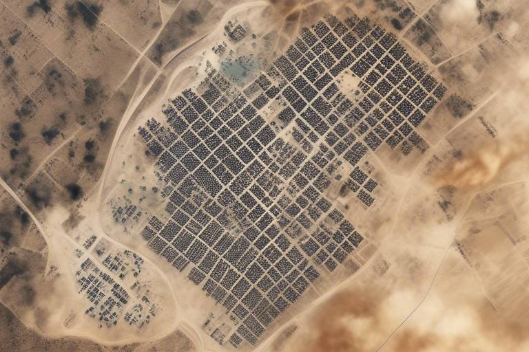
When a crisis erupts, be it a war or a catastrophic event, the first step in providing aid is understanding where the affected populations are headed. Satellites can capture high-resolution images of border crossings, camps, and urban areas where refugees congregate. This information is crucial for NGOs and governments to plan their humanitarian responses effectively. For instance, organizations like the United Nations High Commissioner for Refugees (UNHCR) rely on satellite imagery to identify the most affected regions and allocate resources accordingly.
Moreover, the data collected through satellite imagery can reveal patterns in refugee movements. By analyzing these patterns, humanitarian organizations can forecast future trends and prepare for possible surges in refugee populations. For example, if satellite data indicates an increase in movement towards a specific border, agencies can preemptively set up shelters and medical facilities to accommodate incoming refugees. This proactive approach can make a significant difference in the lives of those fleeing danger.
To better understand how satellite technology aids in mapping these movements, consider the following applications:
- Real-time Tracking: Satellites provide continuous monitoring, allowing for immediate updates on refugee locations.
- Geospatial Analysis: By combining satellite data with geographic information systems (GIS), organizations can analyze the demographics and needs of refugee populations.
- Collaboration with Ground Teams: Satellite data can be integrated with information from local NGOs, creating a comprehensive picture of the situation on the ground.
In addition to immediate crisis response, mapping refugee movements through satellite imagery contributes to long-term planning. Understanding where refugees settle can influence policies on resettlement and integration. Countries can use this data to create more effective programs that address the needs of both refugees and host communities, fostering social cohesion rather than tension.
However, it's essential to recognize the limitations of satellite data. While it provides a broad overview, it may lack the granularity needed to understand individual circumstances. Therefore, combining satellite imagery with on-the-ground reports and local knowledge is crucial for a holistic approach to refugee assistance.
In conclusion, the role of satellites in mapping refugee movements cannot be overstated. They provide a lifeline of information that helps coordinate humanitarian efforts, ensuring that aid reaches those who need it most. As technology continues to evolve, the potential for satellites to enhance our understanding and response to refugee crises will only grow, making it an indispensable tool in the fight for human rights and dignity.
- How do satellites track refugee movements?
Satellites use high-resolution imaging and geospatial data to monitor areas where refugees are likely to move, providing real-time updates to aid organizations. - What organizations use satellite data for refugee assistance?
Organizations like the UNHCR, NGOs, and various government agencies utilize satellite data to plan and execute humanitarian responses. - Can satellite data predict future refugee movements?
Yes, by analyzing patterns and trends in current movements, satellite data can help forecast potential future displacements.
Assessing Natural Disasters
When disaster strikes, time is of the essence. Satellites play a critical role in assessing the aftermath of natural disasters, providing invaluable data that informs response efforts around the globe. Imagine a massive earthquake or a devastating hurricane; the immediate chaos on the ground can make it nearly impossible for first responders to get a clear picture of the situation. This is where satellites come into play, offering a bird's-eye view that can significantly enhance our understanding of the disaster's impact.
Utilizing advanced imaging technology, satellites can capture high-resolution images that reveal the extent of destruction in affected areas. For instance, after a hurricane, satellite imagery can show flooded regions, damaged infrastructure, and even the locations of displaced populations. This data is crucial for emergency management agencies to prioritize their response efforts effectively. By analyzing these images, officials can identify the most severely impacted areas and allocate resources accordingly, ensuring that aid reaches those who need it most.
Furthermore, the ability to monitor natural disasters from space allows for real-time updates, which is essential for ongoing recovery efforts. As conditions change—whether it's the ebb and flow of floodwaters or the stabilization of landslide-prone areas—satellite data provides continuous feedback. This dynamic monitoring enables humanitarian organizations to adapt their strategies and make informed decisions based on the latest information.
In addition to immediate disaster assessment, satellites also contribute to long-term recovery planning. By mapping out the damage, they help in evaluating the needs of affected communities and in designing effective rebuilding strategies. For example, a thorough assessment of a region hit by a wildfire can inform future fire prevention measures and land management practices.
The data collected from satellites not only aids in disaster response but also plays a pivotal role in shaping international humanitarian efforts. Countries can collaborate more effectively when they have access to reliable data, leading to coordinated responses that maximize the impact of relief efforts. In essence, satellites act as a bridge between nations, fostering a spirit of cooperation in times of crisis.
To illustrate the impact of satellite technology in assessing natural disasters, consider the following table that summarizes key satellite capabilities:
| Satellite Capability | Description |
|---|---|
| High-Resolution Imaging | Captures detailed images of disaster-affected areas. |
| Real-Time Monitoring | Provides updates on changing conditions post-disaster. |
| Damage Assessment | Helps identify the extent of destruction for effective resource allocation. |
| Long-Term Recovery Planning | Assists in designing rebuilding strategies and future prevention measures. |
In conclusion, the role of satellites in assessing natural disasters cannot be overstated. They not only provide critical data that enhances the immediate response but also contribute to long-term recovery and prevention efforts. As technology continues to advance, we can expect even greater improvements in how we monitor and respond to natural disasters, ultimately saving more lives and building more resilient communities.
- How do satellites help in disaster response?
Satellites provide real-time data and high-resolution images that help emergency responders assess damage and coordinate relief efforts effectively. - Can satellites monitor environmental changes?
Yes, satellites are used to track various environmental changes, which can influence disaster preparedness and response strategies. - What types of disasters can satellites assess?
Satellites can assess a wide range of natural disasters, including hurricanes, earthquakes, floods, and wildfires. - How accurate is satellite imagery?
Modern satellite imagery is highly accurate, with resolutions that can capture details as small as a few centimeters, providing reliable data for analysis.
Monitoring Geopolitical Tensions
In today's world, where tensions can escalate at a moment's notice, the importance of satellite technology in monitoring geopolitical situations cannot be overstated. These high-tech eyes in the sky provide a wealth of data that is crucial for understanding military buildups and the intricate dance of international relations. Imagine a chess game played on a global scale; satellites serve as the players' keenest observers, offering insights that can make or break diplomatic negotiations.
Satellites are equipped with advanced sensors that can detect movements on the ground, analyze troop deployments, and even monitor the construction of military installations. This real-time intelligence allows governments to assess potential threats and make informed decisions. For instance, if a nation suddenly increases its military presence near a border, satellite imagery can reveal the scale and nature of this buildup, prompting a swift diplomatic or military response. It's like having a security camera installed on a busy street—without it, you might miss crucial events as they unfold.
Furthermore, the data collected from satellites can be shared among allied nations, fostering a sense of collaboration and transparency that is essential in today's interconnected world. This sharing of information not only strengthens alliances but also helps to prevent misunderstandings that could lead to conflict. For example, if one country misinterprets another's military exercises as preparations for war, the consequences could be dire. However, with satellite data providing clear evidence of the situation, diplomatic channels can be utilized to clear up any misconceptions.
To illustrate the impact of satellite monitoring on international relations, consider the following table that outlines key events where satellite data played a pivotal role:
| Event | Year | Impact of Satellite Monitoring |
|---|---|---|
| Cuban Missile Crisis | 1962 | U.S. surveillance satellites provided crucial images that confirmed the presence of Soviet missiles in Cuba, leading to a diplomatic resolution. |
| North Korea Nuclear Tests | 2006-Present | Satellite imagery has been instrumental in monitoring North Korea's nuclear facilities and missile launches, influencing international sanctions. |
| Russia-Ukraine Conflict | 2022 | Real-time satellite data tracked troop movements, providing insights that shaped international responses and sanctions. |
Additionally, satellites are not just passive observers; they can actively contribute to peacekeeping efforts. By providing ongoing surveillance of conflict zones, they help international organizations monitor ceasefires and ensure compliance with peace agreements. This capability is essential for building trust among nations and preventing the resurgence of hostilities. It's like having a referee at a sporting event—without oversight, the game could quickly spiral out of control.
In conclusion, the role of satellites in monitoring geopolitical tensions is vital for maintaining global peace and security. They provide the data needed to make informed decisions, foster international cooperation, and prevent conflicts from escalating. As technology continues to advance, we can expect satellites to play an even more significant role in shaping our understanding of international relations.
- How do satellites monitor military movements?
Satellites use high-resolution cameras and sensors to capture images and data on troop deployments and military activities, which can be analyzed for strategic insights.
- What is the significance of satellite data in diplomacy?
Satellite data enhances transparency among nations, helping to prevent misunderstandings and fostering trust, which is crucial for effective diplomacy.
- Can satellites predict conflicts?
While satellites can't predict conflicts, they can provide real-time data that helps governments assess potential threats and respond appropriately.
Commercial Satellites and Global Trade
In today's fast-paced world, commercial satellites have emerged as unsung heroes in the realm of global trade. These high-tech marvels orbiting our planet are not just for scientific research or military surveillance; they play a pivotal role in the day-to-day operations of international commerce. Imagine trying to navigate a bustling marketplace without knowing where the best deals are or how to avoid traffic jams. That's essentially what businesses face without the insights provided by these satellites. They offer crucial data that can streamline operations, enhance efficiency, and ultimately boost profits.
One of the key advantages of commercial satellites is their ability to provide real-time information on shipping routes and supply chains. With the world becoming increasingly interconnected, knowing the status of shipments can mean the difference between success and failure. For instance, if a company is aware of a delay in shipping due to weather conditions or geopolitical tensions, they can adjust their logistics accordingly, ensuring that they maintain their competitive edge. This capability allows businesses to make informed decisions, reducing the risk of losses and improving customer satisfaction.
Moreover, commercial satellites facilitate the monitoring of maritime activities. They track vessels across the globe, ensuring compliance with international laws and regulations. This surveillance is not just about keeping tabs on cargo ships; it's also about preventing illegal activities such as piracy and unregulated fishing. By maintaining a watchful eye over the seas, satellites contribute to a safer and more reliable environment for global trade. Companies can rest easy knowing that their goods are being transported securely, which fosters trust and strengthens international partnerships.
But the impact of commercial satellites goes beyond just tracking shipments. They also play a significant role in the enforcement of economic sanctions. In an age where sanctions can be a powerful tool for influencing international relations, having accurate satellite data is essential. Governments can monitor compliance with these sanctions, ensuring that targeted countries are adhering to regulations. This level of oversight helps to assess the effectiveness of sanctions and allows for timely adjustments if necessary. As a result, nations can wield their economic influence more effectively, shaping the global landscape in their favor.
To illustrate the importance of commercial satellites in global trade, consider the following table that summarizes their key contributions:
| Contribution | Description |
|---|---|
| Real-time Shipping Data | Provides updates on the status of shipments, allowing businesses to adjust logistics. |
| Maritime Surveillance | Tracks vessels to ensure compliance with international laws and prevent illegal activities. |
| Economic Sanction Monitoring | Enables governments to oversee compliance with sanctions, influencing international relations. |
In conclusion, commercial satellites are not just technological wonders; they are vital components of the global trade ecosystem. By providing essential data and insights, they empower businesses to navigate the complexities of international commerce with confidence. As we continue to rely on these advanced technologies, the future of global trade looks brighter than ever, paving the way for enhanced collaboration and economic growth among nations.
- How do commercial satellites improve supply chain efficiency?
They provide real-time data on shipping routes and potential disruptions, allowing businesses to make informed logistical decisions. - What role do satellites play in maritime security?
Satellites monitor ships to ensure compliance with international laws, helping to prevent piracy and illegal fishing. - Can satellites help enforce economic sanctions?
Yes, they can monitor compliance and assess the effectiveness of sanctions on targeted countries.
Tracking Maritime Activities
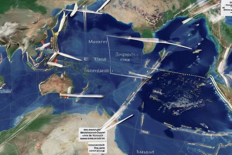
In the vast expanse of our oceans, where the waves dance and the winds whisper secrets, satellites play a pivotal role in monitoring maritime activities. Imagine the world’s oceans as a bustling highway, where ships of all sizes navigate through the waters, carrying goods and resources that fuel our global economy. However, this highway is not without its challenges, including piracy, illegal fishing, and environmental violations. Here’s where satellites come into play, acting as vigilant sentinels that keep a watchful eye on these activities from above.
Using advanced technology, satellites are equipped with sensors that can detect and track vessels across the globe. This data is crucial for various reasons:
- Compliance Monitoring: Satellites help ensure that ships comply with international laws and regulations, such as those set by the International Maritime Organization (IMO).
- Safety and Security: By monitoring maritime traffic, authorities can respond swiftly to incidents of piracy or smuggling, thereby enhancing the safety of sea routes.
- Environmental Protection: Satellites can identify illegal fishing activities, helping to protect marine ecosystems and promote sustainable fishing practices.
Moreover, the data collected from these satellites can be visualized through sophisticated mapping systems, providing real-time insights into shipping routes and maritime traffic patterns. For instance, shipping companies can utilize this information to optimize their routes, reducing fuel consumption and minimizing their carbon footprint. In a world increasingly focused on sustainability, such technological advancements are not just beneficial; they are essential.
Furthermore, the impact of satellite tracking extends beyond immediate security concerns. It fosters international cooperation as countries share data to combat common threats. For instance, nations can collaborate on anti-piracy operations, pooling their resources and intelligence to create a safer maritime environment for all. This collaborative spirit is crucial in an era where global challenges require collective solutions.
As we look to the future, the role of satellites in tracking maritime activities is only expected to grow. With advancements in technology, such as artificial intelligence and machine learning, the ability to analyze maritime data will become even more sophisticated. This will not only enhance the effectiveness of monitoring efforts but also lead to more informed decision-making at both governmental and corporate levels.
In conclusion, satellites are not just tools for observation; they are gateways to understanding and managing the complexities of our oceans. By tracking maritime activities, they ensure the safety of international waters, promote sustainable practices, and enhance global trade. As we continue to harness the power of technology, the oceans will remain a vital lifeline for humanity, safeguarded by the watchful eyes of satellites.
Q1: How do satellites track maritime activities?
A1: Satellites use advanced sensors and imaging technology to monitor vessels in real-time, providing data on their movements and compliance with international laws.
Q2: What are the benefits of tracking maritime activities?
A2: Tracking maritime activities enhances safety and security, promotes environmental protection, and facilitates international cooperation against illegal activities.
Q3: Can satellite data help in optimizing shipping routes?
A3: Yes, satellite data provides insights into maritime traffic patterns, allowing shipping companies to optimize their routes for efficiency and sustainability.
Impact on Economic Sanctions
Economic sanctions are powerful tools used by nations to exert pressure on other countries, often in response to actions that threaten global peace and security. Satellites play a crucial role in monitoring these sanctions, providing real-time data that can significantly influence their effectiveness. Imagine a giant eye in the sky, constantly observing and reporting back on the activities of nations, ensuring compliance with international laws and agreements.
One of the primary ways satellites impact economic sanctions is through their ability to monitor key infrastructure and supply chains. For instance, satellite imagery can reveal whether a country is engaging in illicit trade that violates sanctions. This includes tracking the movement of ships in and out of ports, observing the loading and unloading of goods, and identifying any unusual activities that could indicate a breach of sanctions. By providing this critical information, satellites enable governments to make informed decisions about enforcement measures.
Moreover, the data collected from satellites can help assess the economic impact of sanctions on targeted countries. For example, by analyzing changes in industrial activity or agricultural production through satellite imagery, nations can gauge how effective sanctions are in crippling an adversary’s economy. This information is invaluable for policymakers who need to balance the humanitarian impact of sanctions against their strategic objectives.
Additionally, satellites can help in the enforcement of sanctions by providing evidence of violations. When a country is suspected of bypassing sanctions, satellite data can serve as a vital resource in international negotiations and legal proceedings. This transparency helps build a case against the offending nation and can lead to increased international pressure for compliance.
To illustrate the impact of satellite monitoring on economic sanctions, consider the following table that summarizes key aspects:
| Aspect | Description |
|---|---|
| Monitoring Compliance | Satellites track the movement of goods and resources to ensure nations adhere to sanctions. |
| Assessing Impact | Data from satellites helps evaluate the economic effects of sanctions on targeted countries. |
| Evidence Collection | Satellite imagery provides concrete evidence of sanctions violations for diplomatic and legal actions. |
In conclusion, the integration of satellite technology into the realm of economic sanctions has transformed how nations enforce compliance and assess the impact of their actions. With the ability to monitor activities from above, satellites not only enhance the effectiveness of sanctions but also contribute to a more transparent and accountable international system. As technology continues to evolve, we can expect satellites to play an even more significant role in shaping global economic policies.
- How do satellites help in monitoring sanctions? Satellites provide real-time data on trade activities, allowing nations to track compliance and identify violations.
- What types of data can satellites collect? Satellites can gather imagery related to shipping routes, industrial activity, and agricultural production, among other things.
- Can satellite data influence international relations? Yes, satellite data can provide evidence for negotiations and help build cases against nations that violate sanctions.
Frequently Asked Questions
- How do satellites monitor military movements?
Satellites use advanced imaging technology to capture real-time data on military activities. This includes tracking troop movements, aircraft deployments, and naval operations. By providing a bird's-eye view, they help governments assess potential threats and respond swiftly to emerging conflicts.
- What role do satellites play in environmental monitoring?
Satellites are crucial in observing changes in the environment, such as deforestation, urbanization, and climate shifts. They collect data that informs international agreements on climate action, fostering cooperation among nations to tackle global challenges like climate change and biodiversity loss.
- How do satellites assist in disaster response?
During natural disasters, satellites provide vital information on affected areas, including damage assessments and infrastructure status. This data is essential for coordinating humanitarian efforts, ensuring that aid reaches those in need promptly and effectively.
- Can satellites track refugee movements?
Absolutely! Satellite imagery is instrumental in monitoring refugee flows, enabling organizations to understand migration patterns. This information is critical for planning effective humanitarian responses and resettlement strategies to support displaced populations.
- How do satellites contribute to monitoring geopolitical tensions?
Satellites help in observing military buildups and other activities that may indicate rising geopolitical tensions. This surveillance provides invaluable insights for diplomatic negotiations and peacekeeping efforts, allowing nations to address potential conflicts proactively.
- What is the impact of commercial satellites on global trade?
Commercial satellites enhance global trade by providing data on shipping routes, supply chains, and market trends. This information helps businesses optimize operations and supports governments in mitigating trade disputes by ensuring compliance with international regulations.
- How do satellites monitor maritime activities?
Satellites track maritime activities to ensure compliance with international laws. They help prevent piracy, illegal fishing, and other unlawful activities at sea, promoting safer and more secure maritime trade routes for all nations.
- Can satellite data influence economic sanctions?
Yes, satellite data plays a significant role in monitoring compliance with economic sanctions. By providing insights into the activities of targeted nations, satellites help governments assess the effectiveness of sanctions and make informed decisions regarding their enforcement.

