The Importance of Satellite Data in Conflict Resolution
In today's world, where conflicts can erupt at any moment, understanding the dynamics that drive these situations is crucial. Satellite data has emerged as a powerful tool in the realm of conflict resolution, providing a wealth of information that is not only accurate but also timely. Imagine being able to see a conflict zone from above, gaining insights that ground-level reports might miss. This bird's-eye view is invaluable, as it enhances transparency and supports effective decision-making processes in geopolitical situations. By leveraging satellite technology, stakeholders can make informed choices that can lead to peaceful resolutions, ultimately saving lives and stabilizing regions.
One of the most compelling aspects of satellite data is its ability to provide a clear picture of what's happening on the ground. Traditional methods of gathering intelligence often rely on human reports, which can be biased or incomplete. In contrast, satellite imagery offers an objective lens, capturing real-time changes in landscapes, populations, and even military movements. This capability is especially important in conflict zones, where misinformation can escalate tensions. With satellite data, organizations and governments can verify claims, assess damage, and identify areas in need of humanitarian assistance.
Furthermore, the role of satellite data extends beyond mere observation. It acts as a catalyst for dialogue and negotiation. When conflicting parties have access to the same accurate information, it fosters a sense of trust and accountability. For instance, if one side accuses the other of violating a ceasefire, satellite imagery can provide definitive evidence to either support or refute these claims. This transparency is essential in building a foundation for lasting peace, as it encourages parties to engage in constructive discussions rather than resorting to retaliatory actions.
In summary, the integration of satellite data into conflict resolution strategies represents a significant leap forward in how we understand and address geopolitical tensions. By providing accurate, real-time information, satellite technology enhances transparency, supports informed decision-making, and fosters trust among conflicting parties. As we continue to face complex global challenges, the importance of satellite data in conflict resolution will only grow, paving the way for more effective and peaceful outcomes.
Understanding Satellite Data
Satellite data is a treasure trove of information that is collected from various types of satellites orbiting our planet. This data is not just a collection of pretty pictures; it encompasses a wide range of information, including high-resolution imagery, infrared data, and signals that can be used for multiple applications. Imagine being able to see the world from above, getting a bird's-eye view of conflict zones, environmental changes, and urban development all at once. That's the power of satellite data!
One of the most critical aspects of satellite data is its ability to provide real-time information. For instance, during conflicts, satellite imagery can reveal troop movements, infrastructure damage, and even humanitarian crises. This capability is invaluable, as it enhances transparency and allows for informed decision-making. In a world where misinformation can escalate tensions, having accurate data from above acts like a truth serum, cutting through the noise and providing clarity.
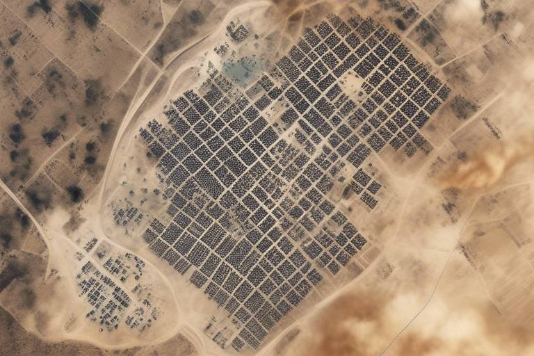
Moreover, satellite data plays a vital role in monitoring conflict zones. By analyzing changes over time, organizations can assess the impact of conflicts on civilian populations and infrastructure. For example, satellite images can show how many homes have been destroyed or how many people have been displaced. This information is crucial for aid organizations and governments trying to respond effectively to crises.
To illustrate this, let's take a look at some common types of satellite data and their applications:
| Type of Satellite Data | Application |
|---|---|
| Optical Imagery | Used for assessing damage and monitoring changes in land use. |
| Infrared Data | Helps in detecting heat signatures, useful for identifying active conflicts or fires. |
| Radar Data | Effective in monitoring ground movements, even in cloudy conditions. |
In addition to monitoring conflicts, satellite data is also instrumental in gathering intelligence. Governments and organizations utilize this data to track illegal activities, such as deforestation, smuggling, or military buildups. With the right tools, analysts can sift through vast amounts of data, pinpointing areas of concern that may not be visible from the ground. It's like having a superpower that allows you to see what others cannot.
However, understanding satellite data isn't just about having access to it; it's also about knowing how to interpret it. Just like reading a map requires skill, so does analyzing satellite imagery. Analysts must be trained to recognize patterns, identify anomalies, and draw conclusions that can inform policy and action. This need for expertise adds another layer of complexity to the use of satellite data in conflict resolution.
In conclusion, satellite data is a multifaceted tool that enhances our understanding of conflict zones and supports effective decision-making. Its ability to provide real-time, accurate information is crucial in a world where every second counts. As we continue to leverage this technology, we must also invest in the skills needed to interpret and act on the data responsibly. The journey into the skies has only just begun, and the potential for satellite data to change the landscape of conflict resolution is immense.
Historical Context of Satellite Usage
The journey of satellite technology is nothing short of fascinating. It began during the Cold War, a period marked by intense rivalry and suspicion between superpowers. The launch of Sputnik 1 by the Soviet Union in 1957 marked the dawn of the space age and opened the floodgates for the use of satellites in various fields, including military and intelligence operations. This event not only demonstrated the potential of satellite technology but also underscored the importance of real-time information in conflict situations.
As the years progressed, the role of satellites evolved significantly. By the 1960s and 1970s, satellite imagery became a game-changer for military strategists. The ability to capture high-resolution images of enemy territories allowed nations to gather critical intelligence without putting personnel at risk. This period saw the development of programs like Project Corona, which utilized satellites for reconnaissance, providing invaluable data that influenced key military decisions.
Fast forward to the 1990s, and we see the rise of commercial satellite imagery. Companies like DigitalGlobe began to offer satellite images to the public, democratizing access to information that was once the exclusive domain of governments. This shift not only enhanced transparency but also empowered non-governmental organizations (NGOs) and researchers to monitor conflict zones and humanitarian crises. The availability of satellite data for civilian use has become a crucial aspect of modern conflict resolution.
In recent years, we have witnessed a significant increase in the usage of satellite data in diplomatic and peacekeeping efforts. For instance, during the Syrian Civil War, satellite imagery was instrumental in documenting human rights violations and assessing the extent of destruction in affected areas. This data not only informed international responses but also helped hold parties accountable for their actions.
Furthermore, the evolution of technology has made satellite data more accessible and user-friendly. Today, organizations like UNOSAT utilize satellite imagery to support humanitarian aid and disaster response efforts, showcasing the critical role of satellites in addressing global challenges. The ability to analyze and interpret satellite data has become a vital skill for conflict resolution experts, enabling them to make informed decisions based on accurate information.
In summary, the historical context of satellite usage reveals a trajectory of growth and adaptation. From its military origins to its current applications in humanitarian and diplomatic efforts, satellite technology has proven to be an indispensable tool in the realm of conflict resolution. As we look to the future, it's clear that the importance of satellite data will only continue to expand, shaping the way we understand and respond to conflicts around the globe.
Case Studies in Conflict Resolution
When we talk about the impact of satellite data in resolving conflicts, it’s like opening a treasure chest filled with invaluable insights. One of the most notable examples comes from the ongoing tensions in the South China Sea. Here, satellite imagery has been instrumental in monitoring territorial disputes and illegal fishing activities. The ability to capture high-resolution images allows nations to present undeniable evidence of violations, thus fostering diplomatic conversations rather than military confrontations. It’s akin to having a bird's-eye view of a chessboard, where every move can be tracked and analyzed.
Another compelling case is the use of satellite data during the Syrian Civil War. Organizations like Human Rights Watch utilized satellite imagery to document the destruction of civilian infrastructure and the displacement of populations. This data not only informed humanitarian efforts but also helped hold parties accountable for their actions. Imagine trying to piece together a jigsaw puzzle without all the pieces; satellite data provides those missing pieces, allowing for a clearer picture of the conflict's impact on civilians.
In Africa, the Darfur conflict serves as a stark reminder of how satellite technology can aid in conflict resolution. Satellite images were used to track the movement of displaced persons and assess the damage to villages. This information was crucial for humanitarian organizations aiming to deliver aid effectively. It’s like having a GPS for humanitarian efforts, ensuring that help reaches those who need it the most.
To illustrate the effectiveness of satellite data further, let's look at a comparative table showcasing different case studies and their outcomes:
| Conflict | Use of Satellite Data | Outcome |
|---|---|---|
| South China Sea | Monitoring territorial disputes and illegal activities | Enhanced diplomatic negotiations |
| Syria | Documenting civilian infrastructure damage | Increased accountability for war crimes |
| Darfur | Tracking displaced populations and assessing damage | Improved humanitarian aid delivery |
These examples showcase how satellite data has not only provided clarity in chaotic situations but has also paved the way for constructive dialogue. It’s a powerful tool in the hands of decision-makers, akin to having a compass in the midst of a storm. The data collected from above serves as a neutral party, offering facts that can help de-escalate tensions and foster peace.
As we analyze these case studies, it's essential to recognize the lessons learned. Each instance highlights the importance of timely and accurate data in conflict resolution. The more we leverage satellite technology, the better equipped we are to tackle the complexities of modern conflicts. In a world where misinformation can lead to escalated tensions, having reliable satellite data is like having a lighthouse guiding ships safely to shore.
- What is satellite data?
Satellite data refers to information collected from satellites orbiting the Earth, including imagery, signals, and other types of data that can be used for various applications, including conflict monitoring. - How has satellite data been used in humanitarian efforts?
Satellite imagery helps humanitarian organizations assess damage, identify needs, and coordinate relief efforts in conflict-affected areas, ensuring aid reaches those in need efficiently. - What are the limitations of satellite data?
Despite its benefits, satellite data can face challenges such as data accuracy, accessibility issues, and privacy concerns that may affect its effectiveness in conflict resolution.
Satellite Data in Humanitarian Aid
In a world where conflicts can erupt unexpectedly, the role of satellite data in humanitarian aid has become increasingly vital. Imagine a situation where a natural disaster strikes or a conflict escalates, and the first responders need to understand the extent of the damage quickly. This is where satellite imagery comes into play, offering a bird's-eye view that ground teams simply cannot match. By providing real-time data, satellite technology empowers humanitarian organizations to make informed decisions swiftly, ultimately saving lives.
One of the most significant advantages of satellite data is its ability to assess damage and destruction in conflict zones. For instance, after an earthquake or a military engagement, satellite images can reveal the extent of infrastructure damage, allowing aid agencies to prioritize their efforts. This capability not only enhances the efficiency of relief operations but also ensures that resources are allocated where they are needed most. Without this critical information, humanitarian efforts could be misdirected, leading to delays and increased suffering.
Moreover, satellite data plays a crucial role in identifying needs on the ground. By analyzing changes in population density and movement patterns through satellite imagery, organizations can determine where displaced individuals are congregating. This information is essential for coordinating relief efforts, such as distributing food, water, and medical supplies. For example, if satellite imagery shows a sudden influx of people into a specific area, humanitarian agencies can mobilize resources to address the urgent needs of these individuals. This proactive approach can significantly improve the effectiveness of aid delivery.
Another critical aspect of satellite data is its ability to assist in coordinating relief efforts. In chaotic environments, where communication may be compromised, satellite data provides a common operational picture that various agencies can rely on. This shared understanding fosters collaboration among different organizations, ensuring that efforts are not duplicated and that aid reaches those who need it most. By using satellite data, humanitarian organizations can create detailed maps that outline areas of need, routes for aid delivery, and safe zones for displaced populations.
However, it is essential to recognize that the utilization of satellite data in humanitarian aid is not without its challenges. Factors such as data accuracy and accessibility can impact the effectiveness of satellite imagery. For example, cloudy weather can obscure satellite views, and the cost of accessing high-resolution images can be prohibitive for some organizations. Despite these challenges, the benefits of satellite data in humanitarian aid are undeniable, and ongoing advancements in technology continue to enhance its effectiveness.
In summary, satellite data is a powerful tool that has transformed the landscape of humanitarian aid. By providing timely and accurate information, it enables organizations to assess damage, identify needs, and coordinate relief efforts more effectively. As we continue to navigate a world fraught with conflict and disaster, the importance of satellite data in humanitarian efforts will only grow, making it an indispensable resource for saving lives and alleviating suffering.
- How does satellite data improve response times in humanitarian crises?
Satellite data allows organizations to quickly assess the situation from above, enabling them to prioritize areas that need immediate assistance. - What types of satellite imagery are most useful for humanitarian aid?
High-resolution optical imagery and synthetic aperture radar (SAR) are particularly valuable for assessing damage and monitoring changes in population density. - Are there any privacy concerns associated with using satellite data?
Yes, while satellite data is crucial for humanitarian efforts, it also raises ethical questions about privacy and surveillance, especially in conflict zones.
Monitoring Ceasefires and Agreements
In the complex world of geopolitics, where tensions can ignite at any moment, the role of satellite data in monitoring ceasefires and peace agreements is nothing short of revolutionary. Imagine trying to keep the peace in a region where trust is as fragile as glass; this is where satellite technology steps in like a vigilant guardian. By providing real-time, accurate information, satellite data becomes a powerful tool for ensuring compliance and fostering accountability among conflicting parties.
When a ceasefire is declared, the stakes are incredibly high. Both sides often have reasons to be skeptical, and without a reliable way to verify adherence to the terms, the risk of resuming hostilities looms large. Here, satellite imagery comes into play, offering a bird's-eye view of conflict zones. These images can reveal troop movements, the establishment of military installations, or even the destruction of key infrastructure. This transparency is crucial; it not only helps to confirm that both parties are holding up their end of the bargain but also serves as a deterrent against potential violations.
To illustrate the effectiveness of satellite monitoring, let’s consider a few notable examples:
- The 2015 Iran Nuclear Deal: Satellite data was pivotal in monitoring Iran’s compliance with the agreement, providing the international community with the necessary transparency to ensure that Iran was adhering to the terms.
- The Syrian Conflict: Various ceasefire agreements in Syria have been monitored through satellite imagery, helping humanitarian organizations assess the situation on the ground and ensuring that both sides respected the ceasefire.
Moreover, the integration of satellite data with ground-based monitoring efforts enhances the overall effectiveness of peacekeeping missions. Organizations like the United Nations and the Organization for Security and Co-operation in Europe (OSCE) have begun to leverage this technology, combining it with on-the-ground reports to create a comprehensive picture of the situation. This synergy not only improves the accuracy of the information but also builds confidence among the parties involved, as they can see that their actions are being monitored objectively.
However, it’s essential to recognize that while satellite data provides invaluable insights, it is not without its challenges. Issues related to data interpretation and the need for ground-truthing—verifying satellite data with on-the-ground observations—remain significant hurdles. The success of monitoring ceasefires and agreements relies heavily on the collaboration between satellite analysts and field operatives. This partnership is crucial for ensuring that the information collected is not only accurate but also actionable.
In conclusion, the role of satellite data in monitoring ceasefires and agreements cannot be overstated. It acts as both a watchdog and a bridge between conflicting parties, fostering trust and accountability. As technology continues to advance, the potential for satellite data to enhance peacekeeping efforts will only grow, paving the way for a more stable and peaceful world.
- How does satellite data ensure compliance with ceasefires?
Satellite data provides real-time imagery and information that can be used to monitor the movements and actions of conflicting parties, ensuring they adhere to the terms of the ceasefire. - What are some limitations of using satellite data for monitoring?
Challenges include data accuracy, the need for ground verification, and potential privacy concerns. Additionally, interpreting satellite data requires expertise and can be subject to misinterpretation. - Can satellite data be used in all conflict scenarios?
While satellite data is invaluable, its effectiveness can vary based on the nature of the conflict, the terrain, and the availability of technology in the region. - What future advancements can we expect in satellite monitoring?
Emerging technologies, such as AI and machine learning, are expected to enhance the analysis of satellite data, making it more efficient and insightful for conflict resolution efforts.
Challenges and Limitations
While the role of satellite data in conflict resolution is undeniably significant, it is not without its . One of the primary concerns is the issue of data accuracy. Satellite imagery can sometimes be misleading due to factors such as weather conditions, the angle of capture, or even the resolution of the images. For instance, cloud cover can obscure critical details in a conflict zone, making it difficult to assess the situation accurately. This can lead to misinterpretations that may exacerbate tensions rather than alleviate them.
Another challenge is accessibility. While many countries have invested in satellite technology, not all have equal access to high-quality satellite data. Developing nations, in particular, may lack the resources to utilize this technology effectively. This disparity can create an imbalance in conflict resolution efforts, where some parties have better intelligence and situational awareness than others. It raises the question: how can we ensure that all stakeholders have equal access to crucial satellite data?
Moreover, there are significant privacy concerns associated with the use of satellite data. The ability to monitor specific areas and individuals from space can lead to potential violations of privacy rights. Governments and organizations must tread carefully to avoid overstepping boundaries and infringing on civil liberties. This becomes especially pertinent in conflict zones, where the line between surveillance and invasion of privacy can become blurred.
Additionally, the interpretation of satellite data requires a certain level of expertise. Misinterpretation can lead to misguided actions, further complicating conflict resolution efforts. To illustrate this, consider a scenario where a satellite captures images of troop movements. Without proper analysis, one might conclude that an offensive is imminent, when in reality, it could be a routine maneuver. Such misinterpretations can escalate tensions and lead to unnecessary conflict.
Finally, the rapid pace of technological advancement presents its own set of challenges. As new tools and methods emerge for analyzing satellite data, there is a constant need for training and adaptation. Organizations involved in conflict resolution must stay updated with the latest technologies and methodologies to ensure they are making informed decisions based on the most current data available. This can be resource-intensive and may not always be feasible, especially in rapidly evolving conflict situations.
In summary, while satellite data is a powerful tool in the realm of conflict resolution, it comes with its own set of challenges. Addressing issues related to accuracy, accessibility, privacy, interpretation, and technological adaptation is essential for maximizing the effectiveness of satellite data in resolving conflicts.
- What is satellite data? Satellite data refers to information collected from satellites orbiting the Earth, including images and signals used for various applications, including monitoring conflict zones.
- How does satellite data contribute to conflict resolution? It provides accurate information, enhances transparency, and supports decision-making processes in geopolitical situations.
- What are the main challenges of using satellite data? Key challenges include data accuracy, accessibility, privacy concerns, and the need for expert interpretation.
- Can satellite data be used for humanitarian aid? Yes, satellite imagery assists humanitarian organizations in assessing damage, identifying needs, and coordinating relief efforts in conflict-affected areas.
The Role of Technology in Satellite Data
In today's fast-paced world, technology is the driving force behind the evolution of satellite data. Just imagine the vast oceans of information that satellites collect daily—images, signals, and more—all thanks to groundbreaking advancements in technology. These innovations not only enhance the quality of data but also expand its applications in conflict resolution, making it a crucial tool for decision-makers and humanitarian organizations alike.
One of the most significant technological advancements is the development of high-resolution imaging. This allows us to capture detailed images of conflict zones, providing insights that were previously unimaginable. With resolutions reaching mere centimeters, we can monitor troop movements, assess infrastructure damage, and even track environmental changes. This level of detail is vital for understanding the dynamics of a conflict and making informed decisions.
Furthermore, the integration of artificial intelligence (AI) and machine learning into satellite data analysis has revolutionized how we interpret this information. These technologies can process massive datasets at lightning speed, identifying patterns and anomalies that human analysts might miss. For instance, AI can automatically detect changes in land use, such as the construction of military installations or the destruction of civilian infrastructure, enabling quicker responses to emerging crises.
Another exciting development is the use of real-time data transmission. Modern satellites can now relay information back to Earth almost instantaneously, allowing for timely updates on conflict situations. This capability is crucial in scenarios where every second counts—think of humanitarian aid efforts where quick assessments can save lives. By providing up-to-date information, organizations can better allocate resources and respond effectively to the needs of affected populations.
Additionally, the role of cloud computing cannot be overlooked. With the ability to store and analyze vast amounts of satellite data remotely, organizations can collaborate more efficiently. Imagine a team of analysts from different parts of the world working together in real-time to assess a conflict zone. Cloud technology makes this possible, breaking down geographical barriers and fostering international cooperation.
However, it’s essential to recognize that while technology plays a pivotal role in enhancing satellite data capabilities, it also brings challenges. Issues such as data privacy, security, and the potential for misuse are significant concerns that need addressing. As we harness the power of technology, balancing innovation with ethical considerations will be paramount.
As we look to the future, the integration of emerging technologies like blockchain for data verification and Internet of Things (IoT) devices for ground-level insights will likely further enhance the effectiveness of satellite data in conflict resolution. The possibilities are truly endless, and the need for collaboration among nations and organizations will be more critical than ever.
- How does satellite data improve conflict resolution?
Satellite data provides accurate, real-time information that enhances transparency and supports informed decision-making, crucial for resolving conflicts. - What technologies are currently being used in satellite data analysis?
Technologies like AI, machine learning, and cloud computing are transforming how satellite data is collected, analyzed, and shared. - What are the challenges associated with satellite data?
Challenges include data accuracy, accessibility, privacy concerns, and the potential for misuse of information. - How can satellite data assist humanitarian efforts?
Satellite imagery helps assess damage, identify needs, and coordinate relief efforts in conflict-affected areas, ultimately saving lives.
Emerging Technologies
The landscape of satellite data is continuously evolving, driven by that enhance our ability to collect, analyze, and utilize this information in conflict resolution. One of the most significant advancements has been the integration of artificial intelligence (AI) and machine learning into satellite data analysis. These technologies allow for the processing of vast amounts of data at unprecedented speeds, transforming raw satellite images into actionable insights.
Imagine trying to find a needle in a haystack; that’s what analyzing satellite data used to feel like. But with AI, the process becomes more like using a magnet to pull out all the needles at once. By automating the identification of patterns and anomalies in satellite imagery, AI can quickly highlight areas of interest, such as troop movements or changes in infrastructure, which are crucial in conflict situations.
Moreover, the use of high-resolution imaging satellites has dramatically improved the clarity and detail of the data we receive. These satellites can capture images with resolutions sharp enough to distinguish between different types of vehicles or to assess the extent of damage in a conflict zone. This level of detail is invaluable for organizations working to resolve conflicts, as it provides a clearer picture of the situation on the ground.
Another emerging technology that is reshaping the field is geospatial analytics. This involves the use of sophisticated algorithms to analyze geographical data and draw insights about spatial relationships. For instance, by overlaying satellite data with demographic information, analysts can identify potential flashpoints for conflict or areas in need of humanitarian assistance. The combination of geospatial analytics with satellite data offers a comprehensive understanding of the dynamics at play in conflict zones.
To illustrate the impact of these technologies, consider the following table that outlines some of the key technologies transforming satellite data analysis:
| Technology | Description | Impact on Conflict Resolution |
|---|---|---|
| Artificial Intelligence | Automates data processing and pattern recognition. | Speeds up analysis and improves accuracy. |
| Machine Learning | Learns from data to make predictions and decisions. | Enhances predictive capabilities for conflict trends. |
| High-Resolution Imaging | Provides detailed satellite imagery. | Facilitates precise assessments of conflict zones. |
| Geospatial Analytics | Analyzes geographical and demographic data. | Identifies potential conflict areas and needs. |
In addition to these technologies, the rise of cloud computing has enabled more efficient data storage and sharing. Organizations can now access satellite data from anywhere in the world, fostering collaboration among stakeholders involved in conflict resolution. This accessibility is crucial, as it allows for real-time updates and shared intelligence, which can be pivotal in rapidly changing conflict scenarios.
With these advancements, we are not just witnessing a technological revolution; we are experiencing a paradigm shift in how we approach conflict resolution. The integration of emerging technologies into satellite data analysis is paving the way for a future where conflicts can be managed more effectively and humanitarian efforts can be better coordinated. As we continue to innovate and collaborate, the potential for satellite data to contribute to peacekeeping and conflict resolution will only grow stronger.
- What is satellite data? Satellite data refers to information collected from satellites orbiting the Earth, which includes imagery, signals, and other types of data used for various applications, including conflict resolution.
- How does AI enhance satellite data analysis? AI automates the processing of satellite imagery, enabling faster identification of patterns and anomalies that are critical for conflict monitoring.
- What role does high-resolution imaging play in conflict resolution? High-resolution imaging allows for detailed assessments of conflict zones, making it easier to understand the situation on the ground.
- Why is geospatial analytics important? Geospatial analytics helps in understanding the spatial relationships and dynamics in conflict areas, aiding in the identification of potential conflict zones and humanitarian needs.
Future Trends in Satellite Data Usage
As we look to the horizon, the future of satellite data usage in conflict resolution is not just promising; it’s revolutionary. With the rapid advancements in technology, we are on the brink of a new era where satellite data will become more integral than ever in managing and resolving conflicts worldwide. Imagine a world where real-time satellite imagery can provide instantaneous updates on conflict zones, allowing decision-makers to act swiftly and effectively. This is not just a dream; it’s becoming a reality.
One of the most exciting trends is the integration of artificial intelligence (AI) and machine learning into satellite data analysis. These technologies are enhancing our ability to process vast amounts of data quickly and accurately. For instance, AI algorithms can now identify changes in landscapes or infrastructure from satellite images, pinpointing areas of destruction or humanitarian need almost instantaneously. This capability not only speeds up the response time but also ensures that aid is directed where it’s most needed.
Moreover, the miniaturization of satellite technology is paving the way for more accessible and affordable satellite data collection. Smaller, cheaper satellites—often referred to as CubeSats—can be deployed in swarms to gather data over large areas. This democratization of satellite technology means that even smaller nations or organizations can harness this powerful tool to monitor conflicts and gather intelligence, leveling the playing field in international relations.
Another trend to watch is the increasing collaboration between governments, NGOs, and private companies. By pooling resources and expertise, these entities can create a comprehensive approach to conflict monitoring and resolution. For example, partnerships between tech companies and humanitarian organizations can lead to innovative solutions that utilize satellite data for crisis management. This collaborative spirit is essential in a world where conflicts are becoming more complex and multifaceted.
Furthermore, the development of advanced data visualization tools is transforming how satellite data is interpreted and utilized. Interactive maps and dashboards can provide stakeholders with clear, actionable insights, making it easier to understand the dynamics of a conflict. These tools not only enhance transparency but also foster trust among conflicting parties by providing an objective basis for discussions and negotiations.
As we move forward, the emphasis on ethical considerations surrounding satellite data usage will also grow. Issues of privacy, data security, and the potential for misuse will require careful navigation. Establishing robust frameworks and guidelines will be crucial in ensuring that satellite data is used responsibly, particularly in sensitive conflict situations.
In conclusion, the future of satellite data in conflict resolution is bright, characterized by innovation, collaboration, and a commitment to ethical practices. As technology continues to evolve, we can expect satellite data to play an even more critical role in fostering peace and stability across the globe. The question isn’t whether satellite data will be influential in the future; it’s how we will harness its full potential to create a more peaceful world.
- What is satellite data? Satellite data refers to information collected from satellites orbiting the Earth, including imagery, signals, and other forms of data used for various applications, including conflict monitoring.
- How does satellite data help in conflict resolution? It provides accurate and timely information, enhances transparency, and supports decision-making processes, allowing for effective responses to conflicts.
- What role does AI play in satellite data analysis? AI enhances the efficiency of data processing, enabling quicker identification of changes in conflict zones and improving the overall effectiveness of responses.
- Are there ethical concerns with satellite data usage? Yes, issues like privacy, data security, and potential misuse are significant concerns that must be addressed to ensure responsible use of satellite data.
Frequently Asked Questions
- What is satellite data and why is it important in conflict resolution?
Satellite data refers to the information collected from satellites orbiting the Earth, which includes imagery and various signals. Its importance in conflict resolution lies in its ability to provide accurate, real-time information about conflict zones, enhancing transparency and supporting informed decision-making processes.
- How has satellite technology evolved over time?
Satellite technology has seen significant advancements since its inception. Initially used for basic reconnaissance, it has evolved to include high-resolution imaging, remote sensing, and data analytics. This evolution has played a crucial role in shaping international relations and conflict resolution strategies throughout history.
- Can you provide examples of satellite data being used in conflict resolution?
Absolutely! There are numerous case studies where satellite data has been pivotal. For instance, during the Syrian conflict, satellite imagery was used to assess damage and humanitarian needs, while in Ukraine, it has been instrumental in monitoring troop movements and ceasefire agreements.
- How does satellite data assist humanitarian organizations?
Satellite imagery is a powerful tool for humanitarian organizations. It helps in assessing damage in conflict-affected areas, identifying the needs of the population, and coordinating relief efforts effectively. This capability ensures that aid reaches those who need it most in a timely manner.
- What challenges does satellite data face in conflict resolution?
Despite its advantages, satellite data faces several challenges, including issues of data accuracy, accessibility, and privacy concerns. These limitations can hinder its effectiveness in conflict resolution, making it essential to address these challenges for better outcomes.
- What role does technology play in enhancing satellite data?
Advancements in technology, such as artificial intelligence and machine learning, have significantly improved the capabilities of satellite data collection and analysis. These innovations make it possible to process vast amounts of data more efficiently, providing deeper insights for conflict resolution.
- What future trends can we expect in satellite data usage?
Looking ahead, we can anticipate further developments in satellite data applications, particularly in the realms of collaboration and innovation. As technology continues to advance, the potential for satellite data to play an even more crucial role in addressing global conflicts will grow, enabling quicker and more effective responses.

