How Satellites Support Effective Command and Control
In today's fast-paced world, satellites have become indispensable tools in enhancing command and control operations across various sectors. From military applications to civilian uses, the role of satellites extends far beyond mere observation; they are the backbone of effective communication, navigation, and surveillance. Imagine a world where critical decisions can be made in real-time, where commanders can see the battlefield as it unfolds, and where logistics can be coordinated with pinpoint accuracy. This is the reality enabled by satellite technology, which provides the infrastructure necessary for efficient operations.
Communication satellites are the lifeline for real-time information exchange. They facilitate seamless communication between command centers and field units, allowing for rapid decision-making and operational efficiency. Think of them as the invisible threads that connect various components of an operation, ensuring that everyone is on the same page. In scenarios ranging from military missions to disaster response, the ability to communicate instantly can mean the difference between success and failure. With the advent of advanced satellite technology, commands can be relayed almost instantaneously, allowing for a fluid response to changing situations.
When it comes to navigation, satellite-based systems like GPS are nothing short of revolutionary. These systems provide accurate positioning data essential for strategic planning and execution of operations. Imagine trying to navigate through a dense forest or a bustling city without a map or directions; that’s the challenge faced without GPS. It ensures that units can navigate effectively in complex environments, reducing the risk of getting lost or misdirected. The importance of accurate navigation cannot be overstated, especially in high-stakes situations where time and precision are critical.
The Global Positioning System is arguably one of the most critical technologies in modern command and control. It enables precise location tracking, which is crucial for coordinating movements and logistics in both military and civilian applications. For instance, a military unit can deploy assets accurately, ensuring they reach their destination without unnecessary delays. Furthermore, GPS technology has permeated civilian life, enhancing everything from ride-sharing services to emergency response teams.
In military contexts, GPS enhances mission planning and execution. It allows forces to deploy assets accurately and respond swiftly to dynamic battlefield conditions. Picture a scenario where troops need to maneuver quickly in response to enemy movements. With GPS, they can pinpoint their location, adjust their strategies in real-time, and execute their missions with precision. This capability not only improves operational effectiveness but also increases the safety of personnel involved.
Beyond military applications, GPS is widely used in civilian sectors. From transportation to emergency services, its contributions are significant. For example, delivery services rely on GPS to optimize routes, ensuring packages arrive on time. Emergency responders use GPS to locate incidents quickly, which can be a matter of life and death. The integration of GPS into everyday operations showcases its importance in enhancing safety and efficiency.
Surveillance satellites play a crucial role in providing intelligence by monitoring activities on the ground. They allow command centers to assess threats and adjust strategies in real-time. Imagine having a bird's-eye view of a situation, where you can see everything happening below. This capability is invaluable in both military and civilian contexts, as it enables proactive responses to emerging threats and the ability to gather critical data for informed decision-making.
The integration of satellite data into command and control systems enhances situational awareness. Commanders can make informed decisions based on comprehensive, real-time information. This integration is akin to piecing together a puzzle; each piece of data contributes to a clearer picture of the operational landscape. By synthesizing information from various sources, commanders can develop strategies that are not only effective but also adaptable to changing circumstances.
Data fusion techniques combine information from multiple satellite sources, creating a unified operational picture. This process is essential for strategic planning and tactical execution across various domains. It allows for a more holistic view of the battlefield or operational area, enabling commanders to anticipate challenges and capitalize on opportunities. By leveraging data from different satellites, the military can enhance its operational effectiveness significantly.
Real-time access to satellite data empowers commanders to make timely decisions. In the heat of battle or during a crisis, the ability to adapt to changing conditions is crucial. With satellite data at their fingertips, commanders can optimize resource allocation and respond to threats as they arise. This capability not only improves operational efficiency but also enhances the chances of mission success.
Despite their numerous advantages, satellite systems face challenges. Issues such as signal interference, cyber threats, and dependency on ground infrastructure can impact their effectiveness in command and control scenarios. For instance, a sudden storm can disrupt satellite signals, leading to communication breakdowns. Similarly, cyber attacks pose a significant risk, as adversaries may attempt to jam or spoof satellite signals. Understanding these challenges is essential for developing robust systems that can withstand potential disruptions.
- What are the main functions of satellites in command and control? Satellites primarily facilitate communication, navigation, and surveillance, enabling real-time information exchange and situational awareness.
- How does GPS enhance military operations? GPS provides precise location tracking, allowing for accurate asset deployment and swift responses to changing battlefield conditions.
- What are the civilian applications of satellite technology? Satellite technology is used in various sectors, including transportation, emergency services, and logistics, enhancing efficiency and safety.
- What challenges do satellite systems face? Satellite systems can encounter signal interference, cyber threats, and reliance on ground infrastructure, which can affect their effectiveness.
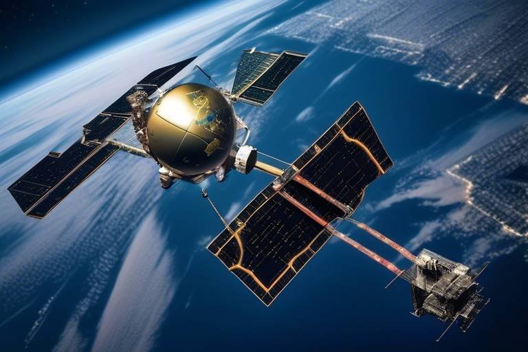
The Role of Communication Satellites
Communication satellites are the unsung heroes of modern command and control operations. They act as the backbone of real-time information exchange, enabling seamless communication between command centers and field units. Imagine being in a high-stakes situation where every second counts; the ability to communicate instantly can mean the difference between success and failure. These satellites facilitate a robust network that transcends geographical barriers, ensuring that messages are delivered promptly and accurately, no matter where the personnel are located.
In the military realm, the importance of communication satellites cannot be overstated. They provide a secure channel for exchanging sensitive information, which is crucial for effective decision-making. For instance, during military operations, commanders rely on these satellites to receive updates about troop movements, enemy positions, and logistical challenges. This real-time data allows them to adapt their strategies on the fly, ensuring that they stay one step ahead of the adversary.
On the civilian side, communication satellites play a pivotal role in various sectors, including disaster management, telecommunications, and even broadcasting. When natural disasters strike, these satellites are often the first line of communication, allowing emergency services to coordinate their efforts efficiently. For example, during hurricanes or earthquakes, communication satellites enable responders to assess damage, deploy resources, and keep the public informed. This capability is invaluable, as it helps save lives and mitigate the impact of such catastrophic events.
Moreover, the technology behind communication satellites has evolved tremendously. Modern satellites are equipped with advanced features such as high-throughput capabilities, which allow for increased data transmission rates. This means that more information can be sent and received simultaneously, enhancing the overall effectiveness of communication systems. Additionally, the advent of low Earth orbit (LEO) satellites is revolutionizing the landscape by providing faster and more reliable connections, especially in remote areas where traditional communication infrastructure may be lacking.
However, with great power comes great responsibility. The reliance on communication satellites also raises concerns regarding security and vulnerability to cyber threats. As our dependence on these systems grows, so does the need for robust security measures to protect sensitive information from potential breaches. Commanders and decision-makers must remain vigilant and proactive in addressing these challenges to ensure that communication remains uninterrupted and secure.
In summary, communication satellites are integral to enhancing command and control operations across both military and civilian applications. Their ability to facilitate real-time information exchange not only improves decision-making and operational efficiency but also plays a vital role in ensuring safety and security in an increasingly complex world. Without these technological marvels, our capacity to respond to crises and execute strategic operations would be severely hampered.
Navigation and Positioning Systems
When we think about navigation and positioning systems, the first thing that often comes to mind is the Global Positioning System (GPS). This incredible technology has revolutionized how we find our way, not just for everyday travelers but also for military strategists and emergency responders. Imagine trying to navigate a dense forest or a bustling city without the precise guidance that GPS offers. It’s like trying to find a needle in a haystack—frustrating and time-consuming!
At its core, GPS utilizes a constellation of satellites orbiting the Earth. These satellites continuously transmit signals that are picked up by GPS receivers. By calculating the time it takes for these signals to reach the receiver, the system can determine the exact location of the device. This process is known as triangulation, and it’s essential for providing accurate positioning data. The implications of this technology are vast, impacting everything from military operations to civilian navigation.
The Global Positioning System is a critical technology that enables precise location tracking, which is crucial for coordinating movements and logistics in both military and civilian applications. In military contexts, GPS enhances mission planning and execution, allowing forces to deploy assets accurately and respond swiftly to dynamic battlefield conditions. For instance, during a military operation, commanders rely on GPS data to ensure that troops are in the right place at the right time, minimizing the risk of errors that could lead to catastrophic consequences.
In the military, the stakes are incredibly high. The ability to pinpoint the location of troops, vehicles, and equipment can mean the difference between success and failure in a mission. With GPS, military forces can:
- Coordinate troop movements with precision.
- Identify and track enemy positions.
- Optimize supply routes for logistics.
This level of accuracy is paramount, especially in complex environments where traditional navigation methods may fall short. The integration of GPS technology into military operations has transformed how forces engage in combat and conduct peacekeeping missions.
But it’s not just the military that benefits from GPS technology. In our daily lives, GPS plays a vital role in various civilian sectors. Think about how you use GPS when:
- Driving to a new location using navigation apps.
- Ordering food delivery that tracks your order in real-time.
- Emergency services locating accident sites swiftly.
These applications demonstrate GPS’s importance in everyday operations and safety. Without GPS, our lives would be considerably more complicated. The technology not only helps us get from point A to point B but also enhances our safety by providing real-time updates and location tracking.
However, it’s essential to recognize that while GPS is a game-changer, it’s not without its challenges. Signal interference, whether from natural obstacles like mountains or urban environments filled with tall buildings, can hinder GPS accuracy. Additionally, there are concerns about cybersecurity. As we become more reliant on satellite systems, the potential for malicious attacks increases, posing a significant risk to both military and civilian operations. Ground infrastructure also plays a role; if the ground stations that communicate with satellites fail, it can disrupt the entire system.
In conclusion, navigation and positioning systems, particularly GPS, are integral to modern command and control operations. They facilitate accurate positioning and enhance operational efficiency across various sectors. As technology continues to evolve, the potential for even more advanced navigation systems is on the horizon, promising to make our world more connected and efficient than ever before.
- What is GPS? GPS stands for Global Positioning System, a satellite-based navigation system that provides location and time information anywhere on Earth.
- How does GPS work? GPS works by triangulating signals from multiple satellites to determine the precise location of a GPS receiver.
- What are the military applications of GPS? GPS is used for troop coordination, enemy tracking, and optimizing logistics in military operations.
- Are there any challenges associated with GPS? Yes, challenges include signal interference, cybersecurity threats, and dependency on ground infrastructure.
Global Positioning System (GPS)
The is nothing short of a technological marvel, revolutionizing how we perceive and interact with the world around us. Imagine being able to pinpoint your exact location anywhere on the planet within mere meters! This incredible capability is not just a luxury for civilians; it is a vital tool for military operations, logistics, and emergency services. GPS has become the backbone of modern navigation, providing precise location tracking that is crucial for coordinating movements and logistics in a variety of contexts.
At its core, GPS operates through a constellation of satellites orbiting the Earth, sending signals to GPS receivers on the ground. These signals are used to calculate the receiver's location based on the time it takes for the signals to travel from the satellites. This process, known as triangulation, allows for real-time updates and accurate positioning. The implications of this technology are vast, impacting everything from personal navigation apps like Google Maps to complex military operations where every second counts.
In military contexts, GPS enhances mission planning and execution in several key ways:
- Precision Targeting: Forces can deploy assets with pinpoint accuracy, ensuring that they hit their intended targets without collateral damage.
- Dynamic Maneuvering: Troops can navigate through challenging terrains and respond swiftly to changing battlefield conditions, adapting their strategies on the fly.
- Logistics Management: Supply chains benefit immensely from GPS, allowing for real-time tracking of resources and personnel, ensuring that they reach their destinations efficiently.
But the influence of GPS extends far beyond the battlefield. In civilian life, GPS is an integral part of our daily routines:
- Transportation: From ride-sharing services like Uber to fleet management in logistics, GPS ensures that vehicles are routed efficiently, saving time and fuel.
- Emergency Services: First responders rely on GPS to navigate to incidents quickly, improving response times and potentially saving lives.
- Recreational Use: Hikers, campers, and travelers use GPS devices to explore new areas safely, enhancing their experiences while minimizing risks.
In summary, the Global Positioning System is a cornerstone of modern navigation technology, providing essential services that enhance both military operations and civilian life. Its ability to deliver precise location data in real-time is a game-changer, enabling better decision-making and improved operational efficiency. As technology continues to evolve, the potential applications of GPS will only expand, further solidifying its importance in our interconnected world.
What is GPS?
GPS stands for Global Positioning System, a satellite-based navigation system that provides location and time information anywhere on Earth.
How does GPS work?
GPS works by using a network of satellites that send signals to GPS receivers, which then calculate their exact location through triangulation.
Is GPS only used for military purposes?
No, while GPS is critical for military operations, it is also widely used in civilian applications such as transportation, emergency services, and personal navigation.
Can GPS signals be interfered with?
Yes, GPS signals can be susceptible to interference, including physical obstructions, atmospheric conditions, and intentional jamming.
Applications in Military Operations
In the realm of military operations, the integration of satellite technology has revolutionized the way armed forces plan, execute, and adapt their strategies on the battlefield. The precise location tracking provided by systems like GPS is not just a luxury; it’s a necessity that enhances operational effectiveness. Imagine a chess game where every piece knows its exact position on the board—this is the kind of advantage GPS offers military units. It allows for improved coordination, ensuring that troops can move with agility and precision.
One of the most significant applications of satellite technology in military operations is mission planning. Commanders can analyze terrain, weather conditions, and enemy positions in real-time, leading to more informed decision-making. For instance, a military unit preparing for an operation can use satellite imagery to assess the landscape, identify potential ambush sites, and determine the best routes for troop movements. This level of foresight can mean the difference between success and failure in critical missions.
Moreover, during actual operations, satellites play a crucial role in logistics and supply chain management. They help track the movement of supplies and reinforcements, ensuring that troops receive the necessary support exactly when they need it. This capability is vital in maintaining the flow of resources, especially in hostile environments where ground transportation might be compromised. The ability to monitor supply routes from above enables commanders to adjust their strategies on the fly, adapting to any unforeseen challenges that may arise.
Another essential aspect is the real-time communication facilitated by satellites. Troops in the field can relay information back to command centers without delay, allowing for immediate adjustments to tactics based on the evolving battlefield scenario. This instantaneous feedback loop is akin to having a coach on the sidelines of a football game, providing insights and strategies as the game unfolds. It empowers military personnel to be dynamic and responsive, rather than reactive, which is crucial in high-stakes situations.
In addition to these operational benefits, satellites also enhance surveillance capabilities. Military forces can monitor enemy movements and gather intelligence from a distance, reducing the risk to personnel on the ground. This intelligence-gathering capability is not limited to visual data; it can also include signals intelligence, which involves intercepting and analyzing communications between enemy forces. By leveraging this information, military planners can anticipate enemy actions and devise counter-strategies, thereby gaining a tactical edge.
To summarize, the applications of satellite technology in military operations are vast and multifaceted. From mission planning and logistics to real-time communication and surveillance, satellites provide the backbone for modern military strategy. As technology continues to evolve, the reliance on satellite systems is only expected to grow, further enhancing the capabilities of armed forces around the globe.
- How do satellites enhance military operations?
Satellites improve military operations through enhanced communication, real-time surveillance, logistics support, and precise navigation. - What is the role of GPS in military operations?
GPS provides accurate positioning data, essential for mission planning, troop movements, and logistics management in military contexts. - Can satellites be used for surveillance?
Yes, surveillance satellites monitor enemy movements and gather intelligence, which is crucial for strategic planning and tactical execution. - What challenges do military satellites face?
Military satellites face challenges such as signal interference, cyber threats, and dependency on ground infrastructure, which can affect their effectiveness.
Civilian Uses of GPS
The Global Positioning System (GPS) has revolutionized the way we navigate our world, and its applications extend far beyond military operations. In our everyday lives, GPS technology has become an indispensable tool, enhancing safety, efficiency, and convenience in various civilian sectors. Imagine driving through a bustling city without the guidance of GPS; it would be like navigating a labyrinth without a map! From personal navigation in our vehicles to sophisticated logistics in supply chains, the impact of GPS is profound.
One of the most common civilian uses of GPS is in transportation. Whether you're using a smartphone app to find the quickest route to your destination or relying on GPS systems embedded in cars, this technology allows drivers to avoid traffic jams and get real-time updates on road conditions. It's like having a personal traffic assistant that knows the best paths and shortcuts!
Additionally, GPS plays a critical role in emergency services. First responders, such as ambulance and fire services, utilize GPS to locate incidents swiftly and efficiently. This capability not only saves time but can also be the difference between life and death. When every second counts, knowing exactly where to go can make all the difference.
In the realm of logistics and supply chain management, GPS technology enables companies to track shipments in real-time, ensuring that goods are delivered on time and efficiently. By integrating GPS data with inventory management systems, businesses can optimize routes and reduce operational costs. This integration is akin to having a bird's-eye view of the entire supply chain, allowing for better planning and execution.
Moreover, GPS is extensively used in recreational activities. Outdoor enthusiasts, such as hikers and campers, rely on GPS devices to navigate trails and explore new territories safely. It provides peace of mind knowing that you can find your way back, no matter how far you wander into the wilderness.
In summary, the civilian applications of GPS are vast and varied, impacting our daily lives in numerous ways. From enhancing transportation efficiency to improving emergency response and transforming logistics, GPS technology is woven into the fabric of modern society. As we continue to innovate and expand the uses of GPS, its importance will only grow, making our world more connected and navigable than ever before.
- What is GPS? GPS, or Global Positioning System, is a satellite-based navigation system that provides location and time information anywhere on Earth.
- How does GPS work? GPS works by using a network of satellites that send signals to GPS receivers, which calculate the user's exact location based on the time it takes for the signals to arrive.
- Are there any limitations to GPS? Yes, GPS can be affected by signal interference, physical obstructions, and reliance on satellite visibility.
- What are some other applications of GPS? Besides navigation, GPS is used in agriculture for precision farming, in aviation for flight navigation, and in mobile devices for location-based services.
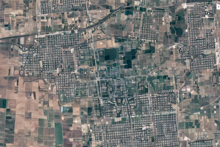
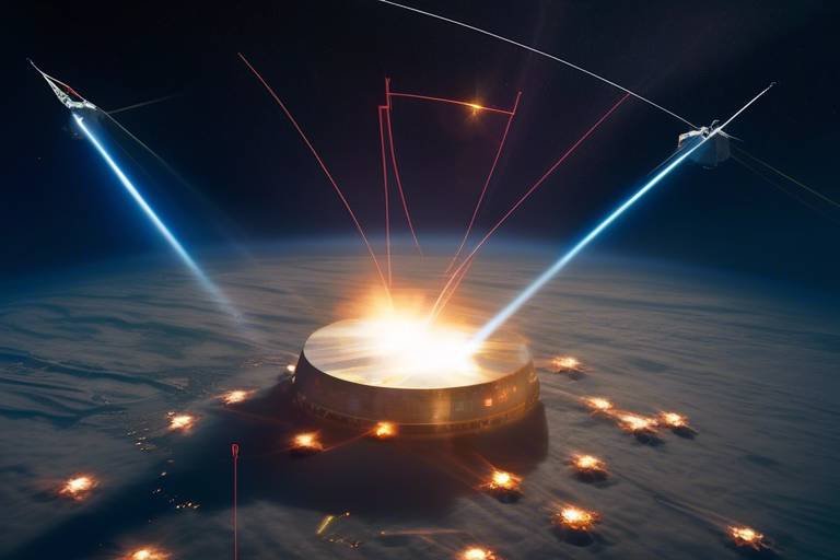
Satellite-Based Surveillance
When you think about surveillance, what often comes to mind? Perhaps images of drones buzzing overhead or CCTV cameras on street corners. However, the reality of modern surveillance is much broader and more sophisticated, thanks to satellite-based surveillance systems. These technological marvels orbiting our planet play a pivotal role in gathering intelligence, monitoring activities, and providing situational awareness in ways that ground-based systems simply cannot match.
Imagine a vast chessboard, where each piece represents a different military unit or civilian operation. The ability to see the entire board is crucial for making strategic moves. Satellite-based surveillance acts like a high-altitude observer, providing a bird's-eye view of the battlefield or urban environment. This capability allows command centers to assess threats, track movements, and make informed decisions based on real-time data. For example, in military operations, surveillance satellites can detect troop movements, artillery placements, or even the construction of enemy fortifications.
Moreover, these satellites are equipped with advanced sensors capable of capturing high-resolution images and collecting various types of data, including infrared and radar. This means they can operate effectively in diverse conditions, whether it's the blinding light of day or the cover of night. To illustrate the importance of satellite-based surveillance, consider the following applications:
- National Security: Governments use satellite surveillance to monitor borders, detect illegal crossings, and gather intelligence on potential threats.
- Disaster Management: In the event of natural disasters, satellites can provide crucial data to assess damage and coordinate relief efforts.
- Environmental Monitoring: Satellites track deforestation, pollution levels, and climate change impacts, offering insights that help in policy-making and conservation efforts.
In essence, satellite-based surveillance is not just about watching; it's about understanding the context of what is happening on the ground. This understanding enhances the ability to respond swiftly and effectively, whether in military operations or civilian applications. The integration of this surveillance data into command systems creates a comprehensive operational picture, allowing for better planning and execution of strategies.
However, it's important to recognize that with great power comes great responsibility. The use of satellite surveillance raises ethical questions about privacy and the potential for misuse. Striking a balance between security needs and individual rights is an ongoing challenge in the age of advanced technology. As we continue to harness the capabilities of satellites, these discussions will be crucial in shaping the future of surveillance and its role in society.
- What are the main benefits of satellite-based surveillance? Satellite-based surveillance provides real-time data, enhances situational awareness, and allows for monitoring in inaccessible areas, making it invaluable for both military and civilian applications.
- How does satellite surveillance differ from traditional surveillance methods? Unlike traditional methods, satellite surveillance offers a broader perspective and can cover vast areas, providing data that is often unattainable through ground-based systems.
- Are there any privacy concerns associated with satellite surveillance? Yes, the use of satellite surveillance raises significant privacy issues, as it can lead to unauthorized monitoring of individuals and activities without consent.
Integration of Satellite Data in Command Systems
In today's fast-paced world, the integration of satellite data into command and control systems is not just a luxury; it's a necessity. Imagine being a commander on the front lines, where every second counts. You need to know exactly what’s happening around you, and that’s where satellites come into play. They act like the eyes in the sky, providing a continuous stream of data that feeds into command centers. This real-time information is crucial for making decisions that can mean the difference between success and failure.
One of the most significant benefits of integrating satellite data is the enhancement of situational awareness. Commanders can access a wealth of information, from troop movements to environmental conditions, all in real-time. This comprehensive view allows for a more informed decision-making process. For instance, if a commander is aware of an impending storm, they can adjust their tactical plans accordingly, ensuring the safety and effectiveness of their units.
Moreover, the integration of satellite data facilitates a collaborative approach to operations. Different branches of the military and even allied forces can share satellite imagery and data, creating a unified operational picture. This is particularly important in joint operations where coordination between various units is essential. By having access to the same data, all parties involved can work together seamlessly, reducing the chances of miscommunication and errors.
To illustrate this point, consider the following table that highlights the key components of satellite data integration in command systems:
| Component | Description | Benefits |
|---|---|---|
| Data Collection | Gathering information from various satellite sources | Provides a comprehensive overview of the operational environment |
| Data Processing | Analyzing and interpreting the collected data | Transforms raw data into actionable intelligence |
| Data Dissemination | Sharing processed data with relevant units | Ensures that all stakeholders have access to critical information |
Additionally, data fusion techniques play a pivotal role in this integration process. By combining information from multiple satellite sources, commanders can create a more accurate and detailed operational picture. This technique not only enhances the quality of the data but also supports strategic planning and tactical execution. For example, if one satellite captures a potential threat while another provides weather data, merging these insights can lead to more effective responses.
Furthermore, real-time access to satellite data empowers commanders to make timely decisions. In the heat of battle, conditions can change rapidly. With integrated satellite systems, commanders can adapt their strategies on the fly, optimizing resource allocation and ensuring that their units are always one step ahead. This flexibility is crucial in modern warfare, where the ability to react quickly can determine the outcome of an operation.
In conclusion, the integration of satellite data into command systems significantly enhances operational effectiveness. By providing commanders with a comprehensive, real-time view of the battlefield, it enables informed decision-making and fosters collaboration among units. As technology continues to evolve, the reliance on satellite data will only grow, making it an indispensable tool for both military and civilian operations.
- What are the main benefits of integrating satellite data into command systems?
The main benefits include enhanced situational awareness, improved decision-making, and better coordination among different units.
- How does data fusion work in satellite systems?
Data fusion combines information from multiple sources to create a unified operational picture, improving the accuracy and utility of the data.
- Can satellite data be used in civilian applications?
Yes, satellite data is widely used in civilian sectors such as transportation, emergency services, and logistics, demonstrating its versatility.
Data Fusion Techniques
In the realm of command and control, play a pivotal role in transforming disparate pieces of information into a coherent and actionable operational picture. Imagine trying to solve a jigsaw puzzle without knowing what the final image looks like; that’s what commanders face without effective data fusion. By integrating data from multiple satellite sources, these techniques allow for a comprehensive understanding of the battlefield or operational environment, enhancing both strategic planning and tactical execution.
At its core, data fusion involves the combination of data from various sensors and sources to produce more reliable and accurate information. This process can be likened to blending different flavors to create a delicious dish; each ingredient adds its unique taste, and together they create something far greater than the sum of their parts. In military operations, for instance, data from reconnaissance satellites, drones, and ground units can be fused to provide a real-time view of enemy movements, terrain conditions, and weather patterns.
The following are some key commonly used in command and control systems:
- Sensor Fusion: This technique combines data from various sensors, such as radar, infrared, and optical systems, to enhance detection and tracking capabilities.
- Information Fusion: This involves merging information from different sources, including satellite imagery and intelligence reports, to create a unified operational picture.
- Decision Fusion: Here, multiple decision-making processes are integrated to improve the overall decision quality, especially in complex scenarios.
To illustrate the effectiveness of these techniques, let’s consider a hypothetical military operation. A commander receives data from several sources: satellite imagery showing troop movements, drone surveillance capturing live video feeds, and ground reports relaying real-time intelligence. By employing data fusion, the commander can synthesize this information to identify potential threats, assess the situation, and make informed decisions swiftly. This capability is crucial in fast-paced environments where the fog of war can obscure clarity.
Moreover, the integration of artificial intelligence (AI) and machine learning (ML) into data fusion processes is revolutionizing how information is analyzed. These technologies can rapidly process vast amounts of data, identify patterns, and predict outcomes more efficiently than human operators alone. This not only speeds up decision-making but also enhances the accuracy of the information being presented to commanders.
However, it’s essential to recognize that while data fusion techniques offer significant advantages, they also come with challenges. Ensuring the quality and reliability of the data being fused is paramount; after all, garbage in means garbage out. Furthermore, the complexity of integrating different data types and formats can lead to potential errors if not managed correctly. Therefore, ongoing training and investment in robust data management systems are critical to maximizing the benefits of data fusion in command and control operations.
In conclusion, data fusion techniques are indispensable in modern command and control frameworks. They not only enhance situational awareness but also empower commanders to make timely, informed decisions that can significantly impact the success of operations. As technology continues to evolve, the integration of advanced data fusion methods will likely become even more refined, paving the way for more effective and efficient command and control capabilities.
Real-Time Decision Making
In the fast-paced world of command and control, is not just a luxury; it’s a necessity. Imagine being a conductor of a symphony, where every musician must play in harmony to create a beautiful piece of music. In a similar vein, commanders rely on timely information from satellites to orchestrate their operations effectively. The ability to access real-time data allows leaders to respond to emerging situations with agility and precision, ensuring that their decisions are informed by the most current intelligence available.
One of the most significant advantages of real-time decision making is the capability to adapt to changing circumstances. For instance, during military operations, conditions on the ground can shift dramatically within minutes. A sudden enemy movement or an unexpected weather change can alter the entire landscape of a mission. By leveraging satellite data, commanders can quickly assess the situation and make informed adjustments to their strategies. This is akin to a chess player who must constantly reevaluate their strategy based on the opponent's moves; the quicker they analyze the board, the better their chances of winning.
Furthermore, real-time decision making enhances resource allocation. In any operation, whether military or civilian, resources are often limited. Commanders must ensure that every asset is utilized optimally. With satellite data providing a comprehensive view of the operational environment, leaders can identify which resources are most needed at any given moment. For example, if a particular unit is under heavy fire, immediate support can be dispatched without delay. This level of responsiveness not only increases the chances of mission success but also reduces the risk to personnel on the ground.
To illustrate the importance of real-time decision making, consider the following
| Scenario | Real-Time Data Impact | Outcome |
|---|---|---|
| Military Engagement | Immediate updates on enemy position | Successful tactical maneuvering |
| Crisis Response | Live tracking of emergency services | Faster response times, saving lives |
| Logistics Management | Real-time inventory levels | Efficient supply chain operations |
This table highlights just a few scenarios where real-time decision making, powered by satellite data, can lead to significantly better outcomes. The ability to act swiftly and intelligently in response to real-time information can be the difference between success and failure in critical situations.
In conclusion, the integration of satellite technology into command and control systems fundamentally transforms the way decisions are made. It empowers leaders to respond to challenges with confidence, ensuring that they remain one step ahead of any potential threats. Just as a skilled conductor ensures that every note is played at the right time, real-time decision making allows commanders to synchronize their actions with the unfolding events on the ground, ultimately leading to more effective operations.
- What is the role of satellites in real-time decision making? Satellites provide essential data that allows commanders to make informed decisions quickly, adapting to dynamic situations as they unfold.
- How does real-time data improve military operations? It enhances situational awareness, allowing for timely adjustments in strategy and resource allocation, which is crucial during military engagements.
- Can real-time decision making be applied outside of military contexts? Absolutely! Civilian sectors such as emergency services and logistics also benefit greatly from real-time data for efficient operations.
Challenges in Satellite Command and Control
While satellites have revolutionized the way we execute command and control operations, they are not without their challenges. These challenges can significantly impact the effectiveness and reliability of satellite systems in both military and civilian contexts. One of the primary issues is signal interference. This can occur due to natural phenomena such as solar flares or man-made obstacles like urban structures and electronic jamming. When signals are disrupted, it can lead to a loss of communication or inaccurate data, which are critical in high-stakes situations.
Another significant challenge is the threat of cyber attacks. As satellites become increasingly integrated into global networks, they also become attractive targets for malicious actors. A successful cyber attack could compromise sensitive data, disrupt operations, or even take control of satellite systems. This is particularly concerning in military operations where the stakes are incredibly high, and any breach could have dire consequences.
Moreover, the dependency on ground infrastructure poses another hurdle. Satellites rely on ground stations for data transmission and command execution. If these ground facilities are damaged or incapacitated, it can severely limit the satellite's operational capabilities. This interdependence highlights the need for robust ground support systems and contingency plans to ensure continuous operation.
Furthermore, the cost of satellite deployment and maintenance can be prohibitive. Developing, launching, and maintaining a satellite network requires significant financial investment, which can strain budgets, especially in military contexts. This financial burden can affect the ability to upgrade technology and maintain operational readiness.
In summary, while satellites are indispensable for effective command and control, they face several challenges that must be addressed. From signal interference and cyber threats to ground infrastructure reliance and high costs, these factors can hinder their performance. Recognizing and mitigating these challenges is crucial for ensuring that satellite systems continue to support effective decision-making and operational efficiency.
- What are the main challenges faced by satellite systems?
Satellite systems face challenges such as signal interference, cyber threats, dependency on ground infrastructure, and high costs of deployment and maintenance.
- How does signal interference affect satellite operations?
Signal interference can disrupt communication and lead to inaccurate data, which is critical in command and control operations.
- Why are satellites vulnerable to cyber attacks?
As satellites become more integrated into global networks, they become attractive targets for cyber threats, which can compromise sensitive data and disrupt operations.
- What role does ground infrastructure play in satellite command and control?
Ground infrastructure is essential for data transmission and command execution; any damage to these facilities can severely limit satellite operations.
Frequently Asked Questions
- What role do communication satellites play in command and control?
Communication satellites are essential for enabling real-time information exchange. They facilitate seamless communication between command centers and field units, which significantly enhances decision-making and operational efficiency in various scenarios, from military operations to disaster response.
- How does GPS enhance navigation in military operations?
The Global Positioning System (GPS) provides precise location tracking, which is crucial for coordinating movements and logistics. In military contexts, it allows forces to deploy assets accurately and respond swiftly to dynamic battlefield conditions, ensuring that units can navigate effectively in complex environments.
- What are the civilian applications of satellite technology?
Beyond military use, satellite technology, particularly GPS, plays a vital role in civilian sectors. It is widely used in transportation, emergency services, and logistics, showcasing its importance in everyday operations and enhancing safety and efficiency in our daily lives.
- How do surveillance satellites contribute to command and control?
Surveillance satellites are crucial for gathering intelligence by monitoring activities on the ground. They allow command centers to assess threats and adjust strategies in real time, providing a comprehensive view of the operational landscape and enabling timely decision-making.
- What are data fusion techniques in satellite command systems?
Data fusion techniques involve combining information from multiple satellite sources to create a unified operational picture. This enhances situational awareness and supports strategic planning and tactical execution across various domains, allowing commanders to make informed decisions based on comprehensive, real-time information.
- What challenges do satellite systems face in command and control?
Despite their advantages, satellite systems encounter several challenges, including signal interference, cyber threats, and dependency on ground infrastructure. These factors can impact their effectiveness in command and control scenarios, making it essential to address these vulnerabilities to maintain operational integrity.