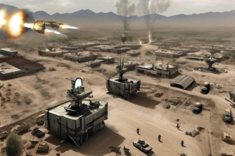
How Satellites Enhance Joint Force Operations
In today’s fast-paced military landscape, the role of satellites cannot be overstated. They act like the nervous system of joint force operations, transmitting vital information that keeps everything running smoothly. Imagine trying to coordinate a massive orchestra without a conductor; chaos would ensue! This is precisely what military operations would resemble without the seamless communication and data sharing provided by satellites. They are the unsung heroes, ensuring that forces can operate effectively across vast distances and diverse terrains. From communication to surveillance, navigation, and data sharing, satellites are at the forefront of enhancing military efficiency and effectiveness.
When it comes to military operations, communication is key. Satellite communication serves as the backbone for maintaining real-time connectivity among joint forces. Think of it as the glue that holds everything together. With troops often stationed in remote locations or engaged in joint missions across different countries, having reliable communication channels is essential for effective command and control. Imagine trying to give orders to a unit on the other side of the world without a direct line of communication—it's a recipe for disaster! Satellite systems ensure that commanders can issue orders, receive feedback, and make critical decisions, all in real time.
Surveillance and reconnaissance are crucial components of modern warfare, and satellites provide advanced capabilities that enhance these functions significantly. They allow military forces to gather critical intelligence on enemy movements, terrain, and environmental conditions. This information is invaluable for strategic decision-making. For instance, if a satellite detects an unusual troop buildup in a specific area, commanders can quickly assess the situation and adjust their strategies accordingly. The ability to monitor the battlefield from above gives joint forces a significant advantage, allowing them to stay one step ahead of the enemy.
One of the most powerful features of satellite technology is real-time data collection. This capability equips joint forces with up-to-date information, enabling them to respond swiftly to emerging threats. In the chaotic environment of warfare, where situations can change in the blink of an eye, having access to real-time data is like having a crystal ball. It ensures operational superiority in dynamic environments, allowing forces to adapt and overcome challenges as they arise. Imagine being able to see the battlefield from above, making informed decisions based on the latest intel—this is the reality that satellites provide.
Imagery intelligence, or IMINT, is another critical aspect of satellite capabilities. The detailed visual information gathered from satellites aids in mission planning and execution while minimizing risks to personnel and assets on the ground. For example, before launching an operation, military planners can analyze satellite images to identify key terrain features, potential obstacles, and enemy positions. This level of detail allows for more informed decision-making and reduces the likelihood of costly mistakes. In essence, satellites provide a bird’s-eye view of the battlefield, enabling forces to plan their moves with precision.
Moreover, signals intelligence, or SIGINT, obtained through satellite systems plays a crucial role in modern warfare. By intercepting and analyzing enemy communications, military forces gain valuable insights into adversary tactics and intentions. This information can be pivotal in shaping operational strategies and ensuring that joint forces maintain the upper hand. It’s like having a spy in the enemy camp, providing critical intel that can turn the tide of battle. The integration of SIGINT capabilities into joint operations enhances situational awareness and helps forces anticipate and counter enemy actions.
The integration of satellite systems with ground-based operations is another game-changer. This synergy streamlines information flow, ensuring that all units are synchronized and can respond effectively to changing battlefield conditions. Imagine a well-oiled machine where every cog works in harmony; this is what integrated operations look like. By connecting satellite data with ground systems, commanders can make informed decisions that take into account the latest developments on the battlefield. This level of coordination is essential for maximizing the effectiveness of joint forces.
In addition to communication and surveillance, satellite navigation systems, such as GPS, are essential for accurate positioning of joint forces. These systems enable precise coordination of movements, enhancing operational effectiveness during missions. Picture a chess game where every piece knows exactly where to move; that’s the kind of precision satellite navigation offers. Enhanced precision in operations reduces the risk of friendly fire incidents and allows military units to execute maneuvers with greater accuracy. This capability is especially critical in complex environments where every second counts.
With enhanced precision comes increased safety and efficiency. The ability to accurately track troop movements and coordinate actions means fewer mistakes on the battlefield. Imagine the confidence that comes with knowing that every unit is exactly where it needs to be, executing their roles flawlessly. This level of operational precision is essential for achieving mission objectives and maintaining the safety of personnel.
Furthermore, satellite systems play a vital role in logistics and supply chain management. They ensure the timely delivery of resources and support to troops in the field, thereby sustaining operational readiness. In military operations, where every minute counts, having a reliable logistics system is crucial. Satellites help track shipments, monitor supply levels, and coordinate resupply missions, ensuring that troops have what they need when they need it. It’s like having a personal assistant who keeps everything organized and running smoothly, allowing commanders to focus on the mission at hand.
Looking ahead, emerging trends in satellite technology, such as miniaturization and increased connectivity, promise to further enhance joint force operations. As satellite technology evolves, we can expect to see more agile and responsive systems that can adapt to the challenges of modern warfare. These advancements will likely lead to even greater efficiency and effectiveness in joint operations, enabling forces to stay ahead of the curve. The future of military operations is bright, and satellites will continue to play a pivotal role in shaping that future.
- How do satellites improve military communication?
Satellites provide real-time communication channels that enable commanders to issue orders and receive feedback from troops stationed in remote locations. - What is the role of satellites in surveillance?
Satellites gather critical intelligence on enemy movements and terrain, enhancing strategic decision-making and operational planning. - How does satellite navigation enhance operational effectiveness?
Satellite navigation systems, like GPS, allow for accurate positioning and coordination of military units, reducing the risk of friendly fire and improving mission execution. - What future trends are expected in satellite technology?
Emerging trends include miniaturization and increased connectivity, which will enhance the agility and responsiveness of joint force operations.
Importance of Satellite Communication
Satellite communication is a game-changer in the realm of military operations. Imagine trying to coordinate a complex dance routine with partners spread across a vast stage; without a reliable communication system, it would be chaos. Similarly, joint forces rely on satellites to maintain real-time connectivity, ensuring that commands and updates flow seamlessly across vast distances and diverse terrains. This connectivity is not just about talking; it's about creating a robust network that enhances command and control, allowing military leaders to make informed decisions quickly.
During military operations, the ability to communicate effectively can mean the difference between success and failure. Satellite communication systems enable various forms of communication, including voice, data, and video transmission. These systems are crucial for:
- Real-time updates: Troops in the field receive immediate information about changing conditions, enemy movements, or logistical needs.
- Coordination of joint forces: Different branches of the military can operate cohesively, sharing vital information that enhances operational efficiency.
- Remote operations: Satellite communication allows for command and control over distant operations, where traditional communication methods may falter.
Moreover, the significance of satellite communication extends beyond just military operations. It plays a critical role in humanitarian missions, disaster response, and peacekeeping efforts. When natural disasters strike, for instance, ground communication infrastructure often gets damaged, making satellite communication invaluable for coordinating rescue and relief efforts. In these scenarios, satellite systems become lifelines, enabling organizations to connect and share vital information even in the most challenging environments.
In summary, satellite communication is not merely a support tool; it is a fundamental component of modern military strategy. Its ability to provide uninterrupted, reliable communication across various platforms ensures that joint forces can operate effectively, adapt swiftly to changing situations, and maintain a strategic advantage over adversaries. As technology continues to evolve, we can only expect satellite communication to become even more integral to military operations, paving the way for a future where connectivity is seamless and instantaneous.
Surveillance and Reconnaissance Capabilities
In the realm of modern warfare, surveillance and reconnaissance capabilities provided by satellites are nothing short of revolutionary. Imagine having an eagle-eye view of the battlefield, capable of seeing every movement, every change in terrain, and every potential threat. This is the power that satellites bring to joint military operations. They enable forces to gather critical intelligence that is essential for making informed decisions. With the ability to monitor enemy movements and assess environmental conditions, military strategists can adapt their tactics in real-time, enhancing their operational effectiveness.
One of the standout features of satellite surveillance is its ability to collect real-time data. This real-time intelligence is crucial for joint forces, as it allows them to respond swiftly to emerging threats. For instance, if an enemy troop movement is detected, commanders can immediately adjust their strategies, deploy reinforcements, or even launch pre-emptive strikes. This capability ensures that military operations are not only reactive but also proactive, allowing forces to maintain the upper hand in dynamic environments.
Another vital aspect of satellite surveillance is imagery intelligence. Satellites equipped with high-resolution cameras can capture detailed images of the battlefield. This visual information is invaluable for mission planning and execution. By analyzing satellite imagery, military planners can identify key terrain features, assess enemy fortifications, and determine optimal routes for troop movements. This kind of intelligence minimizes risks to personnel and assets on the ground, as commanders can plan their operations with a clearer understanding of the battlefield landscape.
In addition to imagery, satellites also play a crucial role in gathering signals intelligence. By intercepting enemy communications, satellite systems provide insights into adversary tactics and intentions. This information can be a game-changer, allowing military forces to anticipate enemy actions and adjust their strategies accordingly. For example, if signals intelligence reveals a planned attack by enemy forces, joint forces can prepare defensive measures or counter-offensive operations, thereby turning the tide in their favor.
To illustrate the significance of these capabilities, consider the following table that highlights the key advantages of satellite surveillance and reconnaissance:
| Capability | Advantage |
|---|---|
| Real-Time Data Collection | Allows for immediate response to threats |
| Imagery Intelligence | Provides detailed visual information for planning |
| Signals Intelligence | Offers insights into enemy tactics and intentions |
In conclusion, the integration of satellite technology into military operations significantly enhances the surveillance and reconnaissance capabilities of joint forces. By providing real-time data, high-resolution imagery, and critical signals intelligence, satellites empower military leaders to make informed decisions that can ultimately determine the success of their missions. As technology continues to evolve, the role of satellites in warfare will only become more pronounced, making them indispensable assets on the modern battlefield.
- How do satellites improve military communication?
Satellites enable real-time connectivity among joint forces, ensuring effective command and control across vast distances. - What types of intelligence do satellites gather?
Satellites gather imagery intelligence, signals intelligence, and real-time data to enhance situational awareness. - How does satellite navigation contribute to military operations?
Satellite navigation systems like GPS allow for precise positioning and coordination of movements, increasing operational effectiveness. - What are the future trends in satellite technology?
Emerging trends include miniaturization and increased connectivity, which will enhance agility and responsiveness in joint force operations.
Real-Time Data Collection
In today's fast-paced military landscape, has become an absolute game changer for joint forces. Imagine being in a high-stakes chess match where every move counts and the board is constantly changing. That's what modern warfare feels like, and satellites are the eyes in the sky that provide crucial insights. With the ability to gather and transmit data instantaneously, satellites empower military commanders to make informed decisions on the fly, enhancing the overall effectiveness of operations.
When we talk about real-time data collection, we’re not just referring to the raw numbers or figures; we're talking about a comprehensive flow of information that includes everything from troop movements to environmental conditions. This data can be visualized and analyzed in real-time, allowing for immediate adjustments to strategies and tactics. For instance, if a satellite detects an unexpected enemy formation, commanders can quickly adapt their plans, redirecting forces to counter the threat before it escalates.
One of the most remarkable features of satellite data collection is its ability to integrate with various intelligence systems. This integration creates a multi-layered approach to surveillance, where data from different sources can be cross-referenced for greater accuracy. For example, if satellite imagery shows a build-up of enemy troops, signals intelligence can confirm their communications, providing a clearer picture of the adversary's intentions. This synergy not only enhances situational awareness but also minimizes the risk of miscalculations that could lead to catastrophic outcomes.
Furthermore, the speed at which this data is processed is nothing short of revolutionary. With advancements in artificial intelligence and machine learning, satellite systems can now analyze vast amounts of data in seconds, identifying patterns and anomalies that human analysts might miss. This capability is like having a supercharged brain that can sift through mountains of information, pinpointing critical insights that can change the course of an operation.
To illustrate the impact of real-time data collection, consider the following table that outlines key advantages:
| Advantage | Description |
|---|---|
| Speed | Instantaneous data transmission allows for immediate decision-making. |
| Accuracy | Real-time updates reduce the chances of miscalculations in strategic planning. |
| Integration | Combines data from multiple sources for a comprehensive operational picture. |
| Adaptability | Enables swift adjustments to tactics based on emerging threats. |
In conclusion, real-time data collection through satellite technology is not just an enhancement; it's a necessity for modern joint force operations. It transforms the battlefield into a dynamic environment where information flows freely and decisions can be made with confidence. As we look to the future, the integration of even more advanced technologies will only serve to amplify these capabilities, ensuring that our forces remain one step ahead of the competition.
- What is real-time data collection? Real-time data collection refers to the process of gathering and analyzing data instantly, allowing for immediate decision-making in military operations.
- How do satellites contribute to military operations? Satellites enhance military operations by providing critical communication, surveillance, navigation, and data sharing capabilities.
- What technologies are involved in real-time data analysis? Technologies such as artificial intelligence and machine learning are increasingly used to analyze satellite data quickly and accurately.
- Why is real-time data collection important in warfare? It allows for swift responses to changing battlefield conditions, improving situational awareness and operational effectiveness.
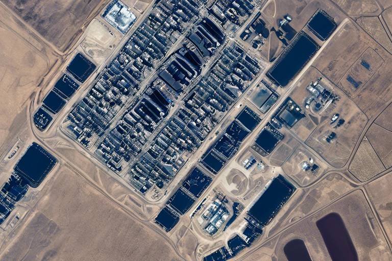
Imagery Intelligence
(IMINT) is an essential component of modern military operations, providing forces with crucial visual insights into the battlefield. Imagine being able to see the enemy's movements from miles away, like having a bird's-eye view of the chessboard while your opponent can only see their own pieces. This capability not only enhances situational awareness but also significantly minimizes risks to personnel on the ground.
Satellites equipped with advanced imaging sensors capture high-resolution images that reveal detailed information about enemy positions, infrastructure, and terrain. These images can be analyzed in real-time, allowing commanders to make informed decisions quickly. For example, if a satellite detects an unusual concentration of troop activity in a specific area, military leaders can respond with targeted strategies, deploying forces where they are most needed.
The power of imagery intelligence lies in its ability to provide a comprehensive understanding of the operational environment. Here are some key aspects:
- Detailed Reconnaissance: IMINT offers a level of detail that is often unattainable through other means. This includes identifying potential threats and understanding the layout of enemy defenses.
- Mission Planning: With accurate imagery, planners can devise strategies that leverage the terrain and enemy weaknesses, ensuring a higher probability of success.
- Risk Mitigation: By utilizing imagery intelligence, military operations can be conducted with a greater degree of safety, as commanders can visualize potential hazards before troops are deployed.
Moreover, the integration of imagery intelligence with other intelligence sources, such as signals intelligence (SIGINT), creates a more robust understanding of the battlefield. This fusion of data allows for a multi-faceted approach to intelligence gathering, where visual data complements intercepts of enemy communications, providing a clearer picture of adversary intentions and capabilities.
As technology advances, the resolution and capabilities of satellite imagery continue to improve. Newer satellites are equipped with hyperspectral sensors, which can detect a broader range of wavelengths, allowing for more detailed analysis of materials and conditions on the ground. This technology can even distinguish between different types of vehicles or detect changes in vegetation, which may indicate enemy activity.
In summary, imagery intelligence serves as a vital tool in enhancing the effectiveness of joint military operations. By leveraging high-resolution satellite images, military forces can gain crucial insights that inform decision-making, streamline mission planning, and ultimately, increase operational success while ensuring the safety of personnel on the ground.
- What is imagery intelligence? Imagery intelligence refers to the collection and analysis of visual information from satellite or aerial imagery to support military operations.
- How does imagery intelligence improve military operations? It enhances situational awareness, aids in mission planning, and helps mitigate risks by providing detailed reconnaissance of enemy positions and terrain.
- What types of sensors are used in satellite imagery? Satellites use various sensors, including optical, infrared, and hyperspectral sensors, to capture different types of data about the Earth’s surface.
- How is imagery intelligence integrated with other intelligence types? Imagery intelligence is often combined with signals intelligence and other data sources to create a comprehensive understanding of the battlefield.
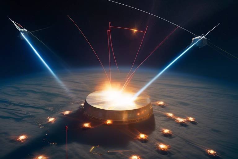
Signals Intelligence
Signals intelligence (SIGINT) is a game changer in the realm of military operations, acting as the unseen hand that guides decision-making on the battlefield. Imagine having the ability to eavesdrop on enemy communications—this is exactly what SIGINT allows joint forces to do. By intercepting and analyzing electronic signals, military units can gain invaluable insights into the tactics, intentions, and capabilities of adversaries. This intelligence is not just about listening in; it’s about understanding the bigger picture. With the right signals intelligence, commanders can anticipate enemy moves, identify weaknesses, and exploit opportunities that might otherwise go unnoticed.
The sophistication of modern satellite systems has elevated the effectiveness of SIGINT to unprecedented levels. These satellites are equipped with advanced sensors capable of capturing a wide spectrum of signals, from radio transmissions to satellite communications. This capability allows for a comprehensive analysis of the electromagnetic spectrum, which can be crucial in shaping operational strategies. For instance, by monitoring enemy communications, forces can detect patterns and predict potential actions, giving them a strategic edge.
Furthermore, the integration of SIGINT with other intelligence disciplines amplifies its effectiveness. When combined with imagery intelligence (IMINT) and human intelligence (HUMINT), the insights gained from signals intelligence can lead to a more holistic understanding of the battlefield. This multi-faceted approach allows military leaders to make informed decisions quickly, adapting to the fluid dynamics of modern warfare.
In terms of practical application, consider a scenario where joint forces are preparing for an operation in a hostile environment. By utilizing SIGINT, they can:
- Monitor enemy communications for real-time updates on troop movements.
- Identify key leaders and their communication patterns, allowing for targeted operations.
- Detect any electronic warfare tactics being employed by the enemy, enabling countermeasures.
Ultimately, signals intelligence serves as a force multiplier. It enhances situational awareness, reduces uncertainty, and increases the likelihood of mission success. As technology continues to evolve, the role of SIGINT in joint force operations will only become more critical, paving the way for innovations that could redefine military strategy in the years to come.
Q: What is signals intelligence?
A: Signals intelligence (SIGINT) involves the interception and analysis of electronic signals, such as communications and radar emissions, to gather information about enemy activities and intentions.
Q: How does SIGINT enhance military operations?
A: SIGINT enhances military operations by providing timely and actionable intelligence, allowing forces to anticipate enemy actions, coordinate responses, and improve overall situational awareness.
Q: What technologies are involved in SIGINT?
A: Technologies involved in SIGINT include advanced satellite systems equipped with sensors, ground-based interception stations, and sophisticated data analysis tools that help decode and interpret signals.
Q: Can SIGINT be used in peacetime?
A: Yes, SIGINT can be used in peacetime for various purposes, including monitoring potential threats, gathering intelligence on foreign military capabilities, and supporting diplomatic efforts.
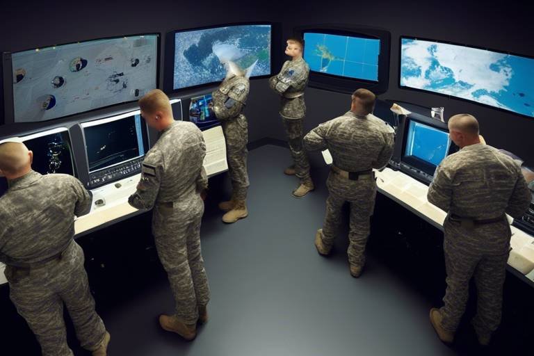
Integration with Ground Systems
In the ever-evolving landscape of military operations, the integration of satellite systems with ground-based operations is not just a luxury—it's a necessity. Imagine a finely tuned orchestra where every instrument plays in harmony; that's what effective integration looks like in the context of joint force operations. When satellite data seamlessly flows into ground systems, it creates a symphony of information that enhances decision-making and operational effectiveness.
One of the most significant advantages of this integration is the ability to maintain situational awareness across diverse units. With real-time satellite data, commanders can visualize the battlefield as if they were right there, on the front lines. This capability allows for timely and informed decisions, which is crucial when every second counts. For instance, if a unit encounters unexpected enemy activity, the integration allows for rapid dissemination of this information, enabling other units to adjust their strategies accordingly.
Furthermore, the operational tempo of modern warfare demands speed and accuracy. The integration of satellite systems with ground operations facilitates the synchronization of movements and actions among various military branches. By utilizing advanced software and communication tools, personnel on the ground can access satellite imagery and data directly, ensuring that they are always operating with the most current information available. This capability is akin to having a GPS guiding you through a complex maze, ensuring you take the most efficient route while avoiding potential hazards.
Additionally, this integration enhances the overall logistical framework of military operations. With satellite systems monitoring supply routes and resource availability, ground forces can make informed decisions about logistics and resupply missions. This ensures that troops receive the necessary support when they need it most, maintaining operational readiness. For example, if a supply convoy is delayed due to unforeseen circumstances, satellite data can help reroute resources quickly, minimizing downtime and ensuring that troops remain equipped and capable.
In conclusion, the integration of satellite systems with ground operations is a game-changer in joint force operations. It not only enhances situational awareness and decision-making but also streamlines logistics and resource management. As technology continues to advance, this integration will only become more sophisticated, further empowering military forces to respond swiftly and effectively to the challenges of modern warfare.
- What is the primary benefit of integrating satellite systems with ground operations?
The primary benefit is enhanced situational awareness, allowing for informed decision-making and improved coordination among various military units.
- How does satellite integration affect logistics in military operations?
It streamlines logistics by providing real-time data on supply routes and resource availability, ensuring timely support to troops in the field.
- Can satellite systems improve response times during operations?
Yes, real-time data from satellites allows for quicker dissemination of critical information, enabling faster responses to emerging threats.
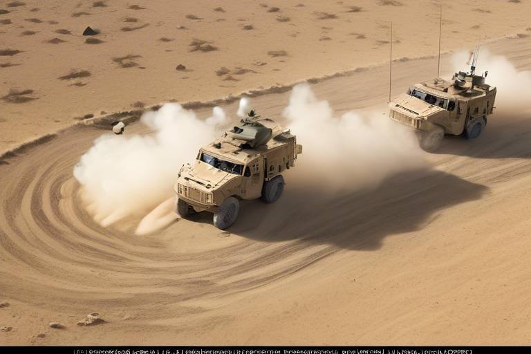
Navigation and Positioning Systems
In the realm of modern military operations, have become indispensable. These systems, primarily powered by satellites, enable joint forces to achieve pinpoint accuracy in their movements, ensuring that every maneuver is executed with surgical precision. Imagine trying to navigate a complex maze without a map; that’s what military operations would be like without satellite navigation. The Global Positioning System (GPS) and other satellite-based navigation systems have transformed how military units operate, allowing them to coordinate their actions seamlessly across vast and often challenging terrains.
One of the most significant advantages of satellite navigation is its ability to provide real-time positioning data. This capability is crucial for joint forces, as it allows them to maintain situational awareness and adapt to rapidly changing battlefield conditions. For instance, during a mission, if one unit encounters unexpected resistance, they can quickly relay their position and receive immediate assistance from nearby forces. This kind of responsiveness can turn the tide of battle and is made possible through the integration of satellite technology.
Moreover, the enhanced precision offered by these systems reduces the risk of friendly fire incidents, which can have devastating consequences. By ensuring that every unit knows the exact location of both allies and adversaries, military planners can devise strategies that minimize the likelihood of miscommunication and errors. This precision is not just about saving lives; it's also about maximizing the effectiveness of every operation. In essence, satellite navigation acts as the backbone of coordinated military efforts, facilitating a level of synchronization that was previously unattainable.
Another critical aspect of satellite navigation is its support for logistics and supply chains. Imagine a scenario where troops are stationed in a remote area, and they require urgent supplies. Satellite systems enable logistics teams to track the precise location of these forces, ensuring that the necessary resources are delivered promptly. This capability is vital for maintaining operational readiness and ensuring that troops have what they need when they need it. Without such systems in place, the risk of delays and miscommunication increases, potentially jeopardizing the success of missions.
As we look toward the future, emerging technologies in satellite navigation promise to further enhance joint operations. Innovations such as miniaturization and increased connectivity will allow for more agile and responsive military strategies. For example, the development of small satellite constellations could provide enhanced coverage and redundancy, ensuring that forces remain connected even in the most challenging environments. This evolution in technology is akin to upgrading from a flip phone to a smartphone; the capabilities expand exponentially, offering new possibilities for operational success.
In summary, the significance of navigation and positioning systems in joint military operations cannot be overstated. They provide the framework for accurate movement, support logistical efforts, and enhance overall mission effectiveness. As technology continues to advance, we can expect these systems to evolve, further revolutionizing the way joint forces operate in the field.
- What are the primary satellite navigation systems used by military forces?
Military forces primarily utilize GPS, GLONASS, Galileo, and BeiDou for navigation. - How does satellite navigation improve operational efficiency?
It provides real-time location data, reducing response times and enhancing coordination among units. - Can satellite navigation systems work in adverse conditions?
Yes, modern systems are designed to function in various environmental conditions, although performance may vary based on factors like terrain and weather. - What future advancements can we expect in satellite navigation?
We can anticipate improvements in accuracy, miniaturization of devices, and increased connectivity, which will enhance military operations.
Enhanced Precision in Operations
When it comes to military operations, precision is not just a luxury; it's a necessity. Imagine a well-orchestrated symphony where each instrument plays in perfect harmony. That's the kind of precision satellite navigation systems like GPS provide to joint forces. With satellites orbiting high above us, they offer a bird's-eye view of the battlefield, enabling troops to navigate complex terrains with pinpoint accuracy. This capability is crucial, especially when you're dealing with the chaos of modern warfare, where split-second decisions can mean the difference between success and failure.
One of the most significant advantages of satellite navigation is its ability to enhance coordination among various military units. Think of it as a highly skilled conductor leading an orchestra. Each unit, whether it's ground troops, air support, or naval forces, can communicate their positions and movements in real-time. This synchronization not only facilitates coordinated attacks but also minimizes the risk of friendly fire incidents, which can be devastating. The ability to track each unit's location ensures that everyone is on the same page, allowing for a seamless flow of operations.
Moreover, the integration of satellite systems into military operations allows for dynamic mission planning. Commanders can adjust strategies on the fly based on real-time data, making tactical decisions that are informed by the most current information available. This agility is essential in unpredictable combat environments, where the landscape can change in an instant. For instance, if a unit encounters unexpected resistance, commanders can quickly reroute reinforcements or adjust supply lines to ensure that troops have the support they need when they need it.
The precision provided by satellite navigation also extends to logistical operations. In many cases, the success of a mission hinges on the timely delivery of supplies and equipment. Satellite systems help track shipments, ensuring that resources are delivered to the right place at the right time. This level of accuracy not only keeps troops well-equipped but also boosts their morale, knowing that they have the support they need to carry out their missions effectively.
As we look to the future, the evolution of satellite technology promises even greater enhancements in operational precision. With advancements like miniaturization and increased connectivity, future satellites will be able to provide even more detailed and accurate data, further refining the capabilities of joint forces. In essence, the integration of satellite navigation into military operations is akin to adding a high-definition lens to a camera; it sharpens the focus and brings clarity to the complex picture of warfare.
- How do satellites improve communication in military operations? Satellites facilitate real-time communication, allowing for effective command and control across vast distances and varied terrains.
- What role do satellites play in surveillance? Satellites provide advanced surveillance capabilities that help gather critical intelligence on enemy movements and environmental conditions.
- How does satellite navigation reduce friendly fire incidents? By providing precise location data, satellite navigation ensures that military units can coordinate their movements accurately, minimizing the chances of accidental engagements.
- What is the future of satellite technology in military operations? Future trends include miniaturization and increased connectivity, which will enhance the agility and responsiveness of joint force operations.
Support for Logistics and Supply Chains
In the complex world of military operations, logistics and supply chains serve as the backbone that supports every mission. Imagine a well-oiled machine where every cog, every gear, and every bolt work in harmony to ensure that the operation runs smoothly. This is precisely what satellite systems do for joint forces. By leveraging satellite technology, military logistics can achieve unprecedented levels of efficiency and effectiveness.
One of the most significant advantages of satellite systems is their ability to provide real-time data on supply chain movements. With this technology, commanders can track the location of supplies, equipment, and personnel, ensuring that everything is where it needs to be at the right time. Think of it as having a bird's-eye view of the battlefield, allowing for immediate adjustments and decisions. This capability not only speeds up the delivery of essential resources but also minimizes the risk of delays that could jeopardize mission success.
Moreover, satellite communication enables seamless coordination between different units. When troops are deployed in various locations, maintaining a constant flow of information is vital. Satellites facilitate this by providing a reliable communication link that transcends geographical barriers. For instance, if a supply truck encounters unexpected obstacles, the information can be relayed instantly to command centers, allowing for quick rerouting or additional support. This level of responsiveness is crucial in high-stakes situations.
Additionally, satellites play a critical role in inventory management. By utilizing satellite technology, military forces can monitor their supplies more effectively, ensuring that they maintain optimal stock levels. This proactive approach helps prevent shortages and overstock situations, which can drain resources and lead to waste. With accurate data at their fingertips, logistics teams can make informed decisions about when to reorder supplies and how to allocate resources efficiently.
To illustrate the impact of satellite systems on logistics, consider the following table:
| Benefit | Description |
|---|---|
| Real-Time Tracking | Allows for immediate updates on supply locations and conditions. |
| Improved Communication | Ensures constant connectivity between units, enhancing coordination. |
| Efficient Inventory Management | Provides accurate data for better stock control and resource allocation. |
| Rapid Response Capability | Facilitates quick adjustments to supply routes and strategies as needed. |
In conclusion, the integration of satellite technology into military logistics and supply chains is not just a luxury; it is a necessity. As warfare evolves and becomes more complex, the ability to adapt and respond swiftly to changing conditions is paramount. Satellites provide the tools needed to ensure that joint forces can maintain operational readiness and effectiveness, ultimately leading to mission success.
- How do satellites improve military logistics? Satellites provide real-time tracking, improve communication, and enhance inventory management, allowing for more efficient and responsive logistics operations.
- What role does satellite communication play in joint operations? Satellite communication ensures that all units remain connected, facilitating coordinated efforts and timely decision-making across diverse terrains.
- Can satellite technology help prevent supply shortages? Yes, by offering accurate data on supply levels and movements, satellite systems enable proactive inventory management to prevent shortages.
Future Trends in Satellite Technology
The landscape of satellite technology is evolving at a breathtaking pace, and it's not just about sending signals into space anymore. As we look toward the future, we can expect **exciting advancements** that will revolutionize joint force operations. One of the most significant trends is the **miniaturization of satellites**. Smaller, more efficient satellites, often referred to as CubeSats, are becoming increasingly popular. These compact devices can be launched in swarms, providing extensive coverage and real-time data collection without the hefty price tag of traditional satellites.
Moreover, the rise of **mega-constellations**—groups of hundreds or even thousands of satellites working together—promises to enhance global connectivity. Companies like SpaceX with their Starlink project are leading the charge, aiming to provide high-speed internet access from space. For military operations, this means that troops can maintain seamless communication, regardless of their location on the battlefield. Imagine a world where soldiers can access critical data and communicate with command centers in real-time, regardless of whether they’re in a dense forest or a remote desert.
Another trend to keep an eye on is the increasing **integration of artificial intelligence (AI)** in satellite operations. AI can analyze vast amounts of data collected from satellites, identifying patterns and providing actionable insights much faster than human analysts. This capability can significantly enhance **strategic decision-making**. For instance, AI-driven analytics can help predict enemy movements or assess environmental conditions, allowing joint forces to adapt their strategies swiftly.
Furthermore, advancements in **satellite propulsion technologies** are paving the way for more agile and responsive systems. New propulsion methods, such as electric or ion propulsion, allow satellites to maneuver more efficiently in orbit. This agility can be crucial during military operations, enabling satellites to reposition themselves to gather intelligence or maintain communication links as needed.
To illustrate these trends, consider the following table that outlines some key advancements in satellite technology:
| Trend | Description | Impact on Joint Force Operations |
|---|---|---|
| Miniaturization | Development of smaller, cost-effective satellites. | Increased coverage and data collection capabilities. |
| Mega-constellations | Large networks of satellites providing global connectivity. | Enhanced communication and real-time data access. |
| AI Integration | Use of artificial intelligence for data analysis. | Faster decision-making and predictive capabilities. |
| Advanced Propulsion | New propulsion technologies for satellite maneuverability. | Improved responsiveness to operational needs. |
As we embrace these trends, the potential for **enhanced operational effectiveness** becomes clear. The future of satellite technology is not just about better communication; it’s about creating a more interconnected and responsive military force. With these advancements, joint forces will be better equipped to face the challenges of modern warfare, adapting to the ever-changing dynamics of conflict with agility and precision.
Q: How will miniaturization affect satellite launches?
A: Miniaturization allows for more satellites to be launched simultaneously, reducing costs and increasing the frequency of launches, which enhances coverage.
Q: What role does AI play in satellite operations?
A: AI helps in analyzing data quickly and efficiently, providing military leaders with valuable insights for strategic decision-making.
Q: Can mega-constellations improve communication in remote areas?
A: Yes, mega-constellations can provide internet and communication services to remote regions, ensuring that troops can stay connected anywhere.
Q: What are the implications of advanced propulsion technologies?
A: Advanced propulsion allows satellites to adjust their orbits more efficiently, which can be crucial for gathering intelligence or maintaining communication links during military operations.
Frequently Asked Questions
- How do satellites enhance communication in joint military operations?
Satellites play a crucial role in maintaining real-time communication among joint forces. They enable effective command and control across vast distances and diverse terrains, ensuring that all units stay connected and informed during military operations.
- What types of intelligence can satellites provide?
Satellites offer various types of intelligence, including imagery intelligence, which provides detailed visual information for mission planning, and signals intelligence, which helps intercept enemy communications. This information is vital for strategic decision-making and operational success.
- How does satellite navigation improve military operations?
Satellite navigation systems, like GPS, are essential for accurate positioning of joint forces. They enhance the precision of operations, allowing military units to coordinate movements effectively and reduce the risk of friendly fire incidents.
- What role do satellites play in logistics and supply chain management?
Satellites are vital in managing logistics and supply chains by ensuring timely delivery of resources to troops in the field. This capability helps maintain operational readiness and supports sustained military efforts during missions.
- What are the future trends in satellite technology?
Emerging trends in satellite technology include miniaturization and increased connectivity. These advancements promise to further enhance joint force operations, making them more agile and responsive to the challenges of modern warfare.
- Can satellites provide real-time data during operations?
Absolutely! Satellites are equipped to collect real-time data, which is crucial for joint forces to respond swiftly to emerging threats. This up-to-date information ensures operational superiority in dynamic environments.
- How do satellites integrate with ground systems?
The integration of satellite systems with ground-based operations streamlines the flow of information. This ensures that all units are synchronized and can effectively respond to changing battlefield conditions, enhancing overall mission effectiveness.