The Role of Satellites in Disaster Response for Military
In today's world, where natural disasters can strike unexpectedly and wreak havoc in mere moments, the role of satellites in military disaster response efforts has become increasingly vital. Imagine a scenario where a devastating earthquake hits a populated area. The chaos that ensues can be overwhelming, but thanks to advanced satellite technology, military forces are equipped with the necessary tools to respond swiftly and effectively. Satellites provide critical data and communication capabilities that not only enhance operational efficiency but also save lives and resources. In this article, we will delve into how satellites are transforming disaster response for military operations, showcasing their importance in various aspects of crisis management.
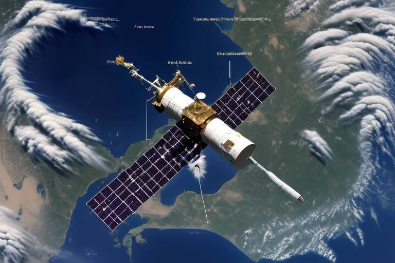
Reliable satellite communication systems are the backbone of military operations during disasters. When traditional communication networks fail due to infrastructure damage, satellites ensure that military personnel can maintain seamless coordination and receive real-time updates. This capability is crucial for effective response strategies, especially in challenging terrains and adverse weather conditions. For instance, during a hurricane, military units can communicate vital information about evacuation routes, resource needs, and safety measures via satellite, ensuring that every decision made is informed and timely.
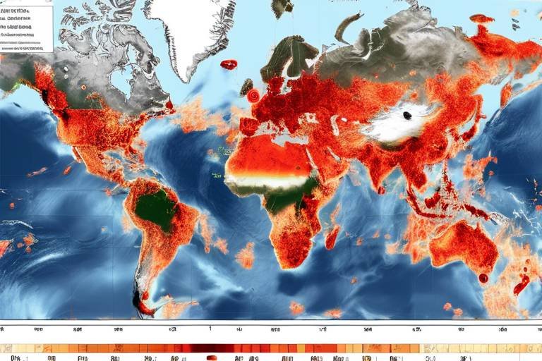
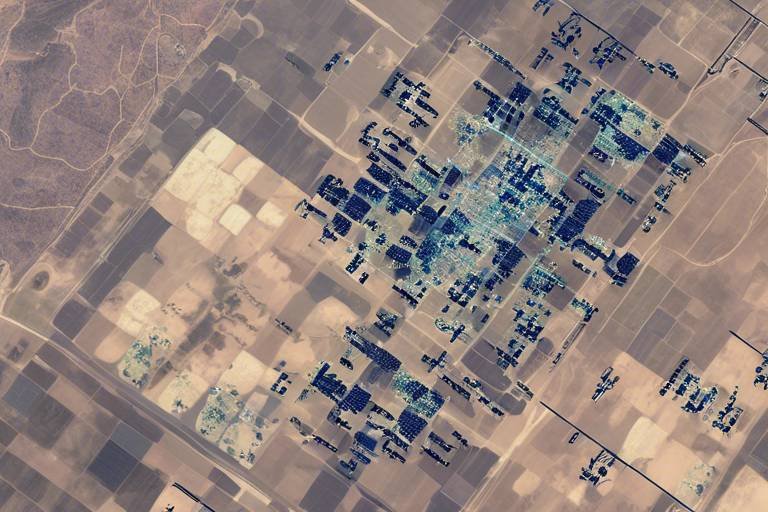
Another significant aspect of satellite technology in disaster response is remote sensing. This technology allows military personnel to gather vital information about disaster-affected areas, which is essential for assessing damage, identifying hazards, and prioritizing rescue operations. By utilizing advanced imaging techniques, military forces can visualize the extent of destruction and strategize their relief efforts accordingly. For example, when a flood occurs, remote sensing can provide critical data on water levels, helping teams to determine which areas are most affected and where immediate assistance is needed.
Different types of remote sensors play unique roles in disaster response, offering diverse data that aids military decision-making and operational planning. These include:
- Optical Sensors: These sensors capture high-resolution images of affected areas, providing detailed visual information that assists military teams in evaluating damage and planning effective response strategies.
- Radar Sensors: Unlike optical sensors, radar sensors can penetrate cloud cover and operate in any weather condition, offering crucial data on terrain and structures.
- Thermal Imaging: This technology detects heat signatures, enabling military units to locate survivors in rubble or dense vegetation, significantly enhancing search and rescue efforts during disaster scenarios.
Geospatial analysis leverages satellite data to create detailed maps and models, facilitating informed decision-making for military leaders in disaster response and recovery efforts. By mapping disaster zones accurately, military forces can identify safe routes for deployment and areas in need of immediate assistance. This not only optimizes resource allocation but also ensures that help reaches those who need it most without delay.
Creating accurate maps of disaster zones is crucial for military operations. These maps help in:
- Identifying safe routes for personnel and equipment.
- Pinpointing locations that require urgent medical assistance.
- Assessing the overall impact of the disaster on infrastructure.
Predictive modeling uses satellite data to forecast potential disaster impacts, allowing military planners to prepare for various scenarios. By analyzing historical data and current conditions, military forces can allocate resources effectively in advance, ensuring that they are ready to respond to any situation that may arise.
Satellites also play a crucial role in logistics and supply chain management during disasters. The timely delivery of aid and resources to affected areas is essential for enhancing operational efficiency. With satellite technology, military units can monitor the movement of supplies and personnel in real-time, allowing them to adjust strategies based on changing conditions in disaster zones.
Real-time tracking via satellite technology ensures that military units can monitor movements and respond quickly to any challenges that arise. This capability is vital for maintaining the flow of resources and ensuring that help reaches those in need without unnecessary delays.
Effective coordination between military and civil authorities is facilitated by satellite communications. This collaboration ensures a unified response to disasters, maximizing the impact of relief efforts. By sharing satellite data, both military and civilian agencies can work together seamlessly, leading to a more efficient and effective response.
Q: How do satellites improve military disaster response?
A: Satellites enhance military disaster response by providing critical communication capabilities and remote sensing technology, allowing for real-time updates and accurate assessments of affected areas.
Q: What types of data can satellites provide during disasters?
A: Satellites can provide various types of data, including high-resolution images, terrain information, and thermal signatures, which are essential for effective decision-making and operational planning.
Q: How does geospatial analysis contribute to disaster response?
A: Geospatial analysis uses satellite data to create detailed maps and models, helping military leaders make informed decisions about resource allocation and deployment strategies.
Satellite Communication Systems
In the chaotic aftermath of a disaster, effective communication can mean the difference between life and death. For military operations, reliable satellite communication systems are not just a luxury; they are a critical necessity. Imagine a scenario where roads are washed out, and traditional communication lines are severed. In such cases, satellites become the lifeline, providing seamless coordination and real-time updates that empower military personnel to respond effectively across various terrains and conditions.
These satellite systems are designed to operate under extreme circumstances, ensuring that military units can maintain communication even in the most challenging environments. With the ability to transmit voice, data, and video, satellite communications enable commanders to make informed decisions quickly. This capability is particularly vital during disasters, where every second counts. The integration of satellite technology into military operations enhances situational awareness, allowing teams to share vital information about troop movements, resource needs, and the status of affected populations.
To illustrate the importance of satellite communication in disaster response, consider the following key features:
- Global Coverage: Satellites orbiting the Earth provide extensive coverage, ensuring that even the most remote areas can be reached.
- Resilience: Unlike terrestrial communication systems that can be disrupted by natural disasters, satellite systems remain operational, providing a reliable means of communication.
- Real-Time Data Transfer: The ability to send and receive data in real-time allows military units to adjust their strategies based on the latest information.
Furthermore, the integration of advanced technologies such as mobile satellite terminals and satellite phones has revolutionized military communications. These devices are portable and can be deployed quickly, ensuring that military personnel can communicate no matter where they are stationed. In a world where disasters can strike at any moment, the reliance on satellite communication systems is more important than ever.
In summary, satellite communication systems are indispensable for military disaster response efforts. They not only facilitate effective coordination but also enhance the overall efficiency of operations in times of crisis. As technology continues to advance, we can expect these systems to become even more robust, further improving the military's ability to respond swiftly and effectively to disasters.
Remote Sensing Technology
In the realm of military disaster response, serves as a pivotal tool that empowers personnel to gather critical information about areas affected by disasters. Imagine being able to assess the aftermath of a catastrophic event without physically stepping into danger zones; that's the power of remote sensing. Utilizing advanced imaging techniques, military teams can evaluate the extent of damage, identify potential hazards, and prioritize their rescue operations effectively.
Remote sensing technology encompasses various methods that allow for the collection of data from a distance. This is particularly important in scenarios where ground access is limited or hazardous. By leveraging satellite imagery and aerial reconnaissance, military units can obtain a comprehensive overview of the disaster landscape. This capability not only enhances situational awareness but also aids in the swift deployment of resources where they are needed most.
To illustrate the effectiveness of remote sensing, consider the following types of remote sensors that play unique roles in disaster response:
- Optical Sensors: These sensors capture high-resolution images that provide detailed visual information about affected areas. They are essential for evaluating damage and planning effective response strategies.
- Radar Sensors: Unlike optical sensors, radar can penetrate cloud cover and operate in any weather condition. This capability is vital for gathering data on terrain and structures, ensuring military operations can proceed regardless of environmental challenges.
- Thermal Imaging: Thermal sensors detect heat signatures, allowing military units to locate survivors in rubble or dense vegetation. This technology significantly enhances search and rescue efforts, making it a game changer in disaster scenarios.
The integration of these technologies allows military leaders to make informed decisions quickly. For instance, while optical sensors provide a clear visual representation of the damage, radar sensors can reveal hidden dangers beneath the surface, such as unstable structures. Meanwhile, thermal imaging can pinpoint live bodies in disaster debris, dramatically increasing the chances of successful rescues.
Moreover, the data collected from remote sensing technologies can be analyzed and transformed into actionable intelligence. This leads to the creation of detailed maps and models, which are indispensable for strategic planning during disaster response. By understanding the landscape and the challenges it presents, military planners can allocate resources more effectively and devise tailored strategies that address the specific needs of the affected areas.
In summary, remote sensing technology is not just about gathering data; it's about transforming that data into life-saving actions. The ability to assess, analyze, and act quickly can mean the difference between life and death in disaster situations. As technology continues to evolve, the military's capabilities in disaster response will only become more sophisticated, ultimately enhancing their effectiveness in saving lives and restoring order in times of crisis.
Q: How does remote sensing technology work?
A: Remote sensing technology works by capturing data from a distance using various sensors, such as optical, radar, and thermal sensors. These sensors collect information about the Earth's surface, which can then be analyzed to assess damage and plan responses during disasters.
Q: What are the benefits of using remote sensing in military operations?
A: The benefits include enhanced situational awareness, the ability to assess damage without physical presence, and improved decision-making through detailed data analysis. This leads to more effective and timely responses in disaster situations.
Q: Can remote sensing technology be used in all types of disasters?
A: Yes, remote sensing technology can be applied in various disaster scenarios, including natural disasters like hurricanes, earthquakes, and floods, as well as man-made disasters. Its versatility makes it an invaluable tool for military and emergency response teams.
Types of Remote Sensors
When it comes to disaster response, the military relies heavily on various types of remote sensors to gather critical data. Each sensor type serves a unique purpose, creating a multifaceted approach to understanding and responding to crisis situations. These sensors can be categorized mainly into three types: optical sensors, radar sensors, and thermal sensors. Each of these technologies offers distinct advantages that can significantly enhance military operations during disasters.
Optical sensors are perhaps the most recognizable form of remote sensing technology. They capture high-resolution images of the affected areas, allowing military teams to visually assess damage. Imagine looking at a photograph that reveals the extent of destruction; that’s what optical sensors provide. They can help identify infrastructure damage, assess the state of roadways, and even locate potential hazards that might impede rescue operations. The clarity of these images can be crucial in formulating effective response strategies.
On the other hand, radar sensors offer a robust alternative, especially when the weather isn't cooperating. Unlike optical sensors, radar can penetrate cloud cover, providing reliable data regardless of the conditions. This capability is essential in disaster situations where visibility may be severely compromised. Radar sensors can map terrain and structures, giving military personnel a clearer picture of the operational landscape. This information is invaluable for planning safe routes for personnel and equipment, ensuring that operations can proceed even in adverse weather.
Finally, we have thermal imaging technology. This type of sensor detects heat signatures, which can be a game-changer in search and rescue missions. Imagine a scenario where survivors are trapped under rubble or hidden in dense vegetation. Thermal sensors can pick up their body heat, allowing military units to locate them swiftly. This technology not only saves time but also significantly enhances the chances of survival for those in distress.
To summarize, the combination of these remote sensors provides a comprehensive toolkit for military disaster response. Whether it’s the detailed imagery from optical sensors, the all-weather capability of radar, or the life-saving heat detection from thermal imaging, each plays a critical role in ensuring that the military can respond effectively and efficiently during crises. Understanding the strengths and limitations of each sensor type enables military planners to deploy the right tools for the job, thereby maximizing the impact of their efforts in disaster-stricken areas.
Optical Sensors
Optical sensors are a game changer when it comes to disaster response, especially for military operations. These high-resolution imaging devices capture stunningly detailed images of disaster-stricken areas, acting like a pair of high-powered binoculars from space. Imagine being able to see the extent of damage caused by a natural disaster, pinpointing where help is needed the most, all without putting anyone in harm's way. That's the power of optical sensors!
When a disaster strikes, time is of the essence. Military teams rely on optical sensors to provide immediate visual assessments of affected regions. This technology allows them to gather critical information on infrastructure damage, population displacement, and even environmental hazards. For instance, after a hurricane, optical sensors can reveal flooded areas, downed power lines, and damaged buildings with incredible clarity. The data collected helps military leaders make informed decisions about where to deploy resources and personnel.
But how do these sensors work? They utilize advanced imaging techniques that capture light reflected from the Earth's surface. This can include various wavelengths of light, allowing for the creation of detailed multi-spectral images. These images can be processed to highlight specific features or changes in the landscape. For example, a military unit can analyze satellite images to identify areas where roads have been washed away or where landslides have occurred, which is crucial for planning rescue operations.
To illustrate the impact of optical sensors, consider the following table that compares the capabilities of different imaging technologies:
| Technology | Resolution | Weather Dependence | Primary Use |
|---|---|---|---|
| Optical Sensors | High | Clear conditions required | Damage assessment, mapping |
| Radar Sensors | Medium | Operates in all weather | Terrain mapping, structural analysis |
| Thermal Imaging | Medium | Night and day use | Search and rescue operations |
The integration of optical sensors into military disaster response strategies not only enhances situational awareness but also improves the overall efficiency of operations. By providing a clear picture of the disaster zone, they enable military units to prioritize their actions and allocate resources more effectively. This capability can literally mean the difference between life and death in a crisis.
In conclusion, optical sensors serve as vital tools in the military's disaster response arsenal. They provide essential visual data that helps shape response strategies, ensuring that aid reaches those who need it most, as quickly as possible. As technology continues to evolve, the role of optical sensors in disaster management will undoubtedly grow, making them an indispensable part of future military operations.
- What are optical sensors used for in disaster response? Optical sensors are used to capture high-resolution images of disaster-affected areas, helping military teams assess damage and plan effective response strategies.
- How do optical sensors differ from other types of sensors? Unlike radar sensors that can operate in all weather conditions, optical sensors require clear conditions to provide high-quality images. They focus on capturing visual data, while radar and thermal sensors have different applications.
- Can optical sensors be used at night? Optical sensors are generally less effective at night or in poor weather conditions. However, thermal imaging technology can complement their use by detecting heat signatures in low visibility situations.
Radar Sensors
Radar sensors are truly remarkable tools that revolutionize how military operations unfold during disaster scenarios. Unlike traditional imaging systems, radar sensors have the unique ability to penetrate cloud cover and operate in various weather conditions. This capability is particularly crucial when disasters strike, as inclement weather often obscures visibility and complicates rescue efforts. Imagine a situation where a hurricane has devastated an area, leaving behind a tangled mess of debris. In such cases, radar sensors can provide crucial insights that would be impossible to gather through optical means alone.
These sensors emit radio waves that bounce off objects and return to the sensor, allowing military personnel to gather information about the terrain and structures in the affected area. The data collected can be processed to create detailed images and maps, revealing the extent of damage and identifying potential hazards. For instance, radar can help in assessing the stability of buildings, determining which structures may be at risk of further collapse, and guiding rescue teams to safer locations. This information is vital for making informed decisions on deployment and resource allocation.
Moreover, radar sensors can operate around the clock, providing continuous monitoring of disaster-affected regions. This persistent surveillance capability means that military units can track changes in the environment, such as the movement of floodwaters or shifts in debris, allowing them to adapt their strategies in real time. In a world where every second counts during a disaster response, having access to reliable radar data can make all the difference between life and death.
To illustrate the effectiveness of radar sensors in disaster response, consider the following table that outlines their key advantages:
| Advantage | Description |
|---|---|
| Weather Resistance | Operates effectively in adverse weather conditions, providing reliable data when other sensors fail. |
| Damage Assessment | Offers insights into structural integrity and potential hazards in disaster zones. |
| Real-Time Monitoring | Allows for continuous tracking of changes in the environment, enabling swift tactical adjustments. |
In summary, radar sensors serve as an indispensable asset in military disaster response efforts. Their ability to function under challenging conditions, coupled with their capacity for real-time data collection and analysis, empowers military teams to respond more effectively and efficiently. By leveraging radar technology, military forces can enhance their situational awareness, ultimately leading to better outcomes for those affected by disasters.
Thermal Imaging
When disaster strikes, every second counts, and the ability to locate survivors quickly can mean the difference between life and death. This is where thermal imaging technology steps in as a game changer for military operations. By detecting heat signatures, thermal imaging allows military units to pinpoint the locations of individuals trapped under debris or hidden in dense vegetation. Imagine a soldier scanning a disaster zone with a specialized camera that can see through the darkness, smoke, or even fog—this is the power of thermal imaging.
Thermal imaging works by measuring the infrared radiation emitted by objects, which is directly related to their temperature. This technology is not just a fancy gadget; it's a critical tool that enhances search and rescue operations. For instance, during a devastating earthquake, thermal cameras can reveal the heat from a person’s body, even if they are buried under rubble. This capability significantly accelerates the rescue process, allowing military teams to prioritize their efforts effectively.
In addition to locating survivors, thermal imaging can also assess the overall situation in disaster zones. It provides valuable information about the heat levels of structures, which helps to determine if a building is still stable or if it poses a risk to rescuers. For example, if a building shows significant heat loss, it might indicate that it has been compromised, prompting military planners to redirect resources to safer areas.
Moreover, the integration of thermal imaging with other technologies enhances its effectiveness. For example, when paired with drone technology, thermal cameras can cover vast areas quickly, providing real-time data to commanders on the ground. This synergy allows for comprehensive assessments of disaster-affected regions, leading to better-informed decisions and strategies. The ability to visualize the unseen is not just impressive; it's essential for saving lives during critical moments.
In conclusion, thermal imaging is a vital component of military disaster response efforts, offering unparalleled advantages in locating survivors and assessing hazardous environments. The technology's ability to see heat signatures transforms the way military units operate in chaotic situations, ultimately leading to more efficient and effective rescue missions. As we continue to advance in technology, the integration of thermal imaging will undoubtedly play an even more significant role in future military operations.
- What is thermal imaging?
Thermal imaging is a technology that detects infrared radiation (heat) emitted by objects, allowing for the visualization of temperature differences in a given area.
- How does thermal imaging help in disaster response?
It helps locate survivors trapped under debris or in difficult-to-access areas by detecting their body heat, even in low visibility conditions.
- Can thermal imaging be used at night?
Yes, one of the primary advantages of thermal imaging is its ability to operate effectively in complete darkness, making it an invaluable tool for nighttime operations.
- What other technologies work well with thermal imaging?
Thermal imaging works well with drones, satellite imagery, and other reconnaissance tools to provide comprehensive situational awareness during disaster response.
Geospatial Analysis
Geospatial analysis is a powerful tool that leverages satellite data to create detailed maps and models, which are crucial in facilitating informed decision-making for military leaders during disaster response and recovery efforts. Imagine being able to visualize the chaos of a disaster zone from above, pinpointing areas of need with precision—this is the magic of geospatial analysis. By transforming raw satellite data into actionable insights, military forces can effectively strategize their operations and allocate resources where they are needed most.
One of the key advantages of geospatial analysis is its ability to provide a comprehensive overview of disaster-affected areas. For instance, when a hurricane strikes, satellite imagery can reveal the extent of flooding, the damage to infrastructure, and even the locations of stranded individuals. By analyzing this data, military planners can prioritize their efforts, ensuring that they deploy personnel and equipment to the most critical locations first. This not only enhances the effectiveness of the response but also helps save lives and minimize suffering.
Moreover, geospatial analysis aids in mapping disaster zones, which is essential for identifying safe routes for deployment and areas in need of immediate assistance. For example, after an earthquake, military units can utilize geospatial tools to assess road conditions and identify blockages, allowing them to navigate safely and efficiently. This kind of detailed mapping is invaluable in chaotic situations where every second counts.
Additionally, predictive modeling plays a significant role in geospatial analysis. By utilizing historical data along with current satellite imagery, military planners can forecast potential disaster impacts. This foresight allows them to prepare for various scenarios, ensuring that they have the necessary resources and personnel ready to go before a disaster strikes. It’s like having a crystal ball that helps military leaders anticipate the future and act accordingly, rather than merely reacting to events as they unfold.
To summarize, geospatial analysis is not just about collecting data; it’s about transforming that data into actionable insights that can dramatically improve military disaster response efforts. By creating accurate maps, facilitating predictive modeling, and enabling effective resource allocation, geospatial analysis ensures that military operations are not only efficient but also effective in saving lives during times of crisis.
- What is geospatial analysis?
Geospatial analysis involves the use of satellite data to create maps and models that help in decision-making during disaster response. - How does geospatial analysis help in disaster response?
It provides a comprehensive overview of affected areas, helping military planners prioritize efforts and allocate resources effectively. - What is predictive modeling in the context of geospatial analysis?
Predictive modeling uses historical and current data to forecast potential disaster impacts, allowing for better preparedness.
Mapping Disaster Zones
Mapping disaster zones is a critical component of military disaster response, providing an essential framework for understanding the extent of damage and the needs of affected populations. When a disaster strikes, whether it's a natural calamity like an earthquake or a man-made crisis, the first step in effective military intervention involves creating a comprehensive map of the impacted area. This process is not just about drawing lines on a piece of paper; it's about gathering data that can save lives and streamline operations.
Using satellite imagery and advanced geospatial analysis, military teams can produce accurate and up-to-date maps that highlight key information, such as:
- Locations of damaged infrastructure
- Accessibility of roads and transportation routes
- Concentration of affected populations
- Hazard zones that may pose additional risks
These maps serve multiple purposes. For instance, they help military forces identify safe routes for deployment, ensuring that personnel can reach disaster zones without unnecessary delays or risks. Additionally, by pinpointing areas in dire need of assistance, military planners can prioritize resource allocation effectively. Imagine trying to find your way through a dense forest without a map; it would be nearly impossible, right? Similarly, military operations in disaster zones require precise navigation to ensure that help reaches those who need it most.
Moreover, the integration of real-time data into these maps allows military units to adapt quickly to changing conditions. As new information comes in—such as shifts in weather patterns or the emergence of new hazards—military leaders can modify their strategies accordingly. This dynamic approach not only enhances operational efficiency but also significantly increases the likelihood of saving lives.
In essence, mapping disaster zones transforms chaos into clarity, enabling military forces to act decisively and effectively. By leveraging advanced satellite technology and geospatial analysis, the military can ensure that every action taken during a disaster response is informed, strategic, and ultimately, life-saving.
Q: How do satellites help in disaster response?
A: Satellites provide critical communication capabilities and gather vital data about affected areas, enabling military and civilian authorities to coordinate their response effectively.
Q: What types of data can satellites collect during a disaster?
A: Satellites can collect various types of data, including imagery of affected areas, weather conditions, and real-time tracking of resources and personnel.
Q: Why is mapping disaster zones important?
A: Mapping disaster zones is crucial for identifying safe routes, prioritizing aid distribution, and ensuring that military operations are efficient and effective in saving lives.
Q: How does geospatial analysis enhance disaster response?
A: Geospatial analysis allows military leaders to create detailed maps and models that inform decision-making and operational planning during disaster response efforts.
Predictive Modeling
is a game-changer in disaster response, particularly for military operations. Imagine being able to foresee potential disasters before they strike, allowing military planners to prepare and allocate resources effectively. This is not just wishful thinking; it’s a reality made possible through the power of satellite technology. By analyzing vast amounts of data collected from satellites, military strategists can create models that predict the impact of various disaster scenarios.
For instance, predictive modeling can simulate different weather patterns and their potential effects on a region. By using historical data and real-time satellite information, military planners can identify which areas are most vulnerable to flooding, earthquakes, or wildfires. This foresight enables them to deploy resources to those areas in advance, ensuring that aid reaches those in need as quickly as possible.
Moreover, these models can help in understanding the cascading effects of a disaster. For example, if a hurricane is predicted to hit a coastal region, predictive modeling can assess not only the immediate impact of the storm but also the potential for subsequent flooding, infrastructure damage, and the resulting humanitarian crisis. This comprehensive approach allows military units to prepare for multiple scenarios, enhancing their response capabilities.
also plays a crucial role in logistics. By forecasting the needs of affected populations, military planners can optimize supply chains and ensure that essential resources—such as food, water, and medical supplies—are delivered promptly. This is where the synergy between satellite data and advanced analytics comes into play. The integration of these technologies allows for real-time adjustments to be made based on evolving conditions on the ground.
In summary, predictive modeling is not just about anticipating disasters; it’s about enabling military forces to act swiftly and efficiently when crises occur. By leveraging satellite data, military planners can create robust strategies that not only save lives but also minimize the impact on communities. As technology continues to advance, the ability to predict and respond to disasters will only improve, making predictive modeling an indispensable tool in military disaster response.
- What is predictive modeling? Predictive modeling is a statistical technique that uses historical data and algorithms to forecast future outcomes, particularly in disaster scenarios.
- How do satellites contribute to predictive modeling? Satellites provide real-time data and imagery that can be analyzed to create models predicting the impact of disasters.
- Why is predictive modeling important for military operations? It allows military planners to prepare for potential disasters, allocate resources efficiently, and enhance overall response strategies.
- Can predictive modeling help in logistics during disasters? Yes, it helps in forecasting the needs of affected populations, optimizing supply chains, and ensuring timely delivery of aid.
Logistics and Supply Chain Management
In the chaotic aftermath of a disaster, the become the backbone of effective military response. Imagine a well-oiled machine that ensures every resource, from food and medical supplies to personnel and equipment, is delivered precisely where it's needed, when it's needed. This is where satellites come into play, acting as the eyes in the sky that keep everything running smoothly. They provide critical data that enhances operational efficiency, allowing military forces to coordinate their efforts seamlessly.
One of the standout features of satellite technology is its ability to facilitate real-time tracking. Picture this: a military unit deployed to a disaster zone needs to monitor the movement of supplies and personnel. With satellite systems, they can track every shipment and personnel movement, adjusting their strategies on the fly based on the changing dynamics of the situation. This level of responsiveness is vital when time is of the essence, as every second can mean the difference between life and death.
Moreover, the integration of satellite technology into logistics ensures that aid reaches the most affected areas without unnecessary delays. This is especially crucial in regions where traditional communication methods might be compromised. By utilizing satellite communications, military forces can maintain an uninterrupted flow of information, coordinating with various teams on the ground and ensuring that everyone is on the same page.
Another key aspect of logistics during disaster response is the coordination with civil authorities. Effective collaboration between military and civilian agencies is essential for maximizing the impact of relief efforts. Satellites play a pivotal role in this coordination, providing a common platform for communication and data sharing. This unified approach not only streamlines operations but also fosters trust and collaboration between military and civilian responders.
To illustrate the importance of logistics and supply chain management in disaster response, consider the following table that outlines the key components and their roles:
| Component | Role |
|---|---|
| Real-Time Tracking | Monitors supplies and personnel movements, enabling quick adjustments to strategies. |
| Data Communication | Ensures uninterrupted communication between military units and civil authorities. |
| Resource Allocation | Optimizes the distribution of aid based on real-time data and assessments. |
| Collaboration | Fosters effective partnerships between military and civilian agencies for coordinated response. |
In conclusion, the role of satellites in logistics and supply chain management during disaster response cannot be overstated. They not only enhance operational efficiency but also ensure that aid reaches those in need swiftly and effectively. By leveraging satellite technology, military forces can navigate the complexities of disaster response with agility and precision, ultimately saving lives and resources.
- How do satellites improve logistics during disasters? Satellites provide real-time tracking and communication, ensuring timely delivery of resources and coordination between military and civilian agencies.
- What role does satellite communication play in disaster response? Satellite communication enables seamless coordination and updates, allowing military units to adapt quickly to changing conditions on the ground.
- Can satellites operate in adverse weather conditions? Yes, satellite technology, particularly radar sensors, can penetrate cloud cover and function effectively in various weather conditions.
Real-Time Tracking
This article explores how satellites enhance military disaster response efforts, providing critical data and communication capabilities in times of crisis, ultimately saving lives and resources.
Reliable satellite communication systems are essential for military operations during disasters, enabling seamless coordination and real-time updates for effective response strategies across various terrains and conditions.
Remote sensing technology allows military personnel to gather vital information about disaster-affected areas, helping to assess damage, identify hazards, and prioritize rescue operations through advanced imaging techniques.
Different types of remote sensors, including optical, radar, and thermal, each play unique roles in disaster response, offering diverse data that aids military decision-making and operational planning.
Optical sensors capture high-resolution images of affected areas, providing detailed visual information that assists military teams in evaluating damage and planning effective response strategies.
Radar sensors penetrate cloud cover and can operate in any weather condition, offering crucial data on terrain and structures, which is vital for military operations during disasters.
Thermal imaging technology detects heat signatures, enabling military units to locate survivors in rubble or dense vegetation, significantly enhancing search and rescue efforts during disaster scenarios.
Geospatial analysis leverages satellite data to create detailed maps and models, facilitating informed decision-making for military leaders in disaster response and recovery efforts.
Creating accurate maps of disaster zones helps military forces identify safe routes for deployment and areas in need of immediate assistance, thus optimizing resource allocation.
Predictive modeling uses satellite data to forecast potential disaster impacts, allowing military planners to prepare for various scenarios and allocate resources effectively in advance.
Satellites play a crucial role in logistics and supply chain management during disasters, ensuring timely delivery of aid and resources to affected areas, thus enhancing operational efficiency.
Real-time tracking of supplies and personnel via satellite technology ensures that military units can monitor movements and adjust strategies based on changing conditions in disaster zones. Imagine a military convoy navigating through a chaotic landscape, where every second counts. With satellite systems in place, commanders can visualize the exact location of their assets on a digital map, allowing for rapid decision-making and efficient resource allocation.
Moreover, the integration of satellite tracking systems enables military forces to collaborate effectively with humanitarian organizations. For instance, when assessing the needs of a disaster-stricken area, military units can share their tracking data with NGOs, ensuring that aid reaches the most affected populations without delay. This level of coordination is crucial in a crisis where time is of the essence.
In addition to tracking supplies, the technology also allows for the monitoring of environmental conditions. By analyzing real-time data on weather patterns and potential hazards, military teams can adapt their strategies accordingly. For example, if a sudden storm is detected in the area, units can be rerouted to safer locations or provided with updated instructions to ensure their safety and effectiveness.
The benefits of real-time tracking extend beyond immediate response. It also plays a significant role in post-disaster recovery. By keeping track of resource distribution and personnel movements, military leaders can evaluate the effectiveness of their operations and make necessary adjustments for future responses. This continuous improvement cycle is vital for enhancing military readiness in the face of unpredictable disasters.
- How do satellites improve communication during disasters? Satellites provide reliable communication links that allow military units to coordinate effectively, share information, and respond quickly to evolving situations.
- What types of data can remote sensing technology provide? Remote sensing technology can provide various data, including high-resolution images, terrain analysis, and thermal signatures, all of which are crucial for assessing disaster impacts.
- How does geospatial analysis help military operations? Geospatial analysis helps create detailed maps and models of disaster zones, allowing military leaders to make informed decisions based on accurate data.
- What is the significance of real-time tracking in disaster response? Real-time tracking enables military units to monitor supplies and personnel movements, facilitating timely adjustments to strategies and improving overall operational efficiency.
Coordination with Civil Authorities
In the chaotic aftermath of a disaster, effective coordination between military forces and civil authorities is crucial for a successful response. When disaster strikes, the military often steps in to provide immediate support, but this support must be seamlessly integrated with local emergency services and government agencies. This collaboration ensures that resources are utilized efficiently and that aid reaches those who need it most without delay.
One of the primary benefits of satellite communication systems is their ability to facilitate this coordination. With real-time data transmission, military units can communicate with local authorities, sharing critical information about the situation on the ground. This includes updates on the status of infrastructure, the location of survivors, and the availability of resources. Such information is vital for civil authorities as they work to manage the crisis effectively.
Moreover, satellite technology allows for the establishment of a common operational picture that both military and civil agencies can access. Imagine a scenario where a hurricane has devastated a coastal city. Military personnel can use satellites to gather data on flooded areas, while local emergency services can report on the status of hospitals and shelters. By sharing this information, both parties can make informed decisions about where to deploy resources and how to prioritize their efforts.
To illustrate the importance of this coordination, consider the following table that outlines key aspects of military-civil coordination during disaster response:
| Aspect | Military Role | Civil Authority Role |
|---|---|---|
| Resource Allocation | Deploying personnel and equipment to affected areas | Assessing local needs and directing resources accordingly |
| Communication | Providing real-time updates through satellite systems | Coordinating with local emergency services for a unified response |
| Situational Awareness | Gathering and analyzing data from remote sensing technologies | Utilizing local knowledge to inform military decisions |
In addition to communication and resource allocation, joint training exercises between military and civil authorities can enhance their preparedness for real-world disasters. These exercises simulate various disaster scenarios, allowing both parties to practice their coordination and response strategies. By working together in a controlled environment, they can identify potential challenges and develop solutions, ultimately leading to a more effective response when a real disaster occurs.
In conclusion, the coordination between military forces and civil authorities is not just beneficial; it is essential for maximizing the impact of disaster response efforts. By leveraging satellite technology and fostering strong relationships, both entities can ensure that aid is delivered swiftly and effectively, ultimately saving lives and helping communities recover more quickly.
- How do satellites improve disaster response? Satellites enhance disaster response by providing real-time communication and remote sensing capabilities, enabling military and civil authorities to coordinate effectively.
- What role do military forces play in disaster response? Military forces assist in logistics, resource allocation, and search and rescue operations, often stepping in when local resources are overwhelmed.
- Can civil authorities rely on military support during a disaster? Yes, military support is often critical during large-scale disasters, and effective coordination ensures that both parties work together efficiently.
Frequently Asked Questions
- How do satellites enhance military disaster response?
Satellites provide critical data and communication capabilities that are essential during disaster situations. They enable military forces to coordinate effectively, gather real-time information, and make informed decisions, ultimately saving lives and resources.
- What types of satellite communication systems are used in military operations?
Military operations utilize various satellite communication systems that ensure reliable connectivity across different terrains and weather conditions. These systems facilitate seamless coordination and provide real-time updates, essential for effective disaster response strategies.
- What is remote sensing technology and how is it used?
Remote sensing technology allows military personnel to gather vital information about areas affected by disasters. This technology employs advanced imaging techniques to assess damage, identify hazards, and prioritize rescue operations, making it a crucial tool in disaster response.
- What are the different types of remote sensors?
There are several types of remote sensors including optical, radar, and thermal sensors. Each type plays a unique role in disaster response: optical sensors provide high-resolution images, radar sensors work in various weather conditions, and thermal sensors help locate survivors by detecting heat signatures.
- How does geospatial analysis aid military disaster response?
Geospatial analysis leverages satellite data to create detailed maps and models, which facilitate informed decision-making for military leaders. This analysis helps in mapping disaster zones, identifying safe routes, and optimizing resource allocation during response efforts.
- What role do satellites play in logistics and supply chain management during disasters?
Satellites ensure timely delivery of aid and resources to affected areas, which enhances operational efficiency. They enable real-time tracking of supplies and personnel, allowing military units to monitor movements and adjust strategies based on the evolving conditions in disaster zones.
- How do satellites assist in coordinating with civil authorities?
Satellite communications facilitate effective coordination between military and civil authorities, ensuring a unified response to disasters. This collaboration maximizes the impact of relief efforts and helps streamline the delivery of assistance to those in need.