The Use of Autonomous Drones for Enhancing Water Quality Restoration
This article explores how autonomous drones are revolutionizing water quality restoration efforts, detailing their applications, benefits, and challenges in various environments. As we dive into this fascinating topic, you’ll discover how these technological marvels are not just flying gadgets but pivotal tools in our fight to restore and maintain the health of our water bodies. Imagine standing by a lake, knowing that a drone overhead is tirelessly gathering data to ensure that the water remains clean and safe for all its inhabitants—sounds like science fiction, right? But it’s happening right now!
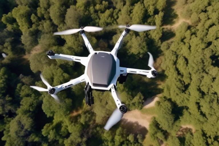
Autonomous drones are unmanned aerial vehicles equipped with advanced technology, enabling them to perform tasks without human intervention. These flying machines are not just toys for tech enthusiasts; they are versatile tools that can monitor and restore water quality across various ecosystems. From rivers to lakes, and even coastal regions, drones are becoming the eyes in the sky that help us keep our water clean. Imagine having a bird's-eye view of a polluted river, where you can see the exact spots that need urgent attention. That’s the power of drones!
Drones are increasingly used for water quality monitoring, providing real-time data on pollutants and ecosystem health. This technology enhances the accuracy and efficiency of environmental assessments, enabling quicker responses to contamination events. For instance, when a factory accidentally releases waste into a river, drones can quickly assess the situation and provide data to authorities, ensuring that action is taken swiftly. The ability to gather and analyze data rapidly can be the difference between a minor incident and a full-blown environmental disaster.
Drones utilize various sensors and imaging technologies to collect data on water quality parameters, such as temperature, turbidity, and chemical composition. These techniques allow for comprehensive assessments of aquatic environments. For example, thermal sensors can detect temperature variations that may indicate pollution, while multispectral cameras can assess vegetation health around water bodies, which is crucial for understanding ecosystem dynamics. The data collected can be visualized in stunning detail, allowing researchers to see the big picture and make informed decisions.
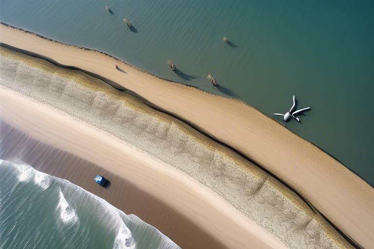
Remote sensing technology enables drones to gather large-scale data over vast water bodies, making it possible to identify pollution sources and track changes in water quality over time. With the ability to cover large areas in a fraction of the time it would take traditional methods, drones are changing the game. They can fly over a lake, capturing images and data that highlight areas of concern, which can then be addressed promptly. This proactive approach is key in preventing long-term damage to our water resources.
By integrating drone-collected data with Geographic Information Systems (GIS), researchers can create detailed maps and models, enhancing their understanding of water quality trends and spatial distributions. This integration provides a visual representation of data, making it easier to communicate findings to stakeholders and the public. Imagine being able to see a map that highlights areas of pollution in red and clean areas in green—this visual tool is invaluable for conservation efforts and policy-making.
The use of drones in water quality restoration offers numerous advantages, including cost-effectiveness, improved safety, and the ability to access hard-to-reach areas, ultimately leading to more effective restoration efforts. Unlike traditional methods that require extensive manpower and equipment, drones can operate with minimal human oversight, reducing costs significantly. Additionally, they can access locations that are dangerous or difficult for humans to reach, such as polluted wetlands or hazardous industrial sites. This not only enhances safety but also ensures that critical data is not missed.
Despite their benefits, the deployment of drones for water quality restoration faces challenges, such as regulatory hurdles, technical limitations, and the need for skilled operators to interpret data accurately. It’s essential to address these challenges to maximize the potential of this technology.
Navigating the regulatory landscape for drone operations can be complex, as different regions have varying laws governing airspace and environmental monitoring, which can hinder the widespread adoption of this technology. For instance, some areas may require special permits for drone flights, while others may have restrictions on flying over certain bodies of water. Understanding these regulations is crucial for organizations looking to implement drone technology in their water quality restoration efforts.
Technical limitations, including battery life, payload capacity, and data processing capabilities, can restrict the effectiveness of drones in some water quality restoration scenarios, necessitating ongoing advancements in drone technology. For example, a drone may only fly for a limited time before needing a recharge, which can be a significant drawback during extensive monitoring missions. As technology advances, we can expect to see improvements in these areas, making drones even more effective in the future.
The future of autonomous drones in environmental restoration looks promising, with ongoing innovations aimed at enhancing their capabilities, expanding their applications, and integrating them into broader environmental management strategies. As we continue to face environmental challenges, the role of drones will undoubtedly grow. They will become essential partners in our quest to protect and restore our precious water resources, ensuring a healthier planet for future generations.
- How do drones improve water quality monitoring? Drones provide real-time data collection and analysis, allowing for faster responses to pollution events.
- What types of sensors are used in drones for water quality assessment? Common sensors include thermal sensors, multispectral cameras, and chemical sensors that measure various water quality parameters.
- Are there regulations governing the use of drones for environmental monitoring? Yes, regulations vary by region and may include permits for drone flights and restrictions on flying over certain areas.
- What are the main challenges facing drone deployment in water quality restoration? Key challenges include regulatory hurdles, technical limitations, and the need for skilled operators to interpret the data collected.
Introduction to Autonomous Drones
Autonomous drones have emerged as a groundbreaking technology that is transforming various sectors, and water quality restoration is no exception. These unmanned aerial vehicles (UAVs) are designed to operate independently, equipped with sophisticated sensors and software that allow them to perform tasks without the need for constant human oversight. Imagine having a bird's-eye view of our lakes, rivers, and oceans, gathering crucial data while soaring above in the sky. This is precisely what autonomous drones can do, and their versatility makes them ideal for monitoring and restoring water quality in diverse ecosystems.
The technology behind these drones is nothing short of remarkable. With capabilities such as GPS navigation, real-time data processing, and high-resolution imaging, they can cover large areas quickly and efficiently. Picture a drone gliding over a sprawling body of water, capturing images and collecting data on temperature, turbidity, and even chemical pollutants. This level of detail is invaluable for environmental scientists and conservationists, enabling them to make informed decisions swiftly.
Furthermore, the autonomous aspect of these drones means they can operate in environments that are difficult or dangerous for humans to access. Whether it's a polluted industrial site or a remote wetland, these drones can gather data without putting human lives at risk. This capability not only enhances the safety of environmental monitoring but also allows for more comprehensive assessments of water quality across varied landscapes.
In summary, the introduction of autonomous drones into the realm of water quality restoration represents a significant leap forward in our ability to monitor and manage aquatic ecosystems. As we continue to face challenges related to pollution and climate change, these drones offer a promising solution, combining advanced technology with the urgent need for effective environmental stewardship.
Applications in Water Quality Monitoring
In recent years, the use of autonomous drones for water quality monitoring has gained significant traction, transforming the way we assess and manage our aquatic ecosystems. These advanced unmanned aerial vehicles (UAVs) come equipped with a variety of sensors and imaging technologies that allow them to collect real-time data on numerous water quality parameters. Imagine being able to fly over a vast lake or river and instantly gather critical information about its health without ever having to set foot on a boat! This capability not only enhances the accuracy of environmental assessments but also enables quicker responses to potential contamination events.
One of the key applications of drones in this field is their ability to monitor pollutants and track changes in water quality over time. For instance, drones can be deployed to assess levels of harmful substances such as heavy metals, nitrates, and phosphates in water bodies. By capturing high-resolution images and data, they can identify pollution sources, whether they stem from agricultural runoff, industrial discharges, or urban stormwater. This immediate access to data allows researchers and environmentalists to act swiftly, mitigating the impact of pollution before it escalates into a larger crisis.
Moreover, drones can utilize remote sensing capabilities to cover extensive areas that would be challenging for traditional monitoring methods. For example, a drone can fly over a large estuary and gather data on water temperature, turbidity, and even chlorophyll levels in a matter of minutes. This is not only a time-saver but also significantly reduces the costs associated with manual sampling. The table below illustrates some of the key water quality parameters that drones can monitor effectively:
| Water Quality Parameter | Measurement Technique | Importance |
|---|---|---|
| Temperature | Infrared Sensors | Indicates the overall health of aquatic ecosystems. |
| Turbidity | Optical Sensors | Measures the clarity of water, affecting photosynthesis and aquatic life. |
| Chlorophyll Levels | Multispectral Imaging | Indicates the presence of algae and overall productivity of water bodies. |
| Nutrient Levels (Nitrates, Phosphates) | Electrochemical Sensors | Essential for assessing nutrient pollution and its effects on water quality. |
Furthermore, integrating drone-collected data with Geographic Information Systems (GIS) enhances our understanding of water quality trends and spatial distributions. By creating detailed maps, researchers can visualize data in a way that highlights problem areas and informs management strategies. This integration is crucial for developing effective restoration plans, as it provides a comprehensive overview of the ecosystem's health and allows stakeholders to make data-driven decisions.
In conclusion, the applications of autonomous drones in water quality monitoring are vast and varied. Their ability to provide real-time data, cover large areas, and integrate with advanced mapping technologies makes them an invaluable tool in our efforts to protect and restore our precious water resources. As we continue to innovate and improve drone technology, the potential for even greater advancements in water quality monitoring and restoration is within our reach.
Data Collection Techniques
When it comes to monitoring water quality, autonomous drones are like the Swiss Army knives of environmental science. They come equipped with a variety of sensors and imaging technologies that allow them to gather crucial data on various water quality parameters. Imagine being able to fly over a vast lake and, within minutes, obtain detailed information about its health without ever setting foot on a boat! This is precisely what drones can do.
One of the most common techniques used by these drones is multispectral imaging. This technology allows them to capture data across different wavelengths of light, which can reveal information about the presence of algae blooms, sediment levels, and even the health of aquatic plants. For instance, when a drone flies over a body of water, it can detect changes in color that may indicate the presence of harmful pollutants or excessive nutrients, which can lead to algal blooms.
Additionally, drones are equipped with temperature sensors that can measure the water's temperature at various depths. This is critical because temperature influences many aspects of aquatic ecosystems, including the solubility of oxygen and the metabolism of aquatic organisms. By collecting this data, researchers can create a more comprehensive picture of the water's health.
Another fascinating technique involves the use of sonar technology. Drones can emit sound waves that bounce off underwater structures, allowing them to create detailed maps of the lake or riverbed. This can be particularly useful for identifying potential sources of pollution, such as areas with excessive sedimentation or where waste runoff might occur. The combination of sonar and imaging technologies enables scientists to visualize and analyze the underwater environment in ways that were previously unimaginable.
Moreover, the data collected by drones can be seamlessly integrated into Geographic Information Systems (GIS). This integration allows researchers to visualize trends and changes in water quality over time, creating detailed maps that can inform restoration efforts. For example, a GIS map could show how pollution levels have fluctuated in a specific area, helping to identify patterns that could lead to more effective management strategies.
In summary, the data collection techniques used by autonomous drones are transforming the way we monitor and restore water quality. With their ability to gather extensive data quickly and accurately, these drones are paving the way for a future where environmental restoration is not only more effective but also more efficient. As technology continues to advance, the possibilities for using drones in this field are virtually limitless.
- What types of sensors do drones use for water quality monitoring?
Drones typically use multispectral cameras, temperature sensors, and sonar technology to collect data on various water quality parameters. - How do drones improve the efficiency of water quality assessments?
By providing real-time data and the ability to cover large areas quickly, drones enhance the accuracy and speed of environmental assessments. - Can drones operate in all weather conditions?
While drones are versatile, their operation can be limited by extreme weather conditions such as heavy rain or strong winds. - How is the data collected by drones used in environmental management?
The data can be integrated into GIS for spatial analysis, helping researchers and policymakers make informed decisions about water quality restoration efforts.
Remote Sensing Capabilities
When it comes to monitoring water quality, the of autonomous drones are nothing short of revolutionary. Imagine a bird's-eye view of vast lakes, rivers, and oceans, where drones fly overhead, gathering critical data without disrupting the natural ecosystem below. These unmanned aerial vehicles (UAVs) are equipped with an array of sensors that can detect a multitude of water quality parameters, including temperature, chemical concentrations, and even biological indicators. This technology allows for a comprehensive understanding of aquatic environments, enabling researchers to identify issues that may not be visible to the naked eye.
One of the most significant advantages of remote sensing is the ability to cover large areas quickly. Traditional methods of monitoring water quality often involve labor-intensive sampling and analysis, which can be both time-consuming and costly. In contrast, drones can gather extensive datasets in a fraction of the time, providing real-time insights into the health of water bodies. For example, a drone can fly over a lake and collect data in just a few hours, whereas conventional methods might take days or even weeks.
Furthermore, the data collected by drones can be processed and analyzed with advanced software, allowing for the creation of detailed maps that visualize water quality across different regions. This capability is particularly useful for identifying pollution hotspots and tracking changes over time. By integrating drone data with Geographic Information Systems (GIS), researchers can create dynamic models that illustrate how water quality varies with seasonal changes, human activity, and natural events.
To illustrate the impact of remote sensing, consider the following table that summarizes the key features and benefits of using drones for water quality monitoring:
| Feature | Benefit |
|---|---|
| Wide Coverage Area | Ability to monitor large water bodies quickly and efficiently |
| Real-Time Data Collection | Immediate insights into water quality issues, enabling swift action |
| Integration with GIS | Enhanced data visualization and trend analysis |
| Non-Intrusive Monitoring | Minimal disruption to wildlife and natural habitats |
In conclusion, the remote sensing capabilities of autonomous drones are transforming the field of water quality monitoring. By providing rapid, accurate, and comprehensive data, these drones empower researchers and environmental managers to make informed decisions that can lead to effective restoration and protection of our precious water resources.
- What types of sensors are used in drones for water quality monitoring?
Drones typically use a combination of multispectral, thermal, and optical sensors to measure various water quality parameters. - How do drones improve the efficiency of water quality assessments?
Drones can quickly cover large areas and provide real-time data, significantly reducing the time and labor involved in traditional sampling methods. - Are there any limitations to using drones for water quality monitoring?
Yes, challenges such as battery life, regulatory restrictions, and the need for skilled operators can impact the effectiveness of drone operations. - Can drones be used in all types of water bodies?
While drones can be used in various environments, their effectiveness may vary depending on factors like size, accessibility, and local regulations.
Integration with GIS
The integration of autonomous drone technology with Geographic Information Systems (GIS) marks a significant leap forward in the field of environmental monitoring and water quality restoration. By marrying these two powerful tools, researchers and environmentalists can create a comprehensive framework for understanding aquatic ecosystems. Imagine having the ability to visualize vast bodies of water in real-time, pinpointing areas of concern, and tracking changes over time—all from the comfort of a computer screen. This synergy not only enhances data collection but also transforms how we interpret and respond to environmental challenges.
One of the primary benefits of integrating drone data with GIS is the ability to generate detailed maps that illustrate water quality trends. For instance, drones equipped with advanced sensors can capture data on various parameters, such as temperature, pH levels, and the presence of pollutants. This data can then be overlaid onto GIS platforms to create visual representations that highlight areas of degradation or improvement. Such maps are invaluable for decision-makers who need to prioritize restoration efforts and allocate resources effectively.
Moreover, the integration allows for spatial analysis, which is crucial for identifying pollution sources and understanding their impact on surrounding ecosystems. By analyzing spatial patterns, researchers can discern relationships between land use practices and water quality outcomes. For example, if a particular area shows consistently high levels of contaminants, it may prompt further investigation into nearby agricultural runoff or industrial discharges. This kind of targeted analysis is essential for developing effective remediation strategies.
To illustrate the effectiveness of this integration, consider the following table that outlines the key components involved in the process:
| Component | Description |
|---|---|
| Drones | Unmanned aerial vehicles equipped with sensors for data collection. |
| Sensors | Devices that measure various water quality parameters. |
| GIS Software | Tools used to analyze and visualize spatial data. |
| Data Analysis | Interpreting collected data to inform environmental decisions. |
Furthermore, the combination of drone technology and GIS facilitates real-time monitoring. As drones fly over water bodies, they can continuously collect and transmit data back to GIS platforms. This capability enables environmental agencies to respond swiftly to contamination events, ensuring that necessary actions are taken before a minor issue escalates into a major crisis. In essence, the integration of these technologies acts as an early warning system, safeguarding our precious water resources.
In summary, the integration of autonomous drones with GIS is a game-changer in water quality restoration efforts. It not only improves data accuracy and accessibility but also enhances our ability to visualize and analyze complex environmental data. As technology continues to evolve, we can expect even more innovative applications that will further empower us to protect and restore our aquatic ecosystems.
- What types of sensors can drones use for water quality monitoring?
Drones can be equipped with various sensors, including those for measuring temperature, turbidity, pH levels, and chemical composition, allowing for comprehensive assessments of water quality.
- How does GIS enhance the data collected by drones?
GIS enhances drone-collected data by providing spatial analysis capabilities, allowing researchers to visualize trends, identify pollution sources, and create detailed maps for better decision-making.
- What are the main challenges in integrating drones with GIS?
Challenges include regulatory hurdles, technical limitations related to drone capabilities, and the need for skilled personnel to analyze and interpret the data accurately.
Benefits of Using Drones
This article explores how autonomous drones are revolutionizing water quality restoration efforts, detailing their applications, benefits, and challenges in various environments.
Autonomous drones are unmanned aerial vehicles equipped with advanced technology, enabling them to perform tasks without human intervention. Their versatility makes them ideal for monitoring and restoring water quality in various ecosystems.
Drones are increasingly used for water quality monitoring, providing real-time data on pollutants and ecosystem health. This technology enhances the accuracy and efficiency of environmental assessments, enabling quicker responses to contamination events.
Drones utilize various sensors and imaging technologies to collect data on water quality parameters, such as temperature, turbidity, and chemical composition. These techniques allow for comprehensive assessments of aquatic environments.
Remote sensing technology enables drones to gather large-scale data over vast water bodies, making it possible to identify pollution sources and track changes in water quality over time.
By integrating drone-collected data with Geographic Information Systems (GIS), researchers can create detailed maps and models, enhancing their understanding of water quality trends and spatial distributions.
The use of drones in water quality restoration offers numerous advantages that significantly enhance the effectiveness of environmental monitoring and management. First and foremost, drones provide a cost-effective solution for data collection. Traditional methods often require extensive manpower and equipment, leading to increased operational costs. In contrast, drones can cover large areas in a fraction of the time and at a much lower cost.
Moreover, drones improve safety for personnel. In many cases, water quality monitoring occurs in hazardous environments where human access can be dangerous, such as polluted lakes or rivers. By deploying drones, we can gather critical data without putting human lives at risk. Picture this: instead of sending a team into a potentially toxic area, a drone can swiftly fly in, gather the necessary information, and return safely.
Another remarkable benefit is the ability of drones to access hard-to-reach areas. Wetlands, remote lakes, and other challenging terrains can pose significant obstacles for traditional monitoring methods. Drones can easily navigate these areas, providing valuable insights that would otherwise be lost. This capability is particularly crucial when addressing urgent environmental issues, as it allows for rapid responses to contamination events.
Furthermore, the data collected by drones is often more accurate and comprehensive than that gathered through conventional methods. Advanced sensors can capture a multitude of parameters simultaneously, leading to a more holistic understanding of water quality. For instance, a drone equipped with multispectral cameras can assess not only the physical characteristics of the water but also its biological and chemical properties.
To illustrate these benefits, consider the following table that summarizes the advantages of using drones in water quality restoration:
| Benefit | Description |
|---|---|
| Cost-Effectiveness | Drones reduce the need for extensive manpower and equipment, lowering operational costs. |
| Improved Safety | Minimizes risk to personnel by allowing remote data collection in hazardous environments. |
| Access to Hard-to-Reach Areas | Drones can easily navigate challenging terrains, providing insights from otherwise inaccessible locations. |
| Accurate Data Collection | Advanced sensors allow for simultaneous measurement of multiple water quality parameters. |
In summary, the integration of drones into water quality restoration efforts not only enhances efficiency and accuracy but also prioritizes safety and accessibility. As technology continues to evolve, we can expect even more innovative applications that will further transform the landscape of environmental monitoring.
Despite their benefits, the deployment of drones for water quality restoration faces challenges, such as regulatory hurdles, technical limitations, and the need for skilled operators to interpret data accurately.
Navigating the regulatory landscape for drone operations can be complex, as different regions have varying laws governing airspace and environmental monitoring, which can hinder the widespread adoption of this technology.
Technical limitations, including battery life, payload capacity, and data processing capabilities, can restrict the effectiveness of drones in some water quality restoration scenarios, necessitating ongoing advancements in drone technology.
The future of autonomous drones in environmental restoration looks promising, with ongoing innovations aimed at enhancing their capabilities, expanding their applications, and integrating them into broader environmental management strategies.
- What types of sensors do drones use for water quality monitoring?
Drones typically use a combination of multispectral cameras, thermal sensors, and chemical sensors to gather data on various water quality parameters.
- Are there any legal restrictions on using drones for environmental monitoring?
Yes, regulations regarding drone operations can vary significantly by region, so it's essential to check local laws before deployment.
- How do drones improve safety in water quality monitoring?
Drones can collect data in hazardous environments without putting human operators at risk, thereby enhancing overall safety.
Challenges and Limitations
Despite the transformative potential of autonomous drones in water quality restoration, there are significant that need to be addressed. One of the primary hurdles is navigating the complex regulatory landscape surrounding drone operations. Different countries and regions have varying laws that govern airspace usage and environmental monitoring. This inconsistency can create confusion and hinder the widespread adoption of drone technology. For instance, in some areas, strict regulations may require special permits for drone flights, especially in sensitive ecological zones. As a result, researchers and environmentalists may find themselves tangled in bureaucratic red tape, delaying critical restoration efforts.
Another critical challenge lies in the technical limitations of drones. While technology is advancing rapidly, several factors still restrict the effectiveness of drones in water quality monitoring. For example, battery life remains a significant concern; many drones can only operate for a limited time before needing a recharge. This limitation can be particularly problematic when monitoring large bodies of water, where long-range flights are essential. Additionally, the payload capacity of drones can restrict the types of sensors that can be used, limiting the range of water quality parameters that can be measured simultaneously.
Moreover, the data processing capabilities of drones can also pose challenges. The vast amounts of data collected during flights require sophisticated software and skilled operators to analyze and interpret the information accurately. Without the right tools and expertise, the valuable data collected can go underutilized, leading to missed opportunities for effective restoration. The need for trained personnel to handle data analysis adds another layer of complexity and cost to drone operations.
Furthermore, environmental factors can impact drone performance. Weather conditions such as high winds, rain, or extreme temperatures can hinder drone flights, making it difficult to collect data consistently. In some cases, the presence of obstacles like trees or buildings can also limit the operational range of drones, particularly in urban or densely vegetated areas. These environmental challenges necessitate careful planning and adaptability in drone deployment strategies.
In summary, while autonomous drones offer exciting possibilities for enhancing water quality restoration efforts, addressing the regulatory, technical, and environmental challenges is essential for unlocking their full potential. As technology continues to evolve, it is crucial for stakeholders to collaborate in overcoming these hurdles to ensure that drones can be effectively integrated into environmental management strategies.
- What are the primary uses of drones in water quality restoration?
Drones are primarily used for monitoring water quality, collecting data on pollutants, and assessing ecosystem health. - How do drones collect data on water quality?
Drones utilize various sensors and imaging technologies to measure parameters such as temperature, turbidity, and chemical composition. - What are the main challenges faced in deploying drones for environmental monitoring?
Challenges include regulatory hurdles, technical limitations, and the need for skilled operators to interpret the data accurately. - How can drones improve the efficiency of water quality assessments?
Drones can provide real-time data and cover large areas quickly, enabling quicker responses to contamination events.
Regulatory Considerations
When it comes to deploying autonomous drones for water quality restoration, play a pivotal role. The landscape of drone operations is governed by a complex web of laws and regulations that can vary significantly from one region to another. This can create a maze of compliance hurdles for organizations looking to utilize drones in their environmental efforts. For instance, in the United States, the Federal Aviation Administration (FAA) has established a set of rules that dictate how and where drones can be flown. These regulations often require drone operators to obtain specific licenses and permits, which can be a time-consuming process.
Moreover, environmental monitoring with drones may also fall under various environmental protection laws, which can impose additional requirements. For example, organizations must ensure that their drone operations do not disturb wildlife or violate local conservation laws. This adds another layer of complexity to the planning and execution of drone missions.
In many countries, the lack of standardized regulations can lead to confusion and inconsistency in how drones are used for environmental monitoring. Some regions may have no clear guidelines at all, while others may impose strict limitations that hinder the effective use of drone technology. This inconsistency can affect the adoption rates of drones in water quality restoration efforts, as organizations may be hesitant to invest in technology that could be subject to sudden regulatory changes.
To navigate these regulatory waters, organizations must stay informed about local and national laws governing drone operations. Engaging with regulatory bodies and participating in discussions about drone policy can also be beneficial. By advocating for clearer and more supportive regulations, stakeholders can help create an environment where drone technology can thrive and contribute effectively to water quality restoration.
As the technology continues to evolve, it is crucial for regulatory frameworks to adapt accordingly. The integration of drones into environmental management strategies should be facilitated by regulations that promote innovation while ensuring safety and compliance. This balance will not only enhance the effectiveness of water quality restoration efforts but also encourage the responsible use of drones in other environmental applications.
- What are the main regulatory bodies overseeing drone operations? In the U.S., the Federal Aviation Administration (FAA) is the primary regulatory body, while other countries have their own respective authorities.
- Do I need a special license to operate a drone for environmental monitoring? Yes, in many regions, operators must obtain specific licenses or certifications to legally fly drones for commercial purposes, including environmental monitoring.
- How can organizations advocate for better drone regulations? Engaging with regulatory bodies, joining industry associations, and participating in public discussions can help organizations influence drone policy.
Technical Limitations
While the potential of autonomous drones in water quality restoration is vast, there are several that can hinder their effectiveness. One of the primary challenges is battery life. Most drones are equipped with batteries that last anywhere from 20 to 60 minutes, depending on the model and payload. This limited flight time can restrict the area that can be surveyed in a single operation, particularly in large water bodies where extensive coverage is necessary. Imagine trying to find a needle in a haystack, but your flashlight only works for a few minutes—this is akin to the struggle faced by drones when tasked with extensive data collection.
Another significant limitation is the payload capacity. Drones can only carry a certain amount of weight, which directly impacts the types of sensors and equipment they can utilize. For instance, while some advanced sensors provide high-resolution data, they may be too heavy for smaller drones, forcing operators to compromise on data quality or coverage area. This can be particularly frustrating when trying to gather comprehensive data on pollutants, as the absence of certain sensors can lead to incomplete assessments.
Furthermore, the data processing capabilities of drones are still evolving. After collecting data, it needs to be processed and analyzed to provide meaningful insights. However, many drones lack onboard processing power, meaning that data must be downloaded and analyzed separately, which can introduce delays in decision-making. This is akin to taking a photo and then waiting for hours to develop it, missing out on the moment when it mattered the most. To tackle these challenges, ongoing advancements in drone technology are crucial, and researchers are actively working on solutions to enhance battery life, increase payload capacity, and improve data processing efficiency.
In summary, while autonomous drones hold great promise for enhancing water quality restoration efforts, their must be addressed to unlock their full potential. As technology continues to advance, we can expect improvements that will make these aerial vehicles even more effective in monitoring and restoring our precious aquatic ecosystems.
- What are the main benefits of using drones for water quality monitoring?
Drones offer cost-effectiveness, improved safety, and the ability to access hard-to-reach areas, making them invaluable for environmental assessments. - How do drones collect data on water quality?
Drones utilize various sensors and imaging technologies to gather data on parameters such as temperature, turbidity, and chemical composition. - What are some challenges faced by drones in environmental monitoring?
Challenges include regulatory hurdles, technical limitations like battery life and payload capacity, and the need for skilled operators to interpret data accurately. - Can drones operate in all weather conditions?
Most drones have limitations regarding wind speed and precipitation, which can affect their ability to collect data effectively.
Future of Drones in Environmental Restoration
The horizon for autonomous drones in environmental restoration is not just bright; it's positively glowing with potential. As technology advances at a breakneck pace, these flying marvels are poised to become indispensable allies in the fight against environmental degradation. Imagine a world where drones seamlessly integrate into our ecological management strategies, not just as tools, but as pivotal components of our restoration efforts. This future is not far off, and it’s exciting to think about the possibilities.
One of the most promising aspects of drone technology is its ability to gather and analyze data with unprecedented speed and accuracy. As we continue to develop more sophisticated sensors and imaging technologies, drones will be able to monitor water quality parameters like never before. For instance, advancements in hyperspectral imaging could allow drones to detect even the slightest changes in water chemistry, enabling rapid responses to pollution incidents. This capability could be the difference between a minor cleanup and a full-blown environmental disaster.
Moreover, the integration of artificial intelligence (AI) with drone technology promises to revolutionize how we interpret data. Imagine drones that not only collect data but also analyze it in real-time, providing immediate feedback on water quality and ecosystem health. This could lead to quicker decision-making processes, allowing environmental agencies to implement restoration measures without delay. The synergy between drones and AI could pave the way for a new era of proactive environmental management.
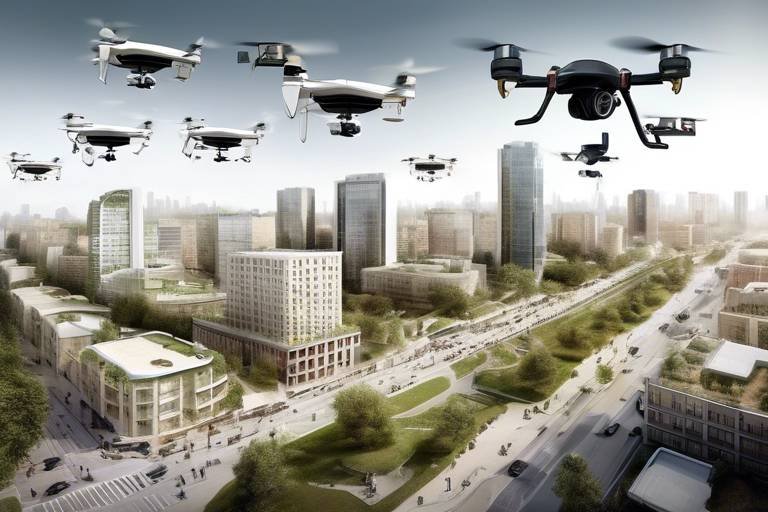
In addition to technological advancements, the future of drones in environmental restoration will also hinge on collaborative efforts among various stakeholders. Government agencies, environmental organizations, and tech companies will need to work together to create standardized protocols for drone operations. This collaboration will be essential in establishing regulatory frameworks that ensure safe and effective drone usage while also promoting innovation. The more we share knowledge and resources, the more effective our restoration efforts will be.
Furthermore, community involvement will play a critical role in the future of drone-assisted environmental restoration. Local communities often have the best understanding of their ecosystems, and involving them in monitoring efforts can enhance data collection and foster a sense of ownership over local resources. Imagine community members using drones to monitor their own lakes and rivers, contributing to data that informs restoration strategies. This grassroots approach not only empowers individuals but also strengthens the bond between people and their environment.
As we look ahead, it’s clear that the future of drones in environmental restoration is not just about technology; it’s about creating a holistic approach to ecosystem management. By combining cutting-edge technology with community engagement and collaborative governance, we can enhance our restoration efforts and ensure a healthier planet for future generations. The possibilities are endless, and the time to embrace this future is now.
- What are the main benefits of using drones for water quality monitoring?
Drones offer cost-effectiveness, improved safety, and the ability to access hard-to-reach areas, making them invaluable for water quality assessments. - How do drones collect data on water quality?
Drones utilize various sensors and imaging technologies to measure parameters such as temperature, turbidity, and chemical composition. - What challenges do drones face in environmental restoration?
Challenges include regulatory hurdles, technical limitations, and the need for skilled operators to interpret the data accurately. - How can communities get involved in drone-assisted environmental restoration?
Communities can participate by using drones for monitoring local water bodies, thereby contributing valuable data to restoration efforts.
Frequently Asked Questions
- What are autonomous drones?
Autonomous drones are unmanned aerial vehicles (UAVs) that can operate without human intervention. They are equipped with advanced technology, allowing them to perform tasks such as monitoring and restoring water quality in various ecosystems effectively.
- How do drones monitor water quality?
Drones use a variety of sensors and imaging technologies to collect real-time data on water quality parameters like temperature, turbidity, and chemical composition. This data helps in assessing the health of aquatic environments and identifying pollutants.
- What are the benefits of using drones for water quality restoration?
Using drones in water quality restoration is cost-effective, improves safety by minimizing human exposure to hazardous environments, and allows access to hard-to-reach areas. This leads to more efficient and effective restoration efforts.
- What challenges do drones face in water quality restoration?
Despite their advantages, drones face challenges such as regulatory hurdles, technical limitations like battery life and payload capacity, and the need for skilled operators to accurately interpret the data collected.
- How do drones integrate with Geographic Information Systems (GIS)?
Drones can collect data that, when integrated with GIS, allows researchers to create detailed maps and models. This enhances the understanding of water quality trends and spatial distributions, making it easier to track changes over time.
- What is the future of drones in environmental restoration?
The future looks bright for autonomous drones in environmental restoration. Ongoing innovations are expected to enhance their capabilities, broaden their applications, and integrate them into more comprehensive environmental management strategies.