The Use of Unmanned Systems in Sustainable Urban Planning
In today's rapidly evolving urban landscapes, the integration of technology is not just a trend but a necessity. As cities grow and face challenges such as traffic congestion, pollution, and resource management, the need for innovative solutions becomes increasingly critical. This is where unmanned systems, including drones and autonomous vehicles, step in as game-changers. They offer a unique perspective on urban development, enhancing efficiency, streamlining data collection, and fostering community engagement. Imagine a city where planning decisions are backed by precise data and where residents actively participate in shaping their environment. That's the promise of unmanned systems in sustainable urban planning.
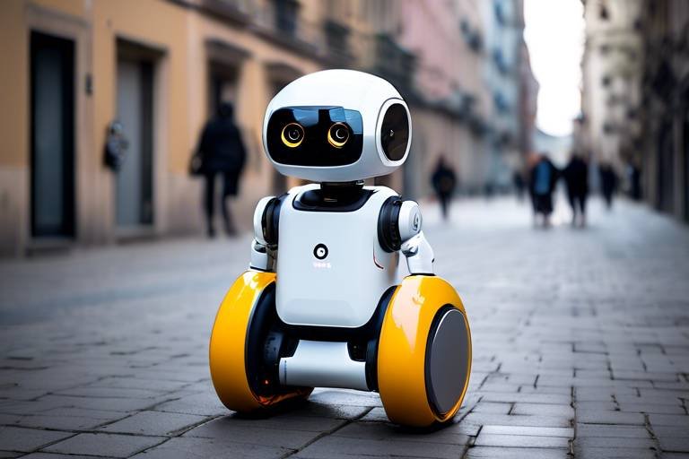
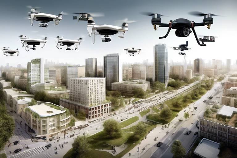
Unmanned systems are a broad category of technologies that operate without human intervention. They range from aerial drones to ground-based autonomous vehicles, each designed to perform specific functions that can significantly impact urban planning. For instance, drones are equipped with high-resolution cameras and sensors that can capture detailed images of urban areas, while autonomous vehicles can transport people and goods efficiently. The relevance of these technologies in modern urban planning cannot be overstated; they enhance operational efficiency by providing real-time data and insights that were previously difficult to obtain. As urban planners strive to create more sustainable cities, the adoption of unmanned systems is becoming a crucial element in their toolkit.
Drones have revolutionized the way urban planners approach data collection and analysis. With their ability to fly over large areas and capture high-resolution images, they provide an aerial perspective that is invaluable for mapping, surveying, and monitoring urban environments. This capability not only improves the accuracy of urban planning initiatives but also supports sustainable development goals. For example, planners can use drone data to identify areas in need of green spaces or to assess the impact of new developments on existing infrastructure.
Effective urban planning relies heavily on accurate data. Drones facilitate high-resolution data collection, allowing planners to analyze various factors such as land use, traffic patterns, and environmental impacts. With this data, planners can make informed decisions that align with sustainability goals. For instance, by analyzing traffic patterns, cities can optimize public transportation routes, reducing congestion and lowering emissions. The ability to gather and analyze data quickly and efficiently empowers urban planners to respond proactively to changing urban dynamics.
Drones also play a crucial role in monitoring environmental factors. They can assess air quality, track vegetation health, and even monitor wildlife in urban settings. This capability is essential for understanding the ecological impacts of urban development. By utilizing drones for environmental monitoring, cities can ensure that their growth does not come at the expense of natural resources. For example, drones can help identify areas where pollution levels are rising, enabling timely interventions to protect public health and the environment.
Regular infrastructure inspections are vital for maintaining urban sustainability. Drones can streamline this process by providing detailed visual inspections of bridges, roads, and buildings. This not only ensures that urban infrastructure remains safe and efficient but also minimizes the resources required for traditional inspection methods. Imagine a city where inspectors can quickly assess the condition of infrastructure from the air, allowing for faster repairs and maintenance. This efficiency can save cities both time and money while enhancing safety for residents.
Autonomous vehicles are not just about transportation; they can also enhance community engagement in urban planning. These technologies can facilitate public participation by gathering feedback from residents in real-time. For instance, an autonomous shuttle could be used to transport community members to planning meetings, making it easier for them to voice their opinions and contribute to the planning process. This collaborative approach fosters a sense of ownership among residents and ensures that urban development reflects the needs and desires of the community.
Despite the numerous advantages, unmanned systems face several challenges in urban planning. Regulatory hurdles, privacy concerns, and technological constraints can hinder their implementation. As cities strive to integrate these technologies, addressing these challenges is crucial for their success.
Navigating the regulatory landscape is essential for the successful deployment of unmanned systems. Existing regulations may not fully accommodate the rapid advancements in technology. Urban planners must advocate for updated policies that support the integration of unmanned systems while ensuring safety and compliance. This proactive approach will pave the way for innovative solutions that can enhance urban planning.
The use of unmanned systems raises significant privacy and ethical concerns. As drones and autonomous vehicles collect vast amounts of data, it is crucial to consider the implications of surveillance on community trust. Urban planners must prioritize transparency and ethical practices in data collection to build trust with residents. Addressing these concerns is not just a regulatory requirement; it is essential for fostering a collaborative planning environment.
Looking ahead, unmanned systems are poised to play a transformative role in urban planning. As technology continues to evolve, we can expect to see innovations that further enhance the capabilities of drones and autonomous vehicles. Imagine a future where cities are equipped with smart drones that can autonomously monitor infrastructure and environmental conditions, providing real-time data to planners. The potential for creating sustainable urban environments is immense, and the integration of unmanned systems will be at the forefront of this transformation.
- What are unmanned systems? Unmanned systems refer to technologies that operate without human intervention, including drones and autonomous vehicles.
- How do drones benefit urban planning? Drones provide aerial data collection, improve mapping accuracy, and support environmental monitoring, enhancing urban planning initiatives.
- What challenges do unmanned systems face? Challenges include regulatory hurdles, privacy concerns, and technological constraints that can affect implementation.
- How can autonomous vehicles enhance community engagement? Autonomous vehicles can facilitate public participation by gathering feedback from residents and improving access to planning meetings.
Understanding Unmanned Systems
Unmanned systems are revolutionizing the way we approach urban planning, and it's essential to grasp what they encompass. These systems are essentially technologies that operate without direct human control, allowing for a level of efficiency and data collection that was previously unimaginable. Think of them as the modern-day superheroes of the urban landscape, swooping in to save the day with their advanced capabilities. They include a variety of devices, but the most notable among them are drones and autonomous vehicles.
Drones, for instance, are equipped with high-resolution cameras and sensors that can capture detailed images and data from above. They can cover large areas in a fraction of the time it would take a human to do so on the ground. This capability not only enhances operational efficiency but also allows urban planners to gather information that is critical for making informed decisions. Imagine trying to map out a city’s traffic patterns or environmental conditions without the bird’s-eye view that drones provide; it would be like trying to solve a jigsaw puzzle with half the pieces missing!
On the other hand, autonomous vehicles serve a different but equally vital role in the urban planning ecosystem. They can transport people and goods without the need for a human driver, which opens up new avenues for community engagement. By incorporating these vehicles into planning processes, urban planners can gather real-time feedback from residents about their experiences and needs, fostering a more collaborative environment. This engagement is crucial for creating urban spaces that truly reflect the desires of the community.
To further illustrate the significance of unmanned systems, let’s break down their functionalities into three main categories:
- Data Collection: Collecting data efficiently and accurately is one of the primary roles of unmanned systems. Drones can gather geographical and environmental data that traditional methods simply cannot match.
- Operational Efficiency: These systems streamline processes, making urban planning not only faster but also more cost-effective.
- Community Engagement: Autonomous vehicles can facilitate public participation, allowing citizens to play an active role in shaping their urban environments.
In summary, understanding unmanned systems is crucial for anyone interested in sustainable urban planning. They are not just tools; they are transformative technologies that can enhance the way we collect data, engage with communities, and ultimately plan our cities. As we continue to explore their potential, it's clear that unmanned systems are paving the way for a more sustainable and inclusive urban future.
Benefits of Drones in Urban Planning
Drones, also known as unmanned aerial vehicles (UAVs), have revolutionized the way we approach urban planning. Imagine soaring above the city, capturing stunning aerial views and collecting invaluable data—all without breaking a sweat! These flying marvels not only enhance the **efficiency** of urban planning processes but also provide a level of detail that traditional methods simply cannot match. From mapping to surveying, drones are becoming indispensable tools for urban planners striving for sustainability.
One of the most significant benefits of using drones in urban planning is their ability to gather high-resolution aerial data. This data is crucial for creating accurate maps and models that reflect the current state of urban environments. With the help of drones, planners can easily monitor changes in land use, track transportation patterns, and assess environmental impacts. It's like having a bird's-eye view of the city, enabling planners to make informed decisions that support sustainable development initiatives.
Moreover, drones are particularly effective in environmental monitoring. They can be equipped with various sensors to collect data on air quality, vegetation health, and even noise levels. For instance, a drone can fly over a park, capturing images that reveal the health of the trees and plants, or it can measure air pollution levels in different city areas. This real-time data allows urban planners to identify environmental issues and implement solutions before they escalate. Just think of drones as the **eco-warriors** of urban planning—fighting to keep our cities green and healthy!
Another area where drones shine is in infrastructure inspection. Regular inspections are essential to ensure that urban infrastructure—such as bridges, roads, and buildings—remains safe and functional. Traditionally, these inspections can be time-consuming and resource-intensive. However, with drones, urban planners can conduct inspections quickly and efficiently. Drones can fly around structures, capturing high-resolution images that reveal any signs of wear or damage. This not only saves time and money but also minimizes the disruption to traffic and daily life in urban areas. Imagine a world where infrastructure inspections are as easy as sending a drone on a quick flight—sounds like a dream, right?
In summary, the benefits of drones in urban planning are numerous and impactful. They enhance data collection, improve environmental monitoring, and streamline infrastructure inspections. As urban planners embrace these technologies, we can expect to see more efficient and sustainable urban development practices. The future of our cities may very well depend on these incredible flying machines!
Data Collection and Analysis
Effective urban planning is akin to piecing together a complex puzzle, where each piece represents critical data that informs decision-making. In this context, drones have emerged as game-changers, offering unparalleled capabilities for data collection and analysis. Imagine being able to gather high-resolution aerial imagery that captures the nuances of land use, traffic patterns, and even environmental impacts—all from a bird's-eye view! This is precisely what drones enable urban planners to do, transforming the way we approach sustainable development.
With the ability to fly over urban landscapes, drones can collect vast amounts of data in a fraction of the time it would take traditional methods. For instance, consider the process of mapping a city. Traditionally, this would involve extensive ground surveys, which are not only time-consuming but also costly. Drones, on the other hand, can cover large areas quickly and efficiently, providing planners with up-to-date information that is crucial for making informed decisions.
The data collected by drones can be analyzed using sophisticated software tools, allowing planners to visualize trends and patterns that might otherwise go unnoticed. For example, drones can help identify areas with high traffic congestion or pinpoint regions that are at risk of flooding. By integrating this data into Geographic Information Systems (GIS), planners can create detailed maps that serve as invaluable resources for developing sustainable urban strategies.
Moreover, the data analysis capabilities of drones extend beyond mere observation. They can be equipped with various sensors to monitor environmental conditions, such as air quality and temperature variations. This real-time data collection not only aids in assessing the ecological impact of urbanization but also supports initiatives aimed at enhancing public health and well-being.
To illustrate the impact of drone data collection, let's look at a comparative table showcasing traditional methods versus drone-assisted methods:
| Aspect | Traditional Methods | Drone-Assisted Methods |
|---|---|---|
| Time Required | Weeks to Months | Days to Weeks |
| Cost | High | Lower |
| Data Accuracy | Variable | High |
| Area Coverage | Limited | Extensive |
As we can see, the advantages of utilizing drones for data collection and analysis in urban planning are substantial. By harnessing this technology, planners can make more informed decisions that align with sustainability goals, ultimately leading to healthier and more efficient urban environments.
In conclusion, the integration of drones into the data collection process not only enhances the accuracy of urban planning but also fosters a deeper understanding of the complex interactions within urban ecosystems. As cities continue to evolve, the role of drones in gathering and analyzing data will undoubtedly become more significant, paving the way for innovative solutions to the challenges of urbanization.
- How do drones improve data accuracy in urban planning? Drones provide high-resolution imagery and real-time data, allowing planners to make more precise assessments of urban environments.
- What types of data can drones collect? Drones can collect various types of data, including aerial images, environmental measurements, and traffic patterns.
- Are there any legal restrictions on using drones for urban planning? Yes, there are regulations that govern drone usage, including airspace restrictions and privacy laws that must be adhered to.
Environmental Monitoring
In the quest for sustainable urban development, has emerged as a critical component. Drones, with their ability to soar above cityscapes, provide an unparalleled vantage point for assessing various environmental factors. Imagine being able to track air quality, monitor vegetation health, and even observe wildlife—all from the comfort of a control room. This is not just a futuristic dream; it’s a reality that unmanned systems are making possible.
One of the most significant advantages of using drones for environmental monitoring is their high-resolution data collection. Traditional methods, such as ground surveys, can be time-consuming and often miss critical data points. Drones, on the other hand, can cover vast areas quickly and efficiently, capturing detailed images and data that can be analyzed to understand environmental conditions better. For example, they can be employed to:
- Assess air quality by measuring pollutants and particulate matter.
- Monitor vegetation health through multispectral imaging, which helps in identifying stressed plants.
- Track changes in land use and land cover over time, providing insights into urban sprawl and habitat loss.
Moreover, drones can facilitate real-time monitoring, allowing urban planners and environmentalists to respond swiftly to issues as they arise. For instance, if a sudden spike in air pollution is detected, immediate actions can be taken to address the source of the problem. This responsiveness is crucial in urban environments where conditions can change rapidly due to various factors, including traffic, industrial activities, and weather patterns.
But the benefits do not stop there. Drones also contribute to community awareness and education. By sharing aerial imagery and data with the public, cities can engage residents in discussions about their environment. This transparency fosters a sense of community ownership and encourages citizens to participate in sustainability initiatives. When people see the impacts of pollution or habitat loss from a bird's-eye view, they are often more motivated to take action.
In conclusion, the role of drones in environmental monitoring is transforming how urban planners approach sustainability. By providing accurate, real-time data, they not only enhance decision-making but also empower communities to engage in the preservation of their urban environments. As technology continues to advance, we can only anticipate even more innovative applications of unmanned systems in monitoring the health of our cities.
- What types of environmental factors can drones monitor?
Drones can monitor air quality, vegetation health, land use changes, and even water quality in urban environments. - How do drones collect data for environmental monitoring?
Drones are equipped with various sensors and cameras that capture high-resolution images and data, which are then analyzed for insights into environmental conditions. - Can drones help in emergency situations?
Yes, drones can provide real-time data during environmental emergencies, such as pollution spikes or natural disasters, allowing for quick response actions. - Are there privacy concerns with using drones for monitoring?
Yes, the use of drones raises privacy issues, especially regarding surveillance. It’s essential to establish regulations that address these concerns while still benefiting from drone technology.
Infrastructure Inspection
In the fast-paced world of urban development, ensuring the safety and functionality of infrastructure is paramount. Traditional inspection methods can be time-consuming, labor-intensive, and often pose risks to human inspectors. Enter drones—the superheroes of infrastructure inspection! These unmanned aerial vehicles (UAVs) are revolutionizing how we monitor and maintain our urban landscapes.
Drones are equipped with high-resolution cameras and advanced sensors that allow them to capture detailed images and data from angles that would be difficult or impossible for human inspectors to reach. Imagine having a bird's-eye view of your city, spotting cracks in bridges, or identifying wear and tear on rooftops without having to scale a ladder. This not only saves time but also enhances safety for workers who would otherwise be exposed to hazardous conditions.
Moreover, the data collected by drones can be processed using sophisticated software to create 3D models and detailed reports. This technology enables urban planners and engineers to conduct thorough assessments of infrastructure conditions, leading to more informed decision-making. For instance, a drone can fly over a highway and capture thousands of images, which can then be stitched together to create a comprehensive visual map of the road's surface. This kind of insight is invaluable for prioritizing maintenance and repair efforts.
To give you a clearer picture, here’s a brief overview of how drone inspections work:
| Step | Description |
|---|---|
| 1. Planning | Define the inspection area and objectives. |
| 2. Deployment | Launch the drone equipped with the necessary sensors and cameras. |
| 3. Data Collection | Gather images and other data during the flight. |
| 4. Data Analysis | Process the collected data using specialized software. |
| 5. Reporting | Create detailed reports and visualizations for stakeholders. |
Additionally, drones can conduct thermal inspections to identify heat loss in buildings, helping to improve energy efficiency. By detecting areas where insulation is lacking, urban planners can recommend upgrades that not only save energy but also reduce costs for residents. This aligns perfectly with the overarching goals of sustainable urban development.
In summary, the use of drones for infrastructure inspection is not just a trend—it's a game-changer. By harnessing the power of technology, cities can ensure their infrastructures are safe, efficient, and ready to meet the demands of the future. As urban areas continue to grow and evolve, embracing unmanned systems like drones will be essential for maintaining the integrity of our urban environments.
- What types of infrastructure can drones inspect? Drones can inspect a wide variety of infrastructure, including bridges, roads, buildings, power lines, and pipelines.
- Are drone inspections more cost-effective than traditional methods? Yes, drone inspections are generally more cost-effective as they reduce labor costs and minimize the time needed for inspections.
- How often should infrastructure inspections be conducted? The frequency of inspections depends on the type of infrastructure and its condition, but regular inspections are recommended to ensure safety and compliance.
- What regulations govern drone inspections? Regulations vary by country and region, but generally include guidelines for flight operations, privacy concerns, and safety protocols.
Community Engagement through Autonomous Vehicles
In today's fast-paced world, fostering community engagement in urban planning is more important than ever. Autonomous vehicles (AVs) are revolutionizing the way we think about public transportation and urban mobility. Imagine a city where residents can easily share their thoughts about urban development while commuting in a self-driving car. This is not just a dream; it is becoming a reality, thanks to the integration of technology in urban planning.
Autonomous vehicles serve as a platform for interactive communication between city planners and residents. With built-in technology, these vehicles can collect real-time feedback from passengers about their experiences, preferences, and concerns regarding urban infrastructure. For instance, during a ride, a passenger might receive a prompt asking about their opinion on a new bike lane or park development. This data can be invaluable for planners looking to create more inclusive and effective urban spaces.
Moreover, AVs can facilitate public workshops and community forums by providing transportation to residents who may otherwise have difficulty attending these events. Imagine a community meeting held at a local park, where residents are driven to the venue in autonomous shuttles. This not only increases attendance but also creates a more vibrant and engaged community atmosphere. By making it easier for residents to participate in planning discussions, cities can ensure that the voices of all community members are heard and valued.
In addition to direct feedback, autonomous vehicles can also gather data on passenger demographics, travel patterns, and preferences. This information can be analyzed to identify trends and areas of concern within the community. For instance, if a significant number of residents express a desire for more green spaces, planners can prioritize these projects in their development plans. By leveraging the data collected from AVs, cities can create more tailored and effective urban solutions that resonate with the needs of their residents.
However, it's essential to address some of the challenges that come with using autonomous vehicles for community engagement. Privacy concerns are paramount; residents may be hesitant to share their opinions if they feel their data is being misused or inadequately protected. Therefore, transparency in data collection and usage is crucial. Urban planners must ensure that residents are informed about what data is being collected and how it will be used to improve their community.
In conclusion, autonomous vehicles offer an exciting opportunity for enhancing community engagement in urban planning. By providing a platform for real-time feedback and increasing accessibility to planning events, AVs can help create a more participatory environment. As cities continue to evolve, embracing these technologies will be essential for fostering stronger connections between planners and the communities they serve.
- How do autonomous vehicles collect feedback from passengers?
AVs can be equipped with interactive interfaces that prompt passengers to share their thoughts on urban planning initiatives during their rides. - What are the benefits of using AVs for community engagement?
They increase accessibility to planning events, gather real-time data on community needs, and foster a sense of participation among residents. - Are there privacy concerns associated with using autonomous vehicles?
Yes, privacy is a significant concern. It's crucial to ensure transparency in data collection and usage to build trust within the community. - Can AVs help in identifying community needs?
Absolutely! By analyzing travel patterns and preferences, AVs can provide valuable insights to urban planners about what residents want in their neighborhoods.
Challenges and Limitations
While unmanned systems, such as drones and autonomous vehicles, present exciting opportunities for enhancing urban planning, they are not without their challenges. One of the most significant hurdles is the regulatory framework governing the use of these technologies. Different regions have varying laws regarding airspace, privacy, and data collection, which can complicate the implementation of unmanned systems in urban settings. For instance, in some cities, the use of drones for data collection may be restricted due to concerns about air traffic safety or privacy violations. As urban planners look to integrate these technologies, they must navigate a complex landscape of regulations that can hinder innovation.
Another challenge lies in privacy and ethical considerations. The deployment of unmanned systems often involves extensive data collection, which raises questions about how that data is used and who has access to it. Residents may feel uneasy about being monitored or having their data collected without their consent. This can lead to a lack of trust between the community and urban planners, which is detrimental to the collaborative spirit necessary for successful urban development. Addressing these concerns is crucial; planners need to ensure transparency and engage with the community to build confidence in how unmanned systems are utilized.
Moreover, there are technological constraints that can limit the effectiveness of unmanned systems. For example, drones require a stable power source and reliable communication networks to operate efficiently. In areas with poor connectivity or frequent power outages, the functionality of these systems can be severely impacted. Additionally, the technology is still evolving, and issues such as battery life, payload capacity, and data processing capabilities need to be continually improved to meet the demands of urban planning.
To illustrate the complexity of these challenges, consider the following table that summarizes the main obstacles faced by unmanned systems in urban planning:
| Challenge | Description |
|---|---|
| Regulatory Frameworks | Varying laws and regulations that govern the use of unmanned systems can hinder their implementation. |
| Privacy Concerns | Data collection practices may raise ethical concerns about surveillance and community trust. |
| Technological Constraints | Limitations in technology can affect the effectiveness and efficiency of unmanned systems. |
In conclusion, while unmanned systems hold great promise for sustainable urban planning, it is essential to address these challenges head-on. By developing comprehensive regulatory frameworks, prioritizing privacy, and advancing technology, we can unlock the full potential of these systems and create more efficient, engaged, and sustainable urban environments.
- What are unmanned systems? Unmanned systems refer to technologies that operate without direct human intervention, such as drones and autonomous vehicles.
- How do drones contribute to urban planning? Drones provide aerial data collection capabilities that enhance mapping, surveying, and monitoring of urban environments.
- What are the privacy concerns associated with unmanned systems? Privacy concerns arise from the extensive data collection involved in using unmanned systems, which can lead to surveillance issues.
- What challenges do urban planners face when implementing unmanned systems? Urban planners face challenges such as regulatory hurdles, privacy issues, and technological constraints when integrating unmanned systems into planning processes.
Regulatory Frameworks
As unmanned systems, such as drones and autonomous vehicles, become increasingly integral to urban planning, navigating the surrounding their use is essential. These frameworks are not just bureaucratic hurdles; they are designed to ensure safety, privacy, and ethical usage of technology in public spaces. However, the rapid evolution of these technologies often outpaces existing regulations, creating a gap that can lead to confusion and inconsistency in implementation.
To effectively integrate unmanned systems into urban planning, it is crucial to understand the existing regulations that govern their operation. These regulations can vary significantly from one region to another, reflecting local priorities and concerns. For instance, some areas may prioritize public safety, while others may focus on environmental protection. Here are some key aspects of regulatory frameworks that urban planners must consider:
- Safety Regulations: These include rules regarding the operation of drones in populated areas, ensuring they do not pose a risk to people or property.
- Airspace Management: Drones must comply with air traffic regulations, which dictate where and when they can fly. This is particularly important in urban areas with dense air traffic.
- Data Privacy: Regulations regarding data collection are critical, as they address how information gathered by unmanned systems is used and shared.
- Environmental Regulations: These ensure that the deployment of unmanned systems does not adversely affect local ecosystems.
Moreover, the need for updated policies is becoming increasingly apparent. As unmanned systems continue to evolve, urban planners and policymakers must collaborate to create regulations that are not only comprehensive but also adaptable to future advancements. This could involve:
| Area | Current Regulation | Proposed Update |
|---|---|---|
| Drones in Urban Areas | Restricted flight zones | Dynamic no-fly zones based on real-time data |
| Data Collection | Generic privacy laws | Specific guidelines for unmanned systems data use |
| Infrastructure Inspections | Manual inspections required | Allow drone-assisted inspections with oversight |
In conclusion, the regulatory frameworks surrounding unmanned systems in urban planning need to be robust yet flexible. By fostering a collaborative relationship between technology developers, urban planners, and regulatory bodies, we can create an environment where these innovative systems can thrive while ensuring the safety and privacy of the communities they serve. The future of urban planning may very well depend on our ability to navigate these regulatory landscapes effectively.
1. What are unmanned systems?
Unmanned systems refer to technologies that operate without direct human control, including drones and autonomous vehicles.
2. Why are regulatory frameworks important for unmanned systems?
Regulatory frameworks ensure the safe and ethical operation of unmanned systems, addressing concerns related to safety, privacy, and environmental impact.
3. How can regulations adapt to new technologies?
Regulations can adapt by involving stakeholders in the policy-making process, ensuring that laws reflect the realities of emerging technologies.
4. What challenges do unmanned systems face in urban planning?
Challenges include navigating complex regulations, addressing privacy concerns, and ensuring public trust in these technologies.
Privacy and Ethical Considerations
The advent of unmanned systems in urban planning, particularly drones and autonomous vehicles, brings forth a myriad of that must be addressed. As these technologies become more integrated into our daily lives, the potential for surveillance and data collection raises significant concerns among community members. Imagine a world where your every move is tracked by flying drones or self-driving cars—this is the reality that many fear as unmanned systems proliferate.
One of the primary issues revolves around data collection. Drones equipped with high-resolution cameras can capture extensive visual information about urban areas, including private properties, public gatherings, and even individuals. While this data can be invaluable for urban planners seeking to improve infrastructure and services, it also poses a risk of infringing on personal privacy. The question arises: how do we balance the need for data with the right to privacy? This is where ethical frameworks come into play.
Moreover, the implications of surveillance extend beyond mere privacy concerns. The potential for misuse of data collected by unmanned systems can lead to a loss of community trust. Residents may feel uneasy knowing that their activities are being monitored, which can hinder public participation in urban planning initiatives. To foster a collaborative environment, it is essential to establish clear guidelines that dictate how data is collected, stored, and utilized. This transparency will help build trust between the community and those implementing these technologies.
To address these privacy and ethical dilemmas, urban planners and policymakers must consider the following:
- Regulatory Compliance: Ensuring that unmanned systems operate within existing privacy laws and regulations is crucial. Regular audits and assessments can help maintain compliance.
- Community Involvement: Engaging the community in discussions about the use of unmanned systems can provide valuable insights and alleviate concerns. Public forums and workshops can serve as platforms for dialogue.
- Data Anonymization: Implementing techniques to anonymize data collected by drones and autonomous vehicles can help protect individual identities while still providing useful information for urban planning.
As we move forward, addressing these privacy and ethical considerations will be paramount. The future of unmanned systems in urban planning hinges not only on technological advancements but also on our ability to navigate the complex landscape of community trust and ethical responsibility. By prioritizing transparency and ethical practices, we can harness the potential of these technologies while safeguarding the rights of individuals.
- What are unmanned systems? Unmanned systems refer to technologies that operate without human intervention, including drones and autonomous vehicles.
- How do drones contribute to urban planning? Drones enhance urban planning by providing aerial data collection capabilities, allowing for improved mapping, surveying, and monitoring of urban environments.
- What privacy concerns are associated with unmanned systems? Privacy concerns include the potential for surveillance, data collection on individuals without consent, and the risk of misuse of collected data.
- How can communities engage with urban planners regarding unmanned systems? Communities can engage through public forums, workshops, and discussions to share their concerns and suggestions about the use of unmanned systems in urban planning.
The Future of Unmanned Systems in Urban Planning
The future of unmanned systems in urban planning is not just a fleeting trend; it is a pivotal shift that promises to revolutionize how cities are designed, developed, and managed. As we look ahead, it’s clear that the integration of drones, autonomous vehicles, and other unmanned technologies will play a transformative role in fostering sustainable urban environments. Imagine a city where traffic congestion is minimized, public spaces are optimized for community use, and environmental impacts are continuously monitored—all thanks to the power of unmanned systems.
One of the most exciting prospects is the potential for real-time data collection. With drones capable of capturing high-resolution images and autonomous vehicles equipped with sensors, urban planners will have access to a wealth of information at their fingertips. This data can be analyzed to identify trends, assess land usage, and make informed decisions that align with sustainability goals. For instance, planners might utilize drones to monitor urban heat islands or track changes in green spaces, allowing for proactive measures to mitigate environmental impacts.
Moreover, as technology continues to evolve, we can expect to see advancements in artificial intelligence (AI) and machine learning, which will further enhance the capabilities of unmanned systems. These technologies can analyze complex datasets more efficiently than ever, providing insights that were previously unattainable. For example, AI algorithms can predict traffic patterns based on historical data, allowing for smarter urban designs that reduce congestion and improve mobility.
In addition to data collection and analysis, unmanned systems will also foster greater community engagement. Imagine a scenario where autonomous vehicles serve as mobile town halls, traveling through neighborhoods to gather resident feedback on proposed projects. This level of interaction not only empowers citizens but also ensures that urban planning reflects the needs and desires of the community. By leveraging unmanned systems, planners can create an inclusive environment where public input is valued and integrated into the decision-making process.
However, as we embrace these exciting possibilities, it's essential to address the challenges that accompany the implementation of unmanned systems. Regulatory frameworks must evolve to keep pace with technological advancements. Planners will need to work closely with policymakers to develop guidelines that ensure safety, privacy, and ethical considerations are prioritized. This collaborative approach will be vital in building public trust and ensuring the successful integration of these technologies into urban planning.
As we envision the future, it’s important to recognize that the journey of integrating unmanned systems into urban planning is just beginning. The potential is immense, but it requires a concerted effort from all stakeholders—planners, technologists, policymakers, and the community. By embracing innovation and fostering collaboration, we can create urban environments that are not only sustainable but also resilient and inclusive.
In summary, the future of unmanned systems in urban planning is bright and full of potential. With advancements in technology, a focus on community engagement, and a commitment to ethical practices, we are on the brink of a new era in urban development. The question remains: are we ready to embrace this change and shape the cities of tomorrow?
- What are unmanned systems? Unmanned systems refer to technologies that operate without human intervention, including drones and autonomous vehicles.
- How can drones improve urban planning? Drones can provide high-resolution data for mapping, surveying, and monitoring urban environments, enhancing the accuracy of urban planning efforts.
- What role do autonomous vehicles play in community engagement? Autonomous vehicles can facilitate public participation by gathering feedback and insights from residents directly in their neighborhoods.
- What challenges do unmanned systems face in urban planning? Challenges include regulatory hurdles, privacy concerns, and the need for updated policies to accommodate emerging technologies.
Frequently Asked Questions
- What are unmanned systems?
Unmanned systems refer to a variety of technologies that operate without direct human control. This includes drones, autonomous vehicles, and other robotic systems that enhance efficiency in various applications, especially in urban planning.
- How do drones contribute to urban planning?
Drones play a vital role in urban planning by providing high-resolution aerial data. They assist in mapping, surveying, and monitoring urban areas, which helps planners make informed decisions for sustainable development.
- What types of data can drones collect?
Drones can collect a wide range of data, including land use patterns, traffic flow, environmental conditions, and infrastructure status. This data is crucial for understanding urban dynamics and making effective planning decisions.
- How do unmanned systems facilitate community engagement?
Autonomous vehicles can enhance community engagement by gathering feedback from residents and enabling public participation in the planning process. This collaborative approach ensures that the voices of community members are heard and considered.
- What are some challenges faced by unmanned systems in urban planning?
Unmanned systems encounter various challenges, including regulatory hurdles, privacy concerns, and technological limitations. Addressing these issues is essential for the successful integration of these technologies into urban planning.
- How do regulations impact the use of unmanned systems?
Regulations play a significant role in the deployment of unmanned systems. Existing laws may not fully accommodate new technologies, necessitating updates to policies to ensure safe and effective use in urban environments.
- What privacy concerns are associated with unmanned systems?
The use of unmanned systems raises important privacy and ethical considerations, particularly regarding data collection and surveillance. It's crucial for urban planners to address these concerns to maintain community trust.
- What is the future of unmanned systems in urban planning?
The future of unmanned systems in urban planning looks promising, with potential innovations that could transform how cities are designed and managed. As technology advances, these systems will likely become integral to creating sustainable urban environments.