The Use of Autonomous Drones for Monitoring Glacier Melting
This article explores how autonomous drones are revolutionizing the monitoring of glacier melting, offering innovative solutions for climate research and environmental conservation.
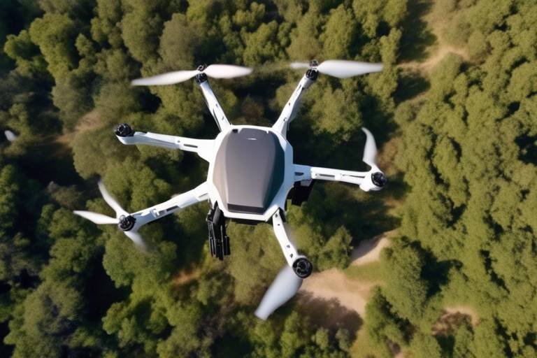
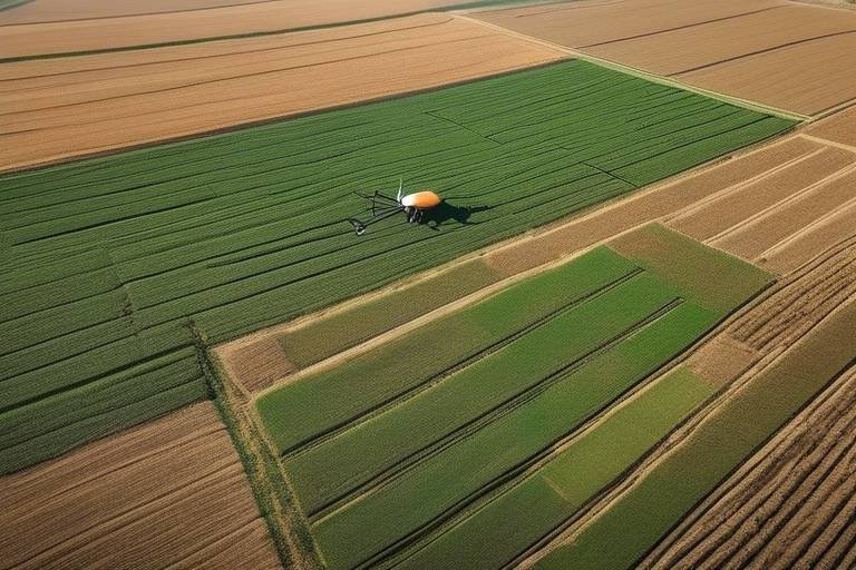
Autonomous drones are unmanned aerial vehicles that operate without direct human control. These technological marvels are equipped with advanced sensors and state-of-the-art technology, making them ideal for scientific research and environmental monitoring. Imagine having a bird's-eye view of the planet, capturing data that was once only accessible through labor-intensive methods. With autonomous drones, researchers can now soar over the vast expanses of glaciers, collecting information that is crucial for understanding our changing climate.
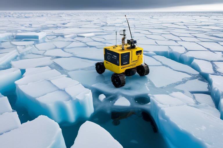
Monitoring glacier melting is crucial for understanding the impacts of climate change. Glaciers are not just stunning natural wonders; they serve as vital indicators of environmental health. As they melt, they contribute to rising sea levels, which poses significant risks to ecosystems and human populations alike. The rate at which glaciers are disappearing can tell us a lot about the health of our planet. For instance, did you know that if all the glaciers in the world were to melt, sea levels could rise by more than 70 meters? This is why keeping tabs on glacier dynamics is more important than ever.
Recent advancements in drone technology have significantly enhanced their capabilities, allowing for more accurate data collection. Improved battery life, sophisticated sensor technology, and advanced navigation systems are vital for effective glacier monitoring. These innovations mean that drones can fly longer distances and gather more data without needing to return to base frequently. As a result, researchers can obtain comprehensive datasets over vast areas, leading to a better understanding of glacier behavior and health.
High-resolution imaging technology enables drones to capture detailed photographs of glaciers, providing valuable data for researchers studying changes in glacier morphology and surface conditions over time. With these images, scientists can track subtle changes that may indicate larger trends. For example, a drone can photograph a glacier's surface every few weeks, allowing researchers to observe how it changes over time, much like flipping through a photo album of a glacier's life.
Drones can collect various types of data, including temperature, humidity, and snow thickness. This data is crucial for modeling glacier dynamics and predicting future melting trends. By analyzing this information, scientists can create simulations that help us understand how glaciers will respond to ongoing climate change. It’s like having a crystal ball that can forecast environmental changes, allowing us to prepare and adapt accordingly.
Several case studies highlight successful applications of drones in monitoring glaciers. For instance, in Greenland, researchers used drones to map the surface of the ice sheet, revealing how much it has thinned over the years. Another study in the Himalayas employed drones to monitor glacial lakes, assessing their stability and potential for flooding. These examples demonstrate the effectiveness of drones in gathering critical data in remote and inaccessible regions, showcasing their pivotal role in climate research.
The use of drones for monitoring glaciers offers numerous environmental benefits. They reduce the need for invasive research methods, minimizing human footprints on sensitive ecosystems. Instead of sending teams of researchers into potentially hazardous and fragile environments, drones can safely gather the necessary data from above. This not only protects the environment but also provides timely data to inform conservation efforts, ensuring that we can act swiftly to mitigate the impacts of climate change.
Drones facilitate collaboration between researchers and climate scientists, enabling them to share data and insights. This teamwork enhances the understanding of glacier behavior and climate change effects. By pooling resources and expertise, scientists can tackle complex questions about our planet's future. It’s like putting together a jigsaw puzzle where every piece counts; each data point collected by a drone helps complete the picture of our changing climate.
The future of drone technology in environmental monitoring looks promising. Ongoing innovations will likely improve data accuracy and expand the scope of research, further aiding efforts to combat climate change. As drones become more sophisticated, we can expect them to play an even larger role in environmental science. Imagine a future where drones can not only monitor glaciers but also contribute to restoration efforts, helping to heal the wounds inflicted by climate change.
- What are autonomous drones? Autonomous drones are unmanned aerial vehicles that operate without direct human control, equipped with advanced sensors for data collection.
- Why is monitoring glacier melting important? Monitoring glacier melting is essential for understanding climate change impacts, as glaciers are indicators of environmental health and contribute to rising sea levels.
- How do drones collect data? Drones collect various types of data including temperature, humidity, and snow thickness, which are essential for modeling glacier dynamics.
- What are the environmental benefits of using drones? Drones minimize human footprints, reduce the need for invasive research methods, and provide timely data for conservation efforts.
- What is the future of drone technology in climate research? The future looks promising with ongoing innovations expected to improve data accuracy and expand research capabilities.
Introduction to Autonomous Drones
Autonomous drones, often referred to as unmanned aerial vehicles (UAVs), are transforming the landscape of scientific research and environmental monitoring. These flying machines operate without the need for direct human control, which is a game-changer in many fields. Imagine a bird soaring high above the earth, equipped with advanced technology that allows it to gather data and capture images with incredible precision. That’s essentially what autonomous drones do, and they’re equipped with a variety of sensors and cameras that make them ideal for monitoring remote and challenging environments like glaciers.
One of the most fascinating aspects of these drones is their ability to navigate complex terrains autonomously. They utilize sophisticated algorithms and GPS technology to chart their courses, allowing them to fly over glaciers and other hard-to-reach areas without risking human safety. This is particularly important in regions that are not only difficult to access but also potentially dangerous due to harsh weather conditions or unstable ice formations.
Moreover, autonomous drones can operate for extended periods, thanks to advancements in battery technology. This means they can cover vast areas and collect data over time, providing researchers with a comprehensive view of how glaciers are changing. For instance, they can fly missions that last several hours, capturing high-resolution images and gathering environmental data that would be impossible to collect manually.
In addition to their impressive technological capabilities, autonomous drones also reduce the environmental impact of research activities. Traditional methods often require extensive ground surveys, which can disrupt local ecosystems. In contrast, drones can collect data without leaving a significant footprint, making them a more sustainable option for monitoring sensitive environments.
As we delve deeper into the world of autonomous drones, it's essential to understand not only their technical features but also their potential applications in monitoring glacier melting. The data they collect can help scientists understand the broader implications of climate change, including rising sea levels and shifts in local ecosystems. With these drones at our disposal, we are not just observing the changes; we are gaining insights that could lead to actionable solutions for environmental conservation.
Importance of Monitoring Glacier Melting
Monitoring glacier melting is not just a scientific endeavor; it’s an urgent necessity in our quest to understand the complexities of climate change. Glaciers are often referred to as the planet's "frozen reservoirs," and their health is a critical indicator of environmental stability. As these massive ice structures melt, they release fresh water into the oceans, which can lead to significant changes in sea levels. But why should we care about rising sea levels? Well, consider this: communities living near coastlines are at risk of flooding, and entire ecosystems can be disrupted. Essentially, the melting of glaciers can trigger a domino effect that impacts both nature and humanity.
Furthermore, glaciers play a vital role in regulating the Earth's temperature. They reflect sunlight, helping to keep our planet cool. When glaciers melt, less sunlight is reflected, leading to a phenomenon known as the albedo effect, which can further accelerate warming. This cycle is alarming and highlights the importance of continuous monitoring. By keeping an eye on these ice giants, we can gather essential data that informs climate models and helps in predicting future changes.
In addition to rising sea levels, monitoring glacier melting is crucial for understanding its impact on freshwater resources. Many rivers around the world are fed by glacial meltwater, especially during the warmer months. If glaciers continue to shrink at an alarming rate, regions that depend on this water source could face severe shortages. This is particularly pressing for agricultural sectors that rely on consistent water supply for irrigation. Thus, tracking glacier melting is not just about observing ice; it’s about ensuring the survival and sustainability of communities that depend on these resources.
Moreover, the data collected from monitoring glacier melting can aid in biodiversity conservation. As glaciers retreat, they alter habitats for various species, both terrestrial and aquatic. By understanding how these changes occur, we can develop strategies to protect vulnerable species and preserve biodiversity. In a world where every species plays a role in the ecosystem, the implications of glacier melting extend far beyond just ice and water.
In summary, the importance of monitoring glacier melting cannot be overstated. It is a multi-faceted issue that touches on environmental health, human survival, and the intricate balance of our planet's ecosystems. As we harness advanced technologies like autonomous drones for this purpose, we are not just observing a phenomenon; we are taking proactive steps towards understanding and mitigating the impacts of climate change.
- Why are glaciers important? Glaciers serve as indicators of climate change and are crucial for regulating Earth's temperature and freshwater supply.
- How does glacier melting affect sea levels? As glaciers melt, they release water into the oceans, contributing to rising sea levels that threaten coastal communities.
- What role do drones play in monitoring glaciers? Drones provide high-resolution imaging and data collection capabilities, allowing researchers to gather critical information in remote areas.
- What are the long-term consequences of glacier melting? Long-term consequences include altered ecosystems, freshwater shortages, and increased flooding risks for coastal regions.
Technological Advances in Drone Design
The world of autonomous drones is constantly evolving, and recent technological advances have significantly enhanced their capabilities, making them indispensable tools for monitoring glacier melting. Imagine a drone soaring through the crisp, cold air of the Arctic, equipped with state-of-the-art sensors that can gather data with pinpoint accuracy. These advancements not only improve the efficiency of data collection but also expand the scope of research in some of the most remote and challenging environments on Earth.
One of the most notable improvements is in battery technology. Modern drones are now equipped with high-capacity batteries that allow for longer flight times, enabling researchers to cover vast areas without the need for frequent recharging. This is particularly important in glacier monitoring, where large expanses of ice need to be surveyed. With flight times extending up to several hours, drones can collect comprehensive data sets in a single mission.
Moreover, the integration of advanced sensor technology has transformed how data is captured. Drones can now be fitted with a variety of sensors, including thermal imaging, LiDAR (Light Detection and Ranging), and multispectral cameras. These tools allow researchers to gather critical information such as temperature variations, ice thickness, and even vegetation health surrounding glacial areas. For instance, thermal sensors can detect subtle changes in glacier surface temperatures, which is vital for understanding melting patterns.
Another key aspect of drone design that has seen significant enhancement is the navigation systems. With the advent of GPS and real-time kinematic positioning, drones can navigate with incredible precision. This is crucial when flying over glaciers, where the terrain can be unpredictable and hazardous. Drones can autonomously plan their routes, avoiding obstacles and ensuring that they cover the intended areas effectively. Additionally, some drones are now equipped with collision avoidance systems that utilize artificial intelligence to detect and evade obstacles in real-time, further enhancing safety during missions.
Furthermore, the development of data processing algorithms has revolutionized how the information collected by drones is analyzed. Advanced software can process vast amounts of data quickly, allowing researchers to visualize changes in glacier morphology and ice dynamics almost in real-time. This capability not only accelerates data analysis but also enables scientists to make timely decisions regarding climate research and conservation efforts.
In summary, the technological advances in drone design are reshaping the landscape of environmental monitoring. With improved battery life, sophisticated sensors, precise navigation, and advanced data processing capabilities, these drones are becoming essential allies in the fight against climate change. They allow us to observe and understand the intricate dynamics of glacier melting, providing invaluable insights that can help inform conservation strategies and policy decisions.
- How do autonomous drones help in monitoring glacier melting?
Drones provide high-resolution imaging and collect various environmental data that are crucial for understanding glacier dynamics and climate change. - What types of sensors are used in glacier monitoring drones?
Drones can be equipped with thermal imaging, LiDAR, multispectral cameras, and other sensors to gather comprehensive data. - How long can drones fly when monitoring glaciers?
Modern drones can have flight times extending up to several hours, allowing them to cover large glacier areas without needing to recharge frequently. - Are drones safe to use in remote glacier regions?
Yes, with advanced navigation and collision avoidance systems, drones can safely operate in challenging environments.
High-Resolution Imaging
This article explores how autonomous drones are revolutionizing the monitoring of glacier melting, offering innovative solutions for climate research and environmental conservation.
Autonomous drones are unmanned aerial vehicles that operate without direct human control. They are equipped with advanced sensors and technology, making them ideal for scientific research and environmental monitoring.
Monitoring glacier melting is crucial for understanding climate change impacts. Glaciers serve as indicators of environmental health, and their melting contributes to rising sea levels, affecting ecosystems and human populations.
Recent advancements in drone technology have enhanced their capabilities, allowing for more accurate data collection. Improved battery life, sensor technology, and navigation systems are vital for effective glacier monitoring.
High-resolution imaging technology enables drones to capture detailed photographs of glaciers, providing valuable data for researchers studying changes in glacier morphology and surface conditions over time. Imagine standing on a mountain, gazing at a vast glacier, but instead of just seeing the ice, you can observe every crack, crevice, and subtle shift in its structure. That's the power of high-resolution imaging!
These advanced imaging systems utilize sophisticated cameras and sensors that can capture images at resolutions that were previously unattainable. This capability allows scientists to:
- Monitor changes in glacier size and shape with pinpoint accuracy.
- Assess the impact of temperature fluctuations on ice surfaces.
- Identify areas of potential instability that could lead to calving events.
The data collected through high-resolution imaging is not just impressive; it's transformative. It enables researchers to create detailed 3D models of glaciers, which can be used to simulate future melting scenarios. Such models are essential for predicting how glaciers will respond to ongoing climate change, helping to inform policy and conservation strategies.
Furthermore, the ability to conduct regular aerial surveys means that researchers can track changes over time, establishing a timeline of glacier behavior that can be correlated with climate data. This kind of analysis is crucial for understanding the broader implications of glacier melting on global sea levels and weather patterns.
Drones can collect various data types, including temperature, humidity, and snow thickness. This data is crucial for modeling glacier dynamics and predicting future melting trends.
Several case studies highlight successful applications of drones in monitoring glaciers. These examples demonstrate the effectiveness of drones in gathering critical data in remote and inaccessible regions.
The use of drones for monitoring glaciers offers numerous environmental benefits. They reduce the need for invasive research methods, minimize human footprints, and provide timely data to inform conservation efforts.
Drones facilitate collaboration between researchers and climate scientists, enabling them to share data and insights. This teamwork enhances the understanding of glacier behavior and climate change effects.
The future of drone technology in environmental monitoring looks promising. Ongoing innovations will likely improve data accuracy and expand the scope of research, further aiding efforts to combat climate change.
Q: How do autonomous drones operate without human control?
A: Autonomous drones are programmed with advanced algorithms that allow them to navigate, collect data, and return to their launch point without the need for direct human intervention.
Q: What types of data can drones collect from glaciers?
A: Drones can collect a variety of data, including high-resolution images, temperature readings, humidity levels, and measurements of snow thickness.
Q: Why is high-resolution imaging important for glacier monitoring?
A: High-resolution imaging allows researchers to observe detailed changes in glacier morphology and surface conditions, which is essential for understanding the dynamics of glacier melting and its implications for climate change.
Q: Are drones environmentally friendly?
A: Yes, drones minimize human footprints and reduce the need for invasive research methods, making them a more sustainable option for environmental monitoring.
Data Collection and Analysis
When it comes to monitoring glacier melting, data collection and analysis are at the heart of understanding the intricate dynamics of these massive ice structures. Autonomous drones are equipped with an array of sensors that allow them to gather a wide variety of data types, making them invaluable tools for researchers. Imagine flying over a glacier and instantly collecting information on temperature, humidity, and even snow thickness. This capability transforms what was once a labor-intensive process into a swift and efficient operation.
For instance, drones can measure surface temperatures with remarkable precision, providing insights into how climate change is affecting glacier health. The sensors onboard can also monitor humidity levels, which play a crucial role in determining the rate of melting. Additionally, drones can assess the thickness of snow layers, which is essential for understanding how much accumulated snow is contributing to glacier mass balance. All this data is crucial for creating accurate models of glacier dynamics.
To illustrate the effectiveness of drones in data collection, consider the following table that summarizes key parameters measured by drones during glacier monitoring:
| Data Type | Description | Importance |
|---|---|---|
| Temperature | Surface temperature readings from various glacier points | Helps in assessing melting rates and climate change impacts |
| Humidity | Measurements of moisture in the air around the glacier | Indicates potential for melting and refreezing cycles |
| Snow Thickness | Depth of snow accumulation on the glacier surface | Essential for understanding mass balance and future melting |
Once the data is collected, the next step involves rigorous data analysis. Researchers utilize advanced algorithms and software to process this wealth of information. By analyzing the data, scientists can identify trends and patterns that reveal how glaciers are responding to changing climatic conditions. This analysis is not just about crunching numbers; it’s about painting a vivid picture of the future of our planet's ice reserves.
Moreover, the integration of artificial intelligence (AI) in data analysis has opened new avenues for predicting glacier behavior. AI can sift through large datasets at astonishing speeds, identifying correlations that might take human researchers much longer to discern. This synergy between drones and AI not only enhances the accuracy of predictions but also allows for real-time monitoring, enabling scientists to respond swiftly to emerging trends.
In conclusion, the combination of autonomous drones and sophisticated data analysis techniques is revolutionizing the way we understand glacier melting. With each flight, these drones not only capture vital data but also contribute to a growing body of knowledge that is essential for tackling climate change. As we continue to refine these technologies, the potential for deeper insights into our planet's environmental health becomes increasingly promising.
- How do drones monitor glaciers? Drones equipped with sensors collect data on temperature, humidity, and snow thickness, allowing researchers to analyze glacier health.
- What are the benefits of using drones for environmental monitoring? Drones reduce the need for invasive research methods, minimize human footprints, and provide timely data for conservation efforts.
- Can drones operate in extreme weather conditions? Yes, many modern drones are designed to withstand harsh weather, making them suitable for remote and challenging environments.
Case Studies of Drone Usage
When it comes to monitoring glaciers, the application of autonomous drones has proven to be nothing short of revolutionary. One standout example is the deployment of drones in the Patagonian Ice Fields. Researchers utilized drones equipped with high-resolution cameras to capture stunning aerial imagery of the glaciers. This approach not only provided a comprehensive view of the ice formations but also revealed significant changes in glacier size and structure over the years. The data collected has been instrumental in understanding the rapid melting occurring in this region, which is crucial for predicting future sea-level rise.
Another compelling case study comes from the Greenland Ice Sheet, where scientists have harnessed drone technology to assess the impact of climate change on this vast expanse of ice. By flying drones over the ice sheet, researchers were able to gather detailed information on the surface temperature and snow thickness. This information is vital for creating accurate models that predict how quickly the ice will melt in response to rising temperatures. The ability to collect such data from hard-to-reach areas has significantly enhanced our understanding of glacier dynamics.
In addition to these examples, a project in the Alaskan Glacier Region showcased the versatility of drones. Here, drones were used not only for imaging but also for collecting environmental data such as humidity and wind speed. This multi-faceted approach allowed researchers to correlate weather patterns with glacier melting rates, providing a clearer picture of how atmospheric conditions influence glacial retreat. The integration of various data types into one cohesive study highlights the drones' ability to facilitate comprehensive research efforts.
Moreover, the Swiss Alps have also seen innovative uses of drones in glacier monitoring. In this region, drones equipped with thermal imaging cameras were deployed to detect heat loss from glaciers. This technology allows scientists to assess how much heat is absorbed by the ice, which is a critical factor in understanding melting processes. The findings from these drone surveys have not only informed local conservation strategies but have also contributed to global discussions on climate change and its effects on mountain ecosystems.
These case studies illustrate the profound impact that autonomous drones are having on the field of environmental science. By providing access to remote areas and enabling the collection of high-quality data, drones are transforming how researchers study glaciers. As technology continues to evolve, we can expect even more innovative applications that will enhance our ability to monitor and respond to the challenges posed by climate change.
- What are autonomous drones? Autonomous drones are unmanned aerial vehicles that can operate independently without direct human control, equipped with advanced sensors for data collection.
- How do drones help in monitoring glacier melting? Drones provide high-resolution imaging and can collect various environmental data, allowing researchers to analyze changes in glacier size and dynamics over time.
- Where have drones been successfully used for glacier monitoring? Drones have been effectively used in regions like the Patagonian Ice Fields, Greenland Ice Sheet, Alaskan Glacier Region, and the Swiss Alps.
- What are the benefits of using drones for environmental research? Drones reduce the need for invasive research methods, minimize human footprints, provide timely data, and enhance collaboration among scientists.
Environmental Impact and Benefits
The environmental impact of using autonomous drones for monitoring glacier melting is profound and multi-faceted. One of the most significant benefits is their ability to collect data without the need for human presence in sensitive ecosystems. Traditional methods of studying glaciers often involve extensive fieldwork, which can disturb the natural environment. In contrast, drones operate from a distance, significantly reducing the human footprint on these fragile habitats.
Moreover, drones are equipped with advanced sensors that allow for the collection of high-quality data on various environmental parameters. This includes not just visual data through high-resolution imaging, but also measurements of temperature, humidity, and snow thickness. By gathering this data, researchers can create detailed models of glacier dynamics, which are crucial for understanding how these massive ice structures respond to climate change.
Another important aspect of drones is their ability to access remote and hard-to-reach areas. Glaciers are often located in rugged terrains that can be dangerous for human researchers to navigate. Drones can easily fly over these regions, capturing data that would otherwise remain untouched. This capability not only enhances the scope of research but also ensures that scientists can monitor changes in real-time, allowing for quicker responses to emerging environmental issues.
In addition to their practical benefits, the use of drones aligns with broader environmental conservation efforts. By minimizing the need for physical presence in the field, drones help protect the delicate ecosystems surrounding glaciers. This means that scientists can gather essential data while also promoting the preservation of these vital natural resources. The non-invasive nature of drone technology represents a shift towards more sustainable research practices.
Furthermore, the data collected by drones can be shared among researchers and climate scientists globally. This collaboration fosters a community of shared knowledge and insights, enabling a more comprehensive understanding of glacier behavior and the impacts of climate change. The ability to quickly disseminate findings means that conservation strategies can be developed and implemented more effectively, ultimately benefiting the environment.
To summarize, the environmental impact and benefits of using autonomous drones for monitoring glacier melting are extensive. They not only enhance data collection efficiency but also promote sustainability and collaboration in climate research. As we continue to face the challenges posed by climate change, the role of drones in environmental monitoring will undoubtedly become increasingly vital.
- How do drones collect data on glaciers? Drones are equipped with various sensors that capture high-resolution images and measure environmental parameters such as temperature and humidity.
- Are drones environmentally friendly? Yes, drones reduce the need for human presence in sensitive areas, minimizing their impact on fragile ecosystems.
- What are the advantages of using drones over traditional methods? Drones can access remote areas easily, collect data more efficiently, and operate without disturbing the environment.
- How does drone technology contribute to climate research? Drones provide timely and accurate data that helps scientists model glacier dynamics and understand climate change impacts.
Collaboration with Climate Scientists
In the ever-evolving field of climate research, the collaboration between autonomous drone operators and climate scientists is becoming increasingly vital. Imagine a world where scientists can gather data from the most remote and inhospitable areas on Earth without ever setting foot in those locations. This is exactly what drones facilitate. By leveraging advanced aerial technology, researchers are not only able to collect data but also share it in real-time, creating a dynamic and interactive research environment.
One of the most significant advantages of this collaboration is the ability to combine expertise. Climate scientists bring their extensive knowledge of environmental systems, while drone operators contribute their technical skills in piloting and data collection. This synergy allows for a more comprehensive understanding of glacier dynamics and climate change impacts. For instance, when scientists analyze the data collected by drones, they can identify patterns and trends that might have otherwise gone unnoticed.
Moreover, the use of drones in glacier monitoring opens up new avenues for research. Climate scientists can design specific studies that utilize drone technology to address pressing questions about glacier behavior. For example, they can investigate how different environmental factors, such as temperature fluctuations and precipitation patterns, influence glacier melting rates. This collaborative approach not only enhances the quality of the research but also accelerates the pace at which findings can be published and shared with the broader scientific community.
Additionally, the ability to collect data over large areas quickly means that scientists can conduct long-term studies without the logistical challenges typically associated with fieldwork. Drones can cover vast regions in a fraction of the time it would take a team of researchers to do so on foot. This efficiency is crucial, especially when monitoring glaciers that are rapidly changing due to climate change.
As this collaboration continues to grow, we can expect to see more innovative projects emerge. For example, joint initiatives between universities, governmental agencies, and non-profit organizations are already underway, focusing on using drones for comprehensive glacier monitoring. These partnerships not only enhance the research but also foster a sense of community among scientists dedicated to understanding and combating climate change.
In summary, the collaboration between drone operators and climate scientists is reshaping the landscape of climate research. By merging technical expertise with scientific inquiry, they are uncovering new insights into glacier dynamics and contributing to a more profound understanding of the challenges posed by climate change. As we look to the future, this partnership will undoubtedly play a crucial role in informing conservation strategies and policy decisions aimed at protecting our planet.
- How do drones collect data on glaciers? Drones are equipped with various sensors that measure temperature, humidity, snow thickness, and capture high-resolution images, allowing for comprehensive data collection.
- What are the benefits of using drones for glacier monitoring? Drones reduce the need for invasive research methods, minimize human footprints, and provide timely data that is crucial for effective climate research and conservation efforts.
- Can drones operate in extreme weather conditions? Yes, many modern drones are designed to withstand harsh weather conditions, making them suitable for monitoring glaciers in challenging environments.
- How do researchers analyze the data collected by drones? Researchers use specialized software to process and analyze the data, identifying trends and patterns that contribute to our understanding of glacier dynamics and climate change.
Future Prospects for Drone Technology
The future of drone technology in environmental monitoring is not just bright; it's practically glowing with potential! As advancements in technology continue to unfold, we can expect a wave of innovations that will enhance the capabilities of drones, particularly in the realm of glacier monitoring. Imagine drones that can operate in extreme weather conditions, equipped with AI-driven analytics that allow them to make real-time decisions on data collection. This could revolutionize how we understand and respond to the impacts of climate change.
One exciting prospect is the development of swarm technology, where multiple drones work together to cover vast areas efficiently. Think of it as a flock of birds, each drone communicating and coordinating with the others to gather data from different angles and perspectives. This collective effort could lead to a more comprehensive understanding of glacier dynamics, capturing changes that a single drone might miss.
Moreover, as battery technology improves, we can anticipate drones with significantly longer flight times. This would allow researchers to conduct extensive surveys without the need for frequent recharges, making it feasible to monitor remote glaciers that are currently challenging to access. Additionally, advancements in sensor technology will likely enable drones to collect even more diverse and detailed data, including 3D mapping of glacier surfaces and subsurface ice structures.
To illustrate the potential advancements, consider the following table highlighting key future developments:
| Development | Description |
|---|---|
| AI Integration | Real-time data analysis and decision-making capabilities. |
| Swarm Technology | Multiple drones working collaboratively for extensive coverage. |
| Extended Battery Life | Longer flight times for more comprehensive data collection. |
| Advanced Sensors | Enhanced data collection including 3D mapping and thermal imaging. |
In summary, the future of drone technology in monitoring glaciers is poised for exciting transformations. With the integration of AI, improved battery life, and advanced sensors, we can expect a new era of environmental research that not only enhances our understanding of glaciers but also contributes significantly to our efforts to combat climate change. The collaboration between technology and environmental science is set to create a powerful alliance in safeguarding our planet's icy giants.
- How do drones monitor glaciers? Drones equipped with advanced sensors collect various data types, including temperature, humidity, and high-resolution images, to analyze glacier conditions.
- What are the benefits of using drones for glacier research? Drones minimize human impact on sensitive environments, allow for data collection in hard-to-reach areas, and provide timely information for conservation efforts.
- Will drone technology continue to improve? Yes, ongoing innovations in battery life, sensor technology, and AI capabilities are expected to enhance the effectiveness of drones in environmental monitoring.
Frequently Asked Questions
- What are autonomous drones?
Autonomous drones are unmanned aerial vehicles that operate independently without direct human control. They are equipped with advanced sensors and technology, making them perfect for tasks like scientific research and environmental monitoring.
- Why is monitoring glacier melting important?
Monitoring glacier melting is essential because it helps us understand the impacts of climate change. Glaciers act as indicators of environmental health, and their melting contributes to rising sea levels, which can affect ecosystems and human populations.
- How have technological advances improved drone capabilities?
Recent advancements in drone technology have significantly enhanced their capabilities. Improvements in battery life, sensor technology, and navigation systems allow drones to collect more accurate and comprehensive data for effective glacier monitoring.
- What types of data can drones collect when monitoring glaciers?
Drones can gather various types of data, including temperature, humidity, snow thickness, and high-resolution images. This data is crucial for modeling glacier dynamics and predicting future melting trends.
- Can you provide examples of successful drone usage in glacier monitoring?
Absolutely! Several case studies demonstrate the successful application of drones in monitoring glaciers. These examples showcase how drones can effectively gather critical data in remote and hard-to-reach areas, providing valuable insights for researchers.
- What are the environmental benefits of using drones for monitoring?
The use of drones for glacier monitoring offers numerous environmental benefits, including reducing the need for invasive research methods, minimizing human footprints, and providing timely data to inform conservation efforts.
- How do drones facilitate collaboration among climate scientists?
Drones enable collaboration between researchers and climate scientists by allowing them to share data and insights easily. This teamwork enhances the understanding of glacier behavior and the effects of climate change.
- What does the future hold for drone technology in environmental monitoring?
The future of drone technology in environmental monitoring looks promising. Ongoing innovations are expected to improve data accuracy and expand the scope of research, further aiding efforts to combat climate change.