The Use of Unmanned Systems in Extreme Weather Forecasting
In recent years, the landscape of meteorology has experienced a remarkable transformation, largely due to the advent of unmanned systems like drones and autonomous vehicles. These innovative technologies are not just futuristic gadgets; they are revolutionizing how we approach extreme weather forecasting. Imagine a world where weather forecasts are not only more accurate but also delivered in real-time, allowing communities to prepare for impending storms, floods, or heatwaves. This is not a distant dream but a reality made possible by the integration of unmanned systems into meteorological practices.
Unmanned systems are equipped with cutting-edge sensors and data collection tools that can operate in environments that are often inaccessible or dangerous for humans. For instance, drones can fly into storm systems, capturing detailed atmospheric data that ground-based stations simply cannot reach. This capability significantly enhances the quality of weather models, leading to improved forecasting accuracy. But it doesn't stop there; the data collected by these unmanned systems can be analyzed and integrated with existing meteorological tools, creating a more comprehensive understanding of weather patterns and trends.
Moreover, the use of unmanned systems in extreme weather forecasting is not just about enhancing accuracy; it also plays a crucial role in disaster preparedness. With timely and precise weather predictions, communities can take proactive measures to safeguard lives and property. Think about it: when a hurricane is approaching, having real-time data allows for better evacuation planning, resource allocation, and overall disaster response. This not only saves lives but also mitigates economic losses associated with extreme weather events.
As we delve deeper into the specifics of how drones and autonomous vehicles are utilized in meteorology, we will uncover the myriad benefits they bring, the challenges faced in their implementation, and the promising future they hold for weather forecasting. Join us as we explore this fascinating intersection of technology and meteorology, where every byte of data could mean the difference between safety and disaster.
Drones are increasingly used to gather atmospheric data in hard-to-reach areas, providing real-time information that significantly improves weather models and forecasts. These aerial devices can fly at various altitudes, capturing information on temperature, humidity, wind speed, and even atmospheric pressure. This data is crucial for understanding weather systems, especially in regions where traditional weather stations may be sparse or non-existent.
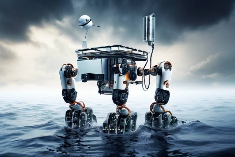
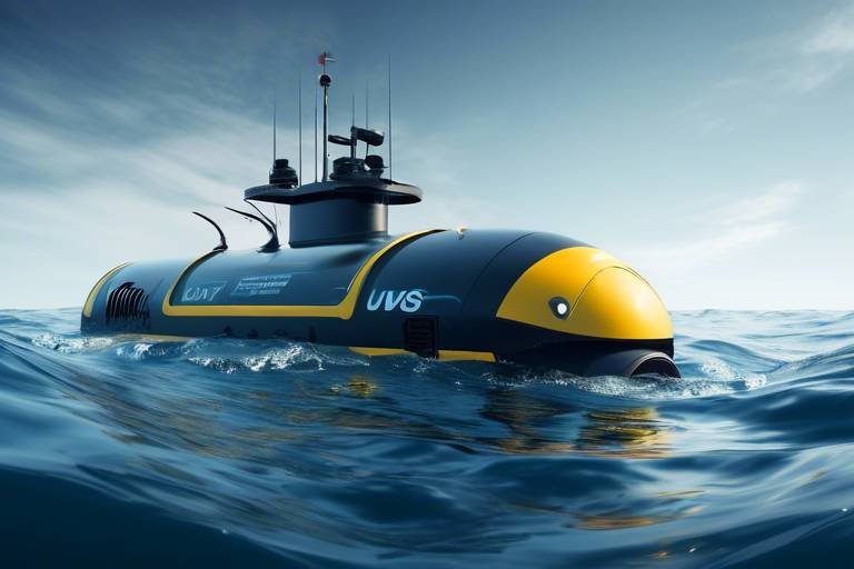
Autonomous vehicles can traverse challenging terrains to collect meteorological data, offering insights that traditional methods may miss, thereby enhancing forecasting accuracy. For instance, these vehicles can operate in remote areas, such as mountains or deserts, where human access is limited. By collecting data from these locations, meteorologists can gain a more accurate picture of weather patterns, leading to better predictions.
Combining unmanned systems with satellite data creates a comprehensive view of weather patterns, allowing for more precise and timely forecasts. Satellite technology provides a broader perspective of weather systems, while unmanned systems offer detailed, localized data. This synergy results in a more robust forecasting model that can account for both macro and micro-level weather phenomena.
Using drones and autonomous systems helps improve the spatial resolution of weather data, leading to better predictions of local weather events. Unlike traditional methods that often rely on spaced-out weather stations, unmanned systems can collect data in real-time and at a much finer scale, enabling meteorologists to pinpoint weather changes as they happen.
Unmanned systems enable continuous monitoring of weather conditions, allowing meteorologists to respond quickly to changes and provide timely warnings. This capability is particularly vital during extreme weather events, where conditions can change rapidly. With real-time data, meteorologists can issue alerts and warnings, ensuring that communities are informed and prepared.
Several case studies highlight successful uses of unmanned systems in extreme weather forecasting, showcasing their effectiveness in various scenarios. For example, during Hurricane Harvey, drones were deployed to assess flood levels and gather data on storm intensity, which greatly aided in emergency response efforts. Such implementations demonstrate the potential of unmanned systems to enhance our understanding and response to extreme weather events.
Despite their benefits, the deployment of unmanned systems in weather forecasting faces challenges, including regulatory issues, technical limitations, and data integration difficulties. Navigating these challenges is crucial for maximizing the potential of these technologies in meteorology.
Navigating the regulatory landscape is crucial for the safe operation of unmanned systems, as safety concerns can hinder their widespread adoption in meteorology. Regulations often lag behind technological advancements, creating uncertainty for organizations looking to implement these systems. Ensuring that unmanned vehicles operate safely and within legal frameworks is essential for building trust and acceptance in their use.
Addressing technical limitations, such as battery life and data transmission, is essential for maximizing the potential of unmanned systems in weather forecasting. Innovations in battery technology and data processing are needed to enhance the capabilities of these systems, enabling them to operate longer and more efficiently in the field.
- What types of unmanned systems are used in weather forecasting? Drones and autonomous vehicles are the primary types of unmanned systems utilized for gathering meteorological data.
- How do unmanned systems improve weather forecasting? They provide real-time data from hard-to-reach areas, enhancing the accuracy and resolution of weather models.
- What challenges do unmanned systems face in meteorology? Challenges include regulatory hurdles, technical limitations, and difficulties in data integration.
- Can unmanned systems help during natural disasters? Yes, they can provide critical data for disaster response and recovery efforts, improving safety and preparedness.
The Role of Drones in Weather Data Collection
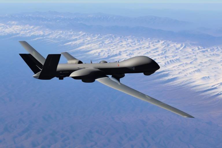
Drones have emerged as game-changers in the realm of meteorology, particularly in the collection of weather data. Imagine a bird soaring high above the clouds, capturing vital information that was once out of reach. This is precisely what drones do—they provide a bird's-eye view of the atmosphere, gathering data from areas that are often inaccessible or too dangerous for traditional weather stations. With their ability to fly at various altitudes and navigate through extreme conditions, drones are revolutionizing how we understand and predict weather patterns.
One of the most significant advantages of using drones in weather data collection is their real-time data acquisition. Equipped with advanced sensors, these unmanned aerial vehicles (UAVs) can measure temperature, humidity, wind speed, and atmospheric pressure on the fly. This immediate feedback loop allows meteorologists to update their models and forecasts almost instantaneously, which is crucial during rapidly changing weather events like thunderstorms or hurricanes. For instance, during a severe storm, a drone can quickly relay information about the storm's intensity and movement, enabling timely warnings to be issued to affected communities.
Moreover, drones can cover vast areas in a fraction of the time it would take traditional methods. They can be deployed to areas where ground-based weather stations are sparse, such as remote islands or mountainous regions. This capability not only enhances data collection but also improves the spatial resolution of weather models. By flying at different altitudes, drones can create detailed vertical profiles of the atmosphere, offering insights that are often missed by conventional forecasting techniques.
To illustrate the impact of drones on weather data collection, consider the following table that summarizes their key features and benefits:
| Feature | Benefit |
|---|---|
| Real-time data collection | Immediate updates to weather models |
| Access to remote areas | Enhanced data coverage and accuracy |
| Vertical profiling | Improved understanding of atmospheric layers |
| Cost-effective operations | Reduced need for extensive ground infrastructure |
Additionally, drones can be programmed to follow specific flight paths, allowing for systematic data collection over time. This capability is particularly useful for monitoring changes in weather patterns due to climate change. By regularly collecting data from the same locations, scientists can analyze trends and make predictions about future weather events. The integration of this data with existing meteorological models creates a more comprehensive understanding of atmospheric dynamics.
In conclusion, the role of drones in weather data collection cannot be overstated. They provide a level of detail and immediacy that is transforming meteorological practices. As technology continues to advance, we can expect drones to play an even more significant role in enhancing our ability to forecast extreme weather, ultimately improving disaster preparedness and response efforts.
Benefits of Autonomous Vehicles in Meteorology
Autonomous vehicles are revolutionizing the field of meteorology by providing unprecedented access to data that was previously difficult or impossible to obtain. Imagine a world where weather forecasting is not just reliant on stationary weather stations, but also on vehicles that can traverse rugged terrains, navigate through stormy conditions, and collect vital atmospheric data. This is not science fiction; it’s happening right now! With their ability to operate in extreme conditions, autonomous vehicles are enhancing the reliability and accuracy of weather predictions.
One of the most significant benefits of using autonomous vehicles in meteorology is their ability to cover vast and challenging terrains. Traditional weather stations are often limited to accessible locations, which can leave significant gaps in data collection. Autonomous vehicles, on the other hand, can reach remote areas, such as mountainous regions or coastal zones, where conventional methods struggle. For instance, a fleet of autonomous drones can be deployed over a hurricane, gathering real-time data on wind speeds and atmospheric pressure that would otherwise be inaccessible.
Moreover, these vehicles are equipped with advanced sensors that can measure a wide range of meteorological variables, including temperature, humidity, and air quality. This comprehensive data collection allows meteorologists to create more accurate models and forecasts. The precision of data collection from autonomous vehicles leads to better predictions of severe weather events, which is crucial for public safety and disaster preparedness.
Another key advantage is the reduction of human risk. Weather conditions can be unpredictable and dangerous, especially in extreme situations like tornadoes or floods. By deploying autonomous vehicles to gather data in these hazardous environments, we can minimize the risk to human life while still obtaining the necessary information to inform forecasts. This capability not only enhances safety but also ensures that meteorological teams can focus on analysis and response rather than data collection.
Furthermore, the integration of autonomous vehicles with existing meteorological systems can lead to improved data resolution. The ability to collect data at various altitudes and locations means that meteorologists can gain a more detailed understanding of local weather patterns. For instance, by using a combination of ground-based sensors and aerial data from drones, meteorologists can create a more nuanced picture of how weather systems develop and change over time. This increased resolution can significantly enhance the accuracy of short-term forecasts, which are essential for effective disaster response.
In addition, autonomous vehicles can operate continuously, providing real-time monitoring capabilities. Unlike traditional methods that rely on periodic data collection, autonomous systems can gather information consistently, allowing for dynamic updates to weather models. This capability is particularly valuable during severe weather events when conditions can change rapidly. With real-time data, meteorologists can issue timely warnings, potentially saving lives and minimizing property damage.
In conclusion, the integration of autonomous vehicles into meteorology is a game-changer. They not only enhance the scope and accuracy of weather data collection but also improve safety and efficiency in forecasting. As technology continues to evolve, we can expect even more innovative applications of autonomous systems in weather prediction, paving the way for a future where our understanding of extreme weather is deeper and more reliable than ever before.
- How do autonomous vehicles collect weather data? Autonomous vehicles are equipped with advanced sensors and technology that allow them to measure various meteorological parameters as they navigate through different terrains.
- What are the safety implications of using autonomous vehicles in extreme weather? By deploying autonomous vehicles in hazardous conditions, we can significantly reduce the risk to human life while still gathering critical data for weather forecasting.
- Can autonomous vehicles improve the accuracy of weather forecasts? Yes, the data collected from autonomous vehicles enhances the resolution and reliability of weather models, leading to more accurate forecasts.
Integration with Satellite Technology
The integration of unmanned systems, like drones and autonomous vehicles, with satellite technology is a game-changer in the realm of weather forecasting. Imagine this: while satellites orbit high above, capturing vast swathes of data from the atmosphere, drones are buzzing around at lower altitudes, collecting hyper-local information that satellites simply can't reach. This combination creates a robust framework for meteorologists to understand weather patterns with unparalleled precision.
Satellite technology provides a broad overview of weather systems, capturing large-scale phenomena such as hurricanes and fronts. However, the resolution of these images can be quite coarse, often missing the finer details that can make a significant difference in weather prediction. This is where unmanned systems come into play. Drones can fly into storm systems, gathering data on temperature, humidity, wind speed, and pressure at various altitudes, which can then be correlated with satellite data to create a more comprehensive picture.
For instance, consider a scenario where a hurricane is approaching land. Satellite data might indicate the storm's general path and size, but drones can provide crucial information about the storm's internal structure and changes in intensity. This data can be invaluable for issuing timely warnings and preparing communities for impending disasters.
Moreover, the integration of these technologies allows for real-time updates. As drones collect data, it can be transmitted back to meteorologists who can analyze it alongside satellite imagery. This real-time feedback loop ensures that forecasts are not only accurate but also timely, which is essential when lives are on the line.
To illustrate the benefits further, here’s a quick comparison of the capabilities of unmanned systems and traditional satellite data:
| Feature | Satellite Technology | Unmanned Systems |
|---|---|---|
| Altitude Coverage | High altitude (hundreds of kilometers) | Low altitude (up to several kilometers) |
| Data Resolution | Coarse (large areas) | High (localized) |
| Real-Time Data Collection | Delayed (hourly updates) | Immediate (live data) |
| Cost of Operation | High (satellite launches) | Lower (drone operation) |
This table clearly demonstrates how the collaboration between satellite technology and unmanned systems can enhance weather forecasting capabilities. As we continue to refine these technologies and their integration, we can expect even more accurate and timely weather predictions, which are vital for disaster preparedness and response.
In conclusion, the synergy between unmanned systems and satellite technology is paving the way for a new era in meteorology. By leveraging the strengths of both, we can achieve a level of forecasting that not only saves time and resources but ultimately saves lives. The future of weather forecasting is not just in the clouds but also in the skies above us, where drones and satellites work hand in hand.
Improving Data Resolution
When it comes to predicting the weather, the resolution of the data we use is absolutely crucial. Think of it this way: if you're trying to find your friend in a crowded concert, having a zoomed-in view of the crowd can make all the difference. Similarly, in meteorology, higher data resolution allows meteorologists to pinpoint weather phenomena with greater accuracy. Unmanned systems, particularly drones, play a pivotal role in enhancing this resolution.
Drones are equipped with advanced sensors that can collect data at various altitudes and locations, including remote and challenging terrains where traditional weather stations might not be able to reach. This capability means that meteorologists can gather detailed data on temperature, humidity, wind speed, and atmospheric pressure in real-time. For instance, a drone flying at 1,000 feet can capture data that ground-based stations might miss, particularly in areas with complex topography, such as mountains or valleys.
Moreover, the data collected by these unmanned systems can be integrated with existing weather models to create a more comprehensive picture of the atmosphere. This integration allows for a finer grid in weather models, which enhances local forecasting. For example, in regions prone to sudden weather changes, having high-resolution data can lead to quicker and more accurate warnings for severe weather events like thunderstorms or tornadoes.
To illustrate the impact of improved data resolution, consider the following table that compares traditional weather forecasting methods with those utilizing unmanned systems:
| Method | Data Resolution | Response Time | Accuracy |
|---|---|---|---|
| Traditional Stations | Low | Slow | Moderate |
| Drones and Unmanned Systems | High | Fast | High |
As we can see, the use of drones significantly enhances the resolution of weather data, leading to faster responses and higher accuracy. This is not just about numbers; it’s about saving lives and protecting property. When severe weather is forecasted accurately, communities can prepare and respond effectively, minimizing the impact of natural disasters.
In conclusion, the integration of unmanned systems into weather forecasting is a game-changer. By improving data resolution, these technologies not only enhance the accuracy of forecasts but also empower meteorologists to provide timely and actionable insights. As we continue to innovate and invest in these technologies, the potential for more effective disaster preparedness grows exponentially.
- What types of unmanned systems are used in weather forecasting? Drones and autonomous vehicles are the primary unmanned systems utilized for collecting meteorological data.
- How do unmanned systems improve weather forecasting? They provide high-resolution data from hard-to-reach areas, allowing for more accurate and timely forecasts.
- What are the main challenges in using unmanned systems for weather forecasting? Challenges include regulatory issues, technical limitations, and data integration difficulties.
- Can drones operate in extreme weather conditions? While drones can operate in various conditions, extreme weather may limit their effectiveness and safety.
Real-Time Monitoring Capabilities
In the realm of meteorology, the ability to monitor weather conditions in real-time is nothing short of revolutionary. Imagine being able to observe the atmosphere as it changes, capturing data that was once elusive and difficult to obtain. Unmanned systems, particularly drones and autonomous vehicles, are at the forefront of this transformation, offering unprecedented insights into weather phenomena. With the capability to fly into storm systems, these devices collect critical data that can significantly enhance our understanding of severe weather events.
One of the most remarkable aspects of real-time monitoring is the speed at which data can be gathered and analyzed. Traditional weather stations often rely on static data points, which can lead to delayed responses in forecasting. In contrast, unmanned systems can traverse vast areas and provide immediate feedback. For example, a drone can be deployed to a hurricane's eye, collecting data on wind speed, humidity, and temperature. This data is then transmitted back to meteorologists within minutes, allowing them to adjust forecasts and provide timely warnings to communities at risk.
Moreover, the integration of real-time monitoring capabilities with advanced analytics creates a powerful tool for meteorologists. By employing machine learning algorithms, the data collected by unmanned systems can be processed to identify patterns and trends that are not immediately apparent. This means that not only are we reacting to current conditions, but we are also predicting future weather events with greater accuracy. The synergy between unmanned systems and data analytics is akin to having a crystal ball for weather forecasting, enabling us to foresee and mitigate the impacts of extreme weather.
However, the implementation of real-time monitoring does come with its challenges. For instance, the reliability of data transmission can be affected by environmental factors, such as heavy rain or strong winds. To counter this, researchers and engineers are continually developing more robust communication technologies. Additionally, the sheer volume of data generated necessitates efficient storage and processing systems. But the benefits far outweigh these challenges, as the ability to monitor conditions in real-time can save lives and property.
To illustrate the impact of real-time monitoring capabilities, consider the following table that outlines key advantages:
| Advantage | Description |
|---|---|
| Immediate Data Collection | Unmanned systems can quickly gather atmospheric data, providing timely insights into changing weather conditions. |
| Enhanced Forecasting Accuracy | Real-time data allows for adjustments to forecasts, improving their reliability and precision. |
| Proactive Disaster Preparedness | Timely information enables authorities to issue warnings and prepare for extreme weather events, potentially saving lives. |
In conclusion, the real-time monitoring capabilities provided by unmanned systems represent a significant leap forward in meteorological practices. With the combination of rapid data collection, advanced analytics, and enhanced forecasting accuracy, we are better equipped to face the challenges posed by extreme weather. As technology continues to evolve, the future of weather forecasting looks brighter than ever, promising a safer and more informed society.
- How do drones collect weather data?
Drones are equipped with various sensors that measure atmospheric conditions such as temperature, humidity, wind speed, and pressure. They can fly to specific altitudes and locations to gather data that is otherwise difficult to access. - What are the main challenges of using unmanned systems in meteorology?
Challenges include regulatory issues, technical limitations such as battery life and data transmission reliability, and the need for integration with existing meteorological systems. - How does real-time monitoring benefit disaster preparedness?
Real-time monitoring allows meteorologists to detect changes in weather patterns quickly, enabling timely warnings and proactive measures to be taken to protect lives and property.
Case Studies of Successful Implementations
In recent years, the integration of unmanned systems into extreme weather forecasting has not only proven beneficial but has also revolutionized how meteorologists approach data collection and analysis. One standout example is the use of drones during Hurricane Harvey in 2017. These drones were deployed to capture real-time aerial imagery and gather atmospheric data over flooded areas that were otherwise inaccessible. The information collected enhanced the accuracy of flood predictions, allowing emergency services to respond more effectively. Imagine being able to pinpoint where the flooding is most severe, all thanks to a drone flying above the chaos!
Another remarkable case is the deployment of autonomous vehicles in the Arctic region to study winter storms. Traditional forecasting methods often struggle with the extreme conditions present in these remote areas. However, researchers sent autonomous snowmobiles equipped with weather sensors to gather crucial data on temperature, wind speed, and humidity. The insights gained from this initiative led to improved models that can predict the intensity and path of winter storms, which is vital for communities that depend on accurate forecasts for safety and preparation.
Furthermore, a collaborative project between several universities and meteorological organizations utilized drones to monitor tornado-prone regions. These drones were equipped with advanced sensors to measure atmospheric pressure changes and wind patterns right before tornado formation. The data collected has been instrumental in developing early warning systems that can alert residents minutes before a tornado strikes, potentially saving countless lives. This is a prime example of how technology can bridge the gap between nature's unpredictability and human safety.
To illustrate the impact of these implementations, consider the following table summarizing the outcomes of these case studies:
| Case Study | Location | Outcome |
|---|---|---|
| Hurricane Harvey | Texas, USA | Enhanced flood prediction and emergency response |
| Arctic Winter Storms | Arctic Region | Improved storm intensity and path forecasting |
| Tornado Monitoring | Midwestern USA | Development of early warning systems |
These case studies not only highlight the effectiveness of unmanned systems in extreme weather forecasting but also inspire further innovation in meteorological practices. As technology continues to evolve, the potential for unmanned systems to enhance our understanding of weather phenomena is limitless. With each successful implementation, we move closer to a future where accurate weather forecasting is not just a possibility but a reality, ensuring that communities are better prepared for whatever nature throws their way.
Q1: How do drones collect weather data?
Drones are equipped with various sensors that measure atmospheric conditions such as temperature, humidity, wind speed, and pressure. They can fly to areas that are hard to reach and gather real-time data.
Q2: What are the main benefits of using unmanned systems in weather forecasting?
Unmanned systems enhance data collection speed and accuracy, improve spatial resolution, and allow for real-time monitoring, leading to better forecasting and disaster preparedness.
Q3: Are there any risks associated with using drones for weather data collection?
Yes, there are risks such as regulatory challenges, safety concerns, and technical limitations that need to be addressed to ensure the effective use of drones in meteorology.
Challenges in Implementing Unmanned Systems
While the integration of unmanned systems like drones and autonomous vehicles into extreme weather forecasting presents a thrilling opportunity for enhanced accuracy and efficiency, it is not without its challenges. One of the primary hurdles is navigating the complex regulatory landscape that governs the use of these technologies. Regulatory bodies often impose strict guidelines to ensure safety, which can slow down the deployment of unmanned systems in meteorological applications. For instance, drone operations must comply with airspace regulations, which can vary significantly from one region to another. This can create a patchwork of rules that complicates the ability to conduct widespread data collection.
Moreover, safety concerns are paramount. The potential for accidents, whether due to technical malfunctions or human error, raises significant worries among regulatory agencies and the public alike. These concerns can lead to a hesitance in adopting unmanned systems, as stakeholders weigh the benefits against the risks. As a result, extensive testing and certification processes are often required before these systems can be used in critical scenarios like severe weather forecasting.
Another challenge lies in the technical limitations of unmanned systems themselves. For example, battery life remains a significant constraint for drones, limiting their operational range and duration. A drone that can only fly for a short period may miss crucial weather data, especially in rapidly changing conditions. Additionally, data transmission can be problematic; many drones rely on radio signals to send back information, but these signals can be disrupted by environmental factors or physical obstructions, leading to gaps in data collection.
To tackle these issues, researchers and engineers are continuously working on innovative solutions. For instance, advancements in battery technology are being explored to extend flight times, while improved communication systems are being developed to enhance data transmission reliability. Furthermore, the integration of unmanned systems with existing meteorological infrastructure can help streamline data collection processes and improve overall efficiency.
Despite these challenges, the potential benefits of unmanned systems in extreme weather forecasting are too significant to ignore. By addressing regulatory and technical hurdles, the meteorological community can harness these cutting-edge technologies to revolutionize how we predict and respond to severe weather events.
- What are unmanned systems? Unmanned systems refer to technologies such as drones and autonomous vehicles that operate without direct human control, allowing for data collection and monitoring in various environments.
- How do drones improve weather forecasting? Drones gather atmospheric data in hard-to-reach areas, providing real-time information that enhances the accuracy of weather models and forecasts.
- What are the main challenges in using unmanned systems for weather forecasting? The main challenges include regulatory restrictions, safety concerns, technical limitations like battery life, and data transmission issues.
- Are there solutions to the challenges faced by unmanned systems? Yes, ongoing research is focused on improving battery technology, enhancing communication systems, and developing frameworks for regulatory compliance to maximize the effectiveness of unmanned systems.
Regulatory and Safety Concerns
The integration of unmanned systems into extreme weather forecasting brings a wave of excitement and innovation, but it also raises a multitude of . As drones and autonomous vehicles take to the skies and rugged terrains, the question of how to safely operate these technologies becomes paramount. For instance, regulatory bodies must establish guidelines that ensure these unmanned systems do not interfere with manned aircraft, especially in crowded airspaces. This is no small feat, as the skies are becoming increasingly congested.
Moreover, safety is not just about avoiding collisions; it also encompasses the reliability of the technology itself. What happens if a drone loses signal or experiences a mechanical failure while collecting critical data during a storm? The implications could be dire, not just for the unmanned system itself but for the accuracy of the data being collected. To mitigate these risks, operators must adhere to strict safety protocols, which may include:
- Regular maintenance checks on equipment
- Implementing fail-safe mechanisms
- Training operators comprehensively
In addition to these operational safety measures, there is also the matter of privacy. The use of drones for weather data collection often means flying over private properties. This raises questions about the ethical implications of surveillance and data collection without consent. Striking a balance between the need for accurate weather forecasting and respecting individual privacy rights is a challenge that regulators must address.
Furthermore, the challenge of data integration cannot be overlooked. With multiple unmanned systems collecting data, ensuring that this information is aggregated and analyzed correctly is crucial. Different systems may operate under varying regulations and standards, leading to potential discrepancies in data quality. This inconsistency can affect forecasting models, ultimately impacting public safety.
In summary, while unmanned systems hold the promise of revolutionizing extreme weather forecasting, the path forward is fraught with regulatory and safety challenges. It is essential for stakeholders—governments, meteorological organizations, and technology developers—to work collaboratively to establish a framework that prioritizes safety while embracing innovation. Only then can we harness the full potential of these remarkable technologies without compromising public safety or trust.
Q1: What are the main regulatory concerns regarding unmanned systems in weather forecasting?
A1: The key regulatory concerns include airspace management, operational safety, privacy issues, and data integration standards. Establishing clear guidelines is essential to ensure safe and effective operations.
Q2: How do unmanned systems ensure data reliability?
A2: Unmanned systems can enhance data reliability through regular maintenance, implementing fail-safe mechanisms, and comprehensive training for operators to handle various scenarios.
Q3: What privacy concerns are associated with using drones for weather data collection?
A3: Drones flying over private properties can raise ethical questions about surveillance and data collection without consent, necessitating a balance between accurate forecasting and individual privacy rights.
Technical Limitations and Solutions
The integration of unmanned systems in extreme weather forecasting is undoubtedly a game changer, but it doesn't come without its technical limitations. One of the most pressing issues is battery life. Drones and autonomous vehicles rely heavily on battery power, and when they are deployed in remote locations for extended periods, they risk running out of juice before completing their missions. Imagine a drone that can only fly for an hour when it needs to cover vast areas; that’s like trying to run a marathon with a broken leg!
Another significant challenge is data transmission. Unmanned systems collect a wealth of information, but transmitting that data back to meteorologists in real-time can be problematic, especially in areas with poor connectivity. It’s like trying to send a postcard from the middle of nowhere; the message might not get through! To tackle these issues, experts are working on several innovative solutions.
For instance, advancements in battery technology are being explored, such as the use of solar panels to extend flight times or the development of more efficient batteries that last longer. Additionally, researchers are looking into swarm technology, where multiple drones work together to cover larger areas more efficiently, thus minimizing the risk of losing valuable data due to battery constraints.
Moreover, to address the data transmission challenges, utilizing mesh networking can be a game changer. This technology allows drones to communicate with one another and relay data back to a central hub, even when direct connectivity is poor. It's like having a group of friends pass along a message until it reaches the intended recipient, ensuring that critical weather data isn’t lost along the way.
In summary, while the technical limitations of unmanned systems present challenges, the ongoing innovations in battery life and data transmission technologies offer promising solutions. As these advancements continue to evolve, we can expect unmanned systems to play an even more crucial role in enhancing the accuracy and efficiency of extreme weather forecasting.
- What are unmanned systems? Unmanned systems refer to drones and autonomous vehicles used for various applications, including weather forecasting.
- How do drones improve weather forecasting? Drones collect atmospheric data from hard-to-reach areas, providing real-time information that enhances weather models.
- What are the main challenges of using unmanned systems in meteorology? Key challenges include battery life, data transmission issues, and regulatory concerns.
- What solutions are being developed for these challenges? Innovations in battery technology, swarm technology, and mesh networking are being explored to overcome these limitations.
Frequently Asked Questions
- What are unmanned systems in extreme weather forecasting?
Unmanned systems, such as drones and autonomous vehicles, are innovative technologies used to collect and analyze meteorological data, especially in challenging environments where traditional methods may struggle. They enhance the accuracy and efficiency of weather forecasts, enabling better disaster preparedness.
- How do drones improve weather data collection?
Drones can reach remote and difficult-to-access areas, capturing real-time atmospheric data. This capability significantly enhances weather models and forecasts, providing meteorologists with a wealth of information that was previously hard to obtain.
- What advantages do autonomous vehicles offer in meteorology?
Autonomous vehicles can navigate challenging terrains to gather meteorological data that might be missed by conventional methods. This ability not only improves the accuracy of weather predictions but also helps in understanding complex weather patterns.
- How do unmanned systems integrate with satellite technology?
By combining data from unmanned systems with satellite observations, meteorologists gain a comprehensive view of weather patterns. This integration allows for more precise and timely forecasts, improving overall situational awareness during extreme weather events.
- What is the impact of improved data resolution?
Improved data resolution means that weather predictions can be more localized and accurate. By utilizing drones and autonomous systems, meteorologists can better predict specific weather events, such as storms or floods, which can save lives and property.
- What are the real-time monitoring capabilities of unmanned systems?
Unmanned systems provide continuous monitoring of weather conditions, allowing meteorologists to quickly respond to changing situations. This capability is crucial for issuing timely warnings and alerts to the public during severe weather events.
- Are there any successful case studies of unmanned systems in weather forecasting?
Yes, several case studies have demonstrated the successful application of unmanned systems in extreme weather forecasting. These examples showcase how drones and autonomous vehicles have effectively contributed to better data collection and improved forecasting accuracy in various scenarios.
- What challenges are associated with implementing unmanned systems?
Despite their advantages, the deployment of unmanned systems in weather forecasting faces challenges such as regulatory issues, safety concerns, technical limitations, and difficulties in data integration. Addressing these challenges is crucial for their effective use in meteorology.
- How do regulatory concerns affect unmanned systems in meteorology?
Navigating the regulatory landscape is essential for the safe operation of unmanned systems. Regulatory and safety concerns can hinder the widespread adoption of these technologies in meteorology, making it important for stakeholders to work together to establish clear guidelines.
- What are the technical limitations of unmanned systems?
Technical limitations such as battery life, data transmission capabilities, and environmental factors can impact the performance of unmanned systems. Addressing these issues is vital to maximize their potential and ensure reliable data collection for weather forecasting.