How Satellites Enhance Readiness for Special Operations
In the high-stakes world of modern warfare, special operations forces (SOF) are often the first line of defense, executing missions that require precision, stealth, and speed. But what gives these elite units the edge they need to succeed? The answer lies in the sky—specifically, in the vast network of satellites orbiting our planet. These technological marvels play a pivotal role in enhancing the operational readiness of special forces, enabling them to gather intelligence, communicate effectively, and navigate challenging terrains with pinpoint accuracy. Imagine being able to see the battlefield from above, receiving real-time updates, and having a direct line of communication with command centers hundreds of miles away. It's like having a bird's eye view combined with a walkie-talkie that works anywhere in the world!
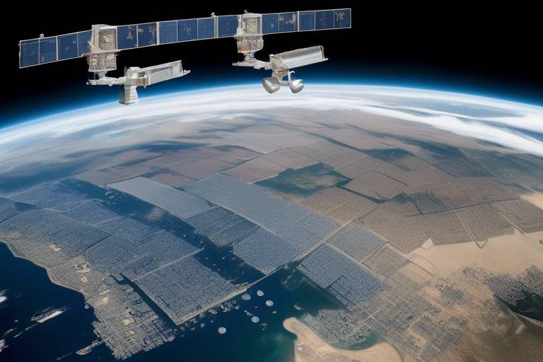
Satellites provide a comprehensive framework that supports various aspects of military operations. From reconnaissance to communication and navigation, each type of satellite serves a unique purpose, contributing to the overall effectiveness of special operations. For instance, reconnaissance satellites can capture high-resolution images of enemy positions, while communication satellites ensure that teams remain connected, even in remote locations. This interconnectedness allows special forces to execute missions with a level of coordination and efficiency that would be impossible without satellite technology.
Moreover, the integration of satellite data into the planning and execution of missions transforms the way special operations are conducted. It’s not just about having access to information; it’s about how that information is utilized. By marrying satellite intelligence with ground operations, commanders can make informed decisions that significantly increase the chances of mission success. Picture this: a team on the ground receives a real-time update about enemy movements from a satellite, allowing them to adjust their strategy on the fly. This kind of adaptability is crucial in the unpredictable landscape of special operations.
However, while the advantages of satellite technology are immense, they are not without challenges. Special operations forces must also contend with potential vulnerabilities, such as electronic warfare tactics that can disrupt satellite communications. This reality underscores the need for robust contingency plans and redundancy in navigation and communication systems. Just like a safety net for a tightrope walker, these systems ensure that even if one layer of technology fails, others can step in to maintain operational integrity.
In essence, satellites are not just tools; they are lifelines that enhance the readiness and effectiveness of special operations forces. They provide the critical information and communication capabilities that allow these elite units to operate in the most demanding environments. As technology continues to evolve, the role of satellites in military operations will only become more significant, paving the way for even more advanced strategies and tactics in the future.
- How do satellites improve communication for special operations?
Satellites ensure secure and reliable communication channels, allowing teams to coordinate effectively during missions, even in remote areas where traditional communication methods may fail.
- What types of satellites are most commonly used in special operations?
Reconnaissance, communication, and navigation satellites are the primary types utilized, each serving a distinct purpose to enhance mission success.
- Are there any risks associated with relying on satellite technology?
Yes, the main risks include vulnerabilities to electronic warfare and the potential for satellite communication disruptions, necessitating backup systems and contingency plans.
The Role of Satellites in Military Operations
In today's fast-paced world, the role of satellites in military operations cannot be overstated. These orbiting marvels have become the backbone of modern warfare, providing essential services that enhance the effectiveness of special operations forces on the ground. Imagine a chess game where your opponent is always three moves ahead; that’s how critical real-time intelligence is in military scenarios. Satellites help level the playing field by gathering crucial information, ensuring that special forces are always prepared for whatever challenges they may face.
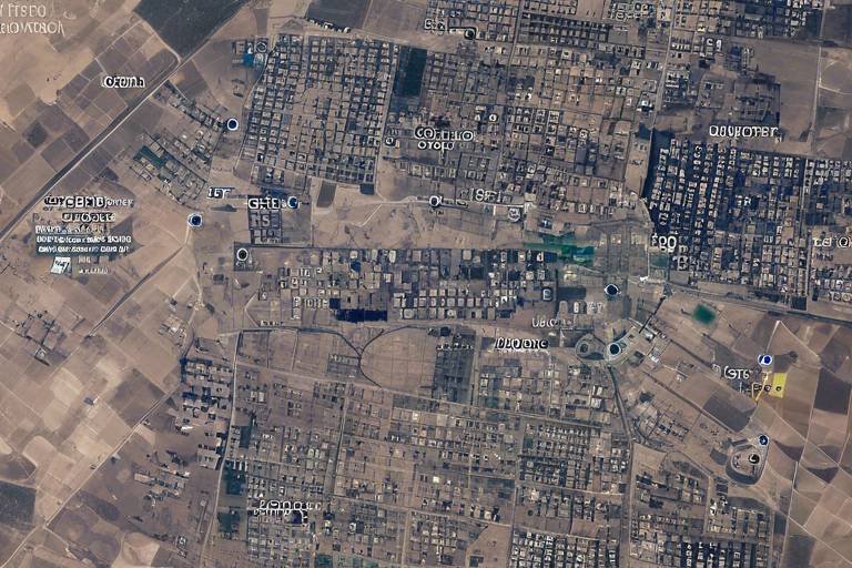
One of the most significant contributions of satellites is their ability to gather intelligence. This isn’t just about taking pretty pictures from space; it’s about collecting data that can change the course of missions. For instance, reconnaissance satellites can capture high-resolution images that allow military analysts to assess enemy positions, troop movements, and even infrastructure. This kind of information is vital for planning tactical maneuvers and executing missions with precision.
Furthermore, satellites provide robust communication capabilities. In the chaotic environment of a battlefield, clear and secure communication can mean the difference between success and failure. Communication satellites ensure that special operations teams can coordinate effectively, even when operating in remote or hostile areas. Imagine trying to execute a complex maneuver without being able to talk to your team; it would be like trying to build a puzzle blindfolded. Satellites eliminate that uncertainty, allowing for seamless communication that enhances operational readiness.
Navigation is another crucial aspect where satellites shine. GPS and navigation satellites provide precise location data, enabling special operations forces to navigate unfamiliar terrains with ease. This capability is particularly important when missions require stealth and speed. Think of it as having a personal guide who knows every nook and cranny of a dense forest or urban landscape. Accurate navigation data influences mission planning, allowing teams to optimize routes, minimize risks, and ensure timely execution of objectives.
In addition to these primary roles, satellites also serve as a platform for various technologies that enhance military operations. For example, satellite-based sensors can detect changes in the environment, such as troop movements or changes in infrastructure. This data can be integrated with other intelligence sources to provide a comprehensive picture of the battlefield. The integration of satellite data with ground forces enables timely decision-making and improved coordination during missions, ultimately increasing the chances of success.
However, it’s essential to recognize that while satellites significantly enhance military operations, they are not without challenges. Vulnerabilities to electronic warfare and the need for redundancy in communication and navigation systems are critical considerations. As we advance further into the digital age, ensuring the security and reliability of satellite systems will be paramount for maintaining operational readiness.
Types of Satellites Used in Special Operations
When it comes to special operations, the right tools can make all the difference, and satellites are at the forefront of this technological revolution. Different types of satellites serve distinct yet complementary roles, each playing a pivotal part in ensuring the success of missions that often take place in high-stakes environments. Understanding these various types can help us appreciate how they contribute to the operational readiness of special forces. Let's dive deeper into the key categories of satellites that enhance the effectiveness of special operations.
First and foremost, we have reconnaissance satellites. These are the eyes in the sky, equipped with advanced sensors that capture high-resolution imagery of enemy positions and terrain. Imagine having a bird's-eye view of the battlefield, allowing special forces to assess threats and plan their tactical maneuvers with precision. The data gathered from these satellites is invaluable, especially when time is of the essence. With real-time intelligence, special operations can adapt their strategies on the fly, ensuring they stay one step ahead of the enemy.
Next up are communication satellites. In the chaotic environment of a special operation, maintaining clear and secure lines of communication is crucial. These satellites provide the backbone for reliable communication between team members, command centers, and support units. Picture a web of connectivity that spans vast distances, enabling seamless coordination even in the most challenging terrains. Whether it's relaying commands, sharing intelligence, or coordinating movements, communication satellites ensure that everyone is on the same page, which can be the difference between mission success and failure.
Another essential type is navigation satellites, particularly those that form part of the Global Positioning System (GPS). These satellites provide precise location data, allowing special operations forces to navigate unfamiliar terrains with ease. Imagine trying to find your way through a dense jungle or a sprawling urban landscape without a reliable map. GPS satellites eliminate that uncertainty, enabling teams to optimize their routes, minimize risks, and execute missions with remarkable accuracy. The integration of GPS technology into mission planning has revolutionized how special forces operate, making them more agile and efficient.
To summarize, the types of satellites used in special operations can be categorized into three main groups:
- Reconnaissance Satellites: For intelligence gathering and real-time imagery.
- Communication Satellites: For secure and reliable communication.
- Navigation Satellites: For precise location data and route optimization.
In conclusion, each type of satellite plays a unique role that significantly enhances the operational readiness of special forces. Their combined capabilities allow for better planning, execution, and adaptability in the field, ensuring that special operations can respond effectively to any challenge that arises. As technology continues to evolve, we can only expect these satellites to become even more integral to military operations, paving the way for new strategies and greater successes in the realm of special operations.
Q1: How do reconnaissance satellites gather intelligence?
A1: Reconnaissance satellites gather intelligence through high-resolution imaging and various sensors that capture detailed information about enemy positions, movements, and terrain features.
Q2: What makes communication satellites essential for special operations?
A2: Communication satellites provide secure and reliable communication channels, ensuring that special operations teams can coordinate effectively, even in remote or hostile environments.
Q3: How do navigation satellites improve mission planning?
A3: Navigation satellites offer precise location data, allowing special forces to navigate unfamiliar terrains efficiently, optimize routes, and reduce risks during missions.
Reconnaissance Satellites
Reconnaissance satellites are the unsung heroes of modern warfare, providing a **vital link** between the skies and the ground. These high-tech marvels are equipped with sophisticated imaging systems that capture detailed photographs and data from thousands of miles above the Earth. Imagine having a bird's-eye view of enemy movements, troop concentrations, and even the layout of a fortified position—all without ever setting foot on the battlefield! This capability is crucial for special operations forces, who rely on real-time intelligence to make informed decisions in dynamic environments.
One of the most significant advantages of reconnaissance satellites is their ability to gather **high-resolution imagery**. This imagery can be processed to reveal intricate details, allowing military analysts to assess enemy positions with incredible precision. For instance, advanced imaging techniques can distinguish between different types of vehicles, identify supply routes, and even detect changes in terrain that could affect mission planning. The information derived from these satellites is not just data; it’s a **game changer** that can tilt the odds in favor of special operations units.
To maximize the potential of reconnaissance satellites, military analysts employ **advanced imagery analysis techniques**. These techniques include digital image processing, machine learning algorithms, and artificial intelligence, which help in interpreting vast amounts of data quickly and accurately. By applying these methods, analysts can transform raw satellite images into actionable intelligence, providing special operations forces with insights that enhance situational awareness.
The true power of reconnaissance satellites is realized when their data is integrated with ground forces. This integration allows for **timely decision-making** and improved coordination during missions. For example, if a reconnaissance satellite identifies an enemy ambush ahead of a special operations team, commanders can adjust their strategy in real-time, avoiding potential casualties and increasing the likelihood of mission success. This synergy between satellite data and ground operations exemplifies how modern warfare has evolved into a highly interconnected battlefield, where information is as crucial as firepower.
However, it's important to note that the effectiveness of reconnaissance satellites is not just about the technology itself; it also hinges on the **training and expertise** of the personnel involved. Special operations forces must be adept at interpreting satellite data and integrating it into their operational plans. This requires a unique skill set that combines technical knowledge with tactical awareness, ensuring that they can leverage the full potential of reconnaissance capabilities.
In conclusion, reconnaissance satellites play an indispensable role in enhancing the operational readiness of special forces. By providing real-time intelligence and facilitating seamless integration with ground operations, these satellites empower military leaders to make informed decisions that can mean the difference between success and failure on the battlefield. As technology continues to evolve, the capabilities of reconnaissance satellites will only become more sophisticated, further solidifying their position as a cornerstone of modern military strategy.
- What are reconnaissance satellites used for?
Reconnaissance satellites are primarily used for gathering intelligence, monitoring enemy movements, and providing high-resolution imagery for military operations. - How do reconnaissance satellites enhance special operations?
They provide real-time intelligence that helps special operations forces assess enemy positions and plan tactical maneuvers effectively. - What technologies are used in reconnaissance satellites?
Reconnaissance satellites utilize advanced imaging systems, digital processing, and artificial intelligence to analyze and interpret data. - How is satellite data integrated with ground forces?
Satellite data is analyzed and then shared with ground units to inform decision-making and improve coordination during missions.
Imagery Analysis Techniques
When it comes to modern warfare, the ability to interpret satellite imagery is akin to having a crystal ball that reveals the enemy's every move. have evolved dramatically, leveraging cutting-edge technology to transform raw data into actionable intelligence. This process begins with the use of advanced algorithms and machine learning, which can sift through vast amounts of imagery to identify patterns and anomalies that the human eye might miss. Imagine trying to find a needle in a haystack; these techniques do just that, making it possible to spot enemy troop movements or equipment deployments in real-time.
Furthermore, high-resolution imagery captured by reconnaissance satellites can be analyzed using various methods, such as change detection and object recognition. Change detection involves comparing images taken at different times to identify alterations in the landscape or troop positions. This method is crucial for understanding how enemy forces are shifting and adapting to the battlefield. On the other hand, object recognition employs sophisticated algorithms to identify specific targets, whether they are vehicles, weapons, or even personnel. By automating these processes, military analysts can generate insights much faster than traditional methods would allow.
Integration of these techniques with ground forces is another game-changer. When satellite imagery is combined with data from drones and ground reconnaissance, the result is a comprehensive operational picture that enhances situational awareness. For instance, using a combination of satellite data and real-time ground reports, commanders can make informed decisions about troop movements and tactics. This integration not only boosts the chances of mission success but also minimizes the risk to personnel on the ground.
Moreover, the role of human analysts cannot be understated. While technology plays a significant role, the experience and intuition of skilled personnel are invaluable. Analysts are trained to interpret the nuances of satellite imagery, understanding the context of what they see. They can discern whether a group of vehicles is merely parked or preparing for a tactical maneuver. This human element, combined with advanced technology, creates a powerful synergy that drives mission success.
In summary, imagery analysis techniques are a cornerstone of modern military operations, providing special forces with the intelligence they need to operate effectively. As technology continues to advance, we can expect these techniques to become even more sophisticated, further enhancing the readiness and effectiveness of special operations forces.
- What are reconnaissance satellites? Reconnaissance satellites are specialized satellites designed to gather intelligence through high-resolution imaging and data collection.
- How do imagery analysis techniques improve military operations? These techniques allow for the quick interpretation of satellite data, enhancing situational awareness and aiding in tactical decision-making.
- What is the role of machine learning in imagery analysis? Machine learning algorithms help automate the process of analyzing vast amounts of imagery, identifying patterns, and detecting changes efficiently.
- Why is human analysis still important in conjunction with technology? Human analysts provide context and intuition that machines cannot replicate, ensuring that critical nuances are not overlooked.
Integration with Ground Forces
Integrating reconnaissance satellite data with ground forces is a game changer in the realm of special operations. Imagine being a special forces operator, deep in enemy territory, with real-time intelligence flowing in from above. This synergy between satellite capabilities and ground-level execution creates a powerful force multiplier. It’s like having a bird’s-eye view of the battlefield, where every move can be anticipated and countered with precision.
One of the key benefits of this integration is the ability to make timely decisions. When reconnaissance satellites provide up-to-the-minute data on enemy movements and terrain conditions, ground forces can adapt their strategies on the fly. This responsiveness is crucial in high-stakes environments where the situation can change in an instant. For example, if a satellite detects an unexpected troop movement, ground commanders can quickly alter their approach, ensuring they maintain the upper hand.
Furthermore, the integration of satellite data enhances situational awareness. Ground troops can access satellite imagery and analytics through mobile devices or secure communication systems. This access allows them to visualize the battlefield in a way that was previously unimaginable. With detailed maps and real-time updates, soldiers can navigate complex terrains and identify potential threats before they become critical issues.
However, this integration is not without its challenges. It requires robust technology and reliable communication systems that can function under various conditions. The data must be processed and disseminated quickly to ensure that ground forces can act on the information. Moreover, training is essential; troops must be well-versed in interpreting satellite data and understanding how to leverage it effectively during missions.
In summary, the integration of reconnaissance satellite data with ground forces transforms the dynamics of special operations. It not only enhances decision-making and situational awareness but also fosters coordination among various units. This collaborative approach is vital for mission success, making it clear that in modern warfare, the sky truly is the limit.
- How do reconnaissance satellites gather data? Reconnaissance satellites use advanced imaging technologies to capture high-resolution images of the Earth's surface, which are then analyzed for intelligence purposes.
- What role do communication satellites play in special operations? Communication satellites provide secure and reliable channels for special operations teams to coordinate and share information during missions.
- Are there risks associated with relying on satellite data? Yes, reliance on satellite data can expose vulnerabilities to electronic warfare, making it essential to have backup systems in place.
- How does GPS technology assist special operations forces? GPS technology provides precise location data, enabling forces to navigate accurately and plan their routes effectively in unfamiliar terrains.
Communication Satellites
When it comes to special operations, communication is not just a convenience; it's a lifeline. play a pivotal role in ensuring that special operations forces remain connected, no matter where they are on the globe. Imagine being in a high-stakes scenario, surrounded by adversaries, and the only thing standing between success and failure is the ability to relay critical information back to command. This is where communication satellites come in, acting as the backbone of military communication networks.
These satellites provide a secure and reliable means of communication that is essential for coordinating complex missions. They enable voice, data, and video communications, which are vital for real-time decision-making. In an environment where every second counts, the ability to communicate swiftly and effectively can mean the difference between victory and defeat. With advancements in technology, modern communication satellites have become increasingly sophisticated, offering enhanced bandwidth and reduced latency.
Moreover, the integration of into military operations allows for:
- Secure Channels: Military-grade encryption ensures that communications are protected from interception, keeping sensitive information safe from enemy eyes.
- Global Coverage: These satellites orbit the Earth, providing coverage to remote and inhospitable regions where traditional communication methods may falter.
- Redundancy: In the event of a satellite failure, multiple satellites can provide overlapping coverage, ensuring that communication lines remain open.
However, the reliance on these satellites does not come without challenges. Adversaries are increasingly developing countermeasures designed to disrupt satellite communications, which can jeopardize operational effectiveness. This ongoing arms race means that special operations forces must remain vigilant and adaptable, constantly updating their tactics to mitigate these risks.
In essence, are not just tools; they are vital components of modern warfare that enhance the operational readiness of special forces. They facilitate seamless coordination, enabling teams to execute missions with precision and confidence. As technology continues to evolve, we can expect these satellites to become even more integral to military operations, providing capabilities that were once thought to be the stuff of science fiction.
- What are communication satellites used for in military operations?
Communication satellites are used to provide secure and reliable communication channels for coordinating missions, sharing intelligence, and executing operations in real-time. - How do communication satellites ensure secure communication?
They utilize military-grade encryption protocols to protect data from interception and maintain secure lines of communication. - What challenges do communication satellites face?
Challenges include vulnerabilities to electronic warfare, potential satellite failures, and the need for redundancy in communication systems.
GPS and Navigation Satellites
In the realm of modern warfare, are nothing short of game-changers for special operations forces. These technological marvels provide precise location data that is crucial for navigating unfamiliar terrains, which is often a key aspect of mission success. Imagine trying to find your way in a dense forest or a bustling urban environment without a map or a compass; it would be nearly impossible. This is where GPS satellites come into play, acting as the modern-day navigators for our elite military units.
When special forces are deployed on a mission, every second counts. They need to know their exact location, the location of their objectives, and how to get there efficiently. GPS satellites transmit signals that allow ground forces to determine their position with incredible accuracy. This data not only aids in navigation but also enhances the overall operational planning. With the ability to map out routes and identify potential hazards, special operations teams can make informed decisions that minimize risks and maximize their chances of success.
Furthermore, these satellites work in conjunction with various technologies to provide real-time updates. For instance, integrating GPS data with advanced mapping software enables teams to visualize their surroundings in a way that was previously unimaginable. They can see not just where they are, but also the terrain features, obstacles, and even the locations of friendly and enemy forces. This level of situational awareness is vital for executing complex missions, especially when time is of the essence.
However, it’s important to note that GPS and navigation systems are not without their challenges. While they offer significant advantages, they also have vulnerabilities. For example, electronic warfare can disrupt GPS signals, potentially leaving forces disoriented and vulnerable. To counteract this, special operations units often employ a variety of navigational aids and backup systems to ensure they can operate effectively, even when GPS is compromised. This redundancy in systems is critical, as it ensures that even when technology fails, the mission can continue.
In conclusion, GPS and navigation satellites are integral to the success of special operations. By providing accurate location data, enhancing mission planning, and improving situational awareness, these satellites empower military forces to execute their objectives with precision and confidence. As technology continues to evolve, so too will the capabilities of these satellite systems, further transforming the landscape of modern warfare.
- How do GPS satellites work? GPS satellites orbit the Earth and transmit signals that allow receivers to calculate their exact location based on the time it takes for the signals to travel.
- What are the main challenges of using GPS in special operations? The main challenges include vulnerabilities to electronic warfare, signal interference, and the need for backup navigation systems.
- Can GPS be used in all environments? While GPS is highly effective in open areas, its effectiveness can be reduced in dense urban environments or heavily forested areas due to signal blockage.
Impact on Mission Planning
This article explores the critical role of satellites in improving the operational readiness of special forces, examining their applications, technologies, and strategic advantages in modern warfare.
Satellites are essential for gathering intelligence, providing communication, and enabling navigation in military operations, significantly enhancing the effectiveness of special operations forces on the ground.
Different types of satellites, including reconnaissance, communication, and navigation satellites, play unique roles in supporting special operations, each contributing to mission success in various ways.
Reconnaissance satellites are crucial for real-time intelligence gathering, offering high-resolution imagery that helps special operations forces assess enemy positions and plan tactical maneuvers effectively.
Advanced imagery analysis techniques allow military analysts to interpret satellite data quickly, providing actionable insights that enhance situational awareness for special operations.
Integrating reconnaissance satellite data with ground forces enables timely decision-making and improved coordination during missions, ultimately increasing the chances of success.
Communication satellites ensure secure and reliable communication among special operations teams, facilitating coordination and command during complex missions in challenging environments.
GPS and navigation satellites provide precise location data, enabling special operations forces to navigate unfamiliar terrains and execute missions with high accuracy and efficiency.
Accurate navigation data significantly influences mission planning for special operations. Imagine trying to navigate through a dense jungle or a bustling urban landscape without the right tools; it would be like trying to find a needle in a haystack! With GPS and navigation satellites, special operations teams can pinpoint their exact location, assess their surroundings, and chart a course that minimizes risks while maximizing efficiency.
Moreover, the integration of satellite data into mission planning allows for the optimization of routes. By analyzing various factors such as terrain, weather conditions, and potential enemy positions, commanders can make informed decisions that lead to successful outcomes. For instance, if a team is tasked with infiltrating a high-security area, they can utilize satellite data to identify the most discreet entry points, avoid detection, and ensure timely execution of their objectives.
To illustrate the impact of satellite navigation on mission planning, consider the following table:
| Factor | Traditional Planning | Satellite-Assisted Planning |
|---|---|---|
| Route Optimization | Manual calculations, prone to errors | Real-time data analysis, precise adjustments |
| Terrain Awareness | Limited maps and local knowledge | High-resolution satellite imagery |
| Time Management | Estimates based on assumptions | Accurate timing based on live data |
This table highlights how the integration of satellite technology transforms the planning process, making it more efficient and reliable. However, it's important to note that while satellites provide invaluable support, they are not infallible. Special operations teams must remain adaptable and prepared for any unforeseen challenges that may arise during their missions.
Despite their advantages, reliance on satellites poses challenges, including vulnerabilities to electronic warfare and the need for redundancy in communication and navigation systems.
- How do satellites improve communication in special operations?
Satellites provide secure and reliable communication channels, ensuring that special operations teams can coordinate effectively even in challenging environments. - What types of satellites are most beneficial for special operations?
Reconnaissance, communication, and navigation satellites each play crucial roles in enhancing the capabilities of special operations forces. - Can satellites be disrupted during missions?
Yes, satellites can be vulnerable to electronic warfare, which is why redundancy in communication and navigation systems is essential. - How does satellite data influence mission success?
By providing accurate and timely information, satellite data enables better planning and decision-making, ultimately increasing the chances of mission success.
Challenges and Limitations
While satellites provide a plethora of advantages for special operations forces, they are not without their challenges and limitations. One of the most significant issues is the vulnerability to electronic warfare. In an age where enemies are increasingly tech-savvy, the risk of jamming or spoofing satellite signals poses a serious threat. Imagine trying to navigate through a dense forest with a GPS that suddenly goes haywire—this is the kind of chaos that can ensue in a military operation when satellites are compromised.
Another challenge is the dependency on technology. The reliance on satellite systems means that any malfunction or disruption can lead to operational setbacks. For instance, if a communication satellite goes offline, it can severely hinder coordination among special operations teams, leaving them isolated in critical moments. This is akin to a ship losing its compass in uncharted waters—without guidance, even the most skilled crew can find themselves adrift.
Moreover, the need for redundancy in communication and navigation systems is paramount. Special operations must have backup systems in place to ensure that they can still function effectively if primary systems fail. This redundancy can come in various forms, such as ground-based communication networks or alternative navigation methods, but it requires additional resources and planning. The table below outlines some of the key challenges and their potential solutions:
| Challenge | Impact | Potential Solution |
|---|---|---|
| Vulnerability to Electronic Warfare | Disruption of critical satellite signals | Implementing anti-jamming technologies |
| Dependency on Technology | Operational setbacks from system failures | Developing backup communication systems |
| Need for Redundancy | Increased complexity and resource demands | Integrating multiple navigation methods |
In addition to these challenges, there are also limitations regarding the availability of satellite data. In some cases, weather conditions can obstruct satellite imagery, making it difficult to gather real-time intelligence. Think about trying to take a picture during a heavy rainstorm; the clarity and accuracy of the image are compromised. Similarly, cloud cover can hinder reconnaissance efforts, potentially leaving forces in the dark about enemy movements.
Finally, the cost of satellite technology cannot be overlooked. Developing, launching, and maintaining satellites requires significant financial investment. For many military budgets, especially in times of economic strain, these costs can be prohibitive. Thus, while satellites are a cornerstone of modern military operations, their integration into special operations must be carefully balanced against these challenges and limitations.
- What are the main challenges faced by satellites in military operations?
Satellites face challenges such as vulnerability to electronic warfare, dependency on technology, and the need for redundancy in systems.
- How do weather conditions affect satellite operations?
Weather conditions like heavy rain or cloud cover can obstruct satellite imagery, making it difficult to gather real-time intelligence.
- What solutions are available for overcoming satellite vulnerabilities?
Implementing anti-jamming technologies and developing backup communication systems can help mitigate vulnerabilities.
- Why is redundancy important in satellite communication?
Redundancy ensures that special operations forces can still communicate and navigate effectively in case primary systems fail.
Frequently Asked Questions
- How do satellites improve special operations readiness?
Satellites enhance special operations readiness by providing critical real-time intelligence, secure communication, and precise navigation. This integration allows special forces to make informed decisions quickly, coordinate effectively, and navigate challenging terrains with confidence.
- What types of satellites are used in military operations?
Military operations utilize various types of satellites, including reconnaissance satellites for intelligence gathering, communication satellites for secure messaging, and GPS satellites for navigation. Each type plays a unique role in ensuring mission success and operational efficiency.
- What is the significance of reconnaissance satellites?
Reconnaissance satellites are vital for capturing high-resolution imagery of enemy positions. This data allows special operations forces to assess situations accurately and plan tactical maneuvers effectively, significantly increasing their chances of success.
- How does imagery analysis enhance mission effectiveness?
Advanced imagery analysis techniques enable military analysts to quickly interpret satellite data, providing actionable insights. This enhanced situational awareness helps special operations forces to adapt their strategies promptly during missions.
- What role do communication satellites play?
Communication satellites are essential for maintaining secure and reliable communication among special operations teams. This connectivity is crucial for coordination and command during complex missions, especially in challenging environments where ground communication may be compromised.
- How do GPS and navigation satellites impact mission planning?
GPS and navigation satellites provide accurate location data, which is crucial for mission planning. With precise navigation, special operations can optimize routes, minimize risks, and ensure timely execution of their objectives, making each mission more efficient.
- What challenges do satellites face in military operations?
Despite their advantages, satellites face challenges such as vulnerabilities to electronic warfare and the need for redundancy in communication and navigation systems. These challenges necessitate careful planning and backup systems to ensure operational readiness.

