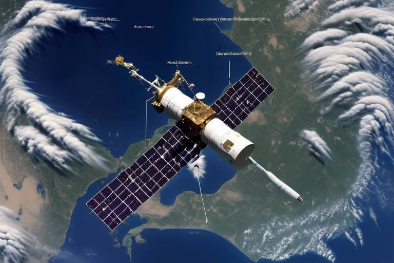
The Future of Satellite Data in National Defense
The landscape of national defense is undergoing a profound transformation, largely driven by the rapid evolution of satellite data technology. In a world where threats can emerge from any corner of the globe, the ability to gather, analyze, and utilize satellite data effectively has become a cornerstone of national security strategies. Imagine a vast web of interconnected satellites orbiting the Earth, each one collecting invaluable information that can be harnessed to safeguard nations. This article delves into the multifaceted role of satellite data in national defense, examining its implications for security, technology, and strategic planning in an increasingly complex global landscape.
As we navigate through the intricacies of modern defense, it's essential to recognize that satellite data is not just about surveillance; it's about informed decision-making. The information derived from satellites can provide insights into everything from troop movements to environmental changes that could impact national security. With the stakes higher than ever, understanding how to leverage this data effectively is paramount for defense agencies worldwide.
Moreover, the future of satellite data in national defense is not just a matter of technology; it also encompasses collaboration among nations. As threats become more sophisticated and global in nature, sharing satellite data and intelligence has become a necessity rather than a luxury. This article will explore how international cooperation can enhance security measures and foster a united front against common threats.
In summary, the future of satellite data in national defense is bright but complex. With advancements in technology, integration of data, and collaboration among nations, the potential for improved security and strategic planning is immense. However, it also raises critical questions about data security, ethical considerations, and the balance between surveillance and privacy. Join us as we explore these themes in depth, painting a comprehensive picture of what lies ahead in the realm of satellite data and national defense.
- What role does satellite data play in national defense? Satellite data provides critical insights for monitoring global events, assessing threats, and making informed decisions in defense operations.
- How is artificial intelligence used in processing satellite data? AI accelerates analysis and enhances predictive capabilities, allowing defense organizations to respond swiftly to emerging threats.
- What are the challenges related to data security? As reliance on satellite data grows, vulnerabilities increase, necessitating robust countermeasures to protect sensitive information.
- Why is international collaboration important in satellite data sharing? Cooperative defense efforts among nations enhance global security and foster stronger alliances against common threats.
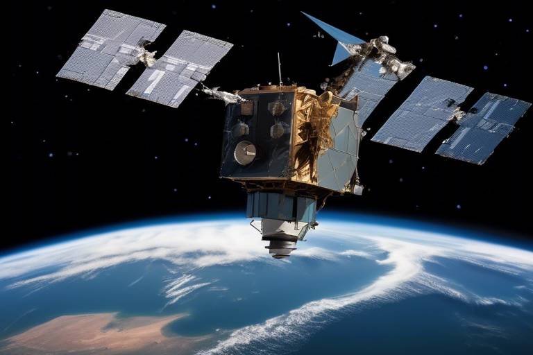
Advancements in Satellite Technology
Recent advancements in satellite technology have revolutionized the way we collect and analyze data, making it a cornerstone of national defense strategies. Imagine a world where every movement on the ground is tracked with pinpoint accuracy, where the fog of war is lifted by the clarity of real-time data. This is not just a futuristic dream; it's the reality we are stepping into today. The integration of high-resolution imaging, enhanced communication systems, and the ability to operate in various spectrums has significantly broadened the scope of satellite capabilities.
One of the most notable advancements is the development of small satellites or CubeSats. These compact satellites are not only cost-effective but also provide flexibility in deployment. They can be launched in groups, allowing for a constellation of satellites that work together to monitor vast areas. This is akin to having a swarm of bees, each contributing to the hive's overall efficiency. With these small satellites, defense agencies can achieve greater coverage and redundancy, ensuring that if one satellite fails, others can step in to fill the gap.
Moreover, advancements in sensor technology have led to the creation of satellites equipped with multispectral and hyperspectral imaging. These sensors can capture data across a range of wavelengths, providing insights that were previously unattainable. For instance, while traditional imaging might reveal a vehicle's location, multispectral imaging can also identify the materials it carries, enhancing situational awareness. This capability is crucial for identifying potential threats, as it allows defense analysts to discern between civilian and military assets with greater accuracy.
Furthermore, the miniaturization of technology has made it possible to pack more capabilities into smaller satellites. Advanced propulsion systems, power generation technologies, and onboard processing capabilities mean that these satellites can perform complex tasks without relying heavily on ground support. This shift not only reduces operational costs but also accelerates the response time in critical situations, making national defense more agile.
To illustrate the impact of these advancements, consider the following table outlining key technological improvements:
| Technology | Advancement | Impact on National Defense |
|---|---|---|
| Small Satellites | Cost-effective, flexible deployment | Enhanced coverage and redundancy |
| Multispectral Imaging | Data across multiple wavelengths | Improved threat identification |
| Miniaturized Technology | Compact and efficient systems | Faster response times |
As we look to the future, the pace of innovation in satellite technology shows no signs of slowing down. With the advent of quantum communication and next-generation propulsion systems, the potential for satellites to enhance national defense is limitless. The question remains: how will nations adapt to leverage these advancements while ensuring security and ethical considerations are upheld? The answers to these questions will shape the strategic landscape of national defense in the years to come.
Data Integration and Analysis
In today's complex world, the integration of satellite data with various intelligence sources is not just a luxury; it has become a necessity. Imagine trying to solve a jigsaw puzzle with only half of the pieces. That’s what decision-making in national defense would look like without effective data integration. By combining satellite data with intelligence from other platforms—like drones, ground sensors, and human intelligence—defense agencies can achieve a comprehensive view of the operational landscape. This holistic approach enhances situational awareness, enabling military leaders to make informed decisions swiftly.
One of the most significant benefits of data integration is the ability to utilize data fusion techniques. These sophisticated methods allow for the merging of different data sets into a cohesive whole, providing a clearer picture of potential threats. For instance, when satellite imagery indicating troop movements is combined with ground-based intelligence reports, the resulting analysis can reveal not only where forces are located but also their possible intentions. This kind of insight is invaluable for preemptive actions and strategic planning.
Moreover, the integration of satellite data with other intelligence sources fosters a more agile response to emerging threats. In the realm of national defense, timing is everything. A delay in response can lead to dire consequences. By employing advanced algorithms and analytics, defense organizations can automate the processing of vast amounts of data, allowing for real-time analysis. This rapid processing capability is essential for identifying patterns and anomalies that may indicate hostile activities.
Artificial intelligence (AI) plays a pivotal role in enhancing the integration and analysis of satellite data. By automating the data processing pipeline, AI enables defense analysts to focus on strategic decision-making rather than getting bogged down in data crunching. Imagine having a super-smart assistant that can sift through mountains of satellite images in seconds, pinpointing critical information that would take a human hours or even days to uncover. This capability not only speeds up the analysis process but also significantly improves predictive capabilities, allowing for proactive measures against potential threats.
At the core of this AI-driven transformation are machine learning algorithms. These algorithms are designed to learn from data inputs and improve over time, making them exceptionally effective for analyzing satellite imagery. For example, a machine learning model can be trained to recognize certain types of vehicles or military installations, providing defense analysts with actionable insights that can be acted upon quickly. This optimization of classification and interpretation is crucial for maintaining a competitive edge in national defense.
Furthermore, the implementation of automated threat detection systems has revolutionized how national defense agencies respond to security risks. By leveraging satellite data, these systems can continuously monitor for potential threats and alert decision-makers in real-time. This capability is akin to having a vigilant guard who never tires, always on the lookout for signs of trouble. As a result, the response to threats can be streamlined, allowing for rapid deployment of resources and personnel where they are needed most.
In summary, the integration and analysis of satellite data are critical components of modern national defense strategies. By harnessing the power of AI and advanced data fusion techniques, defense organizations can enhance their situational awareness and decision-making processes. The future of national security will undoubtedly rely on these technological advancements, ensuring that nations can respond effectively to the myriad challenges they face.
- What is data integration in national defense?
Data integration involves combining satellite data with other intelligence sources to create a comprehensive understanding of the operational landscape. - How does AI enhance satellite data analysis?
AI automates data processing, allowing for quicker analysis and improved predictive capabilities, which helps in timely decision-making. - What are machine learning algorithms?
Machine learning algorithms are systems that learn from data inputs to improve their performance over time, particularly useful in analyzing satellite imagery. - What role does automated threat detection play?
Automated threat detection systems use satellite data to identify potential risks in real-time, enhancing national security responses.
Artificial Intelligence in Data Processing
Artificial intelligence (AI) is revolutionizing the way we process and analyze satellite data, transforming raw information into actionable intelligence at an unprecedented speed. Imagine trying to find a needle in a haystack; now, picture a highly advanced robot that can sift through that haystack in seconds, pinpointing the exact location of the needle. This is essentially what AI does for satellite data—it enhances our ability to detect, interpret, and respond to various threats and opportunities in real time.
One of the most significant advantages of AI in data processing is its ability to handle vast amounts of information. With thousands of satellites orbiting the Earth, collecting data on everything from weather patterns to military movements, the volume of data generated is staggering. Traditional methods of analysis simply can't keep up. AI algorithms, particularly those based on machine learning, can analyze this data quickly, identifying patterns and anomalies that human analysts might miss.
For instance, machine learning algorithms can be trained to recognize specific features in satellite imagery, such as troop movements or changes in infrastructure. This capability allows defense organizations to gain insights into potential threats much faster than before. It's akin to having an all-seeing eye that can monitor multiple areas simultaneously, providing a comprehensive overview of the situation on the ground.
Moreover, AI enhances predictive capabilities, allowing defense agencies to anticipate future events based on current data trends. By analyzing historical data alongside real-time information, AI can generate forecasts that help military strategists make informed decisions. This proactive approach is crucial in a world where the landscape of threats is constantly evolving.
However, the integration of AI into satellite data processing is not without challenges. Issues such as data bias and the need for high-quality training datasets can impact the effectiveness of AI systems. If the data used to train these algorithms is flawed or incomplete, the insights generated could lead to misguided strategies. Therefore, it is essential for defense organizations to ensure that the data fed into AI systems is accurate, reliable, and representative of the scenarios they aim to analyze.
In summary, the role of artificial intelligence in processing satellite data is becoming increasingly vital in national defense. By harnessing the power of AI, defense agencies can improve their situational awareness, enhance decision-making processes, and ultimately ensure a more robust national security framework. As we continue to innovate and improve these technologies, the potential for AI to transform national defense strategies is limited only by our imagination.
- How does AI improve satellite data analysis?
AI improves satellite data analysis by quickly processing large volumes of data, identifying patterns, and providing actionable insights that human analysts may overlook. - What are the challenges associated with using AI in satellite data processing?
Challenges include data bias, the need for high-quality training datasets, and ensuring the accuracy and reliability of the data used. - Can AI predict future threats based on satellite data?
Yes, AI can analyze historical and real-time data to generate forecasts, helping defense organizations anticipate potential threats.
Machine Learning Algorithms
Machine learning algorithms are revolutionizing the way we interpret and classify satellite imagery, transforming raw data into actionable intelligence. Imagine trying to find a needle in a haystack; that’s how overwhelming the vast amounts of satellite data can be. However, with the right machine learning techniques, we can sift through this data with remarkable efficiency. These algorithms analyze patterns and features within satellite images, allowing defense analysts to detect changes and anomalies that might go unnoticed by the human eye.
One of the most exciting aspects of machine learning in satellite data processing is its ability to learn and adapt over time. As these algorithms are exposed to more data, they improve their accuracy and precision, much like a student honing their skills through practice. For example, an algorithm trained to recognize military vehicles can become increasingly adept at identifying different types of vehicles under various conditions, whether it’s during daylight or in challenging weather.
Furthermore, the integration of machine learning with satellite data enhances operational efficiency in several ways:
- Real-time Analysis: Machine learning algorithms can process data in real-time, providing immediate insights that are crucial during defense operations.
- Predictive Capabilities: By analyzing historical data, these algorithms can forecast potential threats, allowing defense organizations to be proactive rather than reactive.
- Resource Optimization: With automated classification, analysts can focus their efforts on the most critical tasks, maximizing the use of human resources.
To illustrate the effectiveness of machine learning algorithms in satellite data analysis, consider the following table that outlines some common applications:
| Application | Description | Benefits |
|---|---|---|
| Change Detection | Identifying alterations in terrain or infrastructure over time. | Quickly assesses damage post-disaster or monitors illegal activities. |
| Object Recognition | Classifying objects such as vehicles, buildings, and natural features. | Enhances situational awareness and threat identification. |
| Image Classification | Categorizing satellite images into predefined classes. | Assists in land use planning and environmental monitoring. |
In conclusion, machine learning algorithms are not just a trend; they are a fundamental shift in how satellite data is processed and utilized in national defense. By harnessing the power of these algorithms, defense organizations can enhance their operational capabilities, improve decision-making processes, and ultimately strengthen national security. As technology continues to evolve, the potential applications of machine learning in satellite data analysis will only expand, paving the way for innovative strategies in defense operations.
Q1: How do machine learning algorithms improve satellite data analysis?
A1: Machine learning algorithms enhance satellite data analysis by automating the classification and interpretation of images, allowing for faster and more accurate detection of changes and anomalies.
Q2: Can machine learning algorithms adapt to new types of data?
A2: Yes, machine learning algorithms can learn from new data inputs, improving their accuracy and effectiveness over time.
Q3: What are some challenges associated with using machine learning in satellite data?
A3: Challenges include data quality, the need for large datasets for training, and potential biases in algorithmic decision-making.
Automated Threat Detection
In an age where threats can emerge in the blink of an eye, systems have become a cornerstone of national defense strategies. Imagine having a sentinel that never sleeps, tirelessly scanning the horizon for potential dangers. That's precisely what these systems do, utilizing advanced algorithms and satellite data to identify and assess risks in real-time. The integration of satellite imagery with automated detection technologies not only enhances situational awareness but also provides defense agencies with the agility to respond to emerging threats swiftly.
The beauty of automated threat detection lies in its ability to process vast amounts of data at lightning speed. Traditional methods of threat assessment often involve manual scrutiny of satellite images, which can be time-consuming and prone to human error. However, with the advent of sophisticated machine learning techniques, automated systems can now analyze patterns, recognize anomalies, and flag potential threats almost instantaneously. This capability is akin to having a highly trained analyst who can sift through mountains of data and pinpoint critical information without breaking a sweat.
Moreover, these systems are designed to learn continuously. As they process more data, they refine their algorithms, becoming better at identifying threats over time. This is particularly crucial in a world where adversaries are constantly evolving their tactics. For example, if a new type of drone is detected in a conflict zone, an automated detection system can learn from this instance and adjust its parameters to recognize similar threats in the future. This adaptability ensures that national defense strategies remain robust and effective, even against unpredictable challenges.
One of the most significant advantages of automated threat detection is its ability to operate in real-time. Consider a scenario where a satellite captures an image of unusual troop movements near a border. An automated system can analyze this data and immediately alert defense personnel, enabling them to take preemptive measures. This rapid response capability is essential in preventing potential escalations and maintaining national security.
However, it's essential to acknowledge that while automated threat detection systems offer numerous benefits, they are not without challenges. Issues related to data accuracy, false positives, and the ethical implications of surveillance must be carefully managed. Defense agencies must strike a balance between leveraging technology for security and respecting privacy rights. As these systems continue to evolve, ongoing dialogue about their ethical use will be crucial to ensure they serve to protect rather than infringe upon civil liberties.
In conclusion, automated threat detection represents a significant leap forward in national defense capabilities. By harnessing the power of satellite data and machine learning, these systems provide a proactive approach to identifying and mitigating risks. As we look to the future, the continued integration of technology in defense will undoubtedly shape how nations protect their interests and maintain security on a global scale.
- What is automated threat detection? Automated threat detection refers to systems that use algorithms and satellite data to identify potential security risks in real-time.
- How does automated threat detection improve national security? It enhances situational awareness and allows for rapid responses to emerging threats, minimizing the risk of escalation.
- Are there ethical concerns associated with automated threat detection? Yes, there are concerns regarding privacy, data accuracy, and the potential for surveillance overreach that must be addressed.
- Can automated systems learn from past data? Absolutely! These systems utilize machine learning to improve their threat detection capabilities over time.
Challenges in Data Security
As we delve deeper into the realm of satellite data for national defense, it becomes increasingly clear that with great power comes great responsibility. The reliance on satellite data has surged, but so have the challenges surrounding data security. Imagine a world where sensitive military information is just a click away for adversaries—this scenario is not far-fetched. The vulnerabilities inherent in satellite systems can lead to catastrophic consequences if not adequately addressed.
One of the primary challenges is the potential for cyberattacks. With the advancement of technology, hackers are becoming more sophisticated, employing tactics that can compromise satellite data integrity. These attacks can range from jamming signals to intercepting communications, potentially leading to misinformation and operational failures. The consequences of such breaches can be dire, affecting not only military operations but also national security as a whole.
Another significant concern is the issue of data privacy. As satellite imagery becomes more detailed and widely available, the risk of infringing on individual privacy rights escalates. The line between national security and personal privacy can blur, raising ethical questions about surveillance practices. For instance, the ability to monitor civilian movements through satellite data can lead to a slippery slope of intrusive government oversight.
Furthermore, there’s the challenge of data management. With the volume of data generated by satellites increasing exponentially, defense agencies must develop robust systems to store, analyze, and protect this information. Poor data management can lead to data breaches, loss of critical information, and even operational delays. The need for advanced cybersecurity measures and protocols is paramount to safeguard sensitive information.
To address these challenges, defense organizations are investing heavily in countermeasures. This includes developing advanced encryption techniques, implementing strict access controls, and conducting regular vulnerability assessments. Additionally, fostering a culture of security awareness among personnel is essential. After all, even the most sophisticated systems can be compromised by human error.
In conclusion, while satellite data plays a pivotal role in enhancing national defense, the accompanying challenges in data security cannot be overlooked. As we navigate this complex landscape, it is crucial for defense agencies to remain vigilant, proactive, and innovative in their approach to safeguarding sensitive information.
- What are the main threats to satellite data security? The primary threats include cyberattacks, data breaches, and unauthorized surveillance.
- How can defense agencies protect satellite data? Agencies can implement advanced encryption, strict access controls, and conduct regular security assessments.
- What ethical concerns arise from the use of satellite data? Issues of privacy and the potential for government overreach in surveillance practices are significant ethical concerns.
- Why is data management critical for satellite data? Effective data management ensures the integrity, availability, and confidentiality of sensitive information.
International Collaboration
In today's interconnected world, in satellite data sharing is not just beneficial; it’s essential for global security. Nations are increasingly recognizing that threats do not respect borders, and thus, a unified approach to defense is paramount. Imagine a chess game where each player has a unique strategy, but without sharing their moves, the game becomes chaotic. Similarly, when countries pool their satellite data, they enhance their ability to anticipate and respond to threats effectively.
The benefits of such collaboration are multifaceted. For one, it leads to improved situational awareness. By sharing satellite imagery and data, countries can create a more comprehensive picture of global events. This integration of information helps in identifying potential threats early, allowing for preemptive action. Moreover, collaborative efforts can significantly reduce costs associated with satellite launches and maintenance, as nations can share resources and expertise. For instance, the European Space Agency has successfully collaborated with various countries to enhance its satellite capabilities, resulting in more robust data collection and analysis.
However, this collaboration is not without its challenges. One of the primary concerns is the protection of sensitive information. Countries must navigate the delicate balance between sharing crucial intelligence and safeguarding national secrets. The risk of data falling into the wrong hands can create significant geopolitical tensions. Additionally, there are varying levels of technological advancement among countries, which can lead to discrepancies in data interpretation and application. To address these issues, nations must establish clear protocols and trust frameworks to ensure that shared data is used responsibly and effectively.
Furthermore, joint operations and exercises play a critical role in enhancing interoperability among allied forces. By utilizing shared satellite data during training exercises, military personnel can develop a deeper understanding of each other's capabilities and operational procedures. This not only strengthens alliances but also prepares forces for real-world scenarios where coordination is vital. For example, during multinational training exercises, countries can simulate real-time responses to crises using satellite data, fostering a spirit of cooperation and readiness.
As we move forward, the legal and ethical considerations surrounding the use of satellite data in national defense will also need to be addressed. Questions surrounding privacy, sovereignty, and the implications of surveillance on civilian populations are becoming increasingly prominent. Nations must engage in dialogues to establish international norms and agreements that respect individual rights while ensuring collective security. This is akin to building a house; without a solid foundation of trust and ethical guidelines, the structure will be unstable and vulnerable to collapse.
In conclusion, the path to effective international collaboration in satellite data sharing is paved with opportunities and challenges. As nations work together to enhance their defense strategies, the importance of communication, trust, and ethical considerations will be paramount. The future of national defense lies in our ability to unite, share, and protect in a world where information is power.
- Why is international collaboration in satellite data important? It enhances situational awareness, improves threat detection, and reduces costs associated with satellite operations.
- What are the challenges of sharing satellite data? Concerns include protecting sensitive information, differing technological capabilities, and legal/ethical implications.
- How do joint operations benefit from satellite data? They improve interoperability, preparedness, and coordination among allied forces.
- What ethical concerns arise from satellite surveillance? Issues of privacy and sovereignty are significant, requiring careful consideration and international agreements.
Joint Operations and Exercises
Joint military operations and exercises are becoming increasingly vital in the realm of national defense, especially as the complexities of global threats evolve. These collaborative efforts among allied forces leverage satellite data to enhance interoperability and preparedness, creating a robust framework for addressing potential threats. Imagine a well-oiled machine, where every cog and wheel works in harmony; that is what joint operations aim to achieve among nations. By utilizing satellite data, military forces can synchronize their activities, ensuring that every move is informed and strategic.
One of the most significant advantages of these joint operations is the ability to share real-time intelligence. When multiple nations come together, they can pool their satellite resources, providing a comprehensive view of the battlefield. This synergy not only improves situational awareness but also fosters trust and collaboration among allies. For instance, during recent joint exercises, countries utilized satellite imagery to track movements and simulate responses to various scenarios, effectively testing their strategies in a controlled environment.
Moreover, joint exercises often involve a variety of scenarios, ranging from humanitarian assistance to combat operations. This diversity allows military forces to train under different conditions, preparing them for any situation they might face in real-world conflicts. The integration of satellite data into these exercises ensures that all participants are on the same page, reducing the chances of miscommunication and enhancing operational effectiveness.
However, the success of joint operations does not come without its challenges. Differences in technology, operational protocols, and even military culture can create friction. To mitigate these issues, nations must invest in training programs that emphasize understanding and utilizing satellite data effectively. By doing so, they can ensure that all forces are equipped to interpret and act upon the information provided by satellites, leading to more cohesive and successful operations.
In summary, joint operations and exercises represent a critical component of modern defense strategies. By harnessing the power of satellite data, allied forces can enhance their readiness and effectiveness, ultimately contributing to a more secure global environment. As we look to the future, the importance of these collaborative efforts will only grow, as nations face increasingly sophisticated threats that demand a united response.
- What are joint military operations? Joint military operations involve collaboration between multiple nations' armed forces to achieve common objectives, often utilizing shared resources and intelligence.
- How does satellite data enhance joint operations? Satellite data provides real-time intelligence and situational awareness, allowing allied forces to coordinate their efforts effectively and respond to threats swiftly.
- What challenges do nations face during joint exercises? Challenges include differences in technology, operational protocols, and military culture, which can create friction and hinder effective collaboration.
- Why is training important for joint operations? Training ensures that all participating forces understand how to interpret and utilize satellite data, promoting better communication and operational efficiency.
Legal and Ethical Considerations
As we delve deeper into the role of satellite data in national defense, we must confront a myriad of that arise from its use. The deployment of satellite technology for defense purposes is not merely a technical challenge; it also raises profound questions about privacy, sovereignty, and the ethical implications of surveillance on civilian populations. With the ability to monitor vast areas from space, the potential for misuse becomes a significant concern. Are we crossing a line when we leverage this technology to observe not just enemy movements, but also the daily lives of innocent civilians?
One of the primary legal frameworks governing the use of satellite data involves international treaties and agreements. For instance, the Outer Space Treaty of 1967 establishes guidelines for the peaceful use of outer space, emphasizing that space exploration should benefit all mankind. However, as nations increasingly utilize satellites for military purposes, the interpretation of what constitutes peaceful use is becoming murky. This leads to questions about sovereignty: when a country uses satellite surveillance to monitor another nation, does it infringe upon that nation's rights?
Moreover, the ethical implications of satellite surveillance cannot be overstated. The power to collect data on individuals and groups without their consent poses significant risks. It raises important questions: How do we balance national security with individual rights? Are there adequate safeguards in place to prevent abuse? To address these concerns, many advocate for the establishment of strict regulations governing the use of satellite data in defense contexts. Such regulations could include:
- Transparency: Governments should disclose the extent and purpose of satellite surveillance activities.
- Accountability: There must be mechanisms in place to hold entities accountable for misuse of satellite data.
- Oversight: Independent bodies should oversee the use of satellite data to ensure compliance with legal and ethical standards.
Additionally, the rise of artificial intelligence in processing satellite data further complicates these legal and ethical discussions. AI systems, while powerful, can perpetuate biases and make decisions that lack human oversight. This raises another layer of concern: Who is responsible when an AI system makes a mistake? As we integrate AI into national defense strategies, we must ensure that human judgment remains a critical component of decision-making processes.
In conclusion, the legal and ethical considerations surrounding the use of satellite data in national defense are complex and multifaceted. As technology continues to advance, it is imperative that we engage in ongoing dialogue about these issues. Only through careful consideration and regulation can we harness the benefits of satellite technology while safeguarding the rights and freedoms of individuals.
- What are the main legal frameworks governing satellite surveillance?
The Outer Space Treaty of 1967 is a key legal framework, emphasizing peaceful use of space and benefiting all mankind. - How can governments ensure ethical use of satellite data?
By establishing regulations that promote transparency, accountability, and oversight. - What role does AI play in satellite data processing?
AI enhances data analysis but raises concerns about bias and accountability in decision-making. - How does satellite surveillance affect individual privacy?
It poses risks to privacy, necessitating a balance between national security and individual rights.
Future Trends and Innovations
As we look toward the horizon of national defense, the in satellite technology are nothing short of revolutionary. Imagine a world where satellites not only provide data but also engage in real-time decision-making. This isn't science fiction; it's the direction in which we're heading. The integration of advanced technologies like quantum computing and next-generation satellite constellations is set to transform how defense agencies operate, making them more agile and responsive to threats.
One of the most exciting developments is the emergence of small satellite technology. These smaller, more cost-effective satellites can be launched in swarms, providing unprecedented coverage and data collection capabilities. Unlike traditional satellites that can take years to develop and deploy, small satellites can be designed and launched in a matter of months. This rapid deployment means that defense organizations can adapt quickly to changing global dynamics. For instance, if a geopolitical crisis arises, a constellation of small satellites can be sent into orbit to monitor the situation closely, providing real-time intelligence to decision-makers.
Moreover, the rise of hyperspectral imaging technology is another game-changer. This technology allows satellites to capture data across a wide spectrum of wavelengths, revealing details that traditional imaging cannot. With hyperspectral imaging, defense agencies can identify materials, detect chemical signatures, and even monitor environmental changes that could indicate potential threats. Imagine the ability to spot a hidden weapons factory or track illegal resource extraction from space—this level of insight could be pivotal in preempting conflicts.
Furthermore, the integration of 5G technology into satellite communications is set to enhance data transmission speeds significantly. This means that defense agencies can receive and analyze satellite data almost instantaneously, allowing for quicker decision-making. In a world where seconds can make the difference between thwarting an attack or not, this advancement is crucial. The synergy between 5G and satellite technology will not only improve communication but also enhance the overall efficiency of defense operations.
However, with these advancements come challenges. As the capabilities of satellite technology grow, so do the risks associated with it. The potential for cyber attacks on satellite systems is an ever-looming threat. Defense organizations must prioritize cybersecurity measures to protect sensitive data. This includes investing in advanced encryption techniques and developing robust protocols to thwart potential intrusions. The future of satellite data in national defense is not just about harnessing new technologies; it’s also about safeguarding them against malicious actors.
In summary, the future of satellite data in national defense is bright and filled with possibilities. From small satellites and hyperspectral imaging to the integration of 5G technology, these innovations promise to enhance situational awareness and operational efficiency. However, as we embrace these advancements, we must remain vigilant against the risks they bring. The balance between leveraging technology for national security and protecting it from threats will define the next era of defense strategies.
- What are small satellites, and how do they benefit national defense?
Small satellites are compact, cost-effective satellites that can be launched quickly in groups, providing extensive coverage and rapid data collection capabilities. - How does hyperspectral imaging work?
Hyperspectral imaging captures data across multiple wavelengths, allowing for detailed analysis of materials and environmental changes that could indicate threats. - What role does 5G play in satellite communications?
5G technology enhances data transmission speeds, enabling real-time analysis and quicker decision-making for defense operations. - What are the cybersecurity risks associated with satellite technology?
As satellite capabilities expand, they become more vulnerable to cyber attacks, necessitating advanced security measures to protect sensitive information.
Frequently Asked Questions
- What role does satellite data play in national defense?
Satellite data is crucial for national defense as it provides real-time intelligence and situational awareness. It helps defense agencies monitor global events, assess threats, and make informed decisions based on accurate information.
- How have advancements in satellite technology improved defense capabilities?
Recent advancements have enhanced data collection capabilities, allowing for more precise monitoring and better situational awareness. This means defense forces can respond more quickly and effectively to emerging threats, making operations more efficient.
- What is data integration, and why is it important?
Data integration involves combining satellite data with other intelligence sources to create a comprehensive view of the situation. This is vital for effective analysis and decision-making in defense operations, as it enables a more holistic understanding of potential threats.
- How does artificial intelligence enhance satellite data processing?
Artificial intelligence accelerates the analysis of satellite data, allowing defense organizations to quickly identify patterns and predict potential threats. This rapid processing capability is essential for timely responses in critical situations.
- What are machine learning algorithms, and how do they benefit defense?
Machine learning algorithms optimize the classification and interpretation of satellite imagery. By providing actionable insights, these algorithms enhance operational efficiency and enable defense analysts to focus on strategic decision-making.
- What challenges does data security pose in the context of satellite data?
As reliance on satellite data increases, so do concerns about data security. Vulnerabilities can expose sensitive information, making it crucial for defense agencies to implement robust countermeasures to protect this data from potential threats.
- Why is international collaboration important in satellite data sharing?
International collaboration enhances global security by facilitating the sharing of satellite data among nations. This cooperation can lead to improved defense strategies and more effective responses to international threats.
- What are the legal and ethical considerations surrounding satellite data use?
The use of satellite data raises important legal and ethical questions, such as privacy concerns and issues related to sovereignty. Defense agencies must navigate these complexities to ensure responsible use of surveillance technologies.
- What future trends can we expect in satellite technology for national defense?
Emerging trends in satellite technology, such as enhanced data processing capabilities and improved sensor technologies, are expected to reshape national defense strategies. These innovations will likely lead to more effective security operations and a stronger defense posture.