The Role of Unmanned Systems in Enhancing the Management of Protected Areas
This article explores how unmanned systems, including drones and autonomous vehicles, are revolutionizing the management of protected areas by improving monitoring, data collection, and conservation efforts.
Unmanned systems encompass various technologies that operate without human presence, including drones and robotic vehicles. These innovations are significantly impacting environmental management and conservation practices. Imagine a world where conservationists can monitor vast landscapes without stepping foot in sensitive habitats. This is not just a dream; it's becoming a reality thanks to unmanned systems. With the ability to operate in challenging terrains and reach remote locations, these technologies allow for a more thorough understanding of ecosystems and their health.
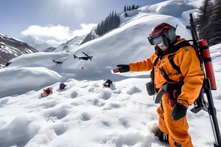
Drones provide cost-effective, efficient solutions for monitoring wildlife, mapping habitats, and surveying landscapes. They enable conservationists to gather critical data with minimal disturbance to ecosystems. Think about it: instead of trudging through dense forests or scaling mountains, researchers can simply deploy a drone, capturing high-resolution images and videos from above. This not only saves time but also reduces the stress on wildlife that might occur with human presence.
Utilizing drones for wildlife monitoring allows researchers to track animal movements, assess population health, and identify threats. This leads to more effective conservation strategies. For instance, by observing migration patterns or nesting behaviors from a distance, conservationists can gather vital information without causing disruption. Imagine being able to see a herd of elephants from the sky, noting their movements and interactions without ever intruding on their natural habitat.
Drones can capture high-resolution images and videos in real time, providing immediate insights into wildlife behavior and habitat conditions, which is essential for timely decision-making. This capability is like having a bird's eye view of the environment, allowing for quick assessments and responses to potential threats. For example, if a drone spots illegal logging activities, conservationists can act swiftly to address the issue before it escalates.
By using drones, conservationists can minimize human interference in sensitive areas, ensuring that wildlife remains undisturbed during monitoring processes. This is crucial in maintaining the natural behaviors of animals, which can be heavily influenced by human presence. Drones act like silent guardians, observing from above without intruding on the ground.
Drones facilitate detailed habitat mapping, helping to identify critical areas for conservation and enabling better resource management within protected regions. With advanced imaging technologies, drones can create accurate and up-to-date maps of habitats, revealing changes over time. This data is invaluable for conservationists as they strategize on how to protect and restore these vital ecosystems. Imagine having a detailed map of a forest that highlights areas of concern, allowing for targeted conservation efforts.
Autonomous ground and marine vehicles are transforming how protected areas are patrolled and managed, offering innovative solutions for monitoring and enforcement. These vehicles can cover large areas without the need for constant human oversight, making them ideal for remote and expansive protected regions.
Equipped with advanced sensors, autonomous vehicles can conduct routine patrols, monitoring for illegal activities like poaching and logging while covering vast areas efficiently. This is akin to having a dedicated team of guards patrolling the boundaries of a national park, ensuring that wildlife and habitats are safe from harm. The efficiency of these vehicles means that conservationists can focus their efforts on strategy and intervention rather than constant monitoring.
These vehicles can collect and analyze environmental data, contributing to a comprehensive understanding of ecosystem health and informing management decisions. By integrating data from various sources, conservationists can gain a holistic view of the environment, allowing for more informed and effective conservation practices. It's like piecing together a puzzle; each piece of data helps to complete the picture of ecosystem health.
Despite their benefits, the implementation of unmanned systems faces challenges, including regulatory hurdles, technological limitations, and the need for skilled personnel to operate and interpret data. For instance, navigating the complex landscape of regulations surrounding drone usage can be daunting for conservationists. Additionally, while technology is advancing rapidly, there are still limitations in battery life and data processing capabilities that need to be addressed.
Emerging technologies such as AI and machine learning are set to enhance the capabilities of unmanned systems, leading to more sophisticated applications in protected area management. Imagine drones that can not only capture images but also analyze them in real time to identify species or detect changes in vegetation. This future is not far off, and it holds incredible potential for conservation.
The integration of unmanned systems into conservation efforts promises to enhance the effectiveness of protected area management, ensuring the preservation of biodiversity for future generations. As we embrace these technologies, we move closer to a world where conservation is more efficient, effective, and respectful of the natural world.
- What are unmanned systems? Unmanned systems include technologies like drones and autonomous vehicles that operate without human presence.
- How do drones help in conservation? Drones provide efficient monitoring, habitat mapping, and real-time data collection, reducing human impact on wildlife.
- What are the challenges of using unmanned systems? Challenges include regulatory hurdles, technological limitations, and the need for skilled personnel.
- What is the future of unmanned systems in conservation? The future includes advancements in AI and machine learning, enhancing the capabilities of these systems.
Introduction to Unmanned Systems
Unmanned systems have taken the world by storm, revolutionizing the way we approach environmental management and conservation. But what exactly are these systems? Essentially, unmanned systems refer to a broad category of technologies that operate without the direct presence of humans. This includes drones, autonomous vehicles, and various robotic tools designed to carry out tasks that would typically require human intervention. Imagine a world where nature is monitored and protected by machines that can navigate rugged terrains and reach remote areas without breaking a sweat—this is the promise of unmanned systems.
The impact of these technologies on conservation practices cannot be overstated. By leveraging unmanned aerial vehicles (UAVs) and autonomous ground vehicles, conservationists can gather critical data, monitor wildlife, and manage protected areas with unprecedented efficiency. The ability to operate in challenging environments means that these systems can provide insights that were previously difficult or impossible to obtain. For instance, drones equipped with high-resolution cameras can survey vast landscapes in a fraction of the time it would take a human team, all while minimizing the disturbance to the ecosystems being studied.
One of the most exciting aspects of unmanned systems is their versatility. They can be deployed for a variety of purposes, including:
- Wildlife Monitoring: Tracking animal movements and behaviors.
- Habitat Mapping: Creating detailed maps of ecosystems.
- Data Collection: Gathering environmental data for analysis.
- Surveillance: Monitoring for illegal activities like poaching.
As we delve deeper into the role of unmanned systems in enhancing the management of protected areas, it's crucial to recognize their potential to not only improve data collection but also to foster a more profound understanding of our natural world. These technologies are not just tools; they are game-changers that offer us a glimpse into the future of conservation. With the right implementation and ongoing advancements, unmanned systems could very well be the key to preserving our planet's biodiversity for generations to come.
Benefits of Drones in Conservation
Drones have emerged as game-changers in the field of conservation, offering a plethora of benefits that traditional methods simply cannot match. Imagine being able to monitor vast stretches of protected land without ever setting foot on it! This is exactly what drones enable conservationists to do. By providing a cost-effective and efficient means of gathering data, drones are revolutionizing how we approach wildlife conservation and habitat management.
One of the most significant advantages of drones is their ability to conduct wildlife monitoring with minimal disturbance. Traditional methods often involve human presence, which can stress wildlife and disrupt their natural behaviors. In contrast, drones can hover silently above, capturing high-resolution images and videos that reveal crucial information about animal movements, population health, and potential threats. This real-time data collection is invaluable; it allows researchers to make informed decisions quickly, adapting their strategies based on the latest insights.
Furthermore, drones excel in habitat mapping. They can create detailed topographical maps and assess the condition of various ecosystems. By identifying critical habitats that require protection, drones empower conservationists to prioritize their efforts effectively. For example, a drone can fly over a forest and produce a map highlighting areas of deforestation or degradation, allowing for targeted interventions.
Another compelling benefit is the reduction of human impact on sensitive areas. When conservationists use drones, they can gather necessary data without physically intruding into wildlife habitats. This minimizes stress on animals and helps maintain the ecological balance. The less human interference, the better the chances for wildlife to thrive. Imagine a scenario where a researcher can monitor a nesting site from hundreds of feet above, ensuring that the birds remain undisturbed while still gathering essential data.
In addition to these advantages, drones offer unparalleled flexibility. They can be deployed in various terrains and environments, from dense forests to open savannas, adapting to the unique challenges each landscape presents. This adaptability is crucial for conservationists who need to respond to changing conditions and emerging threats quickly.
Moreover, the integration of advanced technologies such as thermal imaging and multispectral sensors enhances the capabilities of drones. These technologies allow for the detection of heat signatures from animals or the assessment of vegetation health, providing data that can be critical for conservation efforts. For instance, thermal imaging can help locate nocturnal animals that are otherwise difficult to observe during the day.
In summary, the benefits of drones in conservation are multifaceted. They not only enhance monitoring and data collection but also significantly reduce human impact on wildlife. As we continue to embrace these technological advancements, the potential for more effective conservation strategies becomes increasingly apparent. Drones are not just tools; they are essential allies in the fight to preserve our planet's biodiversity.
- How do drones help in wildlife monitoring? Drones can capture high-resolution images and videos without disturbing wildlife, allowing researchers to track movements and assess health.
- Are drones cost-effective for conservation efforts? Yes, drones reduce the need for extensive manpower and resources, making them a more economical option for data collection.
- What technologies do drones use in conservation? Drones can be equipped with thermal imaging, multispectral sensors, and GPS technology to enhance data collection.
- Can drones operate in various terrains? Absolutely! Drones are designed to adapt to different environments, making them versatile tools for conservationists.
Wildlife Monitoring
Wildlife monitoring is a critical aspect of conservation, and the advent of unmanned systems, particularly drones, has transformed how researchers and conservationists approach this task. Imagine being able to observe the majestic movements of elephants or the elusive habits of rare birds without ever stepping foot into their habitat. Drones equipped with high-resolution cameras and advanced sensors allow for non-invasive observation of wildlife, significantly reducing the stress and disruption that human presence can cause.
By utilizing drones for wildlife monitoring, researchers can track animal movements with unprecedented accuracy. This capability is essential for assessing population health, as it enables scientists to gather vital data on migration patterns, breeding behaviors, and habitat utilization. For instance, a drone can fly over a protected area, capturing thousands of images that can be analyzed to create detailed maps of animal activity. This information is crucial for developing effective conservation strategies and ensuring that interventions are timely and targeted.
Moreover, drones provide real-time data collection, which is a game changer in wildlife management. Imagine receiving immediate insights into the behavior of a threatened species or the condition of its habitat. With the ability to transmit data in real-time, drones allow conservationists to make informed decisions swiftly, whether it’s deploying resources to protect a vulnerable population or assessing the impact of environmental changes. The integration of real-time monitoring can significantly enhance conservation efforts, leading to better outcomes for wildlife.
Another notable advantage of using drones is the capacity to reduce human impact in sensitive areas. Traditional monitoring methods often involve researchers physically entering habitats, which can disturb wildlife and alter their natural behaviors. Drones eliminate this concern by providing a bird's-eye view of the landscape without intruding on the animals’ space. This non-intrusive approach not only ensures that wildlife remains undisturbed during monitoring processes but also allows for the collection of data in areas that are otherwise inaccessible or dangerous for humans.
In summary, the use of drones for wildlife monitoring is revolutionizing conservation efforts. They are not only enhancing the ability to track and study wildlife but also ensuring that these activities are conducted with minimal impact on the ecosystems being observed. As technology continues to advance, the potential for drones in wildlife monitoring will only expand, paving the way for a more sustainable and effective approach to conservation.
- What types of drones are used for wildlife monitoring? Drones used for wildlife monitoring typically include quadcopters and fixed-wing drones equipped with cameras and sensors designed for capturing high-resolution images and videos.
- How do drones help in reducing human impact on wildlife? Drones provide a non-intrusive way to monitor wildlife, allowing researchers to collect data from a distance without disturbing animals or their habitats.
- Can drones be used in all types of environments? While drones are versatile, their effectiveness can vary based on the environment. Factors like terrain, weather conditions, and wildlife behavior can influence drone operations.
- What are the legal regulations regarding the use of drones in wildlife monitoring? Regulations vary by country and region. It is essential for users to be aware of and comply with local laws regarding drone usage, especially in protected areas.
Real-Time Data Collection
In the dynamic world of conservation, has become a game-changer, especially when it comes to utilizing drones. Imagine being able to gather vital information about wildlife and their habitats as it happens, rather than waiting days or weeks for data to be processed. This immediacy allows conservationists to make timely decisions that can significantly impact the effectiveness of their efforts. Drones equipped with high-resolution cameras and advanced sensors can capture images and videos that provide insights into wildlife behavior, habitat conditions, and even the presence of potential threats.
For instance, when monitoring endangered species, real-time data can reveal critical changes in behavior that may indicate stress due to environmental changes or human interference. This information is crucial; it allows for quick interventions, such as restricting access to certain areas or implementing protective measures before a situation escalates. The ability to observe animals in their natural habitat without disturbing them is invaluable, as it leads to a more accurate understanding of their needs and challenges.
Furthermore, the data collected is not just limited to visuals. Drones can also gather environmental data such as temperature, humidity, and even air quality. This multifaceted approach to data collection enables conservationists to build a comprehensive picture of the ecosystem's health. By integrating this data into management strategies, they can prioritize areas for conservation efforts and allocate resources more effectively.
To illustrate the impact of real-time data collection, consider the following table that summarizes key benefits:
| Benefit | Description |
|---|---|
| Immediate Insights | Allows for quick decision-making based on current conditions. |
| Minimized Disturbance | Enables observation without human interference in sensitive areas. |
| Comprehensive Data | Combines visual and environmental data for a holistic view of ecosystems. |
In summary, the integration of real-time data collection through drones is revolutionizing how conservationists approach wildlife management. This technology not only enhances the efficiency of monitoring efforts but also ensures that actions taken are based on the most current and relevant information available. As we look towards the future, the ongoing development of drone technology promises even greater advancements in the realm of conservation, paving the way for a more sustainable interaction with our planet's precious ecosystems.
- How do drones collect real-time data? Drones use high-resolution cameras and sensors to capture images and environmental data, which can be transmitted instantly to researchers.
- What are the advantages of real-time data in conservation? Real-time data allows for immediate responses to changes in wildlife behavior or habitat conditions, leading to more effective conservation strategies.
- Can drones operate in all weather conditions? While drones are versatile, their effectiveness can be limited by severe weather conditions such as heavy rain or strong winds.
- Are there regulations for using drones in protected areas? Yes, there are specific regulations that govern the use of drones in protected areas to ensure minimal disturbance to wildlife.
Reducing Human Impact
One of the most significant advantages of utilizing unmanned systems, particularly drones, in conservation efforts is their ability to reduce human impact on sensitive ecosystems. Traditional wildlife monitoring often involves researchers physically entering habitats, which can disturb the very species they aim to study. Imagine a serene forest, where every rustle and movement is a part of a delicate balance. Now picture a group of researchers traipsing through it, inadvertently scaring away animals and disrupting their natural behaviors. This is where drones come into play, acting as silent observers that can gather vital data without intruding on wildlife.
Drones can hover above and capture high-resolution images and videos, providing a bird's-eye view of the landscape without the need for human presence on the ground. This capability allows conservationists to monitor wildlife activities, assess population dynamics, and evaluate habitat conditions while keeping a safe distance. In essence, drones serve as a remote eye in the sky, offering insights into ecosystems that were previously challenging to obtain without significant human interference.
Moreover, the use of drones minimizes the risk of introducing foreign elements into these environments. For instance, when humans enter a habitat, they can inadvertently bring in pathogens or pollutants. By relying on unmanned systems, we can maintain the integrity of these ecosystems. This is crucial in areas where species are already vulnerable due to habitat loss, climate change, and other stressors. Drones help create a buffer zone between researchers and wildlife, allowing for more accurate assessments of animal behavior and health.
In addition to monitoring, drones can also assist in conducting surveys and mapping habitats with minimal disturbance. This capability enables conservationists to identify critical areas that need protection or restoration, ensuring that efforts are focused where they are most needed. With the ability to cover large areas quickly and efficiently, drones can gather data that would take human teams significantly longer to collect, all while keeping the wildlife undisturbed.
In conclusion, the integration of drones into conservation practices not only enhances data collection but also plays a pivotal role in on fragile ecosystems. By leveraging technology, we can ensure that our efforts to protect biodiversity do not come at the cost of the very species we aim to conserve.
- How do drones help in wildlife monitoring? Drones can capture high-resolution images and videos, allowing researchers to monitor animal behavior and population health without disturbing the wildlife.
- What are the advantages of reducing human presence in protected areas? Reducing human presence minimizes disturbances to wildlife, lowers the risk of introducing diseases, and allows for more accurate data collection.
- Can drones be used in all types of ecosystems? Yes, drones are versatile and can be used in various ecosystems, including forests, wetlands, and coastal areas, to monitor wildlife and habitats.
- What limitations do drones face in conservation efforts? Some limitations include regulatory hurdles, the need for skilled personnel, and potential technological issues that can arise during operation.
Habitat Mapping
When it comes to the preservation of our planet's biodiversity, plays an essential role. Drones have emerged as powerful tools in this arena, enabling conservationists to create detailed, accurate maps of various ecosystems. Imagine being able to fly over vast forested areas or wetlands, capturing high-resolution images that reveal not just the surface, but the intricate details of the habitats below. This technology allows for a level of insight that was previously unimaginable, transforming how we approach conservation.
One of the most significant advantages of using drones for habitat mapping is their ability to cover large areas quickly and efficiently. Traditional methods of mapping often involve labor-intensive field surveys that can take weeks or even months to complete. In contrast, drones can gather data in a fraction of the time. For instance, a single drone flight can cover several square miles, capturing data that would take ground teams much longer to collect. This efficiency not only saves time but also reduces costs, making it a more sustainable option for conservation organizations.
Moreover, drones equipped with advanced sensors can gather a variety of data types, including thermal imaging, multispectral imaging, and LiDAR (Light Detection and Ranging). These technologies allow researchers to assess habitat health, identify changes over time, and pinpoint areas that may require immediate attention. For example, thermal imaging can help detect areas of heat loss in habitats, indicating potential issues such as deforestation or water loss. By integrating these data points, conservationists can develop a comprehensive understanding of the ecosystem's health and prioritize their conservation efforts accordingly.
In addition to mapping existing habitats, drones can also assist in identifying critical areas for conservation. By analyzing the data collected, researchers can highlight regions that are particularly vulnerable or rich in biodiversity. This targeted approach ensures that resources are allocated effectively, maximizing the impact of conservation initiatives. Furthermore, the ability to monitor changes in habitat over time enables conservationists to respond proactively to threats, whether they stem from climate change, human encroachment, or natural disasters.
However, while the benefits of drone-assisted habitat mapping are clear, it's essential to acknowledge the challenges that come with it. For one, there are regulatory hurdles that vary by region, which can complicate the use of drones in certain protected areas. Additionally, the need for trained personnel to operate the drones and interpret the data cannot be overlooked. Despite these challenges, the potential for drones to revolutionize habitat mapping and conservation efforts is immense.
In conclusion, as we continue to explore the capabilities of unmanned systems, habitat mapping stands out as a critical application that not only enhances our understanding of ecosystems but also aids in their preservation. The future of conservation lies in our ability to harness technology effectively, and drones are at the forefront of this exciting transformation.
- What is habitat mapping?
Habitat mapping is the process of creating detailed maps of ecosystems to understand their structure, function, and health. - How do drones assist in habitat mapping?
Drones can capture high-resolution images and collect various types of data, allowing for efficient and accurate mapping of large areas. - What types of data can drones collect?
Drones can gather thermal, multispectral, and LiDAR data, providing valuable insights into habitat conditions. - What challenges are associated with using drones for habitat mapping?
Challenges include regulatory issues, the need for skilled operators, and potential limitations in technology.
Autonomous Vehicles in Protected Areas
In recent years, autonomous vehicles have emerged as a groundbreaking tool in the management of protected areas. These vehicles, which can operate without human intervention, are equipped with advanced technologies that allow them to patrol vast landscapes efficiently. Imagine a fleet of robotic vehicles silently traversing through dense forests or along remote coastlines, gathering crucial data while ensuring the safety of both wildlife and ecosystems. This innovation is not just a futuristic dream; it’s a reality that is reshaping conservation efforts.
One of the most significant advantages of using autonomous vehicles in protected areas is their ability to conduct routine patrols and surveillance. Equipped with an array of sensors, these vehicles can monitor for illegal activities such as poaching, logging, and other forms of environmental degradation. They can cover large territories that would be challenging for human patrols, thus providing a more comprehensive approach to conservation. For instance, while a human ranger may only be able to patrol a few kilometers a day, an autonomous vehicle can traverse hundreds of kilometers, collecting valuable data without the need for rest.
Additionally, these vehicles are designed to collect and analyze environmental data in real time. This capability allows them to assess various factors such as wildlife populations, vegetation health, and even the impacts of climate change on specific areas. By integrating this data into a central database, conservationists can gain a clearer picture of the ecosystem's health and make informed management decisions. For example, if an autonomous vehicle detects a decline in a certain species, conservationists can quickly mobilize to investigate and address potential threats.
However, the use of autonomous vehicles is not without its challenges. Regulatory hurdles can complicate their deployment in certain areas, as laws governing their operation may vary significantly from one region to another. Moreover, the technology itself must be reliable and robust enough to handle the diverse and often harsh conditions found in protected areas. There's also a growing need for skilled personnel who can operate these vehicles and interpret the data they collect effectively.
Despite these challenges, the future of autonomous vehicles in protected area management looks promising. As technology continues to advance, we can expect even more sophisticated applications that enhance conservation efforts. Imagine a future where autonomous drones and vehicles work in tandem, providing an unparalleled level of monitoring and protection for our planet's most vulnerable ecosystems.
- What are autonomous vehicles? Autonomous vehicles are machines that can operate without human intervention, using sensors and AI to navigate and perform tasks.
- How do autonomous vehicles aid in conservation? They conduct patrols, gather data, and monitor for illegal activities, all while covering large areas more efficiently than human patrols.
- What challenges do autonomous vehicles face? Challenges include regulatory issues, technological limitations, and the need for trained personnel to operate them.
- What is the future of autonomous vehicles in protected areas? Advancements in technology, such as AI and machine learning, will likely enhance their capabilities, making them even more effective for conservation efforts.
Patrolling and Surveillance
In the ever-evolving landscape of conservation, autonomous vehicles are stepping up to the plate, revolutionizing how we approach patrolling and surveillance in protected areas. Imagine a world where vast expanses of wilderness can be monitored without the need for constant human presence. This is not just a dream; it's a reality made possible by the integration of advanced technologies into our conservation efforts.
Equipped with state-of-the-art sensors and cameras, these autonomous vehicles can traverse rugged terrains and navigate waterways, covering more ground than a human team ever could. They operate tirelessly, conducting routine patrols that allow conservationists to keep a vigilant eye on the ecosystems they strive to protect. This capability is particularly crucial in areas that are prone to illegal activities such as poaching and illegal logging, where every second counts.
One of the most significant advantages of using autonomous vehicles for patrolling is their ability to gather and transmit real-time data back to conservation teams. This data can include everything from wildlife sightings to environmental conditions, providing a comprehensive view of the area being monitored. For instance, if an autonomous vehicle detects unusual activity—like a sudden increase in human presence in a restricted zone—it can alert conservationists immediately, allowing for swift action.
Furthermore, the technology embedded in these vehicles allows for data integration and analysis. By collecting various types of environmental data—such as temperature, humidity, and wildlife activity—these vehicles contribute to a deeper understanding of ecosystem health. This information is invaluable for making informed management decisions and ensuring that conservation strategies are effective.
However, while the benefits are clear, the implementation of autonomous vehicles is not without its challenges. Issues such as regulatory compliance, technological limitations, and the need for trained personnel to interpret the data remain hurdles that must be addressed. Yet, as technology continues to advance, the potential for these vehicles to enhance the management of protected areas grows exponentially.
In summary, the role of autonomous vehicles in patrolling and surveillance is a game-changer for conservation efforts. They offer a cost-effective and efficient means of monitoring vast areas, ensuring that we can protect our planet's most precious ecosystems with minimal human impact.
- How do autonomous vehicles operate in remote areas?
Autonomous vehicles are equipped with GPS and advanced sensors that allow them to navigate and operate in challenging terrains without human intervention. - Can drones be used for wildlife monitoring?
Yes, drones are extensively used for wildlife monitoring, allowing researchers to track movements and assess populations without disturbing the animals. - What challenges do unmanned systems face in conservation?
Some challenges include regulatory hurdles, the need for skilled personnel, and technological limitations that can affect data collection and analysis.
Data Integration and Analysis
The advent of unmanned systems, particularly autonomous vehicles, has brought about a significant shift in how we approach data integration and analysis in protected areas. These vehicles are not just tools; they are smart, equipped with sophisticated sensors and data collection technologies that provide a wealth of information about the ecosystems they monitor. Imagine having a fleet of robotic assistants tirelessly gathering data, analyzing it on the spot, and relaying crucial insights back to conservationists in real-time. This is the future of conservation management!
One of the most exciting aspects of utilizing autonomous vehicles is their ability to collect diverse types of environmental data. From temperature and humidity levels to soil composition and water quality, these vehicles can monitor various parameters simultaneously. This comprehensive data collection allows for a more nuanced understanding of ecosystem health, which is essential for effective management strategies. For instance, if an autonomous vehicle detects a sudden change in water quality in a protected lake, conservationists can quickly investigate the cause and take necessary action before it leads to significant ecological damage.
Moreover, the integration of data collected by these vehicles with existing databases enhances the overall analysis. By combining historical data with real-time insights, researchers can identify trends, assess the impact of environmental changes, and make informed decisions. For example, if a particular species is declining in population, analyzing data over time can reveal patterns related to habitat changes, human activities, or climate impacts. This kind of data-driven decision-making is crucial in conservation efforts.
To illustrate the power of data integration, consider the following table that summarizes the types of data collected by autonomous vehicles and their potential applications:
| Type of Data | Collection Method | Potential Applications |
|---|---|---|
| Wildlife Movement Patterns | GPS Tracking | Understanding migration routes and habitat use |
| Environmental Conditions | Onboard Sensors | Assessing ecosystem health and detecting anomalies |
| Human Activity Monitoring | Surveillance Cameras | Identifying illegal activities like poaching |
| Soil and Water Quality | Sampling and Analysis | Informing restoration efforts and land management |
In addition to collecting and analyzing data, autonomous vehicles can also facilitate collaboration among various stakeholders. By sharing data with local communities, governmental agencies, and conservation organizations, a more collective approach to environmental management can be achieved. This collaborative effort not only enhances transparency but also fosters a sense of shared responsibility for the conservation of protected areas.
However, it's important to note that while the capabilities of unmanned systems are impressive, challenges remain in terms of data interpretation. Skilled personnel are needed to analyze the vast amounts of data collected and translate it into actionable insights. Training and education in data science and environmental management will be crucial in maximizing the potential of these technologies.
- What types of data can autonomous vehicles collect? Autonomous vehicles can collect a wide range of data, including wildlife movement patterns, environmental conditions, human activity monitoring, and soil and water quality.
- How does data integration improve conservation efforts? Data integration allows for a comprehensive understanding of ecosystem health by combining real-time data with historical information, leading to informed decision-making.
- What are the challenges associated with data analysis? The main challenges include the need for skilled personnel to interpret large datasets and the potential for technological limitations in data collection and processing.
Challenges and Limitations
While the integration of unmanned systems into the management of protected areas is revolutionary, it is not without its . One of the primary hurdles is the complex web of regulatory frameworks that govern drone and autonomous vehicle usage. Different countries and regions have varying laws regarding airspace, privacy, and environmental protection, which can complicate implementation. For instance, a drone that is permitted to fly in one area may face restrictions in another due to local regulations. This inconsistency can hinder conservationists from deploying these technologies effectively across different landscapes.
Another significant challenge is the technological limitations of unmanned systems. While drones and autonomous vehicles have advanced significantly in recent years, they still face issues such as battery life, payload capacity, and the ability to operate in challenging weather conditions. For example, many drones struggle with high winds or heavy rainfall, which can limit their operational windows and reliability. Additionally, the data processing and analysis capabilities of these systems need to keep pace with their data collection capabilities. Without sufficient processing power and software, the vast amounts of data collected can overwhelm conservationists, making it difficult to extract actionable insights.
Moreover, the successful operation of unmanned systems requires a skilled workforce. There is a growing need for trained personnel who can not only operate these technologies but also interpret the data they generate. This presents a skills gap in the conservation field, as many professionals may not have the technical expertise to utilize unmanned systems effectively. The lack of training programs and resources can further exacerbate this issue, limiting the potential of these technologies in conservation efforts.
Finally, while unmanned systems can reduce human impact in sensitive areas, they can also introduce new challenges. For instance, the presence of drones can inadvertently disturb wildlife, particularly if they are not operated with care. This raises questions about the ethical implications of using such technologies in conservation. Conservationists must strike a balance between utilizing these tools for monitoring and ensuring that they do not negatively affect the very ecosystems they aim to protect.
In summary, while unmanned systems hold great promise for enhancing the management of protected areas, addressing these challenges is crucial for their successful implementation. As technology evolves and regulations adapt, the potential for these systems to contribute to conservation efforts will continue to grow.
- What are unmanned systems? Unmanned systems refer to technologies that operate without human presence, such as drones and autonomous vehicles, often used in environmental management and conservation.
- How do drones benefit wildlife monitoring? Drones allow researchers to track animal movements, assess population health, and identify threats with minimal disturbance to wildlife.
- What challenges do unmanned systems face in conservation? Challenges include regulatory hurdles, technological limitations, the need for skilled personnel, and potential ethical concerns regarding wildlife disturbance.
- What is the future of unmanned systems in conservation? Emerging technologies like AI and machine learning are expected to enhance the capabilities of unmanned systems, leading to more sophisticated applications in protected area management.
Future Trends in Unmanned Systems
The landscape of unmanned systems is evolving rapidly, driven by advancements in technology and a growing awareness of environmental conservation needs. As we look ahead, several exciting trends are emerging that will significantly enhance the capabilities of unmanned systems in managing protected areas. One of the most promising developments is the integration of artificial intelligence (AI) and machine learning into unmanned systems. These technologies enable drones and autonomous vehicles to process vast amounts of data quickly and accurately, allowing for more informed decision-making in conservation efforts.
For instance, imagine a drone equipped with AI that can not only capture images but also analyze them in real time to detect changes in wildlife populations or habitat conditions. This capability could revolutionize how conservationists respond to threats, providing them with the insights needed to act swiftly and effectively. Moreover, as these systems become smarter, they will require less human intervention, increasing efficiency and reducing operational costs.
Another trend is the development of swarm technology. This involves deploying multiple unmanned systems that work together to cover larger areas and gather data more comprehensively. Picture a fleet of drones flying in formation, each equipped with sensors to monitor different aspects of an ecosystem. This coordinated approach can lead to a more holistic understanding of environmental health and facilitate targeted conservation strategies.
Furthermore, advancements in battery technology and energy efficiency are crucial for the future of unmanned systems. Longer flight times and extended operational ranges will allow drones and autonomous vehicles to conduct more extensive surveys without the need for frequent recharging. This means that conservationists can gather data over larger areas, providing a more complete picture of the ecosystems they are working to protect.
Lastly, as regulations surrounding the use of unmanned systems continue to evolve, we can expect greater acceptance and integration of these technologies into conservation practices. Governments and organizations are increasingly recognizing the potential of drones and autonomous vehicles in enhancing environmental management. This shift will likely lead to more funding and resources being allocated to develop and implement these systems in protected areas.
In summary, the future of unmanned systems in conservation is bright, with innovations in AI, swarm technology, battery efficiency, and regulatory support paving the way for more effective management of protected areas. As these trends unfold, they will undoubtedly contribute to the preservation of biodiversity, ensuring that our natural resources are safeguarded for generations to come.
- What are unmanned systems?
Unmanned systems are technologies that operate without human presence, including drones and autonomous vehicles, designed to monitor and manage environments effectively. - How do drones help in wildlife conservation?
Drones provide cost-effective monitoring solutions, allowing conservationists to track wildlife, assess habitats, and gather critical data with minimal disturbance to ecosystems. - What role does AI play in unmanned systems?
AI enhances the capabilities of unmanned systems by enabling real-time data analysis, allowing for quicker and more informed decision-making in conservation efforts. - Are there any limitations to using unmanned systems?
Yes, challenges include regulatory hurdles, technological limitations, and the need for skilled personnel to operate and interpret the data collected.
Conclusion: The Future of Conservation
The integration of unmanned systems into conservation efforts is not just a trend; it represents a paradigm shift in how we approach the management of protected areas. As we look to the future, it's evident that these technologies will play a crucial role in enhancing our ability to monitor ecosystems, protect wildlife, and ensure the sustainability of our natural resources. Imagine a world where conservationists can access real-time data from remote locations without ever stepping foot in sensitive habitats. This is not science fiction; it's becoming a reality with the use of drones and autonomous vehicles.
Moreover, the potential for artificial intelligence and machine learning to further augment these systems cannot be overstated. These technologies will allow for more sophisticated data analysis, enabling us to predict environmental changes and respond proactively. For instance, AI algorithms can identify patterns in wildlife movements or habitat degradation, providing invaluable insights that were previously unattainable.
However, with great power comes great responsibility. As we embrace these innovations, we must also address the challenges that accompany them. Regulatory frameworks must evolve to keep pace with technological advancements, ensuring that the deployment of unmanned systems is both ethical and effective. Additionally, training and education will be essential to equip conservationists with the skills needed to operate these advanced tools and interpret the data they generate.
In conclusion, the future of conservation is bright, thanks to the advancements in unmanned systems. By leveraging these technologies, we can enhance our management strategies, protect biodiversity, and ultimately create a sustainable future for generations to come. As we stand at this crossroads, it's essential to remain committed to innovation while maintaining a strong ethical foundation in our conservation practices.
- What are unmanned systems? Unmanned systems refer to technologies that operate without human presence, including drones and autonomous vehicles, which are used for various applications in environmental management and conservation.
- How do drones benefit wildlife conservation? Drones provide cost-effective and efficient monitoring solutions, allowing conservationists to gather critical data on wildlife movements and habitat conditions with minimal disturbance to ecosystems.
- What challenges do unmanned systems face in conservation? Challenges include regulatory hurdles, technological limitations, and the need for skilled personnel to operate these systems and analyze the data collected.
- What is the future of unmanned systems in conservation? The future includes the integration of emerging technologies like AI and machine learning, which will enhance the capabilities of unmanned systems, leading to more sophisticated applications in protected area management.
Frequently Asked Questions
- What are unmanned systems?
Unmanned systems refer to technologies that operate without human presence, such as drones and autonomous vehicles. These systems are transforming environmental management and conservation practices by enabling more efficient monitoring and data collection.
- How do drones benefit wildlife conservation?
Drones offer a cost-effective way to monitor wildlife, map habitats, and survey landscapes. They allow conservationists to gather critical data with minimal disturbance to ecosystems, which is vital for effective conservation strategies.
- Can drones help in real-time data collection?
Absolutely! Drones can capture high-resolution images and videos in real time, providing immediate insights into wildlife behavior and habitat conditions. This capability is essential for timely decision-making in conservation efforts.
- What role do autonomous vehicles play in protected areas?
Autonomous ground and marine vehicles are revolutionizing how protected areas are patrolled and managed. They conduct routine patrols, monitor for illegal activities like poaching and logging, and cover vast areas efficiently.
- What challenges do unmanned systems face in conservation?
Despite their advantages, unmanned systems encounter challenges such as regulatory hurdles, technological limitations, and the necessity for skilled personnel to operate and interpret the data collected.
- What future trends can we expect in unmanned systems?
Emerging technologies like AI and machine learning are set to enhance the capabilities of unmanned systems, leading to more sophisticated applications in protected area management and improved conservation outcomes.
- How do unmanned systems ensure minimal human impact?
By utilizing drones and autonomous vehicles, conservationists can monitor sensitive areas without physically disturbing wildlife, thus ensuring that ecosystems remain intact during monitoring processes.